
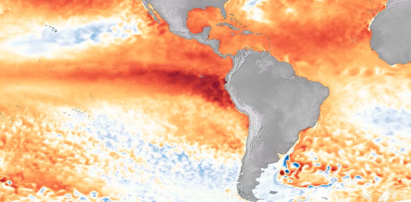
El Niño and La Niña are complex weather phenomena resulting from ocean temperature fluctuations in the Equatorial Pacific.
Higher-than-normal sea-surface temperatures in the Pacific Ocean characterize El Niño. During this phase, the trade winds weaken, causing warm water to move eastward toward the West Coast. In contrast, La Niña involves cooling sea-surface temperatures in the east-central equatorial Pacific. La Niña events are marked by stronger-than-normal trade winds that drive warm water toward Asia. These variations lead to significant global weather impacts.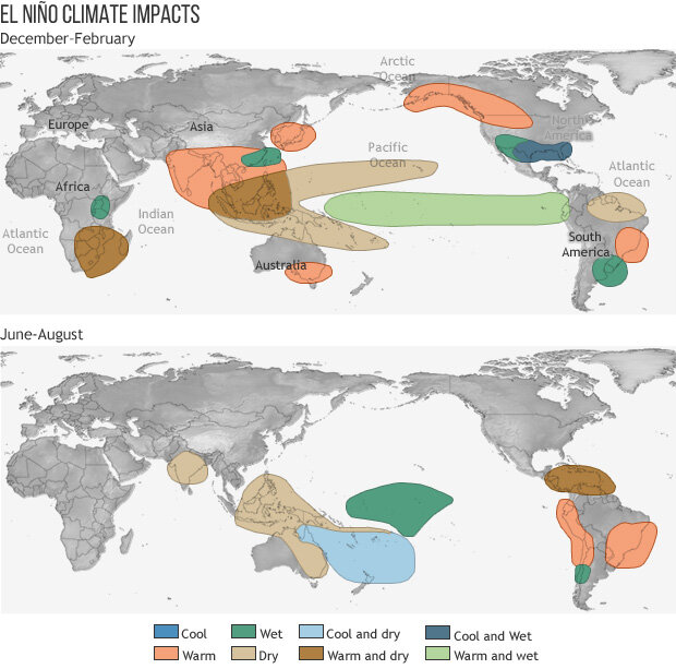
El Niño and La Niña episodes generally last from nine to 12 months, though they can occasionally persist for several years. These events typically occur every two to seven years, but they don’t occur on a regular schedule. Generally, El Niño tends to happen more often than La Niña. As opposing phases of the El Niño-Southern Oscillation (ENSO), they cannot occur at the same time, and there are many periods when neither is present.
What is ENSO?
The El Niño-Southern Oscillation (ENSO) is a term used to describe the variations in the equatorial Pacific’s ocean surface temperatures and air pressure.
When sea-surface temperatures rise above average by about 1 degree Fahrenheit or more, El Niño can develop. Conversely, when temperatures dip below average, La Niña may develop. In ENSO-neutral conditions, temperatures hover around average, preventing the formation of either phenomenon.
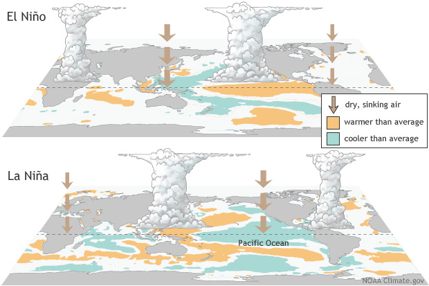
The air pressure component involves comparing pressure differences between the western and eastern equatorial Pacific. Readings are taken from Darwin, on Australia’s north-central coast, and Tahiti, over 5,000 miles to the east. Lower-than-normal pressure in Tahiti and higher-than-normal pressure in Darwin favor El Niño development, while the reverse supports La Niña.
Both temperature and air pressure conditions must align for either El Niño or La Niña to occur.
How do El Niño and La Niña impact the weather?
El Niño and La Niña have minimal impact on summer climate in the United States; the most substantial influence occurs in winter.
During El Niño events, the jet stream typically moves southward, leading to rainier and cooler weather across much of the Southern US while bringing warmer conditions to the Northern US. Globally, El Niño can result in warm, dry weather in regions such as Asia, Australia, and India, and influence weather patterns in parts of Africa and South America. El Niño impacts marine life by disrupting the upwelling of cold, nutrient-rich water along the Pacific coast, leading to a decline in phytoplankton and affecting the entire marine food chain.
With La Niña, the jet stream shifts northward, leading to warm and dry conditions in the Southern US and cooler, wetter weather in parts of the Northern US, especially the Pacific Northwest. La Niña can also lead to a more severe hurricane season. Globally, parts of Australia and Asia can be wetter than usual. During La Niña, the Pacific coast experiences colder, nutrient-rich waters, which support increased marine life and draw more cold-water species to regions like the California coast.
How does El Nino & La Nina affect California?
During El Niño, California often experiences wetter and cooler conditions, which can lead to increased rainfall and potential flooding. These heavy rains can contribute to mudslides and affect agriculture by both replenishing water supplies and causing crop damage.
Conversely, La Niña tends to bring drier and warmer conditions, exacerbating droughts and increasing the risk of wildfires. The lack of precipitation during La Niña can strain water resources, impacting both agricultural production and urban water supply.
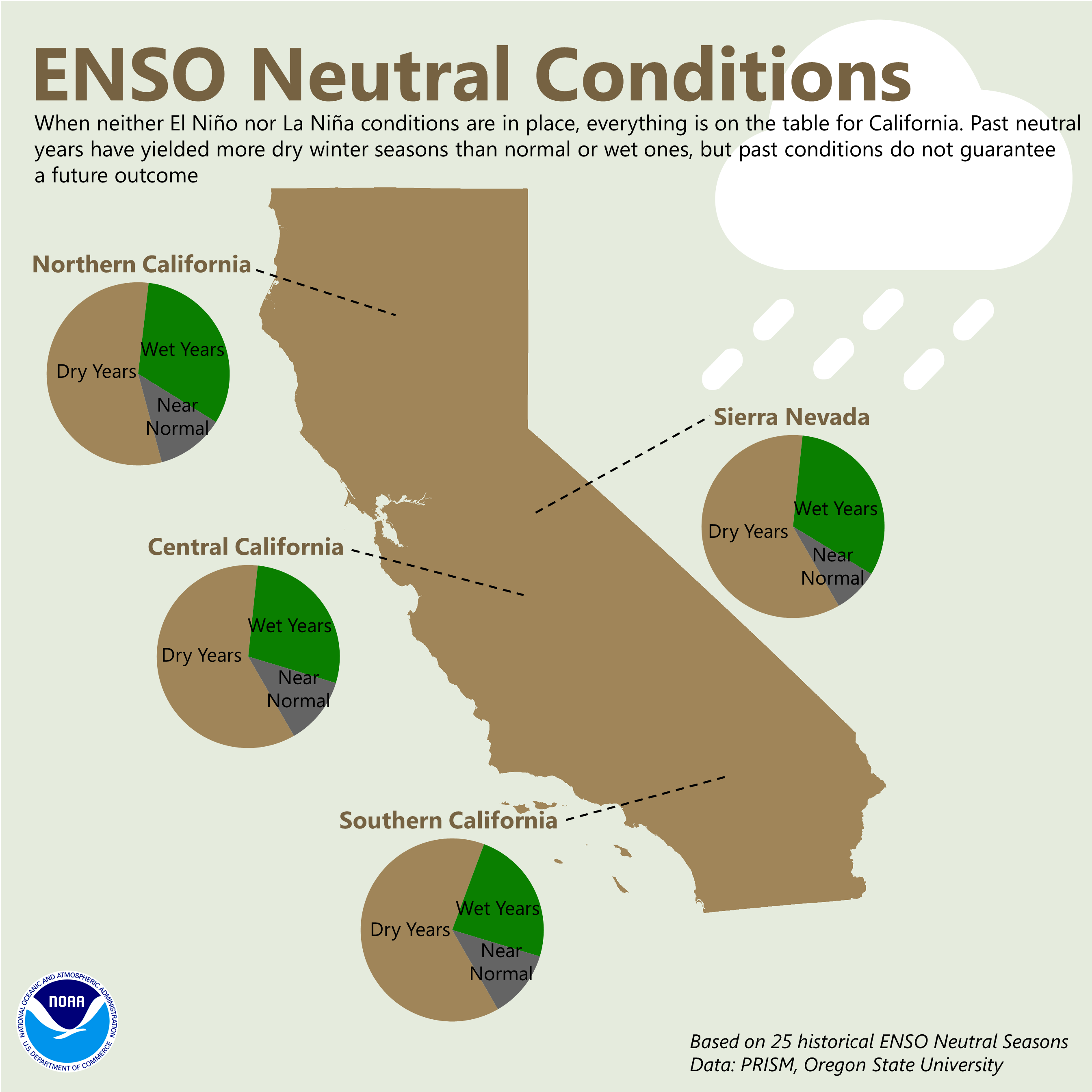
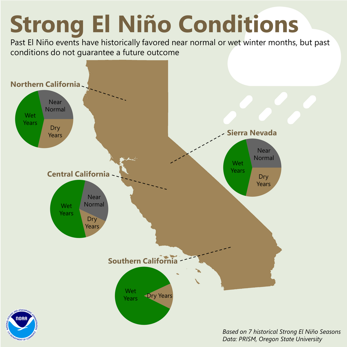
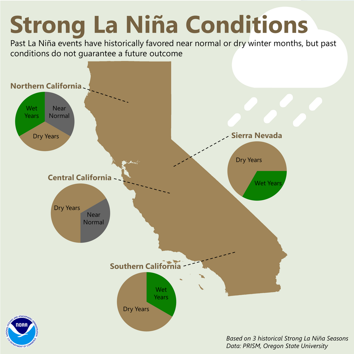
In Northern California, there is little correlation between precipitation and most ENSO patterns, according to the National Weather Service. They note that Southern California is generally much more impacted with El Nino conditions bringing higher than normal precipitation and La Nina bringing below normal precipitation to Southern California.
So there are no guarantees. Not every El Niño period is extra wet in the Golden State, and not every La Nina means a dry year. However, between 50 and 70 percent of El Niños since 1950 have led to above-average winter precipitation in California, according to the National Weather Service, which gives a slight edge to wet El Nino years.
Coverage of El Niño and La Niña on Maven ‘s Notebook
THE CONVERSATION: How heat on the Tibetan Plateau fuels powerful storms in California, half a world away
By Yongkang Xue, University of California, Los Angeles The Tibetan Plateau may be on the other side of the world from California, but what happens on this high-altitude landscape in Asia can set off a chain of events that fuels powerful atmospheric rivers with flooding rainfall and heavy snow hitting the U.S. West Coast. My team of atmospheric scientists discovered this connection, and we explain how it works in a new study in the journal Science Advances. California’s unexpected rainfall […]

SCRIPPS: How does El Niño impact ocean ecosystems?
Scripps Oceanography experts weigh in on how ocean life is impacted by the climate event By Lauren Fimbres Wood, Scripps Institution of Oceanography El Niño is a climate pattern that is declared when monthly sea surface temperatures in the central and eastern tropical Pacific Ocean are measured above normal, for at least five consecutive overlapping three-month periods. This ocean warming has impacts on global temperature, weather patterns, and the life that lives in the ocean. In fact, the name El […]
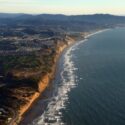
SCRIPPS: How does El Niño impact the California Coast?
Scripps Oceanography scientists share how El Nino mean for the California coastline By Lauren Fimbres Wood, Scripps Institution of Oceanography El Niño is defined by the persistence of warm water in the Pacific Ocean at the equator. This warm water has impacts on global temperature, weather systems and marine life. This El Nino-driven warming also makes sea levels higher because water expands as it heats up due to thermal expansion, and can mean bigger waves along the U.S. West Coast. Below scientists […]
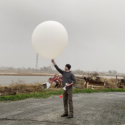
SCRIPPS: How does El Niño impact the weather?
Scripps Oceanography meteorologists and climate scientists answer questions about El Nino’s impact on weather By Lauren Fimbres Wood, Scripps Institution of Oceanography The Pacific Ocean’s El Nino-Southern Oscillation (ENSO) occurs irregularly but can have major impacts on global temperature, weather patterns, coastal hazards, and marine ecosystems. While El Niño has often been associated with increased precipitation and La Niña with drier years, recent research from Scripps Institution of Oceanography at the University of California San Diego shows that is not always […]
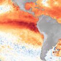
SCRIPPS: What is El Niño and what makes this a very strong El Niño?
Scripps Oceanography experts explain phenomenon, why this event is likely to be a very strong El Niño, and how these events are detected By Scripps Institution of Oceanography NOAA declares an El Niño when temperatures in the equatorial Pacific are 0.5°C (0.9°F) above average for several consecutive months. As of August 2026, the National Oceanic and Atmospheric Administration (NOAA) issued an advisory that with ocean temperatures now 2.0°C (3.6°F) above average there is “a greater than 90% chance of a very strong […]
Read all coverage on Maven’s Notebook.