
Scripps Oceanography meteorologists and climate scientists answer questions about El Nino’s impact on weather
By Lauren Fimbres Wood, Scripps Institution of Oceanography
 The Pacific Ocean’s El Nino-Southern Oscillation (ENSO) occurs irregularly but can have major impacts on global temperature, weather patterns, coastal hazards, and marine ecosystems.
While El Niño has often been associated with increased precipitation and La Niña with drier years, recent research from Scripps Institution of Oceanography at the University of California San Diego shows that is not always the case, and that atmospheric river events can often disrupt this cycle.
Below experts from Scripps Oceanography answer frequently asked questions about El Nino’s impact on global and regional weather.
For additional information on El Niño, visit the El Niño Resource Hub.
How does El Niño typically alter Earth’s weather patterns?
Shang-Ping Xie (Professor of Climate Science and Physical Oceanography, Roger Revelle Chair in Environmental Science): In a typical El Niño year, India’s monsoon rainfall from June to September will decrease and may cause drought conditions. The second stop would be around Australia and Indonesia. They’re also likely to get dry conditions, and perhaps wildfires during their spring season (North America’s fall months).
Then the third stop would be North America. El Niño often causes Southern California and the southwestern states to experience more storms and increased rainfall in the winter months. That said, every El Niño is different and there are random processes in the atmosphere; you can have a dry El Niño winter just like you can have a wet La Niña winter.
The fourth stop — if the El Niño grows in magnitude — is the Pacific coast of South America during North American springtime. Countries like Peru can get heavy rainfall. The final stop would be China and Japan. In that part of the world, research shows that the last echo of a typical El Niño is heavy rains and flooding along the Yangtze River in China and across Japan.
At the global scale, the ocean warming that occurs during an El Niño year is enough to drive average global temperatures higher by heating the atmosphere around the equator. Layering El Niño on top of warming due to human-caused climate change could push global temperatures to new highs, including temporarily past the Paris Agreement threshold of 1.5 degrees Celsius (2.7 degrees Fahrenheit) of warming above pre-industrial levels.
Alexander Gershunov (Research Meteorologist/Climate Scientist): El Niño is a natural pattern, but it’s happening in an unnaturally warming world. With a boost from El Niño, it’s almost certain that we will set a new global temperature record this year. This extra heat on a global scale directly impacts heat wave activity all over the world, which has been rampant this summer and there is plenty of inordinate heat wave activity ahead. Regional heat waves may also be indirectly boosted by El Niño. For example, the extreme deadly heat that impacted India in early summer, was also related to the late start of the monsoon that is, as Shang-Ping notes, a first-order impact of El Niño. In fact, the discovery of El Niño – Southern Oscillation (ENSO) was first driven by the need to explain and predict Indian Monsoon Rainfall (the work of Sir Gilbert Walker published in the 1920s).
What can Californians expect from a strong El Niño year?
Dan Cayan (Climate Science Researcher): Every year sees a winter activation of storminess across the North Pacific, but El Niño years tend to have more numerous, southward shifted winter storms. This causes more storm exposure in Southern California and northern Baja Mexico, along with a vigorous track across the southern tier of the U.S. We’re keenly interested in this 2026-27 strongly developing El Niño because some previous strong cases, like the massive events in 1982-83 and 1997-98, were among the wettest years on record in California. Crucially, this wetness extended across the southwestern states, whose water stocks have dwindled to acute levels since the El Niño of 1997-98.
But although the increased wetness during El Niño’s may provide societal and ecosystem benefits, California has also felt some remarkably harmful impacts. Storms in these winters can have enormous footprints, and extensive westerly winds during their passage across the North Pacific can generate unusually high ocean waves. Together with low barometric pressure of landfalling storms and El Niño inflated coastal sea levels, these high waves can inflict beach and cliff erosion, especially if these storms happen to occur during high tides. Importantly, preparedness for these rare events is enabled by improved short- and medium-range weather forecasts targeting the few-day windows of winter tidal cycle extremes.
Rosa Luna-Niño (Postdoctoral Scholar): El Niño/La Niña provides useful information for the coming winter precipitation in California and the Southwest, but its predictive value is limited and can vary over time. For example, the connection between El Niño/La Niña and Southwest precipitation became stronger during the second half of the twentieth century, peaking around 1971–2000. However, in more recent decades, this connection has weakened and has been mainly limited to the desert Southwest.
This means that the wetter El Niño and drier La Niña pattern in the Southwest is a typical or canonical response, but it does not occur consistently in every period or every El Niño/La Niña event. A couple of studies (see here and here) show that models are overconfident in predicting these typical precipitation outcomes based on El Niño/La Niña, which makes it especially challenging to forecast winters that do not follow the expected pattern.
Can you blame individual weather events on El Niño?
Dan Cayan (Climate Science Researcher): Compared to ENSO neutral and La Niña years, El Niño years exhibit highly significant effects on North Pacific and California storminess. Going beyond the seasonal scale, it is tempting to attribute individual storms to a seasonal phenomenon like El Niño. But the dynamics that govern short-term weather events, like atmospheric rivers, have components that operate independently from longer-term effects that are perpetuated, for example, by El Niño conditions. So, while we might partially attribute elements of individual storms to El Niño, we are left with statistical odds, rather than precise yes or no characterizations. This is why we often consider the seasonal aggregate of storminess when discussing El Niño/ La Niña , which has the advantage of averaging out the peculiarities of single weather events.
Alexander Gershunov (Research Meteorologist/Climate Scientist): Totally agree with Dan Cayan’s assessment and add the following: As far as specific storms go, non-atmospheric river storms like midlatitude frontal cyclones do tend to dance to the tune of El Niño. These storms are responsible for the canonical precipitation patterns associated with ENSO, which, as Rosa Luna Niño points out, have weakened lately. Atmospheric rivers are the agents of ENSO heresy in California. They can make or break El Niño-based canonical forecasts. If atmospheric river activity ends up being average or strong, California is likely to get a wet winter. If it is strongly deficient, California may end up even being dry. The likelihood of that is not strong, but it remains a possibility. Atmospheric river activity in California cannot currently be predicted seasons ahead. So, watching subseasonal or extended-range weather forecasts (forecasts of weather with 2-3 week lead-times, such as those from the Center for Western Weather and Water Extremes) will be important as we get into the cool season.
In California, atmospheric rivers are associated with the vast majority of big flood events, which can occur independent of ENSO.
One exception to atmospheric river activity with regards to ENSO is the coast of Baja California. There, atmospheric landfalls are related to El Niño and La Niña. Atmospheric rivers landfalling in Baja can penetrate into Arizona and New Mexico and produce strong rain there. Because atmospheric rivers and other storms care about El Niño in Baja and the desert Southwest, this is the region with the strongest ENSO canonical signals and this is where I’d expect the strongest skill of ENSO-based canonical seasonal forecasts.
Can scientists predict the precise timing of when El Niño storm activity will occur?
Alexander Gershunov (Research Meteorologist/Climate Scientist): El Niño teleconnections to the Western United States typically kick in in January. January through April is the most skillfully predicted season for El Niño impacts on this region. And the most skillfully predicted regional precipitation is over the desert Southwest.
Will the U.S. see more atmospheric rivers during an El Nino year? Or more intense atmospheric rivers?
Mike DeFlorio (Seasonal to Subseasonal Researcher at the Center for Western Weather and Water Extremes): During strong El Niño winters, the odds are tilted towards wetter-than-normal winters over Southern California relative to an ENSO-neutral or La Niña winter. The relationship is much weaker over Northern California. However, the historical probability of AR landfalls over California does not significantly change due to El Niño. Additionally, the presence of a strong El Niño does not guarantee any specific outcome for precipitation over California – it only alters the probability of these changes occurring. Other components of the climate system (e.g., the frequency and intensity of Madden Julian Oscillation events) can either reinforce or counteract the typical El Niño teleconnection over California.
Julie Kalansky (Climate Scientist and Deputy Director of Operations at the Center for Western Weather and Water Extremes): It’s important to stress that even though we see these general patterns during El Niño and La Niña years, there is still a lot of variability and not every event is going to follow the general pattern. Recent work has shown how atmospheric rivers are often the disruptor of El Niño and La Niña canonical precipitation patterns throughout the West. So, the declaration of an El Niño doesn’t guarantee that Southern California is going to have a wet, stormy winter, but it does stack the deck in that direction.
Alexander Gershunov (Research Meteorologist/Climate Scientist): Although El Niño does not significantly impact the frequency of atmospheric river landfalls along the coast of California, it does tend to boost their intensity somewhat (Luna Nino et al. 2025) as well as tilt them towards a more southerly orientation in Northern California (Guirguis et al. 2018), which does impact precipitation patterns and contributes somewhat to southwest- and south-facing slopes of California’s topography receiving heavy rainfall during El Niño winters.

How are meteorologists and scientists preparing to study this El Niño event from a weather perspective?
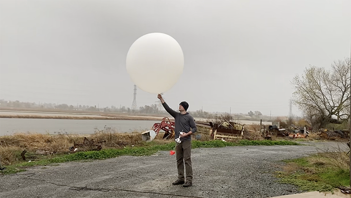
Marty Ralph (Research Meteorologist and Director of the Center for Western Weather and Water Extremes): El Niño operates on a seasonal time scale and weather events occur on a much shorter timescale. As such, it is important that we continue to observe and forecast individual weather events and their impacts throughout the season. CW3E carries out research, develops prediction tools for the west and provides specialized forecasts tailored to the West Coast, especially for extreme precipitation and the atmospheric river storms that produce it. This is part of a Research And Operations Partnership with California’s Department of Water Resources. Another key activity is Atmospheric River Reconnaissance (AR Recon), the program we lead in close collaboration with NOAA, collects observations in and around atmospheric rivers as they form and propagate over the Pacific Ocean prior to striking the west coast. These additional observations collected by the AR Recon program are incorporated into atmospheric weather models, which result in improved predictions of atmospheric rivers and associated extreme precipitation. These observations also enable research to examine relationships between the warm ocean water associated with El Niño and atmospheric rivers that occur this winter. An ongoing Office of Naval Research Departmental Research Initiative, Sea-Air Fluxes and Atmospheric River Initiation, is bringing together a number of researchers, including many from Scripps, to improve our understanding of atmospheric river associated extreme weather modulated by many factors, including ENSO. Additionally, given the highly variable nature of the West Coast precipitation and the potential for extreme atmospheric rivers in any year, using forecasts to manage water, in a program called Forecast Informed Reservoir Operations (FIRO), supports flood risk mitigation enhancement and water resilience. FIRO uses improved forecasts of atmospheric rivers to support water management decisions to retain more water if no storms are forecast, or release it to protect communities from flooding.
For additional information on El Niño, visit the El Niño Resource Hub.

