
Several news sources featured in the Daily Digest may limit the number of articles you can access without a subscription. However, gift articles and open-access links are provided when available. For more open access California water news articles, explore the main page at MavensNotebook.com.
On the calendar today …
- WORKSHOP: Central Valley Flood Protection Board beginning at 9am. Agenda items include a review of California Code of Regulations, Title 23, Waters, Division 1 (Title 23), Rulemaking Package: Revised Fee Updates, and a Progress Update on Rulemaking Effort on Technical Standards of Title 23. Click here for the full agenda.
In California water news today …
Solano County water officials say latest Bay Delta Plan does not address local concerns
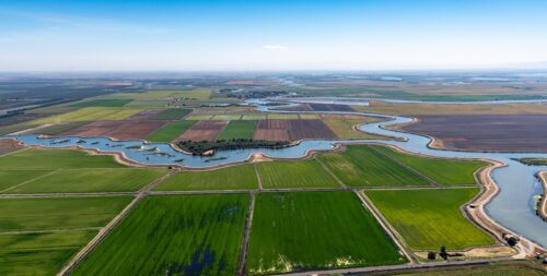
“Some Solano County water officials are saying the latest Bay Delta water plan is better than other alternatives, but does not resolve all the local concerns. “The bottom-line assessment is that the August 2026 final draft is better than the earlier (55% unimpaired flow) proposal by the inclusion of Water Supply Adjustment factors for rainfall-fed watersheds. It also formally elevates Healthy Rivers and Landscapes (and) voluntary agreements into an enforceable pathway. But it does not resolve SID’s and Solano County agencies’ central concerns,” Cary Keaton, general manager of Solano Irrigation District, said in an email response to the Daily Republic. He noted that State Water Resources Control Board simply defended its own modeling and did not conduct the “requested Solano Project reliability analysis or deferring the regulatory pathway for Putah Creek.” “SID does not have concerns regarding the voluntary agreement provisions of the plan. This is a commitment to flow and habitat made by the Solano County Water Agency and other Solano County agencies. SID supports this commitment,” Keaton stated. … ” Read more from the Daily Republic.
California pushes ahead with sweeping water overhaul critics warn is ‘doomed to fail’
“California is moving ahead with a sweeping plan to change how water is managed across the Sacramento-San Joaquin Delta – despite critics warning the proposal risks harming rivers and fish without securing water supplies. The State Water Resources Control Board recently released its August 2026 draft update to the Bay-Delta Plan, which would establish new water-quality protections and rules for the Delta and its tributaries. The watershed is a critical part of California’s water system, supplying water to nearly 30 million people and supporting about 4 million acres of farmland. The board says the proposal is designed to balance those demands while improving conditions for fish, wildlife and tribal communities. “This is California’s opportunity to manage the Bay-Delta for the twenty-first century,” State Water Board Executive Director Eric Oppenheimer said in a statement. … ” Read more from the California Post.
Baykeeper statement: California State Water Board’s deeply flawed Bay-Delta Plan
“Yesterday, the California State Water Resources Control Board (Board) released its long-delayed draft Water Quality Control Plan for the San Francisco Bay and Sacramento-San Joaquin Delta watershed. The plan regulates water quality and volume standards for fresh water flowing from the Sacramento and San Joaquin rivers into the Delta, Suisun Marsh, and San Francisco Bay. By law, the Board must adopt and regularly review its Bay-Delta Plan to ensure reasonable protection of fish, wildlife, and water quality. The last significant update to the Bay-Delta Plan is now 30 years old. In that time, water quality and native fish populations have suffered major declines throughout the watershed, leaving the Bay’s ecosystem and communities that depend on healthy waterways in crisis. … ” Read more from the San Francisco Baykeeper.
SEE ALSO: California moves closer to rewriting the rules of the Delta, from E&E News
Are Kings County farmers getting a bad rap from bad data?
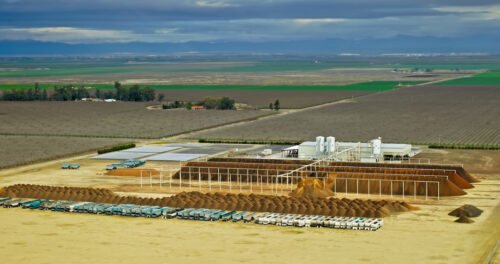 “Kings County farmers are either underreporting how much groundwater they pump – by a lot. Or bad data is to blame. According to the state Water Resources Control Board, farmers in the Tulare Lake subbasin, most of Kings County, have reported less than 35% of their actual groundwater extractions under a mandate aimed at measuring how much is being pumped in the critically over drafted region. Baloney, said one groundwater agency, pegging compliance at closer to 90%. “Bad data would be my official statement,” said El Rico Groundwater Sustainability Agency chair Jeof Wyrick at the board’s August 11 meeting. “We see that it’s closer to 90(%) plus and there’s a few (wells) that we don’t know about but they’re those small parcels. “The state board also said that we have over 150 domestic wells that are out there and I think they did a domestic wells per acre average that is made up out of thin air.” There are only 12 domestic wells in El Rico’s boundaries, Wyrick said. … ” Read more from SJV Water.
California’s drought irreversibly damaged Sacramento Valley aquifers

California Department of Water Resources
“From 2020 to 2022, California faced one of its driest periods on record, in part because of human-caused climate change. Though the drought has eased, scientists have noticed lasting effects on the state’s aquifers that may affect their ability to store water in the future. A new study published in the Proceedings of the National Academy of Sciences of the United States of America found that the drought and resulting overpumping of groundwater caused some aquifers in the Sacramento Valley to collapse and become irreversibly damaged. The study is the first to capture this kind of aquifer collapse in high-resolution satellite data and provides evidence in support of giving the Sacramento Valley’s aquifers additional protections, the authors write. “How fast part of the Sacramento Valley is subsiding was quite surprising to us,” said Stacy Larochelle, a geophysicist at the University of California, Los Angeles, and lead author of the new study. “This is really one of the first times we could capture this transition in so much detail.” “It’s sad that the Sacramento Valley is seeing more subsidence, but that it’s being recognized, documented, and looked at in more detail is a good thing,” said Claudia Faunt, a retired hydrologist at the U.S. Geological Survey California Water Science Center who was not involved in the new study. … ” Read more from EOS.
What is a strong El Niño and what does it mean for California?
“Warming of the tropical eastern Pacific Ocean is creating what meteorologists call a strong El Niño. Many people are asking what that means. In response, Daniel Swain, climate scientist in the University of California Agriculture and Natural Resources’ California Institute for Water Resources, has written an El Niño fact sheet. El Niño is the warm phase of a natural cycle, known as El Niño/Southern Oscillation (ENSO), that occurs roughly every two to seven years in the tropical Pacific Ocean. During El Niño events, the eastern tropical Pacific Ocean warms to well above typical levels. El Niño directly affects local climate in the countries closest to the unusually warm ocean waters, but can also indirectly influence the climate of distant regions thousands of miles away. During the strongest events, El Niño can profoundly affect climate even on global scales, causing temporary planetary warming and disrupting large-scale precipitation patterns. … ” Read more from UCANR.
Water Wrights covers California Water Commission meeting
The California Water Commission held a meeting in Sacramento and online on Wednesday, August 19, 2026. The CWC has nine commissioners appointed by the governor. The commission is tasked with advising the Department of Water Resources, monitors the State Water Project and approves rules and regulations. Their meetings can be all daymarathons, but this meeting was worth the time to sit through because it included the Unified Water Plan UWP, California Water Plan CWP and the Collaborative Action Plan CAP. The California Water Plan is part of the Senate Bill 72 by State Senator Anna Caballero to bring another nine-million-acre feet into the system by 2040. The Unified Water Plan comes from the Water Blueprint for the San Joaquin Valley, the California Water Institute at Fresno State University and the US Bureau of Reclamation. The Collaborative Action Plan is a result of bringing together a diverse group of stakeholders to, well collaborate on a plan that takes into account the environment, urban, domestic and agricultural water needs. Sarah Lesmeister, Assistant Executive Director of the CWC introduced speakers throughout the meeting. … ” Read more from Water Wrights.
Why California can’t tell you where it’s unsafe to swim
“With illness reports floating in the news and blue-green algae mucking up your local lake, you figure you’re better safe than sorry. You search: “where safe to swim bay area.” You skip past the results from agencies you haven’t heard of and go straight to the state of California’s handy “Safe to Swim” map. Official. Easy. Except launching the map brings up a host of caveats. “The data can change at any time” and “is updated daily, depending on staff availability,” the website warns. It really “should not be used for any particular purpose other than general reference.” For a live map that’s meant to show where fecal contamination in water might make people sick it does not inspire confidence. It also doesn’t track harmful algal blooms (HABs), which can cause illnesses like rashes and fevers and even kill dogs. And what’s worse, clicking on the dot closest to you may reveal the “last sample date” was in 2014. The coastal beaches show recent testing, but most inland water bodies don’t. Even Andrew Hamilton, an assistant deputy director at the State Water Boards’ Office of Information Management and Analysis, which publishes the map, recommends swimmers check elsewhere. He calls the Safe to Swim map “somewhat aspirational.” … ” Read more from Bay Nature.
How one Davis lab is trying to stop California’s golden mussel invasion
“The first known detection of the invasive golden mussel in all of North America happened in California. This invasive species has prompted states of emergency, both in San Joaquin County, where they were found at the Port of Stockton, and in Yolo County, where they were found to have spread to the Port of West Sacramento. It’s posing a huge threat to Sacramento-San Joaquin Delta waterways. It’s threatening billions of dollars in losses for farmers and could choke California’s water supply. Working to help stop it is the Davis-based Invasive Species Corporation, which is stepping up with a possible solution. Research scientist Brady Hirschfeld studies how to stop the rapid golden mussel invasion. “It’s really rewarding to be on this side of things,” Hirschfeld said. “I’m really proud to be part of the solution to kill golden mussels.” … ” Read more from CBS Sacramento.
SEE ALSO: No single solution as golden mussels spread across California, officials say, from KMPH
Natural regeneration vs. Replanting: the clash over California’s giant sequoias
“In October 2025, veteran Los Angeles Times reporter Doug Smith stepped into the charred sequoia forests of the southern Sierra Nevada expecting to find a tree species in retreat. After the brutal 2020 and 2021 fire seasons, federal scientists had warned that the giant sequoia was teetering toward collapse. Instead, Smith found the opposite. Four years after the flames swept through Redwood Mountain Grove in Sequoia & Kings Canyon National Parks, he walked into a riot of green. Thousands of wild sequoia seedlings and saplings were punching through the ash. Redwood Mountain — the largest of the Sierra’s 80 fragmented sequoia groves, strung along a narrow 260‑mile band on the range’s western slope — had suffered the most severe fire damage of all. Smith was stunned by the vigor of the comeback. … ” Read more from the Earth Island Journal.
USACE publishes draft Yolo Bypass Feasibility Report, Environmental Assessment
“The U.S. Army Corps of Engineers Sacramento District published its Yolo Bypass Draft Interim Integrated Comprehensive Feasibility Report and Environmental Assessment today, outlining proposed actions for the Yolo Bypass Comprehensive Study. The comprehensive study authority allows for additional monitoring and adaptive management of the existing Yolo Bypass System, follow-on activities to design and construct flood risk management and aquatic ecosystem restoration features, and recommendations for future feasibility studies that could lead to the construction of new water resources development projects that complement the existing Yolo Bypass System. This milestone marks a critical transition in the planning process, leveraging the new RAPID (Risk-informed, Aligned, Proportional, Iterative, and Decisive) feasibility framework that allows for expedited decision-making. “The RAPID planning framework is about getting tangible results for our communities,” said Col. Robert McTighe, commander of the U.S. Army Corps of Engineers Sacramento District. “This modernized process allows us to deliver thorough, compliant environmental reviews while accelerating our ability to move projects toward construction. We are committed to building infrastructure, not paperwork, ensuring we protect communities while enhancing the Sacramento region.” … ” Read more from the US Army Corps.
NASA data feeds river forecasts as snow drought effects linger
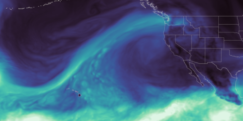 “As the effects of the 2026 snow drought in the western United States carry into summer, NASA Earth data is feeding machine-learning forecasts that inform decisions about water, power, and public safety in Washington state. Tacoma Power, a Washington public utility, is using a U.S. technology company’s river-flow forecasts during a year of water extremes on the Cowlitz River. The utility’s largest hydroelectric project uses water stored behind Mayfield and Mossyrock dams to generate enough electricity to serve more than 151,000 homes each year. Upstream Tech’s HydroForecast combines weather forecasts and river measurements with NASA-produced satellite data on snow cover and vegetation conditions to predict river flow from hours to days ahead. Updated every two hours, the forecasts are used by reservoir managers, hydropower producers, water utilities, and government agencies to prepare for storms, plan reservoir water releases, and navigate dry periods. “Part of NASA’s mission is to make the view from space useful on the ground,” said Erin Urquhart, manager for NASA’s Water Resources program at the agency’s headquarters in Washington, D.C. “When an American company incorporates NASA’s freely available data into forecasts that help water managers prepare for floods, generate power, and steward water supplies, that’s NASA delivering practical value to the nation.” … ” Continue reading from NASA.
POLICY & REGULATION
Delta, SWP levee, canal protection bill headed to the governor
“Legislation that would repair the aging levees in the Delta and the SWP’s California Aqueduct and canals has cleared the state Legislature. Senate Bill 872 – authored by Sen. Jerry McNerney, D-Pleasanton, and supported by the environmental group, Restore the Delta, and the State Water Contractors – depends greatly on funding not yet secured. The bill creates the Delta Levees and Canal Subsidence Fund, state funding for which is being negotiated and includes discussions about federal funding, a McNerney spokesman said. It also would allow for private funds to be used. “Historically, California’s water wars have pitted North against South, environmental groups versus State Water Contractors,” McNerney, co-chair of the Delta Caucus and whose district includes the heart of the Delta, said in a statement. “The unanimous passage of SB 872 sends a clear message: California is ready to finally end its water wars. We’re ready to join together to support vital projects that will protect California’s water and the Delta, while also benefiting the entire state.” … ” Read more from the Daily Republic.
El Niño is coming. Californians still need better tools to recover from disaster.
Julia Stein writes, “Last week, AB 2385 (Petrie-Norris) died in the California Senate Appropriations Committee. Its demise is the latest frustration in the long saga to rebuild from the terrible January 2025 Los Angeles fires—and to apply some lessons learned about disaster recovery in the process. I’ve had a front row seat, as both an Angeleno and a co-leader of the UCLA research team that supported the Blue Ribbon Commission convened by County Supervisor Lindsey Horvath to offer recovery recommendations, to the serious struggles local governments face when disaster strikes. As I wrote last year, among the many roadblocks to effective disaster recovery is a drafting wrinkle in state law that keeps local governments from effectively pre-planning for disaster recovery so that effective tools are at the ready when a disaster occurs. Here in Los Angeles, we found ourselves having to struggle to build a recovery infrastructure while responding to the disaster in real time. Local governments shouldn’t have to do that. … ” Read more from Legal Planet.
California Forever housing plan sidelined as shipyard and manufacturing proposal advances
“After weeks of frantic last-minute lobbying in Sacramento, billionaire-backed real estate development project California Forever could emerge from the current legislative session with permission to fast-track thousands of jobs — but not housing — in Solano County. The legislation is expected to be introduced by two lawmakers who represent Solano County, Assembly Member Lori Wilson, D-Suisun City, and Sen. Christopher Cabaldon, according to a source who was briefed on the negotiations Thursday. It was detailed in a Solano County Board of Supervisors agenda released Friday. The board is being asked for its position on the bill Tuesday and could seek amendments or protections. The Chronicle could not immediately reach Wilson or Cabaldon Friday. … ” Read more from the San Francisco Chronicle.
Data centers’ deep political unpopularity enters debate over CEQA reform measure
“Opponents of Proposition 45, which creates new rules under the California Environmental Quality Act for some building projects, are arguing the so far well-polling ballot measure would grease the skids for the construction of data centers, which poll very badly. The allegation comes as a large and growing coalition of environmental groups, joined by some labor unions and the California Democratic Party, mount a pitched campaign against what they call a corporate power grab clothed as an affordability measure. “It is a way for data center giants, oil, gas and utility corporations to build what they want where they want,” Mabel Tsang, political director of the California Environmental Justice Alliance, said in a rally on the statehouse steps last week. Those leading the campaign for Proposition 45, which is funded by construction and affordable housing groups, the California Chamber of Commerce, utility companies, and also a political action committee funded largely by wealthy tech executives, call the data center argument a red herring. “Proposition 45 unequivocally does not include data centers,” Amelia Matier, a spokesperson for the campaign, said. … ” Read more from the Sacramento Bee.
In commentary today …
Planning for California’s water future starts now
“California has never had the luxury of taking water for granted. Every generation has faced its own water challenges and responded by building the infrastructure, partnerships and policies needed to keep our communities, economy, agriculture and environment thriving. Now it’s our turn. California’s water system is being tested in new ways. We’re experiencing rapid swings between floods and droughts, sometimes within the same season. Warmer winter storms are bringing more rain instead of snow, reducing mountain snowpack that has long served as one of California’s largest natural reservoirs while increasing the risk of devastating floods. … ” Continue reading at ACWA.
California’s neglected infrastructure is harming America
Edward Ring, director of water and energy policy for the California Policy Center, writes, “California attracts a lot of criticism, with perhaps the most bipartisan criticism focusing on its punitive cost of living. And this bipartisan criticism even extends to agreement on the reason California is too expensive. In their bestselling 2025 book Abundance, authors Ezra Klein and Derek Thompson argued that liberal governance has become too legalistic, bureaucratic, and ideologically committed to politics of scarcity. Throughout their book, California was used as the worst example. Klein, an opinion columnist for the New York Times, and Thompson, a veteran of The Atlantic, have indisputable liberal, left-of-center bona fides. But their indictment of liberal policies was unsparing. The influence of their book has been seismic. Since its release, and well before the Iran war moved affordability issues firmly into the spotlight, Democrat politicians have adopted abundance and its twin, “affordability,” as a centerpiece of their campaign platforms. … ” Continue reading from Edward Ring.
In regional water news and commentary today …
NORTH COAST
Nearly 14,000 birds have died in botulism outbreak at wildlife refuge on Oregon-California border
“A deadly botulism outbreak has killed at least 13,730 birds in the Tule Lake National Wildlife Refuge near the Oregon-California border. The refuge, part of the Klamath National Wildlife Refuge Complex, is one of the most important stopover and breeding sites for waterfowl and waterbirds migrating along the Pacific Flyway, which spans from Alaska to the tip of South America. About 80% of waterfowl on the flyway stop at the refuge every year. Historically, it saw up to six million birds pass through each year. Today, that number is closer to one million, in part due to habitat loss and population declines, said Teresa Wicks, a biologist in eastern Oregon and program manager for the Bird Alliance of Oregon. About 80% of waterfowl on the flyway stop at the refuge every year. Historically, it saw up to six million birds pass through each year. Today, that number is closer to one million, in part due to habitat loss and population declines, said Teresa Wicks, a biologist in eastern Oregon and program manager for the Bird Alliance of Oregon. … ” Read more from Channel 8.
Arcata council looks to moratorium on data centers
“The Arcata City Council spent much of its Wednesday evening meeting focused on the future of data and AI centers in the city, hearing a detailed presentation on submarine cable infrastructure, power demands, land‑use rules and the growing pressure from developers seeking to build near Arcata’s cable landing points. Council members said they want to move quickly toward a temporary moratorium while staff studies how and whether such facilities should be allowed. Building official Joe Bishop delivered what he described as an “extensive and unbiased” briefing on the types of data centers, their utility impacts and the unique position Arcata occupies because two trans‑Pacific fiber‑optic cables come ashore near Arcata. … ” Read more from the Eureka Times-Standard.
SEE ALSO: Arcata’s data center is a piddling dwarf compared to the big boys, building official says, from the Lost Coast Outpost
FERC moves forward with Eel River dam removal, upcoming meetings will allow Humboldt residents to weigh in
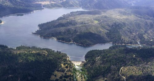
“For the last century, the Potter Valley Project has diverted water from the Eel River south to the Russian River. Now, citing aging infrastructure and seismic concerns, PG&E is moving forward with plans to remove two dams at the site. Some stakeholders in Mendocino County have opposed dam removal, citing the loss of Lake Pillsbury and Van Arsdale Reservoir. But environmental groups say removing the dams would help restore the Eel River and its fisheries. “Folks in Humboldt County should care because water from the Eel flows through much of Humboldt County. Folks all along the South Fork of the Eel River are dependent on that clean water for their drinking water sources, for their irrigation, and, of course, our cultures and our economy,” said Alicia Hamann Executive Director of Friends of the Eel River. … ” Read more from Redwood News.
California native tribes lead charge that will open up one of the longest free-flowing rivers in the US
“Dam, girl. The Eel River is set to become one of the longest free-flowing rivers in the United States after a five-year fight over what to do with dams on the river, spearheaded by California native tribes. Spanning five counties and linking Humboldt to regional and statewide water resources, the massive waterway traces 200 miles north of Mendocino National Forest and empties into the Pacific Ocean. It’s also a sacred resource of the Wiyot Tribe with deep cultural connections to both the river and its fisheries, according to Humboldt’s city website. In fact, 398 river miles are designated as recreational, scenic, or wild under the National Wild and Scenic Rivers System. … ” Read more from the California Post.
Commentary: A glimmer of hope: Eel River Dam removal hearing a chance to be part of history
Regina Chichizola, the managing director for Communities United for Clean Water, writes, “The news is full of stories about declining water quality, toxic algae in local rivers, and environmental rollbacks. As a mom and community member, escalating climate change, low flows, dams, pollution, and resulting toxic algae blooms, especially in the Eel, are disheartening. There is hope, however. Conditions are improving in the Klamath River, where dam removal has helped restore water quality and fish populations. Now we have a rare opportunity to help remove two more dams locally, and thanks to pressure from NGOs and Humboldt residents, FERC has announced it will hold dam removal hearings on Sept. 15 at 6 p.m. and Sept. 16 at 9 a.m. at the Wharfinger building pm in Eureka. This is a once-in-a-lifetime opportunity to turn our climate anxiety and despair into action, and to help fix some of our local problems by removing the antiquated Potter Valley Project. … ” Read more from the Eureka Times-Herald.
SIERRA NEVADA
Lake Tahoe Summit marks 30 years of collaboration to protect the lake
“For three decades, leaders from California and Nevada have gathered around the same goal: protecting Lake Tahoe. This year’s summit looked back at what’s been accomplished and what still needs to be done. More than 900 environmental projects have been completed across the basin since 1997, said Senator Jacky Rosen. Those projects have focused on forest health, water quality and invasive species. “Together, Team Tahoe and all of us, prevented hundreds of thousands of pounds of fine sediments from entering the lake. They completed 100,000 acres of hazardous fuel reduction treatment. They improved more than 800 miles of roads and inspected more than 120,000 boats,” Rosen said. … ” Read more from KUNR.
SEE ALSO: ‘Let the story of Lake Tahoe remind the world’: Pro-climber Tommy Caldwell keynotes 30th Tahoe Summit, from the Tahoe Daily Tribune
Divers restore 89-year-old outlet equipment at French Dam
“Nevada Irrigation District (NID) has carried out underwater maintenance at French Dam in California, US, replacing hydraulic equipment that had been operating for almost 90 years. Commercial divers were deployed at French Lake this summer to work on the low-level outlet gate at French Dam, which is NID’s oldest dam still in operation. Located on Canyon Creek in the South Yuba watershed at an elevation of approximately 6660ft (2030m), French Dam was originally constructed in 1858-1859 and later raised in 1948. The reservoir has a storage capacity of nearly 14,000 acre-feet. … ” Read more from Water and Power Magazine.
SACRAMENTO VALLEY
Celebrating the Sacramento Valley: Tim Collom Conaway Ranch painting
“In a blog post this spring, we announced our collaboration with Sacramento artist Tim Collom on three new paintings depicting his vision of the region. The paintings reflect a day spent touring parts of the Sacramento Valley to draw inspiration, including visits to Conaway Ranch, the Sacramento River waterfront in West Sacramento, and Montna Farms, which became the subjects of the three paintings. The Conaway Ranch painting represents an area of the ranch in the Yolo Bypass. The painting displays and highlights the multi-benefit working lands in the foreground. In the winter months, the bypass provides flood protection to the Sacramento region by routing flows off the Sacramento River, around the city, and out to the Delta to decrease the amount of water flowing through the cities of Sacramento and West Sacramento. During the irrigation season, these same lands are farmed using water diverted and conveyed from the Sacramento River, as captured in the painting. … ” Read more from the Northern California Water Association.
Sacramento’s top Army civil works projects in 3D
“The U.S. Army Corps of Engineers Sacramento District has released a new 3D visualization highlighting some of the district’s top Civil Works projects reducing flood risk throughout California’s Capital Region. Narrated by Sacramento District Commander Col. Robert McTighe, the animation demonstrates how major projects including American River Common Features (ARCF), West Sacramento, Folsom Dam Raise, and Natomas Basin work together as part of an interconnected regional flood risk management system. While the animation focuses on Civil Works, these projects are part of the Sacramento District’s more than $1 billion average annual program, which also delivers Military Programs, Environmental, Interagency and International Services, and Operations missions across the western United States. … ” Read more from the Army Corps of Engineers.
NAPA/SONOMA
Sonoma County supervisors endorse changes to vineyard and orchard regulations to help ailing growers
“The Sonoma County Board of Supervisors is moving forward with changes to a key set of land-use regulations for vineyards and orchards in an effort to support the wine industry as it contends with a multiyear downturn. The changes in question would revise the county’s 26-year-old Vineyard Erosion and Sediment Control Ordinance (VESCO) to create an easier permitting pathway for vineyards and orchards to swap out crops, including winegrapes, so long as the cultivated footprint remains the same. The board unanimously backed the proposal Tuesday, but the policy will return for a second, formal vote in September before it is implemented. The change is part of a larger, board-driven push to bolster local farm producers with new or revised policies governing historically thorny issues, including regulation of farm and winery events, nuisance complaints, zoning designations, right-to-farm rules and land conservation. … ” Read more from the Santa Rosa Press Democrat.
BAY AREA
Nicasio flood protection added to pipeline plan
“Long-term creek maintenance to address flood concerns in Nicasio will become part of the Marin Municipal Water District’s biggest drought resiliency plan in decades. The district board voted Tuesday to incorporate ongoing maintenance at Nicasio Creek and Halleck Creek into the description of the “atmospheric river capture” project. The project is a planned pipeline that would carry more rainwater from the Russian River into Nicasio Reservoir. It is designed to replenish the reservoir with up to about 3,800 acre-feet of water a year during droughts. An acre-foot is about 326,000 gallons. “Over the last 20, 25 years or so, there’s been no maintenance activities on the creek,” said Paul Sellier, water resources director. He said sediment has built up and needs to be removed to prevent worsening flooding. … ” Read more from the Marin Independent Journal.
New six-mile Skyline Watershed Ridge Trail opens August 24
“Local and regional leaders gathered today to celebrate the completion of the Skyline Watershed Ridge Trail, offering public access to a segment of one of the Bay Area’s most scenic and carefully protected landscapes: the San Francisco Public Utilities Commission’s Peninsula Watershed. The new six-mile trail, built by the SFPUC, will officially open to the public on Monday, August 24. It also gives visitors an opportunity to learn about the 23,000-acre Peninsula Watershed and its role in the Hetch Hetchy Regional Water System. The Skyline Watershed Ridge Trail runs on SFPUC property parallel to Skyline Boulevard, extending six miles south from Highway 92. This new out-and-back segment provides a second opportunity for responsible recreation, along with the 10-mile Fifield-Cahill Ridge Trail on SFPUC property north of Highway 92. Free permits for the new, self-guided trail, which are required for entry, can be obtained through a simple online application. … ” Read more from the San Francisco PUC.
SAN JOAQUIN VALLEY
Central Valley conservation group uses animals to reduce invasive species
“Before any of the cities, cars and highways that came to dominate California’s landscape, the vast open land was home to many animals, plants and natural ecosystems. Today, much of the geography has been engineered for human development – and with it, a host of non-native species and insects. But just outside Fresno, there’s an effort to bring the native ecosystem into balance with the new. … There are many invasive plants here at Janssen River Ranch, which sits just below Woodward Park, north of Fresno. Foxtails and star thistles thrive here, to the detriment of animals and native plants. Rebecca Ozeran is a rangeland manager, and has been working with the Sierra Resource Conservation District on a plan to get rid of these harmful plants. It’s part of an effort to improve biodiversity in the area. But they aren’t doing this work alone. Goats are out here too, along with hundreds of sheep. They’re eating away the invasive plants and lowering dry grass that can turn into wildfire fuel. Unlike horses, goats and sheep are resistant to the toxic properties of the non-native plants. … ” Read more and listen to podcast from KQED.
Tulare County hits pause on AI data centers
“Concerns over how much groundwater artificial intelligence data centers could extract prompted the Tulare County Board of Supervisors to adopt an ordinance Tuesday that bans consideration of any new data center development for 45 days. The ban could be extended up to a year. “We all sit on (groundwater sustainability agency) boards, and we know the issues going on and the impact they have on our farming,” Supervisor Larry Micari said. He referred to pumping restrictions in place throughout Tulare County, required under the Sustainable Groundwater Management Act. … ” Read more from SJV Water.
SEE ALSO: California’s San Joaquin Valley fears AI data centers could drain scarce water, from The Cool Down
Golden mussels, Delta tunnel top Kern district discussions
“Kern County agricultural water districts continue to face high costs to battle invasive golden mussels that can clog pipes and wreck equipment. Locals also continued to wonder about the state’s apparent lack of action, particularly to treat infested, exported water before it gets to ag districts. ”I fully contest this could have been stopped before it got bigger had they done this at the beginning,” said Joel Ackerknecht, vice president of the North Kern board at its Aug. 18 meeting. Estimates are it will cost Kern County water districts, collectively, about $36 million a year to keep the mussels to a manageable level, according to county officials. … ” Read more from SJV Water.
SEE ALSO: Experts say Bakersfield’s Golden Mussel is at the top of state’s ‘most wanted’ list for invasive species, from Channel 12
EASTERN SIERRA
Groundwater dispute could trigger $300,000 in duplicate well drilling
“A dispute over groundwater data in eastern Kern County, California, could force the Indian Wells Valley Groundwater Authority to spend up to $300,000 drilling monitoring wells that may already exist nearby. Because Rose Valley records have not been provided by the Indian Wells Valley Water District, the Indian Wells Valley Groundwater Authority on Aug. 12 chose to continue a U.S. Navy agreement that would fund two groundwater monitoring wells, according to SJV Water. The agreement would allow the Navy-Coso Royalty fund to pay up to $300,000 toward drilling two monitoring wells, while the authority would still cover $75,000 in related Stetson Engineers costs. That fund, supported by geothermal operations on Navy property, had been scheduled to expire Aug. 31, 2026. … ” Read more from The Cool Down.
SOUTHERN CALIFORNIA
Strengthening El Niño could exceed previous events dating back to 1950. Here’s what Southern California residents should know.
“The National Oceanic and Atmospheric Administration’s Climate Prediction Center says there is greater than a 90% chance that a “very strong” El Niño event will take place in the Northern Hemisphere during the fall and winter of 2026 and 2027, which could bring one of the wettest winters in years to Southern California. “During the October-December 2026 season, there is a 69% chance of a historic event that would exceed the strength of previous El Niño events dating back to 1950,” according to NOAA’s Climate Prediction Center. Living in Southern California means residents must be prepared for myriad weather events, including heavy rainfall and flooding. … ” Read more from CBS News.
Metropolitan celebrates 4,000 trees planted through rebate program, highlights CalTech project
“Thanks to a cash incentive provided by the Metropolitan Water District of Southern California, 4,000 new trees have been planted over the past two years by participants in the agency’s landmark Turf Replacement Program, which encourages residents, businesses and institutions to replace their water-thirsty grass with more sustainable landscaping. Metropolitan marked the milestone Wednesday (Aug. 19) on the campus of the California Institute of Technology, where officials have embarked on an ambitious project to replace nearly 100,000 square feet of unused grass and plant 59 new trees, which has helped Metropolitan reach 4,000 trees planted through the rebate program. The project on the Pasadena campus will significantly reduce the university’s water use, while providing shade and cooling benefits, improving air quality, capturing stormwater and creating habitat for local wildlife. … ” Read more from the Metropolitan Water District.
This tiny SoCal amphibian is one step closer to getting permanent state protections
“Good news for frog fans — the California Fish and Game Commission voted this month to designate the Western spadefoot as a candidate for the state’s endangered species list. One thing that makes this frog unique? It smells like peanut butter. Why it matters: The small amphibian is found in the grasslands of Southern California and the Central Valley. But habitat loss, urban sprawl and longer droughts have been threatening the species’ population in recent decades. What the protections do: Now that the Western spadefoot is a candidate for permanent protections, any development project planned for Western spadefoot habitats will have to take the amphibians into account. … ” Read more from the LAist.
IMPERIAL/COACHELLA VALLEYS
California lawmakers fight Army Corps proposal to cut $20M in New River water cleanups
“California lawmakers are mounting a fierce defense against a federal proposal to strip funding from critical wastewater infrastructure projects along the U.S.-Mexico border, warning that the move would exacerbate a looming public health crisis in the Imperial Valley. In a joint letter sent to Assistant Secretary of the Army for Civil Works Adam Telle, Sens. Alex Padilla and Adam Schiff, alongside Rep. Raul Ruiz, urged the U.S. Army Corps of Engineers to reverse its plan to deauthorize $20 million designated for clean-up initiatives along the toxic New River. Every day, roughly 60 million gallons of heavily polluted water flow north from Mexico into Calexico, California. Recent water sampling revealed dangerous levels of raw sewage, fecal coliform, ammonia, arsenic, and selenium. Beyond the water itself, toxic fumes like hydrogen sulfide regularly off-gas into nearby neighborhoods, triggering severe health issues for local residents, school children, and Border Patrol agents operating along the banks. … ” Read more from the Imperial Valley Press.
Along the Colorado River …
Officials warn of a bleak Colorado River future as deadline nears
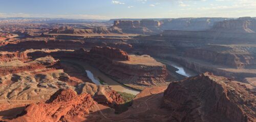 “The future of the Colorado River is looking bleak, and officials in the seven states that depend on its water say they’re happy to negotiate — but with current use rules expiring at the end of the year, compromise seems unlikely. During a more than two-hour PBS special on Wednesday, officials from the Upper and Lower basins, as well as farmers and water experts, painted an alarming picture of a shrinking river without enough water to meet legal allocation obligations set more than 100 years ago. The Colorado River is a vital source of drinking water for 40 million people in the seven states, Mexico and 30 Native American tribes, and it provides water for farming operations and hydroelectricity. The Lower Basin states — Arizona, Nevada and California — and the Upper Basin states — Colorado, New Mexico, Utah, and Wyoming — have been attempting to negotiate an updated water usage agreement for more than two years. So far, they’ve been unsuccessful. … ” Read more from the Arizona Mirror.
As litigation looms and drought takes its toll, state officials defiant over Colorado River’s future
“Routt County rancher Philip Rossi knew as early as January of this year — as the Flat Tops range above the Yampa River basin sat largely bare of snow — that 2026 would be a difficult water year. “You can just feel it,” said Rossi, whose family has run cattle in the upper Yampa River valley for more than a century. “This is no good. We’re just not getting any moisture.” Water managers at the Upper Yampa Water Conservancy District say that agricultural irrigators across the district received only about half of their normal water allocation from storage infrastructure like the Yamcolo and Stillwater reservoirs this year. For Rossi, it was even less, forcing him to pick the best quarter of his cropland to irrigate and let the rest go dry. “Being in this area all my life, this has been the worst that I’ve seen,” Rossi said. “We’ve had our (bad) years — 2012, 2002, 1977. This is the worst that it’s been for me.” Some ranchers in the Yampa basin had to cull a third of their herds before the spring calving season, said Todd Hagenbuch, Colorado State University’s extension agent for Routt County. This summer, many are trucking water to overstressed pastures to keep their cattle alive. … ” Read more from the Colorado Newsline.
Drought status update for the Intermountain West
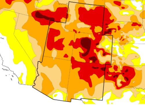 “Record-breaking July temperatures and widespread severe conditions have left nearly 95% of the Intermountain West in drought, per the U.S. Drought Monitor. Isolated monsoon rains failed to provide meaningful, region-wide relief for water supply challenges. Major reservoirs across the Colorado River and Rio Grande Basins are reaching historic lows, triggering mandatory water restrictions and threatening water supplies, hydropower generation, and recreation across the region. Key examples include: The nation’s two largest reservoirs are at critical lows. Lake Mead has hit record lows since its 1937 filling. Lake Powell is critically low at 22% capacity. … While the remaining monsoon rains may provide some relief for local supply and storage, rainfall is unlikely to resolve the Intermountain West’s long-term water supply challenges. … ” Read more from NIDIS.
Drought worsens in Colorado and across the West amid ‘lackluster monsoon’
“Drought conditions continue to expand across Colorado and the West as forecasters predict above-average temperatures for at least the next two weeks. A Thursday drought status update from the National Integrated Drought Information System describes how record-breaking July temperatures and a “lackluster monsoon” have left nearly 95% of the intermountain West in drought. So far, this year has been the hottest on record for nearly every county for the region, which is defined by mountains and high plateaus that includes Nevada, Utah, Idaho, northern sections of Arizona and western parts of Colorado, Wyoming, Montana and New Mexico, according to the update. … ” Read more from Vail Daily.
The Colorado River is drying up. Here’s how to protect it.
“When Pete McBride reached the end of the Colorado River, he expected it to spill into the sea. Instead, he ran aground in the dry earth of the Colorado River Delta, roughly 100 miles from the Gulf of Mexico. The moment, which opens his book Witness to Water: One Photographer’s Mission to Defend the Colorado River, raises a stark question: How does a river that carved the Grand Canyon, supplies drinking water to 40 million people, and irrigates more than five million acres simply… end? That question sparked a deeper look at one of the West’s most urgent (and often overlooked) environmental crises. After hiking the Grand Canyon end to end—roughly 750 miles without a trail—McBride explores why this river’s story is bigger than drought, and what it will take to protect it. … ” Read more from Sunset Magazine.
SEE ALSO: The Colorado River Compact is a dead parrot, from the Inkstain blog
CRIT seeks delay in federal decision on Colorado River operations plan
“The Colorado River Indian Tribes is urging the Bureau of Reclamation to postpone issuing a Record of Decision on the Final Environmental Impact Statement for post-2026 operations of Lake Powell and Lake Mead, citing concerns about the review process and tribal consultation. CRIT is requesting additional time to review the final environmental document and seeking an opportunity to provide input before a final decision is issued, according to a press release. The Bureau of Reclamation published the final environmental review July 31 and could issue a decision in the near future. CRIT officials said the timeline leaves insufficient time to review the document’s revised analysis, modeling assumptions, appendices and technical materials. … ” Read more from the Arizona Free Press.
Arizona wants to suck water supplies from Mexico’s Sea of Cortez
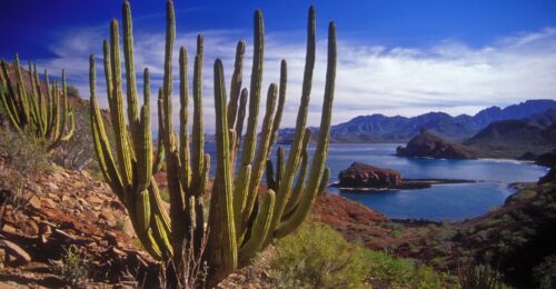
“Desalination companies are pitching new ways to pump water from the Sea of Cortez off Baja California in order to supply Arizona, which is facing massive cuts to its main water source, the Colorado River. EPCOR Water Innovation Partners, a Canadian company, and Acciona, a Spanish company, have pitched Arizona’s Water Infrastructure Financing Authority two different projects that do the same thing: pull salt out of ocean water to make fresh water. Both companies want to keep that fresh water in Mexico, and in exchange, Arizona’s investment would earn the state the right to take more water from the Colorado River – by taking a portion of Mexico’s share. It’s called a “paper water” exchange, similar to the water swap the San Diego County Water Authority is pursuing with its expensive desalinated water in Carlsbad. San Diego is talking to investors in the state of Arizona and Nevada about paying for that water so those states can take more from the river. … ” Read more from the Voice of San Diego.
Report card gives Arizona’s water systems a ‘C’ grade. The reason why is complicated
“A report grading Arizona’s infrastructure gave poor marks to the state’s water systems. An annual “report card” from the American Society of Civil Engineers looked at the state’s dams, wastewater systems, drinking water systems, stormwater systems and levees. None of those categories scored higher than a “C” grade. The report says anything with that grade is “mediocre” and “requires attention.” However, every single one of those categories received a grade higher than the national average. While the low marks might seem alarming, the report’s authors said they are more than meets the eye. For example, Arizona’s dams received a “C-” grade, but relatively few dams have structural problems, and they are often small and remote. The big, visible dams that hold back easily-recognizable reservoirs near populated areas are generally in good shape. … ” Read more from KJZZ.
Google announces donation for Arizona water restoration project
“Google announced Thursday they’re investing $600,000 in a water restoration project here in Arizona. The money will go to the nonprofit group Trout Unlimited, which is spearheading a number of water projects throughout the region and state, including in the Apache-Sitgreaves National Forests in Apache County and the White Mountains. Google is specifically donating towards a project happening in Eastern Arizona area to replace three smaller culverts with larger ones, allowing more water to flow underneath the roadway. The area is seen as an important tributary of the Salt River. Officials say the goal is to improve the natural water flow in the area and re-establish important habitats for the Apache Trout, which was removed from the Endangered Species List in 2024. … ” Read more from ABC 15.
Nevada strikes $16.25M deal to keep water in Lake Mead as feds near decision
“The Southern Nevada Water Authority has agreed to leave some of its water in Lake Mead this year in exchange for cash to comply with what water managers expect to be a firm requirement to do so through 2028. At a board meeting Thursday, directors ratified an agreement between the water authority and the U.S. Bureau of Reclamation that gives Nevada $16.25 million in federal funds for conserving an amount equal to one-sixth of its total Colorado River allocation. In 2026, the authority will leave 50,000 acre-feet in Lake Mead — the struggling reservoir that supplies about 90 percent of Southern Nevada’s water supply and is falling to new record lows each month. John Entsminger, general manager of the water authority, told board members it was a good deal, considering that the Trump administration’s recent final environmental impact statement might require 100,000 acre-feet to be left in Lake Mead during the next two years. … ” Read more from the Las Vegas Review-Journal.
Utah’s reservoir system tumbles closer to 50%, but Cox says it might be a ‘win’
“Utah’s reservoir system is nearing 50% capacity faster than its median average, but Utah Gov. Spencer Cox said that might be a “win” all things considered. The statewide reservoir system — excluding Lake Powell and Flaming Gorge — tumbled to 52% on Thursday, per Utah Division of Water Resources data. The system fell to 70% last year, while the state’s median average for August is 67%. It follows Utah’s record-low snowpack, which led to some of the worst spring runoff conditions ever reported. Snowpack accounts for nearly 95% of the state’s water supply; Cox said it might be surprising that it’s even 52% right now. “If you had told me that we were going to have the snowpack that we had last year and that we’d have reservoirs at 50%, that’s a win. That’s about where we were hoping we’d be as we get toward the end of the growing season,” he said Thursday during his monthly briefing with Utah reporters. … ” Read more from KSL.

