
Several news sources featured in the Daily Digest may limit the number of articles you can access without a subscription. However, gift articles and open-access links are provided when available. For more open access California water news articles, explore the main page at MavensNotebook.com.
In California water news today …
Could water rights scuttle Sites?
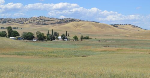
“In late June, a controversial new reservoir project in Northern California received a commitment for nearly $269 million in additional state funding, even as the State Water Resources Control Board weighs comments on a draft water rights decision for the project issued this spring. The upshot of those deliberations could jeopardize the financial viability of the project, which proponents say is vital to California’s water security and critics call yet another threat to the Estuary’s embattled ecosystem. Located in California’s Antelope Valley, the Sites Reservoir project will create an off-stream facility with a capacity of 1.5 million acre feet to capture and store excess flows from the Sacramento River system for later use. The California Water Plan, the state’s strategy for managing water resources, calls for adding nine million acre-feet of additional water, water conservation, or new storage capacity by 2040. The reservoir will be operated in conjunction with both the Central Valley Project and the State Water Project. Unlike traditional reservoirs, it will not dam a river or block fish migration. … ” Read more from Cariad Hayes Thronson at Maven’s Notebook.
Why doesn’t the West Coast see major hurricanes?
“Both the Pacific and Atlantic hurricane seasons are in full swing, but when it comes to major landfalling hurricanes, the focus is on the Atlantic, not the Pacific. This week, Zooming with Zoe takes a look at why California doesn’t get impacted by hurricanes like the East Coast. Historically, the Pacific hurricane season is slightly more active than the Atlantic’s season; 15 vs. 14 named storms, eight vs. seven hurricanes, and four vs. three major hurricanes. One reason for that is the Pacific’s season is slightly longer, running from May 15 – Nov. 30 while Atlantic runs from June 1 to Nov. 30. Another reason is the Pacific is just bigger than the Atlantic, with a lot more room for the storms to grow and develop. … ” Read more from CBS Sacramento.
Tropical Storm Elida to bring moisture and heat to California this week
“It is not often that tropical storms and hurricanes make their names known to California and the Western U.S., but on rare occasions these severe storms can lash the Pacific Coast with strong waves and even spur rare thunderstorms. Tropical Storm Elida, which will be weakening well offshore as it moves north over the next few days, could bring some rain, but most of the state will feel Elida’s presence in the form of more heat and humidity. In part fueled by the abnormally warm waters of a record-strength El Niño, Tropical Storm Elida is now moving over cooler Pacific waters and will weaken into a “post-tropical” cyclone early this week. … ” Read more from the Sacramento Bee.
El Niño is back: What a ‘very strong’ climate pattern could mean for California this winter
“It’s been a little over a month since El Niño arrived, and California may be in for a wet and wild winter. Oceanic conditions have rapidly changed in recent months, giving scientists greater confidence of a strong or very strong El Niño later this year, my colleague Rong-Gong Lin II reports. The National Oceanic and Atmospheric Administration’s Climate Prediction Center said earlier this month there’s a 97% chance that El Niño will be either “strong” or “very strong” over a three-month period ending this December. El Niño is associated with some of California’s most memorably destructive winter seasons. The strong El Niño of winter 2023-24 saw well above average rainfall across coastal Southern California and slightly above-normal precipitation in coastal Northern California, the state Department of Conservation said. … ” Read more from the LA Times.
A major ocean current is on the verge of collapse. Scientists say the effects may reach California
“Earth’s climate systems are inexorably and often unexpectedly interconnected. Dust from North Africa’s Sahara Desert drifts thousands of miles to fuel food webs in the Amazon and the ocean’s depths, while pollution-eating microbes hitch a ride through the atmosphere on gusts of wind or wisps of fog. Among the most influential planet-shaping forces is the Atlantic Meridional Overturning Circulation (AMOC), an immense Atlantic Ocean current system that acts as a planetary conveyor belt. It brings balmy water northward from the tropics to Europe, then cycles the cooled water back south along the seafloor. However, human-caused climate change is slowing this vital system and even threatening a potentially near-future collapse. … ” Read more from SciTech Daily..
Water extinguishes fire, but how does fire affect water? (pt 2)
“Last week, we introduced our research topic and question (i.e., how does fire impact water?), identified relevant data sources, and determined our pre- and post-fire precipitation events. Following that, we assembled hourly streamflow data from the USGS gages1 and aligned the flows to the start of each precipitation event for a direct comparison of pre- and post-Park Fire runoff across our watersheds. This week, let’s dive straight into the results (water metaphor!). Figure 1 below shows the hourly precipitation and the streamflow at each gage for each event. An initial observation is that the rising limb of the hydrograph and peak flow from the pre-fire event occurred more quickly than for the post-fire event (the opposite of what we anticipated). Due to fire burning through vegetation that may otherwise slow runoff, we hypothesized that post-fire runoff would occur more quickly. However, there are some key differences between the precipitation events. … ” Continue reading from the California Water Blog.
As water restrictions hit farmers, solar is making sense
“California’s Central Valley is one of the country’s richest farming regions, blessed with fertile soils, sunny days and a massive man-made system of irrigation canals and reservoirs. But as climate change intensifies, droughts deepen, and water restrictions kick in, growers in much of the valley are getting less water for their fields. They also face new limits on how much they can pump from underground, forcing them to leave hundreds of thousands of acres dry in the coming years. Some are turning to an answer they never thought they’d embrace: solar. “We still want to farm, but taking the chance that water will be here was too risky,” said Todd Tracy, a fifth-generation farmer, as he drove through his groves of green pistachio trees about a half-hour west of Bakersfield. … ” Read more from the LA Times.
Taylor Farms lettuce sample that tested positive for cyclospora was a false positive, FDA says
“A sample of lettuce from Taylor Farms that had tested positive for cyclospora was a false positive, the Food and Drug Administration said Sunday. “Due to the complexity in detection of Cyclospora, FDA laboratory experts re-reviewed the sample results and have concluded that the finding does not represent true amplification and should be considered a false positive,” the FDA said. In the statement announcing the false positive, the FDA said that as of Sunday it had not found any “confirmed positive sample results for product testing for Cyclospora.” Taylor Farms on Friday said it was “voluntarily removing” iceberg lettuce sourced from central Mexico after the lettuce had been linked to one of the largest outbreaks of cyclosporiasis in the U.S. in recent years. … ” Read more from CBS Sacramento.
SEE ALSO: FDA reports false positive after cyclospora outbreak linked to Calif. company, from SF Gate
California Forever dealt huge blow as $3 billion contract goes to Texas
“California Forever, a controversial project with aspirations to expand Solano County by up to 400,000 residents, was dealt a blow last week as a $3 billion contract went to Texas instead. California Forever first became known to the public in 2024, when reports surfaced that a shadowy group of billionaires had purchased 65,000 largely rural acres around Suisun City and Rio Vista, making it the largest landowner in Solano County. The group announced it planned to build a new city with its acquisitions, but the idea was widely unpopular in the county. Amid dire polling numbers, California Forever pulled a November 2024 ballot measure that would have allowed the project to bypass certain zoning restrictions to develop the area. … ” Read more from SF Gate.
SEE ALSO: California Forever: Inside the controversial billionaire-backed city that just suffered a devastating blow, from the California Post
Oregon’s wildfire outbreak exploded over the weekend. Could California see the same?
“A swarm of lightning-sparked wildfires across Oregon exploded in size over the weekend, turning dozens of new ignitions into one of the most significant fire outbreaks in the West this summer. Some of the growth was dramatic. The Hay Creek Complex west of Condon has burned more than 92,000 acres, while the Rowe Creek Complex south of Fossil grew to more than 36,000 acres. The rapid escalation pushed the Northwest to the highest wildfire preparedness level, joining the nation at Level 5. The designation reflects both the number of major fires burning and the growing demand for firefighting crews, aircraft and equipment. … Monsoonal moisture will begin moving north into the region this week, increasing the potential for additional lightning strikes and new ignitions. California is firmly in fire season, but the ingredients that came together in Oregon are not aligned across the state on the same scale. … ” Read more from the San Francisco Chronicle.
In commentary today …
This is why our fresh produce keeps making us sick
In regional water news and commentary today …
SIERRA NEVADA
North Lake Tahoe Fire starts Worm Project Phase 2
“In 2025, the North Lake Tahoe Fire Protection District (NLTFPD), in partnership with the Incline Village General Improvement District (IVGID), launched the 176.5-acre Worm Project, a wildfire fuels reduction initiative named for the long, narrow shape of the treatment area. The project is creating an intensively managed forest buffer around neighborhoods above Highway 431 in Incline Village, extending from private property boundaries onto IVGID and U.S. Forest Service (USFS) lands. By reducing hazardous vegetation, the project helps lower wildfire risk, improve firefighter access, and strengthen the protection of lives, homes, and critical infrastructure. Work includes thinning understory vegetation and removing smaller, suppressed trees while retaining approximately 10–15% of native brush in a mosaic pattern. This approach supports wildlife habitat, protects soil stability and water quality, and preserves the area’s natural forest character. … ” Read more from the Tahoe Daily Tribune.
SACRAMENTO VALLEY
Gravel project supporting Feather River salmon habitat
“The Department of Water Resources (DWR) is starting construction on a salmonid habitat improvement project in the Feather River between the Table Mountain Bridge and Bedrock Park in Oroville. Crews will begin mobilizing heavy equipment and supplies the week of July 20, with in-water work expected to begin the week of July 27. The project consists of placing approximately 7,900 cubic yards of in-river spawning gravel to improve existing spawning habitat sites and will also aid accessibility to existing side channels by excavating and redistributing accumulated streambed material. Migratory fish species such as Chinook salmon and steelhead trout rely on Feather River spawning habitats along the low-flow channel, where most spawning activity occurs. Because gravel doesn’t naturally flow downstream of Oroville Dam, gravel supplementation is necessary to provide sufficient spawning habitat to support existing salmonid populations. Female salmonids dig into gravel and lay their eggs in nests called “redds” using coarse sediment. Clean, rounded gravel approximately 1-4 inches in size is ideal as gravel that is too large is hard to move and gravel that is too small can suffocate eggs. … ” Read more from DWR.
Yolo County looks to buy Knights Landing property for flood control
“County supervisors are scheduled to consider an agreement with Four Corners Farmland Fund to buy land for the Knights Landing Flood Mitigation project. In a report to supervisors for their Tuesday meeting, Yolo administrators say the $94,000 would be used to acquire land for permanent flood control and temporary construction easements, and authorize the director of Public Works to sign the agreement. The 204-acre site is located along the right bank of the Sacramento River, on the east and west sides of County Road 116B at 10245 County Road 116B. It’s zoned as Agricultural Intensive, and is currently used for agricultural purposes. The county has received two grants to implement the project, which includes a series of drainage and levee improvements to the Sacramento River Right Bank Levee and the Knights Landing Ridge Cut that protect the community of Knights Landing. … ” Read more from the Daily Democrat.
Yolo County to declare ‘emergency’ over golden mussels
“Almost a month after invasive golden mussels were discovered at the Port of West Sacramento, Yolo supervisors are expected to declare a state of emergency. The resolution by supervisors, expected to take place at their Tuesday meeting, would allow county government to formally request money from the state to assist in mitigation and control. No fiscal effect associated with the resolution is expected, according to a report from county administrators. Ratification of the declaration will support the county’s ability to seek state and federal assistance with associated costs. “The California Department of Fish and Wildlife recently confirmed the detection of invasive golden mussels in and around the Port of West Sacramento within Yolo County,” according to the administrative report. “The detections represent an established local source population, posing a significant threat to local water infrastructure, agricultural water deliveries, flood control facilities, natural resources, and economy.” … ” Read more from the Daily Democrat.
NAPA/SONOMA
Castle winery in Napa County agrees to stream monitoring to address water-related concerns
“A dispute connected to water use at Castello di Amorosa was settled this week with an announcement the Calistoga-area winery, fashioned as a medieval-style castle, will study a Napa River tributary stream located on its property. The winery and Water Audit California, a local environmental watchdog, announced in a joint statement Monday, July 13, they would collaborate on a study of Nash Creek. The first phase of the work will involve adding monitoring equipment to collect video and data about creek conditions and track water use, according to the statement. The Napa River watershed historically supported thousands of Chinook and Coho salmon along with steelhead trout, but those numbers have been greatly diminished over the past century. Information gathered via the stream study will “guide future habitat restoration and water utilization,” according to the joint statement. … ” Continue reading from the Santa Rosa Press Democrat.
St. Helena residents advised to avoid and report discolored tap water
“Residents of St. Helena may see discolored tap water after a surge of water dislodged sediment accumulated inside water pipes over the weekend. “Out of an abundance of caution, residents should avoid consuming discolored water,” Dr. Issam Najm, St. Helena’s water quality expert, said in a statement from the city. Officials recommended residents use bottled water for drinking and other potable uses. The surge was caused after a private tour bus collided with a fire hydrant on Main Street Saturday, July 18, at about 4:45 p.m., releasing an estimated 4,500 gallons of water per minute, the city said in a statement. The fire department arrived on scene and capped the leak by 5:10 p.m. … ” Read more from the Santa Rosa Press Democrat.
BAY AREA
Marin officials explore sea-level collaboration options
“Marin County and local municipalities can’t address rising seas individually, but now is not the time to form a joint agency to do it, analysts say. The findings come from two assessments discussed by the Board of Supervisors on Tuesday. One was a two-year study by AECOM, a consulting firm advising the county, that evaluated the feasibility of forming a special district, a joint powers authority or other models. The other was commissioned by the Marin Community Foundation and conducted by Coastal Quest, a consulting group focused on climate. “Both studies recognize that Marin’s climate resilience initiatives have thus far been siloed,” said Nadia Seeteram, the county’s chief climate officer. … ” Read more from the Marin Independent Journal.
Marin County beaches score high for water quality despite decline from historical average
“Most Marin County beaches received strong water quality grades during the 2025 monitoring season, though the percentage of top-rated beaches fell below the county’s historical average, according to Heal the Bay’s annual Beach Report Card. The report found that 78% of Marin beaches earned A or B grades during the summer dry season, compared with a five-year average of 97%. Statewide, 91% of California beaches received A and B grades under similar conditions, the report said. Marin County officials said the decline was unexpected because lower rainfall is typically associated with better beach water quality. Heal the Bay reported Marin received about 21 inches of rain during the monitoring period, roughly 8% below the 10-year average. … ” Read more from Local News Matters.
Rain gardens can help filter out toxic pollution in Bay Area cities, new study shows
“A popular design innovation that’s adding green space across Bay Area cities could also be providing a major health benefit. A new study found that rain gardens may help clean up toxic pollution. Teams of researchers from the San Francisco Estuary Institute work almost non-stop to identify dangerous pollutants and toxic chemicals carried into the Bay by stormwater runoff: pharmaceuticals, pesticides, microplastics, just to name a few. Senior Scientist Rebecca Sutton, Ph.D., says the list of sources can vary widely. “So, all the water flowing through our streets during our rainfall in the winter definitely has a lot of different chemicals in it. Some of these chemicals are regulated, and some of them are what we call emerging contaminants,” Sutton said. … ” Read more from KGO.
Commentary: I’m the chairman of Aquarium of the Bay. The climate crisis is reaching S.F.’s waters
Jon Fisher writes, “At Aquarium of the Bay, the most important moments are often quiet ones. A child stands in the tunnel beneath San Francisco Bay and looks up as a leopard shark passes overhead. A parent reaches into a touch pool and feels the wing of a bat ray. For a few seconds, the bay stops being scenery — something glimpsed from a ferry, a bridge or a restaurant window — and becomes alive. Close. Present. That is why the recent news about ocean heat feels so urgent to me. The ocean’s crisis is easy to miss because it can look, from shore, like nothing at all. No flames. No smoke. A bright, sunny day where land meets the bay. Sea lions barking at Pier 39. But beneath the water’s familiar surface, the long memory of the climate is changing. For decades, the ocean has absorbed more than 90% of the excess heat trapped by greenhouse gases. It has been the buffer between us and the full force of what we have done to the atmosphere. Our oceans have kept absorbing the heat we’ve fed them, keeping it like a secret. Because the bill was hidden beneath the surface, most of us never had to look at it. … ” Read more from the San Francisco Chronicle.
SAN JOAQUIN VALLEY
Tracy residents want answers as mysterious debris from Medline warehouse fire continues falling 1 month later
“One month after a massive warehouse fire in Tracy, some residents say they are still finding mysterious white particles covering their homes and yards — and they say they’re getting few answers about what the material is or whether it’s safe. Cars, plants and children’s toys are coated with a fine, plastic-like material about the size of a grain of salt, according to residents living several miles from the burned Medline warehouse. Heather Corbett, who lives about three miles from the facility, said the particles began appearing after the fire and continue to accumulate. “Just really fine particles. They had never been there prior to the fire, and now we’re finding them everywhere,” Corbett said. … ” Read more from CBS Sacramento.
Storm Drain Detectives monitor Mokelumne River’s water quality
“A group of young scientists took to Lodi Lake and the Mokelumne River on Thursday, collecting water quality data while learning firsthand about the importance of protecting the community’s watershed. The Storm Drain Detectives program teaches students in the fifth through 12th grades about water quality and the impact of stormwater runoff. Because Lodi’s storm drains empty directly into the Mokelumne River, participants monitor local waterways throughout the year to better understand how runoff affects water quality. Nine Lodi schools participate in the program, which expects about 200 students during the upcoming school year. “It’s fun, and it’s really good for the kids because it’s teaching environmental science,” said Jud Atwater, a Storm Drain Detectives volunteer and former science teacher. “Kids can’t see if we need to protect something if they don’t even experience it. You get kids out on the river all the time, looking at it and working with it, and then they can make a better decision about whether it’s worth protecting.” … ” Read more from the Lodi News-Sentinel.
SOUTHERN CALIFORNIA
West Hollywood faces long recovery from massive water main break: ‘It was like whitewater rapids’
“The rupture of a 3-foot-wide trunk line Thursday morning sent 17 million gallons of water into a West Hollywood neighborhood, from the Sunset Strip downhill beyond Santa Monica Boulevard. Officials are still trying to assess the damage but say those impacted face a long recovery. West Hollywood Mayor John Heilman estimated that between 150 and 200 cars were damaged or destroyed in the flood. Officials are going door to door to tell residents how they can file claims with Los Angeles Department of Water and Power to pay for water damage. A handful of residential units were inundated, including a few where electricity had to be shut off because their electrical panels were compromised. Most of the damage was centered in underground garages where water had to be pumped out. … ” Read more from the LA Times. | Read via AOL News.
More water pipes burst in Venice, Hollywood as Sunset Strip repairs enter Day 4
“A section of Sunset Boulevard remained closed on Sunday because of last week’s destructive water main break, with officials saying they didn’t know when repairs to the 110-year-old pipe would be completed or the street reopened. “While there is no set completion date yet, our crews remain dedicated to finishing the repairs as quickly and safely as possible,” the Los Angeles Department of Water and Power said in a Sunday news release. Some West Hollywood residents remained displaced Sunday from apartments where underground garages were flooded by Thursday’s water main rupture. And some businesses near the scene remained indefinitely closed. Vanessa Lopez, an LADWP spokeswoman, said that two other water pipe ruptures on Saturday — one in Venice and another in Hollywood — had been repaired. … ” Read more from the LA Times. | Read via Yahoo News.
Series of water main breaks raises concerns over LA infrastructure
“A series of water main breaks across Los Angeles in recent days is raising concerns about the city’s aging infrastructure and whether more failures could occur. Crews continued working to repair the massive trunk line that ruptured Thursday in West Hollywood, leaving behind a large sinkhole on Sunset Boulevard. The break is the latest in a string of water main failures that have flooded streets, damaged homes and businesses, closed roadways and disrupted water service. In Studio City, an 8-inch water main failed, flooding a street and temporarily leaving about 60 customers without water while crews completed repairs. … ” Read more from NBC 4.
As East LA oil spill cleanup continues, 3 companies cited for violations related to incident
“With the cleanup of thousands of gallons of oil from a spill last month ongoing, three companies have been cited for violations related to the incident. On May 22, Camarillo Drilling was conducting drilling operations for a fiber optic line on behalf of HP Communications near the intersection of E. Cesar Chavez and Eastern avenues. Crews struck a 16-inch pipeline, which resulted in approximately 24,654 gallons of crude oil dumping into the street and storm drains — more than 10 times the initial estimates made by first responders at the time of the incident. The oil soon made its way to Long Beach, where crews were seen cleaning up the river between Willow Street and Pacific Coast Highway. … ” Read more from the Long Beach Watchdog.
The $10M race to save a Calif. lake town’s last undeveloped shoreline
“In 1884, a citrus farmer financed the construction of the Rock Dam, transforming a marshy California valley surrounded by forest into Big Bear Lake and forever changing the mountain area about 100 miles northeast of downtown Los Angeles. The original dam was replaced with a bigger one in 1912, and more development moved into Big Bear Valley: highways, ski lifts, a shopping district known as the village, hotels and thousands of homes. Today, some form of development rings nearly the entire circumference of the human-made lake. Some areas are more sparsely built-out than others, but for the most part, the lake is surrounded by second homes, vacation rentals and less common but desperately needed housing for the full-time residents who make up the mountain’s workforce. … ” Read more from SF Gate.
Cadiz secures ‘last permit’ needed for project
“Downtown-based water infrastructure company Cadiz Inc. recently won a major victory when a federal agency approved the company’s latest pipeline plan to convey water from its desert aquifer to water-hungry communities nearby and throughout the Southwest. The U.S. Bureau of Land Management on July 8 approved Cadiz’s plan to convert an abandoned natural gas pipeline to transport aquifer water, a crucial step in the creation of what Cadiz calls the Mojave Groundwater Bank. “This is the last permit we need to begin construction,” said Susan Kennedy, chief executive of Cadiz. But will this victory truly bring Cadiz closer to its decades-long quest to monetize its aquifer under the eastern Mojave Desert? Or will it prove yet another mirage as project opponents manage to place yet more obstacles in Cadiz’s path? … ” Read more from the LA Business Journal.
SAN DIEGO
Hydrogen sulfide readings in Tijuana River Valley show worsening trend. State bill targets outdated standard.
“Hydrogen sulfide readings in the South Bay have exceeded the county’s safety threshold with growing frequency in 2026, signaling a worsening trend in the presence of the toxic gas despite ongoing efforts to address the Tijuana River sewage and pollution crisis at the U.S.-Mexico border. Hourly readings at a hydrogen sulfide monitoring station in Nestor, near Berry Elementary School, exceeded that threshold more than 10% of the time so far this year, up from under 2% in 2024, according to monitoring data obtained from the San Diego County Air Pollution Control District. It’s the sharpest increase of the three sites the district tracks — compared with roughly 1% of hourly readings exceeding the threshold at Imperial Beach Civic Center and about 0.5% at San Ysidro since October 2024. … ” Read more from the San Diego Union-Tribune.
Binational Tijuana–San Diego plan to clean Tijuana River moves forward
“Representatives from all three levels of government convened this week to discuss strategies for water management and conservation in the Tijuana–San Diego region in a meeting officially titled the Interinstitutional Coordination Meeting CILA–SEPROA–Tijuana City Hall, led by Municipal President Abdiel Gutiérrez. The mayor emphasized the value of treating and reusing wastewater for irrigating public parks and green spaces as a strategy that bolsters the city’s efforts to use its water resources more efficiently. He also pointed out that Tijuana currently operates 32 sand traps, critical infrastructure designed to prevent sediment and debris from flowing into storm drains and waterways. … ” Read more from San Diego Red.
Along the Colorado River …
The West’s moment of reckoning is here on the Colorado River
“For more than a century, Western states have fought to keep the federal government out of their business when it comes to water. Now, the Trump administration is about to seize control of the Colorado River, the region’s most important waterway. But it’s not the narrative you might think. Interior Secretary Doug Burgum — himself a former Western governor — has said repeatedly that he preferred to have the states work out the shrinking river’s problems. Far from a brash commandeering of the system, the plan his department is set to finalize as soon as Monday is effectively a kick-the-can exercise for managing the drought-riddled river that supplies water for 1 in 10 Americans. “I would not characterize it as a nightmare, but it certainly wasn’t the preferred path when we entered into these negotiations,” said John Entsminger, Nevada’s lead for the failed water-sharing talks among the seven states with claims to the waterway. … ” Read more from E&E News.
Arizona commentary: Local opinion: Lets prepare for lower Colorado River deliveries
Sharon Megdal, Director of the UA Water Resources Research Center, and David Wegner, a retired federal Colorado River scientist, write, “This year’s low flows of the Colorado River have made the process for updating the 2007 guidelines for sharing Colorado River shortages contentious, inconclusive, and problematic. Inability of the seven U.S. states that share the Colorado River to agree on new guidelines leaves the decision-making for our water future in the hands of the U.S. Department of the Interior. While we await official word, indications are that the federal government will issue a 10-year framework, with renegotiation every two years. A recent briefing hosted by Arizona Department of Water Resources Director Tom Buschatzke suggested that proposed water cuts to Arizona — Central Arizona in particular — for the first two years of the new shortage sharing regime may not be as deep as feared, leaving Arizonans with a sense of temporary relief. However, another winter with precipitation and runoff levels as bad as 2026 would likely require deeper cuts next year. … ” Read more from the Arizona Daily Star.
Commentary: Is the Colorado River in a climate doom loop?
Gary Wockner, director of Save The Colorado, writes, “As negotiations and potential lawsuits over the Colorado River intensify, the U.S. Bureau of Reclamation – which is ultimately in charge of managing the river – would be smart to pull back from the high-stakes gambit and take a hard look at the science. To make it easy for the Bureau, I’ve packed the best and most recent science into four tight paragraphs below. First and foremost, in a new report from the University of Colorado Boulder, the best scientists in the business predict that flows in the Colorado River could drop 30% more by 2050 due to climate change, and that pre-climate flow levels are not coming back. Second, a new scientific study by the group, Tell The Dam Truth, describes how the massive damming of the Colorado River is a source of greenhouse gas emissions. Not only do the reservoirs and hydropower turbines themselves emit GHGs, but the dry-up of two million acres of wetlands in the Colorado River Delta in Mexico, caused by the dams, is the biggest source of GHG emissions in the whole system. … ” Read more from the Colorado Newsline.
‘We can do hard things’
“It’s day one of a 2,000-mile journey for water activist and ultramarathoner Mina Guli. She is preparing to run the length of the Colorado River over the course of around 100 days or less. But first, Mina needs to find her starting line. As she and the crew crunch through dry marsh high in the Rockies, they search for the headwater of the mightiest river in the American West. For a water source that supports 40 million people, it’s drier than it should be—the result of historic snowpack deficits and chronic overuse. Finally, seeping up between the tall grass, the team thinks they’ve found it—a muddy hole no more than 12 inches across that turns into the faintest trickle of a stream. Now, the real work begins.
Perhaps most surprising? Guli doesn’t particularly like to run. “I get scared. I’m really slow. I fall over on trails … But sometimes, you have moments in your life where you realize, if not me, then who?” … ” Read more from the Walton Family Foundation.
Radio show: New federal law could bring running water to tribal homes, but states have concerns
“More than 10,000 homes on Southwestern Indian reservations lack running water. This despite tribes substantial water rights. A new solution is being held up as states fight over the Colorado River.” Listen at NPR.
Denver Water’s 1.5 million customers are falling way short of drought-cutting goals
“When Denver Water looked back at the historically abysmal snowpack, and ahead to a historically scorching summer, the crucial agency for 1.5 million Coloradans set a target of 20% water use cuts to help solve challenges from the ongoing drought. It’s not working. At roughly the midpoint of the high season for lawn watering, which accounts for about half of Denver Water home use, customers have cut only about 2% of the five-year system average. Officials fear that after a weekend of 100-degree temps forecast for the Front Range, they’ll see even worse results as customers reel from a searing streak of daily highs and defend their lawns with amped irrigation. “We are seeking a 20% reduction off the five-year average, and yes we are far behind on that goal,” Denver Water spokesperson Todd Hartman said, in email responses to questions. By mid-July, Denver Water wanted to see 10,300 acre-feet less water used than the long-term average of about 51,000 acre-feet. So far, customers have trimmed use by 1,300 acre-feet. … ” Read more from the Colorado Sun.
In national water news today …
Water sector applauds efforts on WRDA, SRF reauthorization
“The Senate Environment and Public Works (EPW) Committee voted unanimously to pass the bipartisan Water Resources Development Act (WRDA) of 2026, that would also reauthorize the Drinking Water and Clean Water State Revolving Funds (SRF) programs. The Water Resources Development Act is biennial legislation that authorizes flood risk management, navigation and ecosystem restoration projects for the U.S. Army Corps of Engineers. The bill authorizes 61 feasibility studies and 15 new or modified construction projects across the country. WRDA 2026 also reauthorizes the U.S. Environmental Protection Agency’s (EPA) Drinking and Clean Water SRFs. … ” Read more from Water Finance & Management.
Lab closures threaten cyclospora research as parasite outbreak sickens thousands
“Food-safety experts warned that plans to shutter a US Department of Agriculture research facility will hinder efforts to protect consumers from the foodborne cyclospora parasite — a risk that’s underscored by the outbreak that’s spreading across the country. The agency is in the process of closing the Beltsville Agricultural Research Center just north of Washington, DC, and relocating its programs to facilities across the country under a restructuring plan announced last year. The center has two laboratories that play a significant role in investigating cyclospora as well as coordinating research with other federal agencies. Don Schaffner, chairman of the food science department at Rutgers’ School of Environmental and Biological Sciences, said the closing could set back foodborne parasitology research “a decade or more” and “put the United States farther away from understanding complex outbreaks like the current cyclospora outbreak.” … ” Read more from Bloomberg.
Trump admin gives economic interests more sway over wildlife protections
“The Trump administration announced Friday that it has finalized changes to environmental regulations that roll back protections for wildlife. The moves undo automatic protections for some imperiled species under the Endangered Species Act and allow regulators to consider economic factors when deciding whether to designate critical habitat areas, which conservationists say could boost industries’ interests over those of wildlife. The Fish and Wildlife Service overhaul follows another major ESA change earlier this week, which redefined what it means to “harm” a protected species. Interior Secretary Doug Burgum said in a statement that the administration’s changes come as a result of listening to “local voices.”“Nearly 97 percent of species ever placed on the list remain there today,” Burgum said. “Success should be measured by species recovery and delisting, not by adding more species to the list.” … ” Read more from E&E News.
Underwater oxygen loss threatens earth’s stability, researchers warn
“A new review paper led by scientists at UC San Diego’s Scripps Institution of Oceanography warns that the rapid loss of oxygen from the ocean and other aquatic ecosystems is pushing Earth toward an “unsafe space,” with consequences that could be irreversible on human timescales. The study reviews the widespread interactions between aquatic deoxygenation — the decline of dissolved oxygen in the ocean (ocean deoxygenation), coastal waters, rivers, lakes and streams — and the nine processes outlined by the Planetary Boundaries framework. First introduced in 2009, the framework identifies critical Earth system processes and the ways human activities are pushing them beyond the conditions needed to keep the planet stable and resilient. The nine planetary boundaries are climate change, ocean acidification, biodiversity loss, atmospheric aerosol loading, stratospheric ozone depletion, freshwater change, land-use change, chemical pollution and biogeochemical flows (including the nitrogen cycle). The authors propose adding dissolved oxygen conditions to the framework. … ” Read more from Scripps.
Precipitation watch …
Precipitation watch.
Also on Maven’s Notebook today …
Announcements, etc.

