
Several news sources featured in the Daily Digest may limit the number of articles you can access without a subscription. However, gift articles and open-access links are provided when available. For more open access California water news articles, explore the main page at MavensNotebook.com.
On the calendar today …
- WORKSHOP: Salton Sea Management Program beginning at 9am. Annual public workshop on the status of Phase 1 of the Salton Sea Management Program. Click here for the full agenda.
- MEETING: California Water Commission beginning at 9:30am. Agenda items include an update on the Water Storage Investment Program projects, an update on the Chino Basin Program, a State Water Project Briefing: Safety, Operations, and Energy, and a Sustainable Groundwater Management Act Implementation Update. Click here for the agenda and remote access information.
In California water news today …
DWR releases Spring 2026 Semi-Annual Groundwater Update
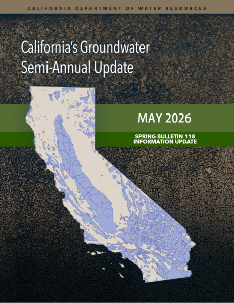 “The Department of Water Resources (DWR) has released the Spring 2026 Semi-Annual Groundwater Update, which provides a look back at California’s groundwater conditions during Water Year 2025 and early Water Year 2026. The groundwater update released today includes Water Year 2025 Groundwater Sustainability Plans (GSP) and GSP Alternative annual report data reported across 101 groundwater basins, which make up over 90 percent of the groundwater use in the state. This information is helping provide an increasingly clearer picture of groundwater conditions, including the amount of change in groundwater storage, groundwater extractions, and managed recharge that occurs each year. … ” Read more from the Department of Water Resources.
Data transparency is key to California achieving groundwater sustainability
Paul Gosselin, DWR Deputy Director for Sustainable Water Management, writes, “Beneath the feet of millions of Californians lies one of the most critical pieces of our state’s water supply – groundwater. This hidden resource provides about 40 percent of California’s total annual water supply and serves as an important buffer during dry periods, supplying up to 60 percent of the state’s water in drought years. As California’s hydrology becomes more variable, long-term sustainability will require adaptive management, including improving recharge during high-flow periods, better coordinating surface water and groundwater use, managing demand, and consistently tracking progress. In a future increasingly defined by swings between intense wet and dry years, managing this largely unseen resource will require strong science, reliable data, enhanced monitoring and forecasting tools, and continued collaboration across local, regional, and state partners. Data transparency is the key to sustainable groundwater management because of its ability to tell California’s groundwater story. From monitoring wells to aerial surveys to GPS monitoring stations tracking subsidence, state and local agencies are working hard to expand the state’s groundwater data network to help water managers make better-informed decisions. … ” Read more from DWR.
Reclamation increases Central Valley Project 2026 water supply allocations for south-of-Delta contractors to 25%; Westlands responds
“The Bureau of Reclamation is increasing Central Valley Project 2026 water supply allocations for south-of-Delta contractors following continued modest improvements in reservoir storage and spring runoff conditions across California’s water system. This allocation update reflects improved operational flexibility and hydrologic conditions resulting from April storm activity, strong carryover storage, and coordinated reservoir management efforts that allowed water managers to capture additional runoff while continuing to meet environmental and flood control requirements … Irrigation water service and repayment contractors south-of-Delta are increased from 20% to 25% of their contract total. Municipal and Industrial water service and repayment contractors are increased from 70% to 75% of their historic use, or public health and safety needs, whichever is greater. Eastside Division contractors are increased from 0 to 49,000 acre-feet. … ” Read more from the Bureau of Reclamation and Westlands Water District.
SEE ALSO:
- Westlands: Water allocation update “disappointing”, from the SJV Sun
- Westside Fresno County farmers get modest boost in federal water allocation, from the Fresno Bee via Yahoo News
See how this 9,000-mile freight train of warm water may fuel a super El Niño
“The key to the intensity of a coming El Niño lies hundreds of feet down in the Pacific Ocean. That’s where a freight train of record-warm water is chugging along. This train, called a Kelvin wave, is carrying ocean waters that have reached 7.5 degrees Celsius (13.5 degrees Fahrenheit) above average in parts of the deep ocean — a huge amount of warming for the ocean, which warms and cools much slower than land. This undersea wave of warmth could contribute to one of the strongest El Niño events on record later this year, with cascading effects expected on global climate patterns into 2027, including increasing risks for drought, flooding rain and record heat and humidity. … ” Read more from the Washington Post.
SEE ALSO: How ‘Super’ El Niño Could Impact Colorado River Water Crisis, from Newsweek
Union of Concerned Scientists: Data centers in California
“California already has many large data centers, and the state is expecting to see a surge of new data centers over the next decade. While data centers and the proliferation of AI pose a wide range of potential impacts on the economy, the environment, and society, this fact sheet focuses specifically on the impacts on the state’s electricity system and its ratepayers, along with policy solutions to mitigate those impacts. If left unaddressed, data center growth could undermine grid reliability, slow the clean energy transition, and raise costs for ratepayers. Policymakers should require data centers to provide more transparency into their operations and pay their fair share of electricity costs. The state should additionally implement guardrails to ensure the growth of data centers does not stall clean energy progress or threaten grid reliability, and that the harmful air quality impacts from backup generation are minimized. … ” Read more from the Union of Concerned Scientists.
California water debate intensifies as Edward Ring pushes major reforms for farmers and the Delta
“The AgNet News Hour focused heavily on California’s growing water crisis and the political battle surrounding agriculture, featuring an extended interview with water policy expert Edward Ring on the future of farming, Delta management, desalination, and the upcoming governor race. Ring, Director of Water and Energy Policy at the California Policy Center, warned that California is approaching a critical turning point where leadership decisions on water infrastructure and regulation could determine the future of agriculture statewide. “It couldn’t be any more important,” Ring said while discussing the urgency surrounding California’s next governor and the state’s long-running water failures. … ” Read more from AgNet West.
Why rocket scientists began counting nuts in California
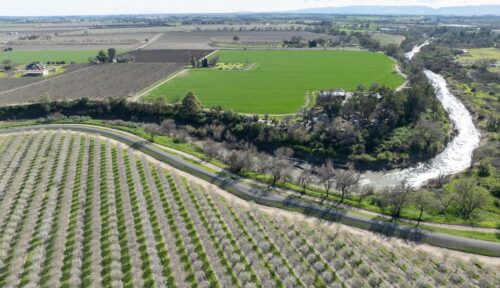
“For decades, experts have done their best to estimate the size of California’s almond crop prior to harvest. With the state producing more than three-quarters of the world’s supply, the global market rises and falls with the fate of the Central Valley crop. Expectation of a shortage can stoke competition among buyers and raise prices, while a large crop forecast can achieve the opposite. “It affects many lives,” Jasbir Sidhu, who grows almonds in Fresno and Madera counties, said of the yearly estimate. Dan Sumner, professor of agricultural and resource economics at the University of California, Davis, said reliable forecasts are important because they help farmers make sensible investments. “You make decisions based on what you think is going to happen,” Sumner said. … ” Read more from Ag Alert.
Ag production forecast shows drop in several state crops
“California production of almonds, peaches and winter wheat is expected to drop while production of durum wheat is projected to rise in 2026, according to a crop forecast released last week by the U.S. Department of Agriculture. The department estimated the 2026 almond crop will come in at 2.7 billion pounds, down from 2.715 billion pounds in 2025, a drop of about 1%. Forecasted yield is 1,940 pounds per acre, unchanged from last year. California’s bearing almond acreage fell 0.7% to 1.39 million acres this year compared to 1.4 million acres in 2025. Total peach production is projected to fall nearly 10% this year to 480,000 tons, a dip from 532,000 tons last year. … ” Read more from Ag Alert.
Northern San Joaquin Valley’s TID canals first in state to install solar panels, sustainable concept could spread across California
“A creative solution to water scarcity and land use is taking shape in the northern San Joaquin Valley – with hopes that this first-in-California concept will spread to the rest of the state. What started as a study by UC Merced researchers in 2021 has become a reality in Stanislaus County canals. On Wednesday regional and state officials, farmers, scientists, students, business leaders and more were invited to tour the first proof-of-concept sites for an innovative project to place solar panels over irrigation canals. Called Project Nexus, the idea was to study how the solar panels could generate carbon-free energy while at the same time reducing water evaporation and algae growth. Spearheaded by municipal water agency Turlock Irrigation District, the initiative includes a completed site in Hickman, about 45-minutes east of Modesto, and a smaller site in Ceres. … ” Read more from the Manteca Bulletin.
This fish is back on the menu after a three-year hiatus. Here’s where, and why
“After three consecutive years of being off restaurant menus, one of the most prized local fish is finally swimming its way back to market, and chefs are hooked. Wild California King salmon, also known as Chinook, is the largest of the Pacific salmon, and one of the most desirable varieties. It’s treasured for its buttery texture and rich flavor, which come from the fish’s high natural oil and omega-3 content. Climatic conditions impact the success of salmon runs, causing regulatory agencies to enforce occasional closures to protect the fish from endangerment. So when the salmon runs are sufficiently robust to allow fishers to harvest them, chefs snap them up. … ” Read more from the Sacramento Bee.
Irvine startup pulls water out of the air
“The large metallic white box sits in a Southern California parking lot, looking unremarkable until water starts flowing from a hose attached to it. Peer inside, though, and it’s nearly empty but for some wires, tubes and a container of light-colored material. The water isn’t being conjured out of thin air by magic but by MOFs — metallic organic frameworks. MOFs are nanocrystalline structures engineered at an atomic level to attract specific molecules. In this case that’s H2O and the machine made by the startup Atoco is silently harvesting molecules from the surrounding air and storing them in the material’s porous cavities that serve as microscopic water tanks. Atoco founder Omar Yaghi shared the 2025 Nobel Prize in chemistry for pioneering MOFs. … ” Read more from the LA Times.
Wildfires, storms and record-breaking heat: Extreme weather advisories cover big swath of U.S.
“Wildfires in California, thunderstorms and threats of flash flooding in the Midwest and extreme heat in the Northeast: A wide range of severe weather events are raging across the nation on Tuesday, putting millions of Americans under weather advisories. Near Southern California, evacuation orders and warnings remained in effect Tuesday as wildfires raged near Burro Peak and across the Simi Valley region. The Sandy Fire in Simi Valley, located about 30 miles northwest of Los Angeles, raged across nearly 1,400 acres since it began Monday morning. Only 5% of the fire had been contained as of 8:30 a.m. local time on Tuesday, according to the California Department of Forestry and Fire Protection. … ” Read more from NBC News.
Climate emergencies are breaking water utilities. Customers are paying
“When the Eaton Fire blitzed central Los Angeles County in January 2025, the foothills community of Altadena sat in its path. Burning more than 14,000 acres in and around the southern edge of Angeles National Forest, the fire concentrated its structural damage in an area of Altadena served by Las Flores Water Company, a small drinking water provider. By the time the flames were extinguished, the water company sustained substantial losses that its customers will cover with expensive surcharges. … These consequences of a climate-related emergency in the Los Angeles foothills are emblematic of the terrible toll being exacted nationwide not just on land and property, but also on essential duties of government, like supplying water. Las Flores is just one calamity among many in recent years. The number of weather disasters causing more than $1 billion in damages in the United States is climbing. According to Climate Central, the last three years have had the highest number of billion-dollar disasters. The vicious storms, floods, freezes, and droughts have destroyed homes and killed hundreds of people. They are also endangering water supply and reliability as well as municipal and residential financial well-being. … ” Read more from Circle of Blue.
As wildfires burn, rainfall can strip oxygen from rivers, killing fish
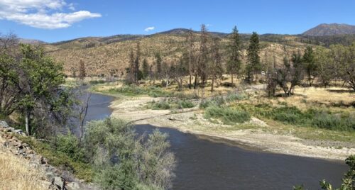
“Runoff from a high-intensity storm during the 2022 McKinney Fire depleted oxygen in the Klamath River to levels lethal to fish, killing aquatic life along nearly 60 miles of one of California’s most culturally significant waterways, according to a U.S. Geological Survey study. The study, conducted in cooperation with the Karuk Tribe, the Yurok Tribe and two universities, is the first published documentation of a rain-on-wildfire event directly linked to lethal water-quality conditions in a large river. The research highlights how continuous water-quality monitoring, uncommon in fire-prone areas, is critical for detecting sudden changes. Using high-frequency monitoring data, scientists revealed how the initial flood wave of stormwater moved quickly downstream while a concentrated pulse of fire-scar material, including ash, charcoal, and sediment left behind by burned hillslopes, arrived later. This caused dissolved oxygen in the water to drop to zero for more than five hours, creating a condition called anoxia, a total loss of oxygen that can quickly kill fish. … ” Read more from the USGS.
Prescribed burns and forest thinning averted millions of tons of emissions and billions in damages
“Work to reduce excess flammable vegetation in forests warded off the release of 2.7 million tons of carbon dioxide, averted nearly 60 premature deaths and avoided $2.8 billion in damages in the Western U.S., according to a new study from the University of California, Davis. The study, published May 7 in the journal Science, also found forest fuel treatments—prescribed burns and mechanical forest thinning operations—during a six-year span prevented more than 25,000 tons of fine particle pollution from being released into the air. The research was supported by the U.S. Forest Service and the University of California’s Giannini Foundation for Agricultural Economics. The findings come as weather forecasters and first response agencies predict an extremely active wildfire season across the West, with record-low snowpack, drought-stricken lands, extreme heat and the ever-looming threat of windy conditions. As of May 8, more than 25,000 wildfires had burned over 1.8 million acres nationwide, well above the 10-year average for acreage burned to that date, according to the National Interagency Fire Center. … ” Read more from Inside Climate News.
In commentary today …
California’s water answer may be hiding in plain sight: The Pacific Ocean
Greg Walcher, president of the Natural Resources Group and author of “Smoking Them Out: The Theft of the Environment and How to Take it Back,” writes, “The Wall Street Journal headline said “San Diego Now Has So Much Water That It’s Selling It.” The article said San Diego generates enough water to rescue Arizona, though that’s jumping the gun just a bit. No such deal has actually been finalized yet, but the fact that the conversation is underway marks a new era in Colorado River negotiations. And not a minute too soon. The latest optimism is not based on any change in the historically low flow of the Colorado River. It’s based on the realization – at long last – that California does not need Colorado River water. That realization has finally come not only to Upper Basin states like Colorado (which has been making this point for decades) but to all of the seven states in the Colorado River Basin, which are entitled to various amounts of river water allocated by a century-old interstate compact and several other legal agreements. California occupies 840 miles of coastline on the world’s largest body of water, the Pacific Ocean. The issue of desalination has risen to the top of the agenda for other Basin States now for two reasons. … ” Read more from the Rocky Mountain Voice.
Coastal desalination could save Colorado’s water. The pushback? Cost
Michael Badagliacco, Editor of USA Liberty Report, writes, “The 1922 Colorado River Compact apportioned 7.5 million acre-feet annually to the Upper Basin, including Colorado, and the same amount to the Lower Basin states. The 1928 Boulder Canyon Project Act fixed specific Lower Basin shares: California 4.4 million acre-feet, Arizona 2.8 million acre-feet, and Nevada 0.3 million acre-feet. The 1948 Upper Colorado River Basin Compact later assigned Colorado roughly 51.75% of the Upper Basin’s share, or about 3.86 million acre-feet. … Reverse osmosis desalination has operated commercially for more than fifty years. The Carlsbad Desalination Plant, completed in 2015 at roughly $1 billion, produces 50 million gallons per day (approximately 56,000 acre-feet annually) using about 3,500 kilowatt-hours per acre-foot. It supplies roughly 7% of San Diego County’s needs. Multiple coastal facilities could generate millions of additional acre-feet yearly for direct delivery to the Los Angeles Basin or for pumping into Lake Powell and Lake Mead, restoring storage without further taxing Colorado’s apportionment. … ” Continue reading at Rocky Mountain Voice.
In regional water news and commentary today …
NORTH COAST
Chinook fishing on Klamath River in California won’t be allowed until July
“Fishing for Chinook salmon on the Klamath River is currently not allowed in California but will be permitted beginning July 1. The California Department of Fish and Wildlife (CDFW) said in a news release that following three consecutive years of closure, salmon fishing will return to the Klamath River Basin for the upcoming summer and fall seasons. According to the release, “These added fishing opportunities come as a result of an increase in numbers of adult Chinook salmon returning from the ocean to the Klamath Basin and Central Valley.” In the Klamath Basin, fishing will open for late spring-run Chinook salmon July 1 and will continue until Aug. 14 on the Klamath River and Aug. 31 on the Trinity River. Fall-run Chinook salmon fishing will begin on Aug. 15 on the Klamath River and continue until Dec. 31. … ” Read more from the Herald & News.
25,000 juvenile Chinook released in lower Smith River
“The following is a press release from Toloa Dee-ni’ Nation: The Tolowa Dee-ni’ Nation’s Fisheries Division and staff at Rowdy Creek Fish Hatchery released approximately 25,000 juvenile Chinook Salmon into the lower Smith River on Friday, May 15. The release was the culmination of an annual fish enhancement program that started with the seining and spawning of adult Chinook in late fall. The hatchery aims to release a total of 60,000 Chinook salmon this spring to support subsistence harvest for tribal members and maintain local recreational fishing opportunities for the public. … ” Read more from the Eureka Times-Standard.
SIERRA NEVADA
Yuba Water Board of Directors approves $500,000 grant to fund spring-run Chinook salmon reintroduction program
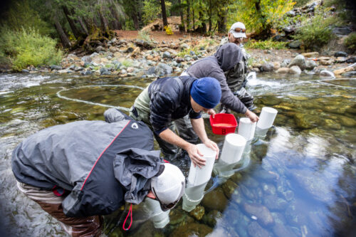
“The Yuba Water Agency says they are continuing efforts to bring spring-run Chinook salmon back to their historical habitat in the upper North Yuba River watershed. On Tuesday, the Yuba Water Board of Directors approved a $500,000 grant to the California Department of Fish and Wildlife (CDFW) to fund another year of the reintroduction program. For the past two years, the Yuba Water Agency has partnered with CDFW on a pilot program to restore the salmon population. The program has successfully placed hundreds of thousands of salmon eggs and adult salmon in the North Yuba River. … ” Read more from Action News Now.
SEE ALSO: Yuba Water Agency supports continuation of salmon reintroduction on the Yuba River, from YubaNet
Amador Water Agency secures a $58 million loan from EPA to upgrade aging treatment plants
“On Tuesday, May 19, the U.S. Environmental Protection Agency (EPA) announced a $58 million Water Infrastructure Finance and Innovation Act (WIFIA) loan to the Amador Water Agency (AWA) to make improvements to several drinking water treatment plants, which will increase treatment capacity and reliability. This loan will help address aging infrastructure and increase capacity to meet the county’s current and future water demands. “Small, rural communities are the backbone of this country, and we must ensure that they have access to clean, safe drinking water,” said EPA Assistant Administrator for Water Jess Kramer. “Congratulations to Amador County for securing $58 million in WIFIA financing. EPA’s WIFIA Loan Program is an effective way for communities to make water infrastructure investment and protect public health. Its flexible financing features and competitive interest rates save communities like Amador millions of dollars.” … ” Read more from the Ledger-Dispatch.
SACRAMENTO VALLEY
USACE team inspect completed American River flood protection project after first winter season
“Completion of Lower American River Contract 3A in 2025 marked a significant milestone for the American River Common Features program, supporting flood risk reduction in one of the nation’s most at-risk regions for catastrophic flooding. The LAR C3A project now provides improved flood protection in an area that came close to failure during the 1986 flood event. During that storm, erosion reached nearly to the top of the levee upstream of the Interstate 80 bridge, and officials determined the levee was within hours of catastrophic failure had the rain continued. This May 5, members of the U.S. Army Corps of Engineers Sacramento and St. Paul districts joined nonfederal sponsor representatives for an inspection of the project following its first winter flood season. “Contract 3A was one of the most technically and logistically complex reaches within the American River Common Features program. It required close coordination across multiple agencies and stakeholders while working in tight spaces and navigating numerous obstacles and restrictions,” said Kevin Lee, project manager with Sacramento District. … ” Read more from the Army Corps of Engineers.
NAPA/SONOMA
Sonoma Water awarded nearly $48 million to upgrade troubled lower Russian River wastewater system
“A long-awaited overhaul of the lower Russian River’s aging wastewater system is on deck after Sonoma Water was awarded a $47.8 million grant from the state. The money, funded through California’s Clean Water State Revolving Fund program, will support the Russian River Sanitation District’s efforts to rehabilitate the system’s 34 miles of sewer lines and four miles of mains, serving 3,300 parcels between Rio Nido to Vacation Beach in Guerneville. “I can’t promise anything, but I think we’re going to see a significant benefit and improvements to the overall functionality of the system,” Carlos Diaz, deputy director in engineering design with Sonoma Water said. … ” Read more from the Santa Rosa Press Democrat.
Sonoma Water raises Russian River dam to shore up summer drinking water supply
“It’s the time of year, when a massive 100-foot rubber dam emerges from the bottom of the Russian River near Forestville. That’s to ensure the 600,000 residents of Sonoma and Marin counties who rely on the river for drinking water have a stable supply during summer, when demand for water increases but river levels are lower. Monday marked the start of the three-day process of raising the dam, which was first raised in the 1970s. Throughout the year, six caissons — or wells — dig 100-180 feet beneath the riverbed to draw up water, which is filtered by gravel along the bottom of the waterway. “The primary source of our water is the Russian River,” said David Royall, assistant general manager for operations and maintenance for Sonoma Water. “We have to maintain a fixed elevation inside of our caissons. Once it gets to 15 feet, that’s when we make the call.” … ” Read more from Local News Matters.
Commentary: The Tragedy of the Commons in Napa: When exactly will we meter groundwater usage?
Dan Mufson writes, “For over a decade, we at Napa Vision 2050, and several Napa County Grand Juries have been concerned about our environment and, in particular, the depletion of our precious groundwater. “This Grand Jury (2014-2015) would stress that there are some troubling issues and that the County would be better served planning for a potential future disaster vs. waiting for it to happen and then trying to put a plan together quickly. Citizens should expect their governmental officials to be prepared for all potential outcomes and have procedures or policies in place that they may rely on when needed.” (“Management Of Groundwater And Recycled Water: Is Napa County In Good Hands?” published March 2015.) … ” Read more from the Napa Valley Register.
BAY AREA
Marin County backs coalition opposing new offshore drilling along California coast
“The Marin County Board of Supervisors approved a $29,000 contribution Tuesday to support a coalition opposing new offshore oil and gas drilling in federal waters as the Trump administration advances its proposed five-year offshore leasing program. The one-time payment will go to Santa Cruz County, which leads the multi-county Save My Coast Coalition. Marin County joined the coalition in November. The funding will support the work of Richard Charter, the coalition’s public advocate. His duties include researching federal actions, drafting public comments and attending hearings. “Marin County strongly opposes any new oil and gas lease sales in the Pacific Region,” said Marin County District 4 Supervisor Dennis Rodoni in a public statement. … ” Read more from Local News Matters.
San Francisco: These pipes are a seismic shift in keeping the water flowing
“An earthquake can strike at any moment, and the San Francisco Public Utilities Commission (SFPUC) works hard to be quake-ready. Recently, the SFPUC finished replacing some of the water system’s oldest pipelines with earthquake-resistant pipes along a critical four-mile route connecting College Hill Reservoir to San Francisco General Hospital, the city’s primary trauma center. This helps ensure that first responders and San Francisco’s most vulnerable residents will have water when they need it most. Completed over 11 years, the project strengthened the system from the source, with seismic upgrades to College Hill Reservoir. College Hill is San Francisco’s oldest working reservoir and holds 13 million gallons of water, enough to fill more than 19 Olympic-size swimming pools! Much of the City’s aging water system is over a century old, and the project was a test case in applying earthquake-resistant pipe in a dense urban setting with challenging underground conditions. … ” Continue reading from the SF PUC.
Here’s why a large number of gas stations have closed in Bay Area
“Finding a gas station in the Bay Area has become more difficult in recent years as hundreds of stations have closed, driven in part by the high cost of removing potentially dangerous underground storage tanks and complying with state law. In San Francisco’s Mission District, a Shell station remains out of service while its steel tanks are replaced – a process that can be complex and hazardous. During one removal, gasoline vapors inside a tank caused an explosion, underscoring the risks involved. California first addressed the issue in 1984, when gas stations were barred from installing new single-walled tanks. The concern was environmental safety. “We just don’t want any foreign substance in our water supply,” said Mark DeMarco of the Santa Clara Valley Water District during an interview with ABC7 news in the mid 1990s. … ” Read more from KCRA.
Video: Measuring the health of the San Francisco Bay
“In this edition of OpenRoad with Doug McConnell and friends, we’ll tag along with scientists collecting data to assess and protect the health of the San Francisco Bay. We’ll get tips on some of the least known, most beautiful state parks in the Bay Area. In addition, we’ll explore nooks and crannies of one of the Bay Area’s most majestic mountains. ” Watch Video from NBC Bay Area. ‘
California turns to AI as whale deaths spike
“Ferries, cargo ships and tankers cut through choppy waters in the San Francisco Bay Tuesday as a whale surfaced nearby, its spout barely visible against the white caps. Until now, whales could easily go unnoticed by mariners, but an AI-powered detection network launched this week is designed to track them day and night. The system, called WhaleSpotter, scans the bay around the clock for whale blows and heat signatures up to 2 nautical miles away, alerting mariners to slow down or reroute when whales are nearby. “They’ll be able to make adjustments way before they get anywhere close,” said Thomas Hall, director of operations for San Francisco Bay Ferry. “It will also allow us to track data over time and see where the whales are camping out so we can adjust our routes during whale season to avoid those areas completely.” … ” Read more from the Associated Press.
Bay Area on track to meet ambitious 50×50 conservation goal
“It’s looking like San Francisco Bay Area conservationists could pull off protecting half the region’s land by 2050, according to a new analysis of public data. “If we continue this pace, we’ll be able to achieve 50×50,” said Amanda Kochanek, speaking last week at a conference for TOGETHER Bay Area (TBA), a nonprofit coalition of local conservation groups and allies. She’s the spatial data automation manager at Greeninfo Network, which produced the analysis and manages the underlying data. “I think that’s pretty exciting.” This progress puts the region way ahead of much of the rest of the world, for which the goal was set in 2022 at 30×30—protecting 30 percent of the world’s lands by 2030. California committed to 30×30 in 2020, ahead of a Biden executive order doing the same for the nation, and is most of the way toward its goal, with 26 percent of lands and 22 percent of waters protected. … ” Read more from Bay Nature.
Restoring sediment pathways to build a climate-resilient shoreline.
“For decades, the Adobe Creek Baylands have existed as a fragmented patchwork of tidal marshes, diked ponds, and channelized creeks. While a beloved spot for local birdwatchers and hikers, the natural sediment delivery that once nourished this landscape has been disrupted. A new report by the San Francisco Estuary Institute, Restoring Sediment Pathways: A Resilient Landscape Vision for the Adobe Creek Baylands (the Vision), offers a science-based roadmap to help this 500-acre landscape keep pace with rising seas while enhancing habitat for endangered species, protecting Petaluma from floods, and ensuring community members and Federated Indians of Graton Rancheria can access the baylands for decades to come. … ” Read more from the San Francisco Estuary Institute.
Mountain View water-boil restrictions lifted for remaining households
“A water-boil notice has been lifted for the last 21 homes affected by a water-main breach in Mountain View, officials say. The City of Mountain View, along with the California State Water Resources Control Board, lifted the restrictions on Tuesday after the breach, north of Cuesta Park on April 24, initially impacted more than 60 households. Residents could only use the water in their homes for flushing toilets during the boil restriction. The fire department delivered bottled water to residents during the restriction period. … ” Read more from KTVU.
CENTRAL COAST
Central Coast salmon fishing gets an upgrade as conditions line up
“Many of us almost forgot what is like to have a real salmon season along the Central Coast of California. As the Chinook situation developed over the past month, things are actually looking pretty good. Last week, water temps dropped a critical four or five degrees thanks to an increase in northwest winds and resultant upwelling, which brings cool nutrient-rich water towards the ocean surface and feed a beautiful array of sea life including salmon. Santa Cruz angler Matt Mitchell got a tip about good water to the north this week. Though most salmon are being caught in Monterey Bay at the usual spots near the deep canyons, Mitchell decided to head north and give it a try. He reported on Monday of the outing with Forrest Cook and his dad Mark saying, “We can across the absolute idealistic salmon conditions with birds and whales working everywhere! We worked all the zones from 30 foot to the bottom which was 235 feet. Finally after a couple hours of trolling, boom! The rod with the toxic hazmat hoochie and a red hotspot at 225 OTW goes off! And Forrest netted his first salmon! We were all thrilled beyond belief to have a solid 31-inch fish in the box!” … ” Read more from Western Outdoor News.
Montecito: Project update: seismic upgrades on track for first reservoir
“Construction is underway on the first of eight of the Montecito Water District’s existing water storage reservoirs which are slated for seismic retrofit and/or replacement to reduce vulnerability to potential future disasters such as earthquakes. Updates began December 2025 on Terminal Reservoir, originally completed in 1952. Terminal’s needed improvements include extensive reinforcement and replacement of concrete footings and walls, and a new concrete roof. “We’ve effectively doubled the strength of the reservoir” stated Blake Coffey, a representative from the MWD’s construction management firm, Water Systems Consulting (WSC), who provided an update to the board at their April 28th meeting reporting that this project is currently on schedule with no anticipated time delays or cost impacts. “This shows the scale of project the Water District is able to do on time and on budget,” said Board President Brian Goebel. “The engineering here is quite impressive.” … ” Read more from the Montecito Journal.
SAN JOAQUIN VALLEY
Water Blueprint for the SJ Valley: Behind the numbers of the San Joaquin Valley’s growing water crisis — and a regional plan to address it.
“If you farm in the San Joaquin Valley, you already feel it. Wells are deeper than they used to be. Water deliveries are less reliable. The cost of water in a dry year can break a season before it starts. The gap between what you need and what shows up is growing. If you manage water infrastructure, you are watching canals lose capacity to the same sinking ground that your predecessors built those canals to fix. The gap between what these systems were designed to deliver and what they can actually carry today is measured in feet of lost elevation and billions of dollars in repairs. If you lead a community here, you know that the people who can least afford another water crisis are the ones closest to it. The gap between a working well and a dry tap is the difference between a healthy community and one that hollows out. Everyone living and working in this Valley is feeling the gap between the water we have and the water we need. It’s a big gap, and it’s going to get bigger. How much bigger? That depends on us. … ” Read more from the Water Blueprint for the SJ Valley.
Manteca City Council OKs $7.9M project for second discharge of storm water into SJ River
“Mozingo Construction has been awarded the $7.9 million bid for the first phase of a new surface water discharge outlet into the San Joaquin River to drain storm water from south of the 120 Bypass. The Manteca City Council on Tuesday awarded the bid for the outfall 3,000 feet west of the western end of Woodward Avenue. It will be located near Aplicella Court at the former Oakwood Lake Water District corporation yard. Besides the outfall structure, the first phase includes a 48-inch forced main to carry stormwater runoff along the toe of the Reclamation District 17 levee. It will go from a pump station near Woodward Avenue and Aplicella Court to the new outfall structure. … ” Read more from the Manteca Bulletin.
California cherry crops decimated by spring storms
“Fortunes went from bad to worse this year for California cherry growers. Each year, growers in the state harvest the nation’s first cherries during a short window, usually from late April to early June. This year, an early heat wave impacted fruit set in many orchards. Then, rainstorms in April and May battered the crop. “It was like getting knocked down and then getting kicked,” said Bill Stokes, who grows cherries in San Joaquin County. Growers in the county, which leads California in cherry production, lost 63% of their crop and suffered financial losses of $174 million, according to a May 11 letter from San Joaquin County Agricultural Commissioner Kamaljit Bagri to the California Office of Emergency Services. … ” Read more from Ag Alert.
Creating public website declared “hardship” for powerful Kings County water district
“There has never been a website offering the public a glimpse into the basic workings of the Tulare Lake Basin Water Storage District – a public agency – and that’s not going to change any time soon. The board voted at its May 12 meeting on a recurring resolution that declares creating a public website to provide such items as meeting times, locations and agendas is a “hardship.” There was no discussion prior to the unanimous vote. SJV Water sent emails and left phone messages seeking comment from Tulare Lake Basin WSD Manager JJ Westra but did not receive a reply. Assistant Manager Chantal Ouellet directed SJV Water back to Westra. Senate Bill 929, passed in 2018, mandates all public agencies, including special districts, create and maintain a website that includes contact information, agendas and financial reports, all posted 72 hours prior to meetings. … ” Read more from SJV Water.
Boaters are crucial to keeping golden mussels out of valley watershed lakes this summer
“Keeping invasive golden mussels out of key San Joaquin Valley reservoirs will mostly be up to conscientious boaters this summer as there is no comprehensive approach to watercraft inspection and decontamination throughout the state. State and local agencies are encouraging boaters to “clean, drain and dry” boats before moving from one body of water to another. But most lakes in the state, including five key reservoirs on the valley’s east side, don’t have mandatory inspections and cleaning stations. Given the rapid and concerning spread of the mussels, Rep. Vince Fong (R-Bakersfield) has secured $5 million in the 2027 Energy and Water Development bill to support boat inspections at Millerton Lake, Pine Flat Reservoir, Lake Kaweah, Success Lake and Lake Isabella. That bill is working its way through the House of Representatives. … ” Read more from SJV Water.
EASTERN SIERRA
Eastern Sierra communities battle massive gold mining project near Mammoth Lakes
“Conservationists are sounding the alarm that an iconic piece of Eastern Sierra scenery could be devastated by an open-pit gold mine if a newly resubmitted project is approved outside the town of Mammoth Lakes. Local advocacy groups said that changes made by the Trump administration to National Environmental Policy Act procedures recently opened the doors for Canadian mining company KORE Mining to put the plan back into motion, despite it being shot down by the Ninth Circuit Court of Appeals in 2024. The project calls for 24-hour, 365-day-per-year mining operations at the Hot Creek Geologic Site, a geothermal creek bed located in Inyo National Forest near Mammoth Lakes. … ” Read more from SF Gate.
SOUTHERN CALIFORNIA
Conservation Groups and Magic Mountain announce agreement to make critical improvements to the Santa Clara River watershed

“Today Friends of the Santa Clara River, Los Angeles Waterkeeper, Wishtoyo Foundation’s Ventura Coastkeeper announced an agreement with Six Flags Entertainment Corporation and Magic Mountain to virtually eliminate polluted runoff from the theme park. The agreement will also restore and enhance habitat on the Santa Clara River. The Santa Clara River is one of Southern California’s largest remaining natural river systems, flowing 100 miles from the San Gabriel Mountains in Los Angeles County to the Pacific Ocean near Ventura. The river is home to endangered southern California steelhead and unarmored threespine stickleback. Restoring flows and water quality in this river system is crucial to the recovery of steelhead regionally. “We’re excited to see a commitment by Six Flags Magic Mountain to get this work done,” said Bruce Reznik, executive director of Los Angeles Waterkeeper. “Magic Mountain shares our goal of improving water quality in the Santa Clara River, and the settlement provides substantial benefit to wildlife like endangered southern steelhead trout.” … ” Continue reading this press release.
Wildfire crews race to keep fierce California blaze from former nuclear reactor site
“Her gray SUV packed and a fire-proof bag ready, Melissa Bumstead didn’t waste any time Monday as plumes of smoke engulfed the sky near her suburb. Most neighbors in West Hills—about 30 miles west of downtown Los Angeles—stayed put after only a voluntary “evacuation warning” was issued for the area. But not her. As the ever-growing Sandy Fire swept across Southern California, the 45-year-old mother could only think of one thing. Bumstead lives less than four miles from the site of possibly the worst nuclear meltdown in U.S. history besides the Three Mile Island accident. The Santa Susana Field Laboratory, or SSFL, is known locally as a problem site—with a pockmarked history amid a spotty cleanup. A blaze hitting the former nuclear reactor and rocket testing site, Bumstead is sure, would be a cataclysm. “This is what it looks like to evacuate when you’re scared,” she said Monday, “because if the smoke were to be radioactive or toxic, you don’t want to breathe it.” … ” Read more from Inside Climate News.
Pico Rivera braces for major impacts from $735M Whittier Narrows Dam Safety Project
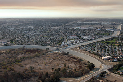 “Last month, the U.S. Army Corps of Engineers launched a communications campaign to raise awareness and provide information about the upcoming Whittier Narrows Dam Safety Project. This $735 million construction project is designed to reduce flood risk for more than one million people living between the dam and the Pacific coast. The Whittier Narrows Dam, completed in 1957 by the U.S. Army Corps of Engineers, serves as both a flood control and water conservation facility. During periods of heavy rainfall, the San Gabriel River and Rio Hondo River flow into the Whittier Narrows Reservoir, helping prevent flooding in surrounding areas, including the City of Pico Rivera. … ” Read more from Los Cerritos News.
Santa Monica Pier again ranked among California’s most polluted beaches
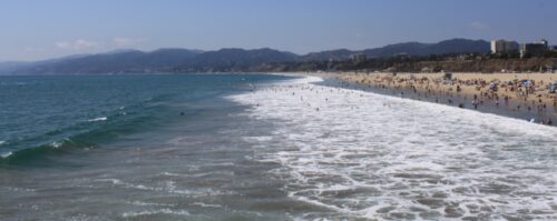 “The Santa Monica Pier ranked among California’s most polluted beaches for the 10th consecutive year, according to Heal the Bay’s annual Beach Report Card released Wednesday ahead of Memorial Day weekend. The environmental nonprofit’s 2025-26 report placed the Pier second on its annual “Beach Bummer” list of beaches with the poorest summer dry-weather water quality grades because of elevated bacteria levels and chronic pollution concerns. Playa Blanca near Tijuana ranked as the state’s most polluted beach, while the Tijuana Slough at the Tijuana River Mouth in San Diego County also made the top 10 list. … ” Read more from NBC 4.
IMPERIAL/COACHELLA VALLEYS
Brawley City Council to consider temporary moratorium on large-scale data centers
“The Brawley City Council will hold its regular meeting Tuesday at 6 p.m. to debate a proposed one-year temporary moratorium on large-scale data centers and related municipal code amendments. The discussion comes amidst a growing regional conversation about the rapid expansion of digital infrastructure. The proposed 12-month freeze is intended to give city planners and officials the necessary time to review and update the Brawley Municipal Code. This ensures future tech developments align with the city’s zoning laws, power grid capacity, and community aesthetic without overwhelming local resources. … ” Read more from KESQ.
Ruiz presses federal water officials for action on New River pollution crisis
“In a quiet Capitol Hill office last week, the decades-long stench of the New River finally met a renewed sense of federal urgency. Rep. Raul Ruiz said in a statement he sat down with International Boundary and Water Commission Commissioner Chad McIntosh and Deputy Commissioner Tony Frye. Their focus was a waterway that has long ceased to be just an environmental eye-sore, hardening instead into a full-blown public health crisis for Imperial County. The meeting followed a May 11 federal roundtable in Calexico, California, where EPA officials, local leaders, and exhausted residents laid bare the realities of living near what is widely considered one of the most polluted rivers in North America. … ” Read more from the Imperial Valley Press.
SAN DIEGO
Aging pipes, persistent breaks challenge Julian’s water system
“Residents and business owners in the East County mountain community of Julian have running water again, after water service was restored following a recent outage and boil-water advisory on Main Street. But local officials caution that the problems are not over yet. According to Julian Community Services District General Manager and Chief Operator Harry “Buddy” Seifert, the outages stem from an aging underground pipe system dating back six decades. “All water was back on as of 5/6/26,” Seifert told East County Magazine this week, while acknowledging that recurring failures remain a concern because “the pipe keeps breaking in different areas after repairs are made.” … ” Read more from East County Magazine.
2025 Marine Debris Report Highlights the Need to Address Plastic Pollution
 Ahead of World Oceans Day and as peak beach tourism season gets underway, San Diego Coastkeeper, Surfrider Foundation San Diego County, and Ocean Connectors released their 2025 Marine Debris Report. In 2025, Coastkeeper, Surfrider, and Ocean Connectors rallied an inspiring 8,179 volunteers who removed 19,880.4 pounds of trash from our coastal beaches, shorelines, and inland waterways. Coastkeeper and Surfrider invite the public to join our efforts to keep our beaches clean, by participating in community cleanup efforts in 2026. … ” Read more from the San Diego Coastkeeper.
Report: Tijuana Slough among California’s most polluted beaches
“The Tijuana Slough at the Tijuana River Mouth ranked among California’s most polluted beaches, while Playa Blanca near Tijuana was listed as the state’s worst beach in Heal the Bay’s annual Beach Report Card released Wednesday ahead of Memorial Day weekend. The environmental nonprofit’s 2025-26 report placed the Tijuana Slough ninth on its annual “Beach Bummer” list of beaches with the poorest summer dry-weather water quality grades because of elevated bacteria levels and chronic pollution concerns. According to Heal the Bay, Playa Blanca and the Tijuana Slough continue to be heavily impacted by transboundary wastewater flows from Baja California, although efforts are underway on both sides of the border to reduce sewage discharges and improve infrastructure. … ” Read more from Channel 10.
Along the Colorado River …
Details of first-of-its kind, short-term Colorado River plan revealed
“The Trump administration is nearing intervention in the yearslong standstill between the seven states that share the Colorado River at a historic point of crisis. A 10-year federal plan would require the states to return to the negotiation table every two years — something that Arizona officials revealed the first details about last week during a public meeting. This shift to a new, short-term agreement in the face of record low reservoir levels was a central tenet of Nevada’s recent proposal for a stopgap measure. “There’s a lot of energy around the idea,” said John Entsminger, general manager of the Southern Nevada Water Authority. “I think that’s where most of the most productive discussions are occurring at the moment.” … ” Read more from the Las Vegas Review-Journal.
How ‘Super’ El Niño could impact Colorado River water crisis
“A potential “super” El Niño later this year could bring much-needed relief to the drought-stricken Colorado River system, raising hopes for improved snowpack, reservoir levels and water supplies across the American West. The river irrigates millions of acres of farmland and provided water to tens of millions of Americans, making the prolonged drought a major concern for long-term water stability. Key reservoirs along the river have seen declining water levels in recent years, raising concerns about power generation, water supply, and local ecosystems. The Colorado River spans roughly 1,450 miles, running from the Rocky Mountains to the Gulf of California in Mexico and the basin is split into two sections. … ” Read more from Newsweek.
A grim water outlook out West
“A good chunk of U.S. alfalfa production is done with the help of irrigation. The same can be said for grass hay production and grazing lands. In the West, the Colorado River remains a foundation source of irrigation water for more than 10 states. Unfortunately, that water resource and its connected Basin reservoirs are facing critically low water levels as spring turns to summer. The primary water storage sources for the Colorado River are Lake Powell and Lake Mead. Those bodies of water are often looked to as indicators for the overall health of the hydrologic basin. Currently, the two lakes are headed to the emergency room, if not already on life support. Lake Powell, located on the Utah-Arizona border, currently sits at only 23% of its capacity and is approaching “minimum power pool” levels where hydroelectric generation is threatened. Downstream, Lake Mead isn’t faring much better. It’s only at 31% of capacity. … ” Read more from Hay and Forage Grower.
Lake Mead projected to hit all-time low in 2027
“Lake Mead is projected to hit an all-time low by summer 2027, according to new projections released by federal authorities. The reservoir is forecast to drop to 1,020 feet in July 2027, 20 feet lower than its previous record low of 1,040 feet in July 2022. That year, long-sunken boats and once-submerged rocks emerged from the water. The projected water level threatens power generation at the Hoover Dam. Anything below 1,035 feet reduces generating power at the dam. When FOX5 visited the lake on April 9, it was at 1,060 feet. It is now at 1,052 feet, down 8 feet. The new projection for the all-time low is 12 feet lower than was projected last month. … ” Read more from Channel 5.
Parker Dam: A crucial but often overlooked part of the Colorado River system
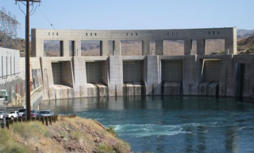 “Parker Dam is the exact geographic “fork in the road” for Southwest water distribution. It acts as the forebay for two of the most critical aqueducts in the United States. The Colorado River Aqueduct which is managed by the Metropolitan Water District of Southern California, which pumps water 242 miles west to Los Angeles and San Diego. And the Central Arizona Project which pumps water 336 miles east to supply Phoenix and Tucson. Lake Havasu is a dynamic environment that’s impacted by upstream agricultural drainage, mineral springs, and fluctuating flows from Hoover Dam, and so salinity can spike rapidly. Hourly monitoring allows Bureau of Reclamation technicians to provide real-time telemetry data to MWD and CAP so they can adjust their treatment facilities or blending ratios before millions of gallons of highly saline water enter their pipelines. … ” Read more from the Coyote Gulch.
Securing Arizona’s water: Public calls for action and investment
“Arizona’s success in the desert is no accident — it’s the result of decades of proactive planning and strategic investment in water security. While headlines often highlight drought and water shortages, Arizona’s future depends on ongoing planning and robust funding for water resources and infrastructure. Water managers have known for a long time that Arizona must invest in new water sources to make up for less water from the Colorado River and to stay resilient. Now, voters agree. A recent poll found that 75% of Arizona voters want action on Colorado River water security, with strong bipartisan support for prioritizing water in the state budget. … ” Read more from KTAR.
Trump signs into law bill for new Southern Nevada water pipeline
“President Donald Trump this week signed into law a bill that clears the way for a new water pipeline to serve Southern Nevada. The White House said the president on Tuesday signed HR 972, also known as the Sloan Canyon Conservation and Lateral Pipeline Act, after it passed both houses of Congress. The bill directs the Bureau of Land Management to grant rights-of-way to the Southern Nevada Water Authority for the construction of a water transmission pipeline. The new underground route is expected to save the residents in the region $200 million and ensure water delivery redundancy in the case of emergencies. … ” Read more from Channel 3.
Renderings show vision for massive data center proposed in Utah, but permits could take years
“Backers of a proposed massive data center are revealing their view of what it could look like, but the project generating intense public outcry in Utah has a long road ahead. The plan for the campus proposed in Box Elder County isn’t final yet. However, O’Leary Digital, the developer of the project, already has a vision of full glass and wooden facades and buildings forming perfect rectangles in front of Utah’s iconic mountains. O’Leary Digital — chaired by principal backer and celebrity “Shark Tank” investor Kevin O’Leary, aka “Mr. Wonderful” — published initial renderings on what the data center project could look like, including a campus with “a cluster of ten 100MW data center buildings,” in addition to another 100 megawatt data center with “thoughtfully-designed buildings.” … ” Read more from the Utah News Dispatch.
SEE ALSO:
- Kevin O’Leary-backed Utah data center project seeks new water right, from the Salt Lake Tribune
- Utah law narrows data center water protests, from Western Water
In national water news today …
‘Sheer weight’ of cities is pushing famous locations under water, study warns
 “It leaves a sinking feeling. Rising seas aren’t the only flood risk afoot on Earth. Scientists have found that the planet’s most populated metropolises are sinking under their own weight, leaving millions of people at risk of going into the drink. This worldwide urban subsidence has the potential to amplify the effect of “sea-level rise,” according to the study’s lead author Dr. Julius Oelsmann, of Technical University of Munich. Per a study in the journal Nature Communications, this double threat of elevating oceans and plunging land has caused sea levels to rise by 6 millimeters annually along urbanized areas of the coast — around three times the global average. … ” Read more from the New York Post.
Trump’s EPA vows to fight ‘forever chemicals’ by loosening regulations
“The Trump administration has announced what it is calling “a major step forward” in the fight against a class of toxic chemicals called PFAS, or per- and polyfluoroalkyl substances. Extended exposure to PFAS, often referred to as “forever chemicals” because they can persist indefinitely in the environment, has been linked to various cancers, autoimmune diseases, and other harms. On Monday, Secretary of Health and Human Services Robert F. Kennedy Jr. lauded Trump as the first president who is “completely committed” to removing forever chemicals, which are found at unsafe levels in tap water in some 80 percent of congressional districts and lurk in the blood of 97 percent of Americans. But what Kennedy considers a step forward looks like a big step back to most of those who have long kept an eye on the issue. That’s because the Trump administration is unraveling key parts of the PFAS limits approved by the Biden administration in 2024, which are the first and only regulations to put limits on PFAS in drinking water in the nation’s history. Restrictions on four substances in the PFAS class would be rescinded entirely, while water utilities would be given two additional years to comply with limits for two other substances. … ” Read more from Grist.
Fish and Wildlife service clears a weedkiller, saying it won’t cause extinction
“The Trump administration has determined that atrazine, a weedkiller used widely on corn and other crops, does not pose an extinction risk to threatened or endangered wildlife, effectively justifying its continued use, according to a federal review made public this week. The findings were the latest turn in a yearslong policy battle over a herbicide that has become a pillar of food production in America, but has been linked to hormonal disruptions in frogs and contamination of waterways across the country, along with cancer and other diseases in humans. The outcome of the review, by the U.S. Fish and Wildlife Service, was a victory for agricultural groups, including the Farm Bureau Federation and the National Corn Growers Association. Farmers applied on average 72 million pounds of atrazine a year on 75 million acres of crops, mostly corn, sorghum and sugar cane, according to the most recently available data. … ” Read more from the New York Times.
Groundwater warning signs grow worldwide
“Groundwater is often out of sight and easy to overlook, but it quietly supports farms, cities, rivers, wetlands, and drinking water supplies around the world. A major international study published May 19, 2026, found that many groundwater systems are under growing stress, with warning signs now appearing across large parts of the globe. The study, published in Environmental Research Letters, analyzed groundwater monitoring records from more than 42,000 wells in 47 countries over roughly two decades. Researchers found that about 29% of monitored wells showed declining groundwater trends, while 18% showed rising water levels. Both situations can create serious problems for communities, agriculture, and the environment. … ” Read more from Western Water.

