

Using science to protect people, economy, and nature in this vital region
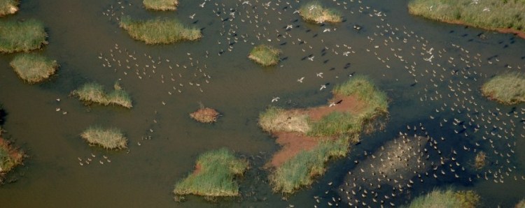
California is on the front lines of climate change, whether that’s accelerating impacts on wildfires, drought, flooding, extreme heat, or sea level rise. No geography is more important or more impacted by climate change than the Sacramento-San Joaquin Bay Delta. It’s one of the largest estuaries in the Americas. This meeting place of freshwater and saltwater is one of the most biodiverse places in the United States, boasting one of the richest varieties of plant and animal life. It’s incredibly important to the people who live there and make their livelihoods there, both in small towns and larger cities, and it is also important to the state’s water supply.
Given the Delta’s critical role in California’s water supply and its vulnerability to climate change, a recent webinar hosted by Wade Crowfoot, Secretary of Natural Resources, brought together experts to discuss innovative strategies for protecting the Delta’s communities, ecosystems, and infrastructure. The event highlighted the latest scientific advancements, collaborative efforts, and actionable solutions aimed at addressing the region’s unique challenges, from rising sea levels and extreme weather to biodiversity loss and water quality concerns.

The role of the Delta Stewardship Council
Jessica Pearson, Executive Officer of the Delta Stewardship Council, part of the Natural Resources Agency, began by speaking about the critical challenges and opportunities facing the Delta in the context of climate change and the Council’s efforts to build resilience for the region.
The Delta is seeing change just like everywhere else, from shifting weather patterns and sea level rise to evolving land use and demographics. The Delta reflects many of the same challenges and opportunities that are facing the rest of the state.
 What makes the Delta unique are the stakes. All of this change is happening at ground zero for our state’s water supply system, it’s happening amid a backdrop of an already beleaguered ecosystem, and it’s surrounded by flood-prone levees that protect people and farmland.
“The Delta Stewardship Council is an independent California state agency charged with advancing the state’s coequal goals for the Delta,” said Ms. Pearson. “Those coequal goals are a reliable statewide water supply and a resilient Delta ecosystem, and the legislature told us to achieve those goals in a way that also protects and enhances the Delta as an evolving place. It’s important to note that even back in 2009, the legislature used the phrase ‘evolving place’ to describe the Delta.”
What’s at risk in the Delta, and why should people care? There are water supplies for 27 million Californians passing through the Delta, as well as water for irrigating vast acreages of agriculture. And people live, farm, and recreate in the region.
“Some people may think, ‘I don’t really live there, so it doesn’t really affect me,'” said Ms. Pearson. “But the reality is that for most Californians, they are connected and rely on it in some way – through their water supply, their job, or through the food that they eat.”
 To protect the Delta’s resources long-term, the Delta Stewardship Council implements the Delta Plan, a comprehensive management plan for achieving the coequal goals for the Delta. The Council focuses on science to ensure that the decisions it makes are likely to be the right ones.
“At the Council, we keep building on the foundational work that is in the state’s Delta Plan,” said Ms. Pearson. “We’ve recognized that climate change is a significant threat to our water future for a long time. While that’s not news, conditions are changing differently and more rapidly than we originally expected.”
The good news is we keep learning, she said. We’re building new tools, and those tools give us advantages in managing the resources that we care about in the Delta and beyond.”
Unfortunately, it’s not all good news. “In terms of the science, we now understand a lot more about vulnerabilities in light of climate change. We’re seeing different types of extreme events, like wildfires, having greater impacts now than in the past.
For example, California’s eight largest wildfires occurred in the Delta’s watershed. Within the last seven years, temperatures have continued to rise. We’re seeing more heatwaves happening, not just in the summer, but also in the spring and fall. We also recognize that extreme events sometimes occur in combination or in a series, such as a strong storm following a catastrophic wildfire, and we need to plan for that. We now have significantly better tools to detect changes and project future conditions for critical components of our water supply and ecosystems.
 “One initiative that I’m very proud of is the Delta Stewardship Council’s Delta Adapts,” she said. “This is a planning effort that synthesizes years of research and outreach to document the Delta region’s assets, such as its people, its ecosystems, and its infrastructure, and then looks at the vulnerability of those assets to extreme events like heat, flooding, and drought. We essentially took a look at global models and expected impacts, and then we were able to downscale that to understand what it means in our backyard, in the Delta. We then crowdsourced with our agency partners and interested parties to collect and prioritize the actions that we need to take and adapt.”
We have a pretty good idea about what will worsen as climate change progresses, she said. For example, sinking land or subsiding land, levee breaches, extreme heat and flood events, and water quality problems, and we’re already hearing about these hardships from people on the ground – from farmers, from disadvantaged communities and tribes.
“We have to grow increasingly comfortable taking action even when we have uncertainty, so we really rely on science for that,” said Ms. Pearson.
The Delta Stewardship Council also has a mission to provide the best possible scientific information. To do that, the Council funds scientific research, as well as summarizes and communicates science to others.
 An example is the State of the Bay Delta Science report, which summarizes the state of the science on critically important topics. The latest edition, released in September, is focused on extreme climate and weather events.
Finally, the Council is also authoring a state-led report on the Delta for the upcoming fifth climate assessment. It’s the first-ever Delta-focused report from the fifth climate assessment. It is expected in the spring.
“So what I hope viewers take away from today’s conversation is really two parts: first, that science matters and is driving our decision making. And second, the Delta Stewardship Council is working to coordinate across agencies and with others to address climate change and to protect the Delta and all of its uses.”

Emerging climate science needs
The Delta is undergoing significant changes, driven by evolving climate conditions. The Delta Independent Science Board recently held an emerging climate science symposium to assess the current state of climate science, the progress made over the past decade, and how these insights can inform adaptation strategies to stay ahead of emerging challenges. Dr. Jayantha Obeysekera, a member of the Delta Independent Science Board, spoke about what was learned from the symposium.
State of Science: Key Takeaways
- Rising Temperatures: Global temperatures are increasing, nearing 1.5°C above pre-industrial levels, with projections suggesting a rise of up to 3°C by 2100. These changes could have profound impacts on ecosystems and infrastructure.
- Increased Atmospheric Moisture: Warmer temperatures enhance the atmosphere’s capacity to hold moisture—approximately 7% more for every degree Celsius of warming. This shift leads to less snow and more rain, depleting California’s natural snowpack storage. Rain-on-snow events, which can trigger flash flooding, are particularly concerning for Delta tributaries.
- California’s Climate Variability: California experiences greater climate variability than any other U.S. region. While storms may become less frequent, they are expected to intensify, such as atmospheric rivers. These storms can also occur in clusters, as seen in 2023. Additionally, the state faces increasing “hydroclimate whiplash,” characterized by rapid transitions between extreme wet and dry conditions.
- Accelerating Sea Level Rise: Sea level rise has doubled over the past 30 years, with projections indicating an increase of 3 to 6 feet by 2100. This poses significant risks to the coastal and Delta regions.
The future climate will be defined by extremes, requiring flexible and adaptive strategies to address this “new normal.” As the baseline shifts, proactive measures will be essential to mitigate risks and ensure resilience in the face of these challenges.
Key Lessons from the Last 5-10 Years of Climate Science
 Over the past decade, significant advancements in climate science have deepened our understanding of extreme events, system-wide changes, and future climate scenarios. Here are the key lessons learned:
- Improved Sub-Seasonal Forecasting: Advances in forecasting have enhanced our ability to predict extreme weather events on a near-term basis, particularly within a 2-3 week timeframe. This improved sub-seasonal forecasting is critical for better preparedness and response to events such as storms, heatwaves, and heavy rainfall.
- Better Understanding of Rare Events: There is now a more comprehensive understanding of rare but impactful phenomena, such as atmospheric rivers, which can drive system-wide changes. Atmospheric rivers are increasingly recognized as major contributors to flooding and water resource challenges.
- Recognition of Emerging Climate Patterns: Scientists have identified and studied new climate phenomena, including flash droughts, hydroclimate “whiplash,” and their connections to wildfires. Flash droughts, which develop rapidly and intensify over short periods, and hydroclimate whiplash—the rapid transition between extreme wet and dry conditions—are becoming increasingly frequent, with significant implications for water management and wildfire risk.
- Enhanced Climate Model Reliability and the Role of AI: Climate models have become more reliable, with significant improvements in their ability to assess and predict future conditions. While global models remain relatively coarse, advancements in downscaling techniques have provided more localized and detailed projections. Additionally, the integration of artificial intelligence (AI) into climate modeling is emerging as a powerful tool to enhance our understanding of complex climate systems.
- Understanding the Transition to Low-to-No-Snow Conditions: There is now a clearer understanding of the timing and implications of transitioning to a future with low-to-no snow conditions. Projections suggest that this transition could occur up to 20 years earlier than previously anticipated, particularly after the mid-century. This shift will have profound impacts on water storage, ecosystems, and resource management. The most significant changes are expected to occur after the mid-century, as emission scenarios might deviate from each other quite significantly.
Adaptation scenarios
“We’ve been talking about uncertainties, but I think we have enough knowledge on science that we can start thinking about adaptation,” said Dr. Obeysekera. “We should not be bothered by too much uncertainty and not do anything. There are some things that can be done and are being done.” These actions include:
- Floodplain Restoration and Forest Management: Restoring natural floodplains and managing forests more effectively can help mitigate flooding, improve water quality, and enhance ecosystem resilience. These solutions work in harmony with nature to provide long-term benefits for both the environment and local communities.
- Reservoir System Adaptations: At the symposium, experts highlighted opportunities to adapt reservoir systems in tributary headwaters. By focusing on additional storage in these areas, we can better manage changing runoff patterns and improve water availability during critical periods.
Technology Integration
- Forecast-Informed Reservoir Operations (FIRO): FIRO utilizes advanced weather forecasting to optimize reservoir management, enabling more precise control over water storage and release. This approach helps balance flood control, water supply, and ecosystem needs.
- Advanced Early Warning Systems: Leveraging technology to enhance early warning systems can improve preparedness for extreme weather events, thereby reducing risks to communities and infrastructure.
Multi-Benefit Strategies
- Flood-MAR (Managed Aquifer Recharge): Flood-MAR strategies involve capturing excess floodwaters and using them to recharge groundwater aquifers. This approach not only reduces flood risks but also bolsters water supplies, providing a dual benefit in regions prone to both flooding and drought.
- Flexible Planning with Regular Updates: In a world where “average” conditions no longer exist, adaptive management is essential. This involves creating flexible plans that are regularly updated based on new data and include trigger points for action. Risk-based management strategies can help address the increasing variability and volatility of climate conditions.
- Embracing Variability: As climate patterns become more unpredictable, it’s critical to adopt strategies that account for extremes. This includes planning for both prolonged droughts and intense flooding, ensuring resilience across a wide range of scenarios.
There is no such thing as “average” anymore, and the future promises even greater variability and volatility in climate., said Dr. Obeysekera. To address this uncertainty, it is essential to adopt more flexible, risk-based management strategies:
- Focus on Extremes, Not Averages: Relying on historical data and adjusting for changes in averages is no longer sufficient. Climate variability is increasing, and the focus must shift to managing extremes. This means preparing for both floods and droughts simultaneously, recognizing that these events are interconnected. For example, floodwaters can be strategically managed to recharge groundwater and mitigate the impacts of future droughts. Planning for extremes, rather than relying on outdated averages, is essential for building resilience.
- Greater Community Engagement and Co-Production of Knowledge: Engaging communities and co-producing solutions with stakeholders is critical for creating effective and equitable adaptation strategies. This includes working closely with tribal communities, local organizations, and other stakeholders to integrate traditional knowledge and community priorities into decision-making.
- Improved Cross-Agency Coordination: Effective climate adaptation requires seamless coordination across agencies; however, not all agencies possess the same expertise or resources. Capacity building is needed to enhance cross-agency collaboration, ensuring that knowledge, skills, and tools are shared effectively.
- Integration of Compound Risks: Climate adaptation must account for the compounding effects of multiple hazards. For example, the interplay between climate change, seismic events, land subsidence, and hydroclimate whiplash can amplify risks and create cascading impacts. Current models often overlook these interconnected risks. Developing tools and frameworks that integrate compound hazards will provide a more comprehensive understanding of vulnerabilities and inform better decision-making.
- User-Focused Tools and Information: Adaptation efforts must prioritize the creation of tools and resources that are designed with end-users in mind. This means providing actionable, accessible, and relevant information that meets the needs of decision-makers, communities, and other stakeholders.

Atmospheric rivers and floods in California’s changing climate
Sasha Gershunov, a research meteorologist at the Scripps Institution of Oceanography, then discussed a paper written for the State of Bay Delta Science titled, Atmospheric Rivers and Floods in California’s Changing Hydroclimate.
 California’s climate is highly volatile and significantly more variable than anywhere else in the United States. This variability stems from the state’s unique climate, where rainfall is infrequent but often intense when it does occur.
California has only one season in its Mediterranean climate during which it generates most of its precipitation. Whether it’s going to be a wet year or a dry year depends on how many atmospheric rivers California gets – or doesn’t get. A lot of that comes from the big storms called atmospheric rivers, which are basically rivers in the sky, but instead of liquid water, they carry water vapor. An average atmospheric river transports an amount of water vapor equivalent to that of ten Mississippi Rivers’ worth of liquid water discharge. There are anywhere from 4 to 7 active atmospheric rivers at any particular time around the world.
“One of the things that’s challenging is that we recently learned that atmospheric rivers are the agents of ENSO heresy,” said Dr. Gershunov. They do not dance to the tune of El Niño or La Niña, making our extremely volatile hydro climate very challenging to predict on seasonal timescales.
 The graphic on the left shows the daily precipitation frequency and intensity in the Russian River watershed. The bars indicate the changes in frequency of precipitation, binned into intensity bins, from dry days or drizzle on the left to increasingly heavier precipitation as we move to the right. “This is a very high confidence expectation that there will be a decrease in precipitation frequency of lighter precipitation events, and an increase in precipitation intensity and the frequency of really heavy and intense precipitation days.”
The shaded bars show the contribution of atmospheric rivers to these changes. “Basically, atmospheric rivers are responsible for the enhancement in the extremes, whereas other types of storms are responsible for the decrease in frequency.”
California’s biggest floods are typically associated with atmospheric river landfalls. Atmospheric rivers in the future are expected to be even greater contributors to total annual precipitation, meaning that our highly volatile hydroclimate is expected to become even more volatile.
 The graph on the right is the estimated return periods of the 1997 storm that dumped close to 20″ of precipitation in the Yuba River basin. “We estimated the return period of a storm, specifically the New Year’s 1997 storm that dumped close to 20 inches of precipitation in the Yuba River Basin, and from about a 125-year return period event, towards the end of the century, we expect that event to become more like a 60-year event.”
The role of our mountains cannot be underestimated. It’s really the topography that squeezes moisture out of atmospheric rivers, causing rain and high mountain snow. Atmospheric rivers are warmer storms than other types of storms, and in a warming climate, they are expected to carry more water vapor. And when you hit the same mountains with wetter atmospheric rivers, you get higher snow lines.

Essentially, the projection is for less snow, particularly at low and mid elevations, and more precipitation on average, but less snow, which means more rain, increased runoff, and a higher propensity for flooding in a warming climate. So California will need to learn how to derive even more of its future water resources from less reliable snowmelt, fewer storms, and more punctuated floodwater.
Dr. Gershunov concluded by noting that California has learned how to cope with this extremely volatile hydroclimate, and therefore, the state is better positioned to address future higher volatility. Through proactive programs such as forecast-informed reservoir operations, coupled with managed aquifer recharge and Flood MAR, the state is already learning how to derive more water resources from floodwater, while protecting us from more flooding in the future.
“Although clearly our changing hydro climate is going to make managing water resources even more challenging in the state, at least we will have some precipitation to manage, whereas other Mediterranean climate regions are projected to dry in a much more severe way.”

Wildfire effects on water quality in the Delta watershed
Clifford Dahm, professor emeritus at the University of New Mexico and former Delta lead scientist, shared key insights from the paper Recent Findings and Future Prospects for Water Quality Effects from Catastrophic Wildfires in California, a contribution to the State of Bay Delta Science report.
Clifford Dahm, professor emeritus at the University of New Mexico and former Delta lead scientist, highlighted some of the findings in the paper, , which is part of the State of Bay Delta Science.
Out of a dataset spanning back to 1932, the eight largest wildfires in California’s history occurred between 2018 and 2024. Notably, all of these fires have at least partially affected the Delta watershed, and the state experienced its first megafire, burning over a million acres.
Wildfires have far-reaching consequences for water quality and the health of aquatic ecosystems. Key impacts include:
- Water Quality Changes: Fires influence water temperature, sediment load, turbidity, dissolved oxygen levels, pH, and the presence of soluble and particulate organic carbon. Post-fire precipitation events can transform systems into “black water” systems, characterized by increased nutrients and metals.
- Organic Contaminants: Both natural and human-produced organic contaminants from fires are particularly problematic in areas where wildlands meet urban environments. These contaminants can disrupt aquatic food webs and contribute to harmful algal blooms.
The recovery of burned landscapes is critical for restoring water quality and ecosystem health. Large-scale fires raise questions about how quickly these areas can recover; however, there are actionable steps to accelerate the recovery process. One of the most effective strategies is promoting rapid vegetation recovery in burned catchments. Restoring vegetation not only stabilizes the landscape but also improves water quality by reducing erosion and nutrient runoff.
Dahm emphasized the importance of proactive measures to support recovery efforts and mitigate the long-term impacts of wildfires on California’s watersheds and ecosystems.
2022 Study Highlights Fire Impacts on Watersheds
The study, 2022 McKinney rain-on-wildfire event, dissolved oxygen sags, and a fish kill on the Klamath River, provided critical insights into the effects of large wildfires on watersheds, focusing on the McKinney Fire in the Klamath River watershed. This fire, which burned approximately 160,000 acres, was closely monitored using a network of continuous sensors, offering a rare and detailed look at the immediate impacts of a rain-on-fire event.

The Yurok and Karuk tribes have maintained a water quality monitoring system with continuous sensors throughout the Klamath watershed for over a decade. This system, developed in response to fish kills in the early 2000s, enables the detection of significant events within the watershed in real time.
During the McKinney Fire, rainfall occurred while the fire was still active, mobilizing ash, charcoal, and other burned materials from the burn scar into the Klamath River. The sensors recorded an immediate and dramatic response in water quality, including dissolved oxygen levels. Unlike traditional grab sampling, which provides only occasional data points, the continuous sensors captured real-time measurements that revealed the full extent of the event.
“That burn scar material produced dissolved oxygen sags all the way down to zero with no measurable dissolved oxygen,” Dr. Dahm noted. “The downstream movement of this material, basically, was almost 50 miles of degraded water quality, and a fish kill of over 10,000 fish occurred from this event. And this is an example where having the right kind of sensors and having the right kind of network in place allows you to actually diagnose and measure these kinds of significant events.”
Post-fire impacts
While active wildfires demand significant resources to protect lives and property, their impacts extend far beyond the moment the flames are extinguished. The post-fire period is a critical window for intervention, particularly to support vegetation recovery and to manage the capture and control of materials mobilized from burn scars.
Burn scars are significant sources of contaminants, and their impact on water systems is an emerging area of global scientific research. These scars often overwhelm water treatment facilities, as they release large amounts of ash, sediment, and other pollutants into waterways. Initial findings reveal that water quality impacts can extend tens to hundreds of miles downstream from the burn site, creating widespread challenges for ecosystems and communities.
 One area requiring further research is the impact of burn scar materials on reservoirs. Approximately 80% of California’s water supply passes through reservoirs, yet little is known about how these systems are affected when filled with debris and contaminants from burn scars. Understanding the long-term effects on water quality and reservoir functionality is essential for improving water management strategies.
The real-time monitoring network established by the Yurok and Karuk Tribes in the Klamath River watershed is a model for effective post-fire water quality assessment. This system provides continuous data, enabling the detection and measurement of significant events, such as dissolved oxygen sags and contaminant pulses. However, similar monitoring capacities are lacking in many other regions. Expanding these networks is a key recommendation for improving our ability to track and respond to post-fire water quality issues.
The downstream movement of contaminants following wildfires is an area where more knowledge is urgently needed. For example, in New Mexico, burn scar materials from a wildfire caused the Rio Grande to become completely devoid of oxygen for hours, with effects observed up to 50 miles downstream. Similarly, in the Klamath River, water quality degradation pulses were measured 60 to 80 miles downstream from the burn scar. These severe impacts underscore the need for further research and improved tools to comprehend and mitigate the spread of contaminants in post-fire environments.
By addressing these gaps in knowledge and expanding monitoring capabilities, we can better prepare for and manage the long-term impacts of wildfires on water systems and ecosystems.
Perspectives on science to support decision-making
Henry DeBey is Deputy Executive Officer for Science at the Delta Stewardship Council. He discussed how science is used to plan and make decisions in the Delta?
California’s future is projected to be shaped by more extreme swings between drought and flood conditions. For the Delta Science Program, they work to strengthen and accelerate the science-to-decision process, from data collection to analysis to action, all while maintaining scientific integrity.
 To do that, first, we need collaborative, open, and actionable science. Collaborative science means working with tribes, communities, and agencies from the start, so that science is grounded in real needs and shared goals. Open Science refers to data that’s publicly available and transparent, which promotes innovation and accelerates discovery. Actionable science is research that directly supports decisions, whether that involves how we operate reservoirs or where we restore habitats.
“In short, science achieves its full value when it’s collaborative, transparent, and able to guide action,” said Mr. DeBey.
Second, we need coordinated scientific monitoring of the environment. Monitoring is our early warning system. ‘It tells us when and how conditions are changing. It’s like a smart watch, constantly tracking your heart rate, breathing, and stress levels. It doesn’t just tell you how you’re doing, it tells you how you’re changing, so you can act before something goes wrong. The Delta has one of the most advanced and longest-running monitoring networks in the world. It includes everything from precipitation gauges to water quality sensors to scientists on the water sampling for fish.”
But changes are afoot. Federal agencies are starting to shift monitoring work to private companies or prioritize their own mandates over shared needs, which risks fragmenting the system and creating gaps in long-term data when we need it most to detect climate trends, he said. So that’s why it’s essential to maintain this monitoring network through strong coordination and stable funding.
Third, we need integrated modeling and other innovative data science tools. Models turn monitoring data into insight. They help us forecast conditions and test scenarios to evaluate different management options. For example, models can project how releasing water from a reservoir might prevent salty ocean water from entering the Delta.
“We have many different types of models, weather models, water flow, fish population models, each answering specific questions,” said Mr. Dubay. “When we integrate these models, they provide a far more complete and useful picture of system-wide change. Automation and advances in artificial intelligence can help run these models in near real-time so managers can anticipate risks and make proactive decisions.”
This is already starting in the Delta. We’re piloting tools that utilize sensors, satellites, and AI to forecast water quality in real-time, he said. Expanding these tools can help us better predict changes in water temperature, harmful algal blooms, and other climate-driven stressors. So, in short, integrated modeling helps us to shift from reacting to climate impacts to predicting and preparing for them.
Fourth, we need to strengthen science communication. Science communication isn’t just about explaining results; it’s about making sure the right information reaches the right people at the right time. That includes scientists working with managers from the start to design research around real decision needs, or managers clearly communicating what decisions they need to make and when, so science is delivered in time to inform them. It also includes decision support tools, such as dashboards, that automatically translate monitoring data and model outputs into clear options with trade-offs, allowing decisions to be made quickly and confidently. In other words, science communication is about connecting people, tools, and information throughout the entire science-to-decision life cycle.
And last but not least, we need adaptive governance. Our systems, laws, permits, policies, and processes have to be rewired in order to flex and adjust as conditions change, he said. So there isn’t just one future; we are heading into multiple possible futures shaped by drought, flood, sea level rise, and ecological change, and our governance systems need to be nimble and able to respond quickly.
During wet years, we should be able to rapidly redirect flood flows to recharge groundwater or reservoirs, as we know that drought may be just around the corner. There has been progress: permits, such as the Incidental Take Permit for Delta water operations, now include adaptive triggers that adjust management based on real-time science. We need to normalize this flexibility and tighten the connection between science and management decisions. And this is as much a cultural shift as it is a procedural one.
“In closing, I want to underscore we have the tools, we have the partnerships, we have the scientific capacity in the state to meet the challenge of extreme events,” said Mr. DeBey. “The task before us is to continue to invest in these tools, to connect them, and to make sure we’re working together so we can adapt in real-time. All of this is available in the State of Bay Delta Science publication.”


