

 The Greater Everglades Ecosystem is a region of tropical wetlands beginning at the headwaters of the Kissimmee River. The Kissimmee drains into Lake Okeechobee, which would historically spill over its southern banks during the wet season and replenish the Everglades with fresh water. The Everglades was once a free-flowing, vast, and shallow river of grass. Watershed alteration began on a small scale in the late 1800s, and reached a peak with the Central and Southern Florida Flood Control Project authorized in 1948. Hundreds of water control structures and thousands of miles of canals and levees were constructed over the ensuing five decades to provide flood protection and water supply. This large civil works project and the millions of residents reliant on the water it supplies have resulted in significant environmental damage.
Why is this system important?
The Florida Everglades is currently the largest wetland ecosystem in the United States covering over 18,000 square miles.  The Everglades supports an extraordinarily rich and unique wildlife population consisting of nearly 70 threatened and endangered species, including the manatee, American alligator, sea turtle, Florida panther, and a variety of birds. About one third of the state’s population (8 million people) rely on the Everglades for their water supply. The Everglades National Park is a World Heritage Site, an International Biosphere Reserve, and a Wetland of International Importance. The economic influence of a healthy Everglades ecosystem is substantial. Recreational fishing alone generates approximately $1.2 billion a year in economic activity in the 13-county Everglades Region. It is projected that investing $11.5 billion in Everglades restoration will result in $46.5 billion in gains to the economy, and create more than 440,000 jobs over 50 years. Major industries impacted by the Everglades include freshwater supply, fishing, hunting, real estate, and tourism/visitation – all contributing to up to $394.1 billion in dependent economic output in 2008.
What are major challenges?
Meeting the water supply and flood protection needs of population growth, urbanization, and the agricultural sector required severe land-use alterations and water flow control. This effort has reduced the area of the Everglades to about half of its original area. Decreases in habitat, combined with a widespread invasion of non-native plants and animals such as the brazilian peppertree and the burmese python, have resulted in severe ecosystem degradation. Water quality within the Everglades suffers from extreme variations in salinity, pollutants from agricultural/urban runoff and other sources (especially excess phosphorus), harmful algal blooms, and high levels of dissolved organic matter and methyl mercury. Water quality challenges have led to deteriorated habitat and stressed native wildlife. Another challenge includes water management and the complications that go with it, including groundwater overdraft and saltwater intrusion. Development pressure is threatening the remaining Everglades landscape on many of the urban/agriculture and Everglades borders. Climate change, especially more variable precipitation events, temperature increases, and sea-level rise are additional challenges to the Everglades and restoration efforts.
How is restoration and scientific research organized?
In 2000, the United States Congress enacted the Comprehensive Everglades Restoration Plan, the most substantial ecosystem restoration ever attempted. In support, the USGS initiated the Greater Everglades Priority Ecosystem Science program to inform and monitor the results of restoration decision-making. To assist ongoing South Florida restoration efforts, the USDOI and its bureaus, the USFWS, the NPS, and the USGS, developed a science plan to identify the science needed to support natural resources in South Florida. In addition, many agencies, consortia, academic institutions, non-profit organizations, and water districts (including the South Florida Water Management District) are involved in research and restoration efforts. The South Florida Ecosystem Restoration Task Force brings together and coordinates federal, State, tribal, and local agencies involved in restoring and protecting the Everglades.
How is scientific research funded?
While the South Florida Ecosystem Restoration Program Federal Crosscut budget is perhaps one of the more detailed fiscal reports, and funding for scientific research is identified throughout the budget narrative, it is generally integrated within projects or programs and not separated as a budget line item. Like the other system reports, given the nature of estimated budgets, it should be considered as providing a “directional” estimate that can be compared with other Federal Crosscut budgets in other systems.
For FY2017, federal agencies requested $174.6 million in funding for Everglades restoration. For reported years 1993-2017, average annual enacted and requested funding has been $231 million and totaled $5.8 billion.
For FY1993 – 2017, State agencies enacted and requested in total, $17.095 billion and on average, $712 million in annual funding for Everglades wetland restoration.
 Florida Everglades Presentation


The Greater Everglades Ecosystem spans all the way up from headwaters north of the Everglades near Orlando, through the upper chain of lakes down through the Kissimmee River watershed and Lake Okeechobee, down through the agricultural areas and Everglades National Park. It includes the conservation areas, the east and west coast estuaries, and Florida Bay all the way out to the reef tracks.
“We have a very expansive definition of what we call the Everglades,” said Dr. Nick Aumen. “I think that’s important because everything we work on is linked as we know ecosystems function. The area that’s shaded represents about 18,000 square miles.”
 He noted that there are some special features to South Florida that can be challenging. It’s a very, very flat landscape; the span from Lake Okeechobee to Florida Bay is about 100 miles, but the drop in elevation is only about 20 feet. “In the Everglades National Park, when you’re driving the main park road, there’s a sign noting where the two main watersheds divide, the Taylor river watershed and the Shark river watershed,” he said. “The sign says, ‘You’re now crossing Rock Reef Pass, elevation one meter.’ That’s the way we work.”
That certainly gives us a lot of problems that turn to managing water, he said. “When it rains a lot, the water stays in one place; it’s like pouring water on this table top. That’s always given water control people and flood control people headaches in how to manage this system but it’s still something we have to deal with.”
He also noted that the southeast coast of Florida is densely populated, and huge population increases are expected to occur in the areas around Orlando and to the south.
South Florida also suffers from the history of having very sensitive natural areas jammed up against urban and agricultural ecosystems. “We have some very sensitive ecosystems,” Dr. Aumen said. “Very small increases in nutrient content can have big implications on Everglades ecology and unfortunately most of our natural areas are downstream of the ag areas and urban areas. That also gives us a little bit of a challenge to deal with.”
 As far as history of water management, Florida is a fairly young state in terms of its human development and change. Most of those changes to the watershed began about 1890. Early explorers recognized the potential for agriculture in Florida with its subtropical climate. “Our two seasons are wet and dry,” he said. “There was a vast extent of flooded lands during the wet season that precluded development. It made it difficult to put in ag development and urban places. As development progressed, there was an increasing pressure to drain the ‘worthless swamp’ and an effort to reclaim these areas and make them useful for agriculture.”
By 1928, there was already quite a bit of agricultural development south of Lake of Okeechobee; small levees were built around the edge of the lake to create the farmland. Then a hurricane came across Florida which created a large storm surge which overtopped the small levees. “About 3,000 people died,” he said. “We’ll never know the exact number because most were unrecorded, undocumented migrant workers in farm fields. There are mass graves in West Palm Beach. It was a huge event in terms of a natural disaster and still counts as a third costliest US natural disaster in terms of loss of human life. That got everybody’s attention.”
 In 1947, there were back-to-back hurricanes about three weeks apart that didn’t result in the loss of human life but did result in most of south Florida being flooded for about three months. Finally, the people of Florida said, ‘We’ve had enough. We have to do something.’ So in 1948, Congress authorized the Central and Southern Florida Flood Control Project, a massive civil works project intended to both provide flood control and water supply. Over the next three decades, the system was put into place that really changed the face of south Florida.
The flood control project was designed primary for flood control and water supply. During the design phase, engineers had estimated that by the year 2000, two million people would be living in South Florida. “They were off by a factor of three but the system still works remarkably well,” Dr. Aumen said. “Unfortunately at the same time, it created some environmental problems that began to be recognized just as some of the components were being constructed and put into place. When it was authorized in 1948, most of our field of ecology was in its infancy. What we know now is vastly different from what we knew then.”
 The system covers 18,000 square miles and sixteen counties from Orlando to Florida Keys. There are 2,100 miles of canals, 2,000 miles of levees and berms, more than 600 water control structures and over 70 pump stations. “We do a lot of pumping of massive quantities of water up short heads with relatively small differences in elevation,” said Dr. Aumen. “We have these big pumps that move a lot of water. Even though there is less topographic relief to deal with, it still ends up being a lot of expense.” He also noted that the pumping stations are all diesel-powered because they have to be operational during hurricanes.
Currently, there are 8.1 million residents in the area; that number is projected to double in 30 years. Most of the development is expected on the coasts, around Orlando, and in the area between Orlando and Lake Okeechobee. Along with a growing urban population, there is a lot of agriculture interspersed in the area that includes a large beef cattle industry, sugar cane, winter vegetables, and tropical fruits.
In the midst of all the urban development and agriculture, there are large protected areas interspersed and downstream from these vast agricultural enterprises and urban development. For example, the Everglades agricultural area just south of Lake Okeechobee is about 700,000 acres of agricultural development, mostly sugar cane but also vegetables, rice, and other crops.
 There are a lot of components to the Central and South Florida Project. The Kissimmee River was channelized in the early 1970s; the 15-year project was completed in the early 1970s at a cost of $10-$11 million. “Now we’re undergoing a massive project to undo a third of that and fill in that channelization and re-flood the river flood plains,” Dr. Aumen said. “That’s just about to be completed after about 20 years and the expenditure is probably pushing $800 million to undo the third of what we did.”
As part of the project, a levee was built around Lake Okeechobee. The project also created Water Conservation Areas, which are large swathes of former Everglades that are used for water storage. Since Florida gets most of its drinking water from subsurface aquifers, the water conservation areas are designed to store water when it’s wet and keep it to recharge the shallow aquifer during the dry season. The northern-most Water Conservation Area is the Loxahatchee National Wildlife Refuge which encompasses about 140,000 acres of what’s left of Northern Everglades.
“The Water Conservation Areas are still Everglades but they’ve been impounded,” Dr. Aumen said. “Just the impoundment of one part of this free flowing system also has had its ecosystem impacts.”
There are protective levees around the agricultural and urban areas, and a vast network of drainage structures to provide the flood control and water supply that the project was designed to do; it includes salinity structures on the coast in order to keep seawater at bay.
 Dr. Aumen presented a detailed map of a portion of Water Conservation Area 1 (or Loxahatchee National Wildlife Refuge) and pointed out that the symbols are either control structures or sampling stations. There are constructed wetlands put in place to reduce the nutrients coming in to the Everglades. It’s a very vast and complex system to manage, he said.
To illustrate the complexity, Dr. Aumen noted that in this area, the Water Management District controls the inflows – the gates and the pumps that feed water in, but the USACE control the outflow. “There has to be a lot of good communication and coordination between those entities to manage this area,” he said. “Even though it’s now an impoundment, it’s still part of the remaining Everglades. We’ve lost about half of this spatial extent of the Everglades to agriculture and urban development so a lot of the work now is designed to protect the remaining half.”
Dr. Aumen said that in the early 70s, water management districts were created. “One of the advantages was it divided Florida into five water management districts,” he said. “The cool thing was each of those were roughly delineated by natural drainage boundaries. You have a single entity that can control a lot of things in the natural watershed. That’s really important, rather than having multiple entities having to make all those decisions across agency sea boundaries and stakeholder boundaries. It is a good system.”
 Major resource management issues are:
- Altered hydro-patterns: The water management system has really cut across and interrupted what was the natural flow of water from Lake Okeechobee in north from the upper chain of lakes all the way down. The lake was much larger than its current boundaries; the natural boundaries of the lake flow down through what are now the Water Conservation Areas through the Everglades. The water is shallow and relatively slow moving because of the lack of topographic relief. “The Everglades is still, and always was, a water base system and we’ve made some big changes with that with this drainage network,” he said. “It’s a very successful drainage network for its flood control and water supply purposes that’s created a lot of environmental problems including alteration of the distribution timing and flow of water. That’s one of our major efforts; when we talk about the focus of restoration, we use the term, ‘just get the water right.’ If we get the water right, then a lot of other things we hope will follow and there’s a lot of good science behind that.”
- Degraded water quality: The Everglades are very sensitive to small changes in nutrient content, particularly phosphorus. “It’s a phosphorus limited ecosystem; that’s all forms of phosphorus: dissolved, particulate, organic, inorganic,” Dr. Aumen said. “What I mean by sensitive, I mean that going from 10 micrograms per liter of total phosphorus to 15 could cause a change that may take decades to undo. Those levels are unheard of mostly in any other natural system. It’s just a unique future of the Everglades – the subtropical setting and the underlying limestone which absorbs phosphorus. We have an additional hurdle of not just dealing with nutrients but dealing with them at such a level that management opportunities are really limited. In water quality, phosphorus is certainly not the only thing; there is nitrogen and all the other nutrients. We have a big mercury problem and we’ve had a major mercury research program going on for decades. We now know that the methylation of mercury is closely tied to carbon and sulfur cycles which bring in all kinds of other management implications, particularly with sulfur.”
- Nonnative plant and animals: There are dozens of invasive plants and animals that have outcompeted our native species in many ways and are causing major problems, he said. “You know about the Burmese pythons,” Dr. Aumen said. “One thing you may not know is that in Everglades National Park, the pythons have almost completely eliminated the medium and small mammal populations in 1.4 million acres. They are completely eliminated. In the park, you cannot find in marsh rabbits, raccoons, otters, even bobcats. Anything that’s in that small to medium mammal category is gone. We still don’t know yet even what implications that has on the ecosystem of the park. The food web has been altered permanently and there’s still a lot of science to be done to show the outcome of that in the long run.”
- Development pressures: Every day, Florida adds about 1000 new residents; a lot of people want to retire Florida because of the climate and that there isn’t a state income tax. “Everything is done to encourage that as well as our tourist industry which brings in a lot of people every year, so development pressure is a big issue.”
- Climate change: Sea level rise will have a big impact; 60 percent of the Everglades National Park is at three feet or less of sea-level, so even a modest range of sea level rise have impacts, he said. Another impact of climate change will be changes in precipitation, projected to be a 10 percent decrease to a 10 percent increase. “For a long time I didn’t think that was much of a difference until some modeling that we did,” he said. “What came out of that exercise was that a 10 percent decrease in long term rainfall coupled with a 1.5-degree centigrade increase in temperature would result in some really drastic problems. There would be multiple years when Lake Okeechobee would be below five feet. We have never experienced anything below 10 feet.”
The major restoration programs are focused around restoring the original flow of water through the Kissimmee River floodplain, Lake Okeechobee, and down through the Everglades. “With this complicated drainage system we put in place, whenever the lake gets high during our wet season or we get a tropical storm or two, we’re releasing vast amounts of water to the east and west coast estuaries that did not have a natural connection with Lake Okeechobee. Those massive discharges are causing all sorts of problems in those estuaries – wiping out sea grass beds and oyster beds with the nutrients that come in. We had a big incidence of harmful algal blooms occurring on both coast, but especially on the eastern coast.”

Restoration is focused on de-compartmentalizing and restoring that natural flow of water in the parts of the Everglades that remain. “That’s really the gist of the restoration,” Dr. Aumen said. “In order to restore that flow, we have to do it with clean water. There’s also been a big effort over many years in making sure that water that we’re putting back into the system is clean enough not to cause changes and damages itself.”
 In terms of challenges, there is a lot of work done on climate change impacts. The science is increasing in terms of predictions on the amount of sea level rise and the impacts on precipitation. Extreme events are also predicted to become more frequent which presents challenges as the flat terrain makes draining floodwaters difficult.
Dr. Aumen then turned to the science enterprise efforts. “I think that compared to some of the systems, I’ll say it’s a mature and well developed effort,” he said. “Please don’t interpret that to mean it’s a perfect or well running effort all the time, but it’s mature and well developed and it’s been in place for a long time. We’ve had a long history of working in a collaborative interagency context. We’ve made a lot of mistakes and we’ve learned a lot of things.”
Dr. Aumen said they work really well together across state and federal agency lines. “We really function in a lot of ways like one group down there; we don’t see those divisions,” he said. “I co-fund projects with the National Park Service. We have scientists working together on joint projects. That’s one of the good things that we’ve developed through actual necessity of a need to pool our efforts and work together well.”
Science entities working to produce science in South Florida include the USGS, the National Park Service, the Environmental Protection Agency, the Environmental Protection Agency, the US Fish and Wildlife Service on the federal side; state agencies include the South Florida Water Management District, the Florida Fish and Wildlife Conservation Commission, and the Florida Department of Environmental Protection, as well as several non-governmental organizations and the tribes.
There are several large science programs in place that include the USGS’s Greater Everglades Priority Ecosystem Sciences Program, the RECOVER (REstoration COordination & VERification) Program, Critical Ecosystems Studies Initiative (CESI), and the Restoration Monitoring and Assessment Program as well as several hydrologic and water quality monitoring programs. “There’s a lot of monitoring going on,” Dr. Aumen said. “Everybody is involved in that both with hydrologic and water quality. At the center of it is the Water Management District with a vast monitoring network that spans the entire state. I fund some monitoring; the Everglades National Park has monitoring. Everybody has all of that information and we try to make that all available in one place.”
 There are a lot of players, Dr. Aumen noted, “One thing we have in common with other major ecosystem programs and enterprises is that there are a lot of moving parts and a lot of agencies and entities involved – water utilities, agriculture, environment, civic groups, and recreational interests,” he said. “There is a lot of involvement by USDA and Florida Department of Agriculture and Consumer Services, the Department of Justice… One of our big partners now is Florida Department of Transportation. We’ve been working with the Department of Homeland Security on invasive species; they’re at the frontlines of preventing things from coming in at our ports.”
 “We have some fairly new collaborations and partnerships that are going there that are really important,” he continued. “We have two major tribes in south Florida, the Seminole tribe of Florida and the Miccosukee Tribe of Indians of Florida, who are very active in all aspects of restoration. There are also local governments and of course the academic sector.”
Dr. Aumen noted that the four southern Florida counties – Monroe County which encompasses the Florida Keys, Miami-Dade County, Broward County, and Palm Beach County are taking an absolute leadership role in responding to the threat of rising sea level because they’re already experiencing it. “We had an event downtown Fort Lauderdale during a recent king tide with a local congressman which was scheduled,” he said. “We were in a real estate office that focused on high end properties in downtown Fort Lauderdale. We were there at nine in the morning. The doors were barricaded with sandbags and there are barriers on the street. Everything was completely dry. By high tide which occurred at 11:30, that street was under a foot and a half of water. Seawater was gushing up out of storm drains like little fountains and that if not for sandbags in front of the door, there would have been water coming into the building.”
The king tides are seasonal tides that have always happened, but clearly they are getting more severe, he said. “The local governments recognize they’re going to have to start doing things now. Each county has a climate change coordinator in place. Even the smaller municipalities – some of them have sustainability and climate change people in place. Some of the leadership is really happening first at the grassroots from the government standpoint.”
 Dr. Aumen then turned to how they are organized to deal with stakeholder involvement. “When the big restoration project was authorized in the year 2000, it created the South Florida Ecosystem Restoration Task Force,” he said. “That is a cabinet level federal entity as it started out with cabinet level people at the top. It’s chaired by the Department of Interior with the Secretary of Interior at the chair position which is normally delegated down to assistant secretary level. Then the other members like the Water Management District would be the executive director or chair of the governing board and so on. That body meets about twice a year.”
The South Florida Ecosystem Restoration Working Group meets every three months, which is about 50 members that cross all the boundaries; there are representatives from the federal, state, and local governments, plus tribes, academia, NGOs, and private citizens. “That’s where the rubber hits the road – that’s where the coordination goes on for the overall restoration,” Dr. Aumen said.
 As part of the working group, there’s the Science Coordination Group which is tasked with being the communication and the coordination between the science and the managers. “The Science Coordination Group has been in place for a long time but it has some challenges,” Dr. Aumen acknowledged. “I think we do very well at communicating the science to each other but we still have some of the same challenges of actually pooling resources and coordinating. Each one of the member agencies that have science activities have their own charges and reasons to do their science. That’s been a major hurdle. Some of those are things they’re required to do are required under lawsuit settlements or under legislation. It’s still is a challenge to take our science dollars and put them together and use them in an effective way.”
There are a number of websites to access the data that is collected. The South Florida Water Management District has the website called DBHYDRO that is makes all their hydrologic and water quality data accessible to the public and free of charge. There are federal websites as well. They have common models that are used across these entities which are very important.
“We have a lot of collaborative approaches,” he said. “We have an interagency modeling center that’s housed at the water management district where we actually put monitors from different agencies in one place. We have a strong peer review component including the National Academy of Sciences (NAS) and we use adaptive management.”


Dr. Aumen then concluded his presentation with his comments on co-production. He attributed their success in this area to the fact that they have a Federal Advisory Committee Act (FACA) exemption which allows for a higher degree of interaction between the agencies and the stakeholders. “Starting in 2009 with one of our restoration initiatives through the water management district, we held a workshop for developing restoration alternatives where literally this number of people in this room would come in for two days, sit at tables in smaller groups and develop restoration alternatives, drawing them out on maps. Circling in the room, there were engineers and scientists from all the agencies being resource supplier. If you have one restoration alternative, you could pull over an engineer and say, ‘I want to put this here. Is that doable?’”
 “You had this real time interaction that go on for several days and in the end you might have a dozen restoration alternatives drawn up,” he continued. “The agencies would take those and then work them up, run them through the models and then come back in two or three weeks and have another one where the outcome from the modeling and the technical analysis was now put back to all the stakeholders and this would go on iteratively. In one case it went on for about nine months.”
Dr. Aumen acknowledged that it was resource intensive and hard to do. “It takes everybody at every agency all of their time for that timespan to be responding to that, but it paid really big dividends in that all of the stakeholders truly felt that they were at the table and in fact some of their ideas were incorporated into restoration alternatives. I think that’s something that we’ve done well and it’s worth looking at.”
Click here to return to the Science Enterprise Workshop main page.
Photo credit: By Everglades NPS from Homestead, Florida, United States – After the Storm, Public Domain, https://commons.wikimedia.org/w/index.php?curid=44758221
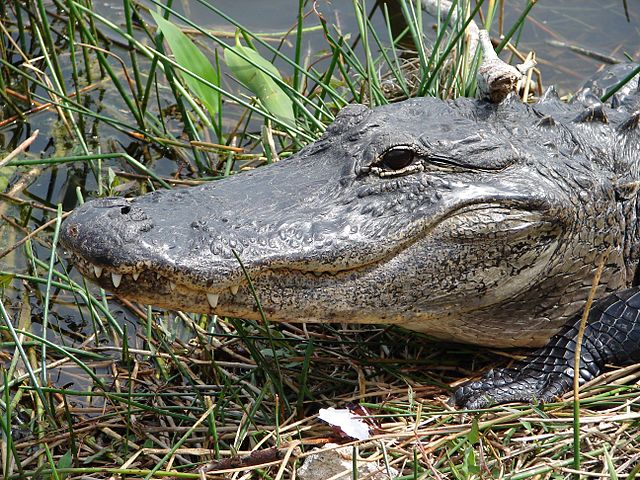
Photo credit: By NPS Natural Resources – Alligator in Everglades National Park. NPS/Karen Battle-Sanborn, CC BY 2.0, https://commons.wikimedia.org/w/index.php?curid=50624807
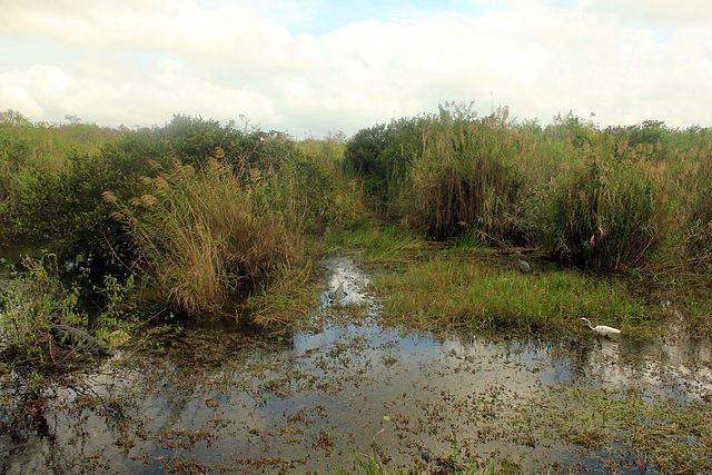
Photo credit: By National Park Service Digital Image Archives – http://www.nps.gov/storage/images/ever/Webpages/originals/361.jpgGallery http://www.nps.gov/storage/images/ever/Webpages/index.html, Public Domain, https://commons.wikimedia.org/w/index.php?curid=24099655
Photo credit: By Hein Mück – Own work, CC BY-SA 3.0, https://commons.wikimedia.org/w/index.php?curid=6084139
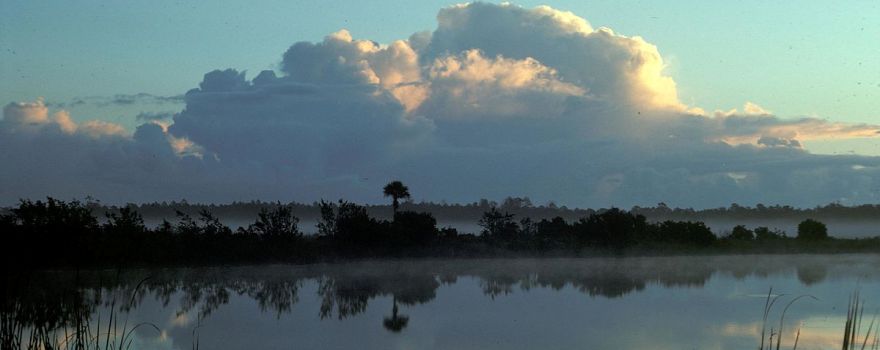
Photo credit: By Everglades NPS from Homestead, Florida, United States – Thunderhead, NPSPhoto Van Nimwegen, Dec 78 EVER 1235, Public Domain, https://commons.wikimedia.org/w/index.php?curid=44899928
