
Several news sources featured in the Daily Digest may limit the number of articles you can access without a subscription. However, gift articles and open-access links are provided when available. For more open access California water news articles, explore the main page at MavensNotebook.com.
In California water news today …
California agencies use confidentiality agreements to keep some Bay-Delta science secret
“California state agencies have quietly been using confidentiality agreements to keep some scientific data and discussions behind the Newsom administration’s updated Bay-Delta plan a secret, raising concerns about transparency in the rule-making process. The California State Water Resources Control Board is set to vote later this month on the updated Bay-Delta plan, a massive policy proposal that aims to balance water needs for communities and agriculture while protecting fish, wildlife, and the environment in the San Francisco Bay-Sacramento-San Joaquin Delta. State officials have denied they are hiding anything and maintain the process has been transparent. The proposed update to the Bay-Delta plan heavily relies on voluntary agreements, deals negotiated between state agencies and major water users, such as farmers. The deals involve larger water users providing water and funding for environmental purposes in exchange for more certainty around their water supply. “It’s detailed, it’s science-based and outcomes-focused,” California Natural Resources Secretary Wade Crowfoot said at a hearing on the plan in January. “I want to be clear; this has always been and meant to be an inclusive process.” … ” Read more from KCRA.
‘Nature-based’ solutions could save insurers and policyholders billions

“After years trudging through marshes around San Francisco Bay studying conservation practices, coastal ecologist Megan Kelso realized that one of the largest determinants of wetland health may not be an invasive species lurking with her among the sea grasses, but decisions made miles away in the executive suites of insurance companies. Wetlands absorb massive volumes of carbon and are vital to combating climate change, Kelso said, and she saw her early field work as the most effective way to keep them healthy. It wasn’t until she started working alongside Mike Beck, director of University of California Santa Cruz’s coastal resilience program, and was offered a grant to research how insurance can promote similar habitat restoration projects, that she had her “aha” moment. “I was thinking, maybe there’s a way to align this huge sector of insurance with nature and conservation in a way that could have a bigger impact than what I was doing before,” Kelso said. … ” Read more from Inside Climate News.
El Niño hype is loud. The numbers back it up, but here’s what they really mean
“‘Blame it on El Niño.’ Those are the words emblazoned on the coffee mug on the desk of Dr. Ben Kirtman — Dean of the Rosenstiel School of Marine, Atmospheric, and Earth Science at the University of Miami. A California native who grew up in Santa Barbara, Kirtman has vivid memories of the 1982-83 El Niño which brought torrential rainfall across Southern California. Up to 18 inches of rain fell between Santa Barbara and LA in early March of ‘83, and Kirtman’s family had one of those rare Southern California houses with a basement. “My introduction to El Niño was pumping the basement out, so that’s why I had such a fascination with it.” That flooded basement spurred Kirtman into a career of forecasting and climate science: working on being able to predict patterns like El Niño months ahead of time. That work has grown into one of the main tools now used to predict El Niño months in advance. … ” Read more from the Sacramento Bee.
On-Farm Recharge Methods Manual: A Summary of Strategies and Challenges
 “Under the Sustainable Groundwater Management Act (SGMA), groundwater sustainability agencies (GSAs) have been charged with developing and implementing groundwater sustainability plans (GSPs) that guide how to meet their subbasin’s sustainability goals. On-farm recharge is one of several key tools identified in GSPs to improve groundwater sustainability by applying excess surface water on farm fields to recharge aquifers. Successful GSP implementation will depend on the leadership of GSAs and the participation of numerous growers to use high flows for aquifer recharge in wet years. This document gathers observed results and lessons learned from over a decade of Sustainable Conservation working directly with growers and irrigation districts to implement on-farm recharge. There are a limited number of scientific research studies documenting the potential and challenges of on-farm recharge. … ” Read more from Sustainable Conservation.
Report: Groundwater recharge: Incentives and strategies
 “Under the Sustainable Groundwater Management Act (SGMA), groundwater sustainability agencies (GSAs) are responsible for developing and implementing groundwater sustainability plans (GSPs) designed to balance groundwater use and replenishment. Groundwater recharge increases groundwater supplies by directing available surface water onto land where it can seep into aquifers. Farmland is often suitable for recharge because water delivery systems are already in place, and dormant or fallow fields can be flooded periodically when water is available during winter storms. California water districts and GSAs are increasingly using financial incentives and water management strategies to expand groundwater recharge and reduce pumping in overdrafted basins. This document presents examples of groundwater recharge incentives and management strategies that water districts and GSAs can adapt to the conditions of their subbasins. … ” Read more from Sustainable Conservation.
Report: A groundwater recharge guide for vineyards
 “A Groundwater Recharge Guide for Vineyards helps California winegrape growers assess recharge opportunities and outline a plan for their operation. Developed by Sustainable Conservation for the California Sustainable Winegrowing Alliance, it covers site suitability, water sources, vine health, water quality, recharge methods, costs, and incentives. Decision tools, grower examples, and a planning worksheet support next steps with local technical assistance providers. A Groundwater Recharge Guide for Vineyards combines Sustainable Conservation’s expertise in on-farm groundwater recharge with the California Sustainable Winegrowing Alliance’s expertise in sustainable winegrape production. The guide is designed to help winegrape growers address groundwater sustainability challenges. … ” Read more from Sustainable Conservation.
CMUA releases new policy paper about water affordability from a system cost perspective
 “A new policy paper from CMUA called Understanding Water Affordability in California: A System Cost Perspective examines the key drivers that are increasing water system costs and explains why rate design alone is not enough to address the water affordability problem for households. A durable statewide affordability system will require ongoing state support, coordinated enrollment, sustained state and federal partnerships, and more, the paper finds. This report explains why affordability pressures are increasing, the challenges beyond a utility’s control that drive up water costs, why local rate-based tools are constrained, and what durable, scalable solutions could look like in California. It is a reference tool for CMUA and its member agencies to support informed engagement with state partners, including the State Water Resources Control Board, the Department of Water Resources, and the California Legislature. This CMUA policy paper is the newest in an ongoing series providing thought leadership about key topics and issues that will shape the present and future of California water and energy.” Click here to read the paper.
Water Blueprint for the San Joaquin Valley releases final Unified Plan
“On September 3, the Water Blueprint for the San Joaquin Valley and the California Water Institute at Fresno State released the final Unified Water Plan for the San Joaquin Valley. The plan is a federally funded report that provides a roadmap for local, state, and federal water investment across the San Joaquin Valley’s eight counties. “Congress asked for one unified plan built from the Valley’s own data, and this report answers that request. It gives federal partners a sequenced, accountable path for protecting infrastructure the nation has already built and the food supply that depends on it,” Austin Ewell, Executive Director of the Water Blueprint for the San Joaquin Valley said in a press release. The plan identified a water supply-demand gap of about 2.4 million acre-feet per year by 2040, but that figure excludes supply reductions that have already occurred under existing regulatory requirements as future constraints are not yet known. … ” Read more from Valley Ag Voice.
Dave Puglia breaks down California agriculture’s biggest challenges
“California agriculture is facing a growing list of challenges, from rising labor costs and water restrictions to regulations, trade pressures and competition from imported produce. On the latest AgNet News Hour, Nick Papagni, “the Ag Meter”, and Josh sat down with Dave Puglia, president and CEO of the Western Growers Association, for a wide-ranging conversation about the issues affecting farmers and the future of the state’s agricultural industry. Puglia discussed the resilience of California farmers, pointing to new opportunities such as agave production as an example of growers adapting to difficult conditions. However, he also warned that California’s regulatory environment, high energy costs and labor challenges are making it increasingly difficult for agricultural businesses to remain competitive. He said agricultural organizations frequently work together in Sacramento to prevent harmful policies from moving forward, describing much of their work as trying to “keep pucks out of the net.” … ” Read more from AgNet West.
State Water Board revises draft water right decision for proposed Sites Reservoir
“The State Water Resources Control Board released for public comment a revised draft water right decision and draft permit for the proposed Sites Reservoir in Northern California that will balance the project’s water supply benefits with the protection of senior right holders, water quality and flows for fisheries. The proposed 1.5 million-acre-foot reservoir, which would be the largest built in California in more than 50 years, would increase the state’s supplies by diverting water from the Sacramento River when flows are relatively high and storing it for farms, cities and the environment. If approved by the State Water Board, the revised drafts allow the project to divert up to 986,000 acre-feet of water per year — enough to supply about 8.4 million people annually. … ” Read more from the Valley Ag Voice.
It’s an interesting time in California water
Center for Watershed Sciences Director Karrigan Bork gave the welcoming address at the California Water Policy Conference at UC Davis last week: “Thank you for the invitation to speak here at the California Water Policy Conference. I love the theme this year: “Adapting Together.” It’s a great theme for where we are right now. … You all remember the curse, “May you live in interesting times?” Well, I’m not sure who we made angry, but we’re living in interesting water times, that’s for sure. Just think about what we’ve got going on in the next month: First, on October 1st, the Department of Interior’s 2027–2028 Operating Guidelines for the Colorado River go into effect. We’re talking about divvying up water for 40 million people across a region facing long-term drought, where managers are holding on to adequate reservoir levels by their fingernails. … ” Continue reading at the California Water Blog.
Now available: The latest issue of the San Francisco Estuary & Watershed Science Journal
 In this edition, Regional studies of algal blooms, Delta smelt habitat, Hydrodynamic conditions for Chinook juveniles, Adaptation of rainbow trout, and considerations for long-term monitoring programs. Read the journal here.
Levees, vetoed legislation and what comes next: Newsom rejects funding bill as both sides debate best path forward
“After a bill aimed at shoring up Delta levees passed the California Legislature unanimously, Gov. Gavin Newsom returned it without his signature this week, calling the measure “unnecessary.” Senate Bill 872, authored by state Sen. Jerry McNerney, D-Stockton, would have established the Delta Levees and Canal Subsistence Fund. Although the bill originally called for $150 million for levee funding and $150 million for canal repair, $170 million was ultimately secured separately through the state budget. The disagreement now centers on what the bill would have done beyond that initial investment: Supporters say it would have created a framework for continued state funding of Delta levee maintenance, while opponents argue it could have disrupted existing programs and complicated an already cumbersome funding process. The bill had broad support, including from San Joaquin County, the San Joaquin Area Flood Control Agency, Restore the Delta and municipalities and organizations across the state. It faced no opposition until the final stages of the legislative process, when the Central Valley Flood Control Association sent Newsom a letter outlining its concerns. … ” Read more from the Lodi News-Sentinel.
Senate committee advances desalination reauthorization bill
“The U.S. Senate Energy and Natural Resources Committee has advanced legislation that would extend federal support for desalination projects and research, including grants for large-scale facilities and pilot testing of emerging technologies. The Desalination Reauthorization Act, introduced by Sens. Alex Padilla (D-Calif.) and John Cornyn (R-Texas), was ordered reported by the committee Oct. 1 with an amendment in the nature of a substitute. The legislation would extend the Bureau of Reclamation’s authority to provide grants for desalination projects, which is scheduled to expire this year. It also would allow the programmatic approval to cover public-private partnerships and prevent Reclamation from imposing an administrative cap on individual project funding, allowing eligible large facilities to receive the full 25% federal cost share. … ” Read more from Water World.
USDA proposes changes to foreign ag land investment regulations
“On June 25, 2026, the Congressional Research Service released a report examining the extent to which the United States government can currently monitor and restrict foreign investment in agricultural land. According to CRS’s report, federal law does not generally restrict foreign investment in or ownership of U.S. farmland. In 2026, the U.S. Department of Agriculture reported that foreign investors — including long-term lease holders — held an interest in about 47.2 million acres of agricultural land as of 2024. This share accounts for 3.6% of all privately held U.S. ag land and 2% of all land in the U.S. Under the Agricultural Foreign Investment Disclosure Act of 1978, any foreign person who acquires, transfers, or holds any interest in U.S. agricultural land is required to submit a report no later than 90 days regarding such transactions and holding to the Secretary of Agriculture. To update how the government tracks foreign ownership of American farmland, the USDA is proposing to update regulations under AFIDA. The public comment period on the proposed rule closed on August 10, 2026. … ” Read more from Valley Ag Voice.
In regional water news and commentary today …
NORTH COAST
Century-old Kinsey ranch near Benbow protected forever under new easement
“The Northcoast Regional Land Trust (NRLT) is proud to announce the completion of a conservation easement on the Kinsey Ranch, a historic 6,625-acre working cattle ranch along the East Branch of the South Fork Eel River in Benbow, CA. The easement permanently protects the ranch’s agricultural, forest, and watershed values while allowing the Kinsey family to continue ranching the land they have called home for more than a century. “It’s a great example of conservation and agricultural communities coming together to keep working lands protected and productive while preserving important habitat for the wildlife that depend on them,” said Zach Wenderott, NRLT Project Manager. “We’re grateful to the Kinsey family and our project partners, including the Department of Conservation and Strategic Growth Council, for helping create an outcome that benefits agricultural use, wildlife, and conservation for generations to come.” … ” Read more from the Redheaded Blackbelt.
The Coastal Commission wants to end beach driving at Centerville, and Humboldt is furious
“Centerville Beach has been losing ground to the Pacific for decades. Now it might lose the trucks. The fight continues over vehicle access at Centerville Beach County Park, about five miles west of Ferndale in Humboldt County. The county wants to repair a low, shoulderless stretch of Centerville Road that high surf regularly buries in sand, raising roughly 900 feet of it up to 10 feet on fill and holding it in place with a rock revetment. The problem is that the project needs a Coastal Commission permit, and commission staff want the county to ban motorized vehicles from the beach as a condition of getting one. That did not go over well at the commission’s meeting in Eureka this month. Locals who drive side-by-sides down to the Eel River mouth to fish for redtail surfperch and smelt argued that the beach is nothing like Oceano Dunes. Commission staff pointed to western snowy plover habitat they say heavy use has degraded. … ” Read more from Active NorCal.
SIERRA NEVADA
Scientists seek new ways to protect Sierra Nevada meadows
“Sierra Nevada meadows may cover a relatively small portion of the landscape, but scientists say they play an important role in supporting wildlife, storing water and maintaining biodiversity. Researchers and conservationists recently gathered at the University of Nevada, Reno’s Lake Tahoe campus to discuss what is known about these ecosystems and what still needs to be studied. The workshop, sponsored by the Tahoe Institute for Global Sustainability, brought together researchers from different fields to identify gaps in meadow research and explore ways to improve conservation and restoration efforts. “They’re critical for wildlife, for water storage, for water quality. These are really unique and just biologically important ecosystems,” said Cody Reed, a meadow ecologist with Point Blue Conservation Science. … ” Read more from the Tahoe Daily Tribune.
The Sierra Nevada’s bluest lake has a mystery even scientists can’t fully explain
“Looking for solitude, beauty and maybe a few thrills, my buddies and I were hoofing it in the high country of California’s eastern Sierra when the mountains served up an unexpected treat, as they always do. Beneath us, at about 10,500 feet, was a lake like none I’d seen. It glistened with such an intense, cinematic glow that I would venture to call it the bluest lake in the Sierra Nevada. Little did I know that the lake’s striking color is something of local alpine lore — as well as a bit of a mountain mystery. My friend Aaron had steered us here. He had first spotted the burst of blue from an airplane, on a flight from Louisville to San Francisco. Using his low-tech binder of paper maps, he determined the spectacle was Burro Lake in the Hoover Wilderness. We decided to tack it onto our four-day hike through a string of passes near Lee Vining in Mono County last month. … ” Read more from the San Francisco Chronicle.
SACRAMENTO VALLEY
Signs of things to come at Pacific Flyway Center
“A shade structure has been added, and the interpretive signs for the 3.25-mile Walk in the Marsh are in the works. “About a year ago, maybe a little more, we worked with California Audubon to develop three interpretive panels,” Veronica Cornett, the project manager, said in a phone interview. Those panels are for the shade structure. One of those panels will inform visitors about the Pacific Flyway, which runs 10,000 nautical miles from the Arctic to Patagonia. It is the migration route for billions of birds, including an estimated 6 million waterfowl in California, including Suisun Marsh and the Delta. It is roughly 1,000 miles wide. The other two panels will provide details about the more common birds, flora and fauna visitors may see on their walk. There also will be maps and trail information and way-finding signs. … ” Read more from the Daily Republic.
BAY AREA
Sebastopol: Camp Meeker Beat: A tale of three water towers
“Camp Meeker has been quiet and peaceful for the most part as we enjoy the summer, with dogs (and sometimes humans) getting off the leash being the major day-to-day stress. The Park and Rec Board continues working away in the background, smoothing out water issues and working with the Ag and Open Space District on a grant that will fund some of the wildfire defense and trail maintenance work, along with repairing the damage done by the small mudslide up by Baumert Reservoir. More on those stories as they develop. In this issue, I will give you an update on our water tanks. More accurately, I will summarize the update provided by the Brelje and Race engineering firm after they were tasked by the Park and Rec Board with doing a full inspection of the three tanks and recommending appropriate courses of action. … ” Continue reading at the Sebastopol Times.
Marin County allocates $3M for El Niño preparations
“Marin County supervisors will spend more than $3 million to fund El Niño readiness this winter. The weather pattern, which occurs when the surface water in the central and eastern Pacific Ocean warm more than usual, has increasingly signaled that Marin will experience excessive rain, atmospheric rivers, elevated flood risks and landslides. Gov. Gavin Newsom declared a state of emergency last month to prepare the state for the expected El Niño onslaught. A week after he signed the Sept. 21 declaration, Hurricane Polo, one of the fiercest hurricanes to emerge from the eastern Pacific, made landfall in Mexico. “I’ve likened it to seeing hot lava coming down a hill,” Marin County Executive Derek Johnson told supervisors. “We know it’s coming because we have a superheated ocean off the coast of California. It’s up to us to prepare.” During the meeting, residents from several Marin neighborhoods requested that attention be paid to special needs in their areas. … ” Read more from the Marin Independent Journal.
CENTRAL COAST
‘Super El Niño’ hype gets a reality check from forecasters in Santa Barbara County
“The “Super El Niño” is here — but Santa Barbara County forecasters say the hype may be getting ahead of the science. The National Weather Service officially classifies the current El Niño as “very strong,” with a higher than 90% chance it’ll remain that way throughout the winter, meteorologist Todd Hall said during a county virtual community meeting Thursday. But while El Niño increases the likelihood of a wetter-than-normal winter in Southern California, Hall warned against treating it as a forecast of what the coming months will carry. “There’s just not enough science there to make these grandiose projections,” circulating on social media and from unofficial sources, Hall said. For Santa Barbara County, the risk of significant winter storms is in fact higher than average, “but overall it’s still low at this point,” he said. … ” Read more from the Santa Barbara News-Press.
After a devastating fire, Channel Islands National Park braces for El Niño
“El Niño is strengthening over the Pacific Ocean, raising the odds of a wetter-than-usual winter in Southern California. At Channel Islands National Park, that could mean a season of welcome rain — but also a difficult test for an ecosystem still recovering from one of the largest wildfires in the islands’ history. The stakes are particularly high on Santa Rosa Island, where a May fire burned 18,379 acres, roughly one-third of the island. The blaze devastated much of a rare grove of Torrey pines, with a postfire assessment estimating that 60% to 80% of the mature trees died. The latest outlook from the National Oceanic and Atmospheric Administration gives this year’s El Niño a 75% chance of reaching historic strength between October and December. The climate event can increase the likelihood of rain in the region, but it does not guarantee heavy rain or the frequency of storms. … ” Read more from SF Gate.
SAN JOAQUIN VALLEY
Fresno boosts lawn rebate to $4 a foot to swap water-guzzling grass for drought-tolerant yards
“Fresno residents and businesses have a larger financial incentive to replace conventional lawns with landscaping that uses less water. City officials have increased the rebate for lawn-conversion projects to make those changes more attainable for property owners adapting to California’s dry climate. According to Fox 26, Fresno’s Expanded Lawn to Garden Rebate now pays $4 per square foot and applies to a larger area of lawn. Through the City of Fresno Public Utilities, the program helps cover the cost of converting irrigated grass to drought-tolerant landscaping. … ” Read more from The Cool Down.
SOUTHERN CALIFORNIA
Southern California to be battered by another hurricane swell — raising risk of rip currents, erosion
“Seemingly relentless hurricane swells have battered Southern California in recent months, eroding beaches before an El Niño winter even begins. Yet another round is due this week. Energetic waves are expected to hit the coastline from Santa Barbara to San Diego on Tuesday through Friday, raising the risk of more coastal flooding and erosion. This week’s rough seas, from distant Hurricane Rachel, will be particularly dangerous because they coincide with an extreme heat warning for the beaches, where high temperatures are forecast to be in the 90s. “With increased beach traffic … people should be really aware of the coastal hazards,” said Rose Schoenfeld, a meteorologist at the National Weather Service Los Angeles. … ” Read more from the San Francisco Chronicle.
With a potentially historic El Niño looming, here’s how Orange County is getting ready
“Southern California is seeing a heat wave that will have the thermometer hovering near 100 degrees in parts of Orange County the next few days. Yet crews across the region are bracing for a downpour. An El Niño forecast that officials say could be historic has agencies across OC preparing for the worst-case scenarios, attempting to ready residents with community meetings and getting staff trained so they are prepared to quickly respond to potential storm damage. “We get it, people are sweltering,” Anaheim city spokesperson Mike Lyster said. “But we still have to prepare.” “And we have to prepare for the maximum scenario, which would be a heavy El Niño with heavy, heavy rain,” he said. … ” Read more from the OC Register.
Warnings, dam cleanouts, ‘preparing for the worst,’ if El Niño sends storms to Eaton fire burn zone
“If El Niño-aided storms surge into the burn areas of Altadena, what kind of havoc will they wreak? No one can say for sure. But evidence of a strong El Niño building in the Pacific, along with high odds for this phenomenon causing above-average rainfall to fall in California this winter, dousing the burn-scared landscape from the January 2025 Eaton fire, has Los Angeles County officials on high alert for debris flows and flooding. Others are worried that already-lagging rebuilding rates could slow even further during any kind of rain delay. “We prepare for the worst, hope for the best. We make sure our flood control system is ready for the storm season,” said Sterling Klippel, assistant deputy director for county Public Works who oversees storm operations, engineering and county dams. … ” Read more from the LA Daily News.
California releases detailed analysis of 2025 LA fires
“The second of two state-commissioned, independent reports on the 2025 L.A. fires has been released. The analysis by the Fire Safety Research Institute details the effectiveness of the response to the Palisades and Eaton fires, which killed at least 31 people and destroyed more than 16,000 homes and buildings, mostly in the Pacific Palisades and Altadena. Gov. Gavin Newsom called for an independent investigation into the response to the fires just a few days after they started on Jan. 7, 2025. His administration commissioned the nonprofit Fire Safety Research Institute to carry it out. L.A. County (via the McChrystal Group) and the L.A. Fire Department have released similar reports. … ” Read more from the LAist.
With new cover in place, LADWP begins filling 117-million-gallon reservoir in Pacific Palisades
“After placing a new floating cover designed to protect drinking water, the Los Angeles Department of Water and Power began refilling the Santa Ynez reservoir in Pacific Palisades, it was announced Friday. DWP began refilling the reservoir Thursday at rate of approximately 1.5 feet to 2 feet per day, with the aim of having it back in service by the end of the year, officials said. In December 2025, DWP announced it would conduct a replacement cover project for the reservoir, which had sparked concerns from residents who were impacted by the Palisades fire in January, when it was also out of service. At the start of 2025, the reservoir was offline — a key water resource that was unavailable during the Palisades fire that destroyed more than 6,800 structures and killed 12 people. Emergency repairs were completed to the reservoir’s floating cover in June, allowing it to be filled to its normal operating level and go back in service. … ” Read more from the LA Daily News.
New report looks at metals in LA River after warehouse fire started in Boyle Heights
“A new report sheds light to the heavy metals that researchers say were carried from the burning Lineage Logistics cold food storage warehouse in Boyle Heights into the Los Angeles River. Researchers from UCLA’s Fielding School of Public Health said at the peak of the fire, which started June 17 and flared up for days, firefighters were spraying 12,000 gallons of water per minute on the nearly 500,000 square-foot warehouse east of downtown Los Angeles. Some of that runoff water containing potentially toxic metals entered drains that lead to the Los Angeles River and, eventually, the ocean, researchers said. During and after the fire, researchers tested runoff water around the warehouse and water in the river both upstream and downstream from the property. Samples also were collected at a spout from a drainage line where it meets the river, a containment boom set up to hold water and near Cudahy Park. … ” Read more from NBC LA.
UCI’s San Joaquin Marsh Reserve threatened by persistent climate change
“Before the early 1900s, much of Orange County was covered with more than 5,000 acres of dense, richly populated wetlands. Today, the San Joaquin Marsh is one of the last remnants of the once-expansive coastal wetland area, and the marsh is at risk of shrinking even further as climate change intensifies, potentially affecting dependent wildlife, UCI students and the Irvine community at large. Established in 1969, the San Joaquin Marsh Reserve encompasses 202 acres managed by UC Irvine through UC Nature, a system-wide program that oversees 42 protected UC reserves. The reserve contains freshwater marshlands, shallow ponds, cattails and bulrushes, as well as two endangered bird species and other wildlife that rely on the marsh. Much of what is now Irvine and Tustin was once an undivided network of wetlands known as la Cienega de las Ranas — the Swamp of the Frogs. After the wetlands were drained in the early 1900s for agricultural use and cleared for duck hunting in the mid-1900s, the marsh area became depleted, significantly shrinking to a present size of about 500 acres, compared to the 5,000 acres it encompassed before the developments. Now, rising sea levels are threatening life in the reserve. … ” Read more from New University.
New releases a leap forward for endangered frog in southern California
“Frog release days always start early, at about 4 a.m., so that staff can get up to the site before the day gets too hot, said Erin Lundy, manager of conservation initiatives at the Aquarium of the Pacific in the U.S. The first challenge is catching the frogs. A newly morphed southern mountain yellow-legged frog (Rana muscosa) is about an inch long, fast, and very good at squeezing into cracks, Lundy said. It can take a couple of hours for staff to scoop them all up from the tanks. Lundy prefers grabbing them with gloved hands, though others use nets. The aquarium has been rearing southern mountain yellow-legged frogs since 2021, as part of a multi-agency, 20-plus-year conservation effort for the species, a Southern California amphibian listed as endangered on the IUCN Red List. Head-starting the frogs by ushering them through metamorphosis in captivity boosts their odds of survive, Lundy said. … ” Read more from Mongabay.
SAN DIEGO
San Diego Foundation grants nearly $1m in binational water health grants
“The San Diego Foundation Wednesday granted nearly $1 million in the Binational Resilience Initiative for 10 projects ranging from addressing Tijuana River pollution to restoring coastal habitats in the California-Baja region. The $983,439 granted will also go to general water health projects and support research and education. “The Tijuana River sewage crisis has affected our communities for far too long, and the need for action is urgent,” said Pamela Gray Payton, vice president and chief impact and partnerships officer at San Diego Foundation. “Water and pollution don’t stop at the border. Neither can our response. These investments bring organizations in San Diego and Baja California together to protect the health of our communities and the places we all share.” … ” Read more from Channel 10.
Along the Colorado River …
How a century-old pricing system has emptied the Colorado River
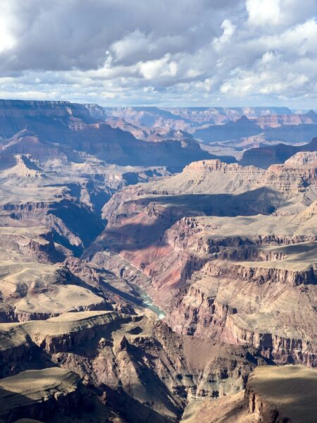 “While fighting over water rights and priorities might take decades, the federal government can start aligning what agriculture pays for federal delivery with what municipal users already pay — without waiting for a new compact or a courtroom fight over title. We are told that nothing can be done about the Colorado River water crisis while officials allow powerful agricultural interests to keep using more of the river for hay and alfalfa than all cities and other industries in the basin combined. In the Lower Basin, agricultural water districts pay roughly 6% of what municipal utilities pay at wholesale. That pricing perpetuates waste and low-value irrigation, discourages conservation, and undermines any real chance of restoring the river’s supplies. Part I of this series (see “Absurdity of the Colorado River crisis,” Big Pivots, Aug. 30, 2026) showed that nearly half the water put to human use in the Colorado River Basin goes to growing feed for cattle — alfalfa, hay and silage — while 40 million people depend on the same river for drinking water. That is not a hydrology problem. It is a political one, built on the doctrine that the oldest water right always wins, no matter how the world around it has changed. This installment goes one layer deeper, into the accounting. The story of the Colorado River is not only about who has the legal right to water. It is about how government pricing, contracts, and cost-shifting have supported overuse on low-value crops. … ” Read more from Big Pivots.
As water levels decline, Lake Mead takes steps to keep boat ramps operational
“As Colorado River water levels continue declining, National Park Service staff are working on projects so you can keep accessing the Lake Mead National Recreation Area. Over the past several years, staff have worked on multiple construction and/or improvement projects like adjusting launch ramps and adding rubber matting in order for boaters to continue using Hemenway Harbor, Callville Bay, Echo Bay, Temple Bar, and South Cove. When looking at water elevation readings from the Bureau of Reclamation, since September 2020, water levels have dropped 46 feet. (To be exact, from 1,083.21 feet to 1,037.80 feet.) According to the latest 24-month study, Lake Mead is expected to fall to about 1,003 feet by July 2027. “With the Bureau of Reclamation’s low water predictions, effective planning and preparation for changing lake levels begin with having solid data to develop work strategies,” said Ed Clark the Lake Mead National Recreation Area Superintendent. … ” Read more from Channel 13.
Arizona’s water bank shifts from saving to spending
“For decades, Arizona prepared for a day when there might not be enough Colorado River water to go around. That day is changing the Arizona Water Banking Authority’s job. Instead of concentrating on putting unused Colorado River water underground for the future, the Water Bank is increasingly focused on how to use the water credits it has already accumulated to help soften the effects of shortages. “We used to bank water through the storage of Colorado River. We do not do that anymore,” Arizona Water Banking Authority Director Rebecca Bernat said in an Arizona Department of Water Resources article published October 1. … ” Read more from Western Water.
Who will stop the draining of San Luis Valley’s water lifeline?
“From satellite view, the entire grid of the northern San Luis Valley looks like a mat from the game of Twister, alternating 50 rounded shades of beige. On the fields planted by family-owned Anaiak Farms, where center-pivot irrigators dampen bone-dry dirt, the late August dust creates a sandstorm every time a potato truck’s wheels drop from asphalt to gravel. Asier Artaechevarria is ankle-deep in drifting sand and rows of freshly dug russet potatoes. He hits a phone in search of more drivers to fill an emergency order from Front Range grocery stores eager for the family farm’s first harvest of the summer. The golden tubers tumble by the ton into the few trucks he has so far managed to assemble for the day, reminding everyone in this field why farming in view of the glorious Sangre de Cristos and Great Sand Dunes still offers days of seemingly limitless bounty. But there is, actually, a limit. … ” Read more from the Colorado Sun.
In national water news today …
Native nations sue over Endangered Species Act changes
“The Smokehouse Tidal Marsh project on the Swinomish Indian Reservation, which began in 2022, will turn 250 acres of former agricultural land into estuaries and wetlands. It’s one of many tribal community projects aimed at restoring endangered and threatened populations of Puget Sound chinook salmon, Puget Sound steelhead, bull trout and southern resident killer whales in the Skagit River Watershed. A primary cause nof decline for each of these species is habitat loss and degradation caused by development and agriculture. “Over the past 150 years or so, there’s been significant damage to the habitat, and (the habitat is) what salmon needs,” said Swinomish Tribal Indian Community Chairman Steve Edwards, who has fished in the area for over 50 years. … ” Read more from High Country News.
Supreme Court to hear major environmental lawsuit
“Who should cover the costs of climate change? That is the question underpinning the first case of the Supreme Court’s new term, a landmark dispute over whether state and local governments can seek to hold oil companies responsible for billions of dollars in costs from floods, droughts, wildfires and other climate-related disasters. The case before the justices pits officials from Boulder, Colo., against two major oil companies — Suncor Energy and Exxon Mobil. The Colorado officials contend that they should be able to proceed with a lawsuit arguing that the oil companies violated state law and seeking to hold them responsible for the costs of environmental damages. The companies, joined by the Trump administration, argue that such lawsuits are barred by federal law and the Constitution. A decision is expected by the end of June or early July. … ” Read more from the New York Times.
Satellite data reveal massive scale of routine oil pollution in oceans. See the map
“Oil slicks from ships and offshore oil platforms cover nearly 1.6 million square kilometers (618,000 square miles) of the ocean surface each year, an area slightly larger than the nation of Mongolia. The estimate comes from a recent report by Skytruth, a U.S.-based nonprofit that used satellite imagery, machine learning and vessel tracking data to trace global oil pollution in the oceans between 2023 and 2025. According to John Amos, CEO of Skytruth, this kind of pollution was largely invisible before satellite imagery made it possible to track. “Any vessel operator could be pretty confident that nobody was going to notice what they were doing out in the middle of the ocean,” Amos told Mongabay by phone. “So that’s changed. We can see it now.” … ” Read more from Mongabay.

