
Several news sources featured in the Daily Digest may limit the number of articles you can access without a subscription. However, gift articles and open-access links are provided when available. For more open access California water news articles, explore the main page at MavensNotebook.com.
In California water news today …
Newsom’s Bay-Delta Plan thrown into confusion after rebuke from Trump administration
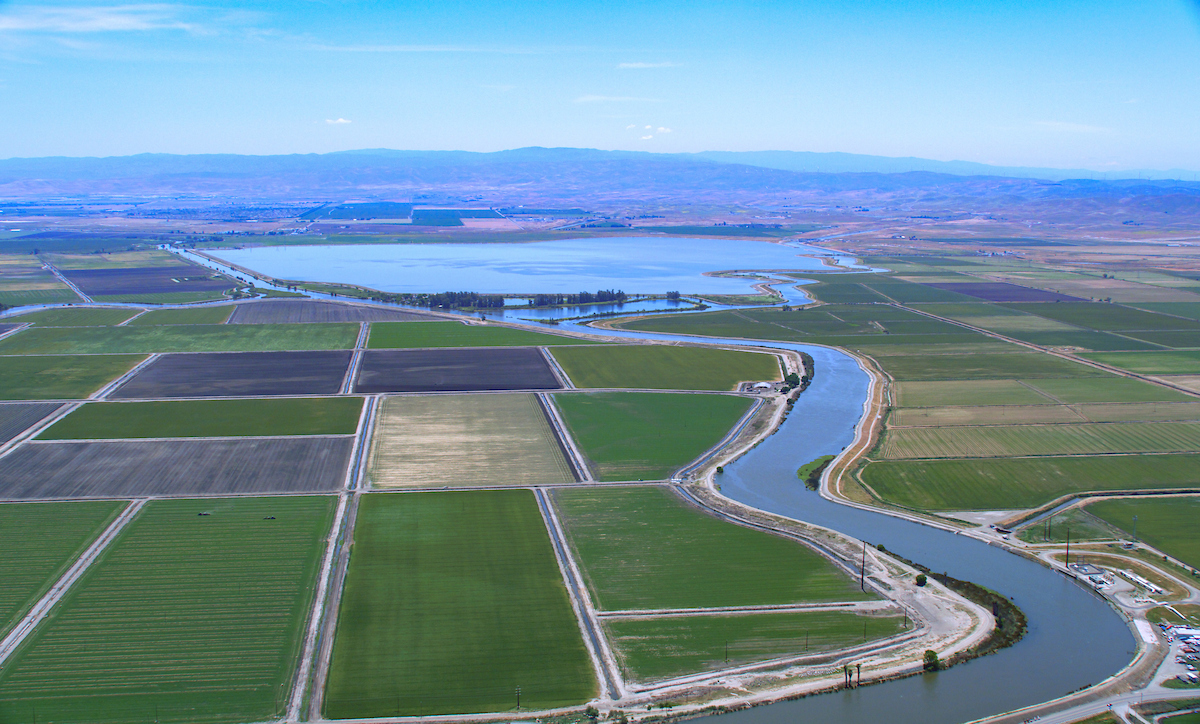
“California’s current plan for making sure the water flowing through the San Francisco Bay-Sacramento-San Joaquin Delta is clean and abundant enough to protect threatened and endangered wildlife is old and not working. This nexus of waterways, so crucial to the functioning of the state, has been long fought over and will be fought over long into the future. At the moment, however, the fight However, looks particularly chaotic. Gov. Gavin Newsom first proposed major changes to rules governing the Bay-Delta in 2020, arguing his proposal strikes a balance for use of the water for cities, growers and fish. The framework for managing the Sacramento River was last meaningfully updated in 1995, despite the fact that it is supposed to be reviewed and updated if needed every three years. The regulations were refined over years and backed by $1.5 billion in state funds. … ” Read more from KQED.
Valley GOP urges state to reconsider new Delta water plan
“Central Valley Republicans are calling on the State Water Resources Control Board to not adopt the proposed Bay-Delta Water Quality Control Plan, saying it will harm farmers and local communities. Lawmakers sent a letter to the board warning that the plan could cause the federal government to withhold funding for habitat restoration projects. Driving the news: State and federal officials have been working on the water plan for years, culminating in a draft plan released in August that is scheduled to be adopted by the State Water Resources Control Board next month. … ” Read more from the San Joaquin Valley Sun.
For the first time, scientists link heavy snow to groundwater in California
“For the first time, scientists have found a direct link between the snow that falls on California’s mountains and the groundwater that lies beneath Central Valley farmlands. Analyzing two decades of measurements from NASA satellites, the researchers discovered that after a snowy winter in the Sierra Nevada, the melting snow that runs off the mountains substantially raises water levels underground. The study documents just how important years of heavy snow are for recharging California’s groundwater aquifers. It also reveals that a year with rain but little snow doesn’t benefit the state’s underground water nearly as much. “It really does seem that the snow, rather than the rain, is what drives the groundwater recharge,” said J.T. Reager, the study’s lead author. “If it rains, a lot of that rain is going to run right off, whereas if it snows, that snow sits there and slowly melts over the entire spring and summer, and provides this nice steady, infiltrating trickle that provides water to farmers, puts more water in reservoirs and also recharges the ground.” … ” Read more from the LA Times. | Read via Yahoo News.
Watershed after fire: New report summarizes years of water quality monitoring in the Sacramento watershed
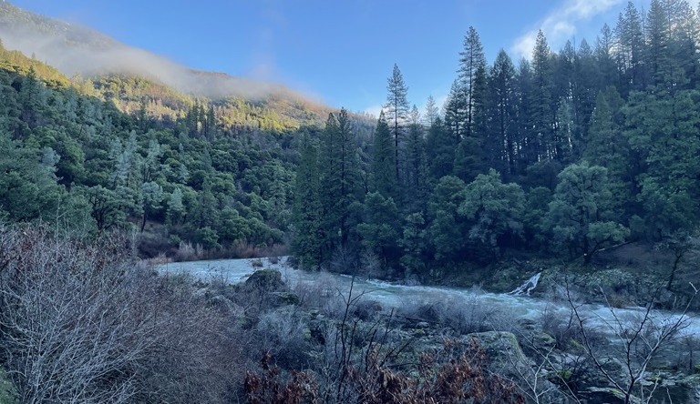
“Water flowing from the forests and mountain streams of the Southern Cascades and Northern Sierra Nevada connects to communities and ecosystems throughout the watershed. Along the way, natural conditions and human activities can affect water quality. Wildfires can intensify those impacts, particularly when rain washes ash, sediment, and other materials from burn scars into nearby waterways. DWR’s Northern Region Office and the Central Valley Regional Water Quality Control Board work together through the Sacramento Watershed Coordinated Monitoring Program (SWCMP) to better understand those changes. Building on nearly 20 years of collaborative monitoring, the latest findings offer a comprehensive look at current conditions across the Sacramento River watershed. The newly published SWCMP Final Report draws on data collected at 56 monitoring stations, where scientists tracked water chemistry, temperature, bacteria, and other indicators of water quality. … ” Read more from DWR.
California adopts new limits to rein in dairy manure pollution and its ‘outsized’ groundwater impacts
“The California valley with the most dairy farms in the state will follow stricter water pollution requirements following years of advocacy and a marathon six-hour meeting this week. The State Water Resources Control Board unanimously agreed to adopt the regulations under what several environmental groups call a long overdue dairy order. Nitrogen from the manure dairies produce turns into excess nitrate in soil, waterways and groundwater, and can eventually contaminate drinking water. Families and children in the Central Valley “are living in crisis,” said Leslie Martinez, of the Leadership Counsel for Justice and Accountability and Defensores del Valle Central para el Aire y Agua Límpio (Central Valley Defenders of Clean Air and Water), a group of San Joaquin Valley residents. “Low-income rural communities of color rely heavily on shallow groundwater and face the greatest exposure,” Martinez said during Tuesday’s meeting in Sacramento. … ” Read more from Inside Climate News.
New forecast points to wet winter in California courtesy of El Niño
“Bay Area residents woke up on Thursday morning to drizzle, a reminder that winter is around the corner. The National Oceanic and Atmospheric Administration expects above-normal amounts of rain and snow across California this winter, according to a monthly outlook published on Thursday. El Niño, the climate phenomenon that will likely reach historic strength this fall, is driving the forecast. “The odds are increasing that it will be an above-normal winter as far as precipitation in California,” Jan Null, a meteorologist and private weather consultant with Golden Gate Weather Services, told SFGATE by phone Thursday. “But there’s no guarantee … Right now, it’s like we have a six-sided die, and five of those sides say above-normal and one side says near-normal or below-normal.” … ” Read more from SF Gate.
Why a looming El Niño makes this weekend’s Coastal Cleanup Day more urgent than ever
“You might have done spring cleaning at your house. Every year, California gets a fall cleaning. A really big one. And it’s that time again. Litter at the beach? Trash on the banks of the local creek? Plastic pollution threatening wildlife? Those are the targets. From 9 a.m. to noon this Saturday, the California Coastal Commission is hosting the 42nd annual California Coastal Cleanup Day — the state’s largest yearly volunteer event. And with sunny skies forecast, organizers say more volunteers are still needed. More than 40,000 people are expected this year at more than 750 sites in all 58 of California’s counties, said Eben Schwartz, marine debris program manager at the California Coastal Commission, which oversees the event. … ” Read more from the Santa Rosa Press Democrat.
California drought history: Main drought events and their lasting impact
“In California, drought has affected water policy, agriculture, and communities for as long as records exist. To understand where California stands today, it helps to start with the basics: what drought actually is, how it fits into the broader story of drought in the United States, and what the state’s own historical record looks like. At Sustainable Conservation, we have spent decades working alongside California farmers, water managers, and communities to build a more water-resilient state. That work has given us a close-up view of how drought shapes decisions on the ground and why understanding its history matters for planning what comes next. Drought does not announce itself the way a hurricane or wildfire does. It is often called a “creeping phenomenon” because it builds slowly, affecting water supplies, crops, ecosystems, and economies over months or years rather than days. There’s no single definition that every agency or country agrees on, but the core idea is that drought happens when an area receives significantly less water than it normally would over an extended period of time. … ” Read more from Sustainable Conservation.
The world’s water cycle is swinging wildly between drought and flood
“In the early morning hours of July 4, 2025, torrential rains stormed down in central Texas, triggered by the remnants of Tropical Storm Barry. By 6:45 a.m. local time, the Guadalupe River rose from less than one foot to more than 34 feet, leading to massive flooding that killed 135 people, most of them in Kerr County, including about 40 children. The devastation could cost the state up to $22 billion, according to AccuWeather. The disaster was cited in the State of Global Water Resources 2025, which the World Meteorological Organization released Thursday. Now in its fifth edition, the report pairs its usual year-in-review with a five-year synthesis of how the planet’s entire water cycle is changing. What it found suggests the Texas flood wasn’t a one-off incident. It’s just one example of a pattern showing up across the globe. … ” Read more from Straight Arrow News.
Forest Service proposal could change protections in California for roadless areas
“The U.S. Forest Service is proposing to rescind the 2001 Roadless Rule, a move that could change how some undeveloped forest areas in California are managed. The proposal comes as the Forest Service says deteriorating forest health and wildfire risk require more flexibility in managing the nation’s forests. “Forest health has been at a decline for the last 30 to 40 years,” said U.S. Forest Service Chief Tom Schultz. “We have overstocked stands, we have unhealthy stands, and we have stands that are primed for catastrophic fire.” To get a closer look at what’s at stake, we took an EcoFlight from Truckee-Tahoe Airport over the Tahoe National Forest and Lake Tahoe Basin. … ” Read more from CBS Sacramento.
In commentary today …
California must defend the ocean and beaches from Trump’s new plans for offshore drilling
Ted Danson, an actor, advocate and Oceana board member, writes, “More than 40 years ago, I was walking along a beach in Santa Monica with my young daughters when we came across a sign that read: “Water Polluted. No Swimming.” My daughters looked at me, confused. They wanted to know why they couldn’t go in the water. I didn’t have a good answer. But I knew then that I wanted to do something about it. That moment led me to join the fight against offshore drilling off California’s coast. I never imagined that, more than four decades later, we’d still be working to stop it. For decades, Californians have chosen to protect this coastline. Yet the federal government’s newly released plan threatens to reverse that progress by once again proposing to open our coast to more offshore oil and gas drilling. Over the years, I’ve watched Californians come together time and again to defend the coast we love. If there’s one thing I’ve learned, it’s that progress isn’t permanent. And every victory must be defended. … ” Read more from Cal Matters.
In regional water news and commentary today …
NORTH COAST
CalTrout receives Wildlife Conservation Board grant to advance habitat restoration on the Shasta River
“California Trout (CalTrout) has received a grant from the California Wildlife Conservation Board (WCB) to implement priority habitat restoration projects at Big Springs Ranch Wildlife Area, one of the highest-priority spring-fed reaches in the Shasta River watershed. The award moves years of watershed-scale planning into on-the-ground action, advancing CalTrout’s Upper Shasta River Habitat Improvement effort with measurable benefits for Chinook and Coho salmon, steelhead, and other native species. Big Springs Ranch Wildlife Area sits on California State lands managed by the California Department of Fish and Wildlife (CDFW) and offers an immediate opportunity to improve instream habitat conditions for wild salmon and steelhead. With this grant, CalTrout and partners will carry out two shovel-ready projects on the property over the course of the next two years, with completion expected by late fall of 2028. … ” Read more from Cal Trout.
Arcata City Council OKs 45-day moratorium for data centers
“The Arcata City Council on Wednesday revisited the conversation on a moratorium on data centers within city limits. Staff presented a presentation explaining the moratorium and what it would entail for the city. Councilmembers were informed that if they approved the moratorium, it would immediately go into effect. The Arcata City Council unanimously voted 5-0 to approve an interim urgency ordinance halting new applications for data‑center development, citing concerns over land availability, resource use, and the absence of a regulatory framework for the fast‑growing industry. The ordinance establishes a 45‑day moratorium on receiving, processing, or approving any land‑use applications for data centers. Assistant City Manager and Finance Director Tabatha Miller told the council the pause gives staff time to evaluate potential public‑health impacts, resource demands and long‑term land‑use implications. … ” Read more from the Eureka Times-Standard.
The Eel River dams are one step closer to coming out. Public comment closes today.
“Today is the last day to tell federal regulators what they should study before two century-old dams come off the Eel River. The comment window on the Federal Energy Regulatory Commission’s scoping document closes September 18, capping a week of public sessions in Eureka. The commission took comments at the Wharfinger Building on Tuesday and Wednesday, following an earlier round in Ukiah in June. The sessions were one-on-one with a stenographer rather than open mic, a format FERC says is less intimidating, though some advocates missed the energy of the packed Klamath hearings. The dams in question are Scott Dam, which created Lake Pillsbury in 1922, and Cape Horn Dam downstream near Potter Valley. Together they make up PG&E’s Potter Valley Project, which has not generated electricity since equipment failed in 2021. PG&E found no buyer and applied to surrender its license and tear the structures out. … ” Read more from Active NorCal.
Huffman still pushing for Coyote Valley Dam feasibility study
“In a press release this week, Rep. Jared Huffman (D – San Rafael), reported voting for legislation that advances “several Northern California Projects,” including a study evaluating the possibility of increasing the storage capacity of Lake Mendocino by potentially raising Coyote Valley Dam. On Wednesday, Huffman announced that he “voted to pass the Water Resources Development Act of 2026,” describing it as “bipartisan legislation (that) authorizes the U.S. Army Corps of Engineers’ civil works program while advancing critical water infrastructure, ecosystem restoration, and climate resilience projects nationwide.” … As for the Coyote Valley Dam Feasibility Study, which local water officials have long pointed to as crucial to securing the region’s water supply, Huffman said the latest WRDA: “Advances evaluation of improvements to increase flood protection while expanding water storage and strengthening long-term drought resilience.” … ” Read more from the Ukiah Daily Journal.
SIERRA NEVADA
85 years of evidence: Englebright Dam’s history helps engineers assess future risk
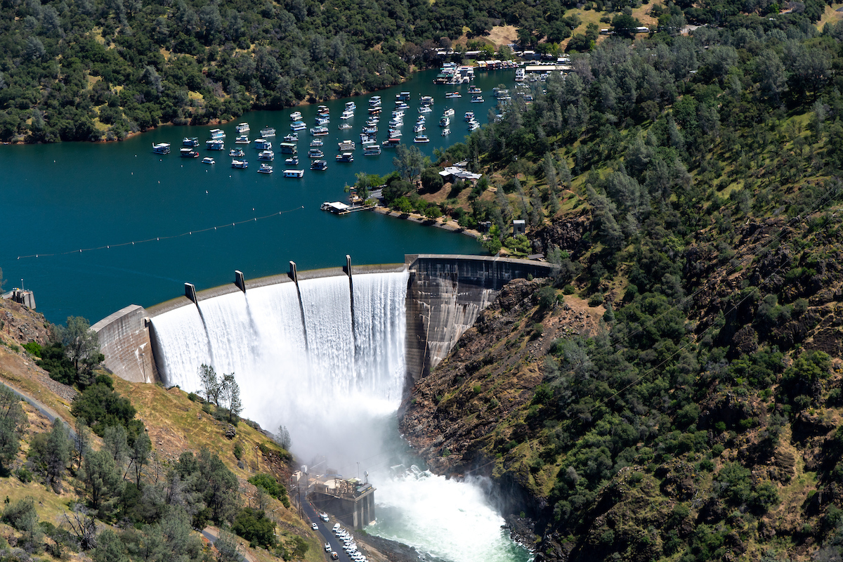
“When engineers assess how a dam might perform during an extreme flood, computer models and calculations can help predict what could happen. At Harry L. Englebright Dam, Sacramento District engineers also had something particularly valuable to work with: more than 80 years of evidence showing what actually has happened. Christopher Rica, a Sacramento District Dam Safety Technical Specialist and geotechnical engineer, and Daniel Vellone, the district’s Dam Safety Program Manager, used that history to examine the potential for erosion of Englebright Dam’s rock abutments during an extreme flood. Their research was presented at the U.S. Society on Dams Annual Conference held May 4-7 in Austin, Texas. Englebright Dam sits on the Yuba River in the Sierra foothills of Northern California, where rock abutments form the natural foundation along the sides of the dam. Although rock may appear solid, natural formations contain cracks, fractures and joints. During extreme floods, high-velocity water can enter those openings creating pressure that can potentially dislodge blocks of rock and cause erosion. The engineering question was whether that process could progress far enough to threaten the stability of the abutments supporting Englebright Dam. … ” Read more from the Army Corps of Engineers.
Keep Tahoe Blue installs new “CD3 Outpost Blue” machines to fight invasive species
“Earlier this month, Keep Tahoe Blue and its partners installed four new mobile, solar-powered watercraft cleaning stations with onboard tools to make it easy for anyone to “Clean, Drain, and Dry” their gear and help stop the introduction and spread of aquatic invasive species in the Lake Tahoe region. The stations, called “CD3 Outpost Blue” machines — for clean, drain, dry, and dispose — were placed at Baldwin Beach and along the shores of Fallen Leaf Lake in coordination with the U.S. Forest Service and the ExplorUS concessionaire, who manage these public lands on the Lake Tahoe Basin Management Unit (LTBMU). Installation of the new machines is part of a coordinated and growing effort to prevent harmful invasive species from spreading in local waterways. … ” Read more from South Tahoe Now.
SACRAMENTO VALLEY
Dropped your phone in the American River? Don’t worry, not all is lost
“Five years ago, while scouring the depths of the American River, Karl Bly found a prosthetic leg. “I see this foot through the water,” the 59-year-old treasure hunter recalls, explaining how he typically dons a snorkel mask and flippers and lies atop his kayak so he can paddle, face in the water, until he observes something that interests him. “I dove down, saw the mechanics of the leg.” He pulled it out of the water and returned to his boat. Bly runs a volunteer group called American River Lost & Found. He keeps more than a dozen kayaks, canoes and inflatables in his yard, garage and strapped atop his car, along with buckets filled with scores of oars and paddles. He has more than 30,000 followers on Instagram and 64,000 on Facebook. … ” Read more from Comstock’s.
BAY AREA
El Niño-driven Kelvin wave could raise Bay Area sea levels by up to 1 foot, scientists say
“A little-known ocean phenomenon linked to El Niño is making its way toward California and could raise Bay Area sea levels by as much as a foot this fall, increasing the risk of coastal flooding across the region. Scientists say a Kelvin wave is expected to arrive along the California coast by October. Unlike the waves seen breaking along the shoreline, a Kelvin wave is a large-scale pulse of ocean energy that travels across the Pacific Ocean. While it won’t be noticeable to swimmers or beachgoers, it can cause sea levels to rise by 6 to 12 inches. “It’s a bulging of the nearest 20 to 30 kilometers of the ocean that propagates up the coastline,” said Dillon Amaya, an assistant professor of marine science at North Carolina State University. … ” Read more from ABC Bay Area.
CENTRAL COAST
New program offers free water assessments and fixes to rural Salinas Valley residents.
“Rural residents in the Salinas Valley are eligible to receive free home water-efficiency assessments through the end of the year. The program builds on a similar initiative that has helped homeowners in North Monterey County. It provides personalized recommendations to help households save water, energy and money. Run by the Salinas Valley Basin Groundwater Sustainability Agency, it is part of broader efforts to support long-term groundwater supplies across the Valley. “The program supports all rural residential [in all six subbasins],” says Piret Harmon, general manager of SVBGSA. “It’s a subset of our groundwater users that are the most vulnerable because they have shallower wells, and if their wells go dry, we don’t have an easy way to help them.” … ” Read more from Monterey County Now.
New fire erupts at Moss Landing battery power storage plant along Monterey Bay that burst aflame in 2025
“Monterey County fire officials reported a new fire Friday morning at the Moss Landing battery power storage plant along Monterey Bay and Highway 1 that had erupted in flame in January 2025. Monterey County’s North County Fire Protection District issued an alert at 7:01 a.m. that it was responding to a fire at Moss Landing Power Plant. The alert said that “out of an abundance of caution,” the district urges residents nearby to “close windows and doors, shut off air systems until further notice” and to “please avoid the area to allow for emergency vehicles to respond.” … ” Read more from the San Jose Mercury News.
Cal Poly entertains mixed-use development over prime farmland
“California Polytechnic State University, San Luis Obispo is considering a proposal to develop nearly 40 acres of on-campus farmland — utilized by the university’s College of Agriculture, Food, and Environmental Sciences — to a mixed-use community space with a hotel and conference center, retail and dining spaces, and a senior living facility, among other proposed uses. A university presentation dated May 12, 2026, titled “Cal Poly Food and Ag Hub,” explained that the proposed development would be located in the West Campus District with approximately 39 acres of land allocated to development and an additional 15 acres allocated for parks, trails, and green space. Currently, the West Campus District is predominately agricultural, according to the university’s Master Plan 2035 which was published in June 2019. For reference, the university began drafting the Plan in 2014. “It is predominantly agricultural, with some of the university’s richest agricultural soils along Stenner Creek and lower Brizzolara Creek. The West Campus also includes supporting land uses along Mt. Bishop Road, including the Technology Park, agricultural facilities and Cal Poly Corporation warehouse,” the 2035 Master Plan stated. … ” Continue reading from Valley Ag Voice.
‘Absolutely world class’: Scenic stretch of California coast is opening to the public
“Miles of pristine hills and valleys along California’s Central Coast have long been off-limits to the public to shield the state’s last remaining nuclear power plant. But not for much longer. A nonprofit land trust has struck a deal to acquire 2,060 acres of wildlands above Avila Beach in San Luis Obispo County and turn what has been part of a sprawling buffer for the oceanfront Diablo Canyon Power Plant into a nature preserve. The move shuts down a competing plan for high-end homes at the site and sets the stage for trails and campsites. On Thursday, the state agreed to finance the endeavor, giving the San Bernardino County-based Wildlands Conservancy the $42 million needed to proceed with the purchase of the area known as Wild Cherry Canyon. The land is owned by a subsidiary of Pacific Gas and Electric Company, which operates the nearby nuclear facility. The acquisition money from the State Coastal Conservancy is one of the agency’s biggest-ever grants for conservation. … ” Read more from the San Francisco Chronicle.
SAN JOAQUIN VALLEY
This nearly forgotten wilderness is a spectacular — and uncrowded — alternative to Yosemite
“While Yosemite’s granite cathedrals and Tahoe’s stunning views pull in millions of visitors each year, a slice of spectacular High Sierra wilderness wedged between the two has gone mostly unnoticed. The remote Emigrant Wilderness in Tuolumne County offers the same drama — rugged peaks, endless granite, aromatic pine forests and more than 80 lakes — but without the crowds. Estimates put the number of visitors at fewer than 20,000 per year to an area larger than San Francisco and Oakland put together. There are few facilities, so most people go there to hike or backpack. I’d only ever skirted Emigrant’s edges, and it wasn’t until a buddy of mine returned from a recent backpacking trip extolling the place that I began conceiving an outing of my own. He described to me a secluded zone near the heart of the mountainous landscape where a bit of bushwhacking and scrambling leads to a stunning granite formation dotted with glimmering lakes full of leaping trout. It sounded incredible and I became determined to get out there. … ” Read more from the San Francisco Chronicle.
State’s high court to hear Kern River case in Redding next month
“California Supreme Court justices will hear oral arguments on a key piece of the ongoing lawsuit over Kern River flows Oct. 7 at a special session of the court to be held in Redding. The hearing will begin at 9 a.m. at the University Preparatory School, 2200 Eureka Way. Those interested in attending may want to get a seat early as this is part of the court’s student outreach program so local high school students and teachers will fill much of the venue. The proceedings will also be broadcast via livestream at https://supreme.courts.ca.gov/. Archives of the hearings are typically posted to the court’s webpage two weeks to a month later. The last time justices ruled on a case involving the Kern River was 140 years ago. That 1886 ruling set the basis for California’s water rights system. This time around, the outcome could be just as weighty. … ” Read more from SJV Water.
SOUTHERN CALIFORNIA
El Niño is coming for California’s beachfront homes and highways
“Waves have stripped sand from Southern California beaches, damaged seawalls and forced evacuations. An intensifying El Niño could bring more trouble this winter. Carlsbad has declared a local emergency to protect a coastal road threatened by erosion, becoming the latest Southern California community to confront damaged shorelines as a potentially powerful El Niño raises concerns about the coming winter. The city’s Sept. 9 declaration will accelerate bluff stabilization along South Carlsbad Boulevard, where inspectors found pavement cracks in June. Engineers recommended extending a protective rock barrier about 192 feet. Similar erosion problems are emerging up and down the Southern California coast. … ” Read more from AccuWeather.
Powerful El Niño could shake up the ocean population near Southern California shores
“Southern Californians could encounter unusual fish, sea snakes and other marine animals in the coming months as a strengthening El Niño warms coastal waters and alters ocean conditions, according to Natural History Museum of Los Angeles County scientists. Some forecast models predict the developing El Niño could be the largest in the roughly 150-year observational record, according to the museum. Warmer waters and changing currents can bring tropical and subtropical species well north of their typical ranges. Scientists said unusual marine visitors are already being spotted in Southern California, including hammerhead sharks off Los Angeles, Orange and Ventura counties, a whale shark off Malibu and mahi-mahi near the Southern Channel Islands. One such visitor has already entered the museum’s collection — a longfinned bigeye caught off the Venice Fishing Pier by local fisherman Julius Cardines. … ” Read more from the LA Daily News.
Commentary: The approaching El Niño is scary, but L.A.’s starred in this horror movie before
Columnist Patt Morrison writes, “El Niño is coming for us. It’s out there over the Pacific Ocean, waiting. Muscling up for the move. It’s come this way before, and it overstayed its welcome. At intervals of 20 years and sometimes more often, it has lashed and splashed us, turned our living rooms into muddy aquariums, swept away our cars and houses, and sometimes hundreds of Angelenos. So, when Sepulveda Boulevard becomes the Sepulveda River in a few months, and the TV news reporters pull on those yellow rain slickers for “Stormwatch ‘26,” remember that L.A. has starred in this movie before. El Niño’s nastiest modern visit was on March 2, 1938, when a pair of storms hit the city of L.A. with 5.88 inches of rain in 24 hours. It rampaged for several days, and flooded the basin so devastatingly that the Oscars, scheduled for March 3, had to be postponed for a week because so many stars and filmmakers were marooned up in the canyons and on their ranches in the San Fernando Valley. More on death and destruction later. … ” Read more from the LA Times. | Read via Yahoo News.
IMPERIAL/COACHELLA VALLEYS
California Natural Resources Secretary Wade Crowfoot discusses growth in Coachella Valley
“As the Coachella Valley continues to grow, state officials say the challenge is finding ways to accommodate new housing and development while protecting the desert landscape and ensuring communities have adequate water. California Natural Resources Secretary Wade Crowfoot recently discussed that balance and what responsible development could look like in the Coachella Valley. Crowfoot, who has served as California’s Natural Resources Secretary since 2019, oversees the state agency responsible for managing and protecting California’s natural environment and resources. California has nearly 40 million residents and more than 100 million acres of land, Crowfoot said, creating a need to balance housing and infrastructure needs with conservation. … ” Read more from NBC Palm Springs.
Along the Colorado River …
Congressman Andy Biggs proposes $19B plan to boost Colorado River water supply
 “Rep. Andy Biggs on Wednesday introduced a sweeping water bill that would pour $19 billion in federal funding into new infrastructure while cutting permit requirements across the drought-stricken Colorado River Basin. The Colorado River Basin Water Security and Infrastructure Act was introduced weeks after the Bureau of Reclamation finalized operating guidelines for 2027 and 2028 that impose 1.25 million acre-feet in annual cuts on the Lower Basin states of Arizona, California and Nevada while sparing the Upper Basin from mandatory reductions. Arizona faces the hardest blow: a 760,000-acre foot reduction, most of it borne by the Central Arizona Project, which serves nearly 6 million people, mostly in the Phoenix and Tucson areas. Biggs, a Republican congressman who is running for governor, said conservation alone cannot close the gap. … ” Read more from KTAR.
Biggs introduces bill to expand Colorado River water supplies, accelerate infrastructure
“Congressman Andy Biggs (R-AZ-05) introduced legislation this week aimed at increasing water supplies and accelerating infrastructure projects across the Colorado River Basin. The legislation comes as the region faces historically low reservoir levels and new reductions in Lower Basin water deliveries. The Colorado River Basin Water Security and Infrastructure Act would direct federal resources toward water augmentation, storage, desalination, recycling, treatment, and conveyance projects while changing federal permitting requirements for certain water infrastructure. The legislation comes amid continued uncertainty over the Colorado River’s long-term management. The seven Basin states did not reach consensus on a long-term post-2026 operating framework earlier this year. The Department of Interior subsequently finalized operating guidelines for 2027 and 2028 in August. … ” Read more from Arizona Free Media.
Business groups call for $2 billion in federal Colorado River spending
“Business groups across the West are calling on the federal government to give at least $2 billion for Colorado River projects. Dozens of chambers of commerce sent a letter to Congress asking for money that would help “ensure long-term water, food and energy security” for the businesses, farms and cities that depend on the river. The Colorado River supplies nearly 40 million people across seven states, and its supplies are severely depleted after more than two decades of drought and climate change. A new federal plan to manage shrinking reservoirs forces big cuts on users in Arizona, California and Nevada. In the past, federal funding has been a big part of helping the region adapt to drier conditions. Now, the signers of the new letter to Congress are asking for a new infusion of money to keep the region’s economy going with less water. … ” Read more from KUNC.
2-year projections show Lake Mead giving up 40 feet while Lake Powell rises by the same
“Projections released Tuesday show Lake Mead dropping almost 31½ feet over the next 11 months, recovering 13 feet, and then plunging 22 feet by Aug. 2028. It’s a wild ride ahead for the nation’s largest reservoir, exposing shorelines that have been underwater since the 1930s. The projections are published in the U.S. Bureau of Reclamation’s 24-month study, a document that is updated each month. Reclamation has started producing two versions of the study — one based on Lake Powell releases of 6 million acre feet, and one based on 7 million. 8 News Now is using the projections based on 6 million acre feet. (An acre foot is 325,851 gallons, enough to supply two to three households for a year.) The federal government continues to prioritize keeping water levels elevated in Lake Powell, more than 200 miles upstream from Lake Mead on the Colorado River. … ” Read more from KLAS.
Cuts to Colorado River water supply sparks discussion of solutions among ASU experts
“The U.S. Department of Interior has ordered cuts to the amount of water Arizona receives from the Colorado River, due to decreasing water levels over recent years. Arizona is one of seven states that draw on water from the river, and the proposed cuts would reduce its share of the water by 760,000 acre-feet, according to the USDI. Other states that share in usage of Colorado River water have implemented mandated restrictions on water usage for average citizens, something cities in Arizona have yet to do. Amid these changes, organizations within ASU are working to find ways to respond to the cuts and keep Arizona’s water usage sustainable for the coming years. One organization is the Kyl Center for Water Policy, which focuses on providing neutral policy analysis and advising on water sustainability in Arizona. … ” Read more from The State Press.
Upper Basin seeks credit for water saved at Lake Powell
“The four Upper Colorado River Basin states are working on a plan that could change what happens to water they voluntarily conserve and send into the Colorado River system. Colorado, New Mexico, Utah and Wyoming want those water contributions to be measured, credited and stored in Lake Powell and other major Upper Basin reservoirs. The request comes as Lake Powell remains exceptionally low and federal water managers prepare for another difficult operating year. In a September 11 letter to the U.S. Department of the Interior, the Upper Colorado River Commission said the states are working with the Bureau of Reclamation on agreements covering voluntary water-conservation projects and how that conserved water will be handled once it reaches federal reservoirs. … ” Read more from Western Water.
Colorado: State water board green lights conservation program
“The state water board has given the green light to a one-year, state-run water conservation program. On Wednesday, the Colorado Water Conservation Board unanimously approved the application review process and criteria for what state officials are calling Colorado’s near-term contribution program for 2027. The move came at the board’s regular September meeting at Copper Mountain. Board member and Colorado River mainstem representative Taylor Hawes reminded the board that their unenviable position was due to a historic drought. “None of us want to be in this situation where we are dealing with these kinds of impacts from climate-change-driven drought,” Hawes said. “We’re doing this in response to what’s being thrown at us in terms of decreased supply.” … ” Read more from Aspen Journalism.
In national water news today …
House weighs eight water, wildlife and access bills
“A House Natural Resources Committee subcommittee held a legislative hearing Sept. 16 on eight water, wildlife and public-access bills, spanning California water, tribal settlements, invasive species, Florida wildlife and Yosemite access. The big picture: The hearing included opening statements from Chair Harriet M. Hageman (R-WY) and Ranking Member Val T. Hoyle (D-OR-4). The bills included the Yosemite National Park Equal Access and Fairness Act, the Golden Mussel Eradication and Control Act of 2025, the Agua Caliente Band of Cahuilla Indians Water Rights Settlement Act, and an amendment to the Aamodt Litigation Settlement Act. The package also included the Pechanga Band of Indians Water Rights Settlement Technical Amendments Act, the Restore Florida Water Independence Act of 2026, the SAFE for Manatees Act and the GATOR Act of 2026. … ” Read more from Legis 1.
Drought in summer 2026 in 12 maps and graphs
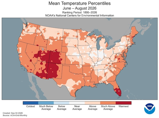 “The contiguous United States experienced its warmest June-August on record in 2026, accompanied by below-normal precipitation and above-normal temperatures that sustained widespread drought, now covering nearly half the country. These extreme conditions fueled a destructive wildfire season that sent unhealthy levels of smoke streaming through large parts of the United States. Major western reservoirs like Lake Mead and Lake Powell hit all-time record lows as they continued to decline. Looking ahead, a potentially historically strong El Niño event is projected to continue developing through the fall and winter, which typically increases chances of wetter than normal conditions in the Southern U.S. and warmer than normal conditions in the Northern U.S. Flash drought continues to worsen in the Southern Plains and Lower Mississippi River Basin. … ” Read more from NIDIS.
El Niño and global heating pushes water vapour in Earth’s atmosphere to record levels in August
“The planet’s atmosphere held more water vapour in August than any other month on record, further increasing the risk of extreme heat and rainfall around the world, according to Europe’s climate change service. Climate scientists said global heating was a contributor to the record because a warmer atmosphere can hold more water, and the historic El Niño in the Pacific Ocean was also likely pushing water vapour levels up. According to the Copernicus Climate Change Service (C3S), the amount of water vapour in the atmosphere through August was 27.35 kg per square metre, beating the previous record from July 2024 by 0.04 kg m². The value describes how much water vapour is in a column of air sitting above a square metre of the Earth’s surface, extending up through the atmosphere. The 0.04 kg m² increase on the previous record, one climate scientist calculated, was the equivalent of about 20 trillion litres of additional water, or 20 cubes of water, each a kilometre wide, high and deep. … ” Read more from The Guardian.

