
A wrap-up of posts published on Maven’s Notebook this week …
Note to readers: Sign up for weekly email service and you will receive notification of this post on Friday mornings. Readers on daily email service can add weekly email service by updating their subscription preferences. Click here to sign up!
In California water news this week …
Newsom’s big water deal is in trouble
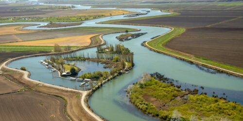
“Gov. Gavin Newsom’s signature water deal is starting to unravel just months before he leaves office. The governor’s plan sought to direct billions of state, federal and water district dollars toward restoring the sensitive Bay-Delta ecosystem while providing farms and cities with more flexible access to the water. Now, two of its most important partners, the federal government and Westlands Water District, the largest irrigation district in the Central Valley, are threatening to walk away. This development puts Newsom in a bind as he tries to cement a water legacy built around making California’s water supply more reliable — an agenda that has occasionally put him on the same side as the Trump administration. The governor has long pressed the State Water Resources Control Board to adopt the plan, which is based on a deal he struck with California water agencies in 2022. … ” Read more from Politico.
SEE ALSO:
- Trump administration tells California its key water plan is ‘unworkable’, from the LA Times| Read via Yahoo News.
- Reclamation Provides comments on State Water Board’s Bay-Delta Plan update, press release from the Bureau of Reclamation
- Westlands Water District to end participation in Healthy Rivers and Landscapes Program absent reversal by the State, press release from Westlands Water District
- Voluntary agreements fail as federal and state partners pull out of updated Bay-Delta Plan, from Restore the Delta
- Edward Ring: Comments on the “Water Quality Control Plan” for the Delta, from Edward Ring
Hurricane Marie damaged LA, OC beaches. Super El Niño could be worse, experts say
“The coastal flooding witnessed in Southern California this month — with high waves caused by Hurricane Marie lashing Dana Point, Long Beach, Laguna Beach and Malibu and damaging property there — could well continue this winter as the El Niño weather phenomenon may increase the likelihood of hurricane impacts on the region, adding swells on top of already-rising sea levels, weather experts say. Nine beachfront homes in Dana Point have been red-tagged as uninhabitable as of Wednesday, Sept. 9. Seven others have been yellow-tagged for restricted access there, as have four in Laguna Beach. A sinkhole devoured the driveway at actor Nicolas Cage’s Malibu home. “My guess is the coastal flooding will be far worse once winter storms really begin to push that water into coastal Southern California,” Daniel Swain, a climate scientist with University of California Agriculture and Natural Resources, said in a forecast outlook published on YouTube. … ” Read more from the LA Daily News.
SEE ALSO: ‘The whole beach is gone’: Big waves bring destruction to SoCal coast. It’s a warning, from the LA Times | Read via Yahoo News
What is El Niño and what makes this a very strong El Niño?
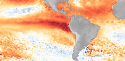
“NOAA declares an El Niño when temperatures in the equatorial Pacific are 0.5°C (0.9°F) above average for several consecutive months. As of August 2026, the National Oceanic and Atmospheric Administration (NOAA) issued an advisory that with ocean temperatures now 2.0°C (3.6°F) above average there is “a greater than 90% chance of a very strong event during the Northern Hemisphere fall and winter 2026-27.” El Niño’s effects can be powerful — the El Niño-driven ocean warming can increase global temperatures, alter atmospheric patterns, raise sea-levels along coastlines, and impact marine ecosystems. In this article,, we dive into what El Niño is, why this year could be a very strong El Niño, and the key observational programs led by Scripps Oceanography helping scientists detect, track and understand this event. … ” Read more from Scripps.
How heat on the Tibetan Plateau fuels powerful storms in California, half a world away
 “The Tibetan Plateau may be on the other side of the world from California, but what happens on this high-altitude landscape in Asia can set off a chain of events that fuels powerful atmospheric rivers with flooding rainfall and heavy snow hitting the U.S. West Coast. My team of atmospheric scientists discovered this connection, and we explain how it works in a new study in the journal Science Advances. California and its neighbors saw record-breaking precipitation during the winters of 2016–2017 and 2022–2023 that caused widespread flooding and infrastructure damage. The U.S. Pacific Coast often gets atmospheric river storms during its winter rainy season, but the events in those years were especially striking because they occurred during La Niña conditions, which are typically associated with relatively dry winters in California. La Niña is El Niño’s cooler counterpart; they are the two extremes of a climate pattern connected to ocean temperatures known as the El Niño-Southern Oscillation. … ” Read more from The Conversation.
Contested Delta Conveyance Project proceedings advance while questions remain regarding project implementation
“As the Newsom administration nears the end of its term, the Department of Water Resources (DWR) continues to seek key approvals for the Delta Conveyance Project (DCP), which would divert up to 6,000 cubic feet per second from the Sacramento River in southern Sacramento County and convey it via a 45-mile long, 40-foot diameter tunnel to the south Delta for export. The Delta Stewardship Council (Council) has scheduled a hearing on October 15, 2026, on the three appeals of DWR’s Revised Certification of Consistency with the Delta Plan on Remanded Items (Revised Certification) for the DCP. The Revised Certification responds to deficiencies identified in the Council’s April Decision D20257 on DWR’s October 2025 certification for the DCP; namely, that DWR failed to support findings (1) under Policy ER P5, Avoid Introductions of and Habitat Improvements for Invasive Nonnative Species, regarding the golden mussel, and (2) that it sited the approximately 600-acre proposed Twin Cities Complex (TCC) to avoid or reduce conflicts with Sacramento Area Sewer District’s (SacSewer) Harvest Water Program. … ” Read more from Somach Simmons & Dunn.
Butte County seeks Oroville Dam accountability
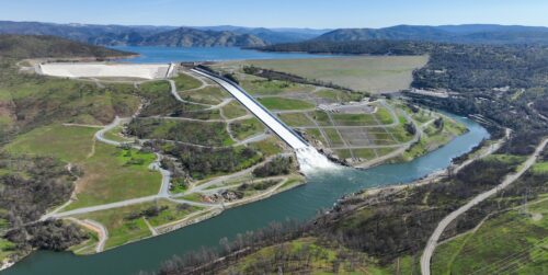
“Butte County officials took their concerns over the long-running Oroville Dam relicensing process to Washington, D.C., earlier this month, meeting with Federal Energy Regulatory Commission representatives as the county pushes for greater recognition of the costs associated with hosting the State Water Project facility. County representatives met with FERC leadership and staff, including the agency’s Office of Public Participation, to discuss the county’s role in the federal relicensing process. According to the county, FERC representatives provided guidance on how county officials and residents can participate as the process moves forward. The county argues that Butte County has carried financial, infrastructure and public safety costs associated with Oroville Dam for more than five decades while much of the economic benefit from the water stored there goes elsewhere in California. “For more than half a century, Butte County has shouldered the costs of hosting one of California’s most important water infrastructure projects, while the benefits have flowed south,” the county said. … ” Read more from the Gridley Herald.
The massive infrastructure projects of the 1960s wouldn’t work today
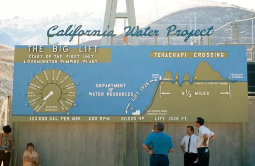
“At the time of its initial construction, California’s State Water Project was one of the largest water infrastructure projects in U.S. history. Construction began in 1961, and the first water deliveries reached Southern California in 1972. Spanning over 700 miles from the Feather River watershed in California’s upper northeast to Lake Perris in the south, it remains a marvel of modern engineering and a testament to the state’s 20th century technological dominance. Its construction was witnessed and documented by both the public and the state government, and California’s Department of Water Resources (DWR) hosts a massive public photo archive that continues to grow. Its photos convey a notably majestic vision of California, celebrating the state’s belief in its ability to “solve” the arid West’s water problems. In addition to their technical and aesthetic mastery, the images express a sense of utopian optimism. The photos in this essay, all taken from 1962 to 1968, reflect a post-World War II confidence that grand infrastructure could tame and re-engineer where “nature” fell short. Big projects were utilitarian in their capacity to solve large-scale water resource problems, yet they also communicated that the nation — or in this case, a colossal state that essentially functions as a nation — was the hero to slay Western water scarcity. … ” Read more from High Country News.
The US is losing its ability to store water when it needs it most
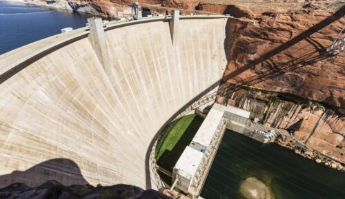 “Turn on a hose in Denver this summer and the water likely flows from the Strontia Springs Reservoir. The small manmade lake in the mountains just west of downtown stores the state’s precious snowmelt and distributes it through the dry months when rain grows scarce and farmers are irrigating frantically. But over its 44 years, Strontia has lost much of its storage capacity. Almost one-fifth of the reservoir is now filled with sediment – sand, silt and mud – the hidden vulnerability of America’s water system. Most of the country’s 90,000 or so storage reservoirs are facing a similar problem to some degree. Engineered decades ago to enable development in some of the country’s harshest conditions, these dams are in a self-propelling sediment loop. Climate change is exacerbating drought and wildfires, decimating vegetation that holds dirt in place. More extreme rainfall, meanwhile, is unleashing torrents of water and debris, as happened in the flash flood that killed two people and washed away bridges and trails in the Grand Canyon last month. … ” Read more from Bloomberg.
A shipyard? A bunch of new houses? In California, not this year.
 “California Forever, a company backed by Silicon Valley billionaires, calls its proposal to build a new city in Northern California a remedy to the state’s biggest problems. California needs homes; the company aims to put several thousand of them about an hour’s drive from San Francisco. The state is desperate for middle-class jobs; California Forever would create a shipyard and manufacturing center ready to hire. The plan is well funded, is backed by labor unions and has the implied support of Gov. Gavin Newsom. And yet a move that would have given the project a definitive push died quietly in a behind-the-scenes scramble during the final days of California’s legislative session, which ended this week. Although not before a stuffed monkey made an appearance and protesters delivered public comment in song. … ” Read more from the New York Times.
A new California law will ban watering decorative grass, even in non-drought years, starting Jan. 1
“It’s been more than three years since California was in a drought. Reservoirs are above average levels. A strong El Niño is brewing in the Pacific that could bring soaking storms this winter. But there’s a new endangered species across the state: grass. A broad new water conservation law will soon take effect in phases, banning the watering of “ornamental turf” at corporate, industrial, government and homeowners association properties with drinking water across California as a way to preserve supplies. Gov. Gavin Newsom signed the new state law in 2023 as California was emerging from a harsh three-year drought. Starting on Jan. 1, it will be illegal for local and regional government agencies across the state — including schools, cities, counties, courthouses, fire stations and libraries — to irrigate decorative grass with potable water whether or not California is in a drought. … ” Read more from the San Jose Mercury News.
California water agencies may get a new defense in lawsuits over hydrants running dry in wildfires
“As the city of Los Angeles and the L.A. Department of Water and Power face lawsuits by residents who claim the city failed to ensure adequate water to fight the Palisades fire, California legislators have passed a bill that would give water agencies a new tool to defend themselves in such cases. The legislation, Senate Bill 1153, would clarify that public water agencies do not have a duty to design, build or maintain a water system for wildfire defense or suppression, and that the inability to maintain water supply or water pressure during a wildfire is not a “substantial cause” of fire damages. The bill, which is awaiting Gov. Gavin Newsom’s signature, also would require urban retail water suppliers in high or very high fire hazard zones to include specific response procedures for wildfires as part of their disaster preparedness plans, including equipment and actions that can lessen the impact of a fire on the water system. … ” Read more from the LA Times. | Read via Yahoo News.
In commentary this week …
California’s future water supplies depend on the outcomes of four intertwined battles
Dan Walters writes, “Since the earliest years of its history, California has been a political battlefield over divvying up the state’s water. The intensity of the multisided conflict, like water itself, ebbs and flows. By happenstance this is one of the more intense and climactic periods in the eternal competition over water. It’s driven by uncertainty over the effects of climate change on precipitation and by looming decisions on how to cope with those effects. What happens on four intertwined fronts in the near future will determine how water will be managed and allocated in the coming decades. In no particular order … ” Continue reading this commentary by Dan Walters.
What are we doing to our world of wonder?
Author Terry Tempest Williams writes, “The Endangered Species Act is one of the few environmental laws formidable enough to hold developers accountable for the destruction of habitat — be it diverting water from a lake for agriculture, drilling for oil or building dams and golf courses. The law can shut down or force amendments on any project or operation that threatens the well-being of an endangered species. For decades, the law’s critics have tried and mostly failed to dismantle its power and integrity. But this year, the Trump administration found a legally binding way to defang it. On Sept. 14, the Endangered Species Act will be revised under a new rule that says habitat destruction no longer falls within the definition of what constitutes harm. In other words, the Departments of the Interior and Commerce have said any stress an animal or plant may face over the loss of its habitat is irrelevant to its well-being. … ” Read more from the New York Times.
In regional water news this week …
Start-up beaver dams transform parched California creeks into salmon havens, new research finds
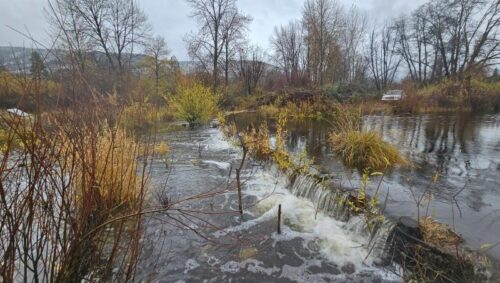
“Battered by early gold mining and diminished by logging and diversions,the lower section of Sugar Creek often ran dry in summer. The tributary of the Scott River in Northern California’s Klamath Basin once supported coho salmon—but as it diminished, so did they. In 2014, NOAA Fisheries researchers worked with the Scott River Watershed Council to sink lines of inexpensive wooden posts interwoven with willow branches across the creek. Called beaver dam analogues (BDAs), the simple structures slowed water flows like beaver dams. Almost immediately, more juvenile coho salmon survived to fill the creek. Within 2 years, more adult coho salmon were returning, new research showed. Their numbers surged on Sugar Creek and French Creek, another stream with BDAs, just as coho salmon in other local creeks without BDAs collapsed from drought. “There was skepticism every step of the way that this would work, that it would provide benefits, until you see the fish actually coming back and you see the fish thrive there,” said Michael Pollock, a research scientist at NOAA Fisheries’ Northwest Fisheries Science Center who led the research. Adult salmon returns demonstrate the benefits of healthy habitat by contributing to fisheries and other economic and environmental gains, he said. … ” Read more from NOAA Fisheries.
Planning for sea level rise splits Humboldt commission
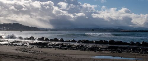
“While workshopping policies that will shape the future of Humboldt Bay, the county’s Planning Commission couldn’t reach consensus on how to address sea level rise. At its Sept. 3 meeting, the commission held its third workshop on the draft Humboldt Bay Area Plan, reviewing five sea level rise scenarios. There’s uncertainty on how to plan for it as it hinges on a variety of factors, including future degree of emissions reduction. A “high” risk scenario was in a previous draft of the plan but the categorization is brought down a notch in the current draft, to “intermediate high.” “The reason we went away from high is because there’s a 0.1 percent chance that it would ever be exceeded and so that is maybe an unrealistic chance that it would happen,” said Planning Director John Ford when asked about it. “Intermediate high itself has a fairly low chance of ever being exceeded, as I recall that’s at 20 percent.” … ” Read more from the Redheaded Blackbelt.
Trinity River weir consolidation streamlines salmon monitoring and opens new chapter for Tribal partnership
“A new chapter for Trinity River salmon begins this fall as the California Department of Fish and Wildlife and Hoopa Valley Tribe bring separate fish monitoring and harvest operations together at one jointly operated location. The Bureau of Reclamation joined its partners today to celebrate the milestone with a ribbon-cutting ceremony recognizing stronger collaboration, more efficient monitoring of Trinity River restoration efforts, and reduced stress on salmon when they are migrating up-river to spawn. Beginning this fall, CDFW and the Hoopa Valley Tribe will collaboratively conduct Reclamation’s run-size estimation activities at the tribe’s harvest weir rather than at a separate monitoring location farther upstream. Working at a single location allows partners to continue collecting critical information on Chinook salmon, coho salmon, and steelhead while reducing repeated capture and handling of migrating fish, streamline monitoring and reduce costs to Reclamation. This approach continues to support selective harvest activities at the Hoopa Valley Tribe’s existing harvest weir on the Hoopa Valley Indian Reservation. … ” Read more from the Bureau of Reclamation.
El Niño: Why chances are increasing for lots of rain this winter in the Bay Area and across California
 “The chances of a wet winter — with soaking storms, coastal flooding and other problems — are growing in the Bay Area and across California as El Niño conditions in the Pacific Ocean continue to strengthen. On Thursday, scientists at NOAA, the National Oceanic and Atmospheric Administration, said there is a greater than 90% chance of a strong El Niño being present in October, November and December, and a 75% probability that it will rank as the strongest in history since modern records began in 1950, up from 69% last month. “Interests in California need to be aware that there is an increasing possibility of above-average rainfall and stormier weather,” said Michelle L’Heureux, a meteorologist with the National Weather Service’s Climate Prediction Center in College Park, Maryland. … ” Read more from the San Jose Mercury News
South Bay Salt Pond Restoration Project is one of the most ambitious nature-based solutions to sea level rise
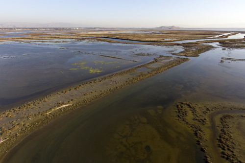 “Dave Halsing stood beneath shifting clouds and flocks of shorebirds next to California’s San Francisco Bay, looking out at the gray waters below. Beyond us, traces of sunlight flickered on the arc of the Dumbarton Bridge. Halsing is the executive project manager of the South Bay Salt Ponds Restoration Project. He invited me to the Ravenswood section of Menlo Park on a windy November day to see a small piece of the massive, puzzle-like initiative he has been involved with for the past seven years. He unlocked a gate, then we climbed into his car and drove onto an earthen levee. This parcel, which includes a section of Don Edwards National Wildlife Refuge, teemed with birdlife. Cormorants bobbed among whitecaps. On a small island, a flock of white pelicans huddled against the wind. To the untrained eye, the South Bay Salt Pond Restoration Project is easy to miss. During our visit, which coincided with a king tide, the ecological rejuvenation it has catalyzed was almost completely hidden underwater. Below the surface was the most ambitious wetland restoration project on the entire West Coast. … ” Read more from the Sierra Club.
Del Puerto Canyon Reservoir project takes another small step forward
“There has been an ongoing battle between the proponents and opponents of the Del Puerto Canyon Reservoir project. The project is commonly referred to as the Del Puerto Canyon dam. According to a recent resolution put forth by the Del Puerto Water District, the project “involves the construction and operation of a reservoir on Del Puerto Creek to provide approximately 82,000 acre-feet of new off-stream storage for use by the Del Puerto Water District and the San Joaquin River Exchange Contractors Water Authority.” Advocates for the project list its benefits as water storage, water supply reliability for wildlife, enhanced local management of groundwater and surface water, and the capture of Del Puerto Creek runoff for increased flood protection. Opponents cite concerns about potential flooding in Patterson in a hypothetical dam failure, the loss of sacred grounds, the loss of recreational activities, and the loss of wildlife habitat. … ” Read more from the Patterson Irrigator.
Beneath the floodplain: How restored riverways are recharging Central Valley aquifers
“Central Valley groundwater has been drawn down faster than it’s been replenished for decades. Water tables have dropped, the ground has sunk significantly in places, and expensive infrastructure like roads and bridges has suffered damage. California’s Sustainable Groundwater Management Act (SGMA), a 2014 state law requiring local water managers to bring over-drafted groundwater basins back into balance by the early 2040s, sets out to fix that. Doing so means more water needs to go into the ground than comes out of it. River Partners has long known its statewide restoration work supports that goal. A new body of research now refines that picture, showing with much more precision how much groundwater our projects recharge, and where. A unique partnership with Lawrence Livermore National Laboratory (LLNL), Stanford University, and Stanislaus State took that on. From December 2023 to March 2026, researchers studied five River Partners restoration projects clustered around the 1,600-acre Dos Rios State Park near Modesto, the largest floodplain reconnection project in state history that River Partners completed in 2022, plus two future project sites in Merced County. … ” Read more from River Partners.
Even Kings County districts that don’t pump may have to pay for groundwater management
“The directors of a Kings County water district didn’t like it, but they agreed to support a land assessment fee to pay for regulations to minimize the impacts of excessive groundwater pumping even though the district, itself, doesn’t actually contribute to the problem. Directors of the Lakeside Irrigation Water District agreed on Sept. 2 to support a land assessment fee being proposed by a separate entity, the Mid-Kings Groundwater Sustainability Agency (GSA), whose boundaries include the water district. That fee must be approved by landowners and agencies within the GSA through a Proposition 218 election. Mid-Kings GSA is proposing to establish an annual fee of $26.84 per acre, which would bring in $2,467,400 in 2027, so it can pay for its general operations, including its portion of a groundwater plan that the entire Tulare Lake subbasin hopes will meet state approval and get the region out of probation. … ” Read more from SJV Water.
What happened to L.A.’s ‘perfect’ Mediterranean weather? Humidity challenges a birthright
“Southern California was built on many myths — but its weather was not one of them. Generations were lured to the region with promises of perfect weather, that “mild Mediterranean-type climate” that could heal the sick and grow practically everything. The railroads advertised the L.A. climate as a last resort for the world’s sickly. It was the place where rained-out sporting events and umbrellas at the Rose Parade were so rare they were occasions for big news. Sure, it could get hot. But, as the boosters always said, “at least it’s a dry heat.” So what went so very wrong this year? The oppressive moisture in Southern California’s air this week has felt more like Florida and the Gulf Coast, with many remarking that this is the worst, most powerful humidity they’ve ever felt. Scientists suspect that the combination of high heat and a suffocating deep-tropical air mass will be considered the worst humidity the region has experienced in the modern era. … ” Read more from the LA Times. | Read via Yahoo News
Wastewater can take harmful algal blooms from bad to worse
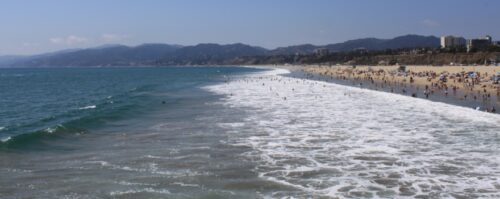 “Single-celled algae within delicate glass-like needles, Pseudo-nitzschia diatoms may be tiny, but they can play a huge role in the ecosystems they occupy. When types of Pseudo-nitzschia that make domoic acid proliferate during harmful algal blooms off California’s coast, marine mammals, seabirds, and humans who eat toxin-laced fish and shellfish can become gravely ill. “Domoic acid is rough. It’s a neurotoxin. It’s nerve damage,” said Dave Bader, chief operations and education officer at the Marine Mammal Care Center, which rescues and cares for sick and injured marine mammals in Los Angeles County. Mass strandings of domoic acid–poisoned California sea lions on the county’s beaches were once rare but have become common in recent years. The toxin spreads through the food web as animals eat the diatoms and each other, but only some animals suffer. In Southern California, Pseudo-nitzschia diatoms are a natural part of the phytoplankton community. For millennia, phytoplankton blooms have been tied to upwelled nutrients, which surge during La Niña and decline during El Niño. But the blooms have become more frequent and more toxic. “There’s just much more domoic acid than there used to be,” said Clarissa Anderson, an oceanographer at the University of California, San Diego’s Scripps Institution of Oceanography. … ” Continue reading from EOS.
Threatened fish thrive in restored SoCal creek, signaling success for water reliability
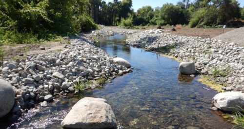
“Just months after reconnecting Anza Creek to the Santa Ana River, San Bernardino Valley Municipal Water District (San Bernardino Valley) has documented adult Santa Ana sucker and hundreds of newly hatched juvenile fish in the restored creek, signaling successful spawning far sooner than biologists expected. The federally threatened Santa Ana sucker occupies a limited area of the Santa Ana River and depends on specialized habitat for feeding and reproduction. Restoring tributaries like Anza Creek expands that habitat, providing native fish with places to spawn and forage for algae to scrape off rocks to eat, and find refuge from high flows. Biologists have also observed Arroyo chub, another native fish considered a species of special concern by the State of California. “This is an extraordinary result,” said T. Milford Harrison, San Bernardino Valley Board President. “Years of science and collaboration went into creating habitat specifically for these native fish. Seeing them thrive in the restored creek so quickly shows this approach is working to protect the natural resources of the Santa Ana River while helping develop reliable local water supplies for the region.” … ” Read more from the San Bernardino Valley MWD.
Atmospheric river forecasting drives record stormwater capture at Orange County’s Prado Dam
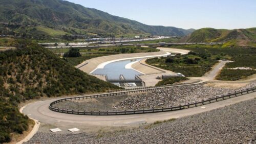
“The Orange County Water District (OCWD) and the U.S. Army Corps of Engineers (USACE) captured 18.1 billion gallons of stormwater at Prado Dam between July 2025 and June 2026, the highest total since the 1940s, according to OCWD. The volume is enough to supply more than 110,000 households for a year and is valued at over $55 million. The district attributes the record to Forecast Informed Reservoir Operations (FIRO), a strategy that uses advanced weather forecasting to track atmospheric rivers and hold more water behind the dam without compromising flood protection. Under the dam’s original rules, Prado released water on a fixed seasonal schedule regardless of the forecast, leaving storage capacity unused when no major storm arrived. FIRO changes that by giving operators roughly five days’ notice of incoming atmospheric rivers, the concentrated bands of moisture behind most of Southern California’s heaviest winter rain. With that lead time, USACE and OCWD can hold more water when no storm is coming, or release it in advance to clear space ahead of one, capturing supply that would otherwise be spilled downstream for flood safety. … ” Read more from Smart Water Magazine.
Some like it hot: DWR scientists endure extreme heat to study desert pupfish at the Salton Sea
“Summer temperatures at the Salton Sea in southeastern California frequently exceed 110° F, making any time spent outdoors hazardous, let alone doing anything strenuous. Even so, DWR scientists Vanessa Velasco and Nicholas Burgos routinely brave the heat as they study one of the region’s most fascinating creatures, the desert pupfish. “The Salton Sea basin gets brutally hot at this time of year, but this is the peak of the breeding season for the pupfish and that’s when our research surveys are crucial,” said Burgos. “It’s a pretty harsh environment for most creatures, which is why their ability to survive here is so remarkable.” The Salton Sea’s only endemic fish species, the desert pupfish can tolerate an extreme range of environmental conditions: salinity levels ranging from fresh water up to almost double ocean water salinity; water temperatures as high as 108° F and as low as 40° F; and low levels of dissolved oxygen. … ” Read more from the Department of Water Resources.
‘Deeply concerning.’ What San Diego area officials say about Chollas Creek chemicals
“For years, the Chollas Creek community has been living and shopping among cancer-causing chemicals from a former aerospace factory. While state officials continue to oversee a mitigation program and work is ongoing, they say more tests are needed to determine the scope of the contamination of trichloroethylene and tetrachloroethylene (TCE and PCE, respectively). State officials believe it could stretch beyond the currently identified 7-acre parcel which includes one of the south San Diego neighborhood’s few grocery stores, Food 4 Less, as well as some units in Euclid Terrace apartments. Last week inewsource published its first story in an ongoing investigation into the contamination that the California Department of Toxic Substances Control ordered Magellan Aerospace and Market Creek Plaza to clean up. … ” Read more from iNewsSource.

