
Several news sources featured in the Daily Digest may limit the number of articles you can access without a subscription. However, gift articles and open-access links are provided when available. For more open access California water news articles, explore the main page at MavensNotebook.com.
On the calendar today …
- WEBINAR: Data Center Series: Water Use and Cooling from 10am to 11am. As the third session in NACo’s Fall Data Center Series, this call will focus on understanding water use and cooling of data centers. Subject matter experts and local leaders will break down the fundamentals of data center water use by explaining common cooling technologies, the sourcing of water and approaches that counties can use to inform local decision-making. The session will pair expert presentations with facilitated Q&A while setting aside time for counties to connect and share experiences. Click here to register.
In California water news today …
Newsom’s big water deal is in trouble
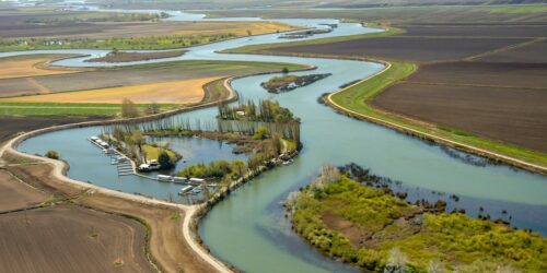
“Gov. Gavin Newsom’s signature water deal is starting to unravel just months before he leaves office. The governor’s plan sought to direct billions of state, federal and water district dollars toward restoring the sensitive Bay-Delta ecosystem while providing farms and cities with more flexible access to the water. Now, two of its most important partners, the federal government and Westlands Water District, the largest irrigation district in the Central Valley, are threatening to walk away. This development puts Newsom in a bind as he tries to cement a water legacy built around making California’s water supply more reliable — an agenda that has occasionally put him on the same side as the Trump administration. The governor has long pressed the State Water Resources Control Board to adopt the plan, which is based on a deal he struck with California water agencies in 2022. … ” Read more from Politico.
Nicole Montna Van Vleck on why Healthy Rivers and Landscapes works for farms, communities and wildlife
“For nearly 100 years, Nicole Montna Van Vleck’s family has grown rice in the Sacramento Valley. Over those generations, the family has also seen firsthand how working agricultural lands can provide important habitat for fish and wildlife. In a new video, Montna Van Vleck shares why that experience is one reason she supports Healthy Rivers and Landscapes (HRL), and why she believes the program offers the best path forward for California’s farms, communities and environment. California ricelands produce food while also providing habitat for millions of ducks, geese and shorebirds that migrate through the Sacramento Valley each year. That role has grown over decades. Rice farmers and conservation partners pioneered practices that use flooded rice fields during the winter months to replicate some of the wetland habitat that historically covered the Sacramento Valley. Today, those working lands are an important part of the Pacific Flyway. … ” Read more from the Northern California Water Association.
The massive infrastructure projects of the 1960s wouldn’t work today
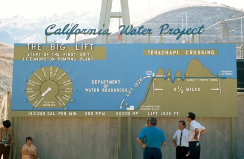
“At the time of its initial construction, California’s State Water Project was one of the largest water infrastructure projects in U.S. history. Construction began in 1961, and the first water deliveries reached Southern California in 1972. Spanning over 700 miles from the Feather River watershed in California’s upper northeast to Lake Perris in the south, it remains a marvel of modern engineering and a testament to the state’s 20th century technological dominance. Its construction was witnessed and documented by both the public and the state government, and California’s Department of Water Resources (DWR) hosts a massive public photo archive that continues to grow. Its photos convey a notably majestic vision of California, celebrating the state’s belief in its ability to “solve” the arid West’s water problems. In addition to their technical and aesthetic mastery, the images express a sense of utopian optimism. The photos in this essay, all taken from 1962 to 1968, reflect a post-World War II confidence that grand infrastructure could tame and re-engineer where “nature” fell short. Big projects were utilitarian in their capacity to solve large-scale water resource problems, yet they also communicated that the nation — or in this case, a colossal state that essentially functions as a nation — was the hero to slay Western water scarcity. … ” Read more from High Country News.
Edward Ring outlines a water plan for California agriculture
“On a recent episode of the AgNet News Hour, Edward Ring, director of Water and Energy Policy at the California Policy Center, returned for Part 2 of a conversation on California water, laying out the combination of projects he believes could substantially increase supplies for farms, communities and cities. Ring began with one of the issues discussed in Part 1: dredging the Sacramento-San Joaquin Delta. He argued sediment removal could improve the Delta’s ability to move water while also reducing flood risk. Ring also pointed to research suggesting the turbidity created by dredging can provide smaller fish with protection from predators. But dredging is only one piece of his proposed water strategy. Asked what he would do if given the opportunity to reshape California water policy, Ring outlined a combination of desalination, additional storage and new methods of moving water from the Delta during wet years. … ” Read more from AgNet West.
California’s endangered winter-run salmon face warm water threat
“Scientists with the California Department of Fish and Wildlife are closely monitoring river conditions to protect endangered salmon as a heat dome brings higher than normal temperatures to large portions of the state. River temperature management is critical for salmon’s survival and spawning. According to the California Department of Fish and Wildlife (CDFW), the agency and federal and state partners are working to give endangered Sacramento River winter-run Chinook salmon eggs a chance for survival after their spawning was observed several weeks later than usual. Officials say the eggs of late-season spawning fish can be at risk due to decreases in river flows and warmer water temperatures. Earlier this year, the CDFW announced that commercial ocean salmon fishing was back after being closed for 3 straight years. To avoid salmon impacts that could result in a return to salmon season closures, cold water pools need to be preserved to help protect California’s salmon populations. … ” Read more from Action News Now.
California’s record heat to fade as Western cooldown brings snow to Northwest mountains
 “Temperatures will trend downward across California and much of the western United States into this weekend, and the air will turn cold enough for snow across some of the higher elevations of the Northwest. The heat peaked along much of the California coast on Wednesday and across interior California on Thursday, with temperatures climbing as much as 20 degrees above the historical average for mid-September. Temperatures reached their highest levels of the year so far on Wednesday in San Francisco, downtown Los Angeles and Long Beach, California, with highs of 94, 105 and 107 F, respectively. All three locations set daily record highs. On Thursday, Fresno, California, challenged its daily record of 108 F, set in 1888, while Las Vegas challenged its record of 108 F, set in 1945. … ” Read more from AccuWeather.
How heat on the Tibetan Plateau fuels powerful storms in California, half a world away
 “The Tibetan Plateau may be on the other side of the world from California, but what happens on this high-altitude landscape in Asia can set off a chain of events that fuels powerful atmospheric rivers with flooding rainfall and heavy snow hitting the U.S. West Coast. My team of atmospheric scientists discovered this connection, and we explain how it works in a new study in the journal Science Advances. California and its neighbors saw record-breaking precipitation during the winters of 2016–2017 and 2022–2023 that caused widespread flooding and infrastructure damage. The U.S. Pacific Coast often gets atmospheric river storms during its winter rainy season, but the events in those years were especially striking because they occurred during La Niña conditions, which are typically associated with relatively dry winters in California. La Niña is El Niño’s cooler counterpart; they are the two extremes of a climate pattern connected to ocean temperatures known as the El Niño-Southern Oscillation. … ” Read more from The Conversation.
California coast braces for another battering as new El Niño-related wave emerges in Pacific
“California beach communities are expected to see rising sea levels in the coming weeks as El Niño continues to strengthen, with more sand erosion and damage possible, according to new data. Another El Niño-influenced phenomenon — a “coastally trapped Kelvin wave” — is moving up the coast of Mexico and will soon hit the U.S. West Coast. This isn’t a surfable wave, and it wouldn’t be overtly noticeable to swimmers or boaters either. But it is expected to increase the sea level off the California coast by another 6 inches or so, and its effects could last months, according to Dillon Amaya, an expert on coastally trapped waves and an assistant professor at North Carolina State University’s Department of Marine, Earth and Atmospheric Sciences. … ” Read more from the LA Times.
How does El Niño impact ocean ecosystems?

“El Niño is a climate pattern that is declared when monthly sea surface temperatures in the central and eastern tropical Pacific Ocean are measured above normal, for at least five consecutive overlapping three-month periods. This ocean warming has impacts on global temperature, weather patterns, and the life that lives in the ocean. In fact, the name El Niño, Spanish for the boy, was coined in the 1600s by Peruvian fisherman, who recognized the phenomenon when changing ocean currents and warmer waters caused a drop in their catch. Additionally, this El Niño comes at a time when the West Coast has already been experiencing an extended marine heat wave that has resulted in sea bird deaths along the coast. In this article, experts from Scripps Institution of Oceanography at the University of California San Diego explain how marine ecosystems are impacted by El Niño and how they track these impacts. … ” Read more from Scripps.
Surge in sick sea lions signals troubling changes in California’s coastal waters
“They’re loud, playful and one of San Francisco’s most recognizable icons. But this summer, sea lions along the Central California coast are also signaling a troubling change in the ocean. Rescuers are responding to a surge in sea lions sickened by domoic acid, a neurotoxin produced by naturally occurring harmful algal blooms. The Marine Mammal Center says it has already rescued more than 150 sea lions with domoic acid poisoning this year — more than twice its typical annual total. At San Francisco’s Pier 39, where sea lions have become a tourist attraction, the animals appear healthy and energetic. But elsewhere along the coast, many are struggling. That includes the animals that are brought into Sausalito’s Marine Mammal Center, the world’s largest marine mammal hospital and a non-profit organization dedicated to rescuing, rehabilitating, and releasing sick, injured, or abandoned marine mammals. … ” Read more from CBS Sacramento.
Restoring public confidence in drinking water after wildfires
“After a wildfire, water systems face two challenges: physical damage to the system and public trust. Fires can damage pipes, treatment facilities, and storage, while contaminants may enter the water system and take time to detect and remove. At the same time, residents may be asked not to use their tap while systems are assessed and repaired. But even after service is restored, people may remain unsure whether their water is safe. Water systems need both the capacity to restore service quickly — and clear, trusted communications to tell residents when tap water is safe to use again. Those findings are at the center of a new workshop synthesis report from the UCLA Luskin Center for Innovation and UC Agriculture and Natural Resources. The report draws on a May 2026 workshop with 54 participants from water utilities, regulatory agencies, research institutions, community organizations, journalism, consulting, and public health. … ” Read more from UCLA’s Luskin Center for Innovation.
California Forever faces a setback
“A state assembly bill to fast-track a shipyard proposed by California Forever as part of is vastly ambitious city-building plan hit a snag late last month, as protests from local opponents effectively stalled the proposal. The “Solano Maritime and Manufacturing Act” would have allowed California Forever to lean on a 2008 environmental impact report that Solano County had already approved rather than starting a new CEQA review from scratch, and would have required any legal challenges under CEQA to be resolved within 270 days. Backing it were former state Senate leaders Darrell Steinberg and Bob Hertzberg, who’d each come on as “special counsel” to California Forever. Assemblymember Lori Wilson (D-Suisun City) and state Sen. Christopher Cabaldon (D-West Sacramento) spoke in support of the bill. However, both of the current legislators made clear they wouldn’t back the law unless the Solano County Board of Supervisors signed off first. … ” Read more from California Local.
What a room full of former adversaries taught me about protecting forests
Patrick Koepele, Executive Director, Yosemite Rivers Alliance, writes, “Last week, I sat in the Tuolumne County Board of Supervisors chambers and watched something I wish more people could see. A retired timber industry forester and a conservation advocate sat side by side at the same table, making the same case. Behind them, two former county supervisors, both well known as conservatives, stood up in public comment to say the same thing the environmental groups were saying. Person after person, from very different corners of this community, spoke with one voice. They were there to ask the board to keep a partnership intact. The board listened, and voted to extend Yosemite Rivers Alliance’s role managing forest health projects in the Stanislaus National Forest for the life of the county’s Master Stewardship Agreement with the U.S. Forest Service, which runs through early 2038. I’m grateful for that vote, and relieved to have it behind us. But the vote isn’t the story. The room is. … ” Read more from the Yosemite Rivers Alliance.
In commentary today …
California’s future water supplies depend on the outcomes of four intertwined battles
Dan Walters writes, “Since the earliest years of its history, California has been a political battlefield over divvying up the state’s water. The intensity of the multisided conflict, like water itself, ebbs and flows. By happenstance this is one of the more intense and climactic periods in the eternal competition over water. It’s driven by uncertainty over the effects of climate change on precipitation and by looming decisions on how to cope with those effects. What happens on four intertwined fronts in the near future will determine how water will be managed and allocated in the coming decades. In no particular order … ” Continue reading this commentary by Dan Walters.
What are we doing to our world of wonder?
Author Terry Tempest Williams writes, “The Endangered Species Act is one of the few environmental laws formidable enough to hold developers accountable for the destruction of habitat — be it diverting water from a lake for agriculture, drilling for oil or building dams and golf courses. The law can shut down or force amendments on any project or operation that threatens the well-being of an endangered species. For decades, the law’s critics have tried and mostly failed to dismantle its power and integrity. But this year, the Trump administration found a legally binding way to defang it. On Sept. 14, the Endangered Species Act will be revised under a new rule that says habitat destruction no longer falls within the definition of what constitutes harm. In other words, the Departments of the Interior and Commerce have said any stress an animal or plant may face over the loss of its habitat is irrelevant to its well-being. … ” Read more from the New York Times.
In regional water news and commentary today …
NORTH COAST
Dam removal activists to rally ahead of Eureka public input sessions next week
“Two public comment sessions on a plan to decommission a hydroelectric project on the upper Eel River will be held in Eureka next week, and dam removal activists plan on filling the meetings. The Federal Energy Regulatory Commission, the agency tasked with regulating dams, wants input ahead of an environmental review process and is hosting the sessions strictly to collect public input. Advocates for dam removal are planning a rally ahead of the meeting Tuesday. They are working to pack the process with commenters and build local support for undamming the Eel. “We hope that FERC hears loud and clear that dam removal is in the broad public interest,” said Alicia Hamann, executive director of Friends of the Eel River, an organization formed to undam the Eel River. … ” Read more from the Lost Coast Outpost.
SIERRA NEVADA
Lake Tahoe agency adopts new rules for plastic camouflage on cell towers
“The Tahoe Regional Planning Agency (TRPA) has adopted new rules aimed at reducing plastic pollution from “monopine” cell towers, which use artificial branches and needles to resemble trees. Effective August 24, 2026, amendments to the agency’s ordinances discourage plastic screening materials on towers and establish additional documentation, monitoring, maintenance and corrective-action requirements when plastics are used. The changes followed more than five years of litigation and advocacy involving attorneys, Lake Tahoe residents and environmental groups, according to EINPresswire. Federal litigation challenging a proposed monopine near Heavenly Valley in South Lake Tahoe was resolved following adoption of the rules. … ” Read more from Inside Tower.
SACRAMENTO VALLEY
Cache Slough Mitigation Bank approved in Solano County
“Westervelt Ecological Services (WES) announces that the Cache Slough Mitigation Bank (Bank) has been approved with mitigation credits available to support infrastructure, transportation, water, renewable energy, and other development projects in the Sacramento-San Joaquin Delta and surrounding areas. The Bank provides freshwater marsh complex and floodplain riparian habitat credits that can be used for federally listed species, including Chinook salmon, steelhead, green sturgeon, delta smelt, and giant garter snake, as well as regulated aquatic resources. The Bank was approved by the U.S. Army Corps of Engineers, U.S. Environmental Protection Agency, U.S. Fish and Wildlife Service, and National Marine Fisheries Service. … ” Read more from Business Insider.
NAPA/SONOMA
After ‘epidemic of brown water,’ St. Helena working on strategy to mitigate decades-long problem
“St. Helena city staff are working out a strategy to clear up the discolored or brown water that sometimes spurts out of city pipes, a persistent, decades-long problem staff have largely attributed to built-up iron and manganese minerals in the water distribution system. “We’re clearly not where we want to be,” Joe Leach, the city’s public works director, said at the City Council’s meeting Tuesday, Sept. 8. St. Helena’s next step to address the water discoloration issue is expected to involve another stage of investigation — by adding a camera system to the water pipes to look for sediment and corrosion, advancing water-quality sampling and more — so the city can narrow in on underlying causes and then carry out a cleanup strategy. … ” Read more from the Santa Rosa Press Democrat.
BAY AREA
El Niño: Why chances are increasing for lots of rain this winter in the Bay Area and across California
 “The chances of a wet winter — with soaking storms, coastal flooding and other problems — are growing in the Bay Area and across California as El Niño conditions in the Pacific Ocean continue to strengthen. On Thursday, scientists at NOAA, the National Oceanic and Atmospheric Administration, said there is a greater than 90% chance of a strong El Niño being present in October, November and December, and a 75% probability that it will rank as the strongest in history since modern records began in 1950, up from 69% last month. “Interests in California need to be aware that there is an increasing possibility of above-average rainfall and stormier weather,” said Michelle L’Heureux, a meteorologist with the National Weather Service’s Climate Prediction Center in College Park, Maryland. … ” Read more from the San Jose Mercury News.
Can nature help California’s coast fight fire and floods?
“Climate change is giving the upper hand to the winds, weather, and water we spend so much time trying to control. In recent weeks, like a mass shooting, intense floods and wind took aim across our country and abroad, sweeping away our puny homes, felling trees, and sending rocks and water caterwauling down canyons from Zion to Nepal, ending thousands of lives in the process. And this right after a summer of fire and heat. “The fact is that a lot of our communities and infrastructure were never built with nature in mind, and as nature becomes more unstable from climate change, we’re increasingly vulnerable,” California Secretary of Natural Resources Wade Crowfoot said in an interview after a September 2 summit hosted by his agency at the Metro Center in San Francisco. Attended by more than 100 Bay Area leaders in climate adaptation policy, funding, and project implementation, the summit sought to identify ways nature-based solutions can improve the resilience of the California coast to climate change. … ” Read more from Knee Deep Times.
SEE ALSO: Guide to Nature-Based Infrastructure Around the Bay Area, from Knee Deep Times
Bay Area’s first ‘living levee’ opens to the public
“The San Francisco Bay shoreline’s first-of-its-kind horizontal “living levee” project is now open to the public. More than 2,000 plants hailing from 30 species are planted on a 500-foot-long slope of the Harbor Marsh shores in the Palo Alto Baylands. Traditional levees are constructed from rocks or concrete, but this project is piled high with vegetation to create a healthier ecosystem for the marsh, acting as a natural buffer between the land and water. Its overall goal: to provide the shore with protection from rising sea levels, which can cause flooding. “It’s the best way to make nature come to us,” said Palo Alto resident Tamar De La Concepcion, who bikes to the shores once a month from her home. “It looks much more beautiful compared to having a few rocks.” … ” Read more from the San Jose Mercury News.
San Francisco, heartland of AI, to weigh moratorium on new data centers
“A San Francisco supervisor wants the city to permanently ban new data centers — and is taking the first step toward doing so, his office said Thursday. It would be a notable move for the city renowned as the worldwide engine of artificial intelligence, but one that reflects rising public opposition to AI and the energy-intensive infrastructure needed to support it. On Sept. 15, Supervisor Shamann Walton plans to introduce a proposal to put a 45-day moratorium on new data center construction, according to his aide Natalie Gee. Gee said a temporary moratorium is the first legislative step toward a permanent citywide ban. … ” Read more from the San Francisco Chronicle.
Heroic HAB volunteers track harmful algal blooms
“In 2022, the HAB-pocalypse happened. All across the San Francisco Bay, harmful algal blooms popped up. Toxins from the bloom killed hundreds of fish, including endangered sturgeon, and prevented hundreds of swimmers and fishers from enjoying their favorite spots. Harmful algal blooms, or HABs, turn waters anything from brown to green when phytoplankton, microscopic organisms that love to hang around the tops of sunlit water, go into overdrive. Warm and sunny summers mix with slow moving waters and excess nitrogen, causing the phytoplankton colonies to grow out of control. Blooms can produce toxins, eat up oxygen, clog up waterways, and make waters unsafe for swimming. The Bay’s reputation for having excessively nutrient rich water is partially thanks to wastewater treatment plants overflowing, dumping raw sewage into waterways. Bad blooms are hard to predict, but one thing’s for certain: nutrient pollution from raw sewage and agricultural runoff doesn’t help. … ” Read more from Bay Nature.
CENTRAL COAST
First results from Grover Beach water supply study released
“The water supply in Grover Beach is one of the biggest issues community members worry about, and the first results from a water supply study show a potential supply gap in the near future. Grover Beach has released the first draft of a long-term water supply study. The report examines how the City plans to meet water demands over a 30-year planning horizon as the community continues to grow. “If a drought occurs, we should be ready for it,” said Grover Beach Public Works Director Jeff Lee. “If the vulnerabilities from either the legal challenges or the environmental challenges materialize, then we need to be ready for that water supply.” … ” Read more from KSBY.
Santa Barbara County receives approval on 5 year dredging plan
“A long-running flood-control strategy for the Carpinteria Salt Marsh Reserve in Santa Barbara County received renewed state approval, allowing county officials to continue managing sediment buildup and restricted water flow in a sensitive coastal area where those problems can increase flood concerns. The California Coastal Commission voted unanimously Aug. 13 to sign off on a five-year maintenance program for the marsh. Routine work authorized under the plan includes sediment removal, openings of the marsh mouth when conditions require it, and upkeep in the southern reach of the drainage network, according to Noozhawk. The area covered is the 250-acre marsh just outside Carpinteria city limits. … ” Read more from Dredge Wire.
SAN JOAQUIN VALLEY
Beneath the floodplain: How restored riverways are recharging Central Valley aquifers
“Central Valley groundwater has been drawn down faster than it’s been replenished for decades. Water tables have dropped, the ground has sunk significantly in places, and expensive infrastructure like roads and bridges has suffered damage. California’s Sustainable Groundwater Management Act (SGMA), a 2014 state law requiring local water managers to bring over-drafted groundwater basins back into balance by the early 2040s, sets out to fix that. Doing so means more water needs to go into the ground than comes out of it. River Partners has long known its statewide restoration work supports that goal. A new body of research now refines that picture, showing with much more precision how much groundwater our projects recharge, and where. A unique partnership with Lawrence Livermore National Laboratory (LLNL), Stanford University, and Stanislaus State took that on. From December 2023 to March 2026, researchers studied five River Partners restoration projects clustered around the 1,600-acre Dos Rios State Park near Modesto, the largest floodplain reconnection project in state history that River Partners completed in 2022, plus two future project sites in Merced County. … ” Read more from River Partners.
SOUTHERN CALIFORNIA
‘It is all hands on deck right now’ as California prepares for El Nino
“On Wednesday, the city of Dana Point issued an emergency declaration due to coastal flooding brought on by Hurricane Marie. This comes as eight homes were red-tagged (meaning they are uninhabitable) and seven homes were yellow-tagged (meaning they have restricted access). For oceanfront homeowner Chris Rodgers, the storm was so bad it almost took away his dream home. “It is all hands on deck right now,” Rodgers said. He said that in his six years of owning the vacation home, this is the worst weather he has ever seen. “So we are just a Hail Mary measure at this point. We are working to backfill under the house with concrete to prevent erosion and us collapsing into the ocean,” Rodgers said. … ” Read more from Spectrum 1.
Santa Ynez Reservoir dry again as Palisades endures third fire season without water
“The Santa Ynez Reservoir in the Pacific Palisades is dry again as the community endures a third fire season since damage to its floating cover was discovered in 2024. With water not expected to return until cover repairs are completed this December, residents are growing increasingly frustrated by the lengthy timelines they feel leave them in the lurch. “I think there’s a lot of hypocrisy here since our insurance money runs out soon and we are supposed to have built our homes by then, but they can’t even fix the reservoir,” said Pacific Palisades resident Morgan Goldberg. Since installation in 2011 to meet water quality standards, the Los Angeles Department of Water and Power (LADWP) has reported major tears in Santa Ynez Reservoir in 2022, 2024, and 2026. … ” Read more from Westside Current.
California officials allow plans for the country’s biggest kelp farm to move forward
“California has long been farm country, and its oceans soon could be, too. State coastal officials voted Wednesday to allow a plan to build the United States’ largest kelp farm 6 miles (10 kilometers) off the Southern California coast to move forward as the Trump administration seeks to ramp up aquaculture in the Pacific Ocean. Ocean Rainforest, which is based in the Faroe Islands in Northern Europe, is planning to grow giant kelp on a roughly 3-square-mile (7.8-square-kilometer) stretch of federal waters to develop products to boost soil and plant health in California’s avocado farms and strawberry fields. Some environmentalists are concerned that the lines used to grow seaweed could tangle whales and that increased boat traffic will disrupt an expanse of ocean that has been wild. … ” Read more from the Associated Press.
SAN DIEGO
San Diego Coastkeeper releases 2025 Tijuana River Valley water quality report
“San Diego Coastkeeper published its 2025 Tijuana River Water Quality Monitoring Report, providing a comprehensive picture of water quality conditions in the Tijuana River Valley over the past year. The findings confirm that sewage contamination, chemical pollutants, and aquatic life threshold exceedances remain chronic and widespread throughout the lower watershed and estuary. Coastkeeper collected monthly samples at two to four sites depending on flow conditions, and the data is shared with the public through an interactive data map at www.sdcoastkeeper.org/tijuana-river-map. … ” Read more from the San Diego Coastkeeper.
Along the Colorado River …
U.S. and Mexico sign new deal for sharing Colorado River water
“Water officials from the United States and Mexico have signed a new agreement for sharing the Colorado River. Mexico will take less water from the river under the new deal, but gain a degree of certainty about its ability to access a shrinking river with a shaky future. Expert onlookers are heralding the deal as a success and a rare example of cross-border collaboration. They said the cuts are necessary in response to a severely depleted Colorado River. The Colorado River, which starts in the snowy peaks of the Rocky Mountains, once met the Pacific Ocean on the Mexican coast. But the river has rarely reached the sea since the 1960s due to extensive water use by cities and farms throughout the American Southwest. … ” Read more from KJZZ.
SEE ALSO: U.S., Mexico set Colorado River rules through 2028, from Western Water
The Colorado River water supply crisis in a few graphs: Part 2 Agricultural water use in the Lower Basin
“The newly released Record of Decision for Colorado River operations and the Operating Guidelines for 2027 and 2028 provide a range of potential reductions in deliveries to the Lower Basin states, starting immediately with a 1.25 MAF shortage. The potential exists for reduced deliveries of up to 3.0 MAF, after consultation, if hydrologic and reservoir conditions require. This new report looks at how that magnitude of reduction compares to recent use in the Lower Basin, particularly by agricultural water users, and provides context for thinking about how these new mandatory cutbacks might be achieved.” Read more from UC Boulder.
Climate change, not data centers, behind Colorado River drought
“As cities dependent on the Colorado River basin for their water face usage restrictions due to a megadrought, social media posts are suggesting nearby data center projects are to blame for the alarmingly low water levels at Lake Powell and Lake Mead. But data centers do not have direct access to water from the basin, and experts said long-term climate trends caused the crisis in the southwestern United States. “Lake Powell dropped 34 feet in one year. Data centers are guzzling water while our reservoirs are drying up,” says text over an August 21, 2026 Facebook reel. On X, another user claimed: “There are many Data Centers that have been put in the Lake Mead area and draw directly from the lake.” The narrative circulated across platforms as the Colorado River basin suffered seasonal record lows in 2026 — and as concerns over the data centers powering America’s artificial intelligence boom emerged as a key issue ahead of November’s midterm elections. But “those statements are just factually inaccurate,” said Bronson Mack, outreach manager for the Southern Nevada Water Authority (SNWA). “Climate change is what is affecting the Colorado River and Lake Mead,” Mack told AFP in a September 3 email. “Not data centers.” … ” Read more from AFP.
Tribes along the Colorado River are still fighting for their rights
“The Colorado River stretches 1,450 miles across the U.S. And for just 17 miles, the river flows through the Fort Mojave Indian Tribe’s reservation, which spans across three states: Arizona, California, and Nevada. Fort Mojave Indian Tribe Chairman, Timothy Williams, on a humid triple digit day in the valley shows me around the tribe’s checkerboard farmland in Arizona. That’s the state in which the tribe has the most water rights. “Look over there, multi-million dollar homes that are right there across the river,” Williams said. “And here’s our infrastructure and trying to provide for an entire people.” The tribe has 133,000 acre-feet of water a year – enough to sustain over a quarter of a million households. Most of that goes to their alfalfa and upland cotton operation, which pays for healthcare services, housing, a state of the art elementary school, tribal utilities and other services. But as states, cities, and the federal government fight over the future of the river, all of that is at risk. And tribes like the Fort Mojave are often left out of the negotiations. … ” Read more from Aspen Public Radio.
A Tipping Point for the Colorado River: PBS NewsHour delves into challenges facing the threatened river system
“ADWR Director Tom Buschatzke, Arizona’s representative to the Colorado River, appeared in August on PBS News’ livestreamed “Tipping Point: A River Reimagined” program. The Director and other guests – all knowledgeable experts on the issues facing the Colorado River system — discussed those current challenges with Tipping Point host Miles O’Brien. Much of Director Buschatzke’ s commentary focused on the need for the system’s four Upper Basin states to contribute to protecting the river. In particular, he identified as a primary sticking point a lack of mandated, observable Upper Basin conservation that is delivered into Lake Powell. “What I need to see out of the Upper Basin is a proposal in which they help contribute to the protection of the river system, and in a way that has certainty,” said Buschatzke to Tipping Point host O’Brien. … ” Read more from the Arizona Department of Water Resources.
Colorado River cuts haven’t hit Arizona farmers yet, but that might be coming
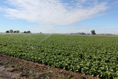
“Most of the Colorado River water allocated to Arizona goes to agriculture. But for now, the 30% statewide cuts imposed by the federal government won’t affect Arizona farmers, who supply most of the nation’s lettuce and other leafy greens for half the year. That’s because Yuma-area farms hold water rights that are senior to almost everyone else’s in the state, and Central Arizona farms already absorbed cuts a few years ago. Still, the relief may not last long. The federal Bureau of Reclamation will revisit the drought-era allocations for the seven states that share the river after next winter. If the Rocky Mountain snowpack is as bad as last winter’s, deeper cuts are likely and the pain will even spread to Yuma-area farmers like John Boelts. Boelts, who is president of the Arizona Farm Bureau, farms 3,000 acres of assorted vegetables, melons, wheat, cotton and other crops. Like most Yuma farmers, he gets his water from the river but not through the Central Arizona Project, which supplies 80% of Arizona’s population. … ” Read more from Cronkite News.
Newly installed technology will help clean out PFAS from Tucson’s groundwater supply
“Officials in Tucson say a recently completed treatment project will assist in the city’s efforts to remove PFAS from groundwater. The human-made chemicals have been tied to health issues including cancer and are used in a host of industrial and consumer products. One way groundwater is contaminated with PFAS is through a firefighting foam containing the chemicals that’s commonly used at airports and military installments — like the ones in Tucson’s southside. The area was declared a superfund site by the EPA in the 1980s because of another contaminant called TCE, and Tucson Airport Remediation Project facility, known as TARP, was set up to treat it by the 1990s. … ” Read more from KJZZ.
Utah ramps up monitoring after zebra mussel DNA detected in Colorado River
“Utah officials are increasing monitoring along the Colorado River after an automated water sampler detected zebra mussel DNA near Potash — a warning sign that officials say they are taking seriously, but not yet considering an infestation. The detection comes as Utah continues its aggressive effort to keep invasive mussels from spreading beyond Lake Powell. Bruce Johnson, with the Utah Department of Natural Resources’ Aquatic Invasive Species program, says the positive sample is an indicator that the state needs to take a closer look. “This is an indicator,” Johnson said. “It means we’re gonna increase our visits on the river. We’re gonna add another sampler just so we can start better tracking what we’re finding.” … ” Read more from KSL.
One Navajo community finally gets electricity after more than 10 years. It’s still waiting for water.
“Thomas Chee and Briana Austin waited more than 10 years to flip a switch that would change their lives. In early September, the Navajo couple watched as electric utility crews connected their home in southeast Utah to the power grid. Their porch light beamed on, and someone called out “Yeehaw!” “(It’s) almost an unreal feeling,” Chee said. “I can’t believe it. … It finally happened. We always was told it’ll be here, it’ll be here. Now all of the sudden, bam. So yeah, it’s an unreal feeling.” Now Chee, the president of the small Navajo community, can focus his attention on the ultimate goal: bringing clean, running water to his community. … ” Read more from the Colorado Sun.
In national water news today …
The push to remove lead pipes is on. Thousands of water systems still don’t know where theirs are
 “Kathryn Pilgrim knew the century-old Victorian she bought in Dunkirk, New York, came with old plumbing. She replaced pipes she suspected of containing lead and later installed a kitchen filter designed to remove heavy metals. But six years after buying the house, she still can’t be sure that her tap water is lead-free because she doesn’t know what material was used for the pipe that runs under her front yard and connects to the city water supply. Dunkirk is nearly two years behind schedule on an inventory that would give Pilgrim and other residents that information. Dunkirk, which supplies water to about 5,000 homes and businesses, is one of more than 1,300 public water systems cited by the U.S. Environmental Protection Agency for failing to meet an October 2024 deadline to hand in an inventory of the water lines that could be leaching the heavy metal into Americans’ drinking water, an Associated Press analysis of the agency’s enforcement data shows. … ” Read more from SF Gate.
Aging US water systems are no match for climate change
“This July, in the middle of the night during one of Southern California’s 2026 heat waves, a 36-inch utility pipe gave way beneath West Hollywood, sending 17 million gallons of water coursing past the nightclubs of the famed Sunset Strip and opening up a massive sinkhole that flooded nearby homes and garages. … The roughly 50,000 community water systems across the US typically operate underground and out of sight, drawing attention only when they aren’t working. But these vital utilities find themselves increasingly in the public eye as they race to upgrade infrastructure and avoid catastrophic failures exacerbated by more severe weather and other factors.Meanwhile, municipal water systems in at least a dozen US states, including Minnesota, Michigan and Georgia, reported a very different threat that month. They were targeted in cyberattacks — believed to be the work of Iranian hackers — that disrupted service in several cities, triggering boil-water advisories and fears of more malicious actions. In 2021, hackers gained control of a water system in Oldsmar, Florida, and tried to raise the level of sodium hydroxide — an ingredient in drain cleaner used to control water acidity — in a mass poisoning attempt. … ” Read more from Bloomberg.
The Trump administration wants to revise the latest National Climate Assessment—three years after publication
“The Trump administration is seeking to revise a federal climate report published three years ago to recast worst-case climate scenarios as implausible and limit their use in federal decision-making. The White House has proposed an “amendment and clarification” to the findings of the National Climate Assessment 5, published in 2023. National Climate Assessments are Congressionally mandated reports composed by hundreds of scientists and researchers and have been published every four years since 1990. Now, the White House wants to go back and change how the highest-emission scenarios — those representing the worst possible outcomes of climate change, known technically as RCP8.5 — can be interpreted and used by the federal government. … ” Read more from the LA Times.

