
Several news sources featured in the Daily Digest may limit the number of articles you can access without a subscription. However, gift articles and open-access links are provided when available. For more open access California water news articles, explore the main page at MavensNotebook.com.
On the calendar today …
- WEBINAR SERIES: Expanding Recharge and Preparing for Wet Weather: “Rapid” Groundwater Recharge Assessment Tool Options from 11am to 12pm. The webinar series will continue the discussion about tools that can support recharge planning. Two expedited, district-scale applications of the Groundwater Recharge Assessment Tools (GRAT) will be presented, and how other districts could use these tools. Presenters: Roshni Katrak-Adefowora, Sustainable Conservation; Kristin Sicke, Yolo County Flood Control & Water Conservation District; and Daniel Siegel, Earth Genome Click here to register. Click here for a flyer.
In California water news today …
Hurricane Marie damaged LA, OC beaches. Super El Niño could be worse, experts say
“The coastal flooding witnessed in Southern California this month — with high waves caused by Hurricane Marie lashing Dana Point, Long Beach, Laguna Beach and Malibu and damaging property there — could well continue this winter as the El Niño weather phenomenon may increase the likelihood of hurricane impacts on the region, adding swells on top of already-rising sea levels, weather experts say. Nine beachfront homes in Dana Point have been red-tagged as uninhabitable as of Wednesday, Sept. 9. Seven others have been yellow-tagged for restricted access there, as have four in Laguna Beach. A sinkhole devoured the driveway at actor Nicolas Cage’s Malibu home. “My guess is the coastal flooding will be far worse once winter storms really begin to push that water into coastal Southern California,” Daniel Swain, a climate scientist with University of California Agriculture and Natural Resources, said in a forecast outlook published on YouTube. … ” Read more from the LA Daily News.
SEE ALSO: ‘The whole beach is gone’: Big waves bring destruction to SoCal coast. It’s a warning, from the LA Times | Read via Yahoo News
This year’s unusual El Niño just got even stronger
“Temperatures in the Pacific Ocean are still rising as this year’s El Niño strengthens. A monthly outlook published Thursday by the National Oceanic and Atmospheric Administration’s Climate Prediction Center gives a 75% chance that El Niño will become “historic” from October to December. Even since August, forecasters have lifted the odds of El Niño exceeding the strength of all previous events on record since 1950. “It’s not the hottest yet, but it could become the hottest,” Alexander Gershunov, a research meteorologist at the Scripps Institution of Oceanography at UC San Diego, told SFGATE. “It hasn’t matured yet completely. It’s going to mature over the next few months as far as sea surface temperatures go.” … ” Read more from SF Gate.
How does El Niño impact the California Coast?
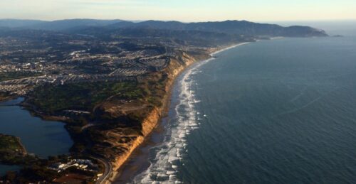
“El Niño is defined by the persistence of warm water in the Pacific Ocean at the equator. This warm water has impacts on global temperature, weather systems and marine life. This El Nino-driven warming also makes sea levels higher because water expands as it heats up due to thermal expansion, and can mean bigger waves along the U.S. West Coast. In this article, scientists with Scripps Institution of Oceanography at the University of California San Diego explain how the California coastline could be impacted by the approaching El Niño, and why data programs that help scientists track and forecast coastal impacts are vital to understanding this El Niño. … ” Read more from Scripps.
Heard about the super Godzilla monster El Niño? Here’s how it could actually affect you.
“It was raining. That was what first startled Alyssa Atwood when she stepped off the plane on Christmas Island in August. Torrential downpours had already turned the dirt roads into impassable waterways, leaving her research team questioning whether their trucks could even reach their lodge. When she finally waded into the Pacific Ocean, it wasn’t quite as she remembered it. “You almost don’t want to wear a wet suit, it’s so hot,” said Dr. Atwood, a paleoclimate scientist at Florida State University who recently returned from the island, a remote coral atoll that sits in the Central Pacific at the geographical bull’s-eye of El Niño. The typical winter peak of El Niño is months away. Yet on Christmas Island, also known as Kiritimati, the ocean was already at least two degrees warmer than average, hovering between 30 and 30.5 degrees Celsius, and the reef was actively bleaching. It was an ominous sign of what forecast models suggest could become a record-breaking El Niño, and stark proof that the ocean had already entered uncharted territory amid what some have called a “super El Niño” or even a “Godzilla El Niño.” … ” Read more from the New York Times.
SEE ALSO:
- How El Niño could bring punishing conditions to the West Coast this winter, from the Washington Post
- 2026’s El Niño is shaping up to be a doozy – it’s already affecting global shipping, fish behavior and heat, from The Conversation
How atmospheric events at the top of the world could have triggered two devastating California floods
“In early 2017 and 2023, California experienced two catastrophic and record-breaking floods that caused billions of dollars in damage, triggered mudslides and forced thousands of people to evacuate. Why this happened left scientists scratching their heads. Both disasters struck during La Niña conditions, which normally bring drier-than-normal weather to California. Now, an international team of researchers thinks it may have the answer. Using detailed computer simulations, a team, led by Yongkang Xue at the University of California, Los Angeles, discovered that a key driver could have been a chain of atmospheric events that started with unusually warm weather on the Tibetan Plateau, thousands of miles away. Their work is published in the journal Science Advances. Uncovering this previously unknown connection started with decades of real-world climate data. First, the researchers analyzed temperature data from the Tibetan Plateau and rainfall data from North America from 1984 to 2023. They focused on the Tibetan Plateau because this vast, high-altitude region can influence weather patterns far beyond Asia. The data showed that when there is unusual heating over the Tibetan Plateau in early winter, heavier rains tend to fall over the western U.S. the following month. But this correlation was not the full picture. … ” Read more from PhysOrg.
Scripps Oceanography and Ocean Science Trust chart path to flood resilience in California
“A report released by California Ocean Science Trust (OST), in partnership with UC San Diego’s Scripps Institution of Oceanography, analyzes the state of the science behind flood risk modeling and mitigation as part of an effort to incentivize risk reduction. The report assesses current flood modeling practices and offers eight recommendations to improve how mitigation infrastructure is reflected in the catastrophe models that are used to set insurance prices. Titled Strengthening Incentives for Flood Risk Reduction in Catastrophe Modeling and Insurance: Recommendations for California Coastal Counties, it calls for improved practices ranging from better representation of phenomena such as atmospheric rivers in the models, greater access to federal flood insurance data, and making it clear in insurance premiums what savings could be achieved through risk reduction. “Insurance could help California prepare for increasing flood risk by rewarding flood mitigation efforts with better pricing and availability,” said Scripps Oceanography research economist Tom Corringham, who co-authored the report with fellow Scripps research economist Denali Pinto. “We offer recommendations for filling critical data and policy gaps to link mitigation efforts with financial incentives, helping insurers and California’s communities realize the economic benefits of investing in resilience.” … ” Read more from Eco Magazine.
SEE ALSO: Report Identifies Path to Stronger State Flood Resilience and Insurance Protections, from Scripps
San Joaquin Valley gets a roadmap for closing its water gap
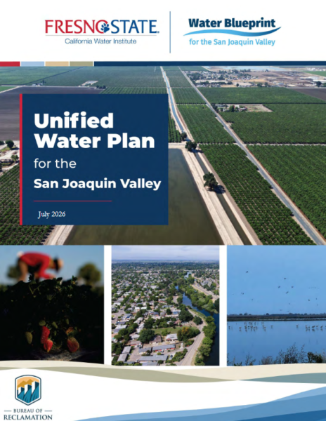 “The Water Blueprint for the San Joaquin Valley and the California Water Institute at Fresno State have released the Unified Water Plan for the San Joaquin Valley, the first study to bring water planning across all eight counties of the region, Fresno, Kern, Kings, Madera, Merced, San Joaquin, Stanislaus and Tulare, into one document. The Valley stretches roughly 250 miles from Stockton in the north to Bakersfield in the south, forming the southern half of California’s Central Valley between the Sierra Nevada and the Coast Ranges. It is also the state’s biggest agricultural engine: farming and related industries account for 14 percent of the region’s GDP and 17 percent of its jobs, and Fresno, Kern and Tulare counties rank among the nation’s top three agricultural counties by revenue. That output sits alongside real hardship, every county in the Valley has a poverty rate above the state average, which is part of why the plan treats drinking water access, not just irrigation supply, as central to its case. … ” Read more from Smart Water Magazine.
Unified Water Plan charts a path to keep the San Joaquin Valley growing
“The California Farm Water Coalition welcomes the release of the Unified Water Plan for the San Joaquin Valley, a congressionally authorized report that gives federal, state, and local leaders a single roadmap for water investment in the region that grows much of the nation’s food. The plan projects a 2.4 million acre-foot annual water supply gap in the San Joaquin Valley by 2040, quantifying the immense challenge of achieving long-term groundwater sustainability under the Sustainable Groundwater Management Act (SGMA) passed in 2014. Prepared by the California Water Institute at Fresno State in coordination with the Water Blueprint for the San Joaquin Valley and funded by the U.S. Bureau of Reclamation, the plan brings the groundwater sustainability plans of all sixteen Valley subbasins into a single regional assessment. “For the first time, we have a unified picture of the Valley’s water challenge and a roadmap to address it. Now we must ensure the projects and solutions identified in the Unified Water Plan receive the funding needed to protect communities, sustain food production and strengthen California’s water future,” said Michelle Paul, executive director of the California Farm Water Coalition. “Families across the nation who depend on California-grown food are counting on it.” … ” Read more from the California Farm Water Coalition.
Edward Ring: Comments on the “Water Quality Control Plan” for the Delta
“The August 2026 final draft of the State Water Resources Control Board’s (SWRCB) “Water Quality Control Plan for the San Francisco Bay/Sacramento-San Joaquin Delta Watershed” has been released. Written comments will be accepted through September 18, and the board will also take oral comments at the October 28-29, 2026 meeting where the SWRCB may formally adopt the plan. Anyone who hasn’t spent a lifetime in this business will quickly realize that this plan is huge and hard to follow. The “plan” is a 128 page PDF, with accompanying staff reports that in aggregate run to thousands of pages. Even for experts, it would take months to fully decipher. From reading the plan and talking with people familiar with it, who have been anticipating its release, I would attempt to describe its purpose and intent as follows: It updates an existing water quality control plan for the San Francisco Bay, as well as the entire Sacramento and San Joaquin river watershed, with a focus on the delta. It expands the definition of beneficial use, updates water quality standards, and sets tributary inflow and delta outflow standards. … ” Read more from Edward Ring.
Start-up beaver dams transform parched California creeks into salmon havens, new research finds
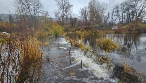
“Battered by early gold mining and diminished by logging and diversions,the lower section of Sugar Creek often ran dry in summer. The tributary of the Scott River in Northern California’s Klamath Basin once supported coho salmon—but as it diminished, so did they. In 2014, NOAA Fisheries researchers worked with the Scott River Watershed Council to sink lines of inexpensive wooden posts interwoven with willow branches across the creek. Called beaver dam analogues (BDAs), the simple structures slowed water flows like beaver dams. Almost immediately, more juvenile coho salmon survived to fill the creek. Within 2 years, more adult coho salmon were returning, new research showed. Their numbers surged on Sugar Creek and French Creek, another stream with BDAs, just as coho salmon in other local creeks without BDAs collapsed from drought. “There was skepticism every step of the way that this would work, that it would provide benefits, until you see the fish actually coming back and you see the fish thrive there,” said Michael Pollock, a research scientist at NOAA Fisheries’ Northwest Fisheries Science Center who led the research. Adult salmon returns demonstrate the benefits of healthy habitat by contributing to fisheries and other economic and environmental gains, he said. … ” Read more from NOAA Fisheries.
Del Puerto Canyon Reservoir project takes another small step forward
“There has been an ongoing battle between the proponents and opponents of the Del Puerto Canyon Reservoir project. The project is commonly referred to as the Del Puerto Canyon dam. According to a recent resolution put forth by the Del Puerto Water District, the project “involves the construction and operation of a reservoir on Del Puerto Creek to provide approximately 82,000 acre-feet of new off-stream storage for use by the Del Puerto Water District and the San Joaquin River Exchange Contractors Water Authority.” Advocates for the project list its benefits as water storage, water supply reliability for wildlife, enhanced local management of groundwater and surface water, and the capture of Del Puerto Creek runoff for increased flood protection. Opponents cite concerns about potential flooding in Patterson in a hypothetical dam failure, the loss of sacred grounds, the loss of recreational activities, and the loss of wildlife habitat. … ” Read more from the Patterson Irrigator.
Can the next generation afford to farm in California?
“A great paradox lies at the heart of California’s nation-leading, $60-billion-a-year agricultural industry: In a state known for its huge farming economy, small farms earn just a sliver of the revenue, and many struggle to stay in business. The lore of the small family farm runs deep in American culture, with Thomas Jefferson making it an organizing principle for the then-young country. But the reality has long been that large-scale agribusinesses dominate the industry, including in California. Small farms — those with annual gross income under $350,000 — accounted for 74 percent of farms in California in 2022, the last year data are available, according to the U.S. Department of Agriculture. The state lost almost 9,000 small farms between 2017 and 2022, going from 55,605 to 46,804, a 16 percent drop in just five years. While small farm statistics are not available at the county level, similar statistics show the same trends in the Sacramento Valley, and experts say the dynamics causing the decline are happening across the state. … ” Read more from Comstock’s.
Record-breaking rain in California was caused by abnormally high temperatures on the other side of the world, study finds
“Abnormally high temperatures on the Tibetan Plateau triggered two catastrophic rainfall events halfway around the world in California and nearby states in early 2017 and 2023, a new study reports. This is the first time that researchers have identified this link, known as a climate teleconnection. The results could improve forecasts of extreme weather in the western U.S., which, in turn, could improve warnings for coastal communities and potentially save lives as well as billions of dollars in property damage, the study’s authors say. In December 2016 and February 2023, the Tibetan Plateau was warmer than usual for these times of the year. Roughly one month after each of these hotspots appeared, parts of California, Nevada, Oregon, Utah and Arizona received record-breaking precipitation, causing a total of around $6.6 billion in damage, according to the study, and killing at least nine people. … ” Read more from Live Science.
Drones hold secret to producing more rain, engineers say
“Amid perpetual drought, population growth, and trillions of gallons of water used in desert agriculture, much of America’s West is in desperate need of more rain and snow. A team of engineers at a Southern California tech company say they believe drones could be part of a solution. The team at Rainmaker says drones are the most precise and cost-effective way of cloud seeding, a process that uses molecules of silver iodide to attract water droplets and enhance the amount rain and snow that falls. To produce more rain than would occur naturally, Rainmaker sends a drone into a cloud that is not yet producing rain or snow and releases silver iodide — an ice nucleating molecule — from the drone. “Over the course of hours, we can produce millions of gallons of new precipitation,” Rainmaker founder and CEO Augustus Doricko told ABC News’ Ginger Zee at the company’s California warehouse. …, ” Read more from Good Morning America.
Rainwater, wildfire runoff, and systems thinking come to Universal City
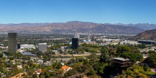 “The 2026 American Rainwater Catchment Systems Association International Conference will convene September 16–17 at the Sheraton Universal Hotel in Universal City, giving California water managers a concentrated look at rainwater harvesting, stormwater capture, reuse, and the codes that increasingly shape those systems. The two-day program is co-located with the International Association of Plumbing and Mechanical Officials’ Annual Education and Business Conference, which runs September 13–17 as IAPMO marks its 100th anniversary in the Los Angeles area where the organization was founded in 1926. For a state still absorbing the hydrologic aftershocks of wildfire, urban growth, and competing demands on potable supplies, the ARCSA agenda is less about a niche building technology and more about how decentralized water can be designed, permitted, staffed, and connected to larger management goals. Conference registration includes ARCSA educational sessions and daily networking breakfasts. Details are at arcsainternational.org/conference-arcsa. … ” Continue reading this press release.
California’s August was the hottest on record, NOAA reports
“As the Bay Area swelters through a three-day heat wave this week, climate analysts announced Wednesday that August marked the hottest month ever recorded in California and across the world. A report from climate organizations found global temperatures in August reached 1.65 degrees Celsius higher than levels since before the Industrial Revolution, making it tied with July 2023 as the hottest month in recorded history. Scientists used a 1.5-degrees-Celsius climate threshold to track warming in comparison to the preindustrial era between 1850 and 1900 — before human activity influenced our climate. The European Union’s Copernicus Climate Change Service conducted the report in collaboration with the European Centre for Medium-Range Weather Forecasts, a research institute producing global weather predictions. The record highs, according to the report, can be attributed to emissions from burning fossil fuels and rapidly increasing sea surface temperatures associated with El Niño conditions in the Pacific Ocean. … ” Read more from the San Francisco Chronicle.
Conservationists sue over Endangered Species Act designation for pond turtles
“A handful of conversation groups sued the U.S. Fish and Wildlife Service on Wednesday over what they call a failure to implement protections for northwestern and southwestern pond turtles. The Center for Biological Diversity and others claim in their suit that the service should have issued final listing rules in October 2024, designating the turtles as threatened. It missed that deadline, leading the plaintiffs to ask a federal judge in Oregon to declare the service in violation of the Endangered Species Act and order it to issue the final listing rules. “It’s inexcusable that it takes multiple lawsuits to get the Trump administration to protect imperiled wildlife like the northwestern and southwestern pond turtles,” said Meg Townsend, a senior freshwater attorney at the center, in a statement. “The longer these adorable turtles wait, the more endangered they become as the wetlands and forests where they live are lost to development, logging and wildfire.” … ” Read more from Courthouse News Service.
California sues over Trump’s changes to Endangered Species Act, arguing they threaten habitat
“California’s beloved condors and sea otters have rebounded from the brink of extinction thanks to the Endangered Species Act. Now the state is going to court to keep the 50-year-old law intact, filing two lawsuits Wednesday to block what Democratic leaders describe as the Trump administration’s rollback of its protections. Attorney General Rob Bonta filed the suits with a coalition of 21 attorneys general, adding to dozens California has already filed to combat the Trump administration’s deregulatory agenda. The complaints target the Trump administration’s revisions to the Endangered Species Act, first enacted under Republican President (and Californian) Richard Nixon. “Caring for our wildlife and our environment is part of caring for our future, yet President Trump seems to care only for himself and his industry friends,” Bonta said in a statement Wednesday. … ” Read more from Cal Matters.
SEE ALSO:
- States sue over Trump’s cuts to endangered species rules, from the New York Times
- Attorneys general sue over changes to Endangered Species Act, from the Courthouse News Service
Industry interests spent big money to stop California from banning PFAS pesticides
“An ambitious bill to keep toxic “forever chemicals” off California produce lost its teeth after the chemical and agricultural industry spent hundreds of thousands of dollars lobbying against it. The bill that landed on Gov. Gavin Newsom’s desk last week simply requires regulators to track and disclose pesticide applications in the state. It’s “a shell of what we set out to do,” said its author, Assemblymember Nick Schultz, D-Burbank. “We missed an opportunity this year to really be a national leader on this issue, and to catch up with a handful of other states that are already pursuing this legislation,” he added, referring to Maine and Minnesota, which have already enacted laws restricting PFAS pesticides. Early versions of Schultz’s bill, A.B. 1603, would have prohibited state regulators from approving new pesticides with perfluoroalkyl and polyfluoroalkyl substances, or PFAS, starting in 2028. In 2030, the legislation would have outlawed the sale of 23 PFAS pesticides already banned in Denmark and started to phase out the rest of the already approved products in 2035. “I was shocked to learn that the state was not doing anything about PFAS-containing pesticides that are regularly used on crops,” Schultz told his colleagues when he sought their support in April. … ” Read more from Inside Climate News.
No rest for cap and invest, no deal on Bay Delta Plan
“The end of the legislative session offered up more questions than answers about the future of California’s signature climate program, teeing up a ready-made fight the next governor will have to deal with. State lawmakers headed home from Sacramento a little over a week ago after reaching a deal to divvy up a shrinking pot of revenue generated by the state’s emissions trading program, known as cap and invest. The agreement calls for the money, raised by selling pollution permits to major polluters, to be split among transit, housing and clean water programs, but Senate leaders and dozens of interest groups that rely on the dollars have made it clear they aren’t satisfied. … The Central Valley’s largest and most powerful irrigation district is pulling out of a deal with Newsom to direct more money towards habitat restoration in the Bay-Delta region. … ” Read the newsletter at Politico.
With support from loggers and (some) environmentalists, Congress unites on major wildfire bill
“A sweeping bipartisan bill that seeks to prevent catastrophic wildfires and restore fire-ravaged forests has revealed a schism in the nation’s environmental movement as some conservation advocates find themselves allied with a longtime foe: loggers. The Fix Our Forests Act, which Congress is close to passing, aims to speed up forest management projects on public and tribal lands by reducing regulatory and legal hurdles. The proposed legislation comes at a time of increasingly devastating wildfires and has garnered wide support among Republicans and the timber industry. However, the traditional Democratic coalition of environmental groups is split over the role humanity has to play in forest management. Some argue ecosystems are best protected when humans leave them alone — a view that dominated during the timber wars of the ’80s and ’90s. Others argue that humans have a responsibility to intervene — an increasingly popular idea as climate change threatens ecosystems around the world. … ” Read more from the LA Times.
In regional water news and commentary today …
SIERRA NEVADA
Tahoe Regional Planning Agency takes landmark action to curb plastic pollution from “monopine” cell towers
“After more than five years of pro bono litigation and advocacy by attorneys Robert J. Berg and Julian Gresser, CEO of the Broadband International Legal Action Network, with support from Lake Tahoe residents, environmental advocates, and legal volunteers, the Tahoe Regional Planning Agency (“TRPA”) has adopted new rules addressing plastic pollution from “monopine” cell towers, setting a new regulatory standard for these faux-tree structures in the Lake Tahoe Basin. Effective August 24, 2026, amendments to Chapter 36 of the TRPA Code of Ordinances discourages the use of plastic screening materials on cell towers and require additional documentation, monitoring, maintenance, and corrective-action requirements when such materials are used. … ” Read more from EIN Presswire.
SACRAMENTO VALLEY
Biodiversity in the Sacramento Valley
“Each year on September 7, California celebrates California Biodiversity Day, an opportunity to recognize the remarkable variety of plants, fish and wildlife that make our state one of the most biologically diverse places in the world. Here in the Sacramento Valley, biodiversity is part of the landscape around us every day. From the ridgetops and forests of the Sierra Nevada, Cascade and Coast Range to the Sacramento River and its important tributaries, floodplains, wetlands, wildlife refuges and productive farms, the Sacramento Valley supports an extraordinary mosaic of habitats. It is a place where farms, rivers, wetlands and wildlife refuges are interconnected—and where people are continually finding new ways to manage water and land together to benefit both communities and wildlife. … ” Read more from the Northern California Water Association.
NAPA/SONOMA
Annual Russian River cleanup day nears as potential deluge of winter rains awaits
“Climate scientists say the unprecedented El Nino pattern currently playing out in the south pacific ocean could mean California is deluged with rain this winter. For Russian River advocates, it means the upcoming 40th annual watershed cleanup couldn’t be more important. Whether in Guerneville or Geyserville, Jenner or Healdsburg, it’s not uncommon to find Russian Riverkeeper staff and volunteers combing the river’s banks. Jimmy Carreras works on community outreach for Russian Riverkeeper. “As community engagement coordinator, a really important thing I do is bring people in,” Carreras said at a recent cleanup. … ” Read more from NorCal Media.
BAY AREA
Amazon data center project in Gilroy upsets locals
“An Amazon data center under construction in Gilroy is frustrating a local transparency group and residents who are voicing concerns about the city’s lack of openness in allowing the project to move forward. Americans for Transparency, a grassroots initiative led by Gilroy resident Georgine Scott-Codiga, filed a formal demand of violations with Gilroy asking for an admission that the land where the Amazon data center is being developed has allegedly violated the California Subdivision Map Act. City officials said they’ve looked into the claim and found no violation. Scott-Codiga wants four issues addressed by the city attorney and Gilroy City Council: stop accepting Amazon’s water connection applications until the subdivision issue is resolved; formally investigate whether the Amazon parcel was illegally created; refer the matter to Santa Clara County for enforcement; and notify Amazon in writing no approvals will be issued until the alleged parcel defect is corrected. … ” Read more from the Gilroy Dispatch.
CENTRAL COAST
A report finds the Monterey Bay commercial fishing industry squeezed by a slew of pressures.
“A new report by the Monterey Bay Fisheries Trust takes a look at the state of Monterey Bay’s commercial fisheries over four decades, finding that while the region’s commercial fishing industry has fundamentally shrunk, it has become more diversified over time. The Monterey Bay Commercial Fisheries: Status and Trends report, released Sept. 2, comes at a time when the local seafood economy faces increasingly unpredictable environmental, economic and regulatory challenges – factors that have pushed fishers to adapt. “I do really feel like it’s a critical moment,” MBFT Executive Director Melissa Mahoney says. “Our ocean is changing, our economy is changing. As a coastal community, if we lose our bridge to our fisheries, that’s huge in terms of our food security going forward.” Seven fisheries central to the region were examined from 1981 to 2024 across Santa Cruz, Moss Landing and Monterey: market squid, coastal pelagic finfish, groundfish, Chinook salmon, Dungeness crab, California halibut and spot prawn. … ” Read more from Monterey County Now.
California approves 5-year marsh dredging plan as cheapest flood shield for Santa Barbara County
“A long-running flood-control strategy for the Carpinteria Salt Marsh Reserve in Santa Barbara County received renewed state approval, allowing county officials to continue managing sediment buildup and restricted water flow in a sensitive coastal area where those problems can increase flood concerns. The California Coastal Commission voted unanimously Aug. 13 to sign off on a five-year maintenance program for the marsh. Routine work authorized under the plan includes sediment removal, openings of the marsh mouth when conditions require it, and upkeep in the southern reach of the drainage network, according to Noozhawk. The area covered is the 250-acre marsh just outside Carpinteria city limits. … ” Read more from The Cool Down via Yahoo News.
SAN JOAQUIN VALLEY
Commentary: A data center could be a transformative opportunity for Modesto
Trevin W. Barber, a Modesto‑based economic developer and municipal entrepreneur, writes, “Recent discussion around a hypothetical data center has revealed something important about Modesto: even the idea of a major project can spark strong reactions. No company has submitted an application or filed a notice of intent, yet the concept alone has generated enough conversation to show how deeply residents care about the city’s future. This is an ideal moment to step back and consider a larger question: How should Modesto manage major development proposals when they do arrive? A large data center facility represents the kind of industrial anchor cities across the country compete for. If a project like this were ever formally proposed, it could become one of the largest tax generators in Stanislaus County. … ” Read more from the Modesto Bee.
Kern County farmers ready fields and ditches as El Niño winter threat grows
“As summer winds down, weather experts are watching the Pacific, warning there’s a strong possibility California could be headed for an El Niño winter, a weather pattern that begins thousands of miles away but can bring major impacts closer to home. Eyewitness News Forecaster Aaron Perlman said El Niño “really starts out in South America where you get these trade winds that head west. Moisture from the water is very warm and it builds towards the US overtime.” El Niño events usually occur every two to seven years. Experts say that from October to January in Bakersfield, the region could see up to 10 to 12 inches of rain this year. … ” Read more from Bakersfield Now.
SOUTHERN CALIFORNIA
SoCal weather whiplash brings flooding, coastal erosion and extreme heat
“From flooded mountain roads to crumbling coastline and now dangerous triple-digit heat, Southern California is being hit by a dramatic stretch of weather that is not over yet. After thunderstorms unleashed heavy rain, lightning and flash flooding in parts of the region Tuesday, temperatures are soaring Wednesday as lingering tropical humidity combines with extreme heat to create potentially dangerous conditions. An Extreme Heat Warning took effect at 8 a.m. Wednesday and will remain in place through 8 p.m. Thursday across much of Los Angeles County. Temperatures could climb well above 100 degrees in some communities, with the hottest inland valleys and foothills potentially reaching around 108 degrees. The humidity is expected to make the heat feel even more oppressive. … ” Read more from KTLA.
SEE ALSO:
- Waves demolished this beach and tore at Long Beach homes’ foundations. Why this storm was different, from the LAist
- Southern California coastlines are reeling from the effects of Tropical Storm Marie, from the LAist
L.A. says it will clean up its biggest gas power plant. Environmentalists aren’t buying it
“A plan to convert L.A.’s largest natural-gas-fired power plant, located on the beach near LAX, to a purported cleaner-burning fuel has drawn the ire of an unlikely opponent: environmentalists. A lawsuit filed in Los Angeles County Superior Court by a coalition of environmental groups accuses the city of Los Angeles and the Department of Water and Power of violating the California Environmental Quality Act when it signed off on a plan for the Scattergood Generating Station in Playa del Rey last year. The $800-million plan would replace two of the plant’s aging units with turbines that can run on a combination of natural gas and hydrogen, which, when produced cleanly, generates no planet-warming carbon dioxide. The DWP has said the plan is integral to meeting L.A.’s climate goals, including 100% clean energy by 2035. … ” Read more from the LA Times. | Read via Boiling Point Newsletter.
Threatened fish thrive in restored SoCal creek, signaling success for water reliability
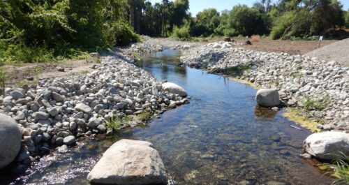
“Just months after reconnecting Anza Creek to the Santa Ana River, San Bernardino Valley Municipal Water District (San Bernardino Valley) has documented adult Santa Ana sucker and hundreds of newly hatched juvenile fish in the restored creek, signaling successful spawning far sooner than biologists expected. The federally threatened Santa Ana sucker occupies a limited area of the Santa Ana River and depends on specialized habitat for feeding and reproduction. Restoring tributaries like Anza Creek expands that habitat, providing native fish with places to spawn and forage for algae to scrape off rocks to eat, and find refuge from high flows. Biologists have also observed Arroyo chub, another native fish considered a species of special concern by the State of California. “This is an extraordinary result,” said T. Milford Harrison, San Bernardino Valley Board President. “Years of science and collaboration went into creating habitat specifically for these native fish. Seeing them thrive in the restored creek so quickly shows this approach is working to protect the natural resources of the Santa Ana River while helping develop reliable local water supplies for the region.” … ” Read more from the San Bernardino Valley MWD.
Atmospheric river forecasting drives record stormwater capture at Orange County’s Prado Dam
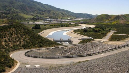
“The Orange County Water District (OCWD) and the U.S. Army Corps of Engineers (USACE) captured 18.1 billion gallons of stormwater at Prado Dam between July 2025 and June 2026, the highest total since the 1940s, according to OCWD. The volume is enough to supply more than 110,000 households for a year and is valued at over $55 million. The district attributes the record to Forecast Informed Reservoir Operations (FIRO), a strategy that uses advanced weather forecasting to track atmospheric rivers and hold more water behind the dam without compromising flood protection. Under the dam’s original rules, Prado released water on a fixed seasonal schedule regardless of the forecast, leaving storage capacity unused when no major storm arrived. FIRO changes that by giving operators roughly five days’ notice of incoming atmospheric rivers, the concentrated bands of moisture behind most of Southern California’s heaviest winter rain. With that lead time, USACE and OCWD can hold more water when no storm is coming, or release it in advance to clear space ahead of one, capturing supply that would otherwise be spilled downstream for flood safety. … ” Read more from Smart Water Magazine.
IMPERIAL/COACHELLA VALLEYS
Court overturns approval of Imperial County data center, orders environmental review
“An Imperial County judge has halted development of a massive data center complex and ordered county officials to analyze its potential environmental impacts. Imperial County Superior Court Judge Brooks Anderholt issued the ruling late Wednesday morning. He said county officials illegally shielded the nearly-1 million square-foot data complex from review under the California Environmental Quality, or CEQA, when they signed off on it in April. The ruling was based on legal challenges against the Imperial County government brought by the city of Imperial and the Sierra Club, a national conservation organization. “I’m thrilled for the people of Imperial County,” said Mark West, the director of the Sierra Club’s San Diego and Imperial Counties chapter, in a phone call Wednesday. “We want to understand the significant environmental impacts that this project is going to have.” … ” Read more from KPBS.
SAN DIEGO
De Anza Cove plan could dramatically expand Mission Bay wetlands
“A long-discussed transformation of De Anza Cove in Mission Bay has cleared a key hurdle, giving the City of San Diego a path toward dramatically expanding wetlands while maintaining space for recreation and camping. The California Coastal Commission approved the city’s plan for De Anza Cove, according to San Diego Coastkeeper Executive Director Phillip Musegaas. The proposal could eventually expand wetlands in the area from about 70 acres to 260 acres, although Musegaas said the full transformation could take at least 20 years. “We’re very supportive of it,” Musegaas said. De Anza Cove is home to a mix of recreational uses, including walking, paddling, golfing, camping, and an RV resort. Nearby is the Kendall-Frost Marsh Reserve, a natural habitat for numerous species. … ” Read more from NBC 7.
County, CDC launch follow up CASPER Survey on Tijuana River Valley health impacts
“The County and the Centers for Disease Control and Prevention (CDC) will launch a second Community Assessment for Public Health Emergency Response (CASPER) to evaluate community health impacts related to the ongoing Tijuana River sewage and pollution crisis. The new survey, Sept. 17 through Sept. 19, will revisit conditions first documented in 2024 and gather updated information from a new sample of representative households. Although long-term solutions to the pollution crisis are underway, County and CDC teams will again walk neighborhoods in the Tijuana River Valley to hear directly from residents. The follow-up assessment will help identify continued health concerns, changes since 2024, and additional support needed for families living with the impacts of sewage contamination. … ” Read more from the San Diego County News Center
County approves $5.8 million to plan its own fix for Tijuana sewage crisis
“The $5.8 million San Diego County supervisors approved Sept. 1 for the Tijuana Sewage Crisis won’t build a sewage treatment plant. It funds design and engineering work — the first step, supervisors say, before the county can chase the hundreds of millions of dollars an actual fix will cost. Supervisors approved the funding in a 4-1 vote, framing it as San Diego’s answer to decades of waiting on Mexico and the federal government, according to its champions, Supervisors Terra Lawson-Remer and Paloma Aguirre. The money will fund design for a permanent box culvert fix at Saturn Boulevard and engineering work on a capture and cleanup system that Aguirre described as the first infrastructure the county would build to capture and treat river flows directly, on U.S. soil. Supporters say it is easier to secure funding through grants and financing with a plan in place than it is to chase money with a vague idea. … ” Read more from the Coronado Times.
Along the Colorado River …
US strikes Colorado River deal with Mexico
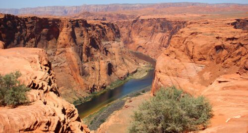
“Officials from the United States and Mexico announced Wednesday a Colorado River water-sharing deal for next two years as the basin continues to be overstressed by prolonged drought. The short-term deal, formally known as Minute 334, calls for Mexico to cut 250,000 acre-feet, or more than 100,000 Olympic swimming pools’ worth of water, in both 2027 and 2028. It also establishes an environmental work group and a pilot program to manage the salinity of Colorado River water as it reaches Mexico. “This Minute makes sure water is shared fairly among our users and protects the health of the Colorado River during these difficult times,” Chad McIntosh, commissioner of the U.S. section of the International Boundary and Water Commission, said in a news release. “Both countries deserve a lot of credit for agreeing to these water reductions and other measures.” … ” Read more from the Colorado Sun.
SEE ALSO:
- Statement from the Department of the Interior — Signing of Minute 334 between the United States and Mexico on Colorado River Operations for 2027 and 2028
- Mexico will share Colorado River shortage with Arizona, other states, from Arizona Central
- In a Time of Crisis, the U.S. and Mexico Renew Their Commitment to the Colorado River, from Audubon
What’s next for the Colorado River?
“For more than the last century, the flows of the Colorado River have been managed and dictated by the demands of a rapidly growing and changing West. There are founding legal documents, and then agreements stacked on those, often known as the “Law of the River.” These agreements are between states, between sovereign nations, including Tribal Nations and Mexico; between districts and companies and branches of the US Government. It’s hard to find the appropriate metaphor for how all of these agreements work together (and at times against one another) to manage the Colorado River system. But even fraught metaphors are sometimes the only way to get through something so complicated. … ” Read more from American Rivers.
Erin Brockovich: The Colorado River crisis has a blind spot
“We need to talk about the Colorado River. It feels like all I can think about as someone who lives in one of the seven states that depend on this 1,450-mile body of water. Arizona, California, Colorado, Nevada, New Mexico, Utah, Wyoming, many Tribal Nations, and Mexico rely on the river for our essential needs, including power and agriculture. … It’s that piece of growing the economy that I believe is the blind spot in this new plan for the Colorado River. It doesn’t mention data centers. Regulators built a rationing plan for a shrinking-but-vital water supply, while ignoring one of its fastest-growing new users. The fight in the Grand Canyon State has just begun. In late August, Arizona attorney General Kris Mayes called for a statewide pause on the approval and construction of new data centers, particularly hyperscale AI projects, asking state lawmakers and Gov. Hobbs to pass a moratorium. … ” Read more from the The Brockovich Report.
CAWCD Board convenes for September meeting – Authorizes legal action, if necessary, regarding Colorado River operations and approves ICS agreement with CRIT
“The Central Arizona Water Conservation District Board (CAWCD) met on Thursday, Sept. 3 at Central Arizona Project (CAP) headquarters in north Phoenix. The Board authorized CAWCD to protect and defend its rights should legal action become appropriate in the rapidly developing legal circumstances surrounding Colorado River operations. CAP’s statement can be found here. The Board also approved an agreement between CAWCD and the Colorado River Indian Tribes for the acquisition of Intentionally Created Surplus. This agreement is for Extraordinary Conservation Intentionally Created Surplus (EC-ICS) credits that were created through fallowing activities at the CRIT farm in 2019-2020. Under this agreement, the Central Arizona Groundwater Replenishment District (CAGRD) will be acquiring the right to take delivery of 9,009 acre-feet of EC-ICS from the CRIT ICS account. If transfer of the ICS proves infeasible, CAWCD and CRIT will execute a lease agreement for an equivalent volume of water on the same terms. Through this agreement, CAWCD and CRIT are also committing to seek additional opportunities to collaborate on mutually beneficial water governance and management partnerships. … ” Read more from the CAP’s Know Your Water News.
In national water news today …
EPA launches cutting-edge scientific study to strengthen nation’s understanding of potential pollutants in drinking water
 “Today, U.S. Environmental Protection Agency (EPA) announced a new scientific study using cutting-edge methods to improve the agency’s understanding of what pollutants may be present in drinking water. This groundbreaking new research by EPA scientists goes beyond traditional testing methods to screen for a broad array of pollutants, including pharmaceuticals, PFAS, and more than 1,000 potential contaminants. This action advances EPA’s commitment to help Make America Healthy Again while following gold standard science. “We have heard loud and clear that Americans are concerned about potential unknown pollutants lurking in their drinking water. The Trump EPA is committed to getting to the bottom of this, so that Americans can feel confident about the safety of their drinking water,” said EPA Administrator Lee Zeldin. “EPA’s state-of-the-art study will shed light on this issue and complement the actions we are already taking under the Safe Drinking Water Act. What we learn will provide clarity and peace of mind while guiding the agency’s continued efforts to Make America Healthy Again.” … ” Read more from the EPA.
The U.S. just saw its warmest summer on record. See where extreme heat dominated.
“The contiguous United States just experienced its warmest summer on record, according to data released Wednesday by the National Oceanic and Atmospheric Administration, with sweltering conditions driven by nights — particularly in the West — that would not cool. The average temperature from June through August was 74.4 degrees Fahrenheit across the Lower 48 and the District of Columbia, surpassing by 0.4 degrees the previous record set during a notoriously sweltering Dust Bowl summer of 1936. The records date to 1895. One of this summer’s most consequential trends unfolded at night. NOAA’s latest data found that 2026 was the warmest summer on record for minimum temperatures, breaking a record set in 2021. And a Washington Post analysis found that 133 million people live in counties where one out of every four nights were extremely hot compared with the previous 45 years. An additional 56.8 million people live in counties where at least one out of every four days was extremely hot, according to the Post analysis of PRISM weather data from Oregon State University from 1981 through 2026. … ” Read more from the Washington Post.

