
Several news sources featured in the Daily Digest may limit the number of articles you can access without a subscription. However, gift articles and open-access links are provided when available. For more open access California water news articles, explore the main page at MavensNotebook.com.
On the calendar today …
- WEBINAR: NOAA Drought Seminar Series: Exploring Drought and Wildfire from 10am to 11am. Vegetation naturally occurring across the landscape and vegetation planted in built environments from landscaping is stored energy for fire. This is depicted in global fire danger rating systems as fuels. Vegetation drying via soil moisture and atmospheric evaporative demand increases fire potential. While this drying establishes an underlying background condition, significant wildfire activity for a given season is dependent on other factors including the type of fuel (grasses versus timber), weather (the extent of heat waves and windy conditions), and topography (the classic fire behavior triangle). A wildfire season is nuanced in its relationship with drought. Did drought enable fine fuel (grass) availability or inhibit its growth? Was a snowpack drought mitigated by spring rains or a lack of summer heatwaves? Did plant evapotranspiration increase fuel flammability even though soil moisture was normal? In this virtual seminar, Tim Brown, Desert Research Institute and Western Regional Climate Center, will present on drought and its relation to fire given our current understanding from research and practitioner knowledge. Click here to register.
- MEETING: Environmental Flows Workgroup from 10am to 11am. The main agenda item is a presentation on operationalizing functional flows to inform and evaluate Flood-MAR diversion approaches. Click here for the agenda and remote access instructions.
- MEETING: Delta Protection Commission from 5pm to 6pm. The Delta Protection Commission will meet to discuss and potentially take action regarding the resubmittal of certification of consistency for the Delta Conveyance Project, and the formation of a two-member subcommittee to help advise the executive director on DCP-related activities, especially between Commission meetings. Click here for the agenda.
- IN-PERSON: Sonoma Water and USDA to host public meeting on proposed Matanzas Creek Dam Rehabilitation Project from 5:30pm to 7:00pm at the Bennett Valley Golf Course – Iron & Vine Restaurant, 3330 Yulupa Ave, Santa Rosa. Originally constructed under the 1958 Central Sonoma Watershed Work Plan, the Matanzas Creek Dam provides essential flood protection for the City of Santa Rosa and surrounding communities. To meet modern seismic and hydraulic design standards set by the NRCS and California’s Division of Safety of Dams, project leaders are proposing key structural improvements. The proposed rehabilitation work includes raising the main dam crest by 7.4 feet, raising the auxiliary spillway crest by 11.4 feet, and removing accumulated sediment area to restore original sediment storage capacity. Together, these improvements would strengthen the dam’s ability to withstand seismic activity and safely handle storm events, reducing flood risk for homes, businesses and infrastructure in Santa Rosa and the surrounding area.
- IN-PERSON: Healthy Coasts Project: Harnessing the power of floods and waves to more sustainably manage sediment for rivers and beaches from 6pm to 7:30pm in Irvine. The Healthy Coasts Project is a collaboration between UC Irvine and USGS researchers that engages a host of public agencies including Orange County Public Works, Orange County Parks, Orange County Water District, several municipalities in Orange County, and a number of federal partners. Our aim is to research the feasibility of transitioning Orange County’s flood infrastructure into a more sustainable system state marked my reduced management costs and greater riparian co-benefits (e.g., stormwater capture, nutrient processing, ecosystem health, natural sediment supplies to beaches). This talk will share recent research documenting changes to Orange County beaches and the role of rivers, waves and nourishment projects in shaping them, and I’ll discuss how we are viewing both the opportunities and challenges with the proposed transformation. If successful in Orange County, rivers all along the California coast could examine the potential for a similar transformation. Click here to register.
In California water news today …
California’s water picture is splitting down the middle, with full reservoirs clashing against a rapidly drying landscape.
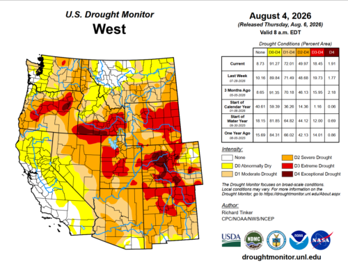 “As of July 31, 2026, California is experiencing a tale of two seasons. On one hand, major reservoirs are holding strong with robust water supplies leftover from prior wet periods. On the other hand, a relentless summer heatwave is rapidly drying out vegetation across the state. The latest numbers from the U.S. Drought Monitor released on July 30 reveal a sharp expansion of dry conditions. Roughly 65 percent of California is now classified as “abnormally dry”. This expanding dryness blankets much of Northern California, the Central Valley, and the Sierra Nevada. Even worse, official “moderate drought” has officially crept into far northern counties, including Humboldt, Siskiyou, Modoc, and Lassen. Climatologists point to intense summer heat and high evaporative demand—essentially, the atmosphere sucking moisture right out of the soil and plants. … ” Read more from the Sierra Daily News.
California at risk of ARkStorm, a 1,000-year megastorm caused by a 30-day lashing
“Scientists have issued a warning about a storm in California that could inundate residential areas with floodwaters as high as 20 feet and submerge everything between San Francisco and Los Angeles. This scenario has been named ARkStorm 2.0 and involves a chain of storms hitting the state one after the other, leading to a scene similar to the biblical flood, not only in name (ARkStorm – a direct play on Noah’s Ark from the biblical Genesis flood narrative) but also in the scale of devastation. ARkStorm stands for “Atmospheric River 1,000-year Storm” and was developed by the US Geological Survey (USGS) and federal, state and academic experts in 2010. The purpose was to help prepare for an extreme weather disaster driven by atmospheric rivers. These long and narrow corridors flowing in the sky carry water vapour from the tropics towards higher latitudes. When they reach California, ARs slam into coastal mountains or the Sierra Nevada, with condensation leading to heavy rain or snow. They are integral to the state’s water supply and weather, but a glitch can cause them to sometimes arrive in quick succession. This would trigger a deluge, floods of astronomical levels, and landslides. In the ARkStorm 2.0 scenario, multiple atmospheric rivers will slam into the West Coast over nearly 30 days, dumping huge amounts of rain and snow, the Daily Mail reported. … ” Continue reading at WION.
Charting a path for the San Joaquin Valley
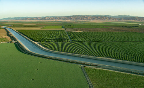
“California’s San Joaquin Valley is one of the most productive agricultural regions in the world. The valley accounts for about 60% of the state’s farm economy and produces an astonishing share of the nation’s fruits, nuts, and vegetables. But all this productivity depends on water, and most groundwater basins in the valley are critically overdrafted, which creates a host of problems. In a recent event examining new PPIC research on SGMA-ready crops, Geoffrey Vanden Heuvel of the Milk Producers Council explained. “We developed this huge agriculture palate that is the San Joaquin Valley over 100-plus years without any regulation of groundwater…That led to an unsustainable situation.” In his opening presentation, PPIC Water Policy Center research fellow Brad Franklin outlined how the 2014 Sustainable Groundwater Management Act (SGMA) seeks to rectify that by mandating that groundwater sustainability agencies bring basins into balance by the early 2040s. To comply with the law, as much as 900,000 acres of land may need to come out of irrigated production by 2040. … ” Read more from the PPIC.
Valley water managers pushback on proposed new $50,000-$250,000 state fee
“The state says it needs more money to police overpumped regions in the San Joaquin Valley and is considering a new fee that could cost water agencies between $50,000 to $250,000. That fee would be charged to groundwater sustainability agencies seeking exemptions from state enforcement measures. It would apply to new exemption requests as well as to agencies seeking to extend exemptions that have already been granted. Southern Tulare County water managers challenged the proposed fee during a July 30 workshop, saying the Water Resources Control Board hasn’t given updated details on its costs and how that money, and other fees, would be spent. “We’ve been invited to participate in this process, but there’s nothing for us to participate in if you don’t give us any budgets or any projections of fees,” Lower Tule and Pixley general manager Alex Peltzer said during the workshop. “If there’s an old budget, where is that? And what are the details of that?” … ” Read more from SJV Water.
Appellate court clarifies groundwater well permitting responsibilities
“In an August 4, 2026, decision (Russian Riverkeeper v. County of Sonoma), the California Court of Appeal determined that a county well-permitting ordinance satisfied the county’s public trust responsibilities, but that the ordinance was not exempt from California Environmental Quality Act (CEQA) review. … Sonoma County relies on more than 45,000 groundwater wells and issues roughly 320 well permits annually. Following the 2018 decision in Environmental Law Foundation v. State Water Resources Control Board — which held that counties share the state’s public trust duties when permitting wells that affect navigable waters — Sonoma amended its well-permitting ordinance (Chapter 25B) in April 2023. The amendment created a science-based Public Trust Review Area (PTRA) covering approximately 19% of the county, introduced discretionary review for wells within the PTRA, and established water conservation and metering requirements. Sonoma claimed the amendments were categorically exempt from CEQA under Class 7, Class 8, and the common sense exemption. Petitioners challenged both the public trust adequacy of the amendments and the CEQA exemption claims. … ” Read more from Hanson Bridgett.
Banking water underground for the next drought
“Storing water underground during wet years can soften the blow of drought, but it cannot promise a full supply when a dry spell drags on. That is the central finding of a study published in the August 2026 issue of the journal Groundwater for Sustainable Development. The University of Arizona Water Resources Research Center announced the research on August 7, 2026, last week. The study looks at a practice called managed aquifer recharge. In plain terms, that means deliberately putting water into the ground when supplies are plentiful. An aquifer is an underground layer of rock, sand, and gravel that holds water, a little like a giant sponge. Water banking takes that idea a step further. Instead of storing water for just a few months, a water bank saves it underground for years. When a drought hits, the operator pulls the water back out. The paper compares this to a household savings account, or to a home solar battery that keeps a reserve for a power outage. There is one key difference the authors point out. … ” Read more from Western Water.
Monitoring salmon from space: How a chance conversation grew into a partnership spanning two hemispheres
“California’s Central Valley was once a shifting mosaic of wetlands and floodplains, where rivers spread across the land each winter and drew back each summer. That rhythm fed young salmon and sustained a way of life for the Native American Tribes who have fished here since long before there was a California. Most of those floodplains are gone now, drained and cut off from the rivers that made them. Salmon have held on, and they remain a food source for Tribes and a livelihood for fishing families up and down the coast. Those families just went three straight years without a season due to low numbers. The same rivers now run through the hub of California’s water system: the Sacramento–San Joaquin Delta, which, through its connection to major State and federal water projects, supplies drinking water to over 27 million people and irrigates about 3 million acres of farmland. Now, California is investing in rebuilding wetlands and floodplains, because they are needed for salmon, a fish that is culturally and ecologically irreplaceable, and because they are essential for a healthy water supply for humans, not to mention their function in reducing flood risk for Central Valley communities. … ” Read more from the California Council on Science and Technology.
A new type of levee is taking root in Northern California
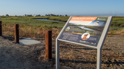
“Visitors to the Palo Alto Baylands Nature Preserve, captivated by gliding birds overhead and golden hills across the Bay waters, could be forgiven for failing to notice that the preserve is also home to the Bay’s newest levee. Most levees look like steep, barren embankments or riprap-clad seawalls, designed to prevent flooding by adding extra feet of height. But this project, though it shares a name, is a different type of infrastructure altogether. Seeded with over 35 species of native plants, the site is a pilot for what’s known as a horizontal levee, or living levee, blending into the estuary’s natural scenery as it spreads its feet of added height over a longer area. In stark contrast to a traditional levee, the Palo Alto Horizontal Levee Pilot Project’s natural appearance and gradual slope are designed to interact with Bay waters the same way natural estuaries do. “When you look at levees that are along the bay front, a lot of times they’ve got really steep faces and big, huge rocks in front of them to protect them from wind waves,” explained Mark Lindley, lead engineer on the Palo Alto living levee. “By having this flat, gradual slope with really dense vegetation on it instead of having rock, the waves break on that slope like they do on a beach.” … ” Read more from Grist.
New study introduces a transferable framework for evaluating the potential for Forecast-Informed Reservoir Operations in watersheds across the country
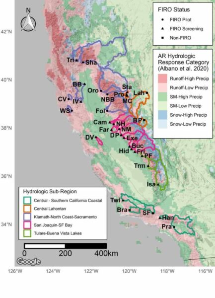
From Albano et al. 2025
“With extreme weather increasing around the world, scientists are working to help critical infrastructure, such as water management systems, adapt. On the U.S. West Coast, where both periods of prolonged drought and intense atmospheric river storms are common, effective water management can be particularly tricky. One strategy that water managers are now pursuing is known as Forecast Informed Reservoir Operations (FIRO). The method relies on increasingly accurate weather forecasts to improve water supply reliability without increasing flood risks to downstream communities. Rather than release water from reservoirs at the onset of the wet season, more water can be held in reservoirs until wet weather is forecasted, when it can then be released ahead of the storm to make room for incoming streamflow. This makes it possible to retain water in cases when rains never arrive, preserving water for the inevitable dry periods. Implementing this system at every reservoir isn’t yet possible, and evaluations of where weather and streamflow forecasts are advanced enough to use this strategy are ongoing. A new study helps advance the evaluation process by identifying the physical and operational constraints that influence how much forecast lead time would be needed to safely use FIRO at a given reservoir. … ” Read more from the Desert Research Institute.
California drew the line on regenerative agriculture. Farmers are making sense of it
“California has long been at the forefront of climate and environmental policy. Last year, the state became the first to officially adopt a statewide definition of regenerative agriculture. The move reinforces the state’s climate goals, which identify natural and working lands as a key part of reaching carbon neutrality. “This was about aligning state policy and programs, especially our grant programs, around a shared definition throughout our state government,” said California Department of Food and Agriculture Secretary Karen Ross. California’s resulting outcome-based framework focuses on eight key areas that aim to improve and restore soil health. Environmental leaders say healthier soils can store more carbon, improve water retention during drought and make farms more resilient to climate change. While the definition outlines the results, it does not prescribe the specific practices to achieve them, leaving farmers, researchers and policymakers to navigate what regenerative agriculture looks like across California’s diverse farming ecosystem. … ” Read more from Capital Public Radio.
Bipartisan Senate bill aims to safeguard the U.S. West’s water supply through expanded desalination funding
“Facing persistent drought and mounting water scarcity across the Sun Belt, a bipartisan pair of Western senators introduced legislation to reauthorize and expand federal funding for desalination research and facility construction. The Desalination Reauthorization Act, sponsored by U.S. Sens. Alex Padilla (D-Calif.) and John Cornyn (R-Texas), would extend the Bureau of Reclamation’s programmatic authority to fund local desalination initiatives — a mechanism set to expire later this year without congressional action. If the programmatic approval lapses, every new desalination project in the country would require an individual act of Congress for authorization. Lawmakers warn that such a bureaucratic hurdle would trigger significant project delays and drive up costs for municipalities seeking fast relief from water shortages. “Access to safe and clean drinking water is a human right, and investments in desalination programs will help us provide drinking water to millions of Americans in need,” Padilla said, pointing to California’s need to adapt to escalating environmental pressures. … ” Read more from the Imperial Valley Press.
California could see the highest sea levels on record this year, thanks to El Niño
“California could see the highest sea levels on record this year, thanks to a historic El Niño, climate change and extreme tides. It’s the latest forecast for what’s expected to be a historically strong season, one that could cause major flooding and widespread damage in the Bay Area. “Folks who really think about coastal risks are very concerned that the single highest sea levels are quite possible this winter in California, and that is going to be a problem,” said Daniel Swain, a climate scientist with UC Agriculture and Natural Resources, during an online talk on Monday. “This is almost certainly going to happen.” The warning comes as the National Weather Service on Monday warned king tides may cause minor flooding along the Marin County coastline and along Bay Area shorelines this week through Thursday morning. … ” Read more from KQED.
El Niño alters marine life in the Pacific
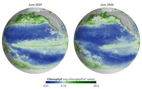 “As of June 2026, El Niño has officially arrived. This naturally recurring phenomenon is characterized by warmer-than-normal water temperatures in parts of the equatorial Pacific along with changes to atmospheric and oceanic circulation patterns. Its regional effects range from desert floods to delayed monsoons to shifts in where tropical cyclones are more likely to form. NOAA’s Climate Prediction Center expects the current El Niño to continue to strengthen through the end of 2026, with a 97 percent chance of lasting through early Northern Hemisphere spring 2027. Even during El Niño’s early stages, satellites have observed characteristic changes along the equatorial Pacific, such as warmer-than-normal sea surface temperatures and higher-than-normal sea surface height. Among the first ecological downstream effects are changes to the marine food web. The maps above show chlorophyll-a concentrations—the pigment present in most phytoplankton—as observed by the OCI (Ocean Color Instrument) on NASA’s PACE (Plankton, Aerosol, Cloud, ocean Ecosystem) satellite. In June 2025 (left), conditions were neutral, while in June 2026 (right), El Niño was strengthening. … ” Read more from NASA/JPL.
Trump’s review of California coastal authority brings out major opposition
“Hearings being held this week could decide whether California continues to have a say over what happens in federal waters off the state’s coast. It’s part of the Trump administration’s efforts to supercharge industrial activities, including offshore drilling, rocket launches and desalination plants along California’s coast. At a hearing Monday at a Santa Monica hotel and at a news conference beforehand, speaker after speaker decried any effort that would allow the federal government to revoke California’s ability to manage its coast. A federal law called the Coastal Zone Management Act gives states with coastlines the right to review and veto projects that may conflict with state policies and economies. The law was signed by President Richard Nixon after a devastating oil spill off the coast of Santa Barbara and is credited with launching the modern environmental movement. More than 50 years later, the federal government has called for a detailed review of California’s compliance with the 1972 law. … ” Read more from the LAist.
Governor Newsom announces new AI cyber defense program to protect California’s critical infrastructure
“Strengthening California’s defenses against emerging artificial intelligence-enabled cyber threats, Governor Gavin Newsom today announced a first-in-the-nation initiative to protect state assets and critical infrastructure while advancing responsible AI innovation. Building on California’s nation-leading 2023 and 2026 Executive Orders on Artificial Intelligence, the Governor is directing state agencies to establish an AI Cyber Defense Program, strengthen cybersecurity coordination across state government, expand AI-enabled defenses for critical infrastructure and local governments, and improve preparedness for emerging AI cybersecurity incidents. “The digital environment is rapidly evolving before our eyes,” said Governor Newsom. “Attacks are faster, more sophisticated, and more frequent, putting at risk the basic systems families count on. California can either wait for the next crisis, or we can build the kind of defenses this moment demands. We are choosing to build.” … ” Continue reading this press release from the Office of the Governor. … ” Read more from Office of the Governor.
In commentary today …
Peter Gleick: Drought, water rationing and dry rivers: our water crisis is here
“Disturbing news about our water resources is now constant and unrelenting. In just the past few weeks, media have reported that Puerto Rico is suffering a deep water crisis as severe drought has cut water supplies to thousands. The Rhine and Po rivers in Europe are at record low levels. The seven states sharing the Colorado River in the US are fighting over unprecedented shortages, while its major reservoirs have shrunk to their lowest levels since they were built. Hungary’s only nuclear power plant is on the verge of shutting down because there isn’t enough water in the Danube River to cool it. Toxic chemicals have been found in all English water bodies. … At any given moment, there are always places around the world suffering from droughts or floods or experiencing water scarcity – a normal consequence of the natural variability of our climate and weather. But what we’re experiencing now is not normal; it is the direct consequence of accelerating human-caused climate changes, on top of decades of neglect and underinvestment in our water institutions and infrastructure. … ” Read more from the Guardian.
In regional water news and commentary today …
NORTH COAST
Fish on! After three years of no salmon at the Klamath salmon festival, a limited number of plates will once again be graced with chinook this weekend
“After four long years, the Yurok Tribe will be serving traditionally cooked salmon at the 62nd Annual Klamath Salmon Festival on Saturday, August 15. “We are especially excited about this year’s event because the return of salmon and the Klamath River’s continued recovery give us much to celebrate,” said the festival’s co-organizer Maya Mace. “We invite everyone to join us in celebrating the mighty Klamath River salmon.” The 2026 Salmon Festival is free to attend and open to all. The family-oriented event offers something fun for everyone. The festival includes a Ney-puy Fun Run/5K, a parade, live music by Blue Rhythm Revue, Indian Card Game, Stick Game, basketball, softball, horseshoe and disc golf tournaments and more than 170 vendors selling high-quality gift items. … ” Read more from the Lost Coast Outpost.
U.S. Rep. Huffman tours Eel River restoration project
“U.S. Rep. Jared Huffman (D-San Rafael) spent last Thursday evening touring the Russ Creek and Centerville Slough Restoration Project, a 1,540-acre project at the mouth of the Eel River Estuary northwest of Ferndale. A Wildlands Conservancy project, undertaken in collaboration with the Humboldt County Resource Conservation District, Natural Resources Conservation Service, U.S. Fish and Wildlife Service, engineering consultants with GHD, construction firm Mercer-Fraser and landowner Jay Russ, among other stakeholders, the Russ Creek and Centerville Slough Restoration Project purports to be one of the largest coastal restoration efforts in California. It’s also a unique project insofar as it is on privately owned land, and in addition to reestablishing 550 acres of continuous floodplain and tribal habitat, it will allow for the preservation and improvement of adjacent agricultural lands — working across multiple plots of private property to address systemic tidal connectivity and drainage challenges along a rapidly subsuming reclaimed agricultural landscape that was once important brackish marshland habitat. … ” Read more from the Eureka Times-Standard.
SACRAMENTO VALLEY
Corning: Clean-up at toxic, fire-battered Specialized Fibers site completed
“It took a while, but Tia Branton, Tehama County Environmental Health Director, reported to the Board of Supervisors in mid-July that the fire-damaged Specialized Fibers site is, “as clean of a slate as we can make it for the new owners.” Work started in May at the site on South Avenue that was ignited back in 2018 and burned for several weeks. Fire crews pushed the debris into tall piles; the property was owned by Bucky Lee, Inc. and operated by Omega Waste, Inc. It was formerly owned by Robert O’Connor, who died in 2020 and left his wife Karen O’Connor to deal with the devastation, both in the courtroom and at the blackened facility. After the fire, investigators found large amounts of hazardous materials, including above-ground storage tanks containing regulated materials such as paint sludge, used motor oil, acetylene tanks, oxygen gas tanks, and petroleum products, in violation of state hazardous waste laws. … ” Read more from the Corning Observer.
Chico commentary: Water usage is everybody’s business
Cheetah Tchudi writes, “The passage of the Sustainable Groundwater Management Act (SGMA) in 2014 marked California’s first steps toward sustainable management of our groundwater resources. Reliable groundwater access is critical for drinking water supplies, healthy ecosystems, and the success of small-scale farms and agricultural production. Local Groundwater Sustainability agencies around the state are tasked with creating plans for groundwater management, with the goal of balancing our water use and reaching sustainability by 2040. The Vina Groundwater Subbasin, which encompasses Chico and Durham, is 98% dependent on groundwater. Historically we have pumped out more groundwater than can be replenished by precipitation and snowpack; this is called groundwater overdraft. Over the last 24 years we overdrafted the Tuscan Aquifer by an average of 4.5 billion gallons a year, every year. While we have experienced a few wet years recently that have helped replenish groundwater, the overall trend shows declining groundwater levels. … ” Read more from the Chico News & Review.
NAPA/SONOMA
Napa bosses slap water fees on struggling wineries to achieve lefty ‘green’ goals
“Napa Valley’s already struggling wine industry is being slapped with a new groundwater bill as county officials scramble to meet California’s state-mandated sustainability goals. Even grape growers who don’t pump groundwater will have to cough up $17.53 for every planted acre under proposed fees for the 2026-27 fiscal year, the Napa Valley Register reported. Those who actually use groundwater for irrigation face another $26.91 per acre, taking their total hit to $44.44. County officials argue that even growers who dry-farm or use surface or recycled water benefit from having groundwater available, according to the outlet. The new charges will help fund the Napa County Groundwater Sustainability Agency, which California requires to meet sustainability goals for the aquifer running beneath the valley from Calistoga to south of Napa. … ” Read more from the New York Post.
BAY AREA
Coalition sues over illegal delays for SF Bay white sturgeon protections
“Today, San Francisco Baykeeper, Restore the Delta, the California Sportfishing Protection Alliance, and Friends of the River filed a lawsuit against the California Department of Fish & Wildlife (CDFW) for postponing required actions under the California Endangered Species Act (CESA) for San Francisco Bay’s White Sturgeon. The groups are represented by the law firm Lozeau Drury. According to CDFW, San Francisco Bay’s White Sturgeon population has plummeted by more than 80% in the last 30 years. Insufficient freshwater flows, poor water and sediment quality conditions, overharvesting, dredging, and algae blooms have all played a role in this decline. In 2023, the nonprofit plaintiffs filed a petition to the California Fish and Game Commission (Commission) to officially list the White Sturgeon as threatened under CESA. Under CESA, CDFW is required to publish a formal review assessing the need for protection under the law; for White Sturgeon, that status review was due in January 2026. The formal review is then followed by a final determination from the Commission. However, CDFW has failed to produce the required status review. … ” Read more from the Department of Fish and Wildlife.
San Francisco’s rain gardens mean fewer chemicals in the Bay
“Controlling stormwater flow has extra urgency in some cities. In those with a single system of pipes collecting both stormwater and wastewater, too much stormwater can exceed system capacity. If this happens, untreated and incompletely treated wastewater can be released into rivers and lakes. This adds to concerns about lawn chemicals, heavy metals, oil, fecal matter, soaps and other material carried in rainwater runoff. There are about 700 communities in the U.S. with “combined” sewer systems. The great majority are in the Northeast. San Francisco’s combined system is the only one on the California coast, says Willis Logsdon, senior watershed planner for the San Francisco Public Utilities Commission. (A “watershed” is a land area that drains rainfall and melted snow into creeks and rivers that feed bodies including lakes, bays and oceans.) … ” Read more from Governing.
Pleasanton council set to discuss $16.5 million water revenue bonds
“The Pleasanton City Council is set to hold a special meeting Tuesday to discuss several noteworthy items, including a resolution that could declare the city’s intent to issue $16.5 million in water revenue bonds in order to finance all of, or a portion of, the city’s planned capital improvements projects related to its water system. These projects are part of the city’s efforts to improve several aspects of the city’s water system. The overall effort is collectively referred to as the “2026 Water Project”, according to the Aug. 11 City Council staff report. The projects were previously approved by the council through the five-year water capital improvement program. “The 2026 Water Project will improve water system capacity, reliability, and supply diversification, including advancing the City’s efforts to restore local groundwater production by developing new wells,” according to staff. … ” Read more from Pleasanton Weekly.
SAN JOAQUIN VALLEY
Kings County groundwater agencies closer to coordination as last entity signs on for region-wide efforts
“The fifth of five groundwater agencies in Kings County officially committed to a region-wide planning effort that water managers hope will fend off the potential of state regulators mandating how much farmers can pump. Over the summer four of the five GSAs in the Tulare Lake subbasin, which covers most of Kings County, agreed to work on a single groundwater management plan and hired two engineering firms to get the job done. The Southwest Kings Groundwater Sustainability Agency (GSA) was the final GSA to agree. At its August 7 meeting, Southwest agreed to join the region-wide effort, rather than writing its own plan. The board agreed unanimously and without comment. … ” Read more from SJV Water.
Water settlement: You could say ‘it ain’t over ’til it’s over’
“In September 1973, baseball legend Yogi Berra was managing the Mets, and they were behind in the standings. “It ain’t over ’til it’s over,” Berra famously said. His words come to mind when considering the settlement of water issues announced by the city of Tehachapi and the Tehachapi-Cummings County Water District on July 27. Locked in conflict since at least September 2021, with four court cases pending, the two public agencies said in a news release that they had “reached agreement on a settlement that is fair and equitable to both sides.” Their 28-page settlement agreement, released Aug. 5, shows there is more work to be done, including multiple court filings. … ” Read more from the Tehachapi News.
EASTERN SIERRA
Clean Up The Lake to lead Upper Twin Lakes environmental cleanup
“Mono County and non-profit Clean Up The Lake (CUTL) have launched the Upper Twin Lakes Cleanup Project near Bridgeport, California this week. The initiative expands CUTL’s mission to safeguard freshwater ecosystems by removing submerged debris and mobilizing communities to protect fragile underwater environments. Mono County extends its deepest gratitude to Clean Up the Lake for bringing this vital stewardship project to our region and expanding their conservation efforts across Eastern Sierra waters. As a treasured destination for anglers, boaters, campers, paddlers, and outdoor enthusiasts, Upper Twin Lakes is both an invaluable natural resource and an area particularly susceptible to the long-term impacts of heavy recreation. This new project builds directly upon findings from CUTL’s July 2025 pilot efforts—which revealed significant amounts of hidden, submerged debris beneath the surface—and addresses a critical need for ongoing cleanup and monitoring in the Twin Lakes system. … ” Read more from the Sierra Wave.
SOUTHERN CALIFORNIA
Toxic site near South L.A. homes finally faces state cleanup order
“The California toxic substances agency has ordered the cleanup of a site in the Central-Alameda neighborhood of Los Angeles, citing what “appears to be a major source of contamination” that “may present a substantial hazard to human health.” Four Star Chemical and American Labs operated in the late 1970s and 1980s at 5701 Compton Ave. handling hazardous waste. When the site was last tested, solvents were found in the soil below the pavement and down 150 feet. The company has been closed for 38 years. “You smell all types of stuff around here,” said Barry Jenkins, a resident who has lived in the neighborhood for more than 50 years. “It smells like a chemical.” It’s nauseating, he said. The businesses had two 3,000-gallon waste storage tanks on site and an additional 4,000-gallon tank for treating waste. There also was waste stored in drums. … ” Read more from the LA Times. | Read via Yahoo News.
IMPERIAL/COACHELLA VALLEYS
Desert Water Agency increases bill assistance program
“Desert Water Agency (DWA) is expanding its Help2Others billing assistance program, giving income eligible customers a one-time $300 credit per 12-month period to help pay their water bills. The annual assistance amount went from $200 to $300, which can cover about two months of an average residential water bill. The change went into effect July 1, 2026. “At Desert Water Agency, we understand that our customers may face hardships that make paying their bills difficult,” said Board President Kristin Bloomer. “We hope that by increasing the amount of assistance available through our Help2Others program, we can ease some of that burden.” … ” Read more from the Uken Report.
Imperial Irrigation District board approves $19.3 million overhaul of Drop 3 hydroelectric unit
“The Imperial Irrigation District Board of Directors approved a $19.3 million overhaul of Unit 2 at the Drop 3 Hydroelectric Plant on the All-American Canal, according to an Aug. 7 IID press release. The 5-megawatt unit has been in service since 1966. The project will replace and rehabilitate major turbine and generator components that have operated for decades, restoring the unit’s generation capability and extending its service life, IID said. “Drop 3 represents the historic connection between IID’s water and power services,” IID Board Chairwoman Karin Eugenio said in the release. “Modernizing this essential infrastructure will strengthen reliability, preserve an important source of renewable energy and prepare the unit to continue serving our communities well into the future.” … ” Read more from the Desert Review.
SAN DIEGO
Popular North County beach loses most of its sand amid heavy swells
“Strong swells and high tides have eroded significant portions of sand from a North County beach in recent weeks, prompting lifeguard tower relocations, parking lot closures, and concerns from beachgoers. In Carlsbad, the erosion has been most dramatic at Tamarack State Beach. In a span of a few weeks, the popular surf spot has lost much of its sand, turning into a rocky shoreline. Lifeguard towers have been relocated and 35 parking spots have been blocked off. Madelyn Morgan, visiting from Huntington Beach, said the scene was not what she expected. “Definitely sad to see,” Morgan said. “Does take away a little. I’m glad to be sitting on the rocks, but, of course, I would love to be on the sand.” … ” Read more from Channel 10.
Along the Colorado River …
Hoover dam is losing power. Inside the ‘slowest-moving train wreck in history’
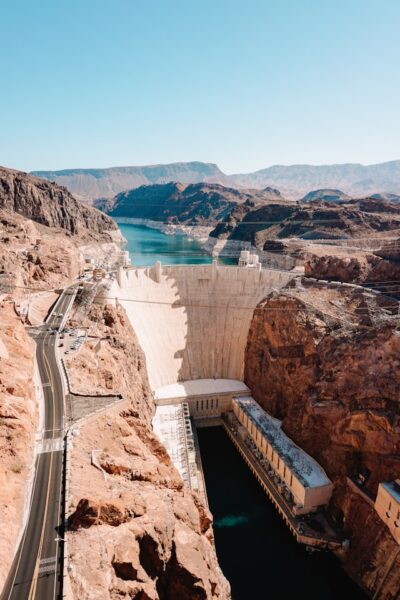 “From the rim of Lake Powell, you can’t see the danger line. There isn’t a flashing gauge or a chart on the canyon wall that warns visitors when one of the most important machines in America begins to fail. There’s only an invisible number: 3,490 feet above sea level. Engineers call it “minimum power pool.” Above that elevation, Lake Powell can still push water through Glen Canyon Dam’s massive penstocks, spin its turbines, and send electricity across the Southwest with no trouble. Below it, the dam loses the function that helped justify its existence. The river still wants to move, but the machine starts running out of ways to move it. Glen Canyon Dam and Lake Powell sit near the center of the Colorado River system, upstream from Hoover Dam and Lake Mead. Together those reservoirs store the water that cities, farms, and power plants across the Southwest depend on. Now the entire system is being pushed past its limits, and Lake Powell is where the cracks are really starting to show. … ” Read more from Popular Mechanics.
Lake Mead, nation’s largest reservoir, hits record low
“Water levels at Lake Mead are now the lowest they’ve been since the nation’s largest reservoir filled about 90 years ago. It’s a striking new milestone for the reservoir held back by Hoover Dam, which straddles the Arizona-Nevada border. More than two decades of drought and climate change have cut back on water supply in the Colorado River system, and policymakers have struggled to rein in demand accordingly. As a result, the massive reservoir that stores water for Phoenix, Los Angeles, Las Vegas and a sprawling agricultural industry has been left about a quarter full. Water is expected to keep safely passing through Hoover Dam for use downstream despite the low levels, but the shrinking reserves could soon harm hydropower production inside the dam. … ” Read more from KJZZ.
Deadpool Data Dump: The Western water situation is dire
“No, Lake Powell’s not that close to actual dead pool — or the level at which water can no longer be released downstream. At least not yet. But it is now within 20 feet of de facto deadpool, or 3,500 feet, which is the surface elevation the feds have said they will “defend” to keep Glen Canyon Dam viable. Besides, in this case I’m using “deadpool” somewhat metaphorically to describe the current state of water on the Colorado River and the rest of the West, which is about as dire as “deadpool” sounds. It’s normal for streamflows to drop in August as the last remnants of high-country snow disappear in the dog-days sun. But since most of the snow was gone by late June, and the monsoon has thus far dropped in only for brief, violent, and occasional visits, almost every creek and river in the West is flowing far below median levels for this time of year. The water is also unusually warm, which is bad for fish. The Animas River in Durango, for example has climbed up into the 70° F territory every day for the last several weeks. … ” Read more from The Land Desk.
Commentary: Large scale desalination could help resolve Colorado River shortage
Edward Ring, director of water and energy policy for the California Policy Center, writes, “The operating agreements that govern Colorado River allocations expire at the end of this year, and negotiations between the seven states that share the water are stalled. With the federal government poised to step in and impose an agreement it formulates, the states — Colorado, New Mexico, Utah, and Wyoming in the upper basin, and Arizona, California, and Nevada in the lower basin — have asked for more time. … Opponents of desalination claim that it’s costly, wastes energy, and exerts a negative environmental impact. But these objections don’t hold up to modern realities. When put in the proper perspective, the energy cost for desalination is reasonable. State-of-the-art seawater desalination plants would require 3,500 gigawatt-hours to produce 1 million acre feet of fresh water. In California, that is roughly the same amount of electricity that is required to pump 1 million acre feet of water over a distance of 400 miles from the Sacramento–San Joaquin Delta through the California Aqueduct, over the Tehachapi Mountains, and into the Los Angeles Basin. Put another way, 3,500 GWh is equal to barely more than 1 percent of California’s current electricity consumption. …. ” Read more from Edward Ring.
Grand County gains access to historic water right to boost Colorado River flows
“For the first time, Grand County can call upon a water right to increase streamflows in the Colorado River while providing environmental, agricultural and recreational benefits to the county. Under a new Operational Framework agreement, Grand County can release up to 10,000 acre-feet, or about 3.3 billion gallons, of water annually from the Colorado-Big Thompson Project, according to a joint news release from Grand County and the Northern Colorado Water Conservancy District (Northern Water). “It’s not very often, if at all, that the county would get access to this amount of water,” Stahla said. … ” Read more from the Grand Junction Sentinel.
Oh Shell No: Colorado Parks and Wildlife works to stop the spread of invasive zebra mussels infecting the Colorado River
“In Colorado, water is critical. But what’s spreading in the water on the western slope has experts concerned. Now, the fight to contain zebra mussels has become a priority around the state for Colorado Parks and Wildlife. Water is precious in the centennial state. A treasure sought constantly by fisherman and Grand Junction area realtor Zach Avila. “It’s gorgeous,” Avila said. “We fish four days a week probably.” When fish are willing to take a bite from his homemade bait, Avila makes East and West Lake his office. … ” Read more from Channel 9.
In national water news today …
‘Frightening’ cyberattacks on water utilities renew calls for regulations
“The coordinated series of cyberattacks launched on U.S. drinking water and wastewater utilities across the country in recent weeks has alarmed lawmakers on Capitol Hill — but it remains to be seen whether the threat will be enough to break the impasse over mandating basic security standards for the sector. The vulnerabilities that hackers have been exploiting to attack water systems in at least 30 systems across 12 states were well known and could have been easily identified and addressed with simple fixes, cybersecurity experts say. But for the better part of two decades, efforts to require the nation’s drinking water and wastewater systems to meet minimum cybersafety standards have been stymied by lawmakers’ reluctance to force new requirements onto the country’s smallest water systems. Now, that reluctance is being tested as pressure mounts to address the alarming vulnerabilities laid bare in Minnesota, Michigan and other states in attacks that a water sector security group said Thursday are “ongoing and expanding.” … ” Read more from E&E News.
As above, so below? Trends in groundwater and streamflow across the United States 1980-2020
“Joint trend analysis of streamflow and groundwater on a national scale is a critical step toward understanding how national water budget components respond concurrently and interactively to environmental drivers. A new USGS study shows that groundwater and streamflow don’t always respond to drivers of change in the same way. Climate, land-use, and disturbance are driving long-term global trends in groundwater levels and streamflow. At large scales, these trends are typically considered separately, despite the well-established concept that groundwater and surface-water comprise a single resource. A new USGS study examined trends in groundwater and surface water through time from 1980 to 2020 as a basis for more holistic understanding of the drivers of water availability over large spatial scales. … ” Read more from the USGS.
EPA stalls long-planned nitrate cancer review as pollution crisis grows
“The US Environmental Protection Agency (EPA) has backed off its re-assessment of cancer-causing nitrates despite decades of research suggesting the contaminant is more harmful than previously thought and that nitrate pollution is at crisis levels in US drinking water. The agency would not confirm the assessment was cancelled, but the work has been stagnant for more than two years and the department responsible for it was eliminated. And scientists and health advocates say regardless of whether it has been cancelled or is locked in a lengthy delay — Americans are paying the price with their health. The EPA set a threshold for nitrates in drinking water more than 30 years ago at a level designed to avoid harming babies after research showed that ingesting nitrates could trigger dangerously low oxygen in babies’ blood, what’s known as “blue baby syndrome.” The EPA announced it would re-assess nitrates — and nitrites — in 2017 to look at other potential health impacts, including cancer, but the work was suspended in 2019 by the first Trump administration. The Biden administration re-started the work, and the EPA accepted public comments on the planned assessment in 2023 but the agency hasn’t provided an update since. … ” Read more from Circle of Blue.

