
Several news sources featured in the Daily Digest may limit the number of articles you can access without a subscription. However, gift articles and open-access links are provided when available. For more open access California water news articles, explore the main page at MavensNotebook.com.
On the calendar today …
- HYBRID: Interweaving Traditional Knowledge Roundtable Series: Tribal Beneficial Uses: An Explainer and Applications from 1pm to 2:30pm. Co-hosted by the Delta Stewardship Council, the Shingle Springs Band of Miwok Indians, and the California Indian Environmental Alliance, this three-part series will bring together Tribal Elders and leaders, agencies, and scientists to share experiences, discuss challenges, and explore practical approaches to interweaving Traditional Knowledge, management, and science. This is the second of three workshops. The topic is Tribal Beneficial Uses: An Explainer and Applications. View the flyer. View the agenda. Register via Eventbrite. To attend virtually on Zoom, register here.
In California water news today …
High-severity fires burn 30 times more acreage than 40 years ago, researchers find
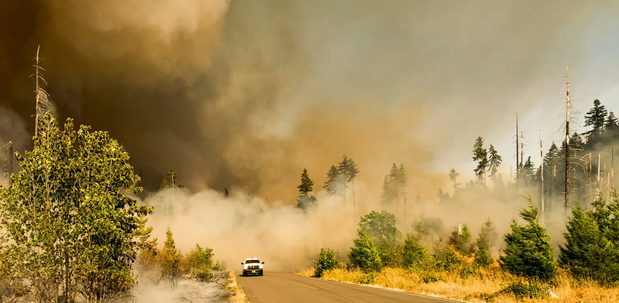 “Forest fires now burn ten times more acreage annually than in 1985, while wildfire severity has gotten even worse. In California, 30 times more acreage burned from high-severity, forest-killing fires, according to new UCLA research. In the 1980s and 1990s, California’s forest fires burned mostly at low or moderate severity, generally benefiting ecosystems. But as fires have grown in size, severe fires causing widespread tree death have overtaken beneficial fire as the most common fire type in California’s forests. The study, published June 22 in the journal PNAS, found that the changes are tied to the increasingly warm and arid environment. These aridity-driven changes were also stronger in more densely forested areas, said UCLA bioclimatologist and senior author Park Williams. … ” Read more from YubaNet.
These fire-spotting satellites could find wildfires before they become disasters
“The U.S. wildfire season got off to a roaring start this year. By the end of June, more than 3 million acres had burned across the country, which is 157% of the previous 10-year average. Fortunately, wildfire responders are about to have a wealth of new data at their disposal. California-based Muon Space has launched the first three operational satellites for Earth Fire Alliance’s (EFA) FireSat constellation. EFA bills FireSat as the first constellation designed specifically for wildfire detection, monitoring, and response. The three satellites launched from Vandenberg Space Force Base aboard SpaceX’s Transporter-17 mission on Tuesday. About two hours after deployment, Muon Space confirmed the satellites were healthy and had established contact with ground operators. This launch was made possible by the success of the Protoflight mission, which sent a demonstration FireSat to orbit in March 2025. … ” Read more from Gizmodo.
The role of water conservation in California’s residential growth
“California is the most populous state in the union and continues to experience long-term population growth: California Department of Finance estimates suggest that there are 39.5m residents in the state as of 2026, with projections suggesting the state will hit 40m residents by 2030. California’s urban water system is shaped by competing demands from households, industry, and agriculture alongside a time and regionally variable water supply. As the population grows, so does residential water demand. In this context, water management and residential growth are inextricably linked. California’s Urban Water Management Plan positions water conservation as a core strategy for managing residential growth and urban demand; the question for the future is not whether conservation is necessary, but how it can support future growth sustainably. … ” Read more from the Daily Cal.
Agriculture leaders discuss state policy impacts
“On July 10, the Kern County Farm Bureau hosted a Tailgate Talk in Bakersfield, California, to discuss recent agricultural policy developments as well as the growing concerns over the state’s predator recovery initiatives. KCFB’s Tailgate talks are informal educational discussions that allow local agricultural leaders to engage with industry experts and stay informed on issues affecting Kern County agriculture. The recent Tailgate Talk included presentations by Richard Filgas, the assistant director of policy advocacy at the California Farm Bureau, and Julie Finzel, the livestock and natural resources advisor serving Kern, Tulare, and Kings Counties at the University of California Cooperative Extension. California Assemblyman Stan Ellis was also in attendance to discuss his proposed bill on wildfire prevention — AB 2410. … ” Read more from Valley Ag Voice.
Dairies say state’s draft plan to protect valley groundwater from nitrates is too costly
“A new regulatory effort to protect Central Valley communities from nitrate pollution in their groundwater has drawn opposition by dairy farmers who say the proposal is too costly for an industry already struggling financially. The State Water Resources Control Board says dairies are diverting so much cow manure onto their own cropland that nitrate levels are rising in underground aquifers. Its proposed solution is to limit such releases, partly by having dairies send manure to other farmers that can use it responsibly. … ” Read more from the Bakersfield Californian.
Can we predict deadly cliff collapses along the California coast? Scientists say it’s possible
“Researchers have figured out how to develop hurricane warnings, tsunami warnings, even an earthquake early warning system. But when it comes to predicting cliff collapses along California’s iconic shoreline, the science has been infamously tricky to pin down. But with every dramatic landslide and tragic death along the coast, officials have turned to scientists for help. Is it possible, many have wondered, to foresee when and where a bluff might collapse — and perhaps even turn these predictions into early warning alerts? Now, after an innovative pilot study backed by decades of specialized research, scientists at UC San Diego’s Scripps Institution of Oceanography say they may have cracked the code. In a report released this month, the team shared a proof of concept and found that there are remarkably reliable ways to detect a coastal landslide well before it happens. … ” Read more from the LA Times.
Trump reduces size of 2 national monuments in Utah as Republicans reshape land management
“President Donald Trump on Monday sharply reduced the size of two national monuments in Utah, undoing protections established by his Democratic predecessors on public lands that are sacred among many Native Americans. Bears Ears and Grand Staircase-Escalante national monuments in southern Utah have ancient cliff dwellings, petroglyphs and scenic canyons, as well as coal and uranium deposits that state officials want made available for development. Trump, a Republican, issued proclamations under the Antiquities Act to reduce their size by about 90% each. He took similar actions during his first term, but those were reversed by President Joe Biden, a Democrat. The latest move comes as Trump and other Republicans have drastically reshaped the management of vast taxpayer-owned lands concentrated in Western states. Trump administration officials and congressional Republicans have sought to expand drilling, mining and logging on public lands, while removing protections for imperiled species and rolling back rules for conservation. … ” Read more from the Associated Press via the Colorado Sun.
In commentary today …
Trump greenlights California’s dumbest water project
LA Times columnist Michael Hiltzik writes, “On July 9, the Trump administration delivered a gift to Cadiz Inc., a politically well-connected firm that has been trying for decades to win approval for a scheme to pump water out of the Mojave Desert and market it to water agencies across the Southland. The administration approved the company’s application to convert an abandoned 220-mile oil and gas pipeline crossing the desert to carry water instead. Susan Kennedy, the chief executive of Cadiz, called the approval “a pivotal milestone” that would enable the project to move into its construction stage. Here’s betting that Kennedy’s statement was somewhat premature. The project still faces significant opposition from environmentalists, local Indian tribes and the state of California. It has been declared ready to go — and declared dead, too — so often that it could serve as a character in a zombie movie or streaming series. … ” Read more from the LA Times.
The experience of climate change captures dangerous shift better than numbers
On July 1, my neighbor gave birth to a baby girl. I met her a few days later, sleeping outside on her aunt’s lap on a hot, hazy evening in Northwest Denver. I ignored another air quality alert on my phone and complimented her full head of hair. I am nearing 30 years old; I remember summers free of wildfire smoke and ozone-alerts. Will she? “Shifting baseline syndrome” refers to the gradual change in accepted norms across generations. In 1995, a marine biologist coined the term to describe the acceptance of deteriorating fishery health caused by the absence of an established ecological baseline. But shifting baseline syndrome can be applied much more generally: The version of the natural world that younger generations consider normal and acceptable may be worse compared to that of their parents, and significantly worse than that of their grandparents, compounding over generations. A potential consequence of widespread shifting baseline syndrome is lowered expectations for environmental quality that lead to unambitious conservation policies and programs. … ” Continue reading from Colorado Newsline.
In regional water news and commentary today …
NORTH COAST
Rain swept ash from a scorched California mountainside into the Klamath River and silently suffocated it for five hours
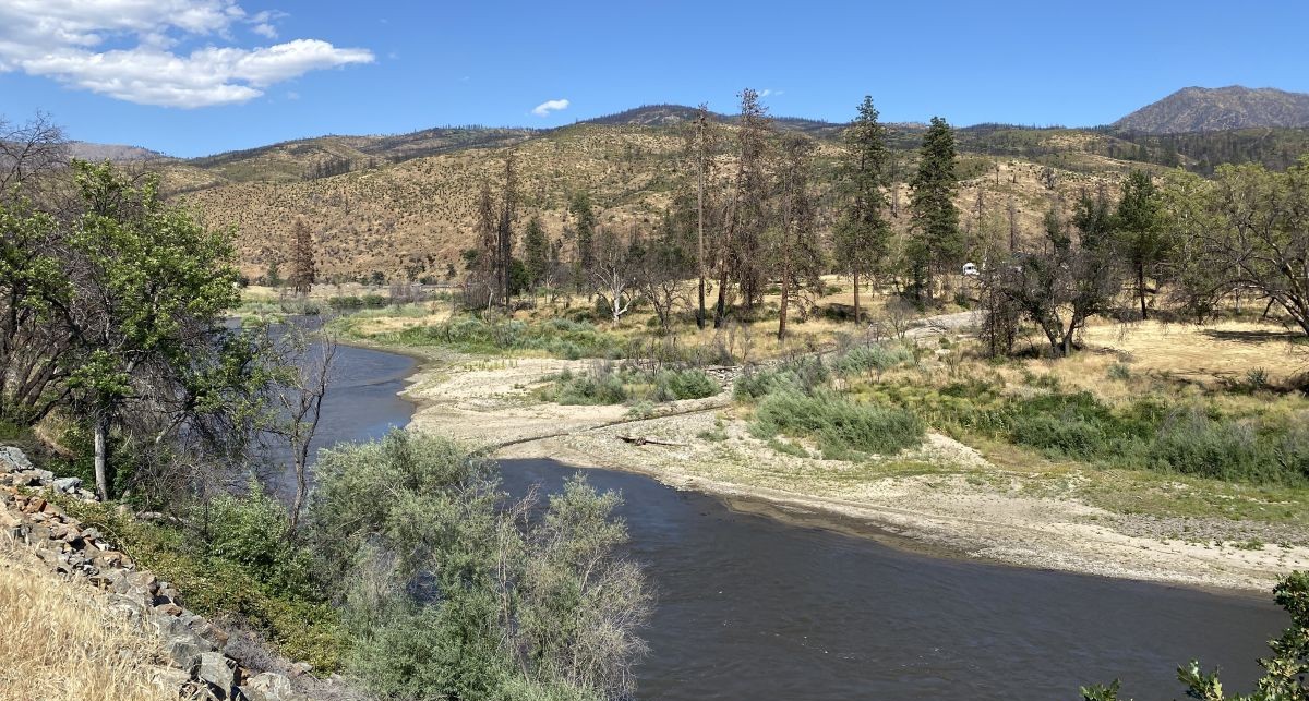
“When a rainstorm swept over the scorched hillsides left by the 2022 McKinney Fire, it seemed like relief was finally arriving. Instead, dissolved oxygen in the Klamath River collapsed to zero — and stayed there for more than five hours. Fish died along nearly 60 miles of one of California’s most culturally significant waterways. Rain was supposed to help. A new USGS study, the first of its kind, documents how it didn’t. The McKinney Fire ignited in late July 2022 in Siskiyou County, becoming the largest wildfire in California that year. It left thousands of acres of scorched hillslopes — bare, unstable ground with little vegetation to slow runoff. When a high-intensity rainstorm followed, water moved fast across that burned landscape, picking up everything in its path. What it carried into the Klamath River was devastating. Stormwater flushed ash, charcoal, and sediment from the fire scar directly into the waterway. Dissolved oxygen dropped to zero — a condition scientists call anoxia — and held there for more than five hours. Fish had no way to survive it. Aquatic life died along nearly 60 miles of river, including juvenile salmon already navigating one of the most challenging migration corridors in the American West. … ” Read more from The Pulse.
Wildlife officers seize illegal gold suction dredge out of the Klamath River
“It took a helicopter and a ground crew to haul one illegal gold dredge out of the Klamath River, a sign of how seriously California is treating a practice it says wrecks fish habitat. On June 24, wildlife officers patrolling near Happy Camp cited a miner for possessing a suction dredge in closed state waters. The California Department of Fish and Wildlife seized the machine as evidence, airlifting it out by helicopter before loading it onto a trailer for storage at a nearby site. The case is one of many. CDFW says it is actively pursuing multiple illegal suction dredging investigations across the state, and the Klamath seizure fits a broader enforcement push on a river already at the center of California’s salmon recovery story. … ” Read more from The Cool Down.
What can be done about Blue Lake’s leaking water tanks?
“Earlier this year, the city of Blue Lake entered into what seemed like a propitious agreement with local landowner Erin McClure after a decade-long dispute over one of the city’s two water storage facilities. That agreement, however, has stalled, and McClure now says she is saddled with a city water tank on her family property that is both without a lease agreement and rapidly falling into disrepair and leaking onto her property. City officials say the hitch in their agreement has to do with securing title insurance for a right-of-way and that the city is awaiting already-secured federal grant funds to begin work on at least one of Blue Lake’s two water storage tanks, both of which the city acknowledges are in need of repair. That’s cold comfort for McClure, who told the Times-Standard late last month that leaking water was quickly turning the small meadow on which the city water tank is situated into a wetland. … ” Read more from the Eureka Times-Standard.
On Mount Shasta, a photographic record outlasts living memory
“Among the many dramatic peaks of the West, few mountains stand out like Mount Shasta in the northernmost reaches of California. Shasta erupts from the landscape, a solo peak with no other mountains nearby to obscure its height or provide any sense of scale. One can spot the summit from a hundred miles to the south, its snow-white tip soaring above the oak savanna. Comparison to The Hobbit’s Lonely Mountain is inescapable. Someone has even installed a 20-foot-long metal dragon sculpture on the plains to the north of the peak. Mount Shasta is home to seven named glaciers, including the longest glacier in California, which is also the first glacier in the continental United States to have been positively identified by modern scientists. The Whitney Glacier was christened by Clarence King, who led the first U.S. Geological Survey party up the summit and named the formation after Josiah Whitney, a preeminent 19th-century geologist. A “colossal cone of a burned-out volcano, springs upward from a plain … bearing upon its summit a cap of solid white” is how King described Shasta in The Atlantic Monthly. There is a photo dated Sept. 11, 1870, of the Whitney Glacier, its mounds of ice split with giant crevasses. Today, the Mount Shasta glaciers, like glaciers across the West, are mostly shrinking. … ” Read more from the High Country News.
SIERRA NEVADA
Rise Gold provides details on upcoming tungsten and gold drilling program at Idaho-Maryland mine
“Rise Gold Corp. (CSE: RISE) (OTCQB: RYES) (“Rise” or the “Company”) is pleased to announce it is commencing a tungsten and gold exploration drilling program at the Idaho-Maryland (“I-M”) Gold Project located in Nevada County, California. The focus of the drill program will be to test targets in the Union Hill and Brunswick areas of the mine both for tungsten and gold. The Company plans to drill eight core holes totaling approximately 11,400 feet of drilling from two locations. Targets in the Union Hill workings include the Lucky-Cambridge, Greek-Tungsten, Union Hill, Georgia, and Gold Blossom veins. In the Brunswick workings, the targets are the 19, 45, 46, and 47 veins. … ” Read more from Investing News Network.
California confirms invasive golden mussel farther north, with Lake Tahoe now at risk
“California’s expanding golden mussel invasion has now reached West Sacramento, pushing the species’ known range northward in the state and bringing it closer to Lake Tahoe, one of the West’s most treasured freshwater destinations. That shift is prompting new worries about Tahoe, where clear water, recreation, and parts of the local economy all rely on efforts to prevent harmful aquatic species from getting established. In late June, the California Department of Fish and Wildlife announced its northernmost California detection of the invasive golden mussel: a find near the Port of West Sacramento, the Tahoe Daily Tribune reported. The mussel, scientifically named Limnoperna fortunei, comes from China and was first found in North America in 2024. Similar to zebra and quagga mussels, it can build large colonies on hard surfaces, including rocks, boats, piers, and pipes. … ” Read more from The Cool Down.
South Tahoe Public Utility District begins construction of 2 new drinking water wells
“The South Tahoe Public Utility District (District) is investing in the future reliability of the community’s drinking water system by constructing two new drinking water wells this summer. The Sunset Well Replacement Project and the new Tanglewood Well Project are part of the District’s long-term asset management program to ensure safe, reliable drinking water for the South Shore for decades to come. The District currently relies on 11 active drinking water wells to provide customers with high-quality Tahoe Tap. California regulations require water systems to meet maximum daily water demand even if their largest well is unavailable. The two new wells will strengthen the District’s ability to reliably serve customers during peak summer demand, emergency situations, planned maintenance, or unexpected equipment outages. … ” Read more from the Tahoe Daily Tribune.
SACRAMENTO VALLEY
Ten of the biggest catches in Northern California to set fishing record
“Redding and the Shasta Cascade region is home to world-class fishing that draws thousands of anglers looking for that special catch. Not only are the fish in these waters healthy, but they are big. California lists nearly 200 angling and diving records of fish (trout, catfish, salmon, tuna, sturgeon), crustaceans (crab and lobster) and mollusks (abalone). Ten of these records are held by anglers who are immortalized in California’s history by catching large fish in rivers, lakes, streams and reservoirs in Shasta, Butte, Trinity and Lassen counties. Before getting into the fish themselves, how does an angler get into the state records? … ” Read more from the Redding Record-Searchlight.
Testing for Big Chico Creek E. coli shifts away from O157 variant
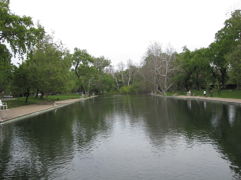
“Sycamore Pool, a popular spot to swim, is currently being monitored for elevated levels of E. coli. An advisory recently posted at the One-Mile Recreation Area swimming pool by the city of Chico states that the creek has a history of elevated levels of E. coli bacteria that could cause illness. The bacteria that caused last year’s gastrointestinal sickness, known as E. coli O157, has luckily at the very least remained absent this summer. Jarrett Beaudoin, public health officer for Butte County, said Monday that Butte County Public Health tested the creek for E. coli O157 once in April and once in May, and both results came back negative. … ” Read more from the Chico Enterprise-Record.
Less snow, more heat: New California water plan outlines what’s ahead
A new watershed resilience plan released by the Regional Water Authority and regional partners examines how climate change could affect water supplies across the American, Bear and Cosumnes river watersheds. The report projects significantly less snowpack by mid-century, more days above 100 degrees and an increase in extreme weather that could raise flood risks.
BAY AREA
Solano County Fair Association will discuss proposed data center
“A highly anticipated discussion is projected to take place on Wednesday during the Solano County Fair Association’s Board of Directors meeting. The discussion surrounds a rather divisive proposal from Santa Ana-based infrastructure developer Global Stack LLC that could bring a data center — an “emergency preparedness hub” — to the Solano County Fairgrounds. In total, the project would take up roughly five acres and operate at a capacity of eight to 10 megawatts. According to Global Stack, the company hopes to modernize or “zhuzh” up more than 70 California fairgrounds by 2030 through privately funded projects featuring small-scale data centers designed to provide “world-class AI capabilities and blackout-proof operations,” along with multi-story parking structures, emergency facilities, and even a heli-pad. … ” Read more from The Reporter.
Famous nude beach to become part of California state parks system
“A breathtaking stretch of Bay Area coastline known for decades as a place where beachgoers could enjoy the beauty of the coast — often without the burden of a bathing suit — will become the newest addition to California’s state park system. California state parks officials announced Monday that they are moving forward with a deal to add the 245-acre oceanfront property known as San Gregorio Ranch to San Gregorio State Beach. Since 1949, the state beach, which sits along the San Mateo County coast near the intersection of Highway 1 and Highway 84, has been popular with visitors from San Francisco, the Peninsula and Silicon Valley. The new acquisition features more than half a mile of wide sandy beach and scenic bluffs with trails and a pond. Directly abutting the northern end of the state beach, the property was purchased last year for $10 million by the Peninsula Open Space Trust, an environmental group based in Palo Alto, from the family of Walter Bridge. … ” Read more from the San Jose Mercury News.
SEE ALSO: Stunning Bay Area coastal ranch with nude beach to become part of state park, from the San Francisco Chronicle
CENTRAL COAST
Commentary: Fort Ord’s unanswered health questions
Julie Akey, a U.S. Army veteran who served at Fort Ord, writes, “Sean Tubo’s July 10 Monterey Herald article, “New study says Fort Ord water posed no public health hazard,” accurately reports the conclusions of ATSDR’s updated Health Consultation. However, the ATSDR answers only a narrow question: whether a limited number of contaminants found in drinking water between 1985 and 1994 were likely to pose unacceptable health risks. The ATSDR report does not answer the broader question that thousands of former soldiers, military families, civilian employees, and Monterey County residents have been asking for decades: Did contamination at Fort Ord sicken and kill many? The agency limited its evaluation to 1985 through 1994 largely to remain consistent with an assessment it conducted in 1996. That may satisfy an administrative objective, but it is not a scientific one. Fort Ord remained occupied after 1994, and thousands of people continued to live, work, attend school and recreate there for years after the Army closed the base. I know because I was one of them. … ” Read more from the Monterey Herald.
Protecting the living waters of the Channel Islands from marine debris
“Channel Islands National Park and Channel Islands National Marine Sanctuary protect some of California’s richest coastal and marine habitats. Keeping these remote islands and surrounding waters free of marine debris requires extensive collaboration among volunteers, conservation organizations, and local lobster fishers who help recover debris from difficult-to-access shorelines. With support from a 2023 award from the NOAA Marine Debris Program, the National Marine Sanctuary Foundation is working to remove large and hard-to-reach marine debris from the Channel Islands. Project partners include Santa Barbara Channelkeeper, Island Packers, Commercial Fishermen of Santa Barbara, California State University Channel Islands Santa Rosa Island Research Station, and other regional groups. Volunteer cleanup crews removed over 18,000 pounds of large debris, including lost fishing gear, from the islands so far. More than 150 volunteers have contributed to over 10 cleanups across Santa Rosa, Santa Cruz, and Anacapa Islands. … ” Read more from NOAA.
This California oil pipeline was dormant for 11 years. Trump reopened it.
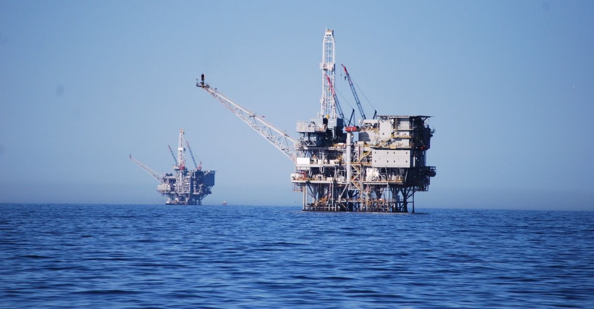
“On a hillside trail near Santa Barbara, Calif., songbirds chirped in the arching branches of oak trees. The bright blue Pacific Ocean lapped at the secluded cliffs below. Given the breathtaking views, it was easy to miss a knee-high sign on an orange pillar. Warning: Crude Oil Pipeline. For decades, state and federal officials had halted new offshore drilling here on California’s coast to protect its shoreline. But in March, amid an oil shortage during the war in Iran, the Trump administration ordered the reopening of a Santa Barbara pipeline that had been dormant since 2015 after a major spill. The reboot has spawned enormous backlash locally, as well as several lawsuits against Sable, the pipeline’s Texas-based owner, from environmental groups and California officials. The pipeline initially burst in 2015 because of corrosion, and it remains vulnerable to another rupture, opponents say. … ” Read more from the New York Times.
SAN JOAQUIN VALLEY
California families say dairy fumes ruined their summers, and one 8,000-cow farm still wants to grow
“For families in Planada, California, the summer heat is compounded by odors from nearby dairies that residents say hang in the air so often that some people keep their windows closed and spend less time in their own yards. Tensions are rising because one of the area’s largest dairies wants to get even larger — something many locals see as adding to a burden their community has long been forced to bear. According to Inside Climate News, a proposed expansion by Hillcrest Dairy in Le Grand would increase the operation’s herd by about 1,700 cows, on top of the roughly 8,000 it already has. The plan also calls for new facilities, including a 50,000-square-foot barn. Merced County has also approved a new manure digester at the site, though the project does not appear to have been built yet, according to the report. … ” Read more from The Cool Down.
California homeowner slashes water use after $637 bill, then learns summer tiers drove it higher
“A $637 water bill is enough to make any family rethink every shower, load of dishes, and sprinkler cycle. For one California homeowner, that kind of shock led to immediate cutbacks at home and served as a harsh reminder that summer water costs can climb far faster than many residents expect. According to 23ABC, northeast Bakersfield homeowner Jennifer Herrera said her June water bill came to $637.03 after she noticed other residents online comparing their own bills. To try to lower usage, Herrera told 23ABC that she and her children have kept showers to under five minutes for more than a month. … ” Read more from The Cool Down.
SAN DIEGO
San Diego prepares as King Tides bring flooding risks to coastal areas
“King tides are bringing temporary flooding risks Monday to low-lying coastal areas along San Diego and the state through at least Wednesday. In response to the tidal surge that began Saturday, the San Diego Stormwater Department has deployed additional staff and increased warning signs in the Midway neighborhood and other heavily impacted areas, according to the city. City crews were also monitoring Mission Beach and are prepared to respond if flooding occurs. Officials urged residents and visitors who live or park in flood-prone zones to plan ahead and take immediate precautions. The city advised using sandbags where appropriate, avoiding parking in known flood areas and remaining alert for posted signage and changing conditions. … ” Read more from KPBS.
Along the Colorado River …
Can Lake Powell and Lake Mead be saved? The ideas reshaping the debate
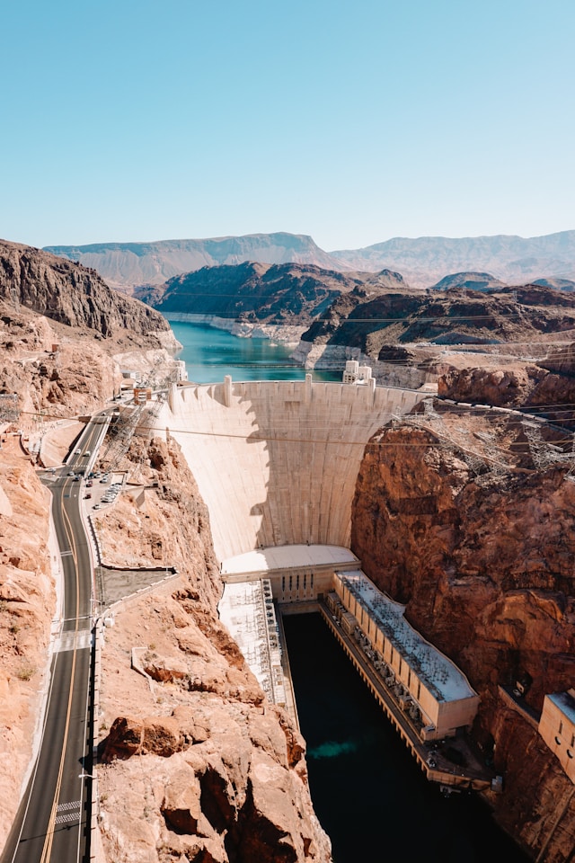 “With negotiations over future Colorado River operations still unresolved and water levels at Lake Mead and Lake Powell remaining far below historical norms, policymakers, water managers and researchers are continuing to examine a range of proposals aimed at stabilizing the river system. The reservoirs remain under pressure after more than two decades of drought in the Colorado River Basin while demand for water continues to exceed the river’s long-term supply. The river irrigates millions of acres of farmland and provides water for tens of millions in the West. As of Friday, Lake Mead was only 27 percent full, while Lake Powell was just 23 percent full, according to U.S. Bureau of Reclamation (USBR) data. The levels represented 46 percent and 34 percent, respectively, of the average water storage for the date. … ” Read more from Newsweek.
Lake Powell reaching critically low elevation levels, nearing ‘dead power pool,’ experts say
“Lake Powell, the second-largest reservoir in the U.S., is nearing critically low water elevation levels, the latest data shows. As of Monday, water levels at Lake Powell measured at 3,524.3 feet above sea level, according to the U.S. Bureau of Reclamation tracker. Minimum, or “dead,” power pool — in which the water is too low to spin the hydroelectric turbines and can no longer produce hydropower — starts at 3,490 feet of elevation, Peter Soeth, public affairs lead at the Bureau of Reclamation, told ABC News. Elevation at Lake Powell is currently about 34 feet above the minimum power pool. … ” Read more from ABC News.
SEE ALSO: Lake Powell Nears ‘Dead Power Pool’—What It Means for Millions of Americans, from Newsweek
WRDA 2026: What the water bill means for the West
” Congress took two big steps toward passing the nation’s most important water infrastructure law, and communities across the Colorado River Basin have plenty of reasons to pay attention. On July 13, the Senate Environment and Public Works Committee released its version of the Water Resources Development Act of 2026, (WRDA 2026) a bipartisan bill that Congress traditionally renews every two years. The next day, the House Transportation and Infrastructure Committee was scheduled to consider its own version, known as H.R. 9497, which was first released on June 26. Think of the Water Resources Development Act as the nation’s to-do list for water. It tells the U.S. Army Corps of Engineers which dams, levees, harbors, and river restoration projects to study and build. It also touches on drinking water, drought planning, and flood protection in every state. … ” Read more from Western Water.
Scottsdale is defending its water future in the face of big Colorado River cuts
“The city of Scottsdale and its water future has been in the headlines a lot lately, from its on-again, off-again plans to get highly treated wastewater directly to your tap to its reliance on Colorado River water amid what are likely to be pretty big cuts coming to that supply. Now, Scottsdale Mayor Lisa Borowski says they’re taking a major step towards securing their long-term water outlook by directing their city manager and city attorney to potentially create a large water use ordinance for the city. Camryn Sanchez from KJZZ’s Politics Desk joined The Show to talk more about it. … ” Read more from KJZZ.
‘Zero flow’ recorded at key spot on Arizona’s drying San Pedro River
“Where water normally flows continuously on the San Pedro River east of Sierra Vista, only ponds and puddles persisted last week. You could hear the squeals of the Gila woodpecker and the clacking of the yellow-breasted chat along the river, but the sound of running water was absent. Some of the ponds and puddles were full of crawfish, but a dead carp also lay in a dry spot in the riverbed. These scenes of a drying river occurred as a key federal stream gauge nearby registered “zero flow” for most of the past three weeks. The Charleston gauge, long considered a key indicator of the San Pedro’s health, dried up late last month for the first time in 21 years. And it stayed dry — or nearly dry — until water from a monsoon storm arrived Friday morning. … ” Read more from the Arizona Daily Star.
Small Arizona town saves water to prevent summer shortages
“This small town in Pinal County could have run out of water before July as drought reduced supplies and tightened allocations, but water conservation has bought them time to avert a bigger crisis. Residents and businesses have collectively reduced municipal water consumption by 30% in the past weeks, stretching the town’s resources until September, Mayor Curtis Stacy told The Arizona Republic. By then, the town could have more than two extra wells running and, they hope, monsoon rains to boost the San Carlos reservoir and increase how much water is available. But they still need a long-term fix. It’s the first time Kearny, a town founded in 1958 about 75 miles north of Tucson, has faced a water crisis of this proportion. The town’s water comes from the Gila River and it’s regulated by a federal decree that means it is the first to get cutbacks in times of drought. For decades, Kearny hasn’t received its full allotment, but has met its needs. … ” Read more from the Arizona Daily Star.
In national water news today …
Melting icebergs can weaken a massive, far-off ocean current system
“Melting and breaking icebergs in the far-off, northeastern region of the Pacific Ocean can weaken a massive current system in the Atlantic Ocean, according to a University of California, Davis study published in Nature Communications. The Atlantic Meridional Overturning Circulation, or AMOC, regulates the global climate by acting as a massive conveyor belt, moving warm, salty water from the tropics to the North Atlantic. Responsible for 70% of oceanic heat transport across the equator, AMOC influences global climate by redistributing heat and energy. Melting icebergs in the North Atlantic Ocean were previously considered the primary drivers of AMOC weakening during Earth’s last ice age, leading to global climate shifts, including cooling in the Northern Hemisphere and warming in Antarctica. Scientists refer to these events and their time periods as Heinrich stadials. “More recently, however, scientists have found that these North Atlantic iceberg melting events happened after the AMOC was weakened and Greenland was cooled,” said lead author Chijun Sun, an assistant professor in the UC Davis Department of Earth and Planetary Sciences. “So the iceberg discharge events in the North Atlantic could not have driven AMOC weakening.” … ” Read more from UC Davis.

