

Several news sources featured in the Daily Digest may limit the number of articles you can access without a subscription. However, gift articles and open-access links are provided when available. For more open access California water news articles, explore the main page at MavensNotebook.com.
In California water news today …
Reclamation’s Shasta plan poses salmon peril
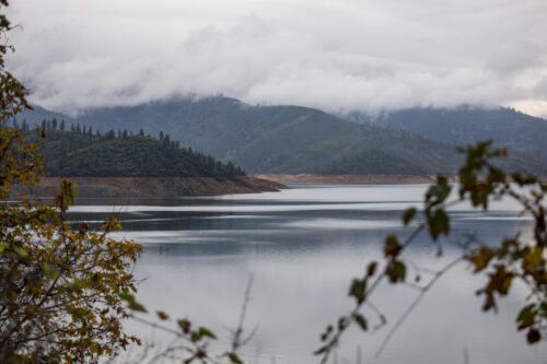
“In spite of a relatively wet winter, late rains, and high reservoir levels—conditions that generally benefit aquatic ecosystems—California’s ailing chinook salmon are facing unexpected peril in the main river system where they spawn. State officials and environmental groups have warned that an aggressive water delivery plan by federal reservoir managers has temperatures in Lake Shasta and the Sacramento River on track to kill vast numbers of salmon this fall. The bleak outlook comes as the U.S. Bureau of Reclamation rapidly spills water from Lake Shasta, the state’s largest reservoir and the infrastructural headwaters of the federal Central Valley Project. This system of canals, dams, reservoirs, and pumps supplies water for about 1 million households and 3 million acres of farmland. In its 2026 Sacramento River Temperature Management Plan, finalized May 29, the Reclamation outlined its intention to finish the irrigation season with about 2.2 million acre-feet of water in Lake Shasta. State officials and salmon advocates have challenged the plan, saying that recent hydrologic conditions have triggered a legal requirement that Shasta contain 200,000 acre-feet more water by the end of this September than the bureau’s target. They’ve also said such rapid releases as the bureau is planning violate state law and federal endangered species protections embedded in rules adopted in 2024 by the National Marine Fisheries Service (the Biological Opinion for the Long-Term Operation of the Central Valley Project). … ” Continue reading from Alastair Bland at Maven’s Notebook.
Kern water districts slash support for Delta tunnel to a third of 2025 levels
“Financial support for the planning phase of the Sacramento-San Joaquin Delta tunnel has plummeted among Kern County agricultural water districts as they continue to seek definitive answers about water supplies and how the tunnel will operate. The Department of Water Resources (DWR) had been seeking $33 million from Kern districts to be paid in two installments this year and in 2027 for the planning and pre-construction phase of the tunnel, known as the Delta Conveyance Project. But it will get considerably less than that based on participation levels that districts have approved during recent meetings. In March 2025, Kern districts had opted to participate – and fund – tunnel planning at 44.96% of the county’s total State Water Project (SWP) contract. That appears to have dropped to 15.77%, according to recent board meetings. … ” Read more from SJV Water.
NOAA releases new sky-high odds of historic El Niño in California
“After emerging in June, El Niño is now gathering power in the Pacific Ocean. A new outlook released on Thursday shows an 81% chance that El Niño, the climate pattern that generally brings a wet winter to California along with a cascade of global weather impacts, will rank as “very strong” from October through December. The forecast, a monthly memo from the National Weather Service’s Climate Prediction Center, also expects that El Niño conditions will linger through early spring 2027. The new report expressed more confidence than June’s that the event will ultimately fall into the strongest of four categories. “I cannot recall a time in my career where the model guidance has been so consistently predicting a strong-to-very strong El Nino,” Michelle L’Heureux, who leads the ENSO team at the Climate Prediction Center, wrote to SFGATE. She added, “This still means there is a 1-in-5 chance of the event being less than very strong, but these are still impressive probabilities for ENSO forecasts made in early July.” … ” Read more from SF Gate.
Slowing Atlantic current fueling stronger California storms
 “A slowing Atlantic Ocean current is projected to intensify powerful storms in California while reducing snowfall over Greenland, according to a new University of California, Riverside study. The Atlantic Meridional Overturning Circulation, or AMOC, works like a giant conveyor belt in the ocean, moving warm water from the tropics northward to heat places like Europe, then cycling the cooled, denser water back south along the ocean floor. “It is well known that the AMOC is a big player in the world’s climate system, and that it is slowing down. What we didn’t know is exactly how the AMOC might impact atmospheric moisture and storms outside the Atlantic region,” said Mohima Mimi, a UCR doctoral student in climate dynamics and the paper’s lead author. “It turns out a weakening AMOC will strengthen storms across parts of North America by the end of the century, along the California coast in particular, while reducing them over Greenland and the Arctic.” … ” Read more from UC Riverside.
SEE ALSO: Weakening Atlantic current drives stronger California storms, from Bioengineer
California calls for communities to make their voices heard as federal administration threatens state’s coast

“The federal administration is continuing its efforts targeting California’s coastline. A new federal review launched late last month threatens the future of how California’s coastline is managed, and the California Natural Resources Agency is encouraging Californians to make their voices heard. The review – singling out California – comes as the federal government targets California’s coast, including proposals to expand dangerous offshore oil drilling and efforts to restart offshore oil pipeline infrastructure. Based on the results of the review, the federal government can attempt to defund and decertify the state’s coastal management program, an unprecedented action that would change whether and how the people of California have a voice in offshore drilling and other federal actions off our coast. The review was ordered by U.S. Secretary of Commerce Howard Lutnick under the false pretense of California’s “environmental extremism.” “California’s coast belongs to all Californians – full stop,” said California Secretary for Natural Resources Wade Crowfoot. “For decades, Republican and Democratic administrations alike have respected the partnership between states and the federal government that has protected our coast while supporting a thriving economy. Yet the Trump administration is singling out California and threatening unprecedented action in pursuit of dangerous new offshore oil drilling. We won’t stand by while the federal government attempts to sideline the people who rely on and care for California’s coast – now is the time to make our voices heard.” … ” Read more from the California Natural Resources Agency.
Trump administration erodes marine protections, invites more fishing
“In April 2025, President Trump signed an executive proclamation reopening nearly half a million square miles of Pacific ocean, coral reef and island habitats to commercial fishing. The order covers the Pacific Islands Heritage Marine National Monument, stretching over Palmyra and Johnston atolls and Kingman Reef, among others. Soon after, the National Marine Fisheries Service issued a letter to commercial fishermen letting them know the monument was open for business. The monument was established in 2009 by President George W. Bush, and expanded in 2014 by President Barack Obama. It’s frequented by rare and endangered animals such as melonhead whales, Hawaiian monk seals, and hawksbill and green sea turtles. … ” Read more from the LA Times. | Read via Boiling Point newsletter.
Ask a scientist: how is rural California anticipating and building resilience to climate change?
“For many Californians, climate change is not a distant threat; it’s a force that is felt daily and has real, life-altering impacts. In rural communities like Allensworth—located about 150 miles northwest of Los Angeles—decades of water scarcity, pollution, and underinvestment have collided with intensifying climate impacts like extreme heat and drought. Yet, residents in Allensworth are amidst a momentous transformation towards becoming a thriving, self-sufficient community while leading some of the most innovative efforts to redefine climate resilience from the ground up. To understand how Allensworth is building resilience that will ultimately allow it to withstand and recover from hazardous climate-related events we interviewed, California resident, Dr. Ranyee Chiang, an expert in environmental policy and director of UCS’s Western States Program. … ” Read more from the Union of Concerned Scientists.
The Drought Data Dashboard (D3): A system for open, transparent, and local drought monitoring
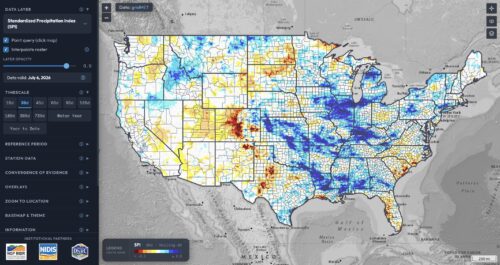
“When drought intensifies, decisions cannot wait. Ranchers decide when to move livestock, water managers balance reservoir operations, and emergency managers coordinate drought response. Yet the information guiding those decisions is often scattered across multiple websites, difficult to compare, and challenging to translate into action. To help close that gap, the Montana Climate Office has launched the Drought Data Dashboard (D3, pronounced “D three”), a free, open-source web platform that delivers daily drought information across the contiguous United States. Designed for drought assessors, producers, water managers, researchers, and the public, D3 brings together leading drought datasets into a single interactive platform while making every method, dataset, and line of code accessible and transparent. D3 is the culmination of nearly a decade of collaboration. The platform grew from the Upper Missouri River Basin Drought Dashboard, developed after the 2017 Northern Plains flash drought exposed the need for more transparent and accessible drought information. … ” Read more from NIDIS.
‘I’d rather my house burn down than get cancer’: Herbicide use upends California’s fight to save forests
“For years, Reid Reichardt walked the forest trails behind his Tahoe Basin cabin nearly every day with his dog Jasmine. Then in 2021, the Caldor fire swept through, incinerating it all. “It was really a sense of mourning and grief to lose this,” Reichardt said, eyes fixed on the towering blackened sticks around him. Since then, Reichardt has watched birds, flowers, a sea of green shrubs and baby conifers fill in the moonscape. It’s been a ray of hope for him, as Jasmine aged and eventually passed. But two months ago, Reichardt got a text from a friend: The Forest Service had approved a plan to kill off shrubs it says are blocking the conifers from growing. It plans to use glyphosate, an herbicide California has determined causes cancer. “I think many people, including me, would say, I’d rather my house burn down than get cancer,” he said. … ” Read more from the LA Times.
In commentary today …
California tracks pesticides, but doesn’t track what reaches water
Katherine Levy, a writer based in Tahoe Vista, writes, “Proposition 4’s $10 billion restoration bond contains no statutory requirement linking funded treatments to compound-specific baseline monitoring. The Legislature could fix that through budget trailer bill language. It hasn’t. California voters approved Proposition 4 in November 2024, the largest climate resilience bond in state history. The proposed 2026-27 budget includes $314 million for wildfire and forest resilience, as the California Natural Resources Agency, the State Water Resources Control Board, and CalFire begin implementation. This spring, the Lake Tahoe Basin Management Unit (LTBMU) authorized glyphosate treatment across 2,400 to 3,600 acres of post-fire terrain, including tributary watersheds that drain to the lake. Lake Tahoe flows into the Truckee River, and the lake supplies drinking water to communities served by the North Tahoe Public Utility District and other local utilities. … ” Continue reading from Capitol Weekly.
In regional water news and commentary today …
NORTH COAST
Siskiyou supervisors seek to reduce community fears about rumored data center
“All the way up in Yreka, this week the Siskiyou County Board of Supervisors addressed constituents concerned about the possibility of a data center coming to land near Mount Shasta, a tiny city an hour north of Redding. “We are well aware of the community’s opposition,” one supervisor said this week, referencing fears among residents about an inquiry posed to the city of Mount Shasta last month. The county allayed such fears during the board meeting saying no inquiries about data center development have been made to county officials or departments thus far. The news of an enquiry about data center development became public during a routine update by Mount Shasta City Manager Todd Juhasz during a council meeting last month. He said an unnamed entity had contacted the city’s planning department about developing a data center at an industrial site once owned by the Crystal Geyser Water Company. … ” Read more from the Shasta Scout.
A new era for the Elk River: How watershed restoration helped heal environmental and community wounds in Humboldt County
“Driving north on U.S. Route 101 in Humboldt County, the earthy smell of fertile pastures reveal that you’ve arrived at the Eel River Delta, the heart of Humboldt County’s agricultural area. Continuing north over Table Bluff, down into the Humboldt Bay Area and Elk River Valley, you are met with the added scent of the mudflats and saltmarsh that surround Humboldt Bay. The Elk River is a symbol of the abundant resources that have supported the region’s economy for generations. Its pastures grew beef, the river produced large amounts of salmon, and its forests held the largest grove of old-growth redwood trees in California. Though the ecosystem suffered for decades as a result of rapid logging, funding from California Climate Investments and the efforts of conservation nonprofits, the City of Eureka, and state and federal partners are helping bring the Elk River back to life again. … ” Read more from California Climate Investments.
SIERRA NEVADA
Lake Tahoe advocates call out California over inconsistent golden mussel boat inspections
“Golden mussels are creating a growing challenge for California’s waterways, and environmental advocates say the state still lacks a consistent strategy to prevent the invasive species from spreading. “It’s been almost two years since golden mussels were first discovered, and we don’t have consistency in those regulations,” said Laura Patten, Natural Resource Director for Keep Tahoe Blue. The mussels have already forced several counties to declare emergencies, while agencies across California work to slow their spread. But as officials respond, one major question remains: why are some waterways requiring boat inspections while others are not? … ” Read more from KMPH.
Wildfire risk reduction work to begin on Tahoe’s North Shore
“Hazardous fuels reduction work is scheduled to begin next week near Kings Beach as the U.S. Forest Service continues wildfire prevention efforts on the Lake Tahoe Basin Management Unit. Mastication treatments are scheduled to begin Monday, July 13, near the Beaver Street area of Forest Roads 16N86 and 16N87. The work is expected to continue through the end of the month, weather, staffing, and conditions permitting. The project will treat about 52 acres of ground vegetation and brush, including manzanita, whitethorn, and bitter brush, along with some small-diameter trees measuring less than six inches in diameter at breast height. … ” Read more from KTVN.
SACRAMENTO VALLEY
City plant operators keep Sacramento’s drinking water safe, but at what cost?
“For six years, Madison Malicki’s morning began at 8 p.m. The Sacramento Water Plant Operator would skip breakfast, get ready for work and jump in her car to start her commute from Dixon to Sacramento on the Yolo Causeway. “ It was tough at first in the beginning of my graveyard shifts,” said Malicki, who grew up in Vacaville. “I’d have to leave well over an hour early just because the construction’s done at night.” Malicki was heading to the Sacramento River Water Treatment Plant off Bannon Street to make it to her 11 p.m. to 7 a.m. shift. Music amped her up for what would often be an isolating eight hours. “When it comes to work, I like songs about money,” she said. “My go-to work song is Barrett Strong, the title is literally ‘Money.’” Malicki usually arrived a bit early, which she said is an unspoken rule at the plant, to relieve the swing shift operators. Her first order of business was checking the lime slaker, a piece of equipment that mixes calcium oxide with water that helps with the PH of the water. … ” Read more from Capital Public Radio.
Can I swim in Lake Natoma? What to know about E. coli in Sacramento-area waterways
“Is Lake Natoma safe to swim in this summer? State officials are not yet certain. Ahead of the July 4 holiday weekend, California State Parks officials warned visitors to Lake Natoma that its water monitoring partner detected elevated levels of E. coli bacteria, indicating water pollution from fecal matter, The Sacramento Bee previously reported. With some of the lake’s most popular recreation areas — Black Miners Bar Day Use Beach, Nimbus Flats and Willow Creek Day Use Area — deemed a health concern, some lake visitors might be second-guessing their trips and looking for alternative places to cool off in the water. Here’s what state health officials recommend for capital region swimmers wanting to hit the lake this summer. … ” Read more from the Sacramento Bee.
BAY AREA
San Francisco expected to get highest July tide on record
“Seawater is expected to spill over San Francisco’s Embarcadero and other low-lying areas along the bay shoreline in the coming days as a result of a king tide. The National Weather Service predicts the highest tide at 11 p.m. Monday, when water at the San Francisco gauge is forecast to be 1.7 feet above normal. It would be San Francisco’s highest July tide on record, and the second-highest in any month outside November to March, after last month’s tidal anomaly peaked at 2 feet. More broadly, a coastal flood advisory is in effect for the shoreline of San Francisco and San Pablo bays from Thursday, July 9, to Thursday, July 16. The Pacific coast is included in the advisory from Saturday to Wednesday. Tides will be highest from late evening through the early morning hours. … ” Read more from the San Francisco Chronicle.
SEE ALSO: King tides are coming, causing coastal flooding advisories in the Bay Area, from KTVU
Historic venue on edge of San Francisco could get a data center
“For more than 85 years, the Cow Palace Arena & Event Center has been home to Republican National Conventions, doomed minor league hockey teams and electronic dance music concerts. Now, under a new proposal, it could also host a data center and helicopter landing pad. Located in Daly City, on the edge of San Francisco, Cow Palace is one of 33 sites in the state, including eight in the Bay Area, that a company named Global Stack LLC is targeting for potential data center development. The common thread: They’re all fairgrounds. The proposal calls for each site to house a small data center, a multilevel parking garage and a helicopter landing pad to aid in emergency response, according to presentations delivered to fairgrounds across the state. … ” Read more from the San Francisco Chronicle.
Suisun City Council gets update on expansion EIR
“Suisun City’s ambitious expansion plan moved another step closer to public scrutiny Tuesday as officials announced the Environmental Impact Report is nearing completion, clearing the way for the first public look at how the proposed growth could affect traffic, the environment and city services. The council also reviewed Fourth of July public safety operations and ongoing efforts to strengthen the city’s finances during its Tuesday meeting. Deputy City Manager Jim Bermudez said the Environmental Impact Report on the Suisun Expansion Specific Plan is nearly complete. “Over the next month, the team is zeroing in on a set of key topics,“ he said. “Kind of the key sticking points, and we are working through those topics, which will allow us to close out all of the remaining sections.” … ” Read more from the Vacaville Reporter.
Garamendi lands Mare Island $1 million sewer earmark
“U.S. Congressman John Garamendi gave a check for $1,092,000 to local officials for the Mare Island Sewer Rehabilitation Project on Tuesday. Mare Island came under Vallejo’s control with existing but out-of-shape naval infrastructure, according to staff accepting the check. The transfer was made without funding in the hopes that development on Mare Island would pay for needed upgrades. That development is still pending, but the sewer has continued to deteriorate, making a federal earmark necessary. Vallejo City Councilmember Dr. Tonia Lediju thanked Garamendi for his attendance and his long-standing commitment to Vallejo and Mare Island. She said the pump station being updated has served the community for decades, and the upgrades lay a foundation for Mare Island’s continued growth. “It reminds us that strong communities are built on strong infrastructure,” she said. … ” Read more from the Vacaville Reporter.
Bay Area cities bracing for new law banning non-functional turf
“Local city governments and agencies are making plans to comply with a 2024 state law that will soon prohibit the use of clean water for the irrigation of non-functional turf. Starting next year, those overseeing local government properties will need to demonstrate compliance with the law or face penalties of up to $1,000 for each day a violation occurs. The law will extend to commercial, industrial and institutional properties in 2028 and homeowners associations in 2029. By 2031, government properties in disadvantaged communities will be included as well. In all instances, impacted areas include grass without practical purpose for human activity or recreation – such as ornamental grass strips along roadways and expansive lawns in corporate parks. … ” Read more from the Los Altos Crier.
CENTRAL COAST
City of Monterey property owners reject stormwater fee
“A proposed stormwater fee in the City of Monterey, intended to cover the majority of operation and maintenance costs of the municipal stormwater management system, failed to pass, with roughly 60 percent of city property owners voting against the fee. As required by Proposition 218, which regulates local governments’ ability to impose property-related fees, ballots were mailed to about 9,270 property owners in the city who would be affected by the potential fee in May, with a deadline to return the completed ballots by July 6, 2026. A majority of property owners would have needed to vote in favor of the fee for it to move forward. Monterey Environmental Regulations Analyst Rebecca Baggot announced the election results on July 7 at a Monterey City Council meeting. Of the 4,119 valid ballots returned to the city, a return rate of roughly 46 percent, 1,648 ballots were cast in favor of the stormwater fee, or about 40 percent, while 2,471 ballots were cast against the proposed fee. … ” Read more from Monterey County Now.
Sierra Club reaches settlement with three Santa Barbara companies over harmful runoff to East Beach
“After every major storm event, there’s always the same advisory: Think twice about swimming in the ocean. Over the past three rainy winters, the environmental nonprofit Sierra Club found high levels of bacteria — such as E. Coli — and other harmful pollutants in stormwater runoff on Santa Barbara’s East Side, flowing unfiltered into East Beach and the ocean. Under the federal Clean Water Act of 1972, that empowers citizen groups to seek compliance with pollution prevention permits, and the Sierra Club was able to initiate lawsuits to hold the sources accountable. This week, after a year of negotiations, Sierra Club announced a settlement agreement with three companies responsible: the waste management company MarBorg, and two construction companies Lash and Kenney. “The Clean Water Act is designed to stop pollution at its source,” explained Deborah Williams, a member of the Sierra Club’s executive committee and a lecturer at UC Santa Barbara in environmental studies. “We greatly appreciate the companies’ willingness to work toward solutions that will help safeguard East Beach for current and future generations,”she said. … ” Read more from the Santa Barbara Independent.
Carpinteria: The business of keeping the Salt Marsh alive, one Saturday at a time
“While many visitors admire the scenic beauty of the Carpinteria Salt Marsh, few realize that some of its most popular educational and stewardship programs are powered almost entirely by the volunteers of the Carpinteria Salt Marsh Docent Program. Every Saturday morning, volunteer docents welcome residents and visitors alike for free guided tours of the Carpinteria Salt Marsh, sharing the area’s remarkable geology, wildlife and history. On the first Saturday of most months, another dedicated group — the Carpinteria Weed Warriors — heads into the marsh to remove invasive plants and help restore habitat for native species. According to longtime volunteer and program coordinator Andrea Adams-Morden, both programs have one simple goal: helping people understand why the marsh matters. “The volunteers are nature enthusiasts who enjoy sharing their knowledge with others,” Adams-Morden said. … ” Read more from the Coastal View.
SAN JOAQUIN VALLEY
Patterson illegally denied 719-home development over groundwater dispute, judge rules
“A battle over housing and groundwater in Stanislaus County has dealt the City of Patterson another legal setback. A Stanislaus County judge has ruled the city illegally denied a key application for the proposed 719-home Keystone Ranch development, finding Patterson violated state housing law when it rejected the project’s tentative subdivision map. The ruling marks the latest chapter in an ongoing dispute that began last year over how to address the city’s groundwater challenges. The conflict stems from a decision by the California Department of Water Resources to reject Patterson’s groundwater sustainability plan and order the city to reduce groundwater pumping by 10%. … ” Read more from the Modesto Bee.
Ceres informs residents of missed 2024 deadline for drinking water line inventory
“The city of Ceres was required to submit an inventory of its water lines in 2024. Though it is now in compliance, it is asking residents for their help in completing the picture for the lines that lead to customers’ taps. Notices were sent to residents, informing them the city missed an Oct. 16, 2024, deadline set by the U.S. Environmental Protection Agency to inventory its water lines. Ceres stated that it submitted an initial drinking line inventory to the Department of Drinking Water in April that included the city- owned lines but not all of the customer service lines. It is now considered in compliance but was required by the state to send notices about the delay. “The city missed that deadline mostly because of staff turnover and staff shortages,” said Ceres Interim City Manager Steve Williams. … ” Read more from the Modesto Bee.
EASTERN SIERRA
Inyokern Airport joins opposition to proposed data center, citing community impacts
“Concerns are mounting over a proposed data center in Inyokern, with local aviation and military officials warning the project could affect airport operations and the China Lake test range. In June, the Inyokern Airport sent a letter of concern to the Kern County Board of Supervisors, the Kern County Planning and Natural Resource Department, and the California Energy Commission. The airport wrote, “Based on information available to the district, the project will introduce new industrial-scale operations that may present potential impacts to aviation safety, navigable airspace, and the airports.” … ” Read more from Bakersfield Now.
IMPERIAL/COACHELLA VALLEYS
Cost-effective lithium production from Salton Sea geothermal brines unveiled
“A groundbreaking advancement in lithium extraction technology promises to reshape the clean energy landscape by tapping into an unconventional and abundant resource: geothermal brines from the Salton Sea region. Researchers have unveiled new pathways that significantly enhance the viability and cost-competitiveness of lithium production from these geothermal fluids, addressing one of the critical bottlenecks in the global shift towards electric vehicles and renewable energy storage. Lithium, a pivotal component of batteries powering electric vehicles and portable electronics, currently faces supply chain challenges owing to traditional mining constraints. Conventional extraction methods often involve energy-intensive processes with substantial environmental footprints. The Salton Sea geothermal brines, rich in lithium, present a vast, yet underutilized resource, but technical complexities have until now stymied efficient recovery. … ” Read more from Bioengineer.
SAN DIEGO
New survey reveals more details about Tijuana River sewage crisis
“San Diego State University researchers unveiled early results on Tuesday of a new survey about what it’s like to live near the sewage-laced Tijuana River. More than 500 people living in Imperial Beach, Nestor, San Ysidro and as far north as Coronado and National City took the Healthy Water, Healthy Air survey. It opened in September 2024 and closed on June 15. “Nausea, headaches, brain fog, stomach issues, anxiety, tiredness, sleep problems: a lot of this has been reported by people taking the health survey,” said Paula Stigler Granados, one of the lead researchers behind the survey and an associate professor at SDSU. … ” Read more from KPBS.
Along the Colorado River …
As the Colorado River water management agreement nears expiration, where does Southern Nevada stand?
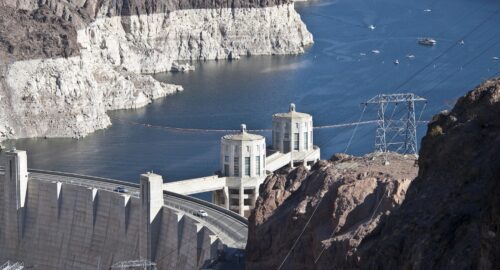
“The mighty Colorado River runs 1,400 miles, providing everything from crop irrigation to outdoor recreation for people in seven U.S. states and Mexico. A century ago, leaders of those states — divided into two basins, Upper and Lower — hammered out an agreement for managing Colorado River water, a landmark multi-state cooperative deal at the time. But major parts of that agreement, which has evolved significantly over the decades, are set to expire later this year. That lapse will potentially affect the 35-40 million people who depend on the Colorado for municipal needs, including some 2.3 million residents of the Las Vegas Valley. … ” Read more and listen from Nevada Public Radio.
Shifting sands: The science shaping desert solar projects
“Photovoltaic (PV) solar facilities are a key element to meeting growing energy demand and achieving state and federal goals for clean power. However, industrial-scale solar facilities often have an expansive footprint. As with any large infrastructure project, developments of that scale can have direct and indirect effects on sensitive habitat. For solar projects being planned in the deserts of the Southwest, one of the less obvious indirect impacts is the disruption of natural wind-blown sand transport across the landscape. Resource agencies, such as the U.S. Bureau of Land Management (BLM), are increasingly requiring evaluation of potential impacts on so called “sand transport” during project planning and permitting. Because this assessment requires rather unique qualifications, this can leave solar power developers scrambling to find qualified consultants. Fortunately, ESA has this expertise in-house. … ” Read more from ESA.
In national water news today …
Calculating the costs of wetland loss
“Wetlands are biodiversity hot spots and provide important carbon storage. During heavy rains, they act like natural sponges on the landscape by storing and slowing the flow of stormwater—reducing downstream flooding and protecting infrastructure. As the climate changes and extreme flooding events become more frequent and intense, flood protection from wetlands may become even more valuable for both the natural and built environment. However, since 1700, at least 40% of the wetland area in the United States has been lost to development and agriculture, meaning these benefits are being lost. A new study in Nature Water puts a price tag on one key wetland service: reducing flood risk. … ” Read more from EOS.
Microplastic pollution can fuel rise in antibiotic resistance, studies find
“Plastic pollution is among the gravest environmental crises facing humanity. Plastic production since 1950 has exceeded 8,300 million metric tons, with most plastic waste ending up in the environment, affecting wildlife, ecosystem functionality, and human health. Simultaneously, the ability of disease-causing bacteria to withstand one or more antibiotics (known as antimicrobial resistance, or AMR) has surged to become a public health emergency now accounting for around 5 million deaths worldwide annually. “AMR is an existential human threat,” says Tim Walsh, a professor at the University of Oxford and director of biology at the U.K.’s Ineos Oxford Institute of Antimicrobial Research, who spoke to Mongabay via video call. “It will kill more people [each year] than TB, HIV and malaria, and if unchallenged could eclipse cancer as the biggest killer.” Until very recently, these two global crises, plastic pollution and antimicrobial resistance, were considered separately by scientists and policymakers. But a new line of research suggests they’re inextricably linked … ” Read more from Mongabay.

