
Several news sources featured in the Daily Digest may limit the number of articles you can access without a subscription. However, gift articles and open-access links are provided when available. For more open access California water news articles, explore the main page at MavensNotebook.com.
On the calendar today …
- PUBLIC HEARING: Delta Conveyance Project water right hearing beginning at 9am. The State Water Resources Control Board Administrative Hearings Office is holding a Public Hearing on the pending Petitions for Change of Water Right Permits for the Delta Conveyance Project. Interested members of the public who would like to watch this hearing without participating may do so through the Administrative Hearings Office YouTube channel at: bit.ly/aho-youtube. Click here for the meeting notice.
- HYBRID: Water Forum Lower American River Science Share from 12pm to 3:30pm. The Water Forum’s first annual LAR Science Share, a deep-dive into the latest science on the American River and parkway, including presentations on Emigrating Salmon Habitat Estimation (ESHE) Model: Predicting Rearing Habitat Needs to Meet Population and Restoration Goals, Listening to the Salmon: Life History Diversity as our Blueprint for Recovery, Parentage-Based Tagging: Using Genetics to Monitor Central Valley Chinook Salmon, and Fine-scale Vegetation Mapping of the American River Parkway. Attend in person at their office (1330 21st Street Suite 103, Sacramento, CA 95811) or attend online via Zoom at this link.
- IN-PERSON: Fish Water People Film Festival: Flow State | Larkspur Screening from 6pm to 9:30pm. Join us in Larkspur for the second annual Fish Water People Film Festival, hosted by California Trout – an evening of storytelling, connection, and celebration of the lands and waters that shape us and our state! Click here for tickets.
In California water news today …
Agriculture and water use on California’s tribal lands
“In a report and fact sheet released last month, [the PPIC] analyzed the development and current status of Tribal water rights in California. In this post, we use remote-sensing and other publicly available data to look at agricultural land and water use on Tribal reservations. Except where noted, this analysis does not capture Tribal agriculture located outside reservation boundaries, and it therefore likely underestimates Tribes’ total agricultural holdings. Additionally, we do not include land outside California for reservations that cross state boundaries. Of the 103 federally recognized Indian reservations in California, only about 20 consistently host irrigated agriculture, and most of these are relatively small-scale (less than 100 acres). In an average water year, about 15,800 acres are irrigated on Tribal reservations (about 0.2% of statewide irrigated acreage), including by non-Tribal residents. Irrigated acreage tends to decline slightly during drought years and rebounds during wet and normal water years. Water demands for this agriculture amount to about 60,000–70,000 acre-feet per year (about 0.2% of total statewide applied water). … ” Read more from the PPIC.
New report studies data center development, water availability, and environmental justice in California
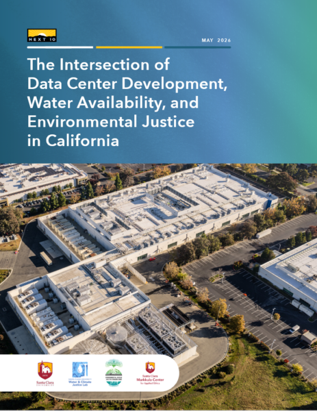 “A new report from the nonprofit Next 10, The Intersection of Data Center Development, Water Availability, and Environmental Justice in California, co-authored by Santa Clara University researchers, asks a question that doesn’t get posed enough: What could be done right now to make the planning and development of data centers in California both more sustainable and more equitable? The short answer, it turns out, is “a lot.” The research, led by Prof. Iris Stewart-Frey (who directs Santa Clara University’s Climate Justice Lab) and Irina Raicu (who directs the Internet Ethics Program at the Center), was published in May 2026. It is co-authored by several Santa Clara University students, and it’s the first effort to map every known operating and planned data center in California and review them through two key lenses: water access and environmental justice. … ” Read more from Santa Clara University.
WATER STORAGE INVESTMENT PGM: Chino Basin Program update highlights progress, costs, and public benefit
“The Chino Basin Program (CBP) was one of the topics discussed at the California Water Commission’s May meeting, where staff from the Inland Empire Utilities Agency outlined the project’s progress toward meeting Water Storage Investment Program requirements. General Manager Kevin Alexander and Program Manager Elizabeth Hurst delivered the update. The Chino Basin Program is one of five projects selected for the Water Storage Investment Program (WSIP), which allocates $2.7 billion from Proposition 1 of 2014 to support the public benefits of those projects. Proposition 4 of 2024 added another $75 million for existing WSIP projects. The CBP is a group of water treatment and storage projects designed to strengthen regional water supply, storage, and delivery systems. The CBP includes a state-of-the-art Advanced Water Purification Facility and aquifer replenishment wells that will produce and store up to 15,000 acre-feet of water annually in the Chino Basin. … ” Continue reading at Maven’s Notebook.
Forever chemicals levels drop after state laws phase out PFAS in textiles
“State laws are working to get PFAS “forever chemicals” out of everything from yoga pants to tablecloths, new testing by NRDC (Natural Resources Defense Council) shows. NRDC tested more than 100 products and found a dramatic drop in the amount of PFAS following restrictions on those chemicals were put in place by New York and California last year. For example, major outdoor brands reduced the level of PFAS in their raincoats by between 97 to 99.99 percent since the new rules went into effect. “Companies complained that they couldn’t get PFAS out of our raincoats, kids’ products, and household textiles, but when states forced their hands, most companies made the change – it shows the laggards can too. Thanks to these two states, we are getting safer clothes and housewares,” said Dr. Anna Reade, Director of PFAS Advocacy at NRDC. NRDC tested 115 products purchased in California and New York in 2025, as detailed in the report released today No PFAS No Problem. … ” Read more from the NRDC.
Archetypes could accelerate agricultural adaptation to less snowpack
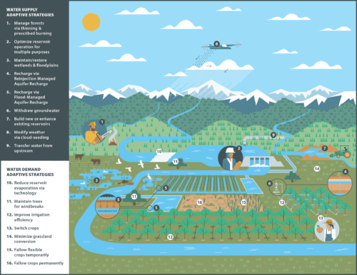
“Future winters promise less snow, more rain. Nobody’s prepared.” So proclaims the title of a recent article in the Proceedings of the National Academy of Sciences of the United States of America that frames adaptation to snow loss as the “million-dollar question” facing the western United States. Declining snowfall—and snowmelt—affects ecosystems, urban and rural water supplies, hydropower, recreation, tourism, and agriculture. As the largest sectoral consumer of fresh water globally, agriculture is particularly vulnerable to snow loss. Much of the U.S. West faces one of the worst snow years on record, and the statistics on future conditions feel dire. Up to 40% of the water demand for agriculture in the region is likely to go unmet as it gets warmer and less snowy. Similar scenarios are shaping up elsewhere around the world, including southern Europe, high-mountain and Central Asia, western Russia, and the southern Andes [Qin et al., 2020]. In response, water managers have developed a range of approaches for adapting to snow loss: infrastructure-based approaches like managed aquifer recharge, nature-based solutions such as forest management and beaver dam analogues, demand-side approaches like multibenefit land repurposing, and polarizing supply-side approaches like reservoir expansion and cloud seeding. … ” Continue reading from EOS.
Oceans are warming — but one spot is getting colder. It could be a clue to the future
“Nearly every corner of the global ocean has warmed over the past century. But one patch of the North Atlantic, located southeast of Greenland and Iceland, has spent decades doing the opposite. While most of the world’s oceans have heated up, this region has cooled. Scientists call it the Atlantic “cold blob,” and a new study suggests it may offer one of the clearest clues yet about changes underway in a major ocean circulation system that helps regulate climate across the Northern Hemisphere. Over roughly the past 150 years, while nearly every other stretch of ocean has warmed, this patch just south of Greenland and Iceland has cooled, by as much as 1 degree Celsius. The cold blob sits thousands of miles from California, but scientists are paying close attention because it may reveal changes in the Atlantic Meridional Overturning Circulation, or AMOC, a vast ocean current system that helps redistribute heat around the planet. … ” Read more from the San Francisco Chronicle.
Could this tiny algae-eater end toxic red tides?
“Sometimes, the grim reapers within the natural world consequently serve the greater good. In this case, the dealer of death is a simple yet ostensibly potent dinoflagellate. “There’s a ‘ruthless predator’ in the ocean that harpoons its prey,” foments the ever-trusted BBC’s Wildlife Magazine, relishing in suspenseful delivery that “It’s not a shark, a squid, or even an ambush predator like the venomous stonefish but a type of predatory plankton called Polykrikos kofoidii.” Sharks, squid, and stonefish, scuttle aside. This little yet well-appendaged plankton wheels and deals under the cover of night aided only by its own built-in flickering glow, harpooning the toxic algae that fuels Southern California’s red tides and swallowing them whole. Marine biologists at the University of California San Diego’s Scripps Institution of Oceanography recently collected water samples from beneath Scripps Pier in La Jolla, and while investigating the peculiar, full-body bioluminescence of P. kofoidii, discovered their consumption of the species mostly associated with red-tide algal blooms, Lingulaulax polyedra, might suggest something. … ” Read more from Surfer Magazine.
In commentary today …
Delta Counties Coalition says Governor’s “milestone” claim on Delta tunnel is premature and disingenuous
“The Delta Counties Coalition (DCC) Chair Supervisor Pat Hume issued the following statement in response to the Administration’s announcement regarding the California Department of Water Resources (DWR) receiving Biological Opinions from the U.S. Fish and Wildlife Service (USFWS) and National Marine Fisheries Service (NMFS) for Delta Conveyance Project construction and construction-related maintenance activities: “The Administration is once again declaring victory on a milestone that does not authorize a single shovel of dirt in the Delta. These Biological Opinions address construction impacts only. They do not resolve how this tunnel would be operated for decades to come, and they do not, on their own, permit any in-water work. For the communities that live, work, and depend on the Delta, the announcement changes nothing about the unresolved harms this project would inflict on our homes, our farms, our water quality, and one of the most important estuaries in the country. … ” Read more from the Delta Counties Coalition.
Learning the right lesson from San Diego’s desal water surplus
Sara Sutherland, senior research fellow at the Property and Environment Research Center (PERC), and Eric Edwards, a PERC senior fellow and an associate professor in agricultural and resource economics at UC Davis, write, “Desalination may sound like the California answer to water scarcity. With drought stressing the Colorado River and other water supplies, the promise of a new supply from the Pacific Ocean seems politically irresistible. But San Diego’s experience should give Californians pause. The San Diego County Water Authority is paying roughly $3,200 per acre-foot for water it doesn’t need, then selling some of it to Riverside County for $1,350. Officials call it innovative water management. It’s not. It’s an effort to minimize losses from an expensive desalination investment. Now, as drought tightens across the seven states that share the Colorado River, Upper Basin states are calling on California to cut its diversions in exchange for more desalination facilities. Before the West bets its water future on desal, California’s 11 years of experience with “the largest, most technologically advanced and energy-efficient seawater desalination plant in the nation” offers a reality check. … ” Read more from the OC Register.
In regional water news and commentary today …
NORTH COAST
In a push to connect rural California, broadband drilling fouled Southern Humboldt’s waterways
“On the evening of June 2, a Southern Humboldt resident looked at Redwood Creek from the Seely Creek Road crossing and knew something was wrong. The water was white — not muddy the way it gets after rain, but opaque, for miles. The resident called the North Coast Regional Water Quality Control Board. Within an hour, two water board engineers were driving Briceland Road west of Redway, stopping at bridges and turnouts, watching the plume move downstream through the canyon. Wide-spread cloudy water, clay particles in suspension. They followed it upstream until they found where it was coming from: a ditch draining from a private property on Briceland Road, running into an unnamed tributary, pouring into Redwood Creek. By Wednesday evening, June 4, the plume had reached the South Fork Eel River. … ” Continue reading from the Redheaded Blackbelt.
New funding marks major milestone for Cannibal Island restoration
“The Wildlife Conservation Board awarded California Trout a $4 million grant to advance restoration of the Cannibal Island Unit in the lower Eel River estuary. The 950-acre Cannibal Island Unit sits at the heart of the lower Eel River estuary, a stretch of coastline that once supported some of the most productive wetland habitat on California’s North Coast. Like much of the estuary, it was diked and drained over generations of agricultural use, cutting it off from the natural tidal flows that salmon, steelhead, and dozens of other species depend on. This funding award advances both the California Salmon Strategy for a Hotter, Drier Future and Governor Gavin Newsom’s goal of conserving 30 percent of California’s lands and coastal waters by 2030 to protect biodiversity and help California adapt to the impacts of a changing climate. … ” Read more from Cal Trout.
SIERRA NEVADA
2025 Lake Tahoe Clarity Report: Water clarity at Lake Tahoe continues to hold steady
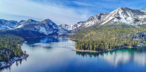 “Staring into the depths of Lake Tahoe, you might think the view goes on forever. But researchers at the UC Davis Tahoe Environmental Research Center have been tracking precisely how far a person can see through the famed lake’s waters for nearly 60 years and sharing the results in the annual Lake Tahoe Clarity Report. The 2025 Lake Tahoe Clarity Report, released today, shows that the annual average clarity remains at a plateau, neither significantly improving nor declining compared to previous years. The annual average was 69.2 feet in 2025. That is 7 feet clearer than last year’s average of 62.3 feet, but not statistically different from recent years, mostly due to a continuing trend of relatively low clarity during summer. … ” Read more from UC Davis.
Can a burned desert watershed bounce back? Nevada restoration efforts offer clues
“After a wildfire, rivers and streams can take years to recover. Native plants and wildlife are often crowded out by invasive species in the aftermath. But in Nevada’s Virgin River watershed, a collaboration between federal agencies and conservation groups is pointing to early signs of recovery. The work is unfolding in a remote stretch of desert in southern Nevada, where the tributary winds through a system that eventually feeds into the Colorado River, a critical water source for millions across the Mountain West. Reaching the site takes nearly an hour and a half on foot through rugged terrain. … ” Read more from Nevada Public Radio.
Sierra Nevada Conservancy awards $4.6M for wildfire projects
“The Sierra Nevada Conservancy has approved more than $4.6 million in funding for wildfire resilience and recreation projects across the Sierra-Cascade region, backing efforts to reduce wildfire risk, improve public access to outdoor spaces and advance future forest restoration work. During the state agency’s recent board meeting, governing members approved nearly $1.5 million for two wildfire resilience projects and just over $3.1 million for seven recreation and tourism projects spanning several Northern and Central California counties. Angela Avery, the executive officer of the Sierra Nevada Conservancy, said the effort started in April 2025. “Since the governor approved the early action wildfire resilience funds from the Climate Bond in April of last year, our staff has worked diligently to get investments out to our regional partners for high-priority projects that protect communities and the landscape from damaging wildfires,” Avery said in a statement. … ” Read more from the Sacramento Bee.
Five years after the Dixie Fire, Northern California communities complete 300-acre wildfire defense project, launch 850-acre expansion
“Sierra Institute for Community and Environment, in partnership with the Taylorsville Firewise Committee and nine private landowners, has completed the Taylorsville Community Defense Zone (TCDZ). The project created a 300-acre shaded fuel break that will protect 88 homes and roughly 140 residents in Indian Valley near Taylorsville, CA. This includes families who relocated to the area after losing their homes in the 2021 Dixie Fire. Sierra Institute is leading the Indian Valley Community Defense Zone Project (IVCDZ) which will treat approximately 850 additional acres of high-priority private forest land across Taylorsville, Genesee, Crescent Mills, and Greenville, California. This work is thanks to funding from CAL FIRE, Sierra Nevada Conservancy (SNC), and the U.S. Forest Service. … ” Read more from YubaNet.
PCWA advances long-term drinking water reliability for Heather Glen
“Placer County Water Agency (PCWA) has been awarded a $16 million financial assistance agreement from the State Water Resources Control Board (SWRCB) to advance the Heather Glen Consolidation Project, an effort that will replace aging water infrastructure and improve long-term drinking water reliability for the Heather Glen community. The project will connect Heather Glen’s water system to PCWA’s Weimar water system, providing the community’s 101 customer connections with access to the stability and operational support of a larger regional water system while replacing aging facilities that have reached the end of their useful life. … ” Continue reading from the Placer County Water Agency.
SACRAMENTO VALLEY
Mechoopda tribe acquires 450 acres of ancestral land
“In a big move back to owning its ancestral land, the Mechoopda Indian Tribe of Chico Rancheria on Monday announced it acquired 450 acres of land along the Big Chico Creek watershed. Known by the tribe as known as Ótakim Séwi in the Mechoopda language, the ancestral land by the Big Chico Creek watershed comes under full ownership by the tribe as part of a goal by California to return at least 7.5 million acres of land and coastal waters to tribal stewardship. Kyle McHenry, cultural director and tribal historic preservation officer for the Mechoopda tribe, said to this newspaper that the tribe earned a grant by the California Natural Resource Agency’s Tribal Nature-Based Solutions Program to acquire the property and to fund a tribal workforce to restore the landscape after it burned in the 2024 Park Fire. … ” Read more from the Chico Enterprise-Record.
BAY AREA
Bay Area warm-up could bring 100-degree heat and high wildfire risk
“By the end of the week, forecasters expect summer-like temperatures across much of the Bay Area, with dry, windy conditions leading PG&E to warn of potential power shutoffs across Northern California due to wildfire risk. High temperatures could reach the 100-degree mark across the North and South Bay. The trend begins Tuesday after possible showers. Temperatures “will rise dramatically” on Wednesday as a ridge of high pressure builds over the region, Bay Area National Weather Service meteorologists wrote in their daily forecast discussion. Inland areas like Livermore could reach into the triple digits by Thursday before dipping into the 80s and 90s this weekend, adding to forecasters’ fire concerns as the region heats up. … ” Read more from KQED.
A chemical from car tires is reaching San Francisco bay and killing salmon
“A chemical in your car tires is washing into San Francisco Bay every time it rains, and it is killing salmon. ABC7 reported that scientists have documented the presence of 6PPD-quinone, a toxic compound produced when a common tire rubber additive reacts with ozone in the air, in stormwater runoff reaching San Francisco Bay. The chemical is lethal to coho salmon and steelhead trout at extremely low concentrations and has been linked to mass fish die-offs in urban streams across the Pacific Northwest. The compound forms when 6PPD, an antioxidant added to nearly all vehicle tires to prevent cracking, breaks down on road surfaces. When rain washes it into storm drains, creeks and rivers, it enters waterways where salmon and steelhead are trying to survive and reproduce. … ” Read more from Active NorCal.
CENTRAL COAST
Two nonprofits petition state board to demand stormwater permits from facilities that allegedly pollute Salinas Watershed.
“With the goal of lowering alleged stormwater-driven pollution by local industrial and commercial sites, two nonprofits that work to protect clean and healthy water filed a petition on June 1 with the Central Coast Regional Water Quality Control Board. According to the California Coastkeeper Alliance and Monterey Waterkeeper, the institutional sites that generate runoff into the Salinas Watershed affect Gabilan Creek, Natividad Creek, Alisal Creek, Santa Rita Creek and the Reclamation Ditch. The petition by the nonprofits demands that the Central Coast Regional Water Quality Control Board implement its clout under the federal Clean Water Act to require stormwater permits for privately-owned commercial, industrial and institutional—often referred to as CII—sites throughout the Salinas River Watershed. … ” Read more from Monterey County Now.
SAN JOAQUIN VALLEY
Cancer-causing ‘forever’ chemicals in 88% of Stanislaus water samples, report finds
“Pesticides linked to cancer were found in 88% of surface water samples in Stanislaus County, according to a recent analysis by the nonprofit Environmental Working Group. The report examined surface water and sediment test data from 10 counties across the state collected between 2020 and 2024 by the California Department of Pesticide Regulation and the U.S. Geological Survey. Surface water testing checks for active contamination flowing through lakes and rivers, while sediment testing looks for potential pollutants in the mud and sand at the bottom of those bodies. … Bifenthrin, a widely used insecticide classified as a possible human carcinogen, was found in 88% of surface water samples collected in Stanislaus County. The bodies of water sampled in the county include Ingram Creek, Del Puerto Creek and Orestimba Creek. … ” Read more from the Modesto Bee.
Hanford-area groundwater agency adds two workshops, one Spanish-language
“The Mid-Kings River Groundwater Sustainability Agency (GSA) added two additional workshops in Hanford on June 16 and June 17 to help landowners register their wells before the July 31 deadline. The June 16 workshop will be held from 1 to 4 p.m. at the Kings County Government Center, engineering building 6. The Spanish-language workshop will be held June 17 from 2 to 6 p.m at the Kings River Hardwick Fire Station, 14680 Excelsior Avenue. Landowners are encouraged to call the GSA to register. … ” Read more from SJV Water.
SOUTHERN CALIFORNIA
Santa Monica Mountains’ last steelhead trout survived the Palisades fire — and even had babies
“Scientists feared the Santa Monica Mountains’ last remaining steelhead trout were dead, smothered by debris flows unleashed by the Palisades fire. But the endangered fish surprised them: A team of biologists recently spotted 30 of the rare trout — and 21 babies — in Topanga Creek. “There was a lot of happy dancing in the creek,” said Rosi Dagit, principal conservation biologist for the Resource Conservation District of the Santa Monica Mountains, which works with public and private landowners to conserve natural resources. That’s because the steelhead here are endangered, at both the state and federal levels. Once, they swam in most streams of the Santa Monicas, but their numbers plummeted amid overfishing and coastal development. Increasingly frequent wildfire has further stressed their habitat. Topanga Creek, a biodiversity hot spot, is home to their last known population in the mountains that stretch from the Hollywood Hills to Point Mugu in Ventura County. … ” Read more from the LA Times.
Las Virgenes tests subsea desalination for water security
“Las Virgenes Municipal Water District is assessing whether subsea desalination could support a more resilient water supply strategy, as drought risk, climate volatility and imported water constraints continue to shape long-term planning for California utilities. The district currently imports all of its drinking water through the State Water Project. That means nearly every gallon delivered to customers travels more than 400 miles from the Sierra Nevada before reaching local taps. In dry years, when snowpack declines and state allocations are reduced, that dependence becomes a major operational and planning challenge. To explore alternatives, LVMWD has partnered with OceanWell on a phased subsea desalination programme. The work began in 2023 and is structured around three stages: a reservoir pilot, an open-ocean demonstration and, depending on results, a potential commercial supply project. … ” Read more from Energy & Environment Leader.
Communities look to Monterey Park AI data center ban as blueprint for fight against Big Tech
“A decisive vote in Monterey Park is reverberating across the San Gabriel Valley. Just days after voters overwhelmingly approved Measure NDC, a ballot measure permanently prohibiting data centers within city limits, residents in neighboring communities are hoping to build on that momentum as they push back against a growing wave of AI-related infrastructure projects. Preliminary election results show more than 86% of voters supported the measure, making Monterey Park the first city in the nation to enact a permanent voter-approved ban on data centers. … ” Read more from Spectrum News.
Environmentalists say bid to end roadless rule could spoil local forests
“Environmentalists are trying to raise public awareness about a plan within the Trump administration to allow roads, and potentially long-term business development, in much of the nation’s federal forest system, including the biggest undeveloped stretch of Orange County. Recently, the effort has included rallies in Los Angeles, Orange and Riverside counties. More rallies are planned in coming weeks in central and northern California. At issue is the fate of the “Roadless Area Conservation Rule,” an administrative regulation that has been in place since 2001 as a way to preserve 60 million acres of federal land for recreation and habitat protection. The rule, which is not a law, has survived every presidential administration of this century, and environmentalists say it has helped protect everything from the Pacific Crest Trail to the California Condor. But it soon might go away. … ” Read more from the OC Register.
SAN DIEGO
New report finds high bacteria levels in Mission Bay and connecting waterways
“A new report released by San Diego Coastkeeper found pollution levels remain persistently high in several creek systems that flow into Mission Bay, leading concerns over the water quality in the beloved recreational waterway. The Coastkeeper’s 2025 Mission Bay Water Quality Monitoring Report, released May 27, details two years of monthly water testing at 10 locations throughout Mission Bay. The findings point to both storm-related pollution and year-round contamination sources affecting the bay, especially at Rose Creek and Tecolote Creek. The report found that both creeks exceed recreation safety standards at least half the time. “Let’s say you go swimming or paddleboarding in Mission Bay. If you’re exposed [or] splash water on yourself and that water has high levels of bacteria, and you ingest a little bit, or you get some in a cut, then that can cause an infection. That can cause a gastrointestinal illness,” Phillip Musegaas, the Executive Director of San Diego Coastkeeper, said. … ” Read more from Channel 8.
Along the Colorado River …
In turbulent times, Trump admin nominates Aubrey Bettencourt to head Reclamation
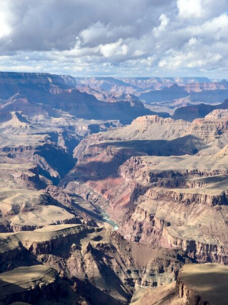 “The White House has made its pick to lead the federal agency that manages water and dams in the American West, a Trump administration official confirmed Monday. If confirmed by Congress, Aubrey Bettencourt, a third-generation California farmer in the Central Valley, will lead the Bureau of Reclamation during a historic time of interstate conflict and record drought along the Colorado River. After years of deadlock in closed-door negotiations, the seven states that share the river are likely to see the Trump administration impose a deal that could mean deep cuts for water users in some of the nation’s fastest-growing cities and most productive agricultural regions. That could lead to an expensive, lengthy battle at the U.S. Supreme Court. … ” Read more from the Las Vegas Review-Journal.
Could the Tijuana River help get Arizona more water?
“Arizona is desperate for water. So much so that its taxpayers are willing to invest in treating Tijuana’s sewage so it’s drinkable. How would that help Arizona? The state would ask Mexico for some of its Colorado River water in exchange. That’s a plan proposed by EPCOR, a private Canadian water utility. The Arizona state legislature granted $1 billion to the Water Infrastructure Finance Authority of Arizona, or WIFA, to jumpstart projects that could make new water, like the one proposed in the Tijuana River Valley. Under the proposal, Arizona could help build a wastewater-to-drinking water facility (like the one San Diego is building called Pure Water) at the federally-owned South Bay International Wastewater Treatment Plant or the city-owned South Bay Water Reclamation Plant. The cleaned sewage water would be sent back to Mexico to a reservoir in Tijuana which holds the city’s drinking water supplies. … ” Read more from the Voice of San Diego.
A water fight in the West: The Colorado River is running dangerously low. States can’t agree how to share what’s left.
“Running from the Rocky Mountains in Colorado to Mexico’s Gulf of California, the Colorado River is being pushed to the breaking point by years of drought and overuse. That dwindling flow is causing panic across the region because the river supplies water to more than 40 million people in seven Western states—Arizona, California, Colorado, Nevada, New Mexico, Utah, and Wyoming. It also provides power to more than 25 million people through hydroelectric dams at the nation’s two largest reservoirs: Lake Powell (in Utah and Arizona) and Lake Mead (in Nevada and Arizona). Water levels at both are down about 75% from peak volumes; declining water levels at Lake Mead could potentially reduce the Hoover Dam’s power generating capacity by 40% as early as this fall. And the situation will likely worsen as climate change accelerates and further dries out the West, with recent studies suggesting the river will provide 10% to 45% less water by 2050. … ” Read more from The Week.
Unease trickles into the Grand Canyon rafting community as water levels dwindle
“It’s late May at Lee’s Ferry, the starting point for rafting trips down the Colorado River in the Grand Canyon. The ferry lies at the end of a two-lane asphalt road that snakes under cliff faces the color of campfire embers. It’s hot. There’s the smell of spray-on sunscreen, the buzz of excited crowds, and – beyond that – the extrasensory vibrations of a tinge of collective anxiety. Anxiety, because the water level in the river is on the lower side of normal for this time of year. Because a historically dry winter in the West means less water in Lake Powell, and less water released into the Colorado River by Glen Canyon Dam. Because, aside from the millions of people who rely on the river system for water and hydropower, there’s an entire river rafting economy in the Grand Canyon that does not know what to expect going forward. … ” Read more from KNAU.
Scottsdale pauses critical water project as doubts mount
“Scottsdale has devoted $100 million to become water self-reliant but recently halted funding to a major project that would provide residents with a new critical supply of drinking water. New environmental regulations, rising infrastructure costs and politics will shape how the city proceeds. City leaders froze spending on a major plan to pump purified recycled water directly to customers’ taps, throwing doubt on where Scottsdale will get future water from and what it will cost ratepayers. … ” Read more from Arizona Central.
Should Arizona consider buying back groundwater rights? Here’s how it’s going in Nevada
“Among many bills introduced by Democrats at the Arizona Legislature this session that never got a hearing one would have established a groundwater rights buyback program. As Arizona looks at dwindling groundwater in many basins across the state and a drier future, the idea would be to allow the state to buy groundwater rights from holders and retire them for good. Last year, Arizona’s neighbors to the north in Nevada did just that. Their state assembly unanimously passed a measure creating a similar program — dubbed the Nevada Voluntary Water Rights Retirement Program. They made the move after trying out a pretty successful pilot program. Laurel Saito is the Nevada water strategy director for the Nature Conservancy. The Show spoke with her about it, beginning with how the buyback program works there.” Listen to show or read transcript from KJZZ.
Growing Arizona’s next generation of water leaders
“As Arizona faces increasingly complex water challenges, the state needs more than innovative technologies and new policies. It needs leaders who can work across sectors, communities and borders to build lasting solutions. That’s the goal of the Water Leadership Institute, a program supported by Arizona Water for All, a pillar of the Arizona Water Innovation Initiative, a statewide project located in ASU’s Julie Ann Wrigley Global Futures Laboratory in collaboration with the Ira A. Fulton Schools of Engineering. The Arizona chapter of the institute, led by the Environmental Defense Fund in partnership with ASU, Water For People, Reconciliación en el Río Santa Cruz and Northern Arizona University’s Water, Society and Policy Lab, is helping cultivate a statewide network of emerging water leaders. Participants include community advocates, utility professionals, nonprofit leaders, researchers, students and others working to strengthen water resilience across Arizona. … ” Read more from Arizona State University.
In national water news today …
Second-warmest spring in U.S. history
“The period of March through May 2026 ranked as the second warmest spring in records going back to 1895 for the contiguous U.S., according to NOAA’s National Centers for Environmental Information (NCEI). Across the past 131 years, only 2012 had a warmer spring, said NCEI in its monthly analysis released on June 8. The nationwide average temperatures for both spring 2012 (56.17 degrees Fahrenheit) and 2026 (55.79°F) are both more than 1.5°F above any rivals in the 131-year database. Spring 2026 was the hottest on record for Arizona, Colorado, Texas, and New Mexico, and 38 of the 48 contiguous states had a top-five hottest spring. … ” Read more from Yale Climate Connections.
Wildfires are reversing years of US air quality gains, study finds
“Wildfires have worsened ozone levels across the United States so much over the last decade that they have reversed around four years of progress, a new study has found. Surface ozone levels, or smog concentrations, steadily increased from 2015 to 2024, deteriorating air quality across the Midwest and Western U.S., researchers at the University of Iowa found in a study released Thursday. According to the study authors, this contributed to an increase of 318 premature deaths per year from fire-sourced ozone since 2013. Their NASA-funded research mapped these ozone levels in kilometer-by-kilometer grids across the entire continental U.S between 2003 and 2024. … ” Read more from Inside Climate News.

