
Several news sources featured in the Daily Digest may limit the number of articles you can access without a subscription. However, gift articles and open-access links are provided when available. For more open access California water news articles, explore the main page at MavensNotebook.com.
On the calendar today …
- MEETING: Working group meetings for the Second Statewide Agricultural Expert Panel from 3pm to 6pm. Staff of the State Water Resources Control Board (State Water Board) will hold two Panel working group meetings for the Second Statewide Agricultural Expert Panel (Panel) on Monday, May 18 and Wednesday, May 27, 2026, to facilitate Panel considerations to public comments received in response to the Draft Panel Report, which provides Panel recommendations on issues relevant to the Panel charge questions. Click here for the meeting notice.
In California water news today …
‘This is exploratory’: Southern California water agencies ramp up interest in Northern California’s Eel River dam
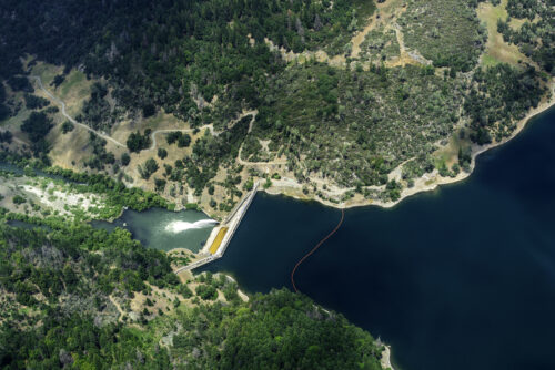
“Directors of a Riverside County water agency said to be interested in a pair of Eel River dams, 600 miles away from their jurisdiction, held a public meeting Thursday night that proved revelatory. It shed light on a recent trip by Elsinore Valley Municipal Water District directors and representatives of a neighboring water agency to the North Coast waterworks. It also gave both supporters and opponents of dam removal on the Eel River a chance to weigh in on the seemingly far-fetched, Trump-era move by the Southern California entities in a complex Northern California water dispute. The updates and public input came in a May 14 board meeting of the Elsinore Valley Municipal Water District, which now has an ad hoc committee dedicated to “exploring opportunities associated with Potter Valley,” according to Director Chance Edmondson. … ” Read more from the Santa Rosa Press Democrat.
Deep in the San Diego County desert, new research has this town at loggerheads on what to do about water
“Just off Palm Canyon Drive in Borrego Springs, a dead honey mesquite tree remains rooted in the hot sand. It’s lifeless but not yet useless — not to the creatures that find shade under its branches or the plants that count on its nutrients. Over the last year, mesquite has been at the heart of a growing water war in Borrego Springs, a tiny but scenic town deep in the San Diego County desert that for years seemed blessed with a rare combination of blazing sun and a font of available groundwater. A century ago, abundant green mesquite blanketed the landscape. But in the decades since, the forest the trees form has deteriorated — just as the town has pumped too much water out of its underground subbasin to sustain its farms, resorts, golf courses and some 3,000 residents. Now, controversy has broken out over whether that mesquite forest relies on the same water as the town. Last year, a study led by UC Irvine scientists concluded it does — research that met with hostility from Borrego Springs’ top industries, which control a large swath of its water rights. … ” Read more from the San Diego Union-Tribune.
Slowing Atlantic circulation may intensify atmospheric rivers
“The majority of California’s water comes from the Pacific Ocean. Atmospheric rivers build over the sea, ride the jet stream east, and slam into the Sierra. When forecasters track wet winters, they watch ocean temperatures off the coast to predict weather conditions. However, they may need to look beyond what is proximate. A new study finds that one driver of California’s wettest storms sits half a world away – in the Atlantic Ocean. The Atlantic Meridional Overturning Circulation (AMOC) carries warm water north toward the Arctic, where the water cools, sinks, and eventually flows back south. The flow helps regulate climate across the Northern Hemisphere. Multiple lines of evidence now suggest it is slowing down. … ” Read more from Earth.com.
What’s a ‘super El Niño’? And other El Niño questions, answered
“The odds are in El Niño’s favor right now. This natural weather phenomenon, part of the El Niño-Southern Oscillation, or ENSO, occurs when warmer-than-average water extends throughout most of the equatorial Pacific Ocean just below the surface. That’s happening now. And powerful bursts of westerly wind have pushed immense amounts of warm water eastward, toward the Niño3.4 region where sea surface temperature, along with other atmospheric conditions, is used to assess the state of ENSO. On May 14, in its monthly ENSO outlook, the NOAA/National Weather Service Climate Prediction Center gave an 82% chance that El Niño will be in place for the period May through July, which implies that it’ll be here within weeks. … ” Read more from Yale Climate Connections.
El Niño and high tide flooding, a possible double whammy for some coastal communities in 2026
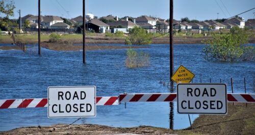 “NOAA’s National Weather Service is predicting El Niño is likely to emerge by July 2026 and continue through the winter, and for many locations in the U.S. this could mean more high tide flooding. To understand why more flooding is expected, it helps to understand what El Niño is and what it does. El Niño (and its counterpart, La Niña) are the warm and cool phases of a natural climate pattern across the tropical Pacific known as the El Niño-Southern Oscillation, often referred to as “ENSO.” The pattern shifts back and forth between the cooler and warmer phases every two to seven years. There’s also a phase in between, ENSO Neutral, when sea surface temperatures are generally close to average. This neutral phase can last for months or years. During an El Niño, the trade winds weaken across the tropical Pacific, triggering Kelvin waves that travel eastward along the equator and then up the west coast of the Americas, warming the upper ocean and raising both sea surface temperatures and sea levels for several months or longer. … ” Continue reading from NOAA.
What a persistent ocean heatwave means for sea life and a possible El Niño year
“California has had a spate of abnormally large marine heatwaves in the past 12 years. Typically, they’ve started far offshore in the spring, reached our coast by the fall, then receded by late winter, according to the National Oceanic and Atmospheric Association, or NOAA. But the current heatwave has stuck around pretty much all year — since last May, particularly off the Central and Southern California coastline. “The only time you ever see that would be during an El Niño, but we’re not in El Niño yet,” said Andrew Leising, an oceanographer with NOAA’s Southwest Fisheries Science Center. … The key point, said Leising, is that El Niño isn’t here yet. So why is the ocean so warm? … ” Read more from the LAist.
Nature as a tool: Using natural infrastructure to reduce extreme weather damage
“Whether from wildfires in California or flooding in Florida, the costs wrought by extreme weather events continue to grow. In 2024 alone, 27 separate weather- or climate-related events—ranging from flooding and severe storms to wildfires and winter storm events—produced losses in excess of $1 billion. In response to these hazards, many communities and governments have built seawalls, levees, or infrastructure to minimize future damage. While such traditional projects can help reduce weather impacts, they also have drawbacks: Not only can they be expensive to build and maintain, they can also disrupt natural ecosystems or lead to other negative downstream consequences. Governments must consider all options when contemplating such projects and give special consideration to projects that leverage natural infrastructure to help protect against extreme weather risks. … ” Read more from R Street.
Heat waves and drought: New report highlights rising toll of natural disasters on U.S. food supply
“As grocery prices remain a focal point of the American economic narrative, a new report released by Trace One reveals that natural disasters are now extracting a $5.1 billion annual toll from the U.S. agricultural sector. The 2026 edition of Where Natural Disasters Are Having the Biggest Impact on the Nation’s Food Supply identifies a shifting landscape of risk for the country’s 1.9 million farms. While pandemic-era supply chain issues once dominated headlines, the report suggests that climate-driven events—ranging from catastrophic flooding in the South to record freezes in Florida—are becoming permanent fixtures of food price inflation. In California’s Imperial County, the data paints a stark picture of the challenges facing local producers. … ” Read more from the Imperial Valley Press.
With more frequent drought on horizon, Catalonia and California pledge cooperation in water research
“The Catalan Institute for Water Research (ICRA) and the California Institute for Water Resources have signed a collaboration agreement aimed at addressing the impact of climate change and droughts, two elements that are increasingly frequent in both territories. This agreement will promote scientific cooperation in research, innovation, and technological development related to sustainable water management, and to promote the movement of researchers between both two centres. The two institutions sealed their cooperation arangement with Catalan president Salvador Illa present in California, while ICRA researchers visited the University of California. One of the central aspects of the collaboration deal will be the exchange of knowledge and experiences, which will allow them to share how the two territories approach water management in extreme climatic conditions. … ” Read more from Catalan News.
California water managers raise 2026 deliveries as reservoirs remain near full
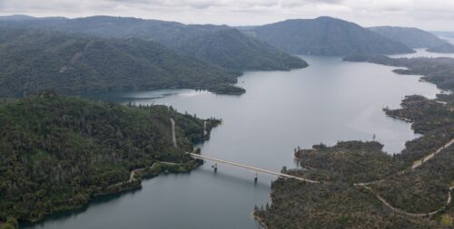
“California officials announced Friday that the State Water Project will deliver more water than expected in 2026. The Department of Water Resources increased the project’s water allocation to 45% from 30% of requested supplies. The allocation tells the state’s 29 public water agencies how much water they can expect to receive. Those agencies supply water to 27 million Californians and irrigate about 750,000 acres of farmland. State officials base allocations on reservoir levels, snowpack and weather conditions. Although California saw record heat in March that melted snow early, rainstorms in April added more water to rivers and reservoirs. That helped the state capture more water without draining stored supplies. … ” Read more from the Sacramento Bee. | Read via Yahoo News.
‘Green rush is over’: What happens to hundreds of abandoned cannabis grow sites?
“A soft orange sunset settled over Humboldt Bay on Wednesday evening as attendees stepped into the Humboldt Association of Realtors’ meeting room, greeted by a table of cookies, coffee, and a low hum of conversation. Close to three dozen people took their seats, a crowd primarily composed of realtors, deeply invested in what happens next for the county’s abandoned cannabis grow sites. The forum brought together four agency representatives whose work intersects at the point where cannabis permitting ends and remediation begins — folks from the Humboldt County Building and Planning Department, the California Department of Fish and Wildlife, and the North Coast Regional Water Quality Control Board. … ” Read more from the Eureka Times-Standard.
Resilient California fishes: Prickly sculpin
“The fresh waters of California support a diverse, highly endemic fish fauna. Many of them are on extinction trajectories. In this blog series, however, we discuss native fishes that are not considered to be in trouble, but that instead have sufficient resiliency to keep populations large and sustainable, even in highly altered habitats. Information on these species should help us to understand why they have such resiliency in the face of large-scale changes to California waterways. Freshwater sculpins are cryptic (i.e., having coloration or markings serving to camouflage the animal), underappreciated fishes that live in coldwater streams and lakes throughout the northern hemisphere, with 10 species in California. In California, they mainly inhabit rocky riffles, runs, and pools in cold, clear streams, where they can be quite abundant. They are rarely seen because of their small size and camouflaged coloration. … ” Read more from the California Water Blog.
Golden mussels still a threat to California waterways. Here’s what to know
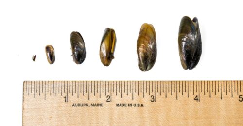 “As the summer boating season gets underway with Memorial Day weekend, golden mussels continue to pose a threat to California’s waterways, officials said. The invasive mussels clog critical water delivery pipes, damage boats and outcompete native fish. They also spread rapidly, mostly via boats. On Tuesday, Kern County supervisors declared a local emergency over the mussels, joining San Joaquin County. Many lakes and waterways across California, including Lake Tahoe, now require inspections before you can put your boat in the water. “Golden mussels are not in Lake Tahoe, and you can help us keep it that way,” the Lake Tahoe Invasive Species Program said. Motorized boats are required to be decontaminated before entering the lake. … ” Read more from the Sacramento Bee.
SEE ALSO: As boating season begins, help protect our waters from golden mussels, from the San Jose Mercury News
California ‘rich dude’ fights $2.5 million fine over public beach access
“John Levy Jr. built his dream home by a lagoon overlooking the Pacific Ocean and turned it into a private retreat he christened “Levyland,” complete with his own pickleball court. Then, the California Coastal Commission came for him. In October, the powerful state agency hit the 74-year-old and his associated trust with up to $2.5 million in penalties, alleging he locked a gate to a beach and blocked a trail to a lagoon, among other things. Levy says the gate isn’t on his land and the trail is private. “I’m quite frankly troubled by what I see as a brazen disregard,” Commissioner Ray Jackson remarked about Levy during a public hearing, characterizing the situation as “a direct affront to the people of California.” … While disputes over California beach access aren’t uncommon, Levy’s battle is being watched nationally for challenging the Coastal Commission’s most potent tool: its authority to impose massive fines. Levy is suing the agency, arguing that its power to level “ruinous financial penalties” without proving allegations in court violates his constitutional right to due process. … ” Read more from the Wall Street Journal (unlocked article; pull down the subscription ask to access the article).
In regional water news and commentary today …
SIERRA NEVADA
Lake Tahoe launches mandatory boat inspections as invasive mussels wreak havoc
“Lake Tahoe’s summer boating season is getting an added layer of protection this year. Given the spread of a prolific invasive species, golden mussels, the moves are well warranted. News 4 reported that as boaters return to the basin, officials are requiring inspections of all motorized vehicles before launch. The Tahoe Regional Planning Agency together with the Tahoe Resource Conservation District will operate at sites in Meyers, Alpine Meadows, and Spooner Summit. The heightened effort follows reports of invasive golden mussels in the area. … ” Read more from The Cool Down.
SACRAMENTO VALLEY
Butte Creek spring-run salmon – May 2026 update
Tom Cannon writes, “Butte Creek is a moderately sized tributary of the Sacramento River, located in California’s Central Valley near Chico, CA (Figure 1). It supports a core population of the threatened spring-run Chinook salmon native to the Central Valley and Sacramento River. Over the past decade, the Butte Creek watershed has experienced some of the largest Sierra fires of recent record.1 Prior to this period, the spring-run salmon in Butte Creek had represented a successful recovery within one of the Central Valley’s few remaining undammed streams. I last updated the status of the Butte Creek spring-run salmon in a November 2024 post. The spawning runs in spring-summers of 2023 and 2024 had been devastatingly low after suffering in the most recent three-year drought (2020-2022). Some recovery in the spawning population in 2025 and 2026 brings a measure of optimism. … ” Read more from the California Fisheries blog.
BAY AREA
New data on salmon-killing chemical in San Francisco Bay
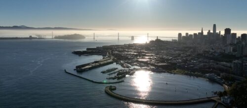 “The chemical, called 6PPDQ, forms in the environment from an ingredient in tires and was first identified in urban stormwater runoff and streams in 2020 by a team of scientists that included SFEI. “To my knowledge, this is one of the first accounts of this compound in an estuary,” says SFEI senior scientist Ezra Miller. “So we are on the forefront of this as we have been since the beginning.” Estuaries are areas where freshwater and saltwater meet, and the Bay is part of one of the nation’s largest estuaries. 6PPDQ is highly toxic to coho salmon, which are extinct in the Bay but are returning to streams as a threatened species just outside the Bay. Steelhead trout, a threatened Bay species, are also sensitive to the chemical. The data, which were collected by the Regional Monitoring Program for Water Quality in San Francisco Bay (RMP) by SFEI scientists from 2021 to 2024, show the highest 6PPDQ levels close to shore after winter storms—the same time of year that steelhead return from the ocean to their birth streams to spawn. Previous RMP data found even higher levels of 6PPDQ in Bay Area stormwater runoff and urban streams. … ” Read more from the San Francisco Estuary Institute.
Larkspur, sewer agency complete $4M pump project
“Work has wrapped up on a collaboration to rehabilitate infrastructure systems in Larkspur. The Heather Gardens lift station and the Heatherwood stormwater pump station have been undergoing an upgrade to improve the systems, originally built in the 1960s. The lift station, operated by the Ross Valley Sanitary District, is used to transport sewer waste to treatment facilities. The pump, operated by the city, removes excess stormwater and mitigates neighborhood flooding. The two systems were originally housed together, which caused problems during storms, said Steve Moore, district general manager. … ” Read more from the Marin Independent Journal.
CENTRAL COAST
SLO County fishermen catch salmon for first time in 3 years. ‘They’re having fun’
“For the first time in three years, Morro Bay fisherman Mark Tognazzini sailed into the harbor this month with a catch of wild Chinook salmon. The state reopened the commercial salmon fishery on May 1 after a three-year hiatus, and the fishermen who survived the closure readied their boats and dashed out to sea to catch their share of an icon of the Pacific coast. Tognazzini said he’s glad to be catching salmon again from the Bonnie Marietta, the boat he built in 1981. The silver fish glinted in the sun as he loaded them onto the dock, ready to be sold at his family’s fish market, Tognazzini’s Dockside Too. “When it’s flat calm and the fish bite, it’s an amazing experience,” he said. “When the fish don’t bite, and it’s shitty weather, it’s a miserable job.” … ” Read more from the San Luis Obispo Tribune.
Why has San Luis Obispo County not leaned harder into desal? It’s trickier than you think
“In many San Luis Obispo County communities, water is the single biggest limiting factor on development. Social media commenters with a shallow understanding of water economics frequently suggest that water districts are weak willed. The argument is, “You got all the water you need, the biggest ocean in the world is right there. Go get it.” The Diablo Canyon desalting facility was the biggest in the nation in 1990 — so PG&E has “been there, done that, got the T-shirt.” The county is studying desalination as a resilient source of drinking water, and there are certainly communities that need water — Nipomo, Los Osos and Cambria spring to mind. But when wells and reservoirs are full of relatively cheap water, it is hard to sell expensive desal. … ” Read more from the San Luis Obispo Tribune. | Read via AOL News.
SAN JOAQUIN VALLEY
Strengthening California’s water resilience through a landmark regional surface water supply project
“The cities of Turlock and Ceres in California have historically relied on groundwater as their sole source of drinking water. Both cities, however, are in an area where groundwater levels have declined due to past over-pumping – creating challenges for long-term water security. To develop a more sustainable and resilient water supply, the Stanislaus Regional Water Authority (SRWA) – a joint powers authority of the cities of Turlock and Ceres – partnered with the Turlock Irrigation District on a $195 million regional surface water supply project. Jacobs was contracted to provide design-build services for the project, which diverts and treats surface water from the Tuolumne River to supplement existing groundwater supplies. … ” Read more from Jacobs Engineering.
Fong secures $5M to combat Golden Mussels in Central Valley
“Congressman Vince Fong has secured $5 million to combat the Golden Mussel infestation across the Central Valley. The funding comes as the Golden Mussel continues to make its way into and disrupt water systems throughout much of Central California, all the way from the San Joaquin River Delta to Kern County farms. The mussels are invasive species that can produce millions of eggs per year. Once they make their way into water systems, they can impact water quality, reduce water flows which can effect food production and have economic impacts for costly repairs to water systems. The invasion is to the point where the Kern County Board of Supervisors could declare it a local emergency. … ” Read more from Channel 12.
IMPERIAL/COACHELLA VALLEYS
Small California city votes to freeze data centers for 5 years as AI boom nears Salton Sea
“A California city is taking an early step to protect residents and natural resources before an AI data center boom can take hold. According to KYMA, on May 13, the Calipatria City Council approved a 4-0 move toward public hearings on a proposed moratorium that would halt new high-energy-demand data center projects within city limits. If the ordinance is approved after those hearings, the city could become Imperial County’s first to adopt such a freeze. That is welcome news for both local households and the environment. Large data centers can use enormous amounts of electricity, and in hot, dry regions, they can also put added pressure on land, water, and public infrastructure. By hitting pause now, Calipatria is giving itself time to examine how fast-moving AI-related growth could affect the region before any projects are locked in. … ” Read more from The Cool Down.
SAN DIEGO
Volunteers attack invasive weeds as 9-day San Diego River Days ends
“More than three dozen volunteers gathered Sunday morning in Ocean Beach to celebrate the end of the 23rd annual San Diego River Days by removing invasive plant species growing along the banks of the San Diego River mouth. The goal of the gathering was to remove an ugly brown weed known as crown daisy so that native plants can grow in its place, allowing birds and other creatures to live in their natural environments. But it was also the culmination of a nine-day celebration of the vitally important, but often underappreciated, San Diego River. “The San Diego River really is the lifeblood of San Diego,” said Natalie Borchardt, the senior manager of natural resources at the San Diego River Park Foundation. “It is the reason that we actually settled here. It is one of the most important features of our region.” … ” Read more from the San Diego Union-Tribune.
Emergency sewer repairs trigger another cross-border pollution close call
“Emergency repairs on a major cross-border wastewater pipeline in Tijuana have been completed after a leak late Thursday increased sewage flows into the South Bay wastewater treatment system. Mexican water authorities released photos Friday showing crews repairing leaks in the Parallel Gravity Line, a massive pipeline that carries wastewater through Tijuana before it is treated near the U.S.-Mexico border. The leak raised concerns in communities already burdened by decades of sewage spills and pollution in the Tijuana River Valley. … ” Read more from NBC San Diego.
Along the Colorado River …
Imperial Irrigation District increases water conservation capacity for Lake Mead
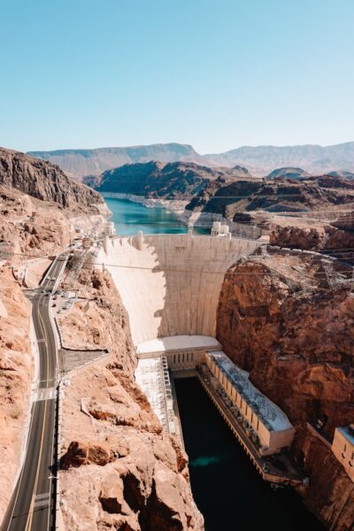 “The Imperial Irrigation District (IID) Board of Directors on Friday, May 15, approved an amendment to its existing System Conservation Implementation Agreement with the U.S. Bureau of Reclamation, according to a press release issued the same day. The amendment will allow IID to create up to 100,000 acre-feet of additional Colorado River conservation in 2026. The additional conserved water will remain in Lake Mead to help stabilize reservoir elevations, protecting Imperial Valley’s only water supply and supporting the broader Colorado River system that serves more than 40 million people. The amendment increases IID’s existing three-year conservation agreement capacity from 700,000 acre-feet to 800,000 acre-feet, in addition to the 106,111 AF conserved for Lake Mead in 2023. … ” Read more from the Desert Review.
Upper Basin Commissioner Mitchell delivers strong message on Colorado River
“As the keynote speaker at the Arkansas River Basin Water Forum in Salida, Upper Colorado River Commissioner Rebecca Mitchell spoke about the Colorado River crisis and water-use negotiations among the seven Colorado River Basin states. Following a warm winter with the lowest snowfall on record, Colorado faces a dire water-resource challenge. Mitchell acknowledged these unprecedented conditions and repeatedly avowed hydrologic reality in the Colorado River Basin as the basis for administering water use. … “Let’s look at the numbers,” Mitchell said. “Even in the most recent years … with reservoirs near the brinks of collapse,” Lower Basin water use was almost 11 million acre-feet in 2021, 2.5 million acre-feet more than the Lower Basin’s allocation. That overuse is based on “a very flawed legal opinion,” not science. … ” Read more from Heart of the Rockies Radio.
Lake Mead’s outlook just went from bad to historically bad
“Lake Mead just got told its worst fortune yet, with federal forecasters predicting that over the next two years, the reservoir is likely to drop more than 20 feet below its lowest level on record set in 2022. The Friday prediction is a reflection of a rapidly changing environment as the Bureau of Reclamation significantly reduces releases from Lake Powell in an effort to keep water flowing in a historically bad snowpack year and the current Colorado River operating agreements are set expire at the end of this year. As of now, the most probable scenario for Southern Nevada’s main water supply places it at 1020.76 feet above sea level in July 2027. Hoover Dam’s hydropower generating capacity is significantly reduced below 1,035 feet in elevation — something that would happen in April, according to the most recent projection. … ” Read more from the Las Vegas Review-Journal.
Colorado River rules face major reset
“According to The Arizona Republic, federal water officials are now considering a new approach for managing the shrinking Colorado River that would rely on a 10-year framework with water-sharing rules reviewed every two years instead of locking in one long-term agreement. The shift comes as drought, declining Rocky Mountain snowpack, and ongoing disputes between the Upper Basin and Lower Basin states continue to complicate negotiations over the river’s future. Arizona officials say the shorter review periods could provide flexibility as conditions change, but they also create uncertainty for cities, tribes, farmers, and water agencies that depend heavily on Colorado River supplies. The Lower Basin states of Arizona, California, and Nevada recently submitted a proposal that would conserve more than 3 million acre-feet of water through 2028, an effort Arizona leaders believe could help stabilize deliveries through the Central Arizona Project Canal. … ” Read more from Western Water.
Commentary: Colorado River supply, the continuing saga
Mike Gardner, Western Municipal Water District Board member, writes, “2026 has been another bad year for runoff in the Colorado River basin. Already depleted reservoirs are losing water rather than filling from spring runoff. Flow into Lake Powell is running less than half of average. The water level in Lake Powell has fallen to about 20 feet above dead pool, the level at which water can no longer reach the hydroelectric generators. To help counter this the US Bureau of Reclamation, which operates the Colorado River, recently ordered release of up to a million acre feet of water from Flaming Gorge Reservoir on the Utah-Wyoming border into Lake Powell. The Bureau also ordered a reduction in water release from Lake Powell to Lake Mead of almost half a million acre feet. The hope is that the electricity generators at Lake Powell can continue to operate until next season’s runoff begins. … ” Read more from the Raincross Gazette.
Arizona: Fighting for Colorado River water is nothing new, but it once nearly led to war with California
“Arizona and the other Colorado River Basin states are once again fighting over how to share one of the West’s most important resources. Negotiations over the future of the river recently broke down, leaving the federal government to decide how the Colorado River will be managed moving forward. But fights over this water are nothing new. Nearly a century ago, the battle became so intense that Arizona sent armed troops to the banks of the Colorado River. The conflict became known as the “Parker Dam War.” The roots of the fight go back to 1922, when the seven Colorado River Basin states negotiated the Colorado River Compact. The agreement was meant to divide the river’s water across the growing Southwest. … ” Read more from Channel 15.
Wildfire risk to focus across the Southwest, Plains
“Conditions will be conducive for wildfires across parts of the Southwest and Plains as a storm moving out of the Rockies will help raise the risk into early week, AccuWeather meteorologists warn. “The same storm that will bring along the risk for a severe weather outbreak early this week will also promote a very high wildfire risk across parts of the Southwest and Plains,” AccuWeather Meteorologist Brandon Buckingham said. This storm will spread gusty winds across the region, combining with low relatively humidity and lack of recent rainfall setting the stage for favorable conditions for fires to rapidly start and spread across the region. Two areas will be at risk for wildfires through Monday. The first area focuses across portions of the Central Valley and Mojave Desert in California. Meanwhile, the second area focuses from eastern Arizona to western Texas and Kansas where there is a very high fire risk from far eastern New Mexico to southwestern Kansas. … ” Read more from AccuWeather.
Low Colorado River levels in Yuma raise water fears
“People who depend on the Colorado River in southwest Arizona say they’re worried the unusually low water they’re seeing right now could be a warning of what’s ahead. In one section of the river as it runs through Yuma, the water level was the lowest it had ever been — a striking change for residents who say the river looked very different just days ago. The low levels come as Arizona and other Lower Basin states scramble to head off what could be catastrophic water shortages in Lake Powell and Lake Mead. Visitors who have been coming to the river for years said they were surprised by what they saw. “Just a couple of weeks ago, the river looked very lively, but now it’s just drying up,” one person said. “It’s a very sad sight to see.” … ” Read more from Channel 13.
Utah’s fragile desert could feel like the Sahara if America’s biggest data center gets built
“Plans for a celebrity-backed “hyperscale” data center in rural Utah, so massive that it would consume more than double the state’s current electricity use, have generated an intense public and political backlash in a state where the motto is “industry” and a Republican supermajority tends to be deferential to development. The project, brought by “Shark Tank” TV personality Kevin O’Leary, would span 40,000 acres, demand 9 gigawatts of power once completed, and raise the state’s carbon emissions by 64 percent, according to estimates. While its water needs remain unknown, the sprawling data center would neighbor the northernmost tip of the shrinking Great Salt Lake, which will likely hit a record-low elevation this year following an unprecedented dry winter. … ” Read more from Grist.
SEE ALSO:
- Data center: New water rights law gives less weight to pushback citing broad impact, from the Utah News Dispatch
- AI data centers in the American West need 7 billion gallons of water a year. The region is running dry, from Quartz
‘The landowners’ right’: As costs rise, some Utah ranchers are leasing fields out for solar projects ‘rather than alfalfa’
“Greg Kesler’s sprawling ranch in Millard County has more than doubled in size over the past decade, stretching across a large swath of high desert land. He built his operation piece by piece, but what’s helped keep it afloat isn’t cattle or training roping horses. It’s solar. About 1,100 acres of his Double Dollar Ranch are covered in a patchwork of solar panels. He leases the land to solar developers that built and own the panels, and the passive income is a welcome windfall. It’s allowed Kesler to buy up surrounding land, expanding his ranch into a kind of private oasis. “It’s just been huge for us,” Kesler said. “Our solar projects [are] on land that was pretty low production anyway. And so instead of producing grass for cows, we’re producing power for homes.” … ” Read more from the Salt Lake Tribune.
‘We’re in trouble’: Flaming Gorge businesses feel the strain of water releases
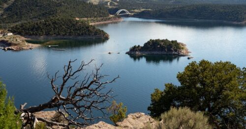
“As water levels at Lake Powell continue to fall to critically low levels, the Bureau of Reclamation is once again turning to Flaming Gorge Reservoir to help stabilize the Colorado River system, leaving businesses near the popular recreation destination worried about what comes next. The Bureau of Reclamation is releasing between 660,000 and 1 million acre-feet of water from Flaming Gorge over the next year in an effort to try and get water levels up at Glen Canyon Dam to continue generating hydropower for millions of people in the area. But some business owners around Flaming Gorge say the rapid drop in water levels is already taking a toll. Flaming Gorge is already several feet below normal for this time of year, and businesses say continued releases could push the reservoir to levels they’ve never experienced. … ” Read more from Channel 4.
Flaming Gorge water releases won’t just boost Lake Powell. They’ll also help these endangered fish.
“Tiny razorback sucker fish have begun spawning in the Green River. Just a few millimeters long now, these larvae will eventually grow up to three-feet long with a sharp hump across their back — if they survive, that is. The razorback sucker is one of four endangered fish in the Green River and larger Colorado River Basin. Dams have changed their home, while invasive smallmouth bass prey on the young fish before they can reach adulthood. Now, a surge of water released from Flaming Gorge into the Green River intended to boost levels at the shrinking Lake Powell may also improve the endangered fish’s odds of survival. … ” Read more from the Salt Lake Tribune.
Lake Powell is draining away from Bullfrog Marina. Now it has to move
“For Dave and Gaye Babcock, Lake Powell is like part of the family. The couple from Helper, Utah, have been coming for nearly 50 years. They got engaged at the lake. His daughter’s wedding was right here at Bullfrog Bay. “We’ve had a lot of good memories here,” Dave Babcock said. “I hope they can keep us coming back.” As the West’s historically dry, warm winter continues to shrink the nation’s second-largest reservoir, those memories may be fading into the past. Lake Powell’s water levels are forecast to drop to new record lows. That’s bad news for 40 million people who rely on the Colorado River for water and power. It’s changing recreation, too. “I’m shocked,” Gaye Babcock said as she pointed across the expanse of orange desert next to the lake. “This whole flat was covered with water, and to see it now, I wouldn’t even believe that we’re at the same place.” … ” Read more from the Utah News Dispatch.
Unfavorable water conditions nothing new for local rafting companies
“Adaptability is the name of the game for outdoor adventure companies when a low water year hits the Roaring Fork Valley’s rafting industry. That means smaller, lighter boats and regularly relocating to where the rivers are running — in other words, where river flow rates meet a high enough cubic feet per second threshold for fun and safe navigation. It requires especially close monitoring and evaluation of river conditions and weather forecasts. Some stretches of rivers get more technical with exposed rocks and rougher water, and some sections will become unnavigably low earlier in the season. It means offering clients an array of different options — such as paddleboards on the North Star Preserve and inflatable kayaks around the Carbondale stretch of the Roaring Fork River. … ” Read more from Aspen Daily News.
Colorado nonprofit offers to buy water for fish, a deal that could help farms weather record drought
“s the drought emergency continues, Colorado’s parched streams and struggling fish may see some relief, not just from snow earlier this month, but from a nonprofit that specializes in brokering deals that can result in more water for the environment. The Colorado Water Trust, founded in 2001, has negotiated agreements that have put more than 98,000 acre-feet of water back into streams. An acre-foot equals 326,000 gallons of water, enough to serve two to four urban households for one year, or enough to cover one acre of land to a depth of one foot. Typically the trust matches water owners with interested buyers and helps move the transactions through the various state agencies that must approve them. Under old Colorado law, water could only be used for a specific purpose, such as farming or municipal drinking water or industrial uses. But new laws allow water to be used for environmental purposes, with proper approvals. … ” Read more from the Colorado Sun.
Colorado Parks and Wildlife resumes weekly testing for invasive species in Colorado River
“With six bodies of water in Colorado now considered infested with zebra mussels, Colorado Parks and Wildlife is kicking off weekly sampling of the Colorado River system. The invasive aquatic species — which poses a significant threat to water infrastructure and ecosystems — was first detected in the state in 2022 at Highline Lake near Grand Junction, and in the Colorado River in 2024. After ramping up sampling efforts last summer, the state wildlife agency found zebra mussels across the river system. This year, Parks and Wildlife is planning to conduct weekly samplings in the Colorado River and on its shoreline from Granby to the Colorado border with Utah, according to a Wednesday, May 13 news release. … ” Read more from Sky Hi News.
In national water news today …
EPA’s draft contaminant candidate list triggers regulatory considerations and opportunities for drinking water treatment technologies
“Last month, the U.S. Environmental Protection Agency (EPA) announced the draft Sixth Contaminant Candidate List (CCL 6) under the Safe Drinking Water Act (SDWA) and released it for public comment. CCL 6 identifies contaminants that are not yet regulated but are known or anticipated to occur in public water systems and may require future regulation. The draft list includes four contaminant groups — microplastics, pharmaceuticals, per‑ and polyfluoroalkyl substances (PFAS), and disinfection byproducts — along with 75 individual chemicals and nine microbes that may be found in drinking water. Although PFAS were included on prior lists, this is the first time the EPA has designated microplastics or pharmaceuticals as priority contaminant groups. Inclusion on the draft CCL 6 signals an emerging concern about these new contaminant groups and the potential for future regulatory action. … ” Read more from Environmental Law & Policy.
Trump cuts to weather data could make forecasts less reliable, warn experts
“As the US prepares for hurricane season and a summer of record-breaking heat, experts fear the Trump administration’s cuts to climate and weather data programming could make the federal government’s weather forecasts less reliable when they are needed most. The National Oceanic and Atmospheric Administration (Noaa) late last year launched a suite of artificial intelligence-powered global weather forecast models which it said would improve “speed, efficiency, and accuracy”. In March, an agency official said those models are being trained with centuries of weather data. … Under Trump, climate and weather data collection has declined, said Medina. This year, the Trump administration proposed a modest budget increase for the National Weather Service, but a 40% cut to Noaa overall. “We absolutely need AI to help us crunch the data faster and to make sense of more and more data that we can collect,” said Medina, who under Joe Biden also served as assistant secretary of state for oceans. “But right now, what we’re doing is cutting back the data collection … we’re going in the wrong direction.” … ” Read more from The Guardian.

