
Several news sources featured in the Daily Digest may limit the number of articles you can access without a subscription. However, gift articles and open-access links are provided when available. For more open access California water news articles, explore the main page at MavensNotebook.com.
On the calendar today …
- WEBINAR: Connecting Solutions for Groundwater Resilience from 10am to 11am. Join Sustainable Conservation for the second webinar in our Spring 2026 Voices from the Field webinar series as we explore how groundwater recharge and multibenefit land repurposing work in tandem to support long-term groundwater sustainability and climate resilience across California. By storing water underground in wet years and strategically reducing demand on groundwater supplies, these approaches can improve water reliability, reduce flood risk, and restore habitat, building a more resilient future for our communities, agriculture, and environment. The conversation will feature leaders from the California Department of Conservation and Earth Genome to discuss the work currently being done and what it takes to implement these solutions at scale. Click here to register.
- LUNCH-MAR: Mattole River Headwaters Drought Relief and Flow Enhancement Project from 12:30pm to 1:30pm. Presenter: Joel Monschke, Stillwater Sciences. To join the Lunch-MAR Session, click here.
In California water news today …
Heat to surge across western US, including 100-degree temps for some cities
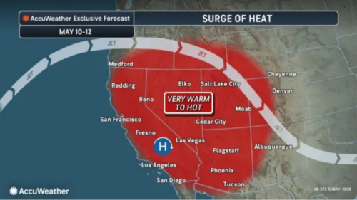 “Heat will soon return across much of the western United States following a six-week hiatus and may exceed some year-to-date high temperatures set in March. While not as extreme as the March heat wave compared to historical averages and early-season records, some locations could still challenge daily records. The effects of a storm that brought showers, spotty thunderstorms and cooler air over the weekend will fade through the rest of the week. Many inland areas of California will be 20 to 30 degrees Fahrenheit warmer from Thursday into the weekend compared to this past weekend, said AccuWeather Senior Meteorologist Tom Kines. “Places like Las Vegas and Fresno, California, could see their first 100-degree temperatures of the year this weekend,” Kines said. Sacramento, California, should reach 90 for the first time since last autumn. … ” Read more from AccuWeather.
El Nino to fuel Pacific hurricane season, increase risks for California, Hawaii, Mexico
“Exceptionally warm waters and a developing El Niño will boost tropical activity during the 2026 Eastern and Central Pacific hurricane season, raising the risk of direct impacts in Hawaii, Southern California and parts of Mexico. The Eastern and Central Pacific basins are expected to produce above the historical average number of named storms, hurricanes and major hurricanes in 2026. The Eastern Pacific hurricane season starts on May 15, while the Central Pacific hurricane season begins on June 1. “This could be an unusually active and potentially impactful year in the Pacific basin, unlike the Atlantic basin, where we are forecasting fewer storms than the historical average,” AccuWeather Lead Hurricane Expert Alex DaSilva said. … ” Read more from AccuWeather.
Lake Oroville nears full at 97% capacity, DWR decreases Feather River releases
“Lake Oroville is nearing full capacity at 97%, according to the Department of Water Resources (DWR). The lake is at an elevation of 893 feet as of May 1. Releases from Lake Oroville to the Feather River have decreased from 1,700 cubic feet per second to 1,300 cubic feet per second on May 3. This accounts for reduced inflows and optimizes storage for water supply, recreation and fish and wildlife enhancement. Releases from the Feather River are assessed by DWR daily. … ” Read more from KRCR.
Lasers in the sky: high-tech missions reveal the West’s critically low “frozen reservoirs”?
“High above the jagged peaks of California’s Sierra Nevada, the view from the cockpit is breathtaking. At first glance, the mountains appear draped in a pristine white blanket. But as the flight crew gears up for a high-stakes mission, the sensors onboard this specialized aircraft prove that looks can be deceiving. “This is a distinct dry year,” says Tom Painter, CEO of Airborne Snow Observatories. Painter, who developed this technology at NASA, isn’t relying on a visual inspection. His plane uses LiDAR, or rapid pulses of laser light, to calculate snow depth with surgical precision. “The LiDAR sprays out about 800,000 pulses per second,” he explains. The result is a 3D map of snow depth accurate to within three centimeters. The technology also helps determine how much water is stored in the snowpack. … ” Read more from Climate Central.
Groundwater law begins reshaping valley
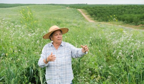
Photo/Caleb Hampton
“Earlier this spring, an excavator maneuvered through the rolling hills of eastern Merced County, stacking almond trees removed by farmer Rosie Burroughs. During the past couple years, Burroughs scrapped about 170 acres of almond and walnut trees. Another 140 acres are slated for removal, reducing the family’s acreage by about a fifth. San Joaquin Valley farmers are increasingly fallowing land as California’s Sustainable Groundwater Management Act curtails pumping. “Every farmer is affected,” Burroughs said. Groundwater serves as a lifeline for orchards and vineyards in the valley that need water regardless of rain or drought. For some growers, it’s their only water source. Under SGMA, which is implemented by local agencies, groundwater basins have until 2040 or 2042 to achieve sustainability. But since 2020 or 2022, depending on local conditions, groundwater agencies have been required to prevent “undesirable results” such as land subsidence and household wells running dry. … ” Read more from Ag Alert.
Groundwater summit moves from capitol to Clovis, changes focus to farmers
“An annual groundwater conference is being moved this year from downtown Sacramento to Clovis in an attempt to reach those most affected by the state’s new groundwater law – farmers. The conference, “Faces of SGMA Implementation Summit” put on by the Groundwater Resources Association will be held June 2-3 at the Clovis Veterans Memorial Building. “I am trying to make it more accessible to the people who are living and breathing SGMA implementation,” said organizer Trelawney Buillis. She referred to the Sustainable Groundwater Management Act, which requires water managers and farmers to bring overdrafted aquifers into balance by 2040. That will likely require up to 1 million acres to be fallowed in the San Joaquin Valley, a severe economic hit. … ” Read more from SJV Water.
Drought, water restrictions drive innovation in tech
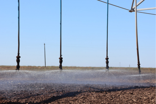
Photo/Manola Secaira
“Ashish Shah is drinking water to prove a point. When he explains his project to people, he finds it’s often the most efficient way to show proof of concept. “If you have 30 seconds, you can explain it real quick,” Shah said. “If you have five minutes, then they might even drink it with you.” Shah’s company, Napa-based Revida Water, processes wastewater from places including wineries and dairies for reuse. Similar projects have existed for years, often focusing on getting the water clean enough that it can be used for irrigation. But Shah’s process makes such wastewater drinkable. It’s why his kids sometimes jokingly refer to his product as “cow poop water.” “They get a kick out of it,” Shah said. Shah said his company is the first to do so. Although the concept can be hard to imagine, Shah said it’s proven to be safe. Revida’s technology ushers the wastewater through a series of steps—including filtration and introducing specific microbes—that have been used in treatment processes before. “We didn’t reinvent the wheel or the science on this. We just put together what was already there,” he said. … ” Read more from Ag Alert.
New system maps and charts West Coast fisheries data to inform decisions on ocean uses
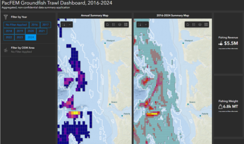 “A new system combines decades of fisheries data and statistics to visualize West Coast fisheries and how they have changed over time. The Pacific Fishing Effort Mapping Project was led by researchers at NOAA, state wildlife departments, and the Pacific States Marine Fisheries Commission. It consolidates location and catch data from fishing vessels with landings and economic figures into revealing maps and charts of major West Coast fisheries. It then shows how they may be affected by other ocean uses. For instance, the new system turns data on the catch value of groundfish into a landscape of colors depicting the West Coast, where the highest value catch areas stand out boldly. “By combining all this data into one place to visualize it all together, we can begin to see patterns, tradeoffs and comparisons that we might not notice otherwise,” said Lisa Pfeiffer, a research economist at the Northwest Fisheries Science Center who helped lead development of the system. Funded by NOAA and the Bureau of Ocean Energy Management, it is designed to inform marine planning and compare different uses of the ocean and their implications for fisheries. … ” Read more from NOAA Fisheries.
SEE ALSO: Breaking Barriers to “Big Earth Data”, from NOAA Fisheries
‘River ghosts’: Journey turns deadly for young salmon as conditions continue to spiral
“Young salmon in California are disappearing at alarming rates as their once-reliable migration routes grow increasingly dangerous. According to Earth.com, scientists studying salmon in the Sacramento–San Joaquin River Delta found that many juveniles are dying before completing a critical stage of their migration to the ocean. The Delta, spanning about 1,100 square miles, once had a mix of gentler channels, wetlands, and floodplains where young salmon could rest, eat, and grow. Over time, much of that habitat has been transformed into straighter, faster-moving waterways. In dry years, shrinking channels can trap salmon in warm, shallow water. In wet years, powerful flows can sweep them out to sea before they’re ready. … ” Read more from The Cool Down.
No joke: New study shows salmon swim faster and farther on cocaine
“This is your salmon filet. This is your salmon filet on cocaine. Any questions? New research published by Current Biology sought to determine how cocaine affects the behavior and health of wild Atlantic salmon smolts. The conclusion is that it does, and quite profoundly. For one thing, coked-up salmon swim faster and farther, the study shows. For unscientific folk, the first reaction to learning about such a study may prompt a series of questions: How the heck do you come up with the idea to give salmon cocaine? How does a researcher get someone to pay for getting salmon high in the name of science? How do you legally get your hands on cocaine to give to the salmon? … ” Read more from the WyoFile.
Rio Vista City Manager expresses California Forever concerns
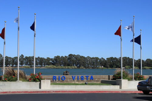 “California Forever officials have denied concerns raised by Rio Vista City Manager Kristina Miller that the Suisun Expansion Specific Plan could become the nation’s largest data center. “Key details of the Suisun Expansion Plan are not being outwardly communicated to the public,” Miller wrote in a Monday letter. “Specifically, the Suisun Expansion Plan as drafted could potentially provide zero housing and virtually no jobs, despite significant marketing of the project as a large-scale housing and commercial development project.” Miller’s letter claims the Suisun Expansion Specific Plan would allow data centers in all zoning designations other than Open Space and Civic Open Space by-right without discretionary review. A table on page 58 of the Suisun Expansion Specific Plan does indicate that data centers would be allowed by right in areas zoned for Commercial Mixed Use, Neighborhood Mixed Use, Maker and Manufacturing, Industry and Technology, and Open Space Industrial. These zoning designations cover 13,410 acres, approximately 85.2 percent of the entire area of the specific plan. … ” Read more from the Vacaville Reporter. | Read via MSN News.
SEE ALSO: Moy looks to push Williams into California Forever fray, from the Daily Republic
Warm, dry start of spring sparks fire season concerns
“More than seven years after the Camp Fire ripped through the Paradise area in Butte County, burning 153,336 acres and killing 85 people, emotion still rings through Laurie Noble’s voice as she talks about preparations for what could be a busy wildfire season. She and her husband, Jim Noble, owners of the 106-year-old Noble Orchard, lost their home and agricultural buildings in the November 2018 blaze. Since then, they’ve slowly been rebuilding, and this year they’ll finish with a new cold storage and packing facility. For Laurie Noble, memories of rushing back to her house to grab whatever she could as the fire quickly approached are still vivid. “Both my husband and I got out,” she said. “I had two cats and next to nothing else. But we were separated, in separate cars. I ended up walking fire trucks through a line of traffic that was double-lane through a residential area.” … ” Read more from Ag Alert.
Wildfire resilience has always been the goal. Now it’s a number
“For the first time, a land manager in Oregon, a county planner in California or a federal agency in Alaska can look up a single number — the Wildfire Resilience Index (WRI) score — for any community, watershed, congressional district or management unit in western North America, and see exactly where resilience to wildfire is high, where it is dangerously low, and why. Developed by researchers at the National Center for Ecological Analysis and Synthesis (NCEAS) at UC Santa Barbara and a team of experts, the Wildfire Resilience Index is the first tool to measure both social and ecological wildfire resilience simultaneously, at 90-meter resolution, across more than 700 million pixels spanning the western U.S. and Canada, and Alaska. It is free, open-access and available today at wildfireindex.org. “Fire is a natural part of many western ecosystems,” said project lead Caitlin Fong. “The real issue is that our communities, infrastructure and policies haven’t kept pace with that reality. The WRI helps pinpoint where misalignments are greatest.” … ” Read more from The Current.
Want to predict wildfire severity? Look to the state of vegetation
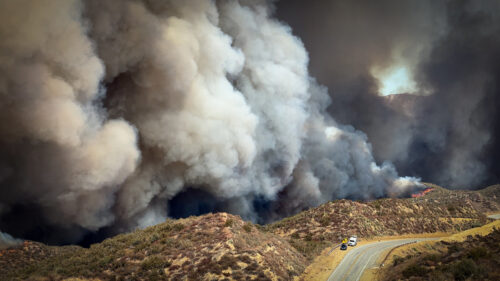
“Urbanization, climate change, and fire suppression practices are contributing to increased wildfire risk at the densely populated wildland-urban interface. These factors make fires more unpredictable and harder to manage. In January 2025, this was made devastatingly clear in Los Angeles, when massive wildfires engulfed entire hillsides and canyons, destroying neighborhoods and damaging surrounding ecosystems. The Mediterranean climate region of California, which stretches up most of the state’s coastline, is a naturally fire-prone landscape because its dry conditions support vegetation growth and also allow for fire to spread easily. As wildfires become more intense, better modeling and understanding of their drivers is crucial in efforts to predict risk. Ward-Baranyay et al. looked at three of the January 2025 Los Angeles wildfires by analyzing preburn conditions, such as fuel characteristics, topography (including elevation and slope), and wind speed. … ” Read more from EOS.
Fire is transforming the US West’s public lands – research shows overlooked cost to recreation
“Colorado’s two largest fires on record, the Cameron Peak and East Troublesome fires, burned hundreds of thousands of acres across some of the state’s most visited landscapes in 2020. The fires scorched trails, campgrounds and beloved ecosystems in and around Rocky Mountain National Park and the Arapahoe and Roosevelt national forests. More than five years later, the scars remain stark: blackened hillsides, closed trails and bare slopes where forests once stood. According to our recent research, which has not yet been peer reviewed, the fires caused significant and lasting declines in visitation at the burned sites. … ” Read more from The Conversation.
The future of Western forests depends on professional pinecone collectors
“High in the crown of a giant sequoia, the world becomes a cathedral of green and amber, hushed but for the creak of ancient wood and the sharp, rhythmic snap of cones being pulled from boughs. Dan Keeley, 31, moved around with a practiced, fluid economy, suspended by thin lines of high-tensile rope 200 feet above the ground on the western edge of California’s Sequoia National Park. To his left, the sequoia’s cinnamon-colored bark provided a steady presence as he leaned out over the negative space between branches. “There is a lot of trust that goes into this work,” Keeley said, speaking over the wind. He eyed a cluster of green, egg-sized cones. “Trust in the trees, predominantly, but also trust in the system — that I’m being sent to the right trees, at the right time, and for the right reason, not all of which are always the case.” Keeley, a lean, tanned former rock climber and arborist, is what some in the forestry industry call a pinecone cowboy, a freelance contractor hired to harvest the genetic future of Western forests. He climbs trees of important or threatened species to collect ripe cones for seeds intended to be used for reforestation. Keeley is part of a specialized workforce that’s become the primary resistance against the rapid erasure of a Western landscape. … ” Read more from High Country News.
In commentary today …
Climate change is impacting California’s water. Here’s how we can prepare.
 Mike Taraszki, a senior vice president and hydrogeologist at WSP, writes, “California rang in the new year by announcing that it was 100% drought free for the first time in 25 years. While that’s good news, it’s risky to assume the trend will last. The last few months of winter were unusually warm, leaving statewide snowpack at nearly half of its historical average. While some places experienced unprecedented rainfall, many are seeing record high temperatures. Swings from deluge to drought are nothing new in California, climate change is rewriting the rules in ways that could represent a real constraint on growth and development. What we do now will dictate the future of our communities and economy. … ” Continue reading this commentary.
In regional water news and commentary today …
NORTH COAST
River otters at the Arcata Marsh: They eat more than fish
“For nearly three decades, Cal Poly Humboldt Wildlife Professor Jeff Black and citizen scientists have been quietly documenting the lives of one of the North Coast’s most charismatic residents: river otters. Now, marking the 27th and final year of this long-term research effort, Black is sharing new observations at the Arcata Marsh & Wildlife Sanctuary—a place where wastewater treatment, wildlife habitat, and public access intersect. Based on two years of intensive study, the latest findings, published in the Northwestern Naturalist, reveal just how deeply river otters rely on the marsh. Otters were present nearly every day, using the wetlands not only to hunt, but to raise pups, socialize, rest, and navigate a landscape shared with hundreds of daily visitors. “Watching the daily interactions between these top predators and their prey was a treat,” says Black. “These river otters regularly switched between fishing for fish and hunting for waterbirds—depending on which pond they entered.” … ” Read more from Humboldt Now.
Superbloom spreads across Redwood National Park hillside
“Death Valley is not the only California park bursting with color this spring. In Redwood National Park, a lupine superbloom is spreading across the Bald Hills, covering part of the landscape in purple and creating another striking wildflower display. “This year at Redwood, we’re experiencing a lupine superbloom,” a Redwood National Park botanist said. Unlike the superbloom in Death Valley, which was fueled by a rare stretch of favorable weather, the burst of flowers in Redwood National Park was sparked by fire. “We’re realizing that one year after a fire, we end up with a lot of vegetative lupins, but two years post-burn, just like the burn that they did in this drainage two years ago, we end up with a lupine superbloom,” the park explained. … ” Read more from AccuWeather.
PG&E receives approval for Rio Dell energy project
“Pacific Gas and Electric Company’s Rio Dell feeder project, which will provide more reliable and increased electrical capacity, has received approval from the California State Lands Commission. At its April meeting, the Commission approved a Final Mitigated Negative Declaration environmental document and issued a 20-year right-of-way lease for use of land on which the project will be conducted. The project includes the installation of two 20-inch conduit castings under the Eel River, using Horizontal Directional Drilling. The Horizontal Directional Drilling method is a trenchless technique meant to avoid disturbance along the bore path to minimize impacts to waterways and sensitive habitats. … ” Read more from the Eureka Times-Standard.
SIERRA NEVADA
Yuba Water expands sediment removal and road repairs at New Colgate
“Yuba Water Agency has expanded recovery operations at its damaged New Colgate Powerhouse in California, with large-scale sediment removal, road reconstruction and hillside stabilisation works now under way following February’s penstock rupture. The latest update marks a shift from emergency response into longer-term restoration activity at the 340MW hydropower facility on the North Yuba River near Dobbins. The powerhouse has remained offline since 13 February, when a 14ft diameter penstock ruptured above the site, releasing around 400 acre-feet of water and causing extensive erosion and infrastructure damage. Yuba Water said work is progressing on multiple fronts, including repairs to Lake Francis Road, sediment excavation within the river corridor and restoration of systems inside the powerhouse itself. Crews have already removed significant volumes of mud and debris from the powerhouse deck, where deposits reached more than 13ft deep in some locations. Approximately 11,000 cubic yards of material have been cleared from around the facility so far. … ” Read more from International Water & Power.
The 11,700 acre Caldor Fire reforestation project includes use of herbicide
“There is growing local concern about the use of herbicides on the forest around Lake Tahoe as well as in the rest of the West. After a fire passes through, the first signs of plant life to emerge are weeds, plants and brush, some of which prevent the healthy rebirth of a forest. With more severe wildfires and a changing climate, it seems a daunting task to bring a forest back, and over the past few years, the U.S. Forest Service (USFS) has had several tools in its toolbox to accomplish this, including fire, hand and mechanical thinning, and pesticides such as glyphosate, more commonly known as Roundup.
Environmental groups and members of the public have had concerns about the use of a pesticide by hand-spraying the unwanted plants and shrubs, even if it is EPA-certified (Environmental Protection Agency). … ” Read more from South Tahoe Now.
Lack of funding significantly reduced 2025 aerial forest surveys
“An annual aerial survey that monitors forest health was significantly reduced in 2025 due to a lack of funding, resulting in many portions of California forests, including the Tahoe area, not being included. Since 2006, the U.S. Forest Service Pacific Southwest Region’s Aerial Survey Program has flown over California forests every year to observe and document tree mortality, defoliation, and other damage. These annual estimates capture tree mortality patterns and trends, which researchers and foresters use to monitor ecosystem disturbances often caused by insects and disease. The information is also important for fire behavior forecasting. … ” Read more from the Tahoe Daily Tribune.
SACRAMENTO VALLEY
A remote Northern California waterfall has gotten so popular that reservations are required
“Sometimes, beauty is a burden. Such is the case with Burney Falls, a Northern California waterfall whose loveliness became such a siren song to costume-wearing Instagram mermaids, selfie-taking TikTok tour guides and off-the-beaten-track road trippers that crowds grew and grew, until the natural wonder just couldn’t handle it any more. Crowds in recent years have damaged trails, trampled plants and clogged rural roads. Now, as part of a pilot program to reduce overcrowding, the California Department of Parks and Recreation will require advance reservations to visit the Shasta County waterfall on many days this summer. … ” Read more from the LA Times.
California’s rice footprint – See the science in action
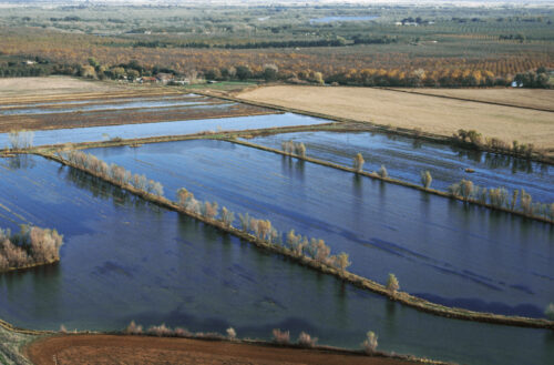
“The Rice Footprint is a landmark conservation science study that – for the first time – quantifies exactly how many rice acres are needed in California’s Sacramento Valley in order to support native wildlife populations. Conducted by researchers at UC Davis and Point Blue Conservation Science, the study analyzed habitat requirements for dozens of species and arrived at a clear, data-backed threshold: 470,000 – 500,000 acres of rice must be planted each year to sustain this ecosystem. … ” Read more from the Northern California Water Association.
Volcano Baby: How the Sutter Buttes turned up, all alone, in the Central Valley.
“In the vast flatness of the Sacramento Valley, encircled by a gravel mine, a gun shop, a fancy duck-hunting club, a Dollar General, a restaurant called Taco Time, several hundred gas wells, and a million billion almond trees, sit the remnants of a tiny volcano. Tiny by volcano standards. The Sutter Buttes are 10 miles wide and poke up 2,000 feet. In classic butte fashion, they are steep on the sides. Nearly all of the rocks out here (and a considerable number of the decorative rocks in Sacramento, about an hour’s drive south) have their origins in this volcano. In front of Taco Time, someone has set out a semicircle of rust-colored andesite chunks that the volcano burped out, presumably meant to discourage cars from parking too close to the picnic table. Rocks can be hard to come by in the Central Valley, where nearly everything is covered by river sediments. In a 50-mile-wide, 400-mile-long valley, the Buttes look improbable, a cartoon splat compared to the Coast Range to the west (tall, majestic) and the Sierra Nevada to the east (also majestic, even taller). Nonetheless, the Buttes exist. How did they get there? … ” Read more from Bay Nature.
BAY AREA
California neighborhood remains without potable water
“On Monday, a neighborhood in Mountain View was still without drinking water because of contamination from a breach in a water main. It’s been more than 10 days, and the area is still under a “boil water” order from the state, with crews scrambling to restore potable water to the homes. The neighborhood across from Cuesta Park has been undergoing a replacement of all the water main pipes, and the problem began on Friday, April 24th. A contract worker reportedly recharged a water main without properly closing a valve, sending some cement slurry into the line. “Which apparently is something that hasn’t happened before in the State of California, to the best of our knowledge,” said Lenka Wright, Mountain View’s Chief Communications Officer. … ” Read more from Action News Now.
CENTRAL COAST
Salinas Valley: The clock is ticking on water projects to bring local groundwater basins into compliance.
“With a short window to tackle a high-stakes problem – water – things are getting serious, fast. Members of the Salinas Valley Basin Groundwater Sustainability Agency’s (SVBGSA) advisory committee met on Thursday, April 16 to talk about potential solutions, and the consequences if deadlines are missed. The goal, under California’s Sustainable Groundwater Management Act, is to develop projects and management actions to bring basins to sustainability by 2040 or 2042. If local groundwater sustainability agencies cannot come up with effective solutions, control could shift to the State Water Resources Control Board, which has the authority to impose pumping restrictions. That could result in fallowing farmland, impacting the county’s top economic driver. “We are asking you to develop a recommendation to the board,” SVBGSA Executive Director Piret Harmon told committee members. … ” Read more from Monterey Now.
Commentary: San Luis Obispo: Should this water desalination project be linked to a nuclear plant?
William Simpson, executive director of the Wild Horse Fire Brigade, writes, “San Luis Obispo County is studying the construction of a major seawater desalination plant along its 90-mile coastline, to provide a drought-proof water supply for 16 partner water agencies. One of the leading options involves pairing or expanding the plant at or near Diablo Canyon, California’s last operating nuclear power station. Desalination is extremely energy-intensive. Reverse-osmosis systems — which force seawater through membranes to filter out salt — typically require 4,000 to 5,000 or more kilowatt-hours of electricity per acre-foot of water produced. (An acre-foot is the amount of water needed to cover an acre of land under a foot of water.) With California’s grid already under strain, securing reliable power is a big challenge. Proponents argue using Diablo Canyon offers clear advantages. The plant already operates a small on-site desalination facility producing up to 1.5 million gallons per day. … ” Read more from CalMatters.
SAN JOAQUIN VALLEY
Madera grower Darren Schmall expands agriculture into agritourism, innovation, and sustainability
“The AgNet News Hour featured a conversation with Madera grower Darren Schmall, highlighting how one Central Valley farmer is blending traditional agriculture with innovation, agritourism, and sustainability to stay competitive in a changing industry. Schmall, a fourth-generation farmer, continues to grow almonds and raisins in Madera and Fresno counties, but has also expanded his operation into a diverse business model that includes concerts, events, and agricultural education. “I’ve always been drawn to educating the public about agriculture,” Schmall said. … ” Continue reading at AgNet West.
SOUTHERN CALIFORNIA
Climate Prediction Center forecasts El Niño year. What does that mean for SoCal?
“The Climate Prediction Center is predicting an El Niño year with some scientists suggesting there is even a potential for a so-called “super” El Niño. The El Niño climate pattern has historically brought heavy rain and flooding to the region. Longtime residents may remember the impacts of past events, including the flooding in 1997-98. “El Niño is when the water temperatures in the Pacific Ocean get really, really warm, and all of that warm water provides energy,” explained ABC7 Chief Meteorologist Dallas Raines. “It’s an energy source for possible heavy rain in Southern California.” … ” Read more from KABC.
New coalition decries ‘parasite’ data centers proposed in City of Industry
“On Saturday morning, hundreds of San Gabriel Valley residents gathered on a warm yet gloomy day in Rowland Heights to protest the creation of battery energy storage systems and data centers in the City of Industry. In February, the City of Industry City Council voted unanimously to change zoning laws to allow for the construction of a battery storage site just northwest of where Azusa Avenue meets the 60 Freeway. Although it only houses around 200 residents, the City of Industry is home to roughly 3,000 businesses, including many factories; with its unusual two-mile-wide, 14-mile-long strip, it neighbors about a dozen different communities. Protesters at Saturday’s rally expressed concerns regarding the impacts on air quality and potential health hazards that may arise with the building of battery storage structures. … ” Read more from the LA Times. | Read via Yahoo News.
IMPERIAL/COACHELLA VALLEYS
Sierra Club seeks to join lawsuit challenging Imperial County Data Center approval
“The Sierra Club has filed a motion to intervene in an ongoing legal challenge to Imperial County’s approval of a massive hyperscale AI data center project, intensifying the battle over large-scale data center development in the Imperial Valley. In papers filed May 1, the environmental organization asked Superior Court Judge L. Brooks Anderholt for permission to join the lawsuit brought by the City of Imperial against the County of Imperial and its Board of Supervisors (Case No. ECU004457). The case centers on the County’s issuance of Grading Permit BP# 63316 and a Notice of Exemption (NOE) for the project proposed by Imperial Valley Computer Manufacturing, LLC — described as potentially the largest data center in California. … ” Read more from the Daily Republic.
SAN DIEGO
Commentary: San Diego can’t afford another flood disaster
Jessica Calix, a San Diego resident, writes, “About two years ago, I lost everything. It was my son’s eighth birthday when a historic flood tore through our San Diego home, destroying everything we owned. He was at school when it happened. On my way to pick him up, I cried, wondering how I would tell him that our pets were gone — that everything was gone. I held it together that night so he could celebrate. The next day, I told him the truth: on Jan. 22, 2024, a catastrophic storm combined with a failure of the city’s stormwater infrastructure submerged our Southcrest home under six feet of toxic floodwater. The water rose so fast that entire street blocks were destroyed before families could evacuate. We had no warning. … ” Read more from the Times of San Diego.
Sales tax for Tijuana River pollution fixes, social services has enough signatures for November ballot, supporters say
“San Diego County voters could decide to raise the sales tax by a half cent in the November election for a series of issues supporters say have historically plagued residents, such as the decades-long Tijuana River sewage crisis. On Monday, outside the San Diego County Registrar of Voters, labor unions and advocacy groups unloaded a truckload of boxes containing what they said were more than 167,000 signatures in support of the Protect San Diego County’s Health and Safety Act. “Today’s submission of over (160,000) signatures is more than a milestone,” said Waylon Matson, cofounder of the nonprofit 4 Walls International. He has been advocating for an end to the pollution crisis for years through his nonprofit. Now, he’s pushing for solutions through the proposed measure. … ” Read more from KPBS.
Along the Colorado River …
The Colorado River is overdrawn, and a corporate reckoning is imminent
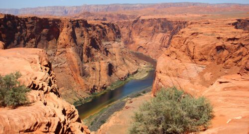
“Imagine that a company had a pension fund that promised $16.5 billion in future payouts but the value of that fund today sits at only $12.4 billion. Moreover, that pension fund has been drawing down the balance for over 25 years to cover the annual shortfall. Finally, imagine if the market conditions are such that the fund is reaching a point of no return—drawn down to such an extent that it will have no pathway to delivering on the promised payouts. This is precisely the situation that has been created on delivery of the promised water from the Colorado River. The allocations under the Colorado River Compact to the seven states of the Basin totals 16.5 million acre feet (MAF) per year. The actual flow of the Colorado River is approximately 12.5 MAF based on the average flows from 2000 through 2023. This is an annual shortfall of 4 MAF for the last two and a half decades. The gap has been made up by drawing down reservoirs in the basin (Lake Mead and Lake Powell) to the point that these reservoirs are now approximately at one-third of their 2000 levels. All of this is in the face of increasingly tightened supply because of climate change, which is predicted to reduce flows in the Colorado River by another 20-30%. Unfortunately, the parallel between water and financial health does not stop at the numbers for balance and withdrawal. … ” Read more from Yale Insights.
Mexican Farmers are unhappy with mandated cuts to Colorado River water
“Last week the lower basin states of Arizona, California, and Nevada, along with tribal leaders, offered to leave somewhere between 700,000 to a million acre-feet of water in the Colorado River system through 2027–2028. The states described it as more than 3.2 million acre-feet of savings by 2028 and a way to stabilize Lake Mead and Lake Powell while longer-term negotiations continue. But what caught my eye about this story is that Mexico – which had received 1.5 maf annually, has been obligated to conserve some of their precious Colorado River water too. Mexico’s role in the Lower Basin’s broader conservation framework is separate from the 700,000-to-1 million acre-feet the U.S. Lower Basin states are offering; under the existing U.S.-Mexico arrangements, Mexico had already committed to a complementary conservation program of 400,000 acre-feet for 2023–2026. Reportedly, farmers south of the border are unhappy with these arrangements. … ” Read more from Coyote Gulch.
Science of less: The Colorado River’s shrinking reality
“Water reaching a Colorado State University dorm has crossed the Continental Divide, passed through tunnels and treatment systems and entered a network built on a river that is shrinking with rules that assumed it wasn’t. The science of the Colorado River’s decline is not new. It is, however, arriving faster than expected. Since the early 2000s, flows in the Colorado River have dropped roughly 20% compared to 20th-century measurements. Average annual flows during the 20th century ran about 14.6 million acre-feet per year; since 2000, that number has fallen to roughly 12.4 million acre-feet. That gap matters because the 1922 Colorado River Compact was drafted around an assumed flow of roughly 16.4 million acre-feet per year, a figure the river has never reliably produced. Brad Udall, a senior water and climate research scientist at CSU’s Colorado Water Center, said the error wasn’t purely a measurement problem. … ” Read more from the Rocky Mountain Collegian.
SEE ALSO: A river running out: 100 years of Colorado River Compact, from the Rocky Mountain Collegian
New Colorado River water saving plan could have a big impact on these housing markets
“Arizona, California, and Nevada have proposed a high-stakes plan to conserve 3.2 million acre-feet of Colorado River water through 2026. While the goal is to stabilize the West’s most vital waterway, the deal signals a permanent shift for the region’s real estate: The era of water-unlimited growth is officially over. “We’ve been used to a world in which there’s unlimited supply, and now we’re not in that world anymore,” says Laurie Schoeman, founder at Housing for a Changing Climate and a former senior housing adviser to the White House under the Biden administration. Her warning comes at a time when few are connecting the dots between the ongoing Colorado River negotiations and the implications they hold for the housing market, which experts like Schoeman say could be substantial. “When you suggest that you can develop housing without an assured water supply, you are really critically impacting the ability for that housing to be sustainable,” she says. “Building homes in the desert without an assured water supply is not a responsible use of municipal, state, or bank dollars.” … ” Read more from Realtor.com.
How record-breaking heat, lack of snow in northern Arizona could impact fire season
“Our team issued a First Alert for this weekend as temperatures in the Valley will be pushing into the triple digits. Up in the High Country, things will also be getting hot, which is dangerous for fire conditions. It’s been a record-breaking winter for many places across the high country. Megan Taylor, a meteorologist at the National Weather Service Flagstaff, said Flagstaff saw one of the driest winters on record, and many places in Northern Arizona are also feeling the heat. “It was many locations, the warmest if not the second warmest winter on record for most locations across Northern Arizona,” Taylor said. She said when it comes to precipitation, we’re actually at a normal level, but the dangerous part is where our snowpack sits. “We’re sitting at about the fifth lowest snowpack since records go back to 1899,” Taylor said. “The snowpack is the piece that’s really lacking. That’s the piece that’s really concerning for fire season.” … ” Read more from Arizona Family.
Colorado warns of severe fire risk in southwestern states. It may be difficult to share resources.
“Colorado’s top wildfire officials said they expect a significantly increased risk of wildfire this summer—and while they’ll partner with neighboring states as much as they can, resources for fighting the blazes will be tested. A dismal snowpack this winter is likely to leave a parched landscape and tinderbox conditions from Colorado’s thickly forested ski mountains to its grassy eastern plains. Officials here are anticipating an exceptionally dire next few months in their state and beyond. “The increased fire risk extends to the multi-state region,” Colorado’s Democratic governor, Jared Polis, said during the state’s annual wildfire outlook briefing in Broomfield on April 30, where officials laid out Colorado’s 2026 Wildfire Preparedness Plan. … ” Read more from Inside Climate News.
Arizona: Groundwater rule is ‘dangerous policy’ contributing to housing shortage, Goldwater Institute says
“A couple of weeks ago, The Show spoke with Kathleen Ferris from Arizona State University’s Kyl Center for Water Policy about a recent court ruling that found the state Department of Water Resources illegally changed how it evaluates whether there’s enough groundwater to approve new housing in certain parts of the Valley. Ferris disagreed with the ruling. “What’s more important? Is a water supply for the home, for the homes that are already here, for the people that are already here, for the investments that have already been made, more important than building new homes? I would say yes,” Ferris said. … ” Read more from KJZZ.
City of Phoenix braces for Colorado River cuts, plans to tap reserves
“The city of Phoenix says it is not running out of water but will need to tap into backup supplies to meet demand over the next 10 years. The Phoenix City Council held a policy session on April 28th where the Water Services Department gave a presentation detailing how potential Colorado River water cuts would impact the city’s water management. As the city waits for final cut details, they’re adopting a plan to prepare expected Colorado River water cuts that includes water conservation campaigns and updated watering techniques for the desert. … “To date we have 675,000 acre-feet of water stored underground, which equates to approximately 4 years’ worth of water supply currently used by our customers that primarily use Colorado River supplies,” said Director of the Water Services Department Brandy Kelso. … ” Read more from KTAR.
Tucson revokes water meter after alleged unauthorized use for Project Blue site
“The City of Tucson has revoked a construction water meter after claiming they discovered a contractor was transporting city water outside the service area to use for dust control at the Project Blue data center site. City Manager Timothy Thomure sent a letter to Brendan Gallagher of Beale Infrastructure on May 4 notifying him that Tucson Water terminated the meter obtained by Ames Construction on April 24. Tucson Water was alerted that water from the city’s system was reportedly being used for dust control purposes at the Project Blue site located at 11000 and 11295 S. Houghton. Thomure wrote that the Tucson Mayor and City Council unanimously rejected any involvement with or support for the Project Blue data center development. The city also rejected any use of water resources for the facility. … ” Read more from KVOA.
As Flaming Gorge starts to shrink, questions — and new ideas — about its future grow
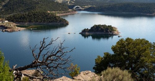
“As the Green River runs high out of Flaming Gorge Reservoir, so is anxiety in the tiny Utah town of Manila catering to outdoor enthusiasts coming to fish, camp or relax on a boat. To boost a dwindling Lake Powell hundreds of miles downstream and keep its dam generating electricity for more than 350,000 homes, federal officials are planning to let out as much as ⅓ of the water in Flaming Gorge over the next year. “You take that much water out of there, and people say, ‘Well, it’s large enough. It’ll be OK,’” Manila Mayor Kathi Knight said of the 91-mile reservoir. “Well, will it really?” The unprecedented move could put some boat ramps out of commission this year. It’s also raising concerns about a shorter summer season, questions about when the water will rise again fears that other big drawdowns could follow in years to come. … ” Read more from the Utah News Dispatch.
Colorado Supreme Court clarifies limits on private “water waste” claims
“In a recent decision with important implications for irrigators, landowners, and water users across Colorado, the Colorado Supreme Court clarified who may enforce Colorado’s statutory prohibition on “water waste.” In Byers Peak Properties, LLC v. Byers Peak Land & Cattle, LLC, 2026 CO 7 (Colo. 2026), the Court unanimously held that Colorado’s water waste statute does not create a private right of action. Instead, enforcement authority rests with the state through the State Engineer. The dispute arose from neighboring ranch properties that historically shared irrigation infrastructure following the division of a larger ranch. After relations between the parties deteriorated, one landowner alleged that the other was diverting excessive irrigation water, resulting in runoff and flooding onto downstream property. The plaintiffs brought claims in water court under several theories, including statutory water waste, nuisance, trespass, and requests for injunctive relief. … ” Read more from Somach Simmons & Dunn.
In national water news today …
83 groups call on HHS, EPA to take emergency action on industrial agriculture’s nitrate pollution crisis
“Today, 83 groups sent a letter to Department of Health & Human Services (HHS) Secretary Robert F. Kennedy Jr. and Environmental Protection Agency (EPA) Administrator Lee Zeldin calling on them to take emergency action on industrial agriculture’s nitrate water pollution crisis to protect Americans’ drinking water at the source and at the tap. The letter comes on the heels of a recent Iowa Environmental Council and Harkin Institute report which found Iowa has the nation’s highest waterway nitrate contamination, linked to high and rising cancer rates. Iowa ranks second in the nation for cancer incidence, and is one of just three states where rates are rising. Iowa’s primary nitrate polluter is industrial agriculture, with more factory farms and more row cropped acreage than any other state. Among other demands, the letter calls on EPA to act on a Safe Drinking Water Act emergency petition filed to protect Iowans’ drinking water in 2024. … ” Read more from Food & Water Watch.
Storm season is here and the National Weather Service is short handed
“The National Weather Service is struggling to recover from last year’s deep staff cuts, raising doubts among some meteorologists about whether the agency is ready for severe storms or hurricane season, which starts next month. One key facility in Oklahoma that leads tornado forecasting and warnings has an unusual five open positions, its website shows. Others around the country will lose meteorologists temporarily as officials shuffle them to cities that will host World Cup soccer games in June and July, according to an internal email reviewed by The New York Times. The agency’s roster of more than 2,500 scientists shrank by about 15 percent last year through firings and early retirements. The Weather Service’s data and expertise forms the backbone for all kinds of forecasts, including those shared by television meteorologists and smartphone apps. The government has been trying to hire back to reverse the damage. … ” Read more from the New York Times.

