
A wrap-up of posts published on Maven’s Notebook this week …
Note to readers: Sign up for weekly email service and you will receive notification of this post on Friday mornings. Readers on daily email service can add weekly email service by updating their subscription preferences. Click here to sign up!
In California water news this week …
Rain and snow are returning to California. Here are the details
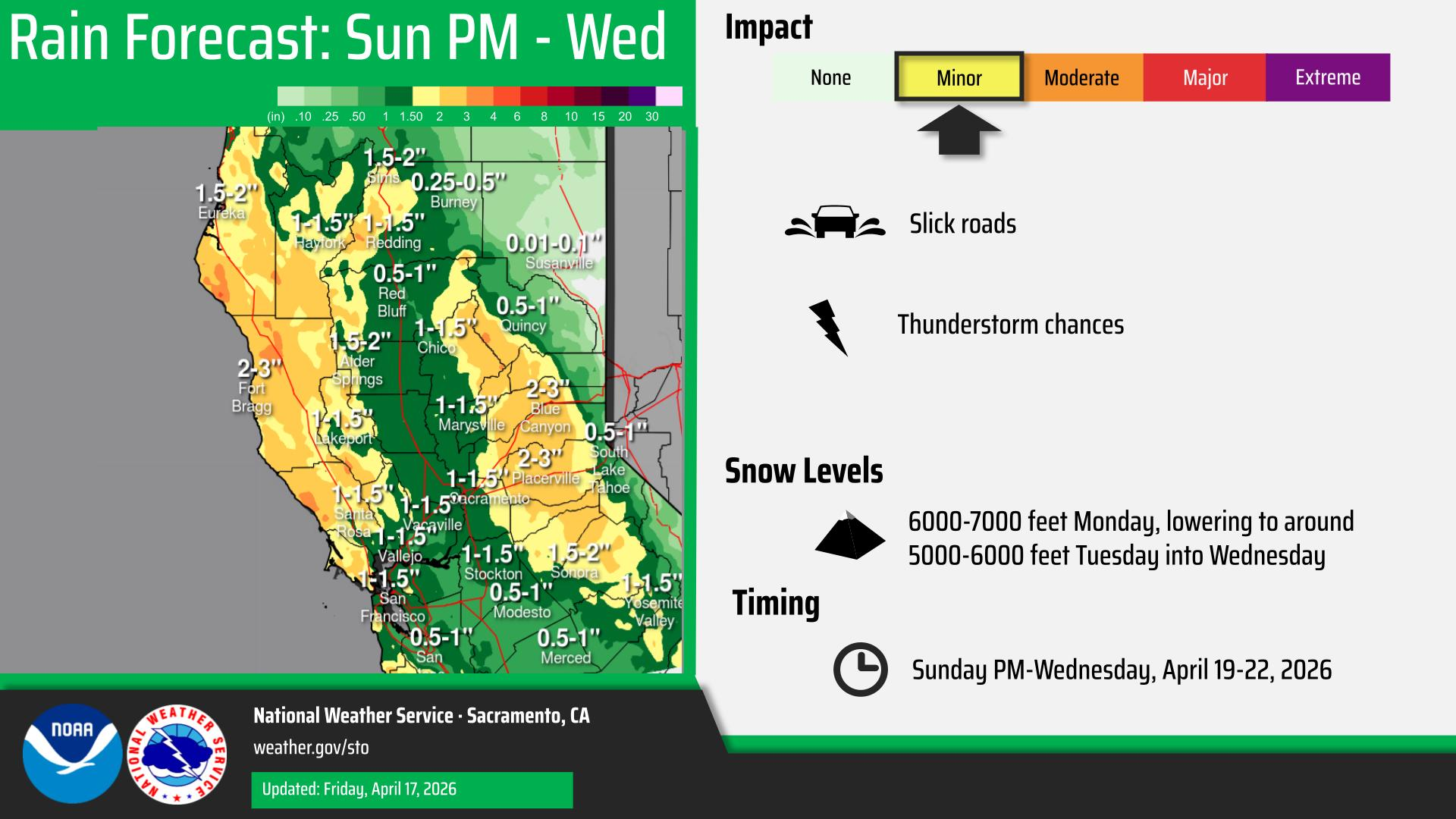
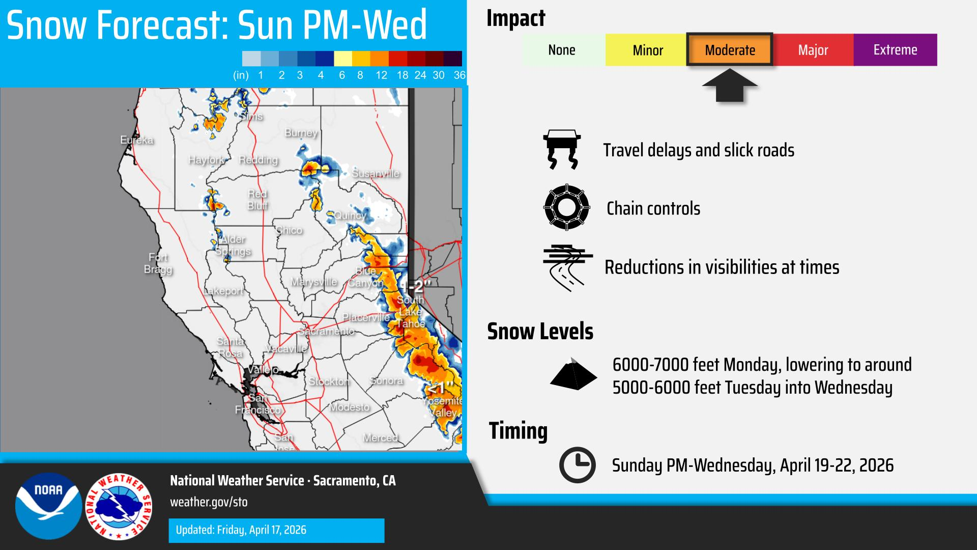
“The dry winds whipping the Bay Area have kicked off a warming trend that will bring above-normal high temperatures through Saturday — but the next chance of wet weather isn’t far away. By Sunday, clouds and winds are predicted to increase as a Pacific storm nudges toward Northern California. Precipitation chances will enter the forecast Monday, with rain and mountain snow probably sticking around through at least Wednesday. The system will have many similarities to the weekend storm that generated unusually large April rain and snow totals, but also some differences. … ” Read more from the San Francisco Chronicle.
‘Abnormally dry’ conditions continue to spread across California
“Abnormally dry conditions continue to spread across California, according to the latest update from the U.S. Drought Monitor. The new map, released Thursday, shows counties across the state are now classified as “abnormally dry,” the first level on the drought scale. The update comes as California’s snowpack has plunged to a record low, sitting at just 10% to 20% of normal. Cal Fire Chief Joe Tyler explained that when the snowpack is low, moisture disappears faster and vegetation dries out weeks earlier than normal. And the drier the grass and brush, the easier it ignites and the faster fire moves through it. … ” Read more from KTLA.
California snowpack hits ‘new record low’ says Cal Fire chief
“Many people closed the books on California’s winter snowpack saga on April 1, when officials measured abysmal snowpack levels on the critical date which usually marks the point where all accumulated snow begins to melt off. It was no surprise when California’s Department of Water Resources (DWR) reported record lows, revealing that the statewide snowpack sat at just 18 percent of its April 1 average. It almost seemed cruel when a storm brought snow to the Sierra Nevada and the few ski resorts in the state still open. Palisades Tahoe, for example, enjoyed more than three feet of powder just before the midway point of the month and looked like it was in the dead of winter. “Mother Nature hit the reset button yesterday,” said resort PR on Monday. Even if that’s the case at high elevation, it turns out the statewide picture has actually gotten worse. … ” Read more from The Inertia.
Bridging the gap between new climate science and water planning in California
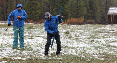
“The snowpack that supplies about one third of California’s water needs historically peaked in April—but the state can no longer count on this natural water storage as the world warms. This winter is a perfect example. Precipitation was near average but the winter was so warm that much of it fell as rain, so the snowpack was sparse to begin with. Then a record heat wave in March melted so much snow that when the state measured it in April, barely any was left at the survey site. The latest climate change research shows that the future of water in California is changing in unprecedented ways. As seen this past winter, snowpacks will shrink as temperatures rise, shifting precipitation from snowfall to rainfall. Atmospheric river storms will be more powerful and hit the state in clusters, saturating the ground and exacerbating the risk of flooding. Swings between drought and deluge will sharpen, intensifying climate extremes. “Our future climate will not be like our past,” says Jayantha Obeysekera, who directs the Florida International University’s Sea Level Solutions Center and is a member of the Delta Independent Science Board. “We need to begin considering potential future conditions in our planning.” … ” Read more from Robin Meadows at Maven’s Notebook.
Are we heading for ‘super El Nino’ – and what could we expect?
“There is a high likelihood that the phenomenon known as “El Niño” will emerge this summer – and it could be exceptionally strong. A so-called “super El Niño” could supercharge extreme weather events and push global temperatures to record heights next year if it develops, according to experts. Meteorologists are keeping a close eye on the climate patterns developing in the Pacific Ocean that will enable stronger predictions about what’s to come in the year ahead. A strong El Niño would put 2027 in the running to break global heat records, and could produce a series of devastating effects, ranging from supercharged rainstorms to drought depending on the region of the world. While it’s not “a slam dunk”, climate scientist and media director for Climate Central Tom Di Liberto said during a briefing held on Thursday that the ingredients for El Niño are there. Forecasts in spring can’t account for unexpected changes that can happen over the summer, he added, but “the risk is high enough to be worried”. … ” Read more from The Guardian.
How the strongest storm on Earth became a warning sign for a potentially historic El Niño
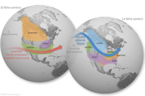
“Super Typhoon Sinlaku, which will soon make landfall on American islands in the western Pacific with winds near 180 mph, is a catastrophic storm. How did it become so strong so quickly? The short answer is that it is a product of an overheated ocean. The implications of this are even more interesting, or arguably alarming: Because it is so powerful, it is now helping push that heat across the Pacific toward what could be the strongest El Niño in a generation. Sinlaku went from a tropical depression to a Category 5 super typhoon in roughly 72 hours, intensifying by 75 mph in a single 24-hour period. That kind of rapid intensification requires extraordinary oceanic fuel, and the western Pacific had plenty to spare. … ” Read more from the San Francisco Chronicle.
California Water Commission approves updates to state dam safety regulations
“California dam safety regulations are set for a significant update after the California Water Commission approved changes proposed by the state Department of Water Resources (DWR) Wednesday, April 15,2026. Under DWR’s Division of Safety of Dams (DSOD), the state proposed additions and modifications to existing dam safety regulations. The Division of Safety of Dams updated Articles Two, Five, Six and Seven to clarify the application process for dam alterations, repairs and removals, as well as time extensions and how unlawfully constructed dams are addressed. The changes also require the State Water Project to cover DSOD labor costs, eliminate hard copies of technical memorandums, allow written hearings and simplify the lien process. … ” Read more from KRCR.
Commercial salmon fishing set to resume along California coast after 3-year shutdown
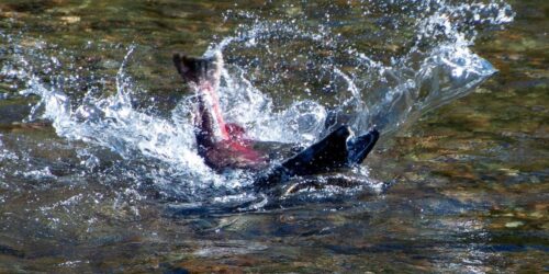
“Commercial fishing crews will be permitted to catch salmon along the California coast this year for the first time since 2022 as regulators plan to end a three-year shutdown after seeing an increase in the struggling salmon population. The Pacific Fishery Management Council, a body established by Congress that manages ocean fishing along the West Coast, is expected to vote Sunday on a plan that will reopen the salmon fishing season under strict limits in California. A sharp decline in the Chinook salmon population led to the ban on commercial fishing in 2023, 2024 and 2025, the longest shutdown in state history. The state’s fishing industry has been hit hard by the shutdown, which has driven many to leave their boats and look for other work. The planned resumption of fishing this spring will enable crews to catch limited numbers of fall-run Chinook salmon on certain dates. “The limited reopening is a lifeline. It gives you a little bit of money,” said Vance Staplin, executive director of the nonprofit Golden State Salmon Assn. “They’re not getting enough to sustain their businesses the way it was prior to this shutdown, by any means.”… ” Read more from the LA Times. | Read via AOL News.
‘It’s a tough pill to swallow’: California salmon season plan draws mixed reactions from North Coast fishermen
“Commercial salmon season is opening off the coast of California for the first time since 2022 this May. The Pacific Fishery Management Council announced this week that it had elected to adopt recommendations for the 2026 fishing season on the West Coast. It’s an auspicious occasion for many, including Gov. Gavin Newsom, who announced the opening in a news release on Monday with the triumphant title “Let’s go fishing! Salmon fishing is back in California after more than 3-year closure.” This season, though, might be less propitious than hoped for fishermen on the North Coast, who have hoped their three years of sacrifice would pay immediate dividends. Salmon fishing will remain closed from the Oregon border to Point Arena (the Klamath Management Zone, or KMZ, and the zone immediately to the south of that) and further restricted from Point Arena to Pigeon Point, forcing fishermen on the North Coast to travel far north to Oregon or south to the central California coast to take advantage of a limited season. … ” Read more from the Eureka Times-Standard.
The ocean off California keeps breaking heat records

“An extreme marine heat wave is simmering the Pacific Ocean off the coast of California, and experts are warning that it could affect coastal weather and ecosystems for months. The ocean heat wave started forming at the end of last year but has worsened in recent weeks, according to readings from the Scripps Pier in La Jolla, which has broken more than 25 daily temperature records this year. The surface water temperature on Wednesday was 68.5 degrees — 7.7 degrees above average for the date. The sea bottom was 67.6 degrees, the hottest April 15 in about 100 years of records. The heat wave is deep, persistent and widespread, spanning from roughly San Francisco to the Mexican border. Those are “pretty significant indicators that this has both staying power and will have consequences for weeks or months or even seasons to come for Southern California,” said Daniel Swain, a climate scientist with the University of California’s Agriculture and Natural Resources. … ” Read more from the LA Times. | Read via AOL News.
Rainstorms after wildfires: Erosion can threaten water quality for years
“When major storms arrive in areas recently burned by wildfire, scientists and engineers at the Water Boards pay particularly close attention—not because problems are guaranteed, but because fire fundamentally changes how landscapes respond to rain. That’s something Griffin Perea, a senior engineering geologist with the Central Valley Regional Water Quality Control Board, has seen repeatedly in Northern California watersheds. “Once a big fire happens, the impacts to water don’t end when the flames are out,” Perea said. “In many cases, the first few winters after the fire are when we see the most severe erosion and sediment movement.” … ” Read more from the State Water Board’s Ebb and Flow.
Forest Service plan to close research stations stokes fear as wildfire season approaches
“The U.S. Forest Service’s plan to close scores of research stations could threaten the nation’s wildfire readiness, many foresters fear, and erode decades of work to understand timber production, soil health, pests and diseases, watersheds and wildlife. Late last month, the Forest Service announced plans to close 57 of its 77 research stations, located across 31 states, merging them into a single organization in Fort Collins, Colorado. The agency described the move as a way to consolidate, not cut, the agency’s scientific work, and “unify research priorities.” It’s unclear how many scientists will be affected by the transition, but it comes as part of a larger agency reorganization that is expected to move roughly 5,000 employees to new outposts. Forest Service leaders have framed the closures as a way to reduce the agency’s real estate footprint, citing a facilities budget Congress has shrunk, as opposed to curtailing its scientific work. … ” Read more from Stateline.
In commentary this week …
Anna Kathawalla writes, ” … California agriculture is tied to the Sustainable Groundwater Management Act (SGMA), a bill passed in 2014 with the goal of reducing groundwater overdraft throughout the state, an agriculture-driven environmental hazard that is depleting aquifers and causing subsidence. The main tension behind SGMA is that the act is expected to cause between 500,000 to 1 million acres of San Joaquin Valley agricultural land to come out of production before 2040, and the act does not come with a built-in support system to help farmers figure out what to do with their land when agriculture is no longer an option. Neither SGMA nor the Valley farmers who it’s hurting the most are at fault—farmers are simply employing decades old agricultural practices to meet national food demand and SGMA is simply trying to preserve the state’s water resources. AW is one of the first farmers to feel the impacts of SGMA fully realized on his land. SGMA, although passed more than a decade ago, is just now taking hold across the state, and farmers are now faced with the difficult choice of farming under restrictions and the potential of facing fines, or not farming at all. … ” Read more from Common Dreams.
An overlooked reason for rising energy and water bills in California
Danielle Blacet-Hyden, executive director of the California Municipal Utilities Association, writes, “There are several reasons why your water and electricity bills keep rising. Many increases can be blamed on market forces beyond anyone’s control, but what’s being left out of the affordability discussion is how well-intended but unfunded policy decisions — three in particular — risk making cost of living expenses even worse, especially for the state’s not-for-profit utility customers. One example is California’s Cap-and-Invest program (formerly Cap and Trade), which enables the trading of carbon credits — called “allowances” — to reduce greenhouse gas emissions. These allowances help not-for-profit utilities keep rates lower, help fund investments in clean energy and support low-income assistance programs. … ” Read more from the Sacramento Bee.
C-WIN: Safe & sustainable water consumption: Without enforcement, regulations on water exports are worthless
“Two terms are often used by legal and policy experts when discussing water consumption: safe yield[1] and sustainable yield.[2] They are sometimes used interchangeably, and they describe the same general concept: the amount of water that can be diverted from surface or groundwater without significant environmental impacts or inequitable social and economic consequences. They arose, however, from different processes. Safe yield has its roots in property rights and the court proceedings that were employed to determine and assign them; it can apply to both surface and groundwater. It’s a legally intensive and orderly approach to water distribution, but it’s only equitable if small or minimally funded parties receive fair treatment during court proceedings to determine allocations for every water user. … ” Read more from C-WIN.
In regional water news this week …
New hiking trails coming near Battle Creek. What you’ll see
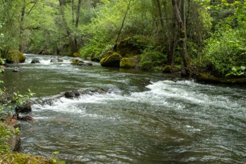
“Conservationists restoring a section of bank along the Sacramento River east of Cottonwood plan to install new hiking trails along Battle Creek. River Partners — a California waterway conservation organization out of Chico — announced it’s going to restore Battle Creek Ranch land along Jellys Ferry Road, near Coleman Fish Hatchery. The nonprofit acquired in November 2025 the 1,721-acre area on the east bank where Battle Creek flows into the Sacramento River, said River Partners spokesperson Sean Murphy. Averaging roughly 20 feet across, Battle Creek flows down a narrow canyon, according to Redding sporting goods store and guide service The Fly Shop: “It’s a rugged wilderness atmosphere, and little has changed in years in what was once home to Ishi and his California Indian ancestors.” … ” Read more from the Redding Record Searchlight.
Stanislaus and Eldorado forests move ahead with Mokelumne Amador Calaveras Forest Health Projects
“The U.S. Forest Service announces the publication of the completed environmental impact statement for the Mokelumne Amador Calaveras Forest Health and Resilience Project in the Federal Register tomorrow. The project area spans 246,838 acres and aims to reduce wildfire risks, protect communities, and improve forest health. The project activities include thinning through timber harvest, fuel reduction through mastication, fuel break construction, prescribed fire, and mitigation of non-native invasive plants. Several treatments will often overlap on the same acres. These actions help to reduce the density and accumulation of vegetation in strategic areas improving forest resilience to wildfire and drought. The project has been a collaborative effort in partnership with the Upper Mokelumne River Watershed Authority, who provided planning management with a consultant team (Stantec). The project has also been developed in collaboration with the Amador-Calaveras Consensus Group – a collaborative, comprised of professionals, environmental groups, industry representatives, recreation groups, local and regional government, and research scientists. … ” Read more from Forest Service.
Fix for what ails Tahoe is costly, lawmakers learn
“Preserving Lake Tahoe’s clear, blue water depends in large part on reducing vehicle travel. The basin, however, lacks reliable and efficient transit for residents, tourists, and commerce, and a funding source to fix it, say experts who testified Friday before the Nevada Legislative Committee for Review and Oversight of the Lake Tahoe Regional Planning Agency. “It’s not the people coming to Tahoe that place the largest strain on this fragile ecosystem,” former Tahoe Regional Planning Agency board member John Friedrich told lawmakers. “It’s the cars they travel in.” Lake Tahoe is surrounded by State Route 28, which is snarled, especially in the summer, by a mix of traffic from 55,000 residents and some 25 million visitors a year, according to studies commissioned by the TRPA. Vehicles emissions, microplastics from tires, and dust from trucks and autos are among the factors preventing Tahoe from reaching a visibility goal of 97 feet deep. “As we say in Tahoe, ‘what happens on the land affects the lake.’ It’s all connected,” observed Tahoe Regional Planning Agency Executive Director Julie Regan. “All that TRPA endeavors to achieve is in service to our environmental threshold standards.” … ” Read more from the Nevada Current.
Construction begins on Iron Canyon Fish Passage Project, unlocking miles of critical salmon habitat on Big Chico Creek
“California Trout (CalTrout), the Mechoopda Indian Tribe, the Big Chico Creek Ecological Reserve (BCCER), and the City of Chico, today announced the start of the instream phase of construction on the Iron Canyon Fish Passage Project on Ótakim Séwi (Big Chico Creek) in Upper Bidwell Park. In 1956, concrete and rebar fish ladder weirs were constructed through a rockfall barrier in Iron Canyon—a narrow bedrock gorge deep within Bidwell Park. The purpose was to help steelhead and spring-run Chinook salmon reach miles of critical cold-water spawning and holding habitat during low water years. Over time, this fish ladder has become nonfunctioning, causing steelhead and salmon to hold downstream where water temperatures are too warm for their survival. The Iron Canyon Fish Passage Project will remediate the barrier, restoring access to 8.5 additional miles of habitat and returning a piece of a watershed that has sustained people, wildlife, and ecosystems for thousands of years. … ” Read more from Cal Trout.
Sacramento: A fighting chance for oaks
“If, as the proverb says, it takes a village to raise a child, wait until you hear how many people it takes just to temporarily save an 850-year-old oak tree. Or, rather, a few thousand trees, towering amid a sea of vernal pools and animal habitat. Consider Coyote Creek, for instance. The waterway, which meanders through a vein of privately held oak woodland in eastern Sacramento County, has become shorthand for a solar-energy project planned for the area. According to its developers at D.E. Shaw Renewable Investments (DESRI), the 1,400-acre Coyote Creek Agrivoltaic Ranch will generate around 200 megawatts of energy—enough to power 44,000 homes in the region, along with 100 megawatts of battery storage. The prospect of clean and accessible solar power in its backyard was enough to hook the Sacramento Municipal Utility District (SMUD), which entered a long-term arrangement in 2021 to purchase power from the Coyote Creek solar farm. … ” Read more from the California Native Plant Society.
Bay Area: Is placing sediment in the shallows to feed marshes working?
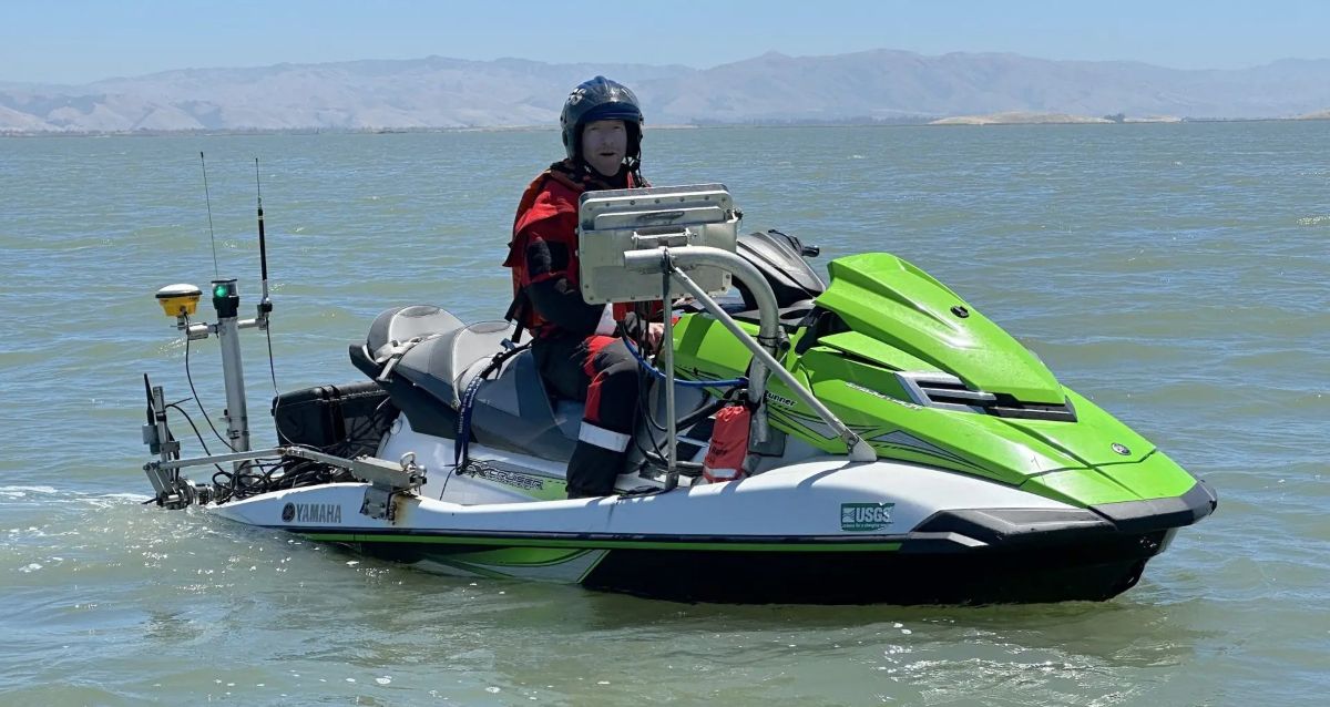
“Scientists experimenting with placing mounds of dredged sediment in the shallows near marshes to see if it helps them build up elevation in the face of sea level rise have more promising results. As reported in this Boxes of Mud story in KneeDeep in March 2025, the experiment involved dredging materials from the Redwood City harbor, barging them over to the East Bay shore near Eden Landing, depositing 950,000 cubic yards back into the Bay, and then carefully monitoring the outcomes. A year since the first reported results, the team of researchers from the U.S. Army Corps of Engineers and the U.S. Geological Survey now have further confirmation that the idea of beneficial reuse to bump up sediment supply for mudflats and marshes is working, and has minimal impacts on creatures in the oozes, fish, or nearby beds of eelgrass. “The mounds have continued to erode slowly and disperse,” says lead scientist Julie Beagle with the Corps. Initially, she says, they thought it would be more dispersive, like a “one time boost,” but “the slow release feeder system” that resulted turns out to be even more promising in the long run. … ” Read more from Knee Deep Times.
Bay Area construction company illegally polluted river, lawsuit alleges
“A huge quarry owned by one of the Bay Area’s most prominent construction companies has violated water pollution standards more than 900 times in the past six years, according to a lawsuit filed in federal court in San Jose. Water that builds up in the A.R. Wilson Quarry in Aromas, owned by Graniterock, has repeatedly been discharged into the nearby Pajaro River, which empties into the Monterey Bay National Marine Sanctuary, the lawsuit by Environment California and the California Sportfishing Protection Alliance alleges. The quarry water contains aluminum, iron, molybdenum, high levels of salts and sediment, and other contaminants that can harm steelhead trout and other fish and wildlife, according to the lawsuit. … ” Read more from the San Jose Mercury News.
Oakley OKs temporary ban on data centers, a first for the Bay Area
“Oakley has become the first Bay Area city to impose a temporary ban on data centers as others in Silicon Valley continue to support the intensive energy needs of artificial intelligence. The Oakley City Council on Tuesday unanimously approved the 45-day moratorium. It will prohibit the city from accepting, processing or approving any land use applications for data centers. The pause also will give officials breathing room to “study, deliberate, and determine the acceptable scope” of data center land uses within the city, according to a staff report. City staff also have the opportunity to “evaluate impacts, gather public input, and ultimately draft zoning regulations” that will promote economic growth while protecting residents. … ” Read more from the San Jose Mercury News.
SEE ALSO: Bay Area city becomes first to ban data centers over power and water concerns, from the San Francisco Chronicle
Zone 7 eyes a new pipeline to secure area’s water future
“Zone 7 Water Agency, the Tri-Valley’s water manager and wholesaler, is considering a large pipeline to exchange water between the Chain of Lakes area and the South Bay Aqueduct to prepare for the harsher water landscape expected in the coming decades. Zone 7 staff, at a special April 1 Board of Directors workshop, shared a proposal for a 7-mile-long, 42-inch-wide pipeline that would run from Lake I and Cope Lake, located south of Stoneridge Drive between the cities of Pleasanton and Livermore, to the South Bay Aqueduct at the Del Valle Water Treatment Plant in south Livermore. A new pump station at the lakes would convey water uphill from the lakes to the aqueduct, while gravity could carry water in the opposite direction. The project would also include a new PFAS treatment plant at Del Valle. … ” Read more from the Livermore Independent.
Ventura City Council approves eminent domain for water project
“The Ventura City Council voted 5-2 to use eminent domain to acquire a 2.43-acre vacant property adjacent to the Ventura Auto Center for the city’s planned water recycling project, VenturaWaterPure. Councilmembers Jim Duran and Alex Mangone voted against the resolution on April 14. “I’m not convinced we fully exhausted a good faith effort” to not use eminent domain, where a government can take over private property for public use, Duran said. Duran said he wanted to see more engagement with the property owner and questioned whether the site was the most viable. … ” Read more from the Ventura County Star.
Mayor Bass has a new plan for addressing climate change in Los Angeles
“L.A. Mayor Karen Bass has released a new plan setting goals for the city to combat climate change and adapt to a warmer future. Bass’ Climate Action Plan calls for doubling local solar power in Los Angeles by 2030 and reducing the use of fossil fuels in buildings and city buses. It outlines how the city intends to reduce emissions of greenhouse gases at the Port of Los Angeles and L.A. International Airport. And it sets targets for reducing water use, addressing risks from extreme heat, and expanding parks and green spaces to cool neighborhoods and restore natural habitat. … ” Read more from the LA Times.
Borrego Springs give us a look at the agricultural use of groundwater in the California desert
“For decades, the desert town of Borrego Springs – in eastern San Diego County, thrived upon what appeared to be an unlimited supply sunshine and groundwater. Lacking an alternative supply of water this isolated community was entirely dependent on the prehistoric groundwater that was lying beneath it. This finite resource acted as the lifeblood for two competing interests: a flourishing agricultural sector and a steady expansion of residential and resort development. … ” Read more from Coyote Gulch.
California’s largest and most polluted lake gets a new conservancy
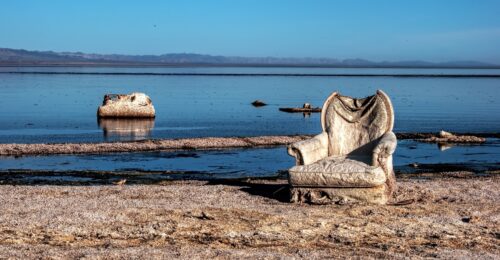 “California has launched the Salton Sea Conservancy, a new state agency to oversee restoration, manage habitat and improve air quality at the deteriorating inland lake. On Friday Gov. Gavin Newsom announced the appointment of a 20-member conservancy board, with members from state agencies, Riverside and Imperial County governments, local water districts, tribal groups and public organizations. The new conservancy is the first created in California in more than 15 years, since the Sacramento-San Joaquin Delta Conservancy was established in 2010. The new body will direct state resources toward what has long been a local problem in the Southern California desert, Newsom said in a statement. “For too long, communities around the Salton Sea have carried the burden of environmental challenges and neglect,” Newsom said in a statement. “Today, California is changing that by launching the Salton Sea Conservancy to advance cleaner air, protect public health, restore critical ecosystems, and ensure the work we’ve started creates lasting opportunities for Salton Sea communities.” … ” Read more from Cal Matters.
Some Salton Sea residents skeptical new conservancy can improve environment after years of health issues
“Governor Gavin Newsom has announced the creation of the Salton Sea Conservancy, which is meant to restore the habitat in the area and improve air quality. It’s the state’s first conservancy in 15 years. “For too long, communities around the Salton Sea have carried the burden of environmental challenges and neglect,” Newsom said in a video statement. “Today, California is changing that.” Residents like Imari Kariotis say they’ve developed chronic health issues from living in the area. “I have breathing issues. So I am on this Nova disc in the morning. I have a rescue inhaler,” Kariotis says. She’s lived in the area for 30 years, and says affordability is what brings most people to the area. But, she says the government has neglected the region. … ” Read more from KESQ.
San Diego now has so much water that it’s selling it
“With the Colorado River in crisis, Arizona and Nevada are turning to an unconventional lifeline: the ocean water off California’s golden beaches. Both desert states are pursuing a deal with the San Diego County Water Authority to tap millions of gallons of fresh water produced by a Carlsbad ocean-desalination plant—the largest in North America—to help offset their reliance on the collapsing Colorado River. … Pending federal and other approvals, Arizona, Nevada and other Colorado River users could strike water-transfer deals with the San Diego utility. No water is literally shipped; rather, the parties would trade access rights to water sources. States would fund much of the estimated 56,000 acre-feet of water that the desalination plant produces annually in exchange for San Diego’s share of the Colorado River. The agreement could supply enough water for some 500,000 people. … ” Read more from the Wall Street Journal (Note: The article is unlocked. Minimize the subscription ask).
MET COMMITTEE: Building flexibility beyond 2026: Interstate water transfers in the Lower Basin of the Colorado River
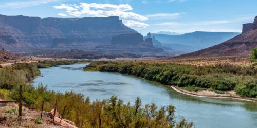 “Several years ago, both the Southern Nevada Water Authority and entities in Arizona each invested $6 million in Pure Water Southern California, anticipating that successful implementation of the project would entitle them to a share of the water produced. Currently, no regulations allow for the long-term availability of this type of exchange. It was anticipated that interstate transfers and exchanges would be included in the post-2026 guidelines; however, the status of the guidelines remains uncertain. Nevertheless, there remains strong interest in advancing interstate exchanges. At the April meeting of Metropolitan’s One Water and Adaptation Committee, Joe Vanderhorst, a retired annuitant working on Colorado River issues, briefed Committee members on a memorandum of understanding (MOU) that has been developed to initiate discussions on how to incorporate interstate transfers or exchanges to provide greater flexibility in Lower Colorado River operations. … ” Read more from Maven’s Notebook.
‘The river is deciding for us’: Shrinking flexibility and rising stakes on the Colorado River
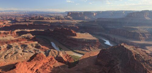 “Over the past several years, the Colorado River Basin states have been working, with limited success, on guidelines that will take effect next year when the current guidelines expire. But given the deteriorating hydrology, basin states’ discussions now focus on how to survive the record dry conditions. At the April meeting of Metropolitan’s One Water and Adaptation Committee, Shanti Rosset, Metropolitan’s Colorado River policy manager, discussed how the dismal conditions are shaping the negotiating landscape in real time. … ” Read more from Maven’s Notebook.

