
A wrap-up of posts published on Maven’s Notebook this week …
Note to readers: Sign up for weekly email service and you will receive notification of this post on Friday mornings. Readers on daily email service can add weekly email service by updating their subscription preferences. Click here to sign up!
In California water news this week …
Sparse snowpack in California fuels concern over fast-approaching fire season
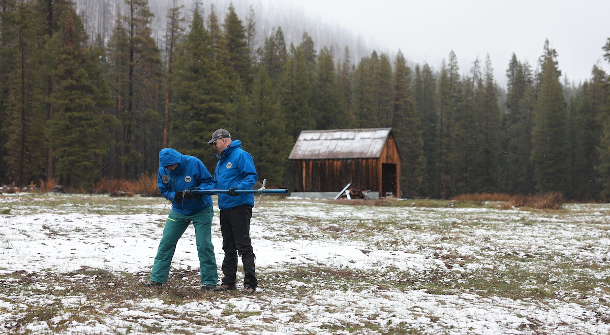
“California clocked its second-worst snowpack on record Wednesday, a potentially troubling signal ahead for fire season. It’s an alarming end to a winter that saw abnormally dry conditions briefly wiped from California’s drought map in January, for the first time in a quarter-century. Though precipitation to date has been near average, much of it fell as rain rather than snow. Then March’s record-breaking heat melted most of the snow that remains. The state’s major reservoirs are nevertheless brimming above historic averages and are flirting with capacity, and a smattering of snow, rain and thunderstorms are dousing last month’s heat wave. But experts now warn that California’s case of the missing snowpack could herald an early fire season in the mountains. On Wednesday, state engineers conducting the symbolic April 1 snowpack measurement at Phillips Station south of Lake Tahoe found no measurable snow in patches of white dotting the grassy field. “I want to welcome you call to probably one of the quickest snow surveys we’ve had — maybe one where people could actually use an umbrella,” joked Karla Nemeth, director of the California Department of Water Resources. “We’re getting a lot of questions about are we heading into a hydrologic drought? The answer is, I don’t know.” … ” Read more from Cal Matters.
‘On a whole other level’: rapid snow melt-off in American west stuns scientists
“Snow surveys taking place across the American west this week are offering a grim prognosis, after a historically warm winter and searing March temperatures left the critical snowpack at record-low levels across the region. Experts warned that even as the heat begins to subside, the stunning pace of melt-off over the past month has left key basins in uncharted territory for the dry seasons ahead. Though there’s still potential for more snow in the forecast, experts said it will likely be too little too late. “This year is on a whole other level,” said Colorado State University climatologist Dr Russ Schumacher, speaking about the intense heat that began rapidly melting the already sparse snowpack in March. “Seeing this year so far below any of the other years we have data for is very concerning.” … ” Read more from The Guardian.
California’s coastal ocean is seeing a rare trend — and what happens next could be critical
“On the last day of winter, as California was in the midst of a historic early-season heat wave, the ocean off Southern California crossed a striking threshold. At Scripps Pier in La Jolla, a long-running sea surface temperature record topped out at 71 degrees, the warmest March reading in the station’s history. It was not an isolated spike. The reading broke a daily record, as had the day before. And the day before that. “The Scripps Pier sea surface temperature bucket measurements have been hitting some all-time highs for the past few months,” said Art Miller, a researcher at Scripps Institution of Oceanography who studies the dynamics of water currents. Experts like Miller say the warm ocean temperatures are part of something larger now taking shape. A strong marine heat wave has developed off the Southern California coast, and the next several weeks will determine whether it fades or deepens into something that carries real ecological and meteorological consequences into summer. … ” Read more from the San Francisco Chronicle.
Latest emergency water conservation info shared by California
“California water officials are not implementing statewide emergency water conservation mandates despite concerning snowpack measurements at Phillips Station, a California Water Boards spokesperson told Newsweek. … Despite the grim news, no emergency conservation measures have been implemented. “Statewide emergency water conservation mandates are not being implemented due to the results of yesterday’s Department of Water Resources snow survey,” the California Water Boards spokesperson told Newsweek on Thursday. “The State Water Board is not currently discussing emergency drought regulations, which could only be implemented under a state of emergency issued by the governor, nor does it expect to do so this summer.” … ” Read more from Newsweek.
Forest Service shake-up comes as risky wildfire season looms
“In announcing one of the largest reorganizations in the 120-year history of the U.S. Forest Service, the Trump administration declared that there would be “no interruption or change” to the agency’s firefighting force. But critics say the upheaval comes at the worst possible time—with the agency’s ranks already depleted and demoralized, and a new federal wildfire forecast showing exceptionally high fire risk in both the Southeast and across much of the West over the next three months. By the end of March, 1.62 million acres had already burned across the country this year —231 percent of the previous 10-year average, the National Interagency Fire Center said in its seasonal forecast released Wednesday. That included the largest wildfire in Nebraska’s history, which last month scorched 640,000 acres and killed an 86-year-old woman who was trying to escape. It is a sign of the challenges facing the federal government’s largest team of wildland firefighters, those in the Forest Service, who already were being integrated with a new U.S. Wildland Fire Service located in the Department of Interior. … ” Read more from Inside Climate News.
Support for Delta tunnel dropping in Kern County
“Financial support for the controversial Delta Conveyance Project has been eroding among Kern County agricultural water districts over the past year and lost another significant chunk when the Wheeler Ridge-Maricopa Water Storage District opted recently to cut its contribution by nearly 97% – from $4.6 million down to $146,000. “We still believe it’s a good and viable project that needs to be built,” Wheeler Ridge General Manager Sheridan Nicholas said. “But it has become extremely difficult, especially for ag, with other expenses going up.” Four other large State Water Project contractors in Kern are also considering lowering their participation levels as the Department of Water Resources is trying to firm up agreements to collect $300 million from contractors for the ongoing planning and design phase of the $20 billion project. … ” Read more from SJV Water.
Court denies DWR’s motion to disqualify law firm from litigation challenging Delta tunnel project
“Today, Judge Stephen Acquisto of the Sacramento County Superior Court rejected an attempt by the California Department of Water Resources (DWR) to deprive two million residents of the Sacramento-San Joaquin Delta of their choice of legal representation in challenges to DWR’s efforts to construct a massive water conveyance tunnel and industrial facilities in the heart of the Delta National Heritage Area. The Sacramento law firm of Somach Simmons & Dunn (SSD) represents the County of Sacramento, Sacramento County Water Agency, Sacramento Area Sewer District, and City of Stockton in ongoing litigation challenging DWR’s plans to divert flows from the Sacramento River and route it around the Delta to its State Water Project contractors in the Silicon Valley, Central Valley, and Southern California. … ” Read more from Somach Simmons & Dunn.
A clearer view: The first seamless elevation map of the Bay-Delta
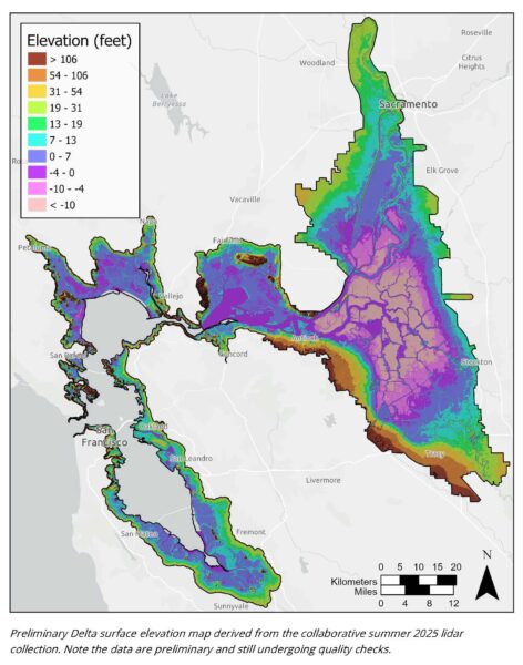 “At the March Delta Stewardship Council meeting, the Delta Lead Scientist’s Report showcased a complete, high-quality elevation map of the entire Bay-Delta estuary—from the Golden Gate to the upper estuary. This marks the first time such a seamless dataset has been created, addressing long-standing challenges in regional mapping. The Bay-Delta is a dynamic landscape, constantly reshaped by natural forces and human interventions. Recent events, such as levee breaches during 2023 storms on the Cosumnes River and intentional restoration projects like Lookout Slough, along with rising sea levels and flooding, such as the Highway 101 inundation in Marin County, further underscore the importance of precise mapping for flood risk assessment, restoration planning, and infrastructure protection. Accurate, consistent elevation data enables better decisions. However, Bay-Delta mapping was previously patchy—collected for varying purposes, with different equipment and standards, across separate areas and years. As a result, agencies stitched datasets and filled gaps with estimates, adding uncertainty to flood protection, habitat restoration, and water management. … ” Read more from Maven’s Notebook.
Growing solutions: The role of rice in restoring the Delta’s landscape
“The Delta Stewardship Council has long recognized that elevation and agricultural emissions are critical issues for the Sacramento-San Joaquin Delta. In response, the Council’s Delta Plan policies and the Delta Adapts initiative have been developed to address challenges such as land loss, restoration elevations, greenhouse gas emissions, and rice cultivation strategies—all aimed at sustaining agriculture in the Delta while combating subsidence. Over the past three decades, the Delta region has benefited from increasingly sophisticated measurements, models, and mapping tools for tracking carbon, surpassing most other estuaries in the country. These advancements continue to improve through innovative pilot projects across both public and private lands, exploring a range of management approaches. With 80% of the Delta too deeply subsided to restore to tidal marsh, rice agriculture stands out as one of the most promising interventions for reducing subsidence while preserving agricultural livelihoods. These priorities and solutions were highlighted at the Delta Stewardship Council’s March meeting, where Dr. Nina Bingham, Senior Environmental Scientist at the California Department of Food and Agriculture, presented an overview of the Healthy Soils Program and discussed how Delta farmers can now receive an incentive through the Healthy Soils Program for switching to rice cultivation in an upcoming grant solicitation. … ” Read more from Maven’s Notebook.
Proposal to raise Shasta Dam levels could submerge tribal sacred sites, tribe warns
“Plans to raise water levels at Shasta Dam are sparking debate, with tribal members warning the change would cause spiritual harm. The proposal would increase water storage capacity, and state leaders say the additional storage is needed during drought years. But for the Redding Rancheria, which has members of the Winnemem Wintu Tribe, the issue goes beyond water. Tribal Chairman Jack Potter said the dam has already disrupted salmon runs and that raising water levels would submerge sacred areas that remain, including burial sites and places where they hold traditional ceremonies. … ” Read more from KRCR.
Decadelong fight over Yuba River dams ends in favor of feds
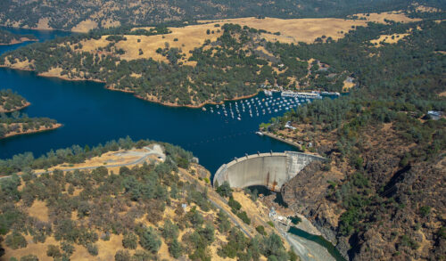
“The federal government has complied with the Endangered Species Act in its activities at two dams on California’s Yuba River, a judge ruled Tuesday in a decade-old case. However, U.S. District Judge Daniel Calabretta had one carveout in his decision. He determined the National Marine Fisheries Service and U.S. Army Corps of Engineers improperly excluded the Brophy Diversion from an analysis. He remanded that aspect of the case to the service for reassessment. The judge’s decision on the motions for summary judgement closes the 2016 case that at its heart focused on three fish: Central Valley spring chinook salmon, Central Valley steelhead, and North American green sturgeon. Friends of the River had argued the service and corps improperly defined the range of agency action at Daguerre Point and Englebright dams. Operating under the wrong legal definition violated the Endangered Species Act and the corps’ duty to protect the fish. … ” Read more from Courthouse News Service.
Seismic activity in California varies with the seasons – and groundwater levels
“Earthquakes occur when the tectonic plates of the earth’s crust shift, jolting past each other in a release of built-up tension. However, other natural forces can also influence seismic activity: Hydrological dynamics, like changes in groundwater and snowpacks, in particular, put pressure on faults. A new study from Caltech finds that a higher rate of change in groundwater levels leads to a noticeable increase in seismic activity. The study examined seismic activity in various regions of California—Los Angeles, the Bay Area, the Imperial Valley, the Eastern Sierra, and so on—from 2006 to 2022. The state’s rainfall levels vary by region; for example, Northern California receives significantly more precipitation than Southern California, leading to more pronounced seasonal changes in groundwater levels. … Utilizing new data analysis methods, the researchers saw that regions experiencing more dramatic changes in groundwater levels exhibit a larger seasonal variation of seismic activity. … ” Read more from Cal Tech.
Agriculture expert panel releases draft report on regulation of on-farm nitrogen use
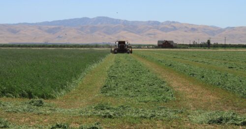 “An independent panel of academics and agricultural industry advisors today released a draft report containing recommendations for updating California’s regulatory approach to nitrogen discharges from farms. Furthering research on the impacts of agricultural practices on water quality, the State Water Resources Control Board convened the Second Statewide Agricultural Expert Panel in 2025 and directed it to consider nine nitrogen-related questions. The State Water Board and nine Regional Water Quality Control Boards will use the report to guide potential future updates to how discharges from irrigated farmland are regulated under the Irrigated Lands Regulatory Program. The eight-member panel held more than a dozen meetings, including two plenary meetings, two listening sessions and 12 work group meetings to consider the questions and compile the draft report. Among other findings, the draft report concludes that there is enough data to support numeric crop-specific targets or limits on nitrogen use in some parts of the state, while more time is needed in other regions to assess groundwater risks from nitrogen. The panel also recommends flexibility for region-specific nitrogen standards and the development of standardized reporting protocols. … ” Read more from the State Water Board.
New AI tool from the USGS forecasts drought 90 days ahead nationwide
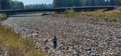
“The U.S. Geological Survey released a new machine learning tool that forecasts droughts up to 90 days ahead nationwide. The tool may provide communities extra time to prepare for water shortages that could impact agriculture, municipal supplies, recreation and ecosystems. The tool forecasts streamflow drought, which is when rivers and streams drop below normal levels for extended periods, which may directly impact water availability even when rainfall returns to normal. The USGS River DroughtCast uses machine learning models trained on data from thousands of USGS streamgages, some with more than 100 years of continuous records, to forecast when rivers and streams will drop to abnormally low levels. “The USGS is putting more than a century of streamflow data to work in a completely new way, using machine learning to predict streamflow drought weeks in advance,” said John Hammond, USGS project manager for the drought forecasting system. … ” Read more from the USGS.
Microplastics and pharmaceuticals named a priority threat in drinking water by health, environment officials
“U.S. Secretary of Health and Human Services Robert F. Kennedy Jr. and Environmental Protection Agency Administrator Lee Zeldin announced new initiatives to tackle microplastics in the human body and drinking water on Thursday. Kennedy said the government will create a $144-million program called STOMP, for the systematic targeting of microplastics. “We are focusing on three questions, what is in the body, what’s causing harm, and how do we remove it?” Kennedy said. Zeldin said the environmental agency will add microplastics and pharmaceuticals to its list of concerning chemicals in drinking water. “For the first time in the program’s history, EPA is designating both microplastics and pharmaceuticals as priority contaminant groups,” he said. … ” Read more from the LA Times. | Read via AOL News.
In commentary this week …
Here’s what California’s dismal snowpack means for the state’s future
Peter Gleick, co-founder and a senior fellow at the Pacific Institute, writes, “April 1 is the most important day for evaluating California’s water resources for the year and is considered the end of the rainy season, which runs from Oct. 1 through March 31. The last day of March is also when final snowpack measurements are made in the Sierra. The bad news this year is that the snow is already almost gone. On average, California’s April 1 snowpack stores around 27 inches of water, equivalent to billions of gallons of water. This year, it is less than 5 inches, and the mountains are largely bare. What we’re seeing is a clear signal of human-caused climate change. California received about its average precipitation this winter; however, only a small fraction was snow. Extraordinarily high temperatures wiped out the snow, either sublimating it off into the atmosphere or turning it into runoff too early in the year to be captured by reservoirs. From a water-supply perspective, the state is in OK shape: Major reservoirs are full, ensuring that, this year at least, cities and farms will get most of their desired allocations. The longer-term trends, however, are worrying. Ever-rising temperatures will continue to turn snow to rain and melt our snowpacks earlier. Our water supply depends on mountain snow storage to supplement our artificial reservoirs. Without the snowpack, we will draw down our reservoirs earlier, cutting into our reserves and worsening the impact of the inevitable droughts we suffer. … ” Read more from the San Francisco Chronicle.
Three steps we can take to solve California’s water crisis
Congressman Vince Fong writes, “Water is life. It’s a simple saying that holds profound meaning, especially in California’s Central Valley. Unfortunately, the Golden State has pursued policies that limit the construction of new reservoirs and prioritize wasteful water flows that are exacerbated by our boom-and-bust cycle of water availability. The consequences of this crisis are severe. Entire communities in the Central Valley are sinking due to subsidence — some by nearly 12 feet. Farmers are forced to ration the limited water resources they receive, threatening agricultural productivity in a region that grows nearly three-quarters of the nation’s fresh fruits and nuts and half of the nation’s vegetables. Families in more urban areas face rising costs and increasing regulations to conserve water. To make matters worse, the barrage of severe wildfires over the past decade has damaged tributaries, contaminating water sources and harming critical infrastructure. But this isn’t just a California problem. The lack of reliable water resources for America’s food production capital is a matter of economic security and affects every American. … ” Read more from the Washington Times.
How the Delta Conveyance Project is being designed with sound engineering and transparency
Graham Bradner, Executive Director for the Delta Conveyance Design and Construction Authority, writes, “California’s Delta Conveyance Project is among the most significant water infrastructure investments in the state’s history. It is a modern upgrade to a more than 60-year-old water delivery system that serves millions of Californians and supports much of the state’s economy. The project is intended to address well-documented risks to water supply and reliability from sea-level rise, seismic vulnerability, and increasingly variable hydrology driven by climate change. Because of its scale and importance, the project demands a high standard of technical rigor, transparency, and realism in how costs and risks are assessed. The Delta Conveyance Design and Construction Authority (DCA) – the purpose-built organization designing and engineering the project – follows a disciplined and transparent public process to drive down costs, manage risk, and maintain construction schedule. The DCA’s approach reflects both the complexity of the project and its responsibility to the public water agencies that will ultimately decide whether to fund the project. … ” Continue reading at Maven’s Notebook.
Yuba River Disaster: It could be coming to a river near you
Keiko Mertz, director of Friends of the River, writes, “The recent rupture of a massive pipe at the New Colgate Powerhouse on the Yuba River, about 50 miles north of Sacramento, was not a natural disaster. It was an infrastructure failure. The rupture of the penstock pipe in February sent a torrent of water down a steep hillside, triggering erosion that carried sediment and man-made debris into the Yuba River. An oil sheen was detected. The emergency also triggered the shutdown of another powerhouse downstream, causing a sudden drop in river flows, killing hundreds — possibly thousands — of young Chinook salmon at a time when the state has been trying to help struggling salmon populations recover. We still don’t know exactly why it happened. Federal regulators have ordered Yuba Water Agency, the public owner and operator of the project, to retain independent forensic engineers to determine the root cause of the failure and to have independent consultants oversee reconstruction. But more of the same is likely to happen in California. … ” Read more from Cal Matters.
Ted Sommer: A flood of hope
“My most inspiring bike ride this past year was not on a mountain or in some exotic destination. It was sixteen flat and muddy valley miles under overcast skies. My destination was a new concrete structure designed to reconnect the Sacramento River with its adjacent floodplain, the Yolo Bypass. This habitat restoration project reflects decades of work by my team and represents one of the most important steps to save Central Valley salmon. In the late 1990s, I worked full-time as a scientist for California Department of Water Resources while moonlighting as a U.C. Davis Ph.D. student. Like several other scientists in my cohort, I was trying to answer the question of why wet years are so good for many species in the Bay-Delta and its watershed. I chose to study the Yolo Bypass, the primary floodplain of the region. This system is essentially an overflow basin for the Sacramento River during big flood events—it is a 60,000 acre partially leveed feature that is designed to safely convey floodwaters away from Valley communities like Sacramento. My logic was that floodplain inundation was one of the most unique aspects of high flow years, so perhaps there was something special about the Yolo Bypass for the ecosystem. … ” Read more from Bay Nature.
Bad news for all: AHO’s draft water rights decision for proposed Sites Reservoir
“On March 20, 2026, the Administrative Hearings Office (AHO) for the State Water Resources Control Board (Board) issued a Draft Decision regarding water rights for the proposed Sites Reservoir. The Draft Decision followed over a year of evidentiary hearings that ended with reply briefs in June 2025. The Draft Decision is accompanied by a Draft Water Rights Permit. The Draft Decision proposes granting the water rights, but with a series of conditions that are much stricter than those proposed by the applicant, the Sites Project Authority. Many of these conditions are the consequence of evidence presented by non-governmental organizations (NGOs) who protested the application, including CSPA. Are CSPA and other NGO protestants happy with the proposed decision to grant the water rights? Nope. Denial is still the right answer. Further diversions from an over-allocated Central Valley watershed are not in the public interest. NGOs presented evidence that demand reduction and alternative water supply sources are feasible to protect public trust resources and still meet reasonable water use. … ” Read more from the California Sportfishing Protection Alliance.
Federal options for large scale seawater desalination
Edward Ring writes, “The Carlsbad desalination plant is reportedly operating at half-capacity, basically because it’s less expensive to import water from the Colorado River. That is likely to change, as Arizona’s Department of Water Resources is negotiating with the San Diego County Water Authority to purchase some of the water they get from the Colorado River. The funds from Arizona will defray some of the cost to increase output from the desalination plant. This is a mutually beneficial exchange that leverages the fact that California cities get water from the Colorado River at a cost that is way below what urban water agencies in Arizona and Nevada are willing to pay. It is a model that can be scaled. As discussed in WC #132, up to 800,000 acre feet per year of California’s withdrawals from the Colorado River could be sold to water agencies in Arizona and Nevada in exchange for those out-of-state agencies paying for construction of seawater desalination plants on the California coast. … ” Continue reading from Edward Ring.
Investigate the AI campaigns flooding public agencies with fake comments
Mary Nichols, former chair of the California Air Resources Board, writes, “California built its tradition of open government — including for citizen boards that set the rules for such functions as automotive repair and security guard licensing — precisely to keep well-funded corporate interests in check. Lobbyists and special interests are constantly scheming to defeat the will of the majority. Now they are able to do more damage using artificial intelligence to simulate fake grassroots opposition to clean air measures, and they are surreptitiously using the identities of real people to deceive regulators. Last June, the South Coast Air Quality Management District received more than 20,000 comments opposing a pair of clean air rules that would have prevented 2,500 premature deaths and 10,000 new cases of asthma. A February investigation by the Los Angeles Times revealed that those comments were submitted through CiviClick, a Washington-based AI-powered comment generation platform, orchestrated by a local political consultant with ties to the natural gas industry. When the district’s cybersecurity team reached out to a small sample of commenters to verify their identities, a majority of respondents said that they had not submitted the comments in their names. Even so, the flood of fake comments seemingly worked. … ” Continue reading from the LA Times.
In regional water news this week …
St. Helena spells out plan to tackle persistent tap water problems
“While St. Helena has made efforts to stop minerals that cause discolored water from flowing through city pipes to residents’ homes, a buildup of those minerals likely still remains in the old water distribution system the city may ultimately seek to replace. Hence the persistence of the problem: The water system occasionally spurts out discolored or brown water, sometimes with an odor. The issue goes back decades, but increased in severity starting in 2023. The city maintains the water is safe to drink. But Issam Najm, an environmental engineer and vice president of Hazin and Sawyer — a water consulting company based in New York City, working with the city to solve the issue — told a crowd of over 50 people at the St. Helena Public Library on Monday, March 30, that, even though the water issues are largely aesthetic, he didn’t want to minimize the impact of those issues. “To me, if you can see the water, you should not drink it,” Najm said. “I don’t want to discuss the health effects of (it): I do not want to drink colored water and you should not drink colored water.” … ” Read more from the Santa Rosa Press Democrat.
When the salmon are running: a season of life, death, and renewal on the American River
“We rarely think about water until something goes wrong. But on the American River this winter, water has been doing exactly what it’s meant to do – carrying life upstream. Over the past few months, Chinook salmon have returned from the Pacific Ocean to the place they were born. Gulls spiraled overhead. Turkey vultures with wingspans stretching to six feet rode thermals above the treeline. In the shallows, fish churned gravel and completed one of nature’s most precise migrations. Now, as the season tapers off, the river has grown quieter. But the work continues. … ” Read more from the State Water Board’s Ebb and Flow.
The Los Angeles Aqueduct is wild
“On the northern edge of Los Angeles, fresh water spills down two stark concrete chutes perched on the foothills of the San Gabriel Mountains, a place simply called The Cascades. It’s a deceptively simple-looking finish line: the end of a roughly 300-mile (or 500 km) journey from the eastern slopes of the Sierra Nevada into the city. On November 5, 1913, tens of thousands of people climbed these hills to watch the first water arrive. When the gates finally opened, water trickled through, but that trickle quickly became a torrent. The project’s chief engineer, William Mulholland, leaned over to the mayor and shouted the line that’s been repeated ever since: “There it is, Mr. Mayor. Take it!” That moment was profound for a lot of reasons, depending on where you live and how you feel about water rights. … ” Read transcript or watch video below from Practical Engineering.
Imperial County demands equity and action on New River crisis
“In a strong message to the State Water Resources Control Board, the Imperial County Board of Supervisors is demanding critical changes to state grant programs, arguing that current funding models are failing to address the acute environmental and public health crisis along the New River. The demands are detailed in a multi-page letter authored by Board Chairwoman Peggy Price, who contends that the current grant process for Proposition 4 border funds disadvantages communities with the most “lived experience” of the crisis. Price argues that equity is not just about competition but “recognizing unequal starting points.” Imperial County supervisors—including Jesus Eduardo Escobar (District 1), Martha Cardenas-Singh (District 2), Price (District 3), Ryan E. Kelley (District 4), and John Hawk (District 5)—are pushing for specific “Proposed Amendments.” … ” Read more from the Imperial Valley Press.
A drying Colorado River threatens Imperial Valley’s future
“In the southeast corner of California, 300-foot-tall sand dunes rise from a sunbaked landscape dotted with ocotillo and creosote bushes. Summer temperatures here regularly exceed 110 degrees, and annual rainfall is comparable to that of the Sahara Desert. Despite its unforgiving terrain, more than 180,000 residents live in Imperial County, one of the country’s most productive agricultural regions and more recently a magnet for data center development and lithium extraction proposals. This has all been made possible by turn-of-the-20th century canals that carve up the region, supplying it with more than a million gallons of Colorado River water every minute. “We’ve often called it the lifeblood of Imperial Valley,” said Robert Schettler, a spokesperson for Imperial Irrigation District, the area’s public utility, which manages the region’s over 3,000 miles of drains and canals. “If something were to happen to that river, we would all have to pack up and leave.” … ” Read more from Capital & Main.
Announcements, notices, and funding opportunities …

