
Several news sources featured in the Daily Digest may limit the number of articles you can access without a subscription. However, gift articles and open-access links are provided when available. For more open access California water news articles, explore the main page at MavensNotebook.com.
In California water news today …
California’s warmest, driest March in years is finally ending
 “This month has been among the driest, warmest Marches on record across much of California, but a storm system moving through the state this week is expected to bring a modest amount of rain in the month’s final days. As of Monday, a National Weather Service station in downtown San Francisco had recorded 0.06 inches of rain for the month, just above the record low for March of 0.03 inches, set in 1923. Across the greater Bay Area, rainfall totals have ranged from zero to around 0.20 inches — more than two inches below normal for the month, according to the National Oceanic and Atmospheric Administration. Farther south, conditions have been even drier. There has yet to be any measurable rain recorded this month in downtown Los Angeles. The last time March passed without measurable rainfall there was 1997, and before that, 1959. Other notably dry Marches included years with only a trace of rainfall, such as 1972, 1956 and 1931, while just 0.01 inches was recorded in 2008, 1934, 1932 and 1885. … ” Read more from the New York Times.
Heated rivalry: Snowpack vs. climate change. Guess who wins.
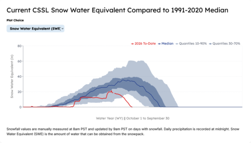
“Across the western United States, the climate crisis is on full display with record-low snow and an early-season heatwave shrinking critical snowpack that many Western states rely on for their water supplies over summer. Our changing climate, rapidly heating due to the burning of fossil fuels, is shifting the winter water cycle with more precipitation falling as rain than snow and warmer-than-normal temperatures causing premature runoff of what remains of the snowpack. With climate change, the potential for winters with low- to no-snow is substantial. These profound shifts jeopardize water supply reliability across the West and are forcing us to adapt our water infrastructure to prepare for a future that doesn’t look like the past. Western states are entering Spring 2026 in a snow drought, with near-record low to record-low snowpack amid unprecedented heat, scarily setting the stage for the possibilities of drought, water shortages and heightened wildfire risk in the coming months. … ” Read more from the Union of Concerned Scientists.
The West’s unprecedented winter could fuel a summer of disaster
“In Park City, Utah, skiers could find patches of grass poking through the slopes for much of the winter — a striking sign of a season that never really arrived. Now, after one of the warmest winters on record, much of the West is entering spring with snowpack at historic lows and an early heat wave that pushed temperatures into triple digits. These woes could be straight out of a climate fiction novel. But the West’s no good, very bad winter was alarmingly real. And, experts say, a worrisome combination of low snowpack and a devastating heatwave could create a summer ripe for climate disasters. “There is no analog,” Marianne Cowherd, a climate scientist at Montana State University, said of what’s happening. “There isn’t a year in the historical record we can look to for information … This limits our ability to look to the past for insight.” Much of that uncertainty stems from what’s happening to the region’s snowpack, a cornerstone of its water system. Snow accounts for 60 to 70 percent of the Northwest’s water supply and is especially critical to the ever-thirsty Colorado River Basin, which supplies seven states. But much of the region has experienced the warmest winter on record. … ” Continue reading from Grist.
Kings River snowpack “in ruins” after hot March
“California’s warm start to the spring has decimated the snowpack in the Kings River watershed. The Kings River Water Association found in its latest snow survey that the watershed’s snowpack is “in ruins.” The April 1 snow survey measured the Kings River snowpack water content at around 12.5 inches, which is 43% of average for April 1, date that California’s snowpack is typically at its greatest. … ” Read more from the SJV Sun.
SEE ALSO: Kings river snowpack at 43% of average as early melt raises water supply concerns, from The Business Journal
Fire, drought and zoning: How California can respond to environmental challenges
“As Pomona College prepares to host a California gubernatorial debate on April 28, Char Miller, W. M. Keck Professor of Environmental Analysis and History, examines what steps policymakers could take to mitigate the state’s most pressing environmental challenges. This interview has been edited for length and clarity. Q: What are the most pressing environmental challenges facing the state right now? A: We face two key and intertwined issues in the state—water and fire. We have too much fire and not enough water. And although the presence or absence of either (and both) of these things varies from year to year, that variability is also a problem. When it rains, we quickly take for granted the elevated levels of our water supplies in the northern reservoirs. On the other hand, fire seasons that lack the ferocity of January 2025, for example, lull us into a dangerous inattention. … ” Read more from Pomona College.
Groundwater and geophysics in California — A Bay Area Geophysical Society panel discussion
“On 21 November 2025, Bay Area Geophysical Society (BAGS) Vice President Michael Wilt convened an online panel on the application of geophysical technology to groundwater management. … As a preamble to this discussion, the Sustainable Groundwater Management Act (SGMA) of 2014 has fundamentally altered California’s approach to groundwater. It mandated the creation of local groundwater sustainability agencies, with the intention to achieve sustainability within each agency by 2040 (for critically overdrafted basins). Kris MacLennan: Rosemary, the first question we have is for you. What technology, geophysical or otherwise, is being applied right now to map and manage groundwater resources? What is it being used for? Rosemary Knight: I will be talking about technologies that image parts of the subsurface using sensors deployed on satellites, aircraft, or through ground-based systems, and now on drones. These technologies deliver images of the subsurface that we interpret to recover the information that we want about the groundwater systems. … ” Read full transcript of panel discussion at GeoScience World.
Seismic activity in California varies with the seasons – and groundwater levels
“Earthquakes occur when the tectonic plates of the earth’s crust shift, jolting past each other in a release of built-up tension. However, other natural forces can also influence seismic activity: Hydrological dynamics, like changes in groundwater and snowpacks, in particular, put pressure on faults. A new study from Caltech finds that a higher rate of change in groundwater levels leads to a noticeable increase in seismic activity. The study examined seismic activity in various regions of California—Los Angeles, the Bay Area, the Imperial Valley, the Eastern Sierra, and so on—from 2006 to 2022. The state’s rainfall levels vary by region; for example, Northern California receives significantly more precipitation than Southern California, leading to more pronounced seasonal changes in groundwater levels. … Utilizing new data analysis methods, the researchers saw that regions experiencing more dramatic changes in groundwater levels exhibit a larger seasonal variation of seismic activity. … ” Read more from Cal Tech.
Agriculture expert panel releases draft report on regulation of on-farm nitrogen use
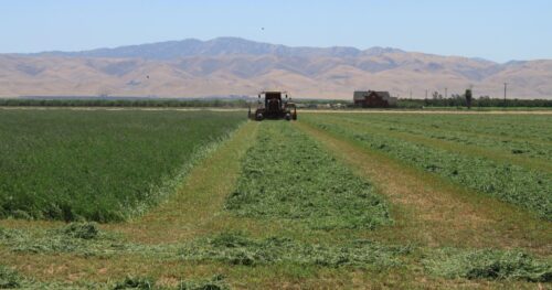 “An independent panel of academics and agricultural industry advisors today released a draft report containing recommendations for updating California’s regulatory approach to nitrogen discharges from farms. Furthering research on the impacts of agricultural practices on water quality, the State Water Resources Control Board convened the Second Statewide Agricultural Expert Panel in 2025 and directed it to consider nine nitrogen-related questions. The State Water Board and nine Regional Water Quality Control Boards will use the report to guide potential future updates to how discharges from irrigated farmland are regulated under the Irrigated Lands Regulatory Program. The eight-member panel held more than a dozen meetings, including two plenary meetings, two listening sessions and 12 work group meetings to consider the questions and compile the draft report. Among other findings, the draft report concludes that there is enough data to support numeric crop-specific targets or limits on nitrogen use in some parts of the state, while more time is needed in other regions to assess groundwater risks from nitrogen. The panel also recommends flexibility for region-specific nitrogen standards and the development of standardized reporting protocols. … ” Read more from the State Water Board.
California water challenges take center stage as experts call for urgent action
“The AgNet News Hour highlighted growing concerns over California’s ongoing water challenges, as water management expert Lindsay Cederquist outlined the real-world impact of limited allocations, regulatory pressure, and the need for immediate policy changes. Cederquist, Director of Water Resources at Diversified Land Management, works directly with growers across the Central Valley to help them navigate increasingly complex water conditions. Her day-to-day role focuses on evaluating farm water portfolios and developing strategies to help operations survive fluctuating water availability. “We sit down and look at the client’s portfolio and see what we can do to help them in each year,” Cederquist explained. “Each water year is different… and they all have their unique challenges.” … ” Read more from Ag Net West.
A Tribal group in California vies for a piece of the AI boom
“In California’s Sacramento River Valley, a lush agricultural region known for producing rice and alfalfa, one tribal group is taking steps to claim a piece of the global AI boom. Colusa Indian Energy, a power company wholly owned by the Colusa Indian Community, is set to announce Tuesday that it’s partnering with developer Strata Expanse to build an AI infrastructure project on land belonging to the Cachil Dehe Band of Wintun Indians. The tribe has agreed to lease several acres of land to start, with plans for that to top 100 acres in the next 18 months, said Kenneth Ahmann, chief operating officer of Colusa Indian Energy. The initial site will serve as a place for customers to test chips, cooling systems and networking tools before committing to larger projects. Eventually, Ahmann said, Colusa Indian Energy hopes to support a sprawling data center campus in the region. … ” Read more from Bloomberg.
In regional water news and commentary today …
SIERRA NEVADA
Restoring the headwaters: A year of progress at Haskell Peak Meadows
“In 2025, SYRCL, in partnership with the Tahoe National Forest, completed a third year of project implementation on the Haskell Peak Meadows Project which includes 229 acres of meadow, fen, and meadow edge habitat within five high priority meadows in the North Yuba Watershed: Haskell Headwaters Fen, Chapman Saddle Meadow, West Church Meadow, Freeman Meadow, and Bear Trap Meadow. The Haskell Peak Meadows Project uses low-tech process-based restoration, by integrating tools such as beaver dam analogs (BDAs) and post assisted log structures (PALS), to assist the system in aggradation and floodplain reconnection. Aggradation is the process of sediment accrual that naturally occurs in healthy meadows via slow flowing waters that deposit sediment. Beaver dam analogs are manmade structures that mimic beaver dams. These low-impact tools have proven to be effective at promoting floodplain connectivity and complexity, increasing habitat heterogeneity, and increasing ecological resilience (Pollock et al. 2017). … ” Read more from the South Yuba River Citizens League.
Aspen restoration at Salmon and Packer Creek: Implementation update
“In May 2025, the South Yuba River Citizens League (SYRCL) secured funding from the Wildlife Conservation Board to implement the Salmon & Packer Creek Aspen Restoration Project in the North Yuba watershed. The project footprint begins at the junction of Packer Lake Road and the Gold Lakes Highway and extends along the northeast side of Packer Lake Road to Packsaddle Campground. This Project will restore 95 acres of aspen, 15 acres of meadow edge habitat for fringe aspen, and increase forest health on 115 acres. The Project is within the boundary of a larger forest health project known as the North Yuba Landscape Resilience Project, led by the Tahoe National Forest and the North Yuba Forest Partnership. The North Yuba Landscape Resilience Project is a 275,000-acre project in Sierra and Yuba County that encompasses TNF system lands. Through ecologically based thinning and prescribed fire the North Yuba Landscape Resilience Project seeks to protect the North Yuba forests in the North Yuba Watershed from the threat of catastrophic wildfire and restore the watershed to a healthier, more resilient state. … ” Read more from the South Yuba River Citizens League.
Record heat devastates Nevada Irrigation District snowpack ahead of peak season
“Historic heat has sharply reduced snowpack across the Nevada Irrigation District (NID), with just 15 percent of average measured during the District’s April snow survey. Snowpack typically reaches its seasonal peak in late March or early April. This year, however, levels are critically low, raising concerns about increased wildfire risk and reduced water availability in the future. “Extremely warm and dry conditions in March have significantly reduced the snowpack,” said NID Water Resources Superintendent Thor Larsen. “This is the second-lowest snowpack recorded for an April survey, with 2015 remaining the lowest year on record.” NID hydrologists conducted the survey on March 26, measuring conditions at five established snow courses. The historic average snow water content across these sites is 33.6 inches; this year, the average measured just 4.9 inches. … ” Read more from YubaNet.
Resort updates: Multiple resorts move up closing dates for the 2025-26 season
“March is coming to a close, and although the door may be cracked for bouts of cold weather, many resorts are deciding to shut down for the season a little earlier than usual due to lack of consistent snowfall and rapidly melting snowpack. Last year’s closures during the 2024-25 season for 11 of the resorts in Tahoe took place in mid to late April with the exception of Palisades Tahoe which had a May closure on Memorial Day. Here’s a list of current closure statuses for resorts as of Monday, March 30 … ” Read more from the Sierra Sun.
Complex operation successfuly concludes after removal of fireworks and barge from Lake Tahoe
‘After days of complex deep-water operations, the portion of the fireworks barge that sank offshore of Ski Beach has now been successfully recovered, marking the conclusion of one of the more technically challenging salvage efforts the community has seen. High waves in July 2025 caused damage to the barge, dumping fireworks into the lake. Recovery required precise coordination between dive teams, marine crews, pyrotechnic specialists, and local agencies, all working under changing weather conditions and difficult underwater environments. What may have appeared from shore as slow progress was, in reality, a carefully sequenced operation where safety and precision guided every step. This was not a simple lift. Crews were working at depths exceeding 100 feet, navigating steep underwater terrain, near-zero visibility, and heavy, irregular materials resting across the lakebed. … ” Read more from South Tahoe Now.
SEE ALSO: Fireworks Barge Recovered from Lake Tahoe After Complex Salvage Operation, from National Today
SACRAMENTO VALLEY
Community meetings on groundwater management set
“On Wednesday, April 1, and Thursday, April 2, the Tehama County Flood Control and Water Conservation District will host outreach workshops in Red Bluff and Corning with information and updates about local sustainable groundwater management. The meetings are set to cover the same material, and there are options to attend either in-person or remotely. … ” Read more from the Red Bluff Daily News.
Illegal bike tracks damaging American River Parkway prompt crackdown push
“Bike riders are causing big problems along Sacramento’s American River Parkway. Some cyclists are digging up nature areas and turning them into off-road tracks for dirtbikes and e-bikes. The Sacramento County Parks Department says there’s been a big increase in vandalism and destruction of the nature preserve due to unauthorized use of off-road bicycles and e-bikes. “People are just going out with shovels and digging in our nature study areas out in our parks and just making little ramps so they can jump on their bikes,” said Ken Casparis, a spokesperson for the parks department. Park rangers say the illegal activity is causing damage to vegetation and sensitive wildlife habitat. … ” Read more from CBS News.
BAY AREA
Cold weather is back in the Bay Area and Tahoe. Here’s what the storms could bring
“The early-season summer-time temperatures that baked the Bay Area and rapidly melted the Sierra Nevada snowpack are coming to an end this week — but only for a couple of days. National Weather Service forecasters said two back-to-back storms this week will wet the state and push out the ridge of high pressure that created the recent heat wave. That period broke the all-time March high-temperature records at every major Bay Area climate station, and saw Lake Tahoe also get its warmest March day on record. “It’s not like we barely beat the records, either — we really shattered the records,” said Dylan Flynn, a meteorologist with the weather service’s Bay Area office. … ” Read more from KQED.
Hot spots in San Francisco area wetlands are teeming with fish food
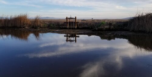
“A University of California Davis (UC-Davis) study has determined that parts of the San Francisco estuary known as the Suisun Marsh are producing an abundance of zooplankton, microscopic animals that form the foundation of a fish’s diet. If wetlands managers adopted strategies to connect managed wetlands with tidal habitats, they could time seasonal flood releases to send a DoorDash-like delivery of plankton pulsing into other waters to feed more fish, according to the study, which was published in the journal Estuaries and Coasts. “Plankton have been declining as a whole in the estuary for decades,” said Kyle Phillips, a postdoctoral scholar with the UC-Davis Center for Watershed Sciences. “The food has been missing, but we found where the food is, and we figured out how to make more. When you flood managed wetlands, you can expect a big boost in zooplankton,” said Phillips, lead author of the study. … ” Read moire from National Fisherman.
Marin Municipal Water District proposes 10-year rollout of ‘smart’ meters
“The Marin Municipal Water District is considering a longer rollout of “smart” meters and might assign the work to staff rather than contractors. A 10-year transition — compared to the three or four years initially planned — will enable the agency to focus immediately on completing a major software system upgrade to improve reliability, security and efficiency, officials said. The district estimates that having staff do the work would save about $9 million over 10 years. Previously, the district discussed delaying the smart meter installations so it could prioritize the projected $10 million to $15 million upgrade of its software system from SAP. The system is used to manage nearly all of the agency’s functions, including billing, water-use tracking, personnel, maintenance planning and customer relations. … ” Read more from the Marin Independent Journal.
CENTRAL COAST
Sen.
“A state lawmaker has unveiled legislation designed to speed up the construction effort that will bring much-needed flood protection improvements to the Pajaro Valley. In the name of increased efficiency, California Sen. John Laird has introduced Senate Bill 1055, meant to expand the suite of contracting tools available to the Pajaro Regional Flood Management Agency. The local agency has been spearheading the ongoing overhaul of the Pajaro River levee system in South Santa Cruz County and North Monterey County alongside state and federal partners. … ” Read more from the Santa Cruz Sentinel.
SAN JOAQUIN VALLEY
Kern River: A valid question; How’s fishing after restoration projects?
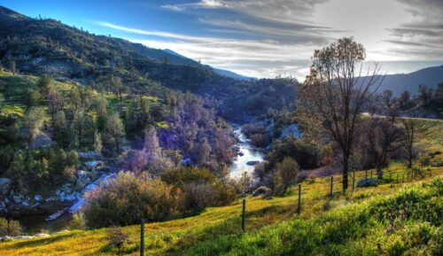
“An angler might wonder; what will one of Trout Unlimited’s restoration projects do to the fishing? It’s a valid question. At times we work with contractors to add numerous logs (or even full trees) and woody debris in a stream to make the habitat more complex. We break up long, straight riffle sections with j-hook rock structures to slow down the flow and create deeper holding water. We build beaver dam analogs (BDAs) to slow the flow and spread the water throughout a wider floodplain keeping cold water in the system longer throughout the year, benefitting all water users — fish, wildlife, ranchers, recreationists, etc. But what is it like to fish these streams after TU and crew leave the scene? High in the Southern Nevada backcountry lives the headwaters to the Kern River. Streams flow through beautiful meadows at high elevations, and TU and partners installed numerous BDAs. Since then, fishing for the native California golden trout has turned into an angler’s dream. … ” Read more from Trout Unlimited.
SOUTHERN CALIFORNIA
The Los Angeles Aqueduct is wild
“On the northern edge of Los Angeles, fresh water spills down two stark concrete chutes perched on the foothills of the San Gabriel Mountains, a place simply called The Cascades. It’s a deceptively simple-looking finish line: the end of a roughly 300-mile (or 500 km) journey from the eastern slopes of the Sierra Nevada into the city. On November 5, 1913, tens of thousands of people climbed these hills to watch the first water arrive. When the gates finally opened, water trickled through, but that trickle quickly became a torrent. The project’s chief engineer, William Mulholland, leaned over to the mayor and shouted the line that’s been repeated ever since: “There it is, Mr. Mayor. Take it!” That moment was profound for a lot of reasons, depending on where you live and how you feel about water rights. … ” Read transcript or watch video below from Practical Engineering.
Next to Joshua Tree National Park, a mining company is staking its claim for rare earth minerals
“An Australian company has launched a rare earths mining project just outside Joshua Tree National Park in critical desert tortoise habitat, an area the company’s director refers to as an “emerging heavy rare earth district.” The company, Dateline Resources Ltd., says that historical sampling of the area in the Pinto Mountains south of Twentynine Palms found enrichment in elements key to powering electric vehicles, wind turbines and defense systems. The United States depends heavily on China for its supply of these critical minerals, a major national security vulnerability the Trump administration has sought to address through a series of regulatory changes and financial incentives aimed at shoring up domestic production. The project is in its early stages, and it’s unclear whether further testing will confirm the presence of rare earth elements across a broad enough area to warrant extracting them. The site is roughly 100 miles southwest of the nation’s only fully functional rare earths mine — Mountain Pass operated by MP Materials, in which the U.S. Department of Defense holds a 15% stake. … ” Read more from the LA Times.
IMPERIAL/COACHELLA VALLEYS
No Data Center’ chants ring out at Imperial County board meeting
“Imperial Valley residents held “Not In My Backyard” signs and chanted “No Data Centers,” demonstrating overwhelming opposition to the proposed hyperscale AI data center as they gathered for a special Board of Supervisors meeting on Thursday evening, March 26. The 6 p.m. meeting quickly reached capacity before it even began, prompting the county to open two overflow rooms where people could watch and make public comments via livestream. These overflow rooms reached capacity by the time the meeting began, leaving out more than 50 people who would then gather in the administration building parking lot. “This community will remember who stood with the people and who stood with the developer; this community will remember the decisions made here and will respond accordingly through public process, public record, and at the ballot box,” said Franscico Leal during his public comment. … ” Read more from the Calexico Chronicle.
SAN DIEGO
Air advisory in southern San Diego due to hydrogen sulfide
“An air quality advisory has been issued for neighborhoods in Southern San Diego after county environmental officials detected elevated levels of hydrogen sulfide in the air from transboundary wastewater and sewage flows near the Tijuana River Valley. Hydrogen Sulfide (H₂S) is a gas that causes a strong rotten egg smell and can cause headaches and nausea. The San Diego County Air Pollution Control District (SDAPCD) issued the air quality advisory after hydrogen sulfide levels began going up March 28-29 in Imperial Beach, Nestor and San Ysidro, with the highest levels in Nestor. … ” Read more from Fox 5.
Along the Colorado River …
Rethinking how the United States and Mexico share the Colorado River
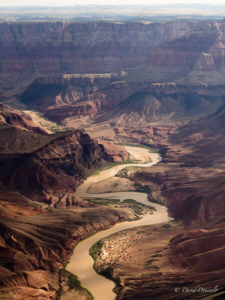 “With the existing Colorado River operating rules set to expire in nine months, the relationships among the Basin States have been the focus of much discussion and analysis, but the agreements between the US and Mexico governing their relationship are terminating at the same time. Discussions between the two countries are just ramping up, and there is a window of opportunity for new, creative arrangements that better reflect conditions on the River and make Mexico less dependent on what appears to be inevitable litigation in the US. This paper looks closely at the hydrology and hydrogeography of the Colorado River and suggests a shift from a fixed volume delivery obligation to one that equitably shares whatever water exists on a percentage basis.” Read the paper from the University of Colorado at Boulder.
Could nuclear power help pump water into the Colorado River?
“What if nuclear power could fix the Colorado River’s water crisis? That’s the pitch from Ben Burr, president of the Idaho-based Blue Ribbon Commission, who is shopping a proposal to build new desalination plants on California’s coast. The plants would convert Pacific Ocean seawater into freshwater and pump it hundreds of miles inland, adding new water to a system that has spent decades losing it. It would require a lot of power to run the plants and pump the water hundreds of miles. The group’s proposal lists a lot of alternative power sources, like solar and wind but also nuclear. Small modular reactors, Burr said, would power both the desalination process and the pumps needed to move water east, while also generating excess electricity for other uses. “Combining it with nuclear really lowers the cost and actually increases your power delivery for other things,” Burr said. … ” Read more from Channel 12.
We are not ready for the scorching, parched summer ahead
Morgan Wagoner, Western Water Program Director, Western Landowners Alliance, writes, “We’ve all read the innumerable news articles about the looming catastrophe on the Colorado River. The Upper and Lower Basins have failed to find a compromise, they’ve blown past multiple deadlines to come to agreement, and the federal government is threatening to impose a solution that may or may not go far enough to protect critical water delivery infrastructure. None of the federal alternatives in the draft Environmental Impact Statement performs acceptably under dry or critically dry conditions; exactly the conditions the basin is currently experiencing. A severe heatwave may decimate what little snowpack remains. However, the basin is even less prepared for the coming summer than this alone would imply, and the human and ecological consequences of inaction will fall hardest on the agricultural landowners and rural communities whose lives are built around this water. … ” Read more from the Fence Post.
Yuma growers await Colorado River deal as supply concerns rise
“Yuma farmers, who supply a large share of the United States’ winter lettuce and vegetable production, are monitoring ongoing negotiations over the future allocation of Colorado River water. According to grower Matt McGuire, the region includes around 210,000 acres (85,000 hectares) of farmland, with approximately 170,000 acres (68,800 hectares) dedicated to vegetable production. “Yuma is special. It’s kind of unique,” McGuire said. The region’s output has led to its position as a key winter vegetable supply area. “More than likely, if you’re eating a leafy green, you’re eating something that came from Yuma right now,” McGuire said. … ” Read more from Fresh Plaza.
Editorial: Nevada deserves to be treated fairly in water discussions
The Las Vegas Review-Journal editorial board writes, “The deadline looms for a new deal on the Colorado River among the seven basin states, including Nevada. Absent an agreement by October, Department of the Interior officials will impose their own arbitrary rules, which likely will include cuts to current allocation levels. John Entsminger, general manager of the Southern Nevada Water District, said the state is ready to defend its rights in court. “We are thoroughly prepared to fight like hell if it comes to that,” he told the Review-Journal’s Alan Halaly. “We’re trying to avoid that, but we have a number of long-term relationships and contracts with outside counsel. If it comes to fighting to protect the water interests of Southern Nevada, we’re ready.” This is entirely appropriate. Adjustments must certainly be made given drought trends and the reality that the 1922 Colorado River Compact overallocated the river in the first place. But Nevada is not the problem. Neither is urban residential water use across the Southwest. In fact, the majority of Colorado River water — as much as 80 percent — supports various agricultural interests operating in a parched desert. … ” Read more from the Las Vegas Review-Journal.
Colorado’s rural farmers try to adapt to shrinking Colorado River
“The Colorado River has 20 percent less water flowing through it than it did in the 20th century due to a decadeslong drought exacerbated by climate change. Caitlin Ochs, a photojournalist and National Geographic Explorer, has been documenting how farmers are trying to adapt. She said each year, members of the Ute Mountain Farm and Ranch in rural southwestern Colorado create multiple plans for what to plant based on water allocations, which vary greatly from year to year. They have already made adjustments on the operations side, including building a mill to add value to the blue corn they grow. “They’ve implemented low-flow nozzles into their center pivot system,” Ochs noted. “They’ve installed these small-scale hydro-powered generators to help them power their mill.” … ” Read more from the Kiowa County Press.
Colorado’s snowpack has likely peaked, but more snow in the forecast will offer relief
“Colorado’s snowpack has peaked, but forecasts show a break in the unseasonably hot temperatures and winter storms on the horizon. This winter is setting the stage for a historic drought year in Colorado with the lowest snowpack on record and temperatures 30 degrees above the norm statewide. Drought conditions are deepening as each hot and dry week passes, with about 74% of Colorado in some level of drought as of March 24 according to the U.S. Drought Monitor. No area of the state is spared by the poor snowpack conditions, but southwestern Colorado currently is the worst, Jason Ullmann, Colorado’s state engineer, told hundreds of water users and professionals gathered at a Southwestern Water Conservation District conference Friday on the Southern Ute Reservation. “We may get some additional snow. We may get additional rain, but likely not enough to bring that back up and get a second peak,” Ullmann said. … ” Read more from the Colorado Sun.
Colorado towns enact Stage 1 water restrictions as drought forecast looks grim
“A dry winter and dwindling snowpack are raising concerns across Colorado, where water managers warn that restrictions may be needed if conditions do not improve heading into spring and summer. Large portions of the state are experiencing moderate to severe drought, with some areas slipping into extreme drought, according to the U.S. Drought Monitor. The lack of consistent snowfall during the winter has limited runoff expectations, a critical source of water supply for reservoirs across the region, according to state water officials and climatologists. Communities along the Front Range of Colorado are already taking action or preparing to act. … ” Read more from AccuWeather.
In national water news today …
EPA watchdog finds nation’s most contaminated sites are vulnerable to flooding, wildfires
“About 100 of the nation’s most contaminated toxic waste sites are in areas prone to flooding and wildfires, a potential public health threat to millions of Americans in surrounding communities, the internal watchdog at the U.S. Environmental Protection Agency has found. The EPA’s Office of Inspector General issued a trio of reports last week assessing the weather-related vulnerabilities of the 157 federal Superfund sites prioritized for cleanup due to the serious risk they pose to public health and the environment. About 3 million Americans live within a mile of a Superfund site, while 13 million people live within 3 miles (4.8 kilometers). Some of the Superfund sites were found to be at risk from multiple natural-disaster threats. The studies found 49 in coastal areas are at risk from sea-level rise or storm surge from hurricanes, with many located near highly populated areas and important ecological locales like Chesapeake Bay. Another 47 are in low-lying sites prone specifically to inland flooding from heavy rain. The review also found 31 sites in areas at high risk for wildfires. … ” Read more from the OC Register.
Judge invalidates Trump’s Endangered Species Act changes
“A federal judge sided with several environmental groups Monday, saying federal agencies violated the text of the Endangered Species Act when revisions were made to the bedrock law during President Donald Trump’s first term. In a 41-page order, U.S. District Judge Jon Tigar vacated four of the challenged provisions — reverting three to its pre-Trump text and one to a 2024 version — and said the Department of the Interior’s changes contradicted the text, and were unlawful or arbitrary and capricious. “The agency’s errors are serious. Its regulations contradict the text of the Endangered Species Act and undercut the efficacy of Section 7 consultation in protecting threatened or endangered wildlife and marine life,” Tigar, a Barack Obama appointee, wrote. … ” Read more from the Courthouse News Service.

