
A wrap-up of posts published on Maven’s Notebook this week …
Note to readers: Sign up for weekly email service and you will receive notification of this post on Friday mornings. Readers on daily email service can add weekly email service by updating their subscription preferences. Click here to sign up!
In California water news this week …
Pacific storms to snap record heat wave in western US next week with cooler air, rain
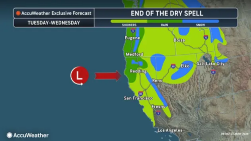 “Many areas have already recorded their highest temperatures of the extensive heat wave, but several more hot days are ahead across much of the interior West and Great Plains. Relief from the heat is on the horizon; however, a shift in the weather pattern will send multiple storms, cooling much of the region and bringing rain and mountain snow to some areas. … From Tuesday into Tuesday night, the next storm will move in from the Pacific Ocean. This storm will bring rain to California, northern Nevada and parts of southern Oregon and Idaho. In places such as San Francisco, it could produce the most significant rainfall since mid-February, with a few tenths of an inch possible. … ” Read more from AccuWeather.
‘Snow-eater’ heat wave behind big Sierra melt is a look at our climate future
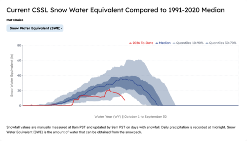 “The snowpack is melting so fast across the Sierra Nevada that ski resorts in the Tahoe area are farming snow to deepen the slush. Meanwhile, state officials are worried the melting snowpack could lead to troubling drought and early wildfire conditions. Climate experts said the truncated winter and an early spring heat wave are exactly what they’ve predicted in a warming world. California has been baked all week with temperatures 20 to 30 degrees above normal for this time of year. “The monthly record has already been completely smashed for South Lake Tahoe,” said Christopher Johnston, a meteorologist with the National Weather Service’s Reno office. The town set a new March record of 76 degrees on Wednesday, 5 degrees warmer than the previous record set in 2015. … ” Read more from KQED.
Atmospheric river storms will be tracked more accurately with new Bay Area weather radar stations
“Hoping to collect more information about the biggest, wettest storms that soak California each year — filling reservoirs and also causing damaging floods — a coalition of Bay Area water agencies on Thursday unveiled a new $19.7 million system of high-tech radar stations that stretches from Sonoma County to Santa Cruz. The network features six new radar installations in Contra Costa, San Mateo, Santa Clara, Santa Cruz, Marin and Sonoma counties that can track storms with faster and higher-resolution updates than the current National Weather Service radar stations. In a typical year, California receives about a dozen big atmospheric river storms, huge conveyor belts of moisture that account for roughly 50% of the state’s annual precipitation. Also called “Pineapple Express” storms, they sometimes deliver localized bursts of extreme weather and rainfall that can cause landslides, flooding and other mayhem. … ” Read more from the San Jose Mercury News.
Millions of hatchery salmon face ‘deadly’ low water flows in warm Sacramento River
“The U.S. Fish and Wildlife Service released more than 6.2 million juvenile Chinook salmon from the Coleman Hatchery into the Sacramento River this week, even as the river faces unusual March heat and low water flows. The announcement of the release came during a spell of extreme heat throughout California, prompting urgent calls from conservationists who warn the young fall‑run Chinook could die in the river’s warm, low‑flow conditions before making their way to the ocean, unless the Bureau of Reclamation releases more water from Shasta Dam. “No sooner do we start to gain a little ground back in rebuilding our salmon runs, the federal Bureau of Reclamation is destroying them again,” Vance Staplin, executive director of the Golden State Salmon Association said in an email. “These fish are in big trouble if the Bureau doesn’t relent very soon.” … ” Read more from the Sacramento Bee.
Sites Reservoir on track for key state permit
“The plan to build California’s largest reservoir in nearly 50 years has cleared one of its last and most fundamental hurdles: tentative approval of the project’s water right. The State Water Resources Control Board on Friday released a draft permit that would allow Sites Reservoir, a proposed 13-mile-long storage facility 70 miles northwest of Sacramento, to draw water from the Sacramento River. While not final, the much-awaited draft permit indicates that state water regulators support the project, which is driven by a coalition of water agencies, and that they will likely sign off on the needed water in the fall. This could pave the way for construction of the $6 billion reservoir to begin as soon as late this year or early next. Sites Reservoir, which has been in discussion for decades, has been widely supported by cities and farms as well as by state leaders, including Gov. Gavin Newsom. However, some environmental groups and tribal communities have opposed the venture, saying it will take water from an already-stressed watershed, thus harming plants and wildlife — including the state’s biggest salmon runs. … ” Read more from the San Francisco Chronicle. | Read via Yahoo News.
CA Water Board issues draft water rights decision for widely-opposed Sites Reservoir Project
“While California Governor Gavin Newsom and President Donald Trump disagree on a number of issues, one project that they both strongly support is the controversial plan to build Sites Reservoir in the rolling foothills of the west side of the Sacramento Valley — at the behest of Big Money interests. The Administrative Hearing Office of the State Water Resources Control Board last Friday issued a draft water rights decision for the proposed Sites Reservoir project, despite longstanding concerns by Tribes, fishing groups and environmental organizations about the project’s environmental impacts, high costs, and limited benefits. “The hearing process involved 21 parties, 60 witnesses, 2,115 evidentiary documents and took place over 32 separate hearing days, with a two-day site visit,” the State Water Resources Control Board wrote in a statement. “The draft decision evaluates the evidence and legal arguments received during the proceedings and provides the rationale for conditions contained in the draft water right permit; it is the product of extensive deliberations by the board members during closed sessions over the last two years.” … ” Read more from Dan Bacher at the Daily Kos.
Tribes, environmental groups urge Governor Newsom to oppose Shasta Dam raise
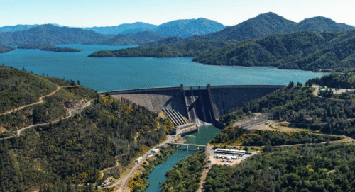 “A coalition of fifty Tribes, environmental justice organizations, commercial fishing groups, recreational advocates, and conservation organizations has called on California Governor Gavin Newsom to oppose efforts to raise the height of Shasta Dam. In a letter addressed to the governor, the coalition expressed concerns over the Trump Administration’s push to advance the controversial project, which they argue violates state law and undermines California’s authority over water governance. The Trump Administration recently allocated an extra $40 million for dam expansion planning. The project, which would raise the dam by 18.5 feet, has long been sought by Central Valley agricultural interests. Supporters say it will boost water storage and reliability for Central Valley agriculture, while critics point to environmental and legal concerns, especially its effects on the protected McCloud River. … ” Read more at Maven’s Notebook.
SEE ALSO: Tribes, environmentalists urge Newsom to oppose federal plan to raise Shasta Dam, from KRCR
Feds bump water allocation up modestly for west Fresno County. Westlands says not enough
“An update from the Bureau of Reclamation means a modest increase in water sent to south-of-Delta contractors, including Westlands Water District. On Tuesday, the bureau announced the yearly allocation would increase to 20% from 15%. This comes as a recent heat wave has experts worried about accelerated melting of the vital Sierra snowpack. Allison Febbo, general manager of Westlands, said in a release that the government needs to better coordinate with experts to adapt allocations to real-world conditions and decrease the need for groundwater pumping. “While we appreciate the modest increase in allocation and acknowledge the constraints of California’s current hydrology — particularly as snowpack declines rapidly — this additional 5 percent is simply inadequate,” Febbo said in a statement. “Continued low allocations lead to increased reliance on groundwater pumping, a direct result of our broken water system that has suffered from decades of underinvestment and unreliable water supplies.” … ” Read more from GV Wire.
What California landowners, water companies, and agencies need to know about the Las Posas Valley groundwater adjudication rulings—and why they matter for SGMA compliance statewide
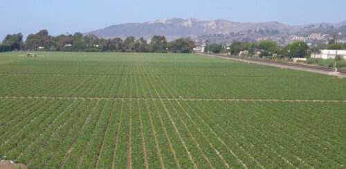 “If you are involved in California groundwater, you’ll want to pay close attention to two recent appellate court decisions from the Las Posas Valley Groundwater Basin. These rulings, issued in March 2026, mark the first contested comprehensive groundwater adjudication affirmed under the framework enacted alongside SGMA. The court affirmed a settlement of the action over objection, addressing how adjudication integrates with SGMA planning, permissible allocation models, dormant rights, and ownership of overlying water rights by mutual water company shareholders. In short, these opinions offer a practical roadmap for post-SGMA groundwater cases across the state. … ” Read more from O’Melveny.
When the water stops: One rural community’s crisis and the national problem behind it
“Residents of Alderpoint recently received a letter in the mail that stopped many of them cold. The Alderpoint County Water District, the only source of water service for the rural community in southeast Humboldt County, warned customers that unless the district could pay a past-due PG&E power bill of $14,357.17, power to the water system could be shut off as soon as April 17, 2026. When power goes, the pumps stop. When the pumps stop, the water stops. And when water stops, county environmental health officials could begin red-tagging homes as uninhabitable — even for residents who have paid their water bills every single month. … What’s happening in Alderpoint is not unique. Across California, hundreds of public water systems are currently designated as failing by the state — more than 79% of them serving disadvantaged communities. The vast majority are small systems just like this one, lacking the resources to keep pace with rising costs and aging infrastructure. … ” Read more from the Redheaded Blackbelt.
Contaminated water from California prison sickens residents of nearby town
“Last July, the California Department of Corrections and Rehabilitation (CDCR) held a series of town halls inside Mule Creek State Prison intended to be run-of-the-mill information sessions on colon cancer. Incarcerated attendees packed the hall on the prison’s E yard with other health concerns in mind: Two months earlier, an investigation by The Appeal circulated through the facility about a severe environmental and infrastructural breakdown at Mule Creek, which incarcerated people believed had poisoned their water and impacted their health. Many had questions pertaining to serious medical conditions, frustrations regarding care provided, the status of the water, and what appeared to be an increase in the number of people suffering from thyroid and kidney ailments. “Why not zone in on cancers that people are getting?” some attendees asked. CDCR officials didn’t have an answer. … ” Read more from Prism Reports.
Suisun Marsh study shows managed wetlands produce more zooplankton than tidal habitats
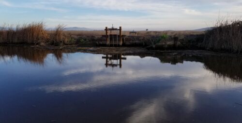
“California’s Bay Area may be a culinary hot spot for people, but food options for fish in the San Francisco Estuary have been limited and declining in recent decades. A study from the University of California, Davis, shows there is a part of the estuary that is teeming with fish food — the managed wetlands of Suisun Marsh. The study, published in the journal Estuaries and Coasts, found that managed wetlands produce 11 to 22 times more zooplankton than tidal habitats, including tidal restoration sites. Zooplankton are drifting, microscopic animals that form the foundation of a fish’s diet. The paper said zooplankton increases in response to controlled floods. … ” Read more from UC Davis.
Five overlooked facts about California’s water supply
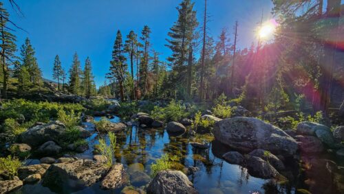
“California’s vast Sierra Nevada mountains act like a giant sponge that squeeze moisture from the clouds drifting eastward from the Pacific Ocean. The forests that flank these then mountains capture and filter rain and snow before it reaches streams, rivers and aquifers. Many of our National Forests, which cover more than 20 million acres of the state, are located in higher elevation areas and play a large role in capturing precipitation. California’s National Forests supply 65 percent of the state’s water while occupying only 20 percent of the total land area. With national attention on California’s record drought, decision-makers and the public are racing to find solutions. While leaders have implemented water conservation measures and engineers are exploring infrastructure solutions, little attention has been given to the source of California’s water – National Forest headwaters. … ” Continue reading from the National Forest Foundation.
Reservoirs contribute to climate change, it’s time for California to track their emissions
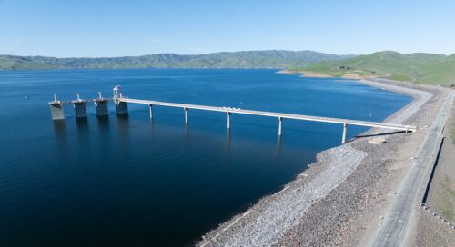
“Today, a petition was filed with the California Air Resources Control Board (CARB) to add dams and reservoirs as reporting entities under California’s Regulation for the Mandatory Reporting of Greenhouse Gas Emissions. Numerous scientific studies have established that dams and reservoirs produce and emit substantial amounts of greenhouse gases, with California’s major dams and reservoirs producing the equivalent of burning 5.8 billion pounds of coal every year. The petitioners, which include Patagonia, California Trout, Friends of the River, Ríos to Rivers, Center for Biological Diversity, Save the World’s Rivers, Ridges to Riffles Indigenous Conservation Group, and the research entity Tell the Dam Truth, assert that these should be tracked to ensure that the state can reach its climate goals. “Methane is a highly potent greenhouse gas, and water storage reservoirs in California are a significant and largely untracked source,” said Keiko Mertz of Friends of the River. “Our goal with this petition is to support the State’s climate efforts. If California is serious about climate leadership, it must measure and combat all major sources of emissions, including those hiding in plain sight.” … ” Continue reading this press release.
With a landmark report and historic investments California doubles down on ocean health
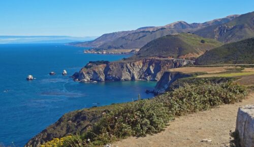 “At a time when federal actions are putting coastal waters and public lands at risk, California is moving in the opposite direction. Yesterday, the California Ocean Protection Council (OPC), in partnership with the California Ocean Science Trust, released the 2026 California Coast and Ocean Report – the first comprehensive, science-based assessment of coastal and ocean health in California history. The report describes not only the pressures facing California’s coast and ocean, but also the historic progress that our state is making to support resilient marine ecosystems and thriving coastal communities. The Council also approved over $6 million in funding for nine key science and restoration projects that support healthy oceans and advance the state’s goal to conserve 30% of its coastal waters by 2030. Scientific research projects will help identify biodiversity “hotspots” to prioritize for conservation, while restoration work will bolster biodiversity in eelgrass, estuary, and kelp forest ecosystems impacted by climate change, wildfire, and other threats. “California’s coast and the Pacific Ocean define who we are Californians,” said California Secretary for Natural Resources Wade Crowfoot. … ” Read more from the Natural Resources Agency.
And lastly … Man brings a cup of water to the Hoover Dam in Las Vegas. Is it true water refuses to go in?: ‘How does it work?’
Have you ever tried this? “The Hoover Dam is an incredible feat of engineering. Built between 1931 and 1936, the Hoover Dam sits on the Colorado River at the border of Nevada and Arizona. At the time of its construction, it was the tallest dam in the world. While there are now taller dams, that doesn’t mean that the Hoover Dam is not impressive. In fact, this dam alone produces approximately 4 billion kilowatt-hours (kWh) of electricity annually, which is enough to supply power to over 1.3 million people in the area. Given the awe-inspiring nature of this construction, it’s no surprise that the landmark welcomes around 7 million visitors every year. While there, tourists may take a walk through the visitor center, snap a few pictures at one of its many lookout points, or try and fail to pour a glass of water down the side of it. Wait, what was that last part? … ” Read more from the Bro Bible.
In commentary this week …
State regulatory decisions (or refusal to make decisions) continue to cost critical water supplies in a changing climate
Geoffrey Vanden Heuvel, Milk Producers Council, writes, “On February 9, 2026, Congressmen Costa, Gray, Valadao and Fong jointly sent a letter to Governor Newsom (read here) asking him to suspend a regulation in the Delta called the Port Chicago water quality standard because the triggering of this standard would require releases from the reservoirs and the loss of as much as 600,000 acre-feet of fresh water to the ocean. If you remember, in January the California drought map showed our state for the first time in a long time completely free of drought. This situation is a contributor to the triggering of the Port Chicago standard that was implemented by the State Water Resources Control board in 1999. The idea being that if there is lots of water in the system, then we can afford to freshen up the western Delta around Port Chicago and that will be good for fish. As the Congressmen pointed out in the letter, the Delta has significantly changed since 1999, and the weather has become even more variable. So, what looks like an above normal year in January can change, and sending water to the ocean early may mean losing water you may need later in the year. … ” Read more from the Milk Producers Council.
Equality begins with water
Jason Morrison, president and CEO of the Pacific Institute, writes, “World Water Day always makes me pause. It is one of the few moments in the year when the world collectively agrees to look at water not as background infrastructure, but as something that shapes people’s daily lives. This year’s theme, “Where water flows, equality grows,” puts a bright light on something we do not say plainly enough. The global water crisis affects everyone, but not equally. Women and girls often carry the heaviest burden when safe water and sanitation are unavailable, and they are too often missing from the decisions that shape water services and investments. The data is stark. 1.8 billion people live in households without water on the premises, and when water must be collected, women and girls are primarily responsible in 7 out of 10 households. That time cost is not a small inconvenience. It is hours taken from school, paid work, rest, and community leadership. Water security is an equality issue because time, safety, and opportunity are equality issues. … ” Read more from the Pacific Institute.
Protecting California’s water – SB 872
Michelle Paul, California Farm Water Coalition, writes, “From the moment California’s earliest residents called the vast, fertile soils of California’s Central Valley home, efforts began to solve one of the state’s oldest challenges: harnessing the water. With rainfall and snowpack varying dramatically year to year, and because most people and farms are in the state’s arid regions, water must be carefully managed and transported long distances to ensure all communities can thrive. California’s water infrastructure has developed over more than 220 years, beginning with the construction of a stone dam on Mission Creek in 1807. Since then, countless projects have been added to meet the evolving needs of each region. Today, nearly every part of the state’s engineered water supply system is interconnected, either through hydrology or connections between physical infrastructure. The most obvious examples of this are the federal Central Valley Project and the California State Water Project, mostly built between 1940 and 1979 to meet agricultural, urban, and now, environmental water supply needs. They both share the Sacramento-San Joaquin Delta, and both systems need upgrades and repairs after, in some cases, 80 years of water deliveries. … ” Continue reading this commentary.
California’s water crisis isn’t a drought—it’s bad policy
Mohamed Moutii, a Research Associate with the Arab Center for Research, a Research Fellow with the Institute for Research in Economic and Fiscal Issues (IREFeurope), and a member of the Ibn Khaldun Initiative for Free Thoughts, writes, “In late December, winter storms brought rain and snow that modestly improved California’s reservoirs and snowpack. Officials quickly cautioned, however, that this would not solve the water crisis. The message was clear: despite years of restrictions and emergency measures, policymakers still have no path to long-term water security. California’s water shortages are routinely attributed to drought, climate change, and population growth, while residents are urged to ration water, shorten showers, and accept fines as a civic responsibility. Yet household behavior does not drive scarcity. California’s water shortage is essentially the product of government policy—decades of price suppression, subsidizing waste, and allocating water according to political rules rather than economic value. Until water is treated as the scarce resource it is—correctly priced and efficiently allocated—no amount of rain or restrictions will fix a crisis of the state’s own making. … ” Read more from the Daily Economy.
In regional water news this week …
Why Dunsmuir, California, claims to have the best water on earth
“A small city along the upper Sacramento River is leaning into its natural assets — from spring-fed drinking water to fly fishing — as it works to balance tourism with long-term sustainability. Dunsmuir, in northern California’s Siskiyou County, has about 2,800 residents and sits along Interstate 5 and the Union Pacific Railroad. Situated in a canyon, it draws visitors for its scenery and access to outdoor recreation. Dunsmuir boasts the “best water on earth,” sourced from underground volcanic flows. “Our water comes from a volcanic tube that never sees the light of day until you turn the tap water on,” Mayor Juliana Luchessi said. … ” Read more from Jefferson Public Radio.
Listening in: River Partners tracking juvenile salmon’s migratory paths
“Central Valley Chinook salmon are in serious trouble. Multiple runs are listed under the Endangered Species Act, and populations have declined dramatically over the past century as dams, diversions, and development have stripped away the cold water, food, and floodplain habitat salmon need to survive. Understanding exactly how juvenile fish navigate what remains of their habitat has never been more urgent. So, what if we could listen to the secrets juvenile salmon share about their migratory journeys? River Partners and other researchers are doing just that at Dos Rios Norte, our floodplain restoration site located 45 minutes north of Sacramento along a vital migratory pathway for imperiled Central Valley Chinook salmon. The 1,600-acre former rice farm is bordered by three critical bodies of water for salmon in the Sacramento Valley: the confluence of the Sacramento and Feather Rivers and Lower Butte Creek. … ” Read more from River Partners.
Record 30,000 endangered Central California Coast Coho salmon return to Mendocino Coast rivers
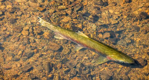
“During the 2024–2025 spawning season, endangered Central California Coast coho salmon (CCC coho) migrated to Mendocino Coast rivers in numbers few scientists thought they would see in their careers. Monitoring teams estimated that more than 30,000 adult coho returned, double the previous season’s record-breaking return of 15,000 coho. These numbers represent a significant leap from the past decade, where as few as 3,000 fish returned annually. Several factors contributed to this surge. Many scientists believe that reconnecting spawning streams to mainstem rivers and other large-scale habitat restoration projects significantly boosted their productivity and abundance. These actions expanded and improved the habitat available for salmon to spawn and grow. Since 2000, NOAA has supported more than 100 restoration projects across the region. For biologists and restoration practitioners who have spent decades surveying streams with few or no fish, the new numbers feel profound. … ” Read more from NOAA Fisheries.
Clearlake residents affected by January sewage spill spared major sewer rate hike — for now
“Clearlake residents still reeling from the Jan. 11 sewage spill on Robin Lane were spared from a 120% sewer rate hike proposed by the Lake County Special Districts during the March 24 Lake County Board of Supervisors meeting — at least for now. The Lake County Board of Supervisors postponed the process to implement the new rates for at least six months to give the county time to wrap up response to the 2.9-million gallon sewage spill that has upended life for about 475 Clearlake residents. “At this time, I am very uncomfortable with even having the conversation about rate increases,” said Lake County Supervisor Bruno Sabatier, whose district encompasses the area impacted by the spill. “We are still in the midst of an emergency and some people still don’t have access to clean, potable water.” But according to officials, rate increases are required — and inevitable -— to meet exceeding operational costs. … ” Read more from the Santa Rosa Press Democrat.
Yolo County water worries hit the courts as officials allege DWR skirted environmental review
“Concerns about groundwater are once again bubbling to the surface in Yolo County. Last month, the California Department of Water Resources determined that a $180 million purchase of water rights from a large farm near Knights Landing would have minimal impact on the environment and was therefore exempt from a lengthy, state mandated review process. Local officials disagreed with that assessment. In separate lawsuits filed last week, Yolo County and the Yolo Subbasin Groundwater Agency alleged that DWR inappropriately skirted the environmental impact review required under the California Environmental Quality Act, or CEQA. According to the plaintiffs, the water transfer, which would provide DWR with the rights to up to 16,000-acre feet of Fair Ranch’s Sacramento River surface water, could put more pressure on the county’s already depleted groundwater reserves. … ” Read more from PBS Abridged.
How stormwater studies can make the San Francisco Bay cleaner
“As stormwater sampling across the San Francisco Bay Area reveals more poorly regulated chemicals, those who want clean water in the Bay face a tricky question: what can be done about it? A raindrop falling over a Bay Area city or suburb might land on a dizzying number of human-made surfaces: artificial turf, roofs, cars, pavement, windows, solar panels, construction sites, and many others. By the time water heads toward San Francisco Bay as stormwater runoff, it can collect hundreds of chemicals from these painted, treated, or worn-down surfaces. In all Bay Area cities except portions of San Francisco, stormwater flows straight to the Bay. “The fundamental challenge of stormwater is that the scale is just really big,” says Karen Cowan, the executive director of the nonprofit California Stormwater Quality Association. “It’s the world we live in, for all practical purposes.” … ” Read more from the San Francisco Estuary Institute.
Marina revives old desal plant to boost drought-resistant water supply
“The Marina Coast Water District is reviving a 30-year-old desalination plant in Marina to provide an additional 300 acre-feet of water annually to the Monterey Peninsula, enough to support a thousand homes. “This is the one that was built in 1996,” said a representative from the Marina Coast Water District, Rem Scherzinger. “We’re going to take this package out, get a new one, slide it right in, plug it in, and off we go. So this is literally we’re using the assets that the district built back 25 years ago.” The reactivated plant is expected to come online next year, providing a drought-resistant water supply. “Droughts are coming and they have been here,” Scherzinger said. “And so we want to make sure that we have a very diverse and drought-resistant, drought-tolerant water supply.” … ” Read more from KSBW.
Program to protect Lemoore-area drinking water wells approved by groundwater agency
“A program to help Lemoore-area domestic well owners if their taps go dry has been approved by the South Fork Kings Groundwater Sustainability Agency (GSA). The GSA anticipates funding for the program through groundwater pumping and land assessment fees. A $1.5 million reserve fund will be set aside for the program. The GSA board approved the program at its March 19 meeting. However, not all damaged wells may qualify for the program. “The purpose of this well mitigation policy is to provide emergency water supply and implement long-term solutions for households that have lost access to drinking water as a result of groundwater levels decreasing,” consulting engineer Amer Hussain told the board. The program is similar to the well program passed by neighboring Mid-Kings River GSA. … ” Read more from SJV Water.
Mono Lake water levels are well below what’s required. Now some want L.A. to tighten its tap
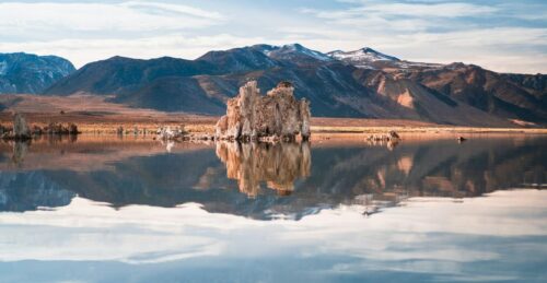 “More than three decades after a landmark decision called for Los Angeles to limit its taking of water to raise the level of Mono Lake, California regulators are reexamining why the lake still hasn’t rebounded and what should be done about it. At the request of state water officials, UCLA climate scientists developed a new model to analyze why the lake remains far below its state-mandated target level. In a new report, they said that without L.A.’s use of water from creeks that feed the lake, its waters would be about 4 feet higher — closer to that required threshold. “The way the exports are regulated, meeting lake level objectives is unlikely,” Alex Hall, a UCLA climate scientist, told members of the California State Water Resources Control Board at a meeting Tuesday. … ” Read more from the LA Times. | Read via AOL News.
The economics of managing Mono Lake
Edward Ring, Director of Water and Energy Policy at the California Policy Center, writes, “Along with the California Condor, one of our state’s most magnificent environmental success stories of the 20th century is how Mono Lake was saved. In the early 1980s, after decades of unsustainable water withdrawals from the Owens River into the Los Angeles Aqueduct, the lake had declined in elevation to 6,372 feet. The decline was primarily caused by the Los Angeles Department of Water and Power diverting an average of 80,000-100,000 acre feet per year from the tributaries feeding Mono Lake. The turnaround has been incredible. Today, LADWP’s average withdrawals from the upper Owens River watershed are down to 16,000 acre feet per year. The level of the lake has risen to an elevation of 6,383 feet, which is within 9 feet of the what the State Water Resources Board has set as the ultimate goal of 6,392 feet. The acute crisis is over. For example, Negit Island, an important rookery where a land bridge was forming due to the dropping lake level, now remains safe from predators. And overall, years of investment in habitat restoration have preserved and enhanced one of North America’s most productive stopovers on the Pacific Flyway, supporting millions of migratory birds. … ” Continue reading from Edward Ring.
Four Roomba-like rovers are cleaning waterways in Port of LA
“A fleet of robotic vessels has been busy the past few weeks scooping up debris in the Port of Los Angeles before the trash flushes into the open ocean. Similar efforts have already been deployed in Huntington Harbour and Newport Harbor, with thousands of pounds of trash removed from Southern California waterways using the Roomba-like devices, with hopes that the low-maintenance method will catch on in harbors across the country. The four Clean Earth Rovers in the Port of Los Angeles were launched in January, with the goal of removing tens of tons of debris over the next year throughout the port’s 15 marinas. Already, an estimated 2,000 pounds of trash have been pulled out of the water. … ” Read more from the OC Register.
The Colorado River is on the brink of possible forced water cuts. One thing is certain: There will be lawyers.
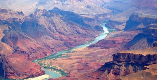
“Under the rusty cliffs of Marble Canyon, the start of the Grand Canyon in Arizona, a nondescript river measurement gauge has been tracking the flow of the Colorado River for decades. It’s a picturesque place, often filled with rafters and swimmers, about 15 river miles downstream from one of the nation’s largest reservoirs, Lake Powell. It’s also central to looming legal battles over the river’s future — and the potential of forced water cuts in Colorado. The Colorado River’s flows at the gauge, called Lees Ferry, are fundamental to water sharing agreements among upstream states, like Colorado, and downstream states including Arizona, California and Nevada. If the river’s flow falls too low, the three downstream states can raise a ruckus, arguing the upstream states are breaking century-old agreements and forcing the basin into a legal mire that might only be decided in the U.S. Supreme Court. … ” Read more from the Colorado Sun.
Amid ‘dire situation’ for Colorado River Basin, headwater states say they can’t cut water they don’t have
“Under pressure to strike a compromise on water cuts, and amid talk of litigation, Wyoming and other upper Colorado River Basin states are pointing to the climate-driven disaster unfolding in the West to insist they can’t cut what Mother Nature isn’t providing in the headwaters. While some observers suspect that argument is cover for withholding more cuts in water use, the upper-basin contingency insists it has negotiated in good faith and still hopes to strike a deal with its lower-basin counterparts despite missed deadlines. They simply cannot commit to calculations that are beyond their control. “If the water is not there, our water users don’t get to use it, and that is typically the case,” New Mexico’s water negotiator Estevan Lopez said. On paper, it might appear the headwater states are being stingy, Lopez added. New Mexico, Colorado, Wyoming and Utah, however, live with “very real and mandatory reductions that are imposed by nature, which we refer to as hydrologic shortage.” … ” Read more from WyoFile.
Announcements, notices, and funding opportunities …

