

In California water news this weekend …
California to be slammed again by another atmospheric river event
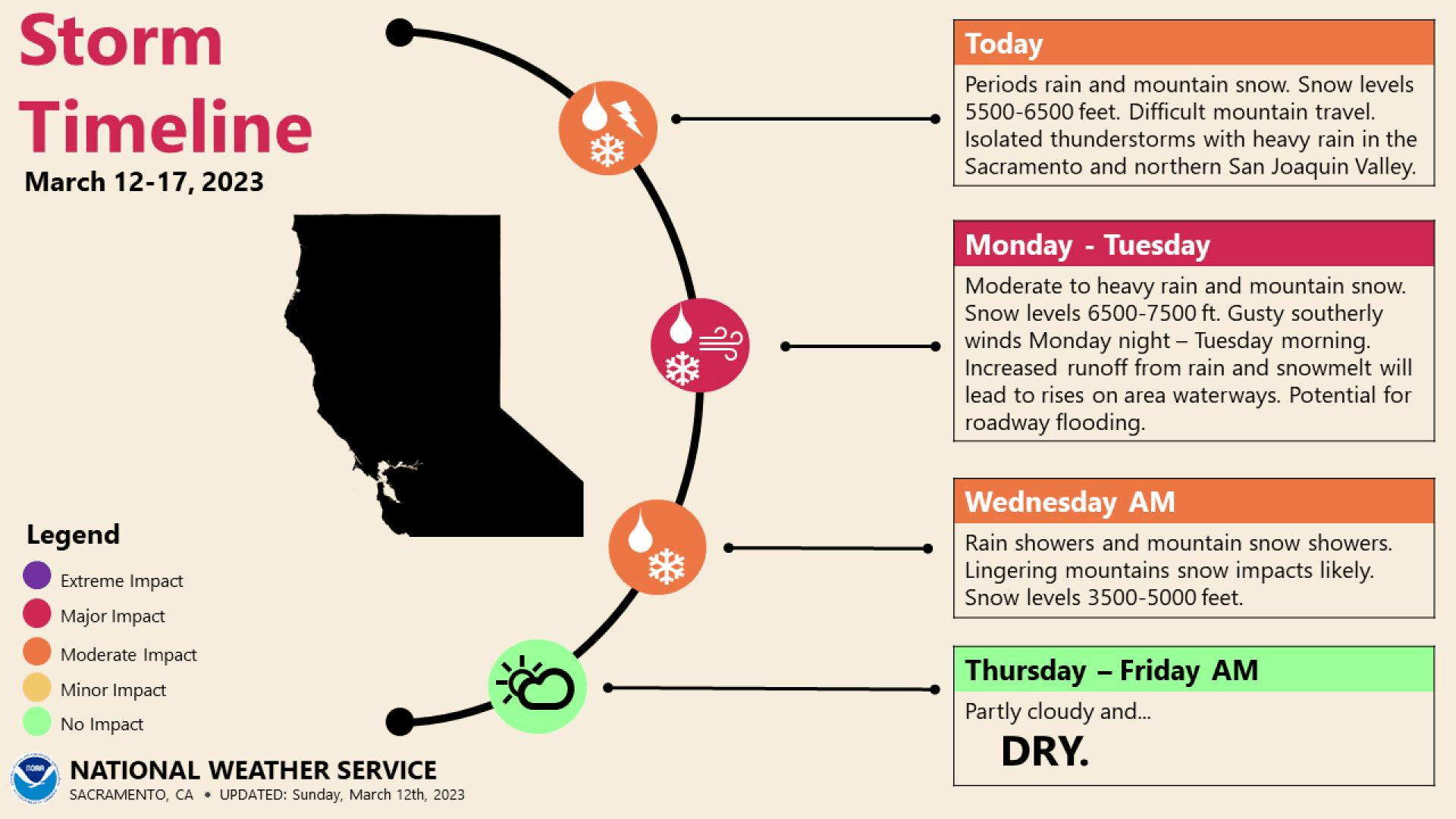 “Days of heavy rainfall and melting snow that triggered Flash Flood Emergencies and that were blamed for the deaths of at least two people could return to the Golden State as another atmospheric event gears up over the moisture-laden Pacific. The weekend brought a period of respite for millions of Californians who were under flood alerts and saw rainfall amounts that reached 12 inches in some communities. … NOAA’s Weather Prediction Center has already warned of a moderate risk for excessive rainfall and has highlighted areas from around San Francisco to Sacramento and points northward for seeing the highest risk of flooding on Monday. On Tuesday, the greatest threat zone will sink south and include much of Central California. … ” Read more from Fox Weather.
Flooding inundates Central California communities, blocking routes out
“Heavy rains are washing out roads and leading to emergency rescues in central California as the state braces for more storms in the coming days. The California National Guard helped with at least 56 rescues in the early hours of Saturday morning after a levee breach inundated the small community of Pajaro in Monterey County. … As the sun rose over the state, more than 9,000 residents were still under evacuation orders as California continued to be pummeled by what meteorologists call an atmospheric river, extremely moist storms common to the West Coast. … It is the 10th such event to hit the state this season.Forecasters project that the unrelenting rainfall will last through the coming week. … ” Read more from the Washington Post.
SPILLWAYS OPEN
California under flood threat releases millions of gallons from reservoir, despite drought

“As a series of atmospheric rivers pummeled California with heavy rain and residents braced for potential flooding, on Friday the state began releasing millions of gallons of water from a major reservoir — despite ongoing drought conditions. The release at Lake Oroville, the state’s second-largest reservoir and home to the nation’s tallest dam, was the first since 2019 and came as a precaution against flooding to communities downstream in case of a possible spillover. The shift from water conservation to flood prevention is just the latest in a winter weather whiplash in California, where 85% of the state was in severe drought three months ago, according to the U.S. Drought Monitor. Now just 19% of the state falls into that category. … ” Read more from NBC News.
As California gets drenched, officials opening Oroville Dam spillway for first time in 4 years
“California water officials opened the main spillway at the Oroville Dam on Friday afternoon, doing so for flood control purposes for the first time since 2019. Ted Craddock, deputy director of the State Water Project, said the water elevation at Lake Oroville has risen by close to 180 feet since Dec. 1 after a parade of storms this winter, now standing at about 840 feet — 60 feet shy of its maximum. State water officials began to increase releases from Lake Oroville, which is operated by the state Department of Water Resources, on Wednesday for flood control purposes, Craddock said during a virtual news briefing ahead of the successful spillway opening at noon. … ” Read more from the Sacramento Bee. | Read via AOL News.
Spillways open at Northern California dams after heavy rainfall
“As continuous storms across the state swell California’s reservoirs above historical averages, two Northern California dams have begun releasing water from their spillways, according to Yuba County. The county shared on Friday that New Bullards Bar dam and Lake Oroville Dam have begun releasing water onto their spillways “to protect valley communities.” Oroville has a total capacity of 3.5 million acre-feet of water and New Bullards Bar has a total capacity of 966,000 acre-feet of water. … ” Continue reading from Fox 40.
California releases water from filling reservoirs. Is the drought over?
“As a wet winter continues to fill California reservoirs, water managers set their sights on flood prevention Thursday and Friday by releasing water from stockpiles to make room for approaching storms and melting snow from the Sierra Nevada. With the warm atmospheric rivers expected to cause local flooding, the looming question is whether warm rains will melt much of the near-record snowpack and bloat the state’s rivers over coming weeks. Reservoir operators typically aim to keep water levels high ahead of summer months, but the race to make room for additional water underscores how weather extremes are making management of the state’s water infrastructure increasingly challenging. … ” Read more from the Sacramento Bee.
GOVERNOR’S GROUNDWATER RECHARGE EXECUTIVE ORDER
Regs relaxed for storing flood water

“Governor Gavin Newsom is hoping to see the deluge from the ongoing storms socked away for dry times by making it easier to recharge underground aquifers. The governor issued an executive order Friday suspending some regulatory requirements to divert flood water for groundwater recharge. The hope is to recharge as much water as possible since more storms are causing extreme flooding in some parts of the state. The move comes after some farmers, water districts and even one county Board of Supervisors complained in January that state red tape was wasting a precious opportunity. … ” Read more from SJV Water.
Gavin Newsom waives permits to put California flood water underground
“California’s severely depleted groundwater basins could get a boost this spring, after Gov. Gavin Newsom issued an executive order waiving permits to recharge them. State water leaders hope to encourage local agencies and agricultural districts to capture water from newly engorged rivers and spread it onto fields, letting it seep into aquifers after decades of heavy agricultural pumping. “We have been hearing for some weeks now about the need for clarity around when flows can be captured for recharge. And we certainly want to make sure that we’re capitalizing on the opportunities that are provided to us this year” said Karla Nemeth, director of the Department of Water Resources. “We are really at the at the start of what will be a significant flood season.” … ” Read more from the Sacramento Bee.
Governor Newsom issues executive order to use floodwater to recharge and store groundwater
“Governor Gavin Newsom signed an executive order to enable local water agencies and other water users to capture water from the latest round of storms to recharge state groundwater supplies. The order suspends regulations and restrictions on permitting and use to enable water agencies and water users to divert flood stage water for the purpose of boosting groundwater recharge. The order includes wildlife and habitat protections, ensuring that any diversions would not harm water quality or habitat or take away from environmental needs. … ” Continue reading this press release from Governor Newsom.
Community Water Center: New executive order allows groundwater recharge that may pollute sources of drinking water
![]() “Allowing landowners to flood their fields without advance analysis of impacts to groundwater quality is potentially harmful to communities surrounded by agriculture. Many of the soils in agricultural areas are poisoned by nitrates. Unpermitted groundwater recharge threatens to pull nitrates from the soil to drinking water supplies. Additionally, groundwater recharge can result in the mobilization of uranium and other heavy metals into drinking water sources. “We appreciate the inclusion of some safeguards, particularly the prohibition of recharge on dairy land that is highly polluted with nitrates, but these protections do not go far enough,” says Michael Claiborne, Directing Attorney of Leadership Counsel for Justice and Accountability. “Community residents we work alongside are impacted by severe flooding and a response is necessary, but we must learn from this for future flooding scenarios to ensure that community health is protected.” … ” Continue reading from the Community Water Center.
“Allowing landowners to flood their fields without advance analysis of impacts to groundwater quality is potentially harmful to communities surrounded by agriculture. Many of the soils in agricultural areas are poisoned by nitrates. Unpermitted groundwater recharge threatens to pull nitrates from the soil to drinking water supplies. Additionally, groundwater recharge can result in the mobilization of uranium and other heavy metals into drinking water sources. “We appreciate the inclusion of some safeguards, particularly the prohibition of recharge on dairy land that is highly polluted with nitrates, but these protections do not go far enough,” says Michael Claiborne, Directing Attorney of Leadership Counsel for Justice and Accountability. “Community residents we work alongside are impacted by severe flooding and a response is necessary, but we must learn from this for future flooding scenarios to ensure that community health is protected.” … ” Continue reading from the Community Water Center.
Statement from Association of California Water Agencies (ACWA) Executive Director Dave Eggerton
![]() “ACWA applauds the Governor’s leadership today in removing barriers to the replenishment of our groundwater resources. By using floodwater to recharge depleted groundwater basins, we improve our resilience during dry years and relieve pressure on our flood control infrastructure. Expanding the state’s ability to recharge groundwater is a commonsense approach and is critical to meeting California’s water supply goals.”
“ACWA applauds the Governor’s leadership today in removing barriers to the replenishment of our groundwater resources. By using floodwater to recharge depleted groundwater basins, we improve our resilience during dry years and relieve pressure on our flood control infrastructure. Expanding the state’s ability to recharge groundwater is a commonsense approach and is critical to meeting California’s water supply goals.”
EXPLORE MORE COVERAGE:
- Newsom seeks to save more floodwater from recent storms, from the San Francisco Chronicle
- Flush with rain, California plans to replenish drought-depleted groundwater with floodwaters, from the LA Times | Read via AOL News
STATE WATER BOARD RESCINDS TUCP RELAXING DELTA WATER QUALITY OBJECTIVES
State water agency rescinds controversial Delta order that put fish at risk
 “As storms swell California’s reservoirs, state water officials have rescinded a controversial order that allowed more water storage in the Sacramento-San Joaquin Delta while putting salmon and other endangered fish at risk. Ten environmental groups had petitioned the board to rescind its order, calling it “arbitrary and capricious, contrary to law, and…not supported by substantial evidence.” The reason for the state’s reversal, according to the State Water Resources Control Board, is that conditions in the Delta have changed as storms boost the snowpack and runoff used to supply water to cities and farms. “An urgent need for the changes no longer exists, the changes are no longer in the public interest, and the impacts of the changes on fish and wildlife are no longer reasonable,” Eileen Sobeck, the water board’s executive director, wrote in a new order reversing the earlier one. … ” Read more from Cal Matters.
Statement from Baykeeper Science Director Jon Rosenfield
 “California’s ample winter rains and snowpack should have made it clear to Governor Newsom and his Water Board that there is no drought emergency this year, and that cutting water quality protections for fish and wildlife was not justified to begin with. Unfortunately, lifting the order now won’t undo the damage that’s been done. The reduced freshwater flows in February harmed the health of the San Francisco Bay estuary, including endangered species like winter-run Chinook salmon, and damaged both commercial and recreational fisheries. Reversing the waiver of water quality standards because there is too much runoff to contain just a few weeks after waiving those standards under the guise of a ‘drought emergency’ demonstrates the Newsom administration’s ongoing failure to plan for California’s droughts and floods. The real emergency here is that Governor Newsom and his Water Board continue to enable unsustainable demands for water that repeatedly drain our rivers and harm our fisheries, whether it is wet or dry outside.”
Statement from Jennifer Pierre, General Manager of the State Water Contractors
![]() “California is increasingly experiencing climate whiplash with much of the state’s precipitation coming from flashy storms followed by long, dry periods. The decision to implement the TUCP was the right call at the time and now that the hydrology has improved, it’s the right call to revise the order. We are grateful for the recent storms that have allowed flow conditions throughout the Bay-Delta watershed to increase substantially and meet all the beneficial uses, in addition to the forecasted storms in the coming weeks. California is still recovering from years of drought and water cutbacks. The past few weeks have shown us that we must establish operational rules that can better respond to hydrologic conditions in real time. Science-based flexibility in our management, implementing the Voluntary Agreements and investing in infrastructure projects like the Delta Conveyance Project all remain necessary to ensure adequate and reliable water supplies for California’s people and the environment.”
“California is increasingly experiencing climate whiplash with much of the state’s precipitation coming from flashy storms followed by long, dry periods. The decision to implement the TUCP was the right call at the time and now that the hydrology has improved, it’s the right call to revise the order. We are grateful for the recent storms that have allowed flow conditions throughout the Bay-Delta watershed to increase substantially and meet all the beneficial uses, in addition to the forecasted storms in the coming weeks. California is still recovering from years of drought and water cutbacks. The past few weeks have shown us that we must establish operational rules that can better respond to hydrologic conditions in real time. Science-based flexibility in our management, implementing the Voluntary Agreements and investing in infrastructure projects like the Delta Conveyance Project all remain necessary to ensure adequate and reliable water supplies for California’s people and the environment.”
OTHER WATER NEWS …
Delta communities brace for more rain
“Surrounded by more than 1,300 miles of levees that make up the Sacramento/San Joaquin Delta, Craig Watson, an employee at Isleton’s Vieria’s Resort, spent Friday morning preparing for the incoming weekend storms. “We never know how much water is going to come into the system from Folsom because we have the north fork, middle fork and south fork running in and Folsom is relatively high,” said Watson. “With the snowmelt, we’ve had at 7,000 feet, we just want to make sure everyone on this island is protected.” The resort consists of a boat launch, boat slips, a small market, a restaurant and a mobile home community that Watson has called home for seven years. … ” Read more from Channel 10.
El Niño queues up as three-peat La Niña ends: what it means to CA
“After enduring historic drought conditions exacerbated by three years of the La Niña weather phenomenon, California is finally free from her clutches, the National Oceanic and Atmospheric Administration said Thursday. However, El Niño may be looming, and with it, comes a whole new set of weather and climate challenges. Unlike the typically dry years La Niña brings to California, El Niño tends to bring increased chances of torrential storms, flooding, mudslides and coastal erosion. It typically occurs every three to five years when surface water in the equatorial Pacific becomes warmer than average. This week, the World Meteorological Organization forecast a 55 percent chance of an El Niño developing heading into autumn. … ” Read more from MSN.
Ducks Unlimited’s California projects show why wetlands can help with floods
“Before Californians built a network of levees and dams to keep cities from flooding, the rivers that formed the Central Valley each winter would spill out of their channels. In the wettest years, they’d flood to form a massive inland sea that stretched hundreds of miles from Redding to Bakersfield. In wet winters such as this one, those rivers keep trying to form that massive seasonal wetland again, testing the strength of the levees that protect communities built on the state’s floodplains. Along two of the state’s most flood-prone rivers, Ducks Unlimited has been working to create wetlands that use those natural flood patterns to create vital habitat for waterbirds and wildlife. The projects highlight why Californians should look to wetland expansion as one of the solutions to help reduce the risks from future floods. … ” Read more from Ducks Unlimited.
Ocean salmon sport fisheries in California closed for April through Mid-May 2023
“Today, on recommendation from California and Oregon agency representatives and industry advisors, the National Marine Fisheries Service took inseason action to cancel ocean salmon fishery openers that were scheduled between Cape Falcon, Ore., and the U.S./Mexico border through May 15. The sport fishery had been scheduled to open off California in most areas on April 1. The actions were taken to protect Sacramento River fall Chinook, which returned to the Central Valley in 2022 at near-record low numbers, and Klamath River fall Chinook, which had the second lowest abundance forecast since the current assessment method began in 1997. … ” Read more from the Department of Fish and Wildlife.
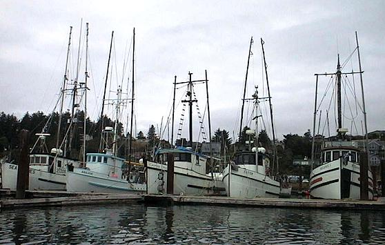
Fishery Council Moves to Close California and parts of Oregon Salmon Fishing in 2023
“Salmon fishermen and women, and many businesses that serve both the sport and commercial salmon boats, are staring at no income in 2023 as a result of moves to close the season. Coastal restaurants and hotels will also feel the hit. The Pacific Fisheries Management Council (PFMC) just wrapped up a meeting on Friday March 10 where it adopted proposals to close the season. The Council (PFMC) will meet in early April and procedurally finalize the closure then. The closure of salmon fishing affects all of California’s marine and inland waters as well as ocean salmon fishing off most of the Oregon coast. This is only the second time in history salmon fishing has been closed in California. The decision was made due to low numbers of adult and two-year-old jack salmon that have survived the hostile conditions they’ve encountered in Central Valley rivers in recent years. All of these rivers are controlled by upstream dam operations. Dam operation decisions favoring agriculture over salmon survival have resulted in very poor natural salmon reproduction in recent years … ” Continue reading this press release from the Golden State Salmon Association.
SEE ALSO: Regulators signal no California salmon season this year amid dismal return of adult fish, from the Santa Rosa Press Democrat
Groups say fire retardant injunction would increase Western U.S. risks ‘dramatically’
 “Several groups of associations, cities and counties are attempting to challenge a case in Montana they say has the potential to take away an important tool from firefighting efforts at a time when Western U.S. wildfires are worsening. The groups, led by the National Wildfire Suppression Association, filed a motion in U.S. District Court District of Montana Missoula this week to intervene as defendants in a case that seeks to enjoin the U.S. Forest Service from using aerial fire retardant. They were part of several groups that include the wildfire-prone counties, as well as towns like Paradise, California, which was destroyed by massive the 2018 Camp Fire. … ” Read more from the Insurance Journal.
Understanding California’s strange fire season and what that means for natural disasters
“California finally saw some respite from its long-spanning drought in January, when rain and snow revitalized the land and plant life. However, experts predict that while drought relief is long overdue, the rain and snow could contribute to a much more dangerous wildfire season later in the year. Experts reason that while the new freshwater is helping plant life grow, the dry season will cause them to wither and dry out. This large number of dry plants will significantly increase the risk of wildfires breaking out and the size of those fires. Why has California’s fire season been so erratic? Understanding more about it might shed some light on patterns for other natural disasters. … ” Read more from Environmental Protection.
How California’s climate has evolved over a geologic timescale
“Travel back in time 10,000 years, and Northern California might be unrecognizable. Towering buildings wouldn’t line the coast as they do today, and nor would there be the same number of redwoods and the prevalence of springtime fog, according to a study from UC Davis. Ocean upwelling — the process of deeper, colder, more nutrient-rich waters rising toward the surface — would be decreased relative to today, with fewer fish and other ocean life in surface waters, according to the study. In fact, it wasn’t until around 4,000 years ago that the ocean and terrestrial environment began to resemble modern landscapes, said Hannah Palmer, lead researcher of the study and a recently graduated UC Davis doctoral student. … ” Read more from the San Francisco Chronicle.
In commentary this weekend …
The West’s weather whiplash should not influence long-term water management
Thomas Piechota, professor of engineering and environmental science and policy at Chapman University in Orange, Calif, writes, “There’s a water contradiction in the West with serious long-term water scarcity in low reservoirs and depleting groundwater tables, while California is in the middle of an extremely wet and snowy winter. As water levels in dangerously depleted Lake Mead and Lake Powell drop to record lows, California has experienced one of the wettest winters on record, with a statewide snowpack that’s almost 200 percent of normal for this time of year and a flooding risks from rain and snow events in March. In this way California is unlike the other six states currently negotiating a set of reductions to address drought conditions and dropping water levels in the Colorado River Basin. The means for managing water scarcity in the Basin does not always apply to California, where there can be an abundance of water and flooding followed by extreme droughts. … ” Read more from The Hill.
It’s no longer a matter of if but when a catastrophic flood will hit Sacramento
Elena Lee Reeder and Kevin L. King with Reclamation District 1000 write, “The Sacramento region’s flood crisis has made national news, with coverage focused on destruction, closed streets and the loss of property and life. Of course, the silver lining is that these storms have nearly filled our depleted reservoirs. But these storms are significant for another, overlooked reason: They serve as a wake-up call for a public that has been lulled into a false sense of security by the long periods of drought California routinely experiences. Nevertheless, as officials responsible for flood protection, we affirmatively know that it’s not a matter of if, but when, Sacramento will experience a massive flood. The barrage of storms since New Year’s Eve has altered a somewhat abstract concept into a harsh reality — that’s the true transformative power of wind and water. … ” Read more from the Sacramento Bee.
Gee, did SF have anything to do with putting more people at risk from rising sea levels?
Dennis Wyatt, editor of the Manteca Bulletin, writes, “San Francisco, by any stretch of the imagination, is not a hotbed of “climate change deniers.” It’s been that way for more than a decade and counting. Yet the powers that be in San Francisco in recent years embraced a plan to take the population of Treasure Island from a population of 2,000 to 19,000, build up to 500 hotel rooms, and add tons of commercial buildings to create a $5 billion neighborhood. Just one small detail. Treasure Island is a 400-acre artificial island created in 1936-37 using mud dredged from the San Francisco Bay by the Army Corps. It was created to build the 1939 Golden Gate International Exposition. Climate experts contend Treasure Island will all be under water in less than 80 years. San Francisco’s coast overall could see as much of a 7-foot rise in sea level by 2100. … ” Read more from the Turlock Journal.
In people news this weekend …
Promotions, passings, profiles – submit people news items to maven@mavensnotebook.com.
 Dr. Anke Mueller-Solger as the new Center Director of the USGS California Water Science Center
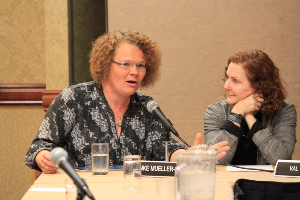
Prior to her appointment, Dr. Mueller-Solger served as the center’s Associate Director for Projects since 2014. She takes over center leadership from Interim Director Ethan Weikel who is the Deputy Center Director Northeast Region of the USGS Maryland-Delaware-D.C Water Science Center. Dr. Mueller-Solger brings a wealth of knowledge to this position. “I am certain that Anke will lead the CAWSC to new heights,” said Eric Reichard, USGS Southwest Region Director. Previously Dr. Mueller-Solger has led a team of 200 scientists who conducted cutting-edge research and monitoring on diverse water science topics, providing science products and data for partners throughout California. … ” Read more from the USGS.
Tom Ellis receives the 2023 Will S. Green Award from the Northern California Water Association
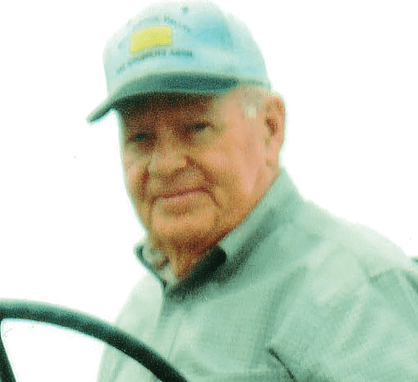 “The 2023 recipient of the Will S. Green Award is Tom Ellis. Like Will S. Green, Tom’s passion, dedication and insight to Sacramento Valley flood protection and water management has made a lasting impact on the region that will be realized for decades to come. Tom has been tireless in his dedication to agriculture and the communities in the Sacramento Valley. His connection to the region runs deep and spans generations, with his grandfather owning and operating dredges that constructed many of the original irrigation, drainage and flood control systems throughout the Sacramento Valley. During his lifetime, Tom has been an active participant and a visible leader in variousefforts for flood protection within the Sacramento Valley. Tom served on the Board of Commissioners of Sacramento River West Side Levee District from 2001 through 2019, including 14 years as president. He represented the district on the Central Valley
Flood Control Association Board of Directors. … ” Continue reading at the Northern California Water Association.
Podcasts …
DAIRY VOICE: Geoff Vanden Heuvel on the water situation in California
How will state groundwater regulations affect the California dairy industry? A new study reveals possible impacts. DairyVoice guest Geoff Vanden Heuvel talks with Editor Emeritus Joel Hastings, describing the findings and how dairy producers are adjusting. He’s the director of economic and regulatory affairs for the California Milk Producers Council and a former dairy producer from Chino. He has followed the implementation of the Sustainable Groundwater Management Act which is now imposing some new water limitations on agriculture across the San Joaquin Valley.
FIFTH & MISSION PODCAST: What’s going on with this record-breaking winter?
Snow in the Berkeley Hills. Floods in the middle of San Francisco. A snowpack that’s reached staggering heights. We’re in the midst of an extreme winter, and another major storm is on the horizon. Chronicle meteorologist Gerry Díaz joins host Cecilia Lei to talk about this winter’s record-breaking precipitation and its impact on California’s drought.
 WATER IS A MANY SPLENDOR’ED THING: The Value of a Levee
If you own a home that requires a lot more work than you have money right now, how do you fix your home? Finding the funds for levee improvements is a lot like managing your own home. You can still live in it as long as things don’t take a turn for the worse. Water is a Many Splendor’ed Thing brings you another water relationship that has a personally significant impact to your life. Produced by Steven Baker, Bringing People Together to Solve Water Problems, water@operationunite.co 530-205-6388
VOICES OF THE VALLEY: The future of sustainable desalination
University of Notre Dame professors Dr. Brandon Ashfeld and Dr. Tengfei Luo and farmer J.P. LaBrucherie join the podcast this week; the trio is part of a research project focused on using technology to make desalination a sustainable water solution for all areas of American life, including agriculture. It’s no secret that desalination is a much-studied and debated topic that can lead to frustration and confusion among scientists and the public. “You’re trying to solve a water problem, but on the other side, you’re burning fossil fuel, which contributes to climate change which leads to the water shortage problem,” Luo said. Ashfeld, Luo, and Labrucherie discuss topics related to agricultural water use, western reliance on the Colorado River, the pros and cons of desalination, and how their developing technology can make desalination a more sustainable practice.
WE GROW CALIFORNIA: A brave new future
Join Darcy and Darcy as they welcome Metropolitan Water District of Southern California’s new Chairman of the Board, Adán Ortega. Serving as the first Latino Chairman, the first Chairman representing the City of San Fernando, and the first former Metropolitan Water District employee to serve as Chairman, it appears Adán has been preparing for this role his entire life. With a once divided board, historical water supply challenges, and portions of Metropolitan’s service area growing, listen in and hear what Adán has planned, his priorities, and what Metropolitan’s brave new future looks like.
TID WATER & POWER: Irrigation season and operations
On Episode 23 of the TID Water & Power Podcast we sit down with TID Water Operations Managers, Chris Rocha and Seth Aldrich to discuss TID’s irrigation operations. TID was the first irrigation district formed in California and, today, provides safe and reliable irrigation water to more than 4,700 growers. More impressively, TID does so through 250 miles of gravity-fed canals – many of which are the original canals, built more than 120 years ago.On this episode we discuss the 2023 Irrigation Season, how the District operates a more than 120 year old irrigation system, and the how that system and operations have been modernized over the years to perform with increased efficiency and better service for our irrigation customers.
WATER TALK: Water insecurity and circularity
A conversation with Dr. Greg Pierce (UCLA Luskin Center for Innovation) about the Human Right to Water, the housing-water-fire nexus, wastewater equity, and green infrastructure.
WATER LOOP: Changing the color of water
Analysis has shown a significant lack of diversity in the sources cited in media coverage. This means failing to include Black, Latino, and Indigenous water experts and to present the stories of people within impacted communities. The Color of Water platform was created to counter this trend. It’s an online directory that journalists can use to connect with a diverse set of experts, as discussed in this episode with Jose Aranda, Relationships Manager for the Water Hub. Jose explains how the Color of Water is training these experts to bolster their skills, sharing where they appear in media coverage, and aiming to add their voices to policy discussions and professional gatherings.
In regional water news this weekend …
NORTH COAST
Klamath tribes submit ‘call for water’ amidst continuing drought
“Because of the continued drought in the region, the Klamath tribes are calling for their water needs to be met according to the law. The Klamath tribes are senior water users, meaning they have top priority to have their water needs met. Because of the ongoing drought, there is not enough water to go around, so some groups are given priority based on agreements that go back over a century. If the tribes’ call for water goes through for water from Fourmile Creek, the Rogue River Valley and Medford Irrigation Districts could be severely impacted. “It would be devastating to our two districts if we lose that water, bottom line,” Rogue Valley River Irrigation District Manager Brian Hampson said. “And the growers over in the Rogue Basin would suffer as well.” … ” Read more from Fox 26.
Landscape-scale fuels reduction and forest health in the Western Klamath Region
“A $5 million CAL FIRE Forest Health Program grant is supporting the Western Klamath Restoration Partnership in their efforts to restore fire resilience at the landscape scale along the Klamath River. This project is part of a larger effort by the Western Klamath Restoration Partnership to improve forest health and resilience across a 1.2 million acre planning area that includes much of the Karuk Tribe’s ancestral homelands. The Western Klamath Restoration Partnership is a collaborative group co-led by representatives from the Karuk Tribe, Mid Klamath Watershed Council, Salmon River Restoration Council, and the U.S. Forest Service, with many other stakeholders, communities, and organizations involved. The Klamath region, like many parts of the state, is increasingly vulnerable to catastrophic wildfire due to historical and modern fire suppression policies and a changing climate. These conditions pose an unprecedented threat to the region’s communities, cultural resources, unique biodiversity, and significant carbon stocks. … ” Read more from California Climate Investments.
Improving forest health in the Yurok Community Forest and Salmon Sanctuary
“A $4.3 million grant from CAL FIRE’s Forest Health Program to the Humboldt County Resource Conservation District is funding work to protect natural, cultural, and spiritual values in a key watershed in the Yurok Tribe’s ancestral homeland. Blue Creek is the most important cold-water tributary to the Klamath River, serving as essential habitat for Chinook salmon, Coho salmon, and steelhead trout, as well as the federally threatened northern spotted owl, marbled murrelet, and Humboldt marten. The Yurok Tribe and Western Rivers Conservancy have worked together over the past decade to purchase lands in the Blue Creek watershed in an effort to return Yurok ancestral lands to Yurok ownership. Now, these partners are teaming up with Humboldt County Resource Conservation District and CAL FIRE to implement forest health and fuels reduction work in the watershed to improve the resilience of this special place. … ” Read more from Cal Climate Investments.
MOUNTAIN COUNTIES
All of Lake Tahoe at risk of ‘widespread avalanche activity’
“A “very likely” avalanche warning has been issued for all of the towns, ski resorts and major roads around Lake Tahoe, just one day into the four-day rain- and snowstorm pummeling the Sierra Nevada. The Sierra Avalanche Center issued a Level 4 (High) avalanche warning early Friday morning, cautioning against travel anywhere near avalanche terrain. “Widespread avalanche activity is expected to occur with heavy loading of the snowpack from rain and high intensity snowfall,” the center wrote. Avalanches that are rated as large or very large — one tier below historic — are “very likely” due to the combination of strong winds and layers of wet snow on top of less dense, less stable snow. … ” Read more from SF Gate.
Several Tahoe ski resorts close lifts due to rain, not snow
“After being buried in 50 feet of snow this season, several ski resorts in the Lake Tahoe region announced Friday that they would close all lift operations for the day due to rain and flooding. At 6:50 a.m., Olympic Valley’s Palisades Tahoe reported that the resort was closed for the day. Rain was falling up to 8,500 feet elevation and winds on the mountain’s ridgeline hit 139 mph, causing high avalanche danger on the mountain and making roadways hazardous, according to Palisades Tahoe public relations manager Patrick Lacey. Additionally, Kirkwood Mountain Resort in Kirkwood, Northstar California Resort in Truckee and Heavenly Mountain Resort in South Lake Tahoe reported they were closed Friday due to severe weather. … ” Read more from the Santa Rosa Press Democrat.
52 feet and counting: Lake Tahoe grapples with ‘ginormous’ snowpack
“Rather than use a yardstick, Deanne Maas measures each new snowstorm at her house atop Donner Summit by carefully examining the widening cracks in her drywall. Some of them now reveal the underlying studs — signs that more than a dozen feet of snow piled outside her house are buckling the walls and roof of her home. She can hardly see outside anymore, as snow covers almost all of her windows. “I feel like I live in a snow cave,” said Maas, 46. Even for a place so accustomed to receiving some of the highest seasonal snowfall totals in the continental United States, this winter is a doozy. The Lake Tahoe area is buckling under hundreds of inches of snowfall amid one of its most powder-filled seasons on record, all part of a historic run of atmospheric rivers and punishing arctic blasts that have filled reservoirs, flooded cities and eased drought conditions across California. … ” Read more from the San Jose Mercury News.
Tahoe’s Emerald Bay freezes over for first time in decades amid atmospheric river
“California’s extreme winter weather just brought one of the Sierra Nevada’s crown jewels to a standstill — literally. For the first time since the early 1990s, Lake Tahoe’s Emerald Bay has completely frozen over. “We’ve lived in the Tahoe area for three years. I have never seen it freeze completely,” Kaytlen Jackson, state park interpreter in the California State Parks’ Sierra District, told SFGATE in a phone interview Friday. When she heard the bay might be frozen over, she headed there right away to get a glimpse. It’s thought that Emerald Bay — known for its shimmering colors, Vikingsholm Castle and gorgeous mountain backdrop — was last completely covered with a sheet of ice in 1993 and 1989. Before that, you’d have to go all the way back to the 1950s, Jackson said. (She added that she was “not 100% on this info though.”) … ” Read more from SF Gate.
SACRAMENTO VALLEY
Sutter County Museum receives major grant to pursue regional flood exhibit
“Geologically speaking, the Sacramento Valley is a giant flood plain for run off of multiple rivers that cut through its fertile grounds. These seasonal floods worked to enrich the soil, create wetland habitat, and support migrating waterfowl and fish populations with vital nutrients. In times of high water, it is said that indigenous tribes would relocate to higher grounds such as the Sutter Buttes mountain range. But details on the flooding that occurred here has been spread out amongst various news articles, books, and oral traditions. For these reasons, the Sutter County Museum in Yuba City has been working on consolidating this history into a permanent regional flood exhibit for the public. … ” Read more from the Appeal Democrat.
Levee left unrepaired on Sacramento County land worries farmer
“One Sloughhouse farmer wants to know why a levee on county land is in a state of disrepair. He’s especially concerned because the location and potential for flooding again could impact access and safety. Farmer Dave Utterback has been raising concerns about an eight-foot levee that has been left in a state of disrepair next to his property, which is owned by Sacramento County. The location and potential for flooding could impact access and safety, and Utterback is questioning why nothing has been done to fix it since it blew out in January. “It blew out in January there…at that point, they had CCC crews come out and put sandbags, but nothing has been done since,” Utterback said. … ” Read morefrom CBS Sacramento.
NAPA/SONOMA
Yet another atmospheric river expected to wallop the North Bay starting Monday night
“The atmospheric river that deluged parts of Sonoma County with up to 3 inches of rain Thursday gave way to actual patches of clear skies Friday, followed by lighter rains Saturday. Sunday will bring more precipitation, but nothing on an Old Testament scale: expect between 0.25 to 0.50 of an inch. Then it will be time, once again, to batten down the hatches. Another atmospheric river is on the way. The next powerful storm system will arrive late Monday night, said Brook Bingaman, a Monterey-based meteorologist for the National Weather Service. Sonoma County can expect 2 to 3 inches of rain in the valleys, and from 3 to 5 inches in the highlands. As happens when one major storm follows so closely on the heels of another, “the impacts are going to be a bit compounded,” said Bingaman. … ” Read more from the Santa Rosa Press Democrat.
BAY AREA
Flood watch issued for the Bay Area Monday
“Hey Bay Area, are you ready for another storm? A flood watch will go into effect for a large swath of the region Monday, as the next round of heavy rain pours down. The alert is expected to last until Tuesday night, according to the National Weather Service. In addition, a high wind watch is set to go into effect Monday night, the agency tweeted. “Ready for another round of strong and damaging winds? High wind watch starts Monday night. Downed trees and more power outages are likely.” Forecasters anticipate flooding from excessive rainfall, which could send water gushing through streets and spilling over rivers and creeks. According to the National Weather Service, the atmospheric river will bring 3 to 7 inches of rain in coastal hills while valleys will see 1 to 3 inches. … ” Read more from the San Francisco Chronicle.
Palo Alto: Tensions flare over creek authority’s plan to replace bridges, widen channel
“After more than two decades of anxiety and frustration, residents around the volatile San Francisquito Creek could finally see improvements next year, when the Newell Road Bridge finally gets replaced, paving the way for other flood-control projects in Palo Alto, East Palo Alto and Menlo Park. But as the three cities prepare to hit the construction phase, officials are confronting fresh challenges, including unpredictable creek behavior that may require modification of plans and a funding gap currently estimated at about $17 million, according to the San Francisquito Creek Joint Powers Authority, a collaboration of cities and water districts that have been working on improving flood control. On top of that, the cities are still working to overcome resident objections that are delaying the project, including the refusal of three property owners on Edgewood Drive in Palo Alto to allow the creek authority to enter their properties to conduct survey work and identify easement needs. … ” Read more from Palo Alto Online.
CENTRAL COAST
Why one part of California has been in the bull’s-eye of so many storms this year
“Hundreds of people in the hills above the town of Soquel remained unable to leave their communities after a creek washed out a main road into the Santa Cruz Mountains on Friday. Work crews were on scene before daylight amid heavy rain and wind, trying to figure out a way to fix the road. It’s the only way into the area of mostly gentle countryside, which eventually morphs into steep canyons and towering redwoods. “My whole family lives up there,” said Kathryn Chandler, who was hoping to return to her home Friday morning but instead found the usually tiny Bates Creek pouring swiftly through a roughly 50-foot-wide chasm on North Main Street. … ” Read more from the San Francisco Chronicle.
Breached levee floods Pajaro River valley, engulfing towns as communities are evacuated
“The Pajaro River on the border of Monterey and Santa Cruz counties breached a levee early Saturday, flooding the Pajaro River Valley. Across the Central Coast’s Monterey County, more than 8,500 people were under evacuation orders and warnings, including roughly 1,700 residents — many of them Latino farmworkers — from the unincorporated community of Pajaro. “This community is a small, disadvantaged community, mostly Latino, mostly low income farmworkers,” said Monterey County Board of Supervisors Chair Luis Alejo. He added that this same flooding happened in 1985. “It’s heartbreaking to see the community under flood waters today. And we know that these residents are going to go through some challenging times over the next several months to try to get their homes repaired and make them habitable again.” … ” Read more from KQED.
Monterey Peninsula water district loses key lawsuit
“Legal challenges to a Monterey Peninsula water district’s ratepayer fee that dates back a least a decade reached fruition this week when a judge ruled against the district and ordered it to stop collecting the fee. The ruling could have a huge impact on district revenues at a time when the Monterey Peninsula Water Management District is partnering with Monterey One Water to invest in the Pure Water Monterey expansion project, which the district says could supply enough water to the Monterey Peninsula for the next few decades. At issue are two fees. … ” Read more from the Monterey Herald.
Flood, evacuation warnings issued in Paso Robles as Salinas River rises
“The city of Paso Robles issued evacuation warnings for neighborhoods near the Salinas River due to rising water levels on Friday, as the National Weather Service sent out a flood warning for the inundated waterway. City emergency services staff also were preparing to close the 13th Street Bridge due to the potential flooding of the river. Motorists were urged to prepare alternative routes, according to a news release from the City of Paso Robles. “Flooding near the river in #Atascadero and #PasoRobles is occurring or will when the river crests this afternoon,” the NWS Los Angeles office said in a tweet. “This is a DANGEROUS situation. Move away from the river.” … ” Read more from the San Luis Obispo Tribune. | Read via AOL News.
Water releases underway at Lake Cachuma ahead of latest downpour
“With a Flood Watch now in place for parts of Santa Barbara County, local agencies have gotten an early start on their storm preparations. As this new round of rain starts to trickle in, water releases at Cachuma Reservoir are already in place, while Lompoc Police officials are starting to issue evacuation notices to residents in the riverbed. Cachuma Lake officials say water levels are more than 10-times their measurements from 2016. They say recent storms on the Central Coast have accelerated those numbers, which is why they are airing on the side of caution with the next anticipated rainfall. … ” Read more from KSBY.
SAN JOAQUIN VALLEY
Heavy rain, floods highlight Valley’s sinking ground
“The series of atmospheric rivers pummeling California have caused flooding and evacuations. They’ve also drawn attention to a longer-term issue in the southern San Joaquin Valley: changing flood zones. Some water experts say overpumping groundwater has caused communities to sink — including in Kings County. “Well, now we’ve got this depression on the east side of Corcoran because of over pumping and nobody knows what’s going to happen,” said Lois Henry, SJV Water. … ” Continue reading at KVPR.
‘Life-threatening’ flash floods devastate small California town
“Parts of Springville, a small town in Tulare County, were placed under an evacuation order at noon, March 10, as “life-threatening” floods devastated the region, officials said. The Hanford office of the National Weather Service issued multiple flood advisories in the Central California area while Twitter users shared photos and videos of water inundating roadways and homes. A weather service warning that remains in effect until 5:45 p.m. described the flood threat level as “catastrophic” and ordered residents to immediately move to higher ground. More emergency information about current evacuation orders can be found on Tulare County’s Evacuation Orders & Warnings website. Multiple users on Twitter shared photos and videos showing how the excessive rainfall has devastated the region. One cow pasture looks like a raging river, while homes and streets are flooded by dark, muddy water. … ” Read more from SF Gate.
Kernville residents haven’t seen the Kern River surge like this before
“For most of us down here in the Valley, the weather hitting California might be inconvenient, but to those in the upper elevations it is a major interruption, both fascinating and dangerous. Kernville is taking on water with the Kern River running as 10 times its typical flow for this time of year. 17 News talked to Kyle Roberts, a Wofford Heights resident who sent in some before and after video of Kernville, some images taken mid-morning, with the river already surging where it passes through Riverview Park, and other images just about 90 minutes later, with Riverview Park out of view completely. … ” Read more from KGET.
EASTERN SIERRA
As snow records fall along the eastern Sierra Nevada, fears loom over impending snowmelt
“Snow began falling early and hard this season at the Mammoth Mountain ski resort, and the record-breaking amounts don’t look like they’ll stop anytime soon. While ski operators in the eastern Sierra Nevada are hoping the buildup of snow will allow them to stay open as late as July 4, the storms have added a dangerous edge to life in nearby towns as residents confront impenetrable snowbanks, high winds, road closures, avalanches and flooding. In a worst-case scenario, massive snowmelt in the coming weeks could inundate towns along U.S. Highway 395, which winds along the base of snow-clad Sierra peaks that reach up to 14,000 feet. At the same time, officials with the Los Angeles Department of Water and Power are worried that record runoff in Mono and Inyo counties could overwhelm the city’s network of aqueducts. … ” Read more from the LA Times.
LADWP crews begin repair work on storm-damaged concrete walls along LA Aqueduct in Olancha, CA
 “Several sections of the concrete-lined channel of LADWP’s Los Angeles Aqueduct collapsed late Friday night approximately two miles south of the town of Olancha. Due to the intense rains at lower elevations, storm water pooled on the west side of certain sections of the aqueduct channel, eroding the supporting soil, leading to the damage. The damage did not affect U.S. HWY 395 nor any local communities in the area. Three 20-foot concrete sections on the west side of the open channel of the aqueduct ruptured with four other sections damaged. Water flow in the aqueduct was minimal at the time of the breach. The water supply to Los Angeles is not impacted at this time. Crews have already started the temporary repairs and expect to complete before the next storm system arrives early next week. … ” Read more from the LADWP.
SOUTHERN CALIFORNIA
Bill seeks to stop waste from coming to Stringfellow acid pits in Jurupa Valley
“Jurupa Valley’s Stringfellow Acid Pits are an infamous toxic waste site, but a proposed bill would prevent offsite waste from being brought there in the future. On Tuesday, March 7, Assemblymember Sabrina Cervantes, D-Riverside, introduced Assembly Bill 777, which would prohibit the “treatment, storage, transfer, or disposal” of any waste from another site at Stringfellow. State Sen. Richard Roth, D-Riverside, will coauthor the bill. The bill is in response to the relocation of containers of lead-laced soil from the Exide battery recycling plant in Los Angeles County to the Stringfellow site. There was debate over whether that particular waste could legally be stored at Stringfellow, but after receiving pushback from Jurupa Valley when the transfer was disclosed in June 2022, the Department of Toxic Substances Control agreed in August to move the containers to another location. … ” Read more from the Riverside Press-Enterprise.
Along the Colorado River …
Colorado River senators meet quietly to facilitate states’ water talks

“Senators from the seven Western states in the Colorado River basin have been quietly meeting “for about a year,” to facilitate difficult discussions between the states over the future of the river. Sen. John Hickenlooper, D-Colo., who spearheaded the caucus, said its goal is “not to take the place of the state water councils or the state governors” who have been wrangling over the future of the drought-ravaged river that supplies water for 40 million people and a multibillion-dollar agricultural industry and generates power for millions more. “Our role is … really to facilitate and try to create an environment where we can find the right compromise and be able to use collaboration and cooperation in such a way that we create as little hardship, as little sacrifice for the farmers and ranchers of the Colorado River basin as possible,” Hickenlooper said. … ” Read more from Cronkite News.
Feds finalizing $250M in water-saving measures to help drought-stricken Lake Mead
“The U.S. Bureau of Reclamation is finalizing $250 million in water-saving deals that are expected to preserve up to 10 feet of Lake Mead’s declining surface levels this year, agency Commissioner Camille Calimlim Touton announced Friday in Tempe. The commissioner attended a discussion of Colorado River water issues at Arizona State University, organized by Sen. Mark Kelly, D-Arizona. The money will pay Lower Colorado River Basin water users, especially farmers, to forego some of their deliveries this year to help keep the reservoir from sinking further toward the point where it no longer flows past Hoover Dam. The initial funding is essentially an emergency measure that pays people not to use water temporarily. Reclamation ultimately will apply other funds approved by Congress over the last two years to projects that increase on-farm efficiency, Touton said, such as canal liners and drip irrigation systems. … ” Read more from the Arizona Central.
Arizona: Rio Verde Foothills faces another delay getting their water supply flowing again
“Restoring the water supply to the unincorporated Rio Verde Foothills community has hit another hurdle. A bill in the Arizona House that was designed to get water flowing again by using a third party provider and Scottsdale infrastructure has failed. Rep. David Cook (R-Globe), who voted to pass the bill, says the problem is there’s a clash between Scottsdale and Maricopa County. … ” Continue reading at KJZZ.
How a ‘cold shock’ of water from Lake Powell could thwart invasive Grand Canyon bass
“Federal dam managers are preparing a springtime assault against smallmouth bass on the Colorado River, possibly using cool water from deep in Lake Powell to keep the non-native fish from getting entrenched in Grand Canyon. Environmental and river recreation advocates hope the U.S. Bureau of Reclamation will pair cold water with a rush of water from deep behind Glen Canyon Dam, both disrupting bass reproduction around Lees Ferry and restoring eroded sandbars farther downstream. That option, officially under study, is politically sensitive because it would cost hydropower production and move water out of a reservoir that has dropped to about a quarter of its storage capacity. … ” Read more from Arizona Central.
A plan to ship oil alongside the Colorado River sees revived opposition amid national railway safety debate
“Two Colorado Democrats this week are making a last ditch effort to block a proposed 88-mile railway in Utah that they say would drive up climate emissions and could lead to a catastrophic oil spill in the upper Colorado River, contaminating a vital water supply for nearly 40 million Americans that’s already critically threatened by deepening drought. The Uinta Basin Railway was approved by the Surface Transportation Board in 2021 and received provisional approval by the U.S. Forest Service last summer to travel through a 12-mile roadless area of the Ashley National Forest. It would connect the oil fields of Utah’s Uinta Basin to the national rail network and refineries on the Gulf Coast. The project is estimated to quadruple the region’s crude production to upwards of 350,000 barrels per day that would be transported by freight via the national rail network, which includes a stretch of railroad that runs directly alongside the Colorado River for more than 100 miles. … ” Read more from Inside Climate News.
Also on Maven’s Notebook this weekend …
NOTICE of 180-Day Temporary Water Right Permit Application T033357 to Appropriate Water from Rock Creek in San Joaquin County

