

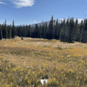
A series of USGS interactive maps have recently been published. The maps identify locations and levels of mercury contamination resulting from historical gold mining California’s Sierra Nevada.
From the USGS:
Many may not know that mercury was used by miners during the California Gold Rush to extract gold. Using a process called amalgamation miners would combine mercury with gold ore to form a gold-mercury amalgam. The mercury was then removed by heating. After the mercury had evaporated, pure gold was left behind.
However, this method had severe environmental consequences. Millions of pounds of mercury were released into rivers and other bodies of water. This caused long-lasting ecological damage, especially to wildlife. One form of mercury, called methylmercury, is especially toxic. Mercury levels in sport fish remain elevated in areas downstream of historical gold mines where amalgamation was practiced. This has led to fish-consumption advisories in these parts of California.
To better understand mercury contamination caused by historic mining, USGS scientists took samples of sediment, water, and biota, or animal life, and tested them for mercury and methylmercury.
The result of this research is set of interactive maps. The maps show what the scientists found and where they found it. The maps include: an introductory map showing the study area and its major watersheds; a map of historical placer (unconsolidated sediment) gold mines in the study area; three individual maps showing the amounts of mercury found in sediment, water, and biota (animals); a composite map showing the integrated amounts of mercury for all three sample types; and a map of remediation (or clean-up) efforts to date.

In addition to the maps themselves, there is a video on how to use the features of the maps, and a data release with the complete set of data behind the maps.
To view the maps and learn more about this science, visit: Legacy Mercury Contamination from Historical Gold Mining.
MORE ON MERCURY ON MAVEN’S NOTEBOOK …
THE CONVERSATION: Colorado’s subalpine wetlands may be producing a toxic form of mercury – that’s a concern for downstream water supplies
By Eve-Lyn Hinckley, University of Colorado Boulder The wetlands found across the Rocky Mountains of Colorado just below tree line are magical places. Dripping with mosses and deep green sedges, these open expanses flanked by evergreens are a breathtaking sight for passing hikers. Moose graze there, and elk gather during their mating season. These subalpine wetlands are also crucial for regulating the supply of clean water from the highlands to metropolitan regions downslope, including Denver. However, new research shows the […]


COURTHOUSE NEWS: Mercury in rivers surges to levels with serious consequences
Researchers have found sharp increases in mercury levels in ecologically sensitive areas, including bird flyways in East Asia and North America, as well as Amazonian regions affected by mining and deforestation. By Chloe Baul, Courthouse News Service A Tulane University-led study finds that mercury levels in the world’s rivers have more than doubled since the 1850s, with gold mining, industrial waste, and soil erosion driving a rise that could threaten ecosystems and public health. A study published on Wednesday in […]

USGS: Mapping mercury in San Francisco Bay
From the USGS: Scientists at the USGS are tracking mercury pollution in the Bay using remote sensing technology, creating detailed maps to monitor mercury pollution and support wetland restoration in a rapidly changing estuary. The Remote Sensing of Mercury Pollution in South San Francisco Bay project aims to create maps of multiple chemical forms—or “species”—of mercury across time and space, giving resource managers new tools to monitor water quality, especially after extreme storms. By combining satellite imagery, shipboard radiometry, and […]

DESERT RESEARCH INSTITUTE: New study finds Rocky Mountain snow contamination
An examination of Rocky Mountain snow finds higher contamination levels of mercury and others metals in the northern part of the range, consistent with increased current and historical mining in the region. From the Desert Research Institute: Mountain snowpacks accumulate snow throughout the winter, building up stores of water that will supply communities across the American West throughout the long dry season. Now, a new study shows that as storms carry snow to the Rocky Mountains, they are also bringing […]

USGS: Wildfires increase mercury concentrations in headwater streams
The U.S. Geological Survey is researching the effect of wildfires on the release of stored mercury from forest watersheds and subsequent transport, methylmercury formation, and bioaccumulation post-fire. Wildfires not only alter the re-release of mercury into the environment but also affect its reactivity and availability to the food web, complicating predictions of mercury exposure risks to wildlife and humans amid other co-occurring stressors. Mercury is a toxic heavy metal that poses significant wildlife and human health risks. It is converted […]
