

On the calendar today …
- MEETING: California Water Commission will meet beginning at 9:30am. Agenda items include Resolutions of Necessity for Yolo Bypass Big Notch Project; Water Storage Investment Program projects update, the Harvest Water Program virutal site visit and contracts, and DWR grant programs update. Click here for the agenda and remote access instructions.
- ONLINE WORKSHOP: California Water Plan Update 2023 – Flood Resource Management Strategy from 10am to 2pm. The California Water Plan describes and updates a broad set of resource management strategies (RMSs) that help local agencies and governments manage their water and related resources. Every RMS can be a technique, program, or policy that can be used to meet water-related management needs of a region and the state as a whole. During this workshop, the Water Plan Team will gather comments on the draft Flood Resource Management RMS. This will be an online only workshop, please register to receive the link.
- OCWA Simulcast: Solve the Water Crisis Coalition A Comprehensive Effort to Bring Focus to the Water Supply Crisis from 11:30am to 1pm. In person in Irvine or attend virtually. Solve the Water Crisis Coalition, through a critically needed education effort, will bring into sharp focus the ongoing water supply crisis that is already impacting residents’ quality of life, economic growth, community health, and the environment, as well as risking California’s future. By raising awareness among California policymakers and thought leaders, Solve the Water Crisis Coalition will demonstrate the enormous water supply crisis and the urgency that requires bold and immediate State action to secure California’s future. Join us, March 15, for an insightful look at the ever-worsening water supply crisis in California. Our special guest, Craig Miller, will provide his unique perspective on how the SWC Coalition has approached the issue to date, and what they expect to do in the future. Click here to register.
- WEBINAR: Restoration Speaker Series: Undamming the Klamath from 12pm to 1pm. Undamming the Klamath: with the Klamath River Renewal Corporation, Barry McCovey, Yurok Tribe, and NAS. The series is part of a new education initiative that aims to teach students and policymakers about Tribally led large-scale restoration projects, long-lasting environmental damage, and ecosystem functions throughout Northern California. Click here to register.
- MEETING: San Joaquin Valley Blueprint from 2pm to 3:30pm in-person at the International Agri-Center in Tulare or virtually. We are excited to have Ellen Hanak, Vice President and Director of PPIC Water Policy Center, presenting on PPIC’s recent policy brief: “The Future of Agriculture in the San Joaquin Valley.” Alvar Escriva-Bou, lead author of the brief, will also join her to answer questions. We’re looking forward to another informative meeting to discuss water strategy, collaborative water solutions, and policies with an opportunity for open discussion. If you would like to participate, please RSVP HERE. Join Zoom Meeting https://us02web.zoom.us/j/
5727866505 Meeting ID: 572 786 6505 - EVENT: EPA’s Martha Guzman on Environmental Justice at UC Davis King Hall, Room 1301. The UC Davis Institute of the Environment and UC Davis School of Law California Environmental Law and Policy Center are excited to host Environmental Protection Agency (EPA) Regional Administrator Martha Guzman for an insightful presentation March 15. Guzman is the leader of EPA’s Pacific Southwest Regional office, which covers the region spanning Arizona, California, Hawaii, Nevada, the U.S. Pacific Islands territories, and 148 Tribal Nations. Guzman will share the strategies that the Biden administration is employing to restore communities and improve public health and the environment, along with her regional priorities. Topics will include EPA’s commitments to centering environmental justice and civil rights in the agency’s work, as well as updates on regulatory activities, compliance and enforcement work, and new resources and funding including those made available through the Bipartisan Infrastructure Law and the Inflation Reduction Act. Click here to register.
In California water news today …
California, battered by atmospheric rivers, faces a big melt this spring
“The latest atmospheric river surging into California probably won’t result in worst-case flooding, state water officials and scientists said Monday. But as global warming shifts the range of possibilities, this winter’s often record levels of snow and rain could set the stage for deluges in spring if there are more strong storms or an early heatwave, they warned. … Now large parts of the state are under flood alerts, with 10 inches or more rain expected March 14 and 15 in some areas. And satellite images show there could be more dangerous storms ahead, state climatologist Michael Anderson said at a March 13 briefing.“We have this little blob showing up here, with a couple of little tendrils extending,” he said, showing a weather map during the online presentation. “And that gives us the sense that this is either one or two atmospheric rivers that may be forming up,” to affect the state between March 21 and March 23, he said. “The worst-case scenario would be back to back atmospheric rivers in that time period.” … ” Read more from Inside Climate News.
2 more atmospheric rivers could hit West Coast in next week, per preliminary forecasts
“As many as two more atmospheric rivers could douse the already sodden West Coast in the next week, according to weather experts with the state’s Department of Water Resources. While the Bay Area is in the midst of a storm expected to last into Wednesday, at least one more storm system and potentially two are likely to cross over California between March 19 and 22. According to state Climatologist Michael Anderson, most of Northern California and virtually the entire coast of the state are likely to receive an average of between 2 and 6 inches of rain over the next six days. … ” Read more from SF Gate.
How rising temperatures are intensifying California’s atmospheric rivers
“California is no stranger to big swings between wet and dry weather. The “atmospheric river” storms that have battered the state this winter are part of a system that has long interrupted periods of drought with huge bursts of rain — indeed, they provide somewhere between 30 and 50 percent of all precipitation on the West Coast. The parade of storms that has struck California in recent months has dropped more than 30 trillion gallons of water on the state, refilling reservoirs that had sat empty for years and burying mountain towns in snow. But climate change is making these storms much wetter and more intense, ratcheting up the risk of potential flooding in California and other states along the West Coast. That’s not only because the air over the Pacific will hold more moisture as sea temperatures rise, leading to giant rain and snow volumes, but also because warming temperatures on land will cause more precipitation to fall as rain in the future, which will lead to more dangerous floods. … ” Read more from Grist.
Dan Walters: California’s ghostly Tulare Lake will be revived this year
“Spanish soldier and California explorer Pedro Fages was chasing deserters in 1772 when he came across a vast marshy lake and named it Los Tules for the reeds and rushes that lined its shore. Situated between the later cities of Fresno and Bakersfield, Tulare Lake, as it was named in English, was the nation’s largest freshwater lake west of the Mississippi River. It spread out to as much as 1,000 square miles as snow in the Sierra melted each spring, feeding five rivers flowing into the lake. Its abundance of fish and other wildlife supported several Native American tribes, who built boats from the lake’s reeds to gather its bounty. When the snowmelt was particularly heavy, the lake rose high enough that a natural spillway would divert water into the San Joaquin River and thence to the Pacific Ocean through the Sacramento-San Joaquin Delta and San Francisco Bay. … ” Continue reading from Cal Matters.
California reservoir levels: Charts show water supply across the state
 “California has a vast network of local, state and federal reservoirs that store and supply water to cities and farms across the state. Water stored in the reservoirs typically makes up about 60% of the state’s total water supply. Rain and snowfall during the rainier months of the year between November and March are critical for the reservoirs and their ability to supply water during drier months. Following consecutive years of drought, many of the reservoirs remain thirsty. The Chronicle is tracking daily water storage levels at 48 of the state’s major water supply reservoirs compared with their historical averages (1991 to 2020). The storage level is shown as percentages of total storage capacity for each reservoir. The charts are updated daily at 8:00 a.m. to reflect the most recent data. … ” Read more from the San Francisco Chronicle.
US forecaster says El Nino could arrive by summer 2023
“La Niña has ended and ENSO-neutral conditions are expected to continue through the Northern Hemisphere spring and early summer 2023, a U.S. government weather forecaster said on Thursday, with El Niño possibly forming during summer 2023 and persisting through the fall. “The forecaster consensus favors ENSO-neutral through summer 2023, with elevated chances of El Niño developing afterwards,” the National Weather Service’s Climate Prediction Center said. The La Niña weather pattern is characterized by unusually cold temperatures in the equatorial Pacific Ocean. … ” Read more from Reuters via Yahoo News.
Supervisors reiterate Solano’s opposition to Delta tunnel project
“Supervisor Mitch Mashburn said the proposed 45-mile Delta conveyance tunnel will “threaten national security” by affecting operations at Travis Air Force Base. Specifically, he said, it will create greater truck and other traffic through Solano County and hinder the base’s intake of goods that the base, in turn, delivers around the world. “So this project threatens national security,” Mashburn said. He said that is reason enough to oppose the project, but the county has a long list of concerns. … ” Read more from the Daily Republic.
DWR concludes Groundwater Awareness week activities and releases update on statewide groundwater conditions
 “Each year, DWR celebrates National Groundwater Awareness Week by distributing information and educational materials that increase the public’s understanding of groundwater. As part of an ongoing effort to promote groundwater awareness and provide the latest groundwater information, DWR has just released the newest Semi-annual Groundwater Conditions Update, which includes a look back at the previous water year informed by DWR’s groundwater data and tools. New this year, the report also includes data reported by groundwater sustainability agencies as required under the Sustainable Groundwater Management Act (SGMA). “We are seeing how local and state efforts to monitor groundwater conditions are really paying off,” said Paul Gosselin, DWR’s Deputy Director of Sustainable Groundwater Management. “With the extreme changes in climate that we are experiencing, including swings of flood amidst prolonged drought, this data is driving decision-making now and into the future.” … ” Read more from DWR News.
How California is using recent floods to prepare for future drought
“As more heavy rain pummels California, the torrential downpours that have flooded large swaths of the state could help address another climate-change-related problem: drought. This month, state water regulators approved a plan to divert floodwaters from the San Joaquin River to replenish critical groundwater stores that have been depleted after drought fueled by rising global temperatures. It’s one way the state, which experts say has not been prepared for periods of excess water, is attempting to capitalize on historic amounts of rain and snow after experiencing three of its driest years on record. “California’s new climate reality is it requires us to better manage extreme wet conditions and extreme dry conditions,” said Jule Rizzardo, assistant deputy director for the division of water rights at the California State Water Resources Control Board. “This is one of the really important tools in our toolbox: to be able to capture those high flows and recharge our groundwater supplies.” … ” Read more from the Washington Post.
California growers enjoy groundwater recharge — but wary of storms at bloom
“California growers are understandably thankful for all the storms the state has received this winter, but as spring approaches, they’d just as soon see Mother Nature calm down. The Golden State depends on the snowpack for 1/3 of its supply. As it melts in the spring, it fills the state’s reservoirs, where managers have already let some water out because of fears of spillage this spring. It’s been a long time since that happened. The snowpack itself is something to behold, experts believe it will set a record this year. There are nearly 55 feet of snow on Donner Summit, third highest in recorded history. But the atmospheric rivers that start way off near Hawaii are still coming, and that has growers concerned. … ” Read more from Growing Produce.
Farmers, researchers working to shore up California’s water woes
“Mike Wackman is the general manager for the Omuchumme-Hartnell Water District. As a farmer, to see fields flooded is a sight to behold. To replenish aquifers deep in the ground, Wackman has had to open caps to let stormwater pumped out of the river into the vineyard. “At first they thought I was crazy when we started this, but we’ve got a lot more interest over the last three to four years, especially now that we have the project up and running,” Wackman said. There is interest because of the state’s years of drought, which saw farmer heavily rely on groundwater in the aquifers. … ” Read more from Spectrum 1.
Pacific fishery council moves to close California salmon fishing in 2023
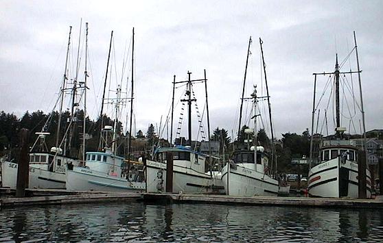
“For the first time since the fishing closure of 2008-2009, federal regulators have moved to close all recreational and commercial salmon fishing off the California coast. At its meeting on March 10, the Pacific Fishery Management Council (PFMC) proposed the closure of California ocean recreational fisheries in all areas from the Oregon/California border to the U.S./Mexico border in all three alternatives due to the low abundance forecasts for both Klamath and Sacramento River fall Chinook. The Council also proposed the closure of all California ocean commercial fisheries in all areas from the Oregon/California border to the U.S./Mexico border and in both the Oregon and California Klamath Management Zones for the 2023 season. … ” Read more from the Stockton Record.
SEE ALSO:
-
- No California salmon: Fishery to be shut down this year, from Cal Matters
- Commercial salmon fishing closed in California for third time ever, from the San Francisco Chronicle
Sunny Slope Water Company shifts contamination costs to polluters
“Across the country, water suppliers are discovering harmful contaminants in their water source and facing the question of how to pay for cleanup. While the supplier, the contaminant and the impacted community vary from case to case, one solution has proved effective across the board: make manufacturers pay for the costly treatment instead of ratepayers in the community itself. Sunny Slope Water Company, a mutual water company in Pasadena, California, used this strategy and was able to fully recoup the costs needed to serve clean water to more than 25,000 residents in the greater Los Angeles area. Sunny Slope, which relies 100% on groundwater pumped from five wells, was unable to use two of these wells after it discovered dangerously high levels of 1,2,3,-Trichloropropane (TCP) – a toxic and carcinogenic chemical – during routine testing. Because the State of California bans this chemical in drinking water except at very low concentrations, Sunny Slope was required by law to take action. … ” Read more from Water Finance & Management.
In commentary today …
California’s agriculture has outstanding economic performance, but at what cost?
Angel S. Fernandez-Bou, Senior Climate Scientist with the Union of Concerned Scientists, writes, “I was an Agricultural Engineer. Well, technically I still am, but years ago, when I was in graduate school and discovered advocacy, I started working at the system level. Now, I am a SocioEnvironmental Systems Engineer. Understanding the environment holistically has helped me see the web of intersecting problems and challenges that we experience nowadays in California, especially in how most agriculture is practiced. More importantly, I have realized we cannot implement a solution if it is going to create a new problem. I love agriculture, and it is hard to see it become more and more unsustainable, contributing to negative side effects rather than being an essential part of nature. … ” Read more from the Union of Concerned Scientists.
Editorial: Restore California’s floodplains to capture more stormwater, protect human life
The Los Angeles Times editorial board writes, “The southern Sierra Nevada is covered with the deepest snowpack in recorded history, and the rest of the range is not far behind. When all that snow melts, where will it go? You can read the answer in the landscape of the Central Valley. To the eye it is nearly flat, covered by layers of gravel, silt and clay washed from the mountains over the eons by rain and melting snow. Amid the flatness are gradual slopes down to the valley’s center, where the Sacramento River creates a watery vein in the north and the San Joaquin River does the same in the middle. Once — before the late 19th century, when newcomers began to drain the land and channel the water from wetlands into farm fields — the southern part of the valley held the largest freshwater lake, by surface area, west of the Mississippi. … ” Read more from the LA Times.
Why rain-on-snow floods from atmospheric rivers could get much worse
Keith Musselman, an assistant professor in geography, mountain hydrology and climate change at the University of Colorado Boulder, writes, “California’s latest atmospheric rivers are sending rainfall higher into the mountains and onto the state’s crucial snowpack. The rain alone is a problem for low-lying areas already dealing with destructive flooding, but the prospect of rain on the deep mountain snow has triggered widespread flood warnings. When rain falls on snow, it creates complex flood risks that are hard to forecast. Those risks are also rising with climate change. For much of the United States, storms with heavy rainfall can coincide with seasonal snow cover. When that happens, the resulting runoff of water can be much greater than what is produced from rain or snowmelt alone. The combination has resulted in some of the nation’s most destructive and costly floods, including the 1996 Midwest floods and the 2017 flood that damaged California’s Oroville Dam. … ” Read more from the LA Times.
What happened in Pajaro isn’t just a ‘natural’ disaster
Michael Méndez, an Andrew Carnegie fellow and assistant professor of environmental planning and policy at UC Irvine, and Manuel Pastor, a professor of sociology and director of the Equity Research Institute at USC, write, “In the last few years, California has experienced extreme wildfires, heat waves and the ever-present COVID-19 pandemic. What has become abundantly clear, particularly from the ravages of the pandemic on low-income communities of color, is that disaster risk is not an equal-opportunity affair. The latest evidence of this came this past weekend as the Pajaro River levee failed and flooded a small town populated mainly by migrant workers and their families. In an eerie coincidence, the levee failure occurred on March 12, 95 years to the day the St. Francis Dam catastrophically failed because of a defective foundation and other design flaws. … Just as with the St. Francis Dam, the failure of the Pajaro levee was not totally a “natural” disaster. … ” Read more from the LA Times.
Today’s featured article …
DR. JEFFREY MOUNT: California Drought: What will it take to protect species?
 Freshwater-dependent species in California are in decline due to many factors, but the impacts on native species populations are greatest during drought. With droughts becoming increasingly intense, taking action to protect native species is necessary. In this presentation by Dr. Jeff Mount, Senior Fellow with the Public Policy Institute of California Water Policy Center (PPIC), he argues for an ecosystem-based approach that provides flexibility for environmental water and focuses more on habitat than water. The challenge, he says, is to rebuild drought resilience in a landscape full of novel ecosystems in a rapidly changing climate.
Dr. Jeff Mount began by pointing out something often missed in discussions: California’s native species are drought-adapted in extraordinary ways.
In regional water news and commentary today …
NORTH COAST
Siskiyou County: Rivers, creeks, and streams see a rise in water levels with all this heavy rain
“The Office of Emergency Services of Siskiyou County warns that heavy rain is forecasted to impact the area. There is a high potential for flash flooding and debris flow in and around recently burned areas such as areas near the McKinney fire. OES says “these hazards can occur with little to no warning. For your safety, avoid areas within or near fire-scarred terrain.” The National Weather Service says there has been a significant rise in water levels, in creeks, streams, and rivers. “Before this rain came the rivers in Siskiyou County were below normal or well below normal,” Ryan Sandler with the Medford office National Weather Service says. “But now they’ve come up a lot, Indian creek near Happy Camp has come up a lot.” … ” Read more from KDRV.
Eel River crosses flood threshold, record rain recorded
“It’s official, rainfall totals recorded at the National Weather Service’s Woodley Inland office yesterday set a new record for the date at 1.54 inches, breaking the previous record of 1.28 inches set in 1980 and again in 2012. Meanwhile, a flood warning remains in effect for the Eel River, which hit flood stage early this morning at Fernbridge and is expected to peak at 23.1 feet before dawn tomorow. As of 11:15 a.m., the river was at 20.18 feet, just over the 20-foot flood threshold. A special action statement has been issued that advises taking steps to protect livestock in low-lying areas, according to the Eureka office of the National Weather Service. Impact areas including Fernbridge, Scotia, Bridgeville, Fort Seward and Miranda. … ” Read more from the North Coast Journal.
MOUNTAIN COUNTIES
Nevada County receives over $1.5 million in grant funding for forest resilience projects
“Three local agencies in Nevada County have been awarded grant funding from the Sierra Nevada Conservancy (SNC) for forest resilience projects that will reduce wildfire risk and restore forest health in the region. … ” Read about the grant recipients at YubaNet.
Tahoe ski resorts are so buried in snow they are having to dig out chairlifts
“Glacial temperatures, battering rainfall and historic levels of snow are complicating conditions at ski resorts around Lake Tahoe, leaving crews to work around the clock to dig out chairlifts — usually suspended high above the slopes — that are now buried in snow. Some popular resorts like Palisades and Kirkwood shut down Tuesday due to the escalating weather conditions as they faced 100 mph winds and avalanche warnings, officials said. Most of the resorts expected to be open by the weekend, when tamer conditions are forecast. However, “Conditions right now are pretty extreme,” said Shelby Dunlap, a spokesperson for Sierra-at-Tahoe, which was open but with a limited footprint as crews worked to unfreeze lift towers and chairs and dig out mounds of snow. … ” Read more from the San Francisco Chronicle.
Lake Tahoe’s Emerald Bay completely freezes over for the first time in 30 years
“Amid an onslaught of intense winter storms that have hit California in recent weeks and sent record snow across the Sierra Nevada, Lake Tahoe’s Emerald Bay has frozen over for the first time in decades. The bay, a treasured landmark on the lake’s south-west shore and popular destination, regularly gets icy during Tahoe’s chilly winters, but has not frozen completely in 30 years. Last week, as temperatures in the region fell below freezing, California state parks staff snowshoed in and found a thin layer of ice covering the bay. “It’s fairly common for it to freeze to a certain extent, especially along the edges of the bay,” Kaytlen Jackson, with the California state parks’ Sierra district, told SFGate. “Every year I’ve lived here, I’ve seen it freeze to some extent. It’s uncommon for it to freeze completely like it is now.” … ” Read more from The Guardian.
SACRAMENTO VALLEY
Groundwater wells activated in Roseville could bank nearly 44 million gallons of water, city says
“The city of Roseville announced Tuesday that it would again start its groundwater wells to bank additional surface water amid heavy rain and snow in the state this winter. Roseville is expected to bank 133 acre-feet of water, or nearly 44 million gallons — enough to provide drinking water to 366 homes for a year, according to a release from the city. “Banking” involves storing excess surface water underground during wet periods, to use later during dry times. According to city officials, the groundwater aquifer under our feet can hold twice the amount of water as Folsom Reservoir. … ” Read more from KCRA.
SEE ALSO: Roseville activating well storage to bank 44 million gallons of water, from Roseville Today
Cosumnes River flows avoid flood stage as another wet, warm storm blasts region
“Flows slowed on the fast-moving Cosumnes River, which will not reach flood stage overnight, state river watchers said Tuesday afternoon. The forecast is a shift from earlier projections that had the Cosumnes at its 12-foot flood stage at 11 p.m. Tuesday at Michigan Bar near Rancho Murieta and 42 feet, the flood stage downstream at McConnell. By 4:30 p.m., new projections from the California-Nevada River Forecast Center pegged Michigan Bar at 11.5 feet at its height at 2 a.m. Wednesday. McConnell was expected to register at 41.3 feet at crest at 1 p.m. Wednesday, according to the center. … ” Read more from the Sacramento Bee.
NAPA/SONOMA
USACE announces high-flow release from Warm Springs Dam at Lake Sonoma
“The U.S. Army Corps of Engineers San Francisco District (USACE) is projected to begin a series of high-flow releases from Warm Springs Dam at Lake Sonoma starting mid-morning Wednesday, March 15, in response to reservoir levels and improving downstream conditions on the Russian River. An increase in releases at Coyote Valley Dam at Lake Mendocino is also expected to occur Wednesday afternoon or Thursday morning. Recent storms have significantly increased reservoir levels well into the flood control pool at Lake Sonoma for the first time since 2019. These storms have also sustained levels at, or close to, flood stage in communities along the Russian River. The river is now forecast to appreciably recede below flood stage. The high-flow release on Wednesday is intended to restore conditions capable of accommodating additional rainfall this season. … ” Read more from the Arm Corps of Engineers.
California court refuses to dismiss ESA challenge to Corps’ operation of Coyote Valley Dam on Russian River
“Recently, the United States District Court for the Northern District of California refused to dismiss a lawsuit filed by a concerned citizen against the U.S. Army Corps of Engineers (Corps) and National Marine Fisheries Service (NMFS) alleging Endangered Species Act (ESA) violations in connection with the Corps’ operation of the Coyote Valley Dam on the Russian River in Northern California. The court opined that federal defendants cannot avoid having to defend their prior actions simply by initiating the consultation process under section 7(a)(2) of the ESA, and the equities weighed against a stay of the litigation while the consultation process unfolds. The plaintiff alleges that after the Corps and NMFS consulted on the operations of the Coyote Valley Dam and NMFS issued a jeopardy biological opinion with reasonable and prudent alternatives, the Corps failed to comply with the terms and conditions of the incidental take statement (ITS) that accompanied the biological opinion. … ” Continue reading at Nossaman LLP.
What are atmospheric rivers and why do they keep drenching Sonoma County?
“A weather phenomenon known as an atmospheric river was to blame for the heavy rain and high winds that led to downed trees, flooded roads and power outages across Sonoma County on Tuesday. Atmospheric rivers are relatively long, narrow regions in the atmosphere — like rivers in the sky — that transport most of the water vapor outside of the tropics, according to the National Oceanic and Atmospheric Administration. These columns of vapor can carry an amount of water vapor roughly equivalent to the average flow of water at the mouth of the Mississippi River. When they make landfall, they often release this water vapor in the form of rain or snow. Atmospheric rivers can travel thousands of miles and are responsible for 30% to 50% of the wet season precipitation along the West Coast, according to NOAA. … ” Read more from the Santa Rosa Press Democrat.
BAY AREA
East Bay reservoirs are full, but atmospheric rivers won’t end water worries
“After 11 atmospheric rivers and counting this winter, reservoirs that supply water to the East Bay are brimming. As of today, four out of five local East Bay reservoirs are completely full. But despite concerns about capacity in other parts of the state during the current storms, water managers in the East Bay say local reservoirs are still safe. According to the East Bay Municipal Utility District (EBMUD), their total storage is currently at 87%. “That’s perfect. It means we have room in the reservoirs for the storm that’s coming in right now, and we’re creating space for the snowmelt,” said Andrea Pook, a spokesperson for EBMUD. So far, the storms have been beneficial to East Bay watersheds, which have mainly avoided the types of catastrophic flooding that has wracked parts of the South Bay and Monterey County. But even with the torrential rains over the last months, Pook warned that the region’s long-term water problems are far from over. … ” Read more from the San Jose Mercury News.
CENTRAL COAST
Pajaro levee’s weaknesses were well-known. How years of inaction caused a major catastrophe
“The Pajaro levee breach that sent more than 2,000 rural residents fleeing the floodwaters coursing through their community was hardly a surprise. Not to federal officials who decades ago flagged the Pajaro River earthen levee as needing repair. And not to local authorities who repeatedly sought funding over the years to protect homes and farmland. The aged levee’s construction was faulty from the start, Santa Cruz County flood control officials noted in a report last year. But as with many public safety infrastructure needs across California and the U.S., funding was hard to come by, and construction delays further dragged out repair projects. … ” Read more from the San Francisco Chronicle.
Farmers fear massive losses from Pajaro flood
“Like so many in the fertile Pajaro Valley where livelihoods are linked to the rhythms of the growing season, Fabiola Alcaraz is anxiously eyeing the calendar as fields and equipment that deliver a bounty of beautiful red strawberries and raspberries sit under several feet of muddy floodwater. She manages a cold storage unit in Pajaro that keeps the freshly picked berries cool as they await shipment to grocers throughout the Bay Area and beyond. But a breach longer than a football field that severed a levee upstream during Saturday rainstorms spilled floodwater through the town and into the nearby farms. … ” Read more from Silicon Valley News.
SEE ALSO: As Pajaro River levees erode, officials consider severing Highway 1 to relieve pressure, from the LA Times
Ag Order 4.0 could double Central Coast cover cropping
“Requirements under Ag Order 4.0 could make the practice of cover cropping more necessary for Central Coast growers. Certain types of cover crops can help growers to better manage nitrogen, a cornerstone of the new requirements. Research Horticulturalist with the U.S. Department of Agriculture, Eric Brennan explained the order provides incentives for growers who use cover crops. “When you grow a cover crop, you can get this credit,” said Brennan. “When you are growing that cover crop it slows the movement of nitrogen down into the aquifer. It makes our use of that nitrogen that’s left over more efficient.” … ” Read more from Ag Net West.
Ventura commentary: Innovating our way through a manufactured water crisis
Bruce E. Dandy, Board President of United Water Conservation District in Ventura County, writes, “Reliable water supplies have long challenged those who call Ventura County home. From severe droughts that nearly obliterated early settlements more than a century ago to the extended dry periods of recent years, it is clear that new approaches to water management are needed to ensure sustainability. For example, the district is currently cutting through bureaucratic red tape, delays and funding issues by partnering with the U.S. Navy on a project to minimize saltwater intrusion on the coast. The two organizations are developing a barrier to block the salt water and a treatment plant to remove salt from groundwater, a creative solution that will result in a “new” source of water that is enough to supply thousands of homes and acres of farmland. … ” Read more from the Ventura County Star.
SAN JOAQUIN VALLEY
California’s Central Valley was once a watery landscape of lakes and marshes. Then we sucked it dry.
“Fly above California’s Central Valley and a vast earth-toned checkerboard spreads out below. The fertile plain — as big as Tennessee and bathed in sunlight 300 days a year — yields a third of the produce grown in the United States. In his book “Coast of Dreams,” the historian Kevin Starr described the birth of the irrigated culture as “an imposition of will.” He wrote, “Across a century, great public works, ferocious machines, and the back-breaking labor of millions now forgotten had brought into being a place that nature never intended.” Before the 1848 discovery of gold triggered a stampede of settlers into the state, the Central Valley was endowed with a watery landscape now hard to comprehend: dense riparian forests, swampy marshes, grasslands crowded with elk and pronghorn. Tulare Lake, between Bakersfield and Visalia, was the largest freshwater lake west of the Mississippi, with a surface area four times that of Lake Tahoe. In wet years, it was possible to sail from the lake all the way to San Francisco. … ” Read more from the California Sun.
Column: California plans to divert 600,000 acre feet of San Joaquin River water. Here’s where
Columnist Marek Warszawski writes, “Fresno County’s newest large-scale water storage project is happening below ground. With California inundated by rain and snow, state and federal water regulators hatched a plan to help replenish underground aquifers further depleted by heavy agriculture pumping during the recent drought. In an agreement announced last week, more than 600,000 acre-feet of floodwater from the San Joaquin River system will be diverted and allowed to soak back into the earth in areas with permeable soils and wildlife refuges. How much water is 600,000 acre-feet? Enough to overflow Millerton Lake, which stores 520,000 acre-feet at capacity. Or enough to meet the annual needs of more than 1 million average households. … ” Read more from the Fresno Bee. | Read via Yahoo News.
Madera County residents feeling the strain of back-to-back storms
“People in Oakhurst and Coarsegold are feeling the strain of the back-to-back storms. “I know we’ve been in a drought for like the last 30 years, but if this is an example of not being in a drought, that might make me wanna move,” said Reyjon Keeton. He has lived in Coarsegold with his wife and four kids for about five years. Keeton said it’s common for water to flow over the roadway to his house, but this year has been overwhelming. “It actually washed out this area here, and we couldn’t even get out of our driveway even if it went down.” said Keeton. … ” Read more from Channel 30.
Friant-Kern Canal repairs damaged by storm
“A major repair project of the Friant Kern Canal was able to withstand all of the storms so far this winter, including doing what it was intended to do during the New Year’s storm. But the latest major storm that happened on Thursday night and Friday was too much for it to handle. The Friant-Kern Canal repairs at Deer Creek sustained damage on Friday night. The Friant-Kern Canal repairs had sustained minimal damage through this season’s storms until Friday. And it will be difficult to assess the damage for now especially with another major storm expected today. Photos posted by the Friant Water Authority, which oversees the Friant-Kern Canal, shows the enormous amount of flooding that happened at the site due to the most recent storm. … ” Read more from the Porterville Recorder.
Lake Kaweah releasing water as dam fills up, officials say. May cause flooding
“Officials say they are monitoring Kaweah Lake and Terminus Dam as the region has been pelted with rainfall in recent weeks. They assured residents the dam is not close to overflowing, according to the U.S. Army Corps of Engineers Sacramento District. “However, USACE teams are now monitoring the dam and lake levels around the clock and are coordinating with state and local partners to update release projections multiple times per day,” they said in a news release on Tuesday. Water is flowing out of the spillway at 4,200 cubic feet per second and will go up to about 7,800 cfs by Wednesday afternoon, the corps said. Then the flow will decline into the weekend as less rainfall adds to the lake. … ” Read more from the Fresno Bee.
USACE monitoring Terminus Dam and Lake Kaweah
“The U.S. Army Corps of Engineers Sacramento District is closely monitoring Terminus Dam and Lake Kaweah in connection with the ongoing severe weather event. Terminus Dam is not currently at risk of being damaged or overtopping, as the lake level is well below the top of dam. However, USACE teams are now monitoring the dam and lake levels around the clock and are coordinating with state and local partners to update release projections multiple times per day. The outflow of water from the dam outlet is approximately 4,200 cubic feet of water per second as of Tuesday morning, and is expected to increase to approximately 7,800 cfs by Wednesday afternoon, declining into the weekend as the inflow recedes. The outflow fluctuates to accommodate unregulated downstream flow. Forecasted rain and increasing water outflow may cause localized flooding downstream of Terminus Dam. … ” Read more from the Army Corps of Engineers.
Lake Kaweah and Success open spillways, operate as normal
“After the recent deluge and atmospheric river poured over the valley, officials reassure residents that local dams are expected to withstand the storm. Both Lake Success and Lake Kaweah are nearing capacity due to the recent rainfall in Tulare County, according to a press release from the Tulare County Sheriff’s office. To remedy this, Lake Success’s dam spillways have opened. Lake Kaweah may also be opening their spillways after the next incoming storm. These spillways are designed to ensure the vast flows of incoming water do not damage the dam structure, according to Ryan Watson, project manager of the United States Army Corps of Engineers. “[The dam] is safe at [capacity] level, but that doesn’t mean that it’s unsafe when it’s below or above it,” Ken Wright, public affairs specialist of the Army Corps of Engineers said. “The dams are not in danger of being damaged.” … ” Read more from the Foothills Sun-Gazette.
Kings River officials managing reservoirs to avoid overfill this spring
“Water releases from Pine Flat Reservoir into the Kings River have been reduced as part of an ongoing plan to manage significant rain and snowmelt this year, according to the Kings River Water Association. The U.S. Army Corps of Engineers Monday began reducing the dam’s river release to a fish-maintenance flow at 50 cubic feet per second. The water association originally anticipated that Mill Creek, the unregulated stream which usually carries small flows or none at all, was forecast to reach a peak discharge of 9,550 cubic feet per second to the Kings River. The peak was anticipated Tuesday night around midnight. However, the water association now predicts the creek won’t reach anywhere near the previously forecast peak. … ” Read more from the Hanford Sentinel.
Crews hope sandbags will keep floodwater out of Firebaugh
“The Fresno County Sheriff’s Office issued evacuation warnings for people in Firebaugh. They say the San Joaquin river could rise, causing flooding across the city. The FCSO along with local police went door to door to let residents know what was going on. Multiple CAL FIRE hand crews were deployed across the city to build a barrier out of sandbags along the banks of the river. Crews worked for hours in front of the Riverfront Inn to protect the inn and nearby homes from a direct hit. The wall was a few feet high and three sandbags wide. … ” Read more from Your Central Valley.
New evacuation orders in Tulare County overnight. Water spilling out of dam, sheriff says
“Tulare County Sheriff Mike Boudreaux issued new evacuation orders and began visiting homes Wednesday along the Tule River in Porterville. The order was announced just before midnight due to water levels rising in Success Lake to the point it was running over the spillway at Schafer Dam, the sheriff’s office said. People were ordered to leave any structures on Tule River from Schafer Dam at Lake Success in Porterville to the east side of Road 284. Boudreaux said in a video on social media deputies and firefighters would be going to about 100 homes in the area to notify people. “We realize it’s late at night,” he said after midnight Wednesday. “Social media is not going to be the way to get to them.” … ” Read more from the Fresno Bee.
USACE monitoring Isabella Dam and Lake during heavy rains
“The U.S. Army Corps of Engineers Sacramento District is closely monitoring Isabella Dam and Lake in connection with the ongoing severe weather event. Current projections of snowmelt volume as a result of these storms are well within the capacity of Isabella Lake. We estimate that reservoir volume at the conclusion of this event will be between 230,000 and 270,000 acre-feet. The overall capacity of Isabella Lake is 568,000 acre-feet. We are coordinating with our state and local partners to update our projections multiple times a day. If current projections hold, we will not need to use either the service or emergency spillways. We plan to use the outlet works located below the crest of the main dam for any increased outflows, which will be coordinated in advance with downstream water users. … ” Read more from the Army Corps Engineers.
Kern River outflow from Lake Isabella is ramping up but, no, it is not a “flood release”
“Outflow from Lake Isabella into the Kern River increased on Tuesday but only because downriver users requested the water, according to Kern River Watermaster Mark Mulkay. Outflow went from about 500 cubic feet per second (cfs) Monday to 1,013 cfs by 9 a.m. Tuesday, according to the U.S. Army Corps of Engineers hourly reservoir reports page. The lake is currently at 266,619 acre feet and can hold about 560,000 acre feet so it has more room to fill, Mulkay said. The plan still is to fill the lake as high as possible this year, but to do it safely, he added. … ” Continue reading from SJV Water.
VIDEO: Capturing the before and after on two Kern County waterways
“The images of flooding in Central California are frightening and awesome all at the same time. SJV Water tried to capture and make sense of just some of the damage wreaked by two rivers in Kern County alone.” Check out the video at SJV Water.
EASTERN SIERRA
Extreme snow, avalanches, keep Highway 395 closed along Mono Lake
“Usually, at this time of year, traffic flow along Highway 395 along the west shore of Mono Lake is fairly quiet. This year, the highway is closed and there’s no traffic at all north of Lee Vining—but it’s anything but quiet along the shore of Mono Lake. Avalanches first closed Highway 395 along Mono Lake on February 26, covering the highway and running nearly to the lake’s edge. On February 28 more avalanches came down, taking out the power to Mono City and Bridgeport. And with continuing blizzards, more snowstorms, and atmospheric rivers bringing rain, the situation got worse from there. … ” Continue reading from the Mono Lake Committee.
SOUTHERN CALIFORNIA
SoCal sees record rainfall as storm brings flooding, evacuations and power outages in NorCal
“California’s 11th atmospheric river storm of the season barreled through a beleaguered state this week, dropping more rain and snow, sending thousands scrambling for higher ground and leaving more than 300,000 without power. The rain was expected to continue into Wednesday across Southern California, which saw rainfall records Tuesday. Los Angeles International Airport, downtown L.A., and the Santa Monica and Long Beach airports all recorded new daily rainfall totals. Santa Barbara Airport’s record was the biggest, with 2.54 inches of rain. Officials say showers will decrease during the day and give way to cloudy skies by Thursday. … ” Continue reading at the LA Times. | Read via Yahoo News.
Palmdale: Water use restrictions eased
“As atmospheric rivers continue to pummel the state and reservoirs are filling beyond their historical levels, the Palmdale Water District is rolling back mandated water use restrictions. The Board of Directors on Monday voted to change mandated water conservation measures to voluntary, removing fines and patrols for landscape watering outside the prescribed schedules. “This has been a long drought and we appreciate the efforts of our customers who responded to our call for conservation,” Resource and Analytics Director Peter Thompson Jr. said. “Our water supply looks good this year, but conservation is still very important.” … ” Read more from the Antelope Valley Press.
Saving water, time, and money by fixing leaks in affordable housing
“As drought – and longer term drying trends – worsen in Southern California, it is becoming increasingly clear that we have no water to waste. There has been a lot of attention on water wasted to lawns, but there is invisible water waste happening inside our homes, too. In fact, Pacific Institute research shows that there is almost as much water-saving potential inside of homes as there is in our yards. Across the region, millions of gallons of water are being wasted to leaky, inefficient fixtures and appliances. There have been important improvements in water efficiency over the past decades, thanks to updated plumbing codes and collective conservation efforts by water agencies, property owners, residents, and businesses alike. However, there is still great potential – and need – to reduce water waste and improve efficiency. … ” Continue reading at the Pacific Institute.
Santa Monica has captured most of its rain this winter
“As yet another atmospheric river descends on Southern California this week, Santa Monica is prepared. Since November, the city has been using a first-of-its-kind water recycling facility to capture rain and store it underground for future use. “Instead of this water flowing into the ocean, we’re taking that back and keeping it locally to replenish water supplies,” Santa Monica water resources manager Sunny Wang told Spectrum News 1, as he stood atop the stealthy infrastructure that makes it possible: a parking lot. … ” Read more from Spectrum 1.
Claremont: Outdoor watering restrictions eased, surcharges suspended
“For those of you wondering if it’s ever going to stop raining, Claremont’s water provider has a message: When the rain does end you can water the lawn twice per week. Golden State Water Company announced Tuesday that due to the Metropolitan Water District of Southern California’s recent decision to lift the local water emergency for agencies dependent on the State Water Project, residents are no longer bound to the one-day-per-week watering schedule imposed last spring. “In response to increasing water allocations from the State’s water system and MWD’s decision to lift emergency water restrictions, effective April 1st Golden State Water Company’s Claremont customers can increase outdoor watering from one day a week to two days a week,” said Ben Lewis, general manager, Golden State Water’s Foothill District. … ” Read more from the Claremont Courier.
SAN DIEGO
Water Authority seeks public input on 2024 rate increase and two-year budget
“The San Diego County Water Authority has asked for public input over the next two months as it drafts a new two-year budget and sets rates to cover the cost of water-reliability projects that keep San Diego immune from drought. Agency staff has recommended a $1.85 billion budget for the two-year period beginning July 1, 2023, and ending June 30, 2025. That represents a 5% increase, but the 2024 rate increase is tentatively set at 14%, though efforts are underway to lower that. The difference is because water sales are down significantly from decades past, which puts upward pressure on rates because large fixed costs for reliability projects must be spread over fewer gallons sold. … ” Read more from the Times of San Diego.
Along the Colorado River …
Colorado River crisis tests a proud region

“In late February, a dozen miles north of the Mexico border, farmer Mark Osterkamp walked across cracked earth and into a lush green field, plunging a shovel into the soil and pulling out a handful of cold, wet carrots. Despite its arid climate, California’s Imperial Valley produces most of the U.S. winter vegetables, providing the lettuce, celery, cilantro, spinach, cabbage, broccoli, carrots and other crops that allow people from Seattle to Boston to eat salads and cook fresh produce year-round. Unlike most agricultural regions, the Imperial Valley—with little rain and no groundwater—depends on a single source of water: the Colorado River. “That’s our lifeblood,” said Tina Shields, water manager for the Imperial Irrigation District. … ” Read more from Ag Alert.
Facing cuts, farmers step up on water conservation
“On a blustery day early this month, Imperial Valley farmer Ronnie Leimgruber climbed into an irrigation ditch between fields of alfalfa, taking measurements and applying a sealant to the threaded pipes of a water pump. The pump delivers water to a hose-drag irrigation system, a field-length structure with dozens of hoses that is designed to conserve water when irrigating crops. Amid warnings the Colorado River is running dry, farmers across the Imperial Valley are working to transform their irrigation infrastructure and save water. These farmers hold senior rights to more than a third of all the water in the river’s Lower Basin. And under California’s plan for cutting its use of Colorado River water, they are set to shoulder most of the burden. … ” Continue reading at Ag Alert.
Commentary: One state stands in way of fair Colorado River water cuts. (Hint: it isn’t Arizona)
Alexandra Arboleda, a water rights attorney with The Storey Lawyers and vice president of the Central Arizona Water Conservation District board, writes, “The conundrum of the Colorado River is a tug-of-war between priority and equity. To adapt to a changing future, the “Law of the River” must strike a balance between the two because, as Thomas Aquinas observed, “law is nothing other than a certain ordinance of reason for the common good.” Achieving an outcome for the common good will require the foresight of high-priority water users to reach a compromise – or the exercise of the secretary of the Interior’s authority as Water Master to stabilize the system, protect infrastructure and secure the water supplies of approximately 40 million people who depend on the river. … ” Read more from Arizona Central.
Facing drought, western states seek to deny groundwater to foreigners
“Just off an arid stretch of highway in western Arizona, a Saudi dairy company pumps unrestricted amounts of groundwater from underneath its fields, uses it to grow thousands of acres of alfalfa and ships the bales of hay overseas to feed cows more than 8,000 miles away. Arizona officials now want to stop them. As the American West battles its worst megadrought in over 1,200 years, state elected officials throughout the region are rethinking how groundwater is used and who gets access to it — with some even targeting foreign-owned companies. … ” Read more from the Pew Charitable Trust.
Supreme court case could reshape indigenous water rights in the Southwest
“Tucked away on the northern New Mexico portion of the 27,000-square-mile Navajo Nation is a green oasis in an otherwise arid, often overgrazed landscape. The region, which received only 3.8 inches of rain in 2020, is home to one of the largest tracts of contiguous farmland in the continental United States. Water from Navajo Lake flows through 70 miles of canals before heading down an additional 340 miles of lateral irrigation ditches to a sea of roughly 700 central pivot-irrigated circles. There, the Navajo Agricultural Products Industry, known as NAPI, grows blue cornmeal, whole sumac berries, and juniper trees, among other culturally relevant foods under the Navajo Pride label. … The U.S. government has yet to uphold its end of a deal struck over 60 years ago, in which the Navajo Nation traded some of its water rights to divert San Juan River water, a major tributary to the Colorado River, to the growing urban areas along the Rio Grande in exchange for irrigation infrastructure for NAPI. Sixty years later, and as water resources dwindle, the remaining 40,000 acres of irrigation originally promised to the farm remain undeveloped. … ” Read the full story at Civil Eats.
Nevada considers allowing Las Vegas water agency to limit residential use
“Nevada lawmakers are considering a remarkable shift in allowing the water agency that manages the Colorado River supply for Las Vegas to limit single-family residential use in the desert city and surrounding county. It’s another potential step in a decades-long effort to ensure that one of the driest metropolitan areas in the U.S. has enough water. Already, ornamental lawns are banned in Las Vegas, new swimming pools have a size limit and the water used inside homes is recycled. While some agencies across the U.S. West tie increased water use to increased cost, Nevada could be the first to give a water agency, in this case the Southern Nevada Water Authority, the power to restrict what comes out of residents’ taps to about 30,000 gallons above the average use. … ” Read more from the Las Vegas Review-Journal.
In national water news today …
EPA proposes rules to limit ‘forever chemicals’ in drinking water
 “The Environmental Protection Agency is proposing the nation’s first drinking-water standards for a group of human-made chemicals — commonplace in consumer items — that pose a greater danger to human health than scientists once thought.The proposal could force water utilities to spend billions of dollars to comply with the EPA’s planned limits on polyfluoroalkyl and perfluoroalkyl substances, or PFAS, even though those limits are less stringent than advisory levels for safe consumption the agency set last year. Officials say that small and rural utilities will have access to federal subsidies and assistance, blunting the financial impact of the rule, if enacted. … ” Read more from the Washington Post.
SEE ALSO: EPA targets ‘forever chemicals’ in historic water rule, from E&E News
PFAS is lining up to be the most expensive environmental hazard in history
“The U.S. EPA has released its proposed maximum contaminant levels (MCLs) for Perfluorooctanoic acid (PFOA) and Perfluorooctane sulfonate (PFOS) – two common types of per- and polyfluoroalkyl substances (PFAS). Under the proposed MCLs, drinking water utilities across the country would be forced to respond if concentrations are found in excess of 4 parts per trillion (ppt) by either taking the contaminated sources out of service or treating the contaminated sources. EPA also announced this week it is proposing to regulate four other PFAS – PFNA, PFHxS, PFBS, and GenX Chemicals – as a mixture. PFAS is so ubiquitous that water systems that test for it tend to find it – this has proven to be the case in states that already have PFAS MCLs, such as California, Massachusetts and New York. As water providers across the nation discover these contaminants in relative unison, the demand for treatment technologies and infrastructure upgrades are likely to rise. Large, unexpected costs are hard for water utilities to manage as they are already tasked with doing more with tightening budgets. … ” Read more from Water Finance & Management.
How water partnerships can yield better results
“Imagine this: you organize a large potluck dinner. You take great pains to get people to sign up for a dish – in some cases times telling your colleague which dish to bring, because they do it so well – and you ensure that all dishes are complementary and all diets are accommodated. The feast is going to be massive, and no one will need to eat for days afterwards. Then your guests arrive. Instead of bringing a prepared dish, they come laden with grocery bags and want to cook in your kitchen. For the first guest this is ok, albeit surprising. But after the fifth guest arrives with the same intention, there is barely room to move in your kitchen, and the chaos deepens as people seek cooking pots and utensils. Frustrated cooks grumble at each other and compete for the last clean mixing bowl. What was supposed to be a cozy gathering turns into an endless night while people wait for the chance to use the oven. Instead of the guests dining together, the dishes trickle out and no one feels satisfied. Was this the potluck you anticipated when you planned the event? Definitely not. And no one wanted that outcome. Partnering in a development context – specifically in the water sector – can be a lot like this fictional potluck gone wrong. … ” Read more from Circle of Blue.
Extreme floods and droughts worsening with climate change, study finds
“The intensity of extreme drought and rainfall has “sharply” increased over the past 20 years, according to a study published Monday in the journal Nature Water. These aren’t merely tough weather events, they are leading to extremes such as crop failure, infrastructure damage, even humanitarian crises and conflict. The big picture on water comes from data from a pair of satellites known as GRACE, or Gravity Recovery and Climate Experiment, that were used to measure changes in Earth’s water storage — the sum of all the water on and in the land, including groundwater, surface water, ice, and snow. “It’s incredible that we can now monitor the pulse of continental water from outer space,” said Park Williams, a bioclimatologist at the University of California, Los Angeles who was not involved with the study. … ” Read more from CBS News.
Also on Maven’s Notebook today …
NOW AVAILABLE: California Stream Gaging Prioritization Plan
ANNOUNCEMENT: New Fixing the World Restoration Speaker Series to Focus on Tribally Led Restoration

