

Dr. John Durand is a research scientist at UC Davis, where he studies estuarine food webs and fishes. He has conducted multiple studies throughout the Delta and currently helps run a long-term monitoring project, the Suisun Marsh fish study, which has been ongoing for over 40 years.
In this presentation, part of the Department of Fish & Wildlife’s Conservation series, Dr. Durand discussed recent studies in Suisun Marsh of phytoplankton and zooplankton of different types of wetlands, and how managed wetlands could support tidal restoration projects.
What is a wetland?
 Dr. Durand began with a definition of a wetland. The legal definition of a wetland is (more or less) based on whether it is inundated by water some or all of the year and is dominated by poorly drained soils and hydrophilic (water-loving) plants. It is a broad definition that includes many different habitats found in California, such as freshwater lakes, vernal pools, riparian corridors, tidal freshwater systems, bay shorelines, pickleweed marshes, and others.
Wetlands are of interest to scientists because they are incredibly full of life. “Because I’m interested in how those systems produce food for the aquatic food web, I tend to be gazing down in the water and less up at the plants or community or the structure,” he said. “I think that approach is somewhat unusual. A lot of the research historically into wetlands has focused a lot on elevation, the topology of the marsh, and the sorts of plants that populate it to preserve plant biodiversity associated with marshes. And while that’s very important, I think that to some degree, we’ve missed out on the productivity aspect of it that supports so many different native species of fishes, zooplankton, phytoplankton, bird communities, and reptile communities. A lot of vertebrates are supported by wet marshes because they tend to be these intensively productive systems.”
Development and wetlands
 Dr. Durand acknowledged that many wetlands are incredibly ‘jenky’ looking, partly because they are productive habitats, muddy and full of bugs and critters, and partly because these landscapes tend to abut upon places of intense human colonization. Humans have been drawn to estuaries and have developed civilizations and communities adjacent to wetlands and estuaries in general because of the productivity and the resources available in those systems.
The graphs on the slide are from a paper by Lotze et al. in 2006. On the bottom axis of the graph are the stages of human development from prehistory, hunter-gatherer, agricultural, industrial development, and different periods of globalization.

The figure on the bottom is a measure of ‘civilization intensity’ or the human population in response to those stages of global development. The top figure is a measurement of the relative abundance of plants and animals across that same period of time.
“The obvious trend here is that as human populations have expanded in response to increasing technological capabilities and wealth, essentially, we’ve seen a level of exploitation that has particularly affected estuarine environments across the world,” said Dr. Durand. “Each of these different colors is representative of a different estuary globally. The trend is pretty clear.”
 “The trend has been really clear in the San Francisco Estuary as well,” he continued. “The decline has been really precipitous. It’s just occurred in the past 100-150 years in the San Francisco Estuary. The origin of the decline can be dated from the Gold Rush, when sediments started washing down hills, through the rivers, and into the estuary.”
So, due to the intensification of human development, wetland systems tend to be highly managed. In California, they are extremely highly managed, such as high flows spilling into the Yolo Bypass and activating the floodplain or drains from agricultural areas that carry water, fertilizers, pesticides, and other chemicals into wetlands.
“Whether we’re managing it as stormwater drain off from urbanized communities or just pumping water onto them, they tend to be highly managed systems now,” said Dr. Durand. “Yet at the same time, they remain extremely wild, which is the sort of cool paradox and exciting thing about estuaries. There’s a lot of critters in them, and we’ve made efforts to accommodate them.”
Some of those efforts include:
 New fish ladder: When the Yolo Bypass is flooded, salmon and sturgeon move up into the Bypass. Recently, a fish ladder was constructed to help them get out of the Bypass and back into the Sacramento River more easily without being stranded.
Wildlife friendly ag: In the other parts of the Yolo Bypass Wildlife Area, farmers schedule flooding and planting for rice fields to create opportunities for wildlife to forage. Increasingly, the Yolo Bypass is also being managed to benefit fish species.
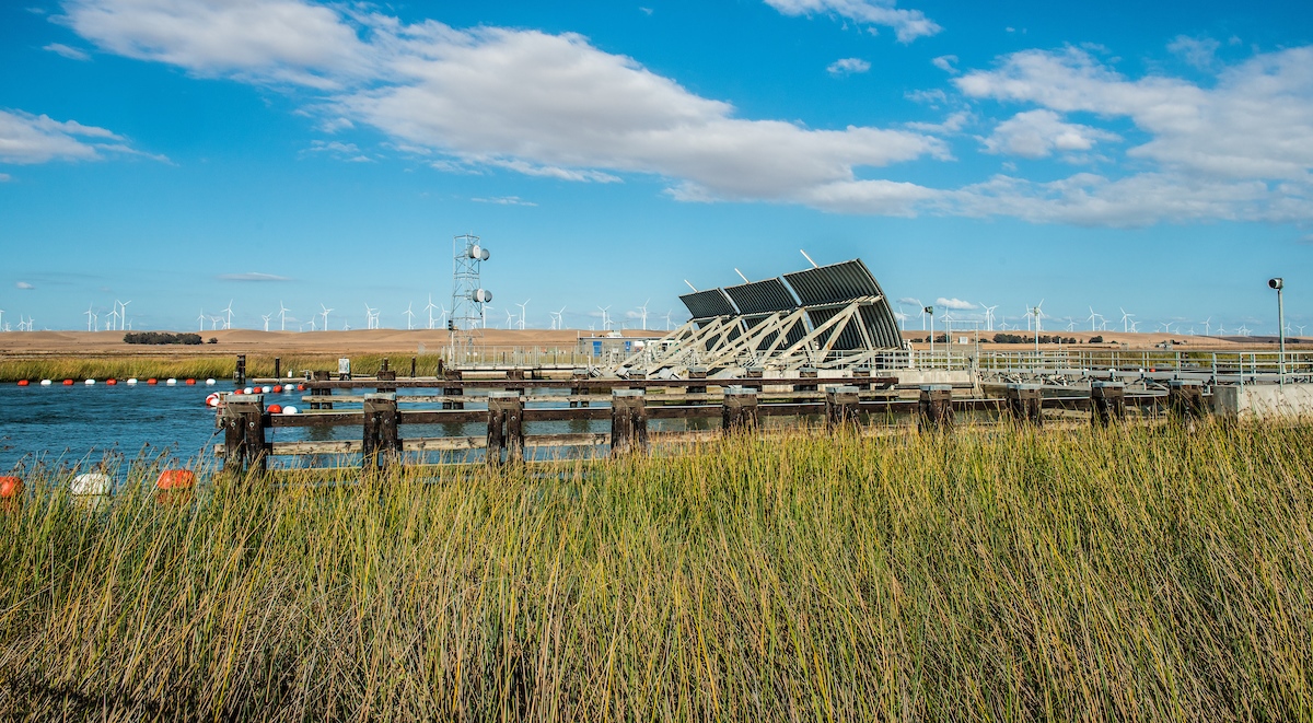
Controlling salinity: The Montezuma Slough Salinity Control Gates control the salinity of the water in Suisun marsh in response to the water projects diverting water.
Wildlife refuges: There is a system of Central Valley wildlife refuges that offers refuges for migratory waterfowl and other species. Water is supplied to the refuges as part of the 1992 Central Valley Improvement Act. The refuges work to maintain the small remaining wetlands from what was once a vast system.
Marshes as ecotones
 “I’d like to encourage you to think about them not just as places to get wet once in a while, but as ecotones,” he said. “They are edge habitats, whether it’s a wetland or a slough or floodplain, or a creek and sort of this idea of a natural wetland, or whether it’s a highly managed system in the form of a wildlife hunting pond, or flood control canals, or agricultural ditches and floodplains. A lot of the magic of productivity in ecosystems of all sorts happens along edges, where different kinds of habitats butt up against each other, creating a diversity of food resources and habitat resources that all kinds of animals up and down the trophic scale can take advantage of.”
Tidal marshes are ecotones both in space and time. In the Suisun Marsh, there’s a lot of surface area between the terrestrial and aquatic habitats, so that ecotone is dominated by adjacent proximity. Also, tidal marshes are flooded twice daily; they flood up on the high tide and drain out on low tide twice a day. That creates a process of accumulation and transformation of organic products and then dispersion of those products before accumulation begins again.


And so that’s an ecotone in time: places might be wet for periods and then dry for periods. Floodplains are an extreme example; they are inundated on a seasonal basis. The Yolo Bypass and the Cosumnes River floodplain flood up and undergo a transformative process where the water hits the landscape, things start decaying, things start growing on decaying matter, blooms of phytoplankton started occurring, and annual forbs start growing. These floodplains produce organic material that goes into the water and is dispersed across the landscape.


“So, in summary, water interacting with land over time supports these processes of aggregation, transformation, and dispersion which creates what we know as a food web,” said Dr. Durand. “Nutrients and organic carbon get reprocessed into primary production or microbial production, which then feeds zooplankton and invertebrates, which then feed fish, birds, and other animals living in these systems. That’s food, or at least the basis of food. And that’s the good stuff that comes out of marshes when it gets activated and moved by water throughout the water column.”
California’s wetlands: past and present
Wetlands in California pre-development were very extensive, but by the early 1900s, that had largely changed due to placer mining dumping large amounts of sediment into the river systems, population intensification, and the conversion to agriculture.

The map on the left side shows the historic wetlands up and down the Central Valley, along with Tulare Lake, a seasonal lake that was probably the largest in California at the time. The map on the right shows the wetlands that still exist today; at least 90% of the historical wetlands have been converted into agriculture and urban centers. The Suisun Marsh is one of the largest remnants of the system; although it has been somewhat modified, it still is an extremely productive wetland.
The Delta and the Upper San Francisco Estuary have been greatly degraded since the early 1800s when Europeans and Americans were first exploring the region from the East Coast. Then, the Delta was a system largely dominated by wetland and terrestrial habitats, but by the early 1900s, the Delta had been transformed mostly into an agricultural system.
“We’ve reclaimed a lot of habitat for agriculture, and the aquatic systems that remain are impounded by levees and are open water habitats,” he said. “It’s in stark contrast to what we think the historic system was where there was a much more porous interface between the land or wetland and open water.”
The lands that form the Delta islands in between the waterways have become deeply subsided largely due to agriculture; the soils become oxidized and are chemically evaporated or blown away as carbon becomes carbon dioxide and is removed from the system. The western and central Delta islands are extremely subsided – 15 feet or more below sea level. This is important because it limits opportunities for the restoration or rehabilitation of those habitats.

There have also been tremendous changes in the timing and direction of water flows. This tends to be a global phenomenon for estuaries and wetlands worldwide but is especially true of the San Francisco Estuary.

“We’ve definitely changed water flows in the San Francisco Estuary as a result of the Central Valley Project and the State Water Project, which divert water down through the southern part of the Delta into Southern California, and the system of dams that regulate water,” Dr. Durand said. “Our water is very much regulated across the landscape of the Delta.”
Non-native species in the Delta
 The estuary has been invaded by many new species, likely the result of changing landscape uses and changing water uses. For example, aquatic weeds have taken hold in the Delta in the past 40 years as water essentially is moving slower, has become warmer, and has been redirected, facilitating the invasion of aquatic weeds.
“Certainly, there’s been invasion pressure for many years,” he said. “But in the last few decades, invasion pressure has continued. Invasions have been more successful as there have been changing opportunities because of the alteration of the system. And so we have a variety of aquatic weeds that are changing the aquatic landscape.”
There have also been many other species that have come in, such as invasive jellies, Mississippi silversides, and Asian clams.
 Dr. Durand said there isn’t a significant difference between alien and introduced species. Introduced species have been introduced to the system and taken hold. However, introduced species should be distinguished from invasive species; many introduced species don’t become invasive in terms of taking over a niche, dominating some aspect of the food web, or pushing out other species. He noted that the three species shown on the slide are invasive species that have altered the system irreversibly.
“Striped bass have been introduced in the Delta; they’ve been here almost 150 years, so they are naturalized to the system. They probably self-regulate their population because they tend to feed on their juveniles. The striped bass has been unfairly maligned in recent discussions in the Delta, but I think that they tend not to be invasive disruptors on the scale of Mississippi silversides, the clams, and others.”
He noted that the potamocorbula is a small brackish and saltwater clam that grows in such high densities that it can filter the water column of chlorophyll, so it becomes an aggressive competitor to animals like copepods that form the fish food web. The clams can limit the amount of zooplankton by outcompeting them.
A novel ecosystem
 The figure on the slide is from a 2009 paper by Hobbs et al. that described these altered ecosystems as novel. On the x-axis is the change in abiotic conditions (such as temperature or salinity). On the y axis are changes in biotic conditions (plants and animals).
“He documented this progression from a historical condition to biotic and abiotic condition changes to some kind of hybrid system to a novel system,” said Dr. Durand. “He argued that as you change one axis, it starts to influence the other axis, and you get to a point where you have a hard time reversing the system. So once you enter that period, where you’re in a novel ecosystem, you have to manage it moving forward, instead of looking at it as a historical endpoint to go back to.”
 Dr. Durand gave an example based on the Delta. The slide shows the long-term monitoring data for Delta species. Delta smelt are on the edge of extinction. Striped bass is an introduced species that did quite well until the past couple of decades. Longfin smelt have been following the Delta smelt trajectory. Threadfin shad are variable but have been struggling of late.
When the levees were constructed and water diverted for human uses, it changed how water moved across the landscape. That, in turn, allowed invasive plants and animals that are ecosystem engineers to move in aggressively. Along with the invasive species, there was increased water clarity and a loss of phytoplankton and zooplankton production. And that led to an increase in invasive fish like the Mississippi Silversides, which thrive in the relatively clear water. Invasive fish lead to other consequences as well.
“The question becomes, how do you move backward in time?” said Dr. Durand. “It’s very difficult to remove invasive species. It’s difficult to change the physical parameters of the system, but even if you bust down levees and open up wetlands, we still would struggle to try to control invasive species. And along with that, we struggle with maintaining water quality that’s appropriate for our native species. That’s the paradox of restoration and novel ecosystems; we have to ask ourselves constantly, what are we restoring to, and what will the intended benefit be?”
 The state is working to address the species declines in part through the Eco Restore, an ambitious program to restore habitat at various sites throughout the Delta. Many restoration projects are underway, including Nurse-Denverton Slough in the Suisun Marsh, Dutch Slough, Liberty Island, and the Cache-Lindsay complex.
“We’re very interested in how these restored habitats will function and how if in any way they’ll actually work to reverse or at least moderate these declines in fish species,” said Dr. Durand.
Water management in the Suisun Marsh
The Suisun Marsh is in the middle of the estuary, east of the more saline bays of San Pablo Bay and west of the fresher water in the Delta. It’s probably the largest tidal wetland in the lower 48 and maybe the entire area of North America and the largest remaining Central Valley wetland. The Marsh is dominated by brackish tidal channels and natural-like tidal marshes.


The Marsh has muted tidal seasonal freshwater ponds, which are highly managed wetlands used primarily for waterfowl hunting; they are flooded up during the wintertime and maintained as freshwater systems and typically left to dry out in the summertime.
One tool for managing the system as a tidal brackish to freshwater system are the Salinity Control Gates located at the eastern end of Montezuma Slough. The gates are operated to shut on the flood tide, which keeps the freshwater between the gate and the east end of Montezuma Slough; the gates are then opened at ebb tide, allowing freshwater to move down from the Sacramento River into the system.
 The slide shows the ownership of the Suisun Marsh tracts. The blue areas are private holdings, mostly all hunting clubs managed for waterfowl hunting. During the summer months, the ponds dry out, allowing annual forbs to grow, which will attract waterfowl in the later months. The salinity control gates close in September and October, and freshwater from the Sacramento River starts to freshen up the entire system.
The hunting clubs circulate the water across the landscape. Dr. Durand said that the forbs and other plant growth decay, and a couple of things can happen. It can create intense blooms of primary production of phytoplankton and zooplankton, or, if not managed correctly, it can also create anoxic conditions of low dissolved oxygen. It was a serious problem about a decade ago, which has largely been regulated by staggering exchanges of ponds into the sloughs.
The water is circulated throughout the hunting season; the season ends, and the ponds are drained. Water is exchanged over a series of neep tide cycles; the ponds are allowed to flood up a little bit to allow the seeds to set, then the pond is allowed to dry again.
“That pattern of management has been in place for over 100 years in the marsh and has created a very productive system,” he said.
One of the benefits of having managed systems with levees and gates is that there is a way to manage invasive plants and animals that can occupy these habitats. “It allows us essentially to reset them and remove any kinds of noxious invaders that might have taken over. This lends itself to a novel way of aggressive landscape management that open tidal restorations don’t often have available to them.”
 The way the water moves is that there is an external water supply in the form of a tidal slough that is pulled onto the wetland through a tidal gate structure. There are flaps on the gates which open up when water is going out with the tide and close shut when the tide changes. This allows water to be moved in and across the different sites with a high degree of control.
Even though fisheries have declined in other parts of the estuary, the Suisun Marsh has remained a hotspot for fish across the last four decades. One of Dr. Durand’s graduate students, Dylan Stompe, developed an integrated database of the various fish surveys in the estuary. He did a spatial analysis that identified the higher places of abundance of certain key species and found that the Suisun Marsh and the confluence in the Delta are an important center of biomass.
RELATED: BAY DELTA SCIENCE CONFERENCE: Space Jam: A spatially explicit history of estuary fish species, presentation by Dylan Stompe at the 2021 Bay Delta Science Conference
Dr. Durand presented a slide for three of the POD species, which shows the distribution of fish from 1980 to 2017, with the lighter colors indicating a higher abundance of the species.
“It shows the center of the distribution being right here in Suisun Marsh,” he said. “We think that’s largely a function of the productivity of that system.”

The catch of native fish in the Suisun Marsh study has remained relatively stable since 1980. However, he noted that the non-native species have varied quite a lot through the years. In the early 1980s, there was a crash in native species. But since then, the catch of native species has been pretty consistent across the years, so Suisun Marsh tends to be a stable environment for them.

Suisun Marsh: a viable habitat
So why is Suisun Marsh such a viable habitat? “We think it’s a function of the tidal gradients and essentially a function of heterogeneity across the landscape, which offers lots of different opportunities for fish to capitalize on foraging and find refuge,” he said.
 There are three major basins or topographical elements of Suisun Marsh: the Cordelia complex, the North Suisun complex, and the Nurse-Denverton complex. Nested within these basins are a series of smaller tidal sloughs that are fairly long and essentially aggregate productivity by collecting phytoplankton, zooplankton, and invertebrate food resources up in the upper ends. Adjacent to those tidal sloughs are multiple managed wetlands that feed into those systems.
“We think that complex of basins, within which are nested slough complexes, within which are nested, managed wetlands, create these layers of connectivity and exchange that keep food in circulation and keep foraging opportunities in circulation in the wetland,” said Dr. Durand. “The benefits of it are that it comes from multiple sources, not just from the naturalistic wetlands that we think of as open tidal, which are actually fairly scarce in Suisun Marsh, but also from the managed systems as well.”


In work done by Jacob Montgomery, he found that chlorophyll and zooplankton biomass does indeed increase the further you go up the slough. The graph shows the productivity of Montezuma Slough; the x-axis is the distance from the salinity control gates, and the y-axis is the concentration of chlorophyll a, a proxy for phytoplankton; zooplankton biomass estimates are the red dots.
“He found that those estimates for chlorophyll certainly went up in the terminal ends of the sloughs and the estimates for zooplankton became more variable and certainly increased as well at the terminal ends,” said Dr. Durand.
Sloughs and productivity
They wanted to know how much water was moving in and out and if it was taking food production across the landscape, so they did a slough flux study.
The four slough systems, Sheldrake, Peytonia, Hill, and First Mallard, are shown on the slide. Each slough is a bit different than the others. Sheldrake is the most channelized; it’s surrounded by tall levees and not a lot of interchangeable landscape. Peytonia Slough has managed wetlands bordered by levees on one side and open space and more or less natural wetland habitat to the north of it. First Mallard Slough is a tiny slough located in the Rush Ranch open space, which is probably the most natural-like slough in the whole estuary; it has tidal exchange in which it tends to fully exchange waters daily. Hill Slough is a new restoration project that has high flows.

The top set of graphs shows the flow across the system; the gray lines show the calculated flow, and the yellow line is the tidal average.
“There’s very little movement back and forth in Sheldrake,” said Dr. Durand. “On the other extreme is Hill Slough, which has an enormous volume of water associated with it because it’s such a large system. And so we see a lot more tidal movement, tidal flows back and forth, in and out through the mouth.”
The bottom set of graphs shows the estimates of the flux of chlorophyll in and out of the system; chlorophyll is a proxy for food production. The centerline is zero flux; above the line is flux out through the mouth of the slough, and below the line is flux back into the slough system.
Dr. Durand explained the results. “With Sheldrake, it had very low chlorophyll levels for most of the period that we monitored. And flux was pretty minimal, it just kind of fluxed back and forth, except for this one event here, and I’m going to come back to that.”
“Peytonia had more elevated chlorophyll levels, possibly because of the volume of the system, and there was more residence time upstream,” he continued. “But if anything, chlorophyll didn’t really flux out through the mouth; it reversed flux back up into the system. The same thing with First Mallard; it had very low chlorophyll levels and really a small flux out at certain times of the tidal cycle but not nothing of really great magnitude.”
“Hill Slough had really intense swings back and forth, and we don’t quite know why these patterns exist. Hill Slough is connected to a perennial source of fresh water, which may account for some of the intense fluxes. Also, this study was done in the summer, so some of the early values here could have been a result of flow-driven flux out through the slough, which then declined over the summer, leading to it acting like a more closed slough system.”
“But I think the real takeaway here is that these engines of productivity aren’t necessarily barfing tremendous amounts of food out into the whole marsh system, but rather they have localized production that affects local areas, and fishes can move in and out and take advantage of that,” said Dr. Durand.
Going back to Sheldrake, Dr. Durand acknowledged it was a ‘weird’ signal. “It took us a while to figure out what was going on. We think that essentially the pond at that site adjacent to it exchanged a bunch of water that had been sitting in a ditch, probably a borrow ditch inside the levee. And for whatever reason, they released a lot of that water.”
 Simultaneously, parallel studies were looking at how fish benefit from different kinds of wetland habitats, so there were caged fish in several places throughout the marsh, including some close to Sheldrake Slough.
“The thing that was really striking is that the fish that were on a pond had really high levels of growth all the way through the study as there were tons of zooplankton available for it to feed on,” said Dr. Durand. “In other systems like the fish in First Mallard branch, the chlorophyll availability was pretty low. And by extension, zooplankton were not highly available for these fishes.”
“In Sheldrake Slough, there was one spurt of growth that occurred after the pond draining period, so we think that that fish benefited temporarily from this dump of phytoplankton that stimulated the food web locally in Sheldrake,” said Dr. Durand. “So, the moral of the story is that even though there’s not a lot of activity in that slough typically, when the managed wetland dumps resources into it, fishes can take advantage of it.”
So, where is the productivity coming from? They ran a transect across the northwest corner of the marsh from the Blacklock restoration site up to Luco Pond. They also did a comparative study of the fish resources in Blacklock pond compared to adjacent waterways and then a managed system, Luco Pond, that was nearby.


They found that the fish catch in the Blacklock marsh was rather depauperate compared to a lot of the adjacent waterways; the one species that dominated the system were the invasive Mississippi silversides. Other than that, it wasn’t very abundant with fish, and it didn’t have a lot of diversity as compared to the open channels, Nurse-Denverton Slough, Arnolds Slough, and little Honker Bay, all sites that were adjacent to it.

Dr. Durand then pointed out the difference between Blacklock and the fish catch in Luco Pond. The slide shows the bar histograms of catch per unit effort comparing Blacklock Marsh on the left to Luco Pond on the right. The upper left corner is for Mississippi silverside; Blacklock had many invasive Mississippi silversides.

However, silversides weren’t found inside the managed wetland; instead, they found three-spined stickleback in abundance, which is consistent with findings in other managed wetlands. He noted that striped bass are known to feed outside the outfalls of managed wetlands, and they are eating three spine stickleback.
Western mosquitofish were found everywhere in wetland habitats; they were introduced by vector control. They found some black crappie inside the marsh, and inside the managed wetland, they found common carp and other species as well.
“The interesting thing here is that we had a different community inside the managed wetland itself, which was dominated by native species,” Dr. Durand said.
Williamshen et al. found that fish abundance and fish diversity for most species increase as you move up the slough towards the terminal end, including striped bass, tule perch, splittail, and other species. The exception is two introduced species: Mississippi silverside and Shimofuri gobi.
“We think there’s a lesson in terms of how we manage our systems for native fishes and how we prevent invasion by non-native fishes that are not necessarily desirable,” he said.
The studies have expanded into managed wetlands and tidal wetlands across the marsh and the Delta. Grad students Kyle Phillips and Alice Tung are looking at the production of zooplankton and phytoplankton across managed wetlands under the hypothesis that these are important and productive elements.
The top row of plots shows a time series for the abundance of chlorophyll across Meins Landing. The chlorophyll, shown by the green dots, increases throughout the flood up period and declines just before exchange.
“One of the things that they’re finding is the exchange of flood up promotes these blooms of phytoplankton and zooplankton,” he said.

The bottom row of the plots shows the density of zooplankton; the size of the dot is the abundance.
“It’s a little bit complicated,” he said. “But suffice it to say, as the wetland flooded up and matured over the season, the community composition shifted from a bloom of zooplankton to a very high concentration of daphnia by the end of the season.”
 The picture shows the zooplankton in the water. “We call it Zoop Soup. And it’s a lot of bugs. And so fishes that are in the ponds are really benefiting from that. And we believe that fishes that are outside the ponds benefit, as well, when exchange occurs.”
“The question is, when does exchange occur? When is the optimal time to manage these systems? And how can we move water from the managed landscape to the open landscape as effectively as possible to benefit the species we care about?”
When the ponds are flooded, system production spikes. The graph below shows the pond values for chlorophyll across two years. The blue line shows the values for the slough; the orange line are the values for the ponds. “Comparing the pond with the slough, we don’t see very large spikes in adjacent sloughs, but we see giant spikes in chlorophyll early on the season following flooding,” said Dr. Durand. “There are some aberrations in the second year; the study in Luco Pond didn’t really see much of a spike. But we did see that same spike recapitulate itself in Meins Landing and Wings Landing.”

He noted that the spike is also mirrored by increases in zooplankton following exchange events.

Managed wetlands – an important resource
 Eco Restore has 30,000 acres of restoration completed or in progress; over 85,000 acres are proposed.
“I just want to highlight that in Suisun Marsh, we have a ton of really productive open tidal wetlands – over 6000 acres of it,” said Dr. Durand. “We also have 52,000 acres of extremely productive habitat that are managed and can be possibly re-managed to support our tidal wetlands, and do so in a way that benefits not only the owners of the properties who are managing them but also benefits our native fishes and benefits waterfowl.”
“We get multiple benefits from re-managing or re-operating the system, and if we were to think about managed wetlands having an important part of our restoration plan for the Delta, I think that we would have more control over the sorts of outcomes that we get from restoration because it gives us levers that we can control the system with.”
He gave a hypothetical example.
 The Tule Red restoration project recently became operational at the southern end of Suisun Marsh on Grizzly Bay. Adjacent to Tule Red is another holding currently owned by a restoration and mitigation company. Tule Red is vulnerable to invasion by clams and Mississippi silversides. Is there a way to maintain that productivity without invasive species moving in?
“We hypothesize that there might be a way of creating supplemental support for these managed wetlands by supporting open tidal restoration systems using managed systems as adjuncts,” said Dr. Durand.
“We know that the Grizzly King managed wetland can be extremely productive. And so we asked the question, where should we put that productivity? Should we just exchange it back with Grizzly Bay? I would argue no, because the dilution factor would be so high that all that stuff would disappear. But if we dump it into Tule Red, we would have a really powerful one-two system that would be more beneficial than just opening up Grizzly King to a tidal system because we have the same problem of invasion and lack of control of productivity.”
Sea level rise
 All of these ideas and plans about wetlands, wetland functions, and managed wetlands are all contingent upon sea level rise. They modeled sea level rise for the northern part of Suisun Bay out to 2150. Dr. Durand acknowledged there’s much uncertainty in projections that far into the future, but given current projections, the projected mean sea level shows the marsh inundated by 2150.
“By 2150, if the projections hold, we expect the whole thing to be underwater which brings up a lot of questions that we really have to think about and address as we’re moving forward,” said Dr. Durand. “Realistically, we can probably only plan about 50 years out when making decisions about how we manage lands. But we should be thinking about ways that we may need to defend the city of Fairfield. We may need to increase the height of levees; we may need to aggressively invest in subsidence reversal strategies that allow us to just keep up with sea level rise, both for the city’s benefits and for wildlife benefits. And these are the questions we have to be thinking about more.”
Takeaways
- Tidal wetlands productivity derives from both natural and managed landscape features.
- Periods of drying and wetting can enhance productivity.
- Controlling connectivity with open habitats can help control less desirable species.
- Managed wetlands will be essential to preservation efforts and can support restored sites.
- Sea level rise will radically disrupt our restoration and management schemes.
QUESTIONS & ANSWERS
QUESTION: Has fresh groundwater exploitation or depletion under the estuary resulted in saltwater intrusion deeper into the Delta during dry periods?
Dr. John Durand: “Most Delta water rights holders are pumping directly from the channel. And at least in the past couple of droughts, we’ve been pretty successful in maintaining reasonably freshwater conditions in the Delta, both to support agriculture and to support fish species. So there has been a dual purpose for the management of those flows. I don’t have any information about groundwater pumping. Typically, on the islands that are farmed, they’re pumping water off the islands to keep them dry enough; because they are so subsided, water tends to be constantly flowing onto the island. So if anything, they’re pumping water off of them to maintain conditions that are appropriate for agriculture. And so issues with groundwater pumping tend to occur farther down in the south valley down the San Joaquin Valley.”
QUESTION: What is happening with Frank’s track and the plans to reduce salt intrusion there? Do you have any ideas?
 Dr. John Durand: “A couple of really interesting proposals were put out there. Right now, we’re really stuck with putting in the periodic barrier. Certainly, in the 2012 to 2016 drought, a temporary rock barrier was put in at False River in Frank’s tract. And so we think that really helped save a lot of water, in terms of maintaining freshwater conditions in the Delta. It’s an awkward system, but it but it works. And we’ve used barriers to some good effect throughout the Delta.
“Certainly in the 1970s, when we got hit by the first of these really sharp, intense droughts, we used rock barriers throughout the Delta, also in the North Delta. And we’ve avoided doing that because there were conflicts, both with passage through the systems as well as concerns about how water was flowing. But the Franks track barrier has been really effective.”
“There’s another proposal put out by a UC Davis group that looked about reclaiming Franks Tract and redesigning the system to have a long-term existing hard barrier there. It would be kind of a novel ecosystem; there’d be a wetland and an emergent landscape that would be available for recreation, and then to the west of that would be an open water system. Brett Milligan did that work, but I don’t think it’s gotten traction. Although I think it serves twin purposes of keeping an open water habitat available for recreational enthusiasts and also helping to mitigate brackish water or saltwater flows from intruding into the Delta.”
QUESTION: What is the likelihood of redirecting sediment back into the managed wetland?
Dr. John Durand: “I don’t know if this answers the question, but there is a restoration site, the Montezuma Wetlands, that has been taking dredge spoils and pumping it back in to reverse subsidence. And they recently completed their first stage of restoration. So that’s one way that they are reutilizing sediments that have been lost. Generally, it’s a sediment starved system … Traditionally, we were dredging and dumping it out by Angel Island, I think, and letting it go out to sea. I don’t think we do that anymore; we’re trying to repurpose it. Parts of Suisun Marsh, like Tule Red, in particular, tend to accrete sediment, which makes them very, very rare, but that has to do probably with the prevailing winds that blow it back up on the shore there.”
QUESTION: Is the management of Suisun Marsh for waterfowl production responsible for the subsidence of the marsh? Should Suisun Marsh be managed as a perennial marsh to prevent subsidence and keep up with sea level rise?
 Dr. John Durand: “The Suisun Marsh is not terribly subsided. The Central Delta is very subsided as a result of agriculture, but agriculture didn’t really take in Suisun Marsh … either it wasn’t terribly productive, or it wasn’t really easy to get produce out to market in San Francisco. So, for whatever reason, early on, it became much more of a refuge, first for market hunting, which provided markets in San Francisco during the 1850s and throughout the end of that century, and then later for waterfowl hunting. So, in short, the Suisun Marsh is not terribly subsided, except for places like Montezuma Wetlands. I think the Montezuma Wetlands were grazed possibly and also farmed a little bit, which led to more extreme subsidence, but other parts of the marsh are not nearly as subsided. Really, the levee system there is just to control the water quality inside the ponds.”
QUESTION: Depending on the area in the Delta, wouldn’t having more tidal areas versus ponds allow for sediment accretion and tidal marsh plant carbon fixation to better keep up with sea level rise?
Dr. John Durand: “Open areas would accrete more sediment if there were more sediment in the water column that supported that, but right now, I don’t know that we see that process occurring just because the system does tend to be sediment starved. We kind of reached peak sediment in the 1990s. So there was a big slug of sediment that really altered the estuary coming from placer mining, and that slug of sediment peaked in the late 1900s. Since then, we’ve been losing sediment, and so many places that are open tidal baylands and mudflats have been decreasing. Sediment has been escaping those systems, so we’ve seen the reverse.
“Now, in terms of intensive subsidence reversal using plant growth, there’s an experiment right now that’s been ongoing at Twitchell Island where we’ve been planting tules and rice to try to reverse subsidence, and they’ve been successful. That’s really intense cultivation that they have going on there, but the rate of subsidence reversal is very slow compared to the amount they have to catch up. Then with the rate of sea level rise on top of that … Intensive agriculture is one way to reverse that subsidence. Pond management when you’re already at sea level would probably have to be a lot less aggressive. I think we need to study that.”
QUESTION: Earlier in the presentation, you talked about the higher CPUE for fishes in Suisun Marsh. But those channels are very small compared to the open waters of the estuary. Have you calculated the abundance of various fish species in the marsh compared to open waters?
Dr. John Durand: “We probably need to do that. I think it’s really species-specific. So the other extreme is going to be something like splittail. The splittail are going to have a much higher abundance in those edge habitats; longfin smelt, you wouldn’t expect it. And also, it is really challenging to compare gear types, and that’s the problem that Dylan encountered when he tried to do an integrated dataset and tried to account for that. So his projections suggest that as a result of his calculations, which are a little bit buried in the algorithm, he found the catch for those species was much higher, at least in parts of the marsh, at least for the species that he looked at, which was striped bass, threadfin shad, and American shad. He found that the relative abundance is pretty high.
“But what we really need to do is that kind of comparison. I think it’s going to be hard to figure out. Well, anyway, I could go on and on. Let’s sit down and talk about maybe have some good ideas about how we can do it because I’ve been stymied trying to calculate the volumetric abundance of fishes in those sorts of habitats versus open water just because of the constraints of sampling and the differences in environment. And so, yeah, I should probably sit down and do that, preferably with an outside partner to correct my bias.
QUESTION: What about the mitten crab invasion that happened many years ago – is that still around? And if not, why not?
 Dr. John Durand: “They came, it was a big crisis, and they kind of went away. They’re still out there. They’re just not very abundant anymore. This is a real typical pattern with species invasions. They often have an initial spike as they radiate out into new habitats. And then they either get hit by some kind of disease, or they become integrated into the food web, and they become a target of predation. And I don’t know what it was with the mitten crab.
In some cases, they started feeding on their own; the populations start self-regulating. Crabs are famous for this. Big crabs eat little crabs, and they’re pretty indiscriminating in terms of what species they eat, so they self-regulate by eating their own young. And it seems bizarre, but essentially they produce a massive amount of eggs, the larvae grow, the larvae feed, and so the adults take advantage of their own offspring which are essentially aggregating food resources for them.”
QUESTION: Can you comment on achieving better multi-benefit outcomes for Putah Creek fish passage and wetlands managed for waterfowl in the Yolo bypass?
Dr. John Durand: “Right now, Putah Creek is a little creek that runs out of the coastal mountains, through Lake Berryessa, and down past Davis and dumps into the Yolo bypass. And historically, it’s in doubt whether Putah Creek actually was perennially connected or not just because flows varied and because it may have been intermittently connected. And today, we manage it … because of the agreement with Putah Creek and Solano County Water, we have perennial flows through the creek. We regulate those flows by releases from Lake Berryessa. And at the bottom end of it, there’s a check dam that is closed at times to support irrigation of rice fields and waterfowl potentially, and then is opened up to allow for fish passage at times of the year.
“I think there’s been an issue periodically with the timing of the check dam in that we haven’t been able to open it up in a timely fashion to allow fishes, particularly Chinook salmon, to migrate up into Putah Creek and spawn at the right time. So they essentially missed the stream migration. And so that I don’t know that the check dam is going anywhere, but it would be great to have a better system that allowed more consistent fish passage and connectivity with the Toe Drain and the Yolo Bypass … “
QUESTION: Chlorophyll and zooplankton abundance are really proxies for standing biomass; true primary and secondary productivity is hard to measure. Any thoughts on possible differences in productivity rates in natural and managed wetlands?
 Dr. John Durand: “We just showed biomass. Alice Tong has been measuring chlorophyll rates; the chlorophyll rates go through the roof after flood periods and then decline. So we’ve been doing those sort of in laboratory incubations. And the rates change over time. We go from the spikes where the exchange occurs and then a gradual decline in the system. Kyle Phillips has also been looking at that, particularly looking at succession patterns of zooplankton production with different kinds of vegetation. And using chlorophyll-a production as a proxy for production, he sees real changes in that as well.
“When these ponds exchange, rates go through the roof. And, of course, they’re also accumulating. So the question for a management strategy is to allow production to occur at a high rate and then exchange to occur at the appropriate time and then reinitiate that process to keep it going. A lot of it is driven by plant growth; the annual forbs that grow tend to drive it because they’re nitrogen fixers. So they’re putting nutrients in the system. And then also, there are just biogeochemical processes occurring in the landscapes as they dry and wet, and we don’t know that much about them. But we see similar things going on the Bypass when it floods up.”
QUESTION: How can we document the likelihood that invasive species occurring inside the populations are partly due to flow management?
Dr. John Durand: “Smarter people than I have tried to do that very thing. When we look at the Delta as a whole, there are a lot of smoking guns. It’s not just one thing. And it’s not just one thing that happened in the last 50 years; it’s a legacy of changes that have been occurring for 150 years, since 1850. I think it’s really hard to document that conclusively. But in my conceptual model of how the changes happen, I see consistencies in terms of the original retooling of the landscape, then the reoperation of water flows, and the changes in water quality and species constituents that we see today. Those have shifted for a very long time. And a lot of it is the legacy that we inherited.”
“It’s almost like the idea of an extinction debt. Essentially, we created the conditions for it many, many years ago, and we’re seeing that come to fruition now. And, of course, it’s all accelerated. The populations that we do have are very vulnerable, especially right now, because of climate change. We’ve had some very, very hot summers, which have definitely negatively affected species, but going back and figuring out what the initial cause was? I just don’t know how fruitful that is anymore.”

