

Several news sources featured in the Daily Digest may limit the number of articles you can access without a subscription. However, gift articles and open-access links are provided when available. For more open access California water news articles, explore the main page at MavensNotebook.com.
On the calendar today …
- PUBLIC HEARING: Delta Conveyance Project water right hearing beginning at 9am. The State Water Resources Control Board Administrative Hearings Office will hold a Public Hearing on the pending Petitions for Change of Water Right Permits for the Delta Conveyance Project. Interested members of the public who would like to watch this hearing without participating may do so through the Administrative Hearings Office YouTube channel at: bit.ly/aho-youtube. Click here for the meeting notice.
- WEBINAR: River Data at Your Fingertips — Geoconnex Explorer and What’s Next from 11am to 12pm. After years of development, the Internet of Water Coalition is excited to showcase Geoconnex Explorer, the first public access point into the Geoconnex system. The Explorer opens up access data from waterways across the contiguous United States, making it easier than ever for users to find critical information from trusted sources like the United States Geological Survey and Water Quality Portal. As the first public-facing application built on the Geoconnex system, the Explore demonstrates how water data can become discoverable, usable, and connected for all. In this webinar, key developers from the Center for Geospatial Solutions — the team behind Geoconnex Explorer and stewards of the IoW Coalition — to dive into the tool. We’ll discuss how it was built, highlight current capabilities, share what’s next for the broader Geoconnex system, and of course, answer your questions. Join us September 15 at 2pm ET for the inside scoop on Geoconnex Explorer. Click here to register.
- WEBINAR: Regulatory Alignment Study – Draft Final Recommendations and Implementation Steps from 2pm to 3pm. The California Department of Food and Agriculture (CDFA), in collaboration with the California Environmental Protection Agency (CalEPA) and the State Water Resources Control Board (Water Boards), will host a public webinar on September 15, 2025, to provide an overview of the draft recommendations as part of the Regulatory Alignment Study. Crowe LLP, CDFA’s consultant on the study, will lead the public webinar and provide an overview of the Regulatory Alignment Study, highlights from the draft Final Recommendations and Implementation Steps Report, and guidance on how to submit feedback. Click here to register.
In California water news today …
The dwindling Colorado River can’t wait for states to cut water use, experts say
 “The Colorado River’s massive reservoirs are now so depleted that another dry year could send them plunging to dangerously low levels, a group of prominent scholars warns in a new analysis. The researchers are urging the Trump administration to intervene and impose substantial cutbacks in water use across the seven states that rely on the river — California, Arizona, Nevada, New Mexico, Colorado, Utah and Wyoming. “We’ve got a real problem, and we ought to deal with it sooner rather than later,” said Jack Schmidt, director of Utah State University’s Center for Colorado River Studies, who co-authored the analysis. “Everybody needs to be looking at ways to cut right now.” .. “The results are grim,” the experts wrote in the report, which was released Thursday. If next year turns out to be a repeat of this year, they wrote, total water use would exceed the river’s natural flow by at least 3.6 million acre feet — nearly as much as California used in all last year. … ” Read more from the LA Times. | Read via Yahoo News.
SEE ALSO: Colorado River Crisis: Lake Mead & Lake Powell Could Plunge to Perilous Levels by 2026, Urgent Conservation Needed, from Hoodline
Arizona water negotiations ongoing as Trump nominee stalled in Senate
“As southwestern states struggle to reach a new Colorado River agreement, a different kind of drought is affecting the negotiations, a drought of federal leadership. More than 150 Trump nominees remain stalled in the Senate, including one with significant consequences for Arizona’s water future. Ted Cooke, the former general manager of the Central Arizona Project, was nominated by President Trump in June to lead the Bureau of Reclamation. However, his confirmation remains blocked by Senate procedural tactics, leaving a critical leadership position in limbo during crucial water negotiations. The current acting commissioner of the Bureau of Reclamation is David Palumbo, though Cooke has been nominated to the role. Palumbo stepped in as acting commissioner following the departure of the previous commissioner, Camille Tuton, early this year. … ” Read more from Channel 15.
2 bills meant to speed up California Delta Tunnel project die without vote
 “Last Tuesday, the California Legislature cast a vote on Gov. Gavin Newsom’s controversial water tunnel project in the Sacramento-San Joaquin River Delta by not voting at all. A couple of bills meant to speed up the process were allowed to die in committee before reaching the state Assembly. Opponents of the project consider it a victory in a fight to protect the water of the delta and the towns that live along its banks. The delta town of Isleton sits frozen in time, a relic from its “Old West” past. It may be a little quiet these days, but it’s no ghost town — yet. It all depends on the river that runs alongside the town. “Well, the history of Isleton is really deep in the river,” said Iva Walton. “Isleton used to be the main stop on the steamboat between Sacramento and San Francisco. So, it has a long history of depending on the traffic on the river.” … ” Read more from CBS News.
Landsat at work: Helping farmers keep soil healthy
“For farmers, uncertainty is a constant. Much is beyond their control, and the weather is just one example. What looks like a bumper crop of soybeans one day could be shredded by hail or flooded by a deluge the next. But farmers can make choices that put the odds in their favor. They can buy crop insurance to help in case of a weather disaster. They can adopt conservation practices that preserve and improve soil health to give crops a better foundation. Agricultural businesses—such as food manufacturers with an eye to the future—have a vested interest in how farmers who supply crops are growing them. Healthy soils support consistent, quality yields and benefits both farmers and the broader agriculture system. Conservation practices that protect soil health also advance sustainability goals—an overarching approach to fulfilling the world’s food needs using environmentally responsible practices. Satellites have become a valuable component for many aspects of farming, and they provide land use and land cover information to support conservation methods. The Landsat program, the United States’ globally recognized gold standard satellite for providing scientific quality data, remains one of the vital indicators of landscape change around the world. … ” Read more from USGS.
‘Zone zero’ rule could be California’s wildfire savior — or its environmental undoing
“Depending on whom you talk to, the proposed new defensible space rules for “zone zero” will help save homes in very high fire hazard severity zones, or decimate much of Southern California’s urban tree canopy without really deterring the types of wildland fires that destroyed much of Altadena, Pacific Palisades and Malibu earlier this year. Either way, the state Board of Forestry and Fire Protection’s Zone 0 Advisory Committee will likely get an earful of comments during its public meeting Thursday from 10:30 a.m. to 5 p.m. at the Pasadena Convention Center. The committee will be presenting its proposed rules for creating “fire defensible spaces” or “ember-resistant zones” within five feet of buildings in very high fire hazard severity zones protected by city and county firefighters as well as all areas protected by state firefighters. These five-foot-wide buffers are now widely known as “zone zero.” … ” Read more from the LA Times.
Trump wants to open forests to more trucks, logging. Which CA lands are at risk?
“President Donald Trump’s Secretary of Agriculture has moved to rescind the “roadless rule” that protects portions of national forests from development — including 4.4 million acres in California — and members of the public can still submit comments about the change to the federal government. Every national forest in California would be affected. … Since 2001, the roadless rule has protected designated areas from development and logging, limiting or barring the construction or reconstruction of roads. About 21% of California’s national forestlands are protected. Throughout the U.S., the 2001 rule covers 59 million acres. The administration has said the move to end the rule would open up these forests to more logging and has said that more roads would help with wildfire prevention. As NPR reported, the U.S. Forest Service has previously found that roads appeared to do nothing to mitigate wildfires. … ” Read more from the Sacramento Bee.
What Native-held lands in California can teach about resilience and the future of wildfire
“It took decades, stacks of legal paperwork and countless phone calls, but, in the spring of 2025, a California Chuckchansi Native American woman and her daughter walked onto a 5-acre parcel of land, shaded by oaks and pines, for the first time. This land near the foothills of the Sierra National Forest is part of an unusual category of land that has been largely left alone for more than a century. The parcel, like roughly 400 other parcels across the state totaling 16,000 acres in area, is held in trust by the federal government for the benefit of specific Indigenous people – such as a family member of the woman visiting the land with her daughter. Largely inaccessible for more than a century, and therefore so far of little actual benefit to those it is meant for, this land provides an opportunity for Indigenous people to not only have recognized land rights but also to care for their land in traditional ways that could help reduce the threat of intensifying wildfires as part of a changing climate. … ” Read more from The Conversation.
California will fare better than other states as Trump guts climate reporting rules
“For nearly 20 years, thousands of industrial plants across the U.S. and California have been required to track and report the greenhouse gas pollution they spew into the atmosphere. This month, the Trump administration moved to permanently end that program, which has long held bipartisan support, originating during the administration of George W. Bush. President Trump’s Environmental Protection Agency administrator, Lee Zeldin, said that greenhouse gas reporting was expensive and burdensome, and that cutting the program would save American businesses up to $2.4 billion in regulatory costs. But ending the requirement will make it harder for some state regulators to track climate progress, and for residents to know if their neighboring power plant or factory is reducing or increasing emissions. “Measuring and reporting climate pollution is a critical step in reducing the deadly impacts of climate-driven extremes that cause more pollution, catastrophic weather events, health emergencies and deaths,” said Will Barrett, assistant vice president for nationwide clean air policy at the American Lung Assn. “Ignoring this reality is a deadly choice, and not one that EPA should be making for American families.” … ” Read more from the LA Times.
In regional water news and commentary today …
NORTH COAST
Charting the journey of sacred Sáttítla to national monument status
“Most attorneys remember their first case. For some 80 Stanford Law alumni, their first case was Pit River Tribe v. Bureau of Land Management, their first client, actually four, including the 11 autonomous bands that make up the Native American tribes grouped under the umbrella of Pit River Tribe; the broader Native Coalition for Medicine Lake Highlands Defense; the nonprofit Mount Shasta Bioregional Ecology Center; and an association representing a dozen or so cabin owners in the Medicine Lake Highlands area known as Sáttítla. At stake was the protection of a pristine area in the Shasta-Trinity, Klamath, and Modoc National Forests encompassing hundreds of thousands of acres of lush forests and barren landscapes, with unique volcanic formations, including parts of one of the longest-known lava tube systems in the world and the massive Medicine Lake Volcano. … ” Read more from Stanford News.
MOUNTAIN COUNTIES
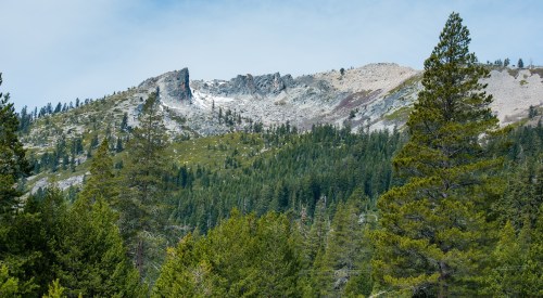
This nearly forgotten wilderness is a spectacular — and uncrowded — alternative to Yosemite
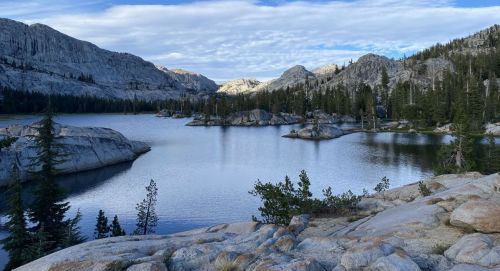
Gregory Thomas writes, “While Yosemite’s granite cathedrals and Tahoe’s stunning views pull in millions of visitors each year, a slice of spectacular High Sierra wilderness wedged between the two has gone mostly unnoticed. The remote Emigrant Wilderness in Tuolumne County offers the same drama — rugged peaks, endless granite, aromatic pine forests and more than 80 lakes — but without the crowds. Estimates put the number of visitors at fewer than 20,000 per year to an area larger than San Francisco and Oakland put together. There are few facilities, so most people go there to hike or backpack. I’d only ever skirted Emigrant’s edges, and it wasn’t until a buddy of mine returned from a recent backpacking trip extolling the place that I began conceiving an outing of my own. He described to me a secluded zone near the heart of the mountainous landscape where a bit of bushwhacking and scrambling leads to a stunning granite formation dotted with glimmering lakes full of leaping trout. … ” Read more from the San Francisco Chronicle.
Tahoe makes strides in providing clean drinking water to the community
“On Wednesday, the Tahoe City Public Utility District celebrated the Grand Opening of the West Lake Tahoe Regional Water Treatment Plant. More than 80 local and state agency partners and regional leaders gathered to celebrate the new facility, marking a step forward for safe drinking water in west shore facilities. The utility district said the celebration reflected the years of planning, remarks from local and state leaders, guided tours and a first sip of water from the new treatment plant. “A project of this scale can only happen through strong partnerships, and TCPUD extends our deepest gratitude to the partners and funders who made this project possible,” the Board President, Judy Friedman, said. … ” Read more from Fox 40.
SACRAMENTO VALLEY
Big Chico Creek turns muddy brown
“If anyone needs another reason not to swim in Big Chico Creek right now, it has turned brown. Opaque, murky water was present on Friday in Big Chico Creek at Sycamore Pool and as far as Forest Ranch after more than two months of a no-swim advisory, placed on Big Chico Creek because of the presence of E. coli that made five people sick this year. Corning resident Brianna Zimmerman, sitting on a blanket Friday at One Mile Recreation Area, said she and her family come to Chico all the time for its parks, but stopped coming to swim at Sycamore Pool because the creek was deemed unsafe to swim in. Friday was the first time Zimmerman had ever seen the water in the creek so brown. … ” Read more from the Chico Enterprise-Record.
BAY AREA
Above-normal heat, dry thunderstorms in Bay Area weather forecast
“Another tumultuous week of weather is in store for the Bay Area as the region shifts from above-normal heat to chances of dry lightning. Starting Monday, an area of high pressure is forecast to bring temperatures as much as five to 15 degrees above average for this time of year, Roger Gass, a meteorologist for the National Weather Service’s Bay Area office, told SFGATE. Daytime highs are expected to approach the upper 70s and lower 80s across most of the Bay Area, and into the mid-to-upper 90s in interior portions of the region, such as Livermore, Concord and Santa Rosa. Some places, like Lake Berryessa, Pinnacles National Park and Byron in Contra Costa County, could climb into triple digits. … ” Read more from SF Gate.
Unbeknownst to Point Reyes ranchers, $10 million in restoration funds lined up by Nature Conservancy long before landmark deal
“It was a small blip in the blizzard of recent news about the future of Point Reyes National Seashore. A California agency that finances habitat improvement projects approved $10 million in late August for restoration of land that’s set to be vacated by seashore ranchers under a historic settlement announced this year in the final days of the Biden administration. The grant is going to The Nature Conservancy, the same group that brokered the closed-door talks with ranchers and spearheaded a reported $30-million-plus package accepted by a dozen of those families to exit the seashore – and end years of litigation by environmental groups critical of the ecological impact of private farming in the public park. … ” Read more from the San Jose Mercury News.
Lagunitas Creek salmon habitat restoration progresses
“A work crew has returned to Lagunitas Creek to move thousands of tons of gravel and rock in an effort to restore an endangered fish spawning habitat. The Marin Municipal Water District began work on “phase 1b” of the project in August, so far completing restoration at two of the five sites for the year. Work is scheduled to continue through the end of October. “Lagunitas is just an exceptional stream, especially for coho salmon,” said Jonathan Koehler, fisheries program manager at the Marin Municipal Water District. “Coho are federally endangered, they’re state endangered, and it’s been identified as a high-priority creek to recover the species.” Marin County has the largest population of wild endangered coho salmon from Monterey Bay to the Mendocino County-Sonoma County line. Once believed to have numbered in the thousands, coho populations dwindled to the hundreds during the 20th century because dam construction blocked miles of former spawning grounds and tributaries. … ” Read more from the Marin Independent Journal.
Sausalito study delivers ‘dreary news’ on rising sea
“Waves breaking over bayfront promenades. King tides flooding low-lying streets. Bay water flowing out of storm drains. Sausalito faces these problems because of rising bay waters, city consultants said during a forum on neighborhood options for adapting to rising sea levels by 2050 and 2100. “We’ve seen 5 inches of sea level rise since 1975,” John Gibbs, an urban designer with the firm WRT, told 75 attendees on Wednesday at the community meeting. “We’re projected to see almost 10 inches (more) in the next 25 years.” More impactful than rising sea levels are storm surges that could rise an additional 3.5 feet, said Gibbs, whose team has been studying the city’s shoreline since 2023. The bay’s levels could be 3 feet higher than today by 2100. Storm surges could exceed 6 feet. The remedies, which cost millions of dollars, involve deciding what resilience strategies — in the water, on the shoreline and inland — would preserve Sausalito’s waterfront character, culture and commerce. … ” Read more from the Marin Independent Journal.
New Cache Creek Watershed Stewardship Group launched
“Residents throughout the lower Cache Creek watershed – which follows Cache Creek from the Lake County line to where it crosses Interstate-5 – will soon have an opportunity to participate in protecting their local waterway through the newly formed Cache Creek Watershed Stewardship project. The project is scheduled to launch in early 2026. “The Cache Creek Conservancy will manage the innovative project that will build a Stewardship Group in partnership with Capay Valley Vision/Regeneration, with funding provided by a grant from the Cooperative Watershed Management Group/WaterSmart program of the Federal Bureau of Reclamation,” according to Project Manager Lynne Haralson. … ” Read more from the Daily Democrat via MSN News.
‘I was shocked’: Annual draining of Menlo Park pond alarms residents
“Svetlana Shmygol was walking along Menlo Park’s community pond late last month when she saw something that alarmed her: the pond usually inhabited by an entourage of ducks and turtles was drained and in a nearby parking lot, a turtle idled. “I was shocked,” said Shmygol, a regular visitor to the Duck Pond who began anxiously snapping photos of the aquatic reptiles being left with little or no water. “(The) pond was empty, and turtles were just walking.” Shmygol was witnessing Menlo Park’s annual eviction of the ducks and turtles that live in the city’s 115,000-gallon, man-made pond, which sits near city hall. The city says it temporarily relocates the pond’s aquatic life each year so that it can empty the pond and replace the green, murky water with clear water. … ” Read more from the San Francisco Chronicle.
CENTRAL COAST
Volunteers needed for ‘First Flush’ rain event at Monterey Bay National Marine Sanctuary
“Every summer, pollutants land on dry streets in coastal Monterey County and every winter they wash away with the rain. Examining water samples collected before and during that first rain allows scientists to see what kind of pollutants are entering the sea. But collecting those samples takes a crew of volunteers. The public is invited to take part in First Flush, an annual water monitoring event in Monterey County that takes place before and during the first significant rainfall of the season. Volunteers will gather rainwater samples so scientists can identify where urban pollutant concentrations are highest, but they must live in Monterey County and get to their assigned sites within 15 minutes of a call that the First Flush is underway. … ” Read more from Local News Matters.
Lake Cachuma staff keep reservoir free of invasive mussels
“The no-swimming rule keeps people out of Lake Cachuma, but it also applies to certain freshwater pests. Since 2017, staff at Lake Cachuma have worked to prevent the spread of a foreign species of mussels that could harm Santa Barbara County’s water supply and damage the fragile ecosystem of the lake. The fear over the mussels entering the lake goes back to 2013, when it was discovered that the invasive species had been introduced to Lake Piru in Ventura Count. The local prevention program is funded by the California State Parks Division of Boating and Waterways, with another two years of grant funding approved in August. … ” Read more from Noozhawk.
SAN JOAQUIN VALLEY
MEETING NOTES: Cawelo adds another oilfield “produced water” project
“The Cawelo Water District is working on a new “produced water” project to increase its irrigation supplies. Produced water is water that comes up with oil during pumping. The district has used oilfield produced water blended with other surface supplies for irrigation for about two decades. Discussion about the new project began in early August. The project is expected to be completed in early 2026. Construction was pushed back due to a delay in biological studies but is expected to start at the end of this month. A board member asked if there would be any issues that could arise with the biological studies. David Ansolabehere, general manager for the district, said he did not expect any. He was confident that the project should be finished by the end of the year. … ” Read more from SJV Water.
SOUTHERN CALIFORNIA
Water bills in L.A. County are rising faster than inflation, UCLA research shows
“Over the last decade, water bills in Los Angeles County have risen nearly 60% on average, outpacing inflation and adding to financial strain for low-income households, according to a UCLA report. The researchers compared average costs for the same amount of drinking water in 2015 and 2025, and said the results show water affordability is an escalating problem in Southern California. “It is concerning that we have this trend of rates outpacing inflation,” said Edith de Guzman, a cooperative extension water researcher at UCLA’s Luskin Center for Innovation. … ” Read more from the LA Times.
The water around the Santa Monica Pier is going to turn pink: Here’s why
“If you’re going to be anywhere near the Santa Monica Pier on Monday, you might notice something different. The difference? The water will be pink, instead of the normal blueish-green we are all used to. That is because researchers from the University of California, Los Angeles Samueli School of Engineering, in cooperation with The Bay Foundation, are releasing a non-toxic pink dye into the water near the pier — around 100 yards north and 100 yards south of it — starting on Monday. This project builds on a 2024 experiment by the UCLA Coastal Flood Lab and The Bay Foundation, continuing efforts to study how the Santa Monica Breakwater influences ocean circulation and contributes to poor water quality. It is the first time such an experiment will be conducted in the Santa Monica Bay. … ” Read more from KTLA.
Commentary: After LA fires, a ‘toxic soup’ lingers in the homes that remain, endangering families
Nicole Kolinsky, executive director of the Coalition for Insurance Accountability, writes, “A few days after the September 11 attacks, the Environmental Protection Agency assured New Yorkers the air near Ground Zero was safe to breathe. Tragically, that wasn’t true. In the 24 years since, studies have linked toxic exposure in Manhattan to soaring cancer rates among first responders, residents, office workers and students. Thousands have died and thousands more are sick. The federal victim compensation fund has paid nearly $15 billion to more than 65,000 people. Today Californians face a similar public health crisis — only this time, it’s unfolding across wildfire-scarred communities. And insurers are making matters worse. … ” Read more from Cal Matters.
Along the Colorado River …
CPW working hard to keep zebra mussels from sticking
“This summer, Colorado Parks and Wildlife (CPW) has ramped up testing and treatment of Colorado waters to prevent the further spread of zebra mussels in rivers and lakes. Between April and mid-August, the agency collected some 318 water samples from different spots along the Colorado River, plus 58 samples from the Eagle River and 26 samples from the Roaring Fork River. Four of the Colorado River samples contained zebra mussel veligers, which are free-swimming larvae and the last juvenile stage of the mollusks. No adult zebra mussels were detected in any of the water samples. … Over the past three years, CPW officials have been monitoring Western Slope waters closely in efforts to halt the spread of the invasive species. … ” Read more from KUNC.
Colorado state water board to decide next week if Shoshone water rights can be used for environment
“The state water board will decide next week whether to approve a proposal from the Western Slope that would allow one of the oldest and most powerful water rights on the Colorado River to be used to benefit the environment. The Colorado Water Conservation Board is set to hear nearly 13 hours of testimony from the Glenwood Springs-based Colorado River Water Conservation District and its supporters, as well as four Front Range water providers, who requested the hearing because they object to certain aspects of the proposal. All the parties participating in the contested hearing agree that the water rights associated with the Shoshone hydropower plant in Glenwood Canyon are beneficial for the environment and would like to keep this water flowing west. But like many things regarding the Colorado River, the devil is in the details. … ” Read more from Aspen Journalism.
SEE ALSO: Colorado water officials prepare to weigh environmental benefits of powerful Shoshone water rights on the Colorado River, from the Colorado Sun
A new study finds eastern Colorado is drying faster than the Western Slope due to climate change
“A new paper analyzing climate models finds that eastern Colorado is likely drying out faster than western parts of the state due to climate change, potentially exacerbating a critical mismatch in water resources across the state. Earlier research has established that both regions will likely grow more arid due to human-caused global warming. By running a series of global climate models, researchers at the National Center for Atmospheric Research in Boulder found that the trend is more pronounced and occurs sooner east of Colorado’s Continental Divide. The trend could amplify a division that has defined the state’s water politics for more than a century, said Alex Rugg Stebbins, a lead author and a project scientist at NCAR. … ” Read more from Colorado Public Radio.
In national water news today …
Trump asks federal court to let it drop regulations on some PFAS chemicals in drinking water
“Federal attorneys are asking a court to allow the EPA to drop a series of regulations on PFAS in drinking water. The chemicals are used in a range of products and are tied to health issues like cancer. The EPA introduced the first federally enforceable limits on six different types of PFAS in drinking water last year, under the Biden administration. The Trump administration’s EPA announced plans to undo regulations on four of those in May. Now it’s asking a federal court to make it official. … ” Read more from KJZZ.
Solving the world’s microplastics problem: 4 solutions cities and states are trying after global treaty talks collapsed
“Microplastics seem to be everywhere – in the air we breathe, the water we drink, the food we eat. They have turned up in human organs, blood, testicles, placentas and even brains. While the full health consequences of that exposure are not yet known, researchers are exploring potential links between microplastics and negative health effects such as male infertility, inflammation, liver disease and other metabolic problems, and heart attack or stroke. Countries have tried for the past few years to write a global plastics treaty that might reduce human exposure to plastic particles and their harm to wildlife and ecosystems, but the latest negotiations collapsed in August 2025. Most plastics are made with chemicals from fossil fuels, and oil-producing countries, including the U.S., have opposed efforts that might limit plastics production. While U.S. and global solutions seem far off, policies to limit harm from microplastics are gaining traction at the state and local levels. … ” Read more from The Conversation.
Paleoclimate patterns offer hints about future warming
“Rising carbon dioxide (CO2) levels are known to raise temperatures in Earth’s atmosphere. But slow feedback processes, including heat storage in the ocean and changes in the carbon cycle, mean that sometimes, such temperature changes don’t manifest right away; it can take decades, or even millennia, for Earth to reach equilibrium.However, different climate models generate vastly different estimates of when such an equilibrium will be reached. One reason for these differences is the “pattern effect,” or the way uneven sea surface temperature changes can create distinct ocean warming patterns that affect atmospheric circulation and thus cloud cover, precipitation, and heat transfer. This complex interplay of factors can increase or decrease warming and shape the climate’s sensitivity to greenhouse gases.One way to help predict what long-term warming patterns might look like is to turn to the past. … ” Continue reading at EOS.

