
On the calendar today …
- MEETING: Delta Independent Science Board from 9am to 3pm. The Delta ISB will meet to discuss its review of the draft Environmental Impact Statement for the Delta Conveyance Project, which was released by the United States Army Corps of Engineers on December 16, 2022, as well as updates to its other reviews and activities to help inform the Board’s work plan. Click here for the meeting notice and remote access instructions.
- WEBINAR SERIES: Planning and Conservation League: Extreme Measures for Extreme Times from 9am to 12:15pm. The title of the 2023 Assembly is Extreme Measures for Extreme Times: What We Need to do Now. The sessions, held on successive Thursdays, will focus on the topics of water, land use, transportation, CEQA/ environmental litigation, habitat connectivity, and wildfire. Water will be the topic on February 9. Click here for more information. Click here to register.
- WEBINAR: U.S. EPA and Department of the Army: “Waters of the United States” Final Rule Overview from 9am to 10am. In December 2022, the agencies announced the final “Revised Definition of ‘Waters of the United States’” rule which will be effective 60 days after it is published in the Federal Register. The agencies developed this rule with consideration of the relevant provisions of the Clean Water Act and the statute as a whole, relevant Supreme Court case law, and the agencies’ technical expertise after more than 45 years of implementing the longstanding pre-2015 “waters of the United States” framework. This rule also considers the best available science and extensive public comment to establish a definition of “waters of the United States” that supports public health, environmental protection, agricultural activity, and economic growth. The agencies are hosting a webinar to provide an overview of the final rule. Please note that when the webinar reaches capacity, registration will be closed. However, the agencies will record the webinar and post the recording to EPA’s website at https://www.epa.gov/wotus. Click here to register.
- WORKSHOP: State Water Board Bay Delta Plan Update beginning at 9:30am. Agenda items include Upcoming Actions to Update and Implement the Water Quality Control Plan for the San Francisco Bay/Sacramento- San Joaquin Delta, and a workshop on the Draft Scientific Basis Report Supplement in Support of Proposed Voluntary Agreements for the Sacramento River, Delta, and Tributaries Update to the San Francisco Bay/Sacramento-San Joaquin Delta Water Quality Control Plan. Click here for the complete agenda and remote access instructions.
- WEBINAR: A Conversation with Felicia Marcus from 10am to 11am. Grab a cup and please join us for RWA’s first virtual COFFEE & CONVERSATION of 2023 as we welcome Felicia Marcus, the William C. Landreth Visiting Fellow at Stanford University’s Water in the West Program and former Chair of the State Water Resources Control Board. RWA Executive Director Jim Peifer will join Felicia Marcus in a virtual discussion about what it will take for California to adapt its water system to climate change and how initiatives like the Sacramento Regional Water Bank could be part of the solution. Please submit any specific topics or questions that you would like Felicia Marcus to address by Monday 16, 2023, to Christine Kohn at christine@INprOnline.com. Click here to register.
- MEETING: Delta Protection Commission from 5pm to 7pm in West Sacramento. Agenda items include an Executive Director Report, 2022 Annual Report, Delta as place reports, Delta Protection Adivsory Committee report, Section 106 consultation on the Delta Conveyance Project, and the approach for comments on Delta Conveyance Project Draft EIS. Click here for the full agenda.
California storms …
California set to get needed break from storms. How long will it last?
“A much-needed break from the relentless train of storms from the Pacific is set to unfold across California, and AccuWeather meteorologists believe the pause in major rain and mountain snow events should last through the end of January. During much of late December and the first half of January, storms from the central Pacific continuously plowed into California while grabbing plumes of subtropical moisture along the way. The storms brought drought-easing rain and yards of snow to the mountains but also triggered deadly and damaging flooding and mudslides as snow shut down travel over the Sierra Nevada passes. While storms will continue to roll along across the northern Pacific in the coming weeks, a zone of high pressure will build at most levels of the atmosphere along the West Coast of the United States. … ” Read more from AccuWeather here: California set to get needed break from storms. How long will it last?
SEE ALSO:
- After epic rains, California will have time to dry out. But for how long?, from the LA Times
- From drought and storm to calm in California, from the Christian Science Monitor
Relentless California atmospheric rivers drop 32 trillion gallons of water over 3 weeks
“It’s been three-plus weeks of nearly non-stop rain in California as a stubborn weather pattern sent wave after wave of tropically-infused atmospheric rivers, triggering widespread flooding, landslides and power outages across the state. … San Francisco reported measurable rain on 17 of the 23 days between Dec. 26 and Jan. 17, including 12 days that featured at least a half inch and four days with an inch or more. Los Angeles reported rain on 14 of those 23 dates. A dry Jan. 1 was the only day stopping Arcata from experiencing 25 consecutive days with measurable precipitation. Overall, the FOX Forecast Center calculated an estimated average of 11 inches of rain fell across the entire state through the prolonged period. That translates to roughly 32 trillion gallons of water in the state between the heavy lowland rains and feet of snow in the Sierra Nevada mountain range and the Siskiyou Mountains that fell since Dec. 24. … ” Read more from Fox Weather here: Relentless California atmospheric rivers drop 32 trillion gallons of water over 3 weeks
Press release: New analysis reveals recent storms would have yielded water for up to 2 million people, farms, and businesses if Sites Reservoir were operational today
 “The Sites Project Authority today announced findings from a new analysis that projected Sites Reservoir could have diverted and captured 120,000 acre–feet of water in just two weeks if the reservoir had been operational from Jan. 3 through Jan. 15. Based on forecasted flows, the analysis shows that the reservoir would continue to capture water over the next few weeks as flows continue to run high. “This is exactly the type of scenario that Sites is being built for—short windows of extremely high flows. There is an untapped opportunity to capture and store a portion of the significant amount of flow from the Sacramento River that occurs during these rare but major storms without impacting the value of these high flows for our environment,” said Jerry Brown, Executive Director of the Sites Project Authority. ... ” Read more from Sites JPA here: New analysis reveals recent storms would have yielded water for up to 2 million people, farms, and businesses if Sites Reservoir were operational today
SEE ALSO: Sites Reservoir team discusses hopes and hurdles, from KRCR
California rain totals: Charts show dramatic effect of recent storms
“Storms fueled by atmospheric rivers have torn across California over the past month, producing historic amounts of rain and snow — with devastating effects. “We haven’t seen this level of widespread impacts from storms across the state since the early 2000s,” said Chronicle Newsroom Meteorologist Gerry Díaz. … The flurry of storms has created the wettest 10-day period since 1998 at a number of sites across Northern and Central California, including Stockton, Oakland, Livermore Airport, Sacramento Airport, Modesto and downtown San Francisco. The values on the charts add up rainfall amounts over 10 days for each location. … ” Read more from the San Francisco Chronicle here: California rain totals: Charts show dramatic effect of recent storms
How government regulations are preventing flood waters from replenishing drought-stricken areas
“A chorus of Republicans and moderate Democrats in the San Joaquin Valley has called for the Newsom administration to ease pumping restrictions and export more water to drought-stricken regions of the state. For two weeks a surge of floodwater flowed nearly unimpeded through the Sacramento–San Joaquin Delta and into the bay. It was another missed opportunity to seize on a wet year to export and store more water, argued the lawmakers. Climate extremes and a lack of preparation underline the challenge. But the fault lies with an inflexible process for updating the pumping permits rather than on water managers, according to a group of irrigation districts and water agencies with contracts for the exports. This week the same regulatory inertia put up another obstacle in the way of Delta pumping. “With these excess flows, we could turn on the pumps and get water out to the vital Central Valley, which is struggling right now,” said Assembly Republican Leader James Gallagher, during a press conference last week. “Communities are lacking drinking water.” ... ” Read more from Agri-Pulse here: How government regulations are preventing flood waters from replenishing drought-stricken areas
California storms feed systems set up to capture rainwater
“As Californians tally the damage from recent storms, some are taking stock of the rainwater captured by cisterns, catches, wells and underground basins — many built in recent years to provide relief to a state locked in decades of drought. The banked rainwater is a rare bright spot from downpours that killed at least 20 people, crumbled hillsides and damaged thousands of homes. Los Angeles County, which has 88 cities and 10 million people, collected enough water from the storms to supply roughly 800,000 people for a year, said Mark Pestrella, director of the Los Angeles County Public Works department. In the four years since Californians approved a measure to invest hundreds of millions of dollars each year to build small and medium-sized infrastructure projects that collect rainwater, experts say progress has been gradual, but not insignificant. … ” Read more from the Federal News Network here: California storms feed systems set up to capture rainwater
Saved by a rainy day? Californians ‘harvest’ water during historic storms
“When Kitty Bolte looked at her yard at the start of California’s powerful winter storms, she saw more than half a foot of standing water behind her house. At first Bolte, a horticulturalist by trade, contemplated pumping it out onto the street. But with the historic rains coming in the midst of a historic drought, that seemed oddly wasteful. So instead, she and her boyfriend decided to save it. They found a neighbor selling IBC totes – large 330-gallon plastic containers surrounded by wire – on Craigslist, and filled them up using an inexpensive Home Depot pump. They also dragged some spare garbage cans outside to sit under the downpour, gathering 800 gallons in all. … Bolte’s plan is to store the water she gathered and use it in the summer to water their native trees, which helps assuage her guilt about cultivating a garden in a drought. “This makes me feel relieved to keep them alive in the summer by not using water that could be used for other sources.” ... ” Read more from the Guardian here: Saved by a rainy day? Californians ‘harvest’ water during historic storms
Despite rain storms, California is still in drought
“A rapid string of punishing storm systems, known as atmospheric rivers, has brought extreme amounts of rain and snow to California during the past weeks, but the sudden deluge has not made up for years of ongoing drought. The storms inflicted widespread flooding and killed at least 20 people. The onslaught of precipitation also started to refill reservoirs and pile up snowpack in the Sierra Nevada. Simultaneous flooding and drought are “basically a byproduct of the high variability of California’s climate,” said Jay Lund, co-director of the Center for Watershed Sciences at the University of California, Davis. … ” Continue reading at the New York Times here: Despite rain storms, California is still in drought
SEE ALSO:
- What California’s excessive snow means for spring and the megadrought, from Fox Weather
- California went from drought to ‘epic’ snow. What it could mean for spring flooding, from the Sacramento Bee
California weather forecasters bolstered by airborne researchers diving into atmospheric rivers
“As the parade of storms hitting California leaves behind widespread damage and impacts, scientists are literally diving into these atmospheric river events to better predict and understand what’s coming on the horizon. Flying over the Pacific Ocean on specially-equipped aircraft, the “hurricane hunters” of the National Oceanic and Atmospheric Administration (NOAA) play a huge role in helping communities determine the severity of atmospheric river storms. Atmospheric rivers are essentially rivers of water vapor in the sky that are pushed along by strong, low-altitude winds, sometimes at hurricane speeds. Since the start of this year California has been battling major atmospheric rivers that have caused devastation to many here locally. … ” Read more from CBS News here: California weather forecasters bolstered by airborne researchers diving into atmospheric rivers
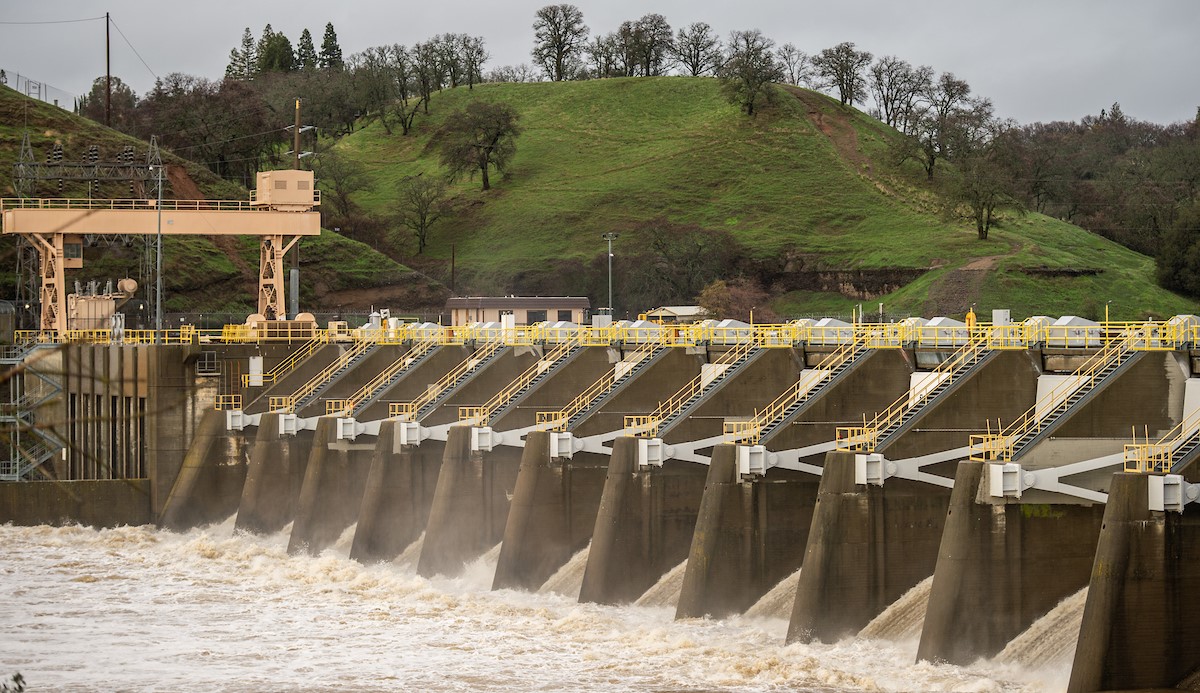
So much rain and snow may boost hydropower — good news for California’s grid
“Torrential rain across California in recent weeks has caused plenty of misery, but it could also generate some good news on the energy front: If rain and snow totals hold up, all the precipitation will boost hydroelectric production — and that would help the Golden State’s electric grid, especially in the summertime when the system comes under strain. “Based on the reservoir levels and what we’re seeing this year, we expect to have more hydroelectricity generated this year than we have for the last several years,” said Lindsay Buckley, spokesperson for the California Energy Commission. … ” Read more from the LA Times here: So much rain and snow may boost hydropower — good news for California’s grid
How much did deadly storms cost California? $1 billion and counting
“After California’s powerful winter storms finally subsided, emergency officials and accountants have stepped in to start tallying the damage. One expert said he expects the total cost to California will be over $1 billion. Damage in Sacramento County alone likely topped $123 million, according to a preliminary estimate from the county. The series of storms, which began New Year’s Eve, killed at least 20 people around the state, including five people in Sacramento County.President Joe Biden declared a major disaster Jan. 14, paving the way for additional federal funds and indicating that Washington will cover a significant portion of the cost to rebuild. … ” Read more from the Sacramento Bee here: How much did deadly storms cost California? $1 billion and counting
How do California’s storms weigh in compared with history’s big ones?
“The storms that have walloped California in fierce waves since last month have left many communities cleaning up and digging out from flooding and landslides. By one metric, though, the state has seen much worse.So far this winter, cumulative precipitation across California is well above average for the past 70 or so years, according to data from the National Oceanic and Atmospheric Administration. But it isn’t as high at this point in the season as it was in some years, including 2017, when drenching storms nearly caused a catastrophic collapse at the Oroville Dam in Northern California.The data is a reminder that nature can dish out even more to the state than what it has this season, though there’s still plenty of time for more storms to push through before the drier months. (These precipitation levels include both rain and snow. The latter is recorded as its liquid equivalent amount.) ... ” Read more from the New York Times here: How do California’s storms weigh in compared with history’s big ones?
For all their ferocity, California storms were not likely caused by global warming, experts say
“As California emerges from a two-week bout of deadly atmospheric rivers, a number of climate researchers say the recent storms appear to be typical of the intense, periodic rains the state has experienced throughout its history and not the result of global warming. Although scientists are still studying the size and severity of storms that killed 19 people and caused up to $1 billion in damage, initial assessments suggest the destruction had more to do with California’s historic drought-to-deluge cycles, mountainous topography and aging flood infrastructure than it did with climate-altering greenhouse gasses. Although the media and some officials were quick to link a series of powerful storms to climate change, researchers interviewed by The Times said they had yet to see evidence of that connection. Instead, the unexpected onslaught of rain and snow after three years of punishing drought appears akin to other major storms that have struck California every decade or more since experts began keeping records in the 1800s. … ” Read more from the LA Times here: For all their ferocity, California storms were not likely caused by global warming, experts say
In other California water news …
Column: Have no Prop. 1 water projects been built in California? No, but they are moving slowly
“California voters approved a ballyhooed $7.5-billion bond issue eight-plus years ago thinking the state would build dams and other vital water facilities. But it hasn’t built zilch. True or false? That’s the rap: The voters were taken. The state can’t get its act together. Republicans and agriculture interests in particular make that charge, but the complaint also is widespread throughout the state. There’s some truth in the allegation. But it’s basically a bum rap. No dams have been built, that’s true. But one will be and two will be expanded. And hundreds of other smaller projects have been completed. ... ” Continue reading at the Los Angeles Times here: Column: Have no Prop. 1 water projects been built in California? No, but they are moving slowly
San Joaquin County residents voice opposition to Delta Tunnel project
“When it comes to managing the boom and bust cycle of California’s water supply, Governor Gavin Newsom and the Department of Water Resources (DWR) have promoted a $16 billion project that would pump water from the delta down south. Opponents to the plan have called it a “water grab” meant to serve the interests of Los Angeles and other parts of southern California. “There’s a lot of people that live in Los Angeles, about 20 million of them. There’s a lot less who live here, and so it’s no surprise why we are overlooked on this issue time and time again,” said Rep. Josh Harder to a gathering of San Joaquin County constituents Wednesday in a town hall focusing on water. “They will drink us dry. They will turn us into a desert without putting a dent in their water use,” said one man in the crowd. … ” Read more from Channel 10 here: San Joaquin County residents voice opposition to Delta Tunnel project
Fallowing with a (re)purpose
“If you were brought up several decades ago, the traditional sustainability-conservation mantra ran something like: use it up. Wear it out. Make it do, or do without. The challenge was to find a secondary use for something like taking a small used grocery produce bag with you as a pickup package when you walked the dog or saving rubber bands and tin foil sheets for another project. It wasn’t just one-and-done — it was finding creative ways to extend the usable life of something. That concept of repurposing is being tested in three almond pilot areas in the San Joaquin Valley (Pixley Irrigation District Groundwater Sustainability Agency, Greater Kaweah GSA, Madera County GSA) where the lack of water supplies has, at least temporarily, removed acreage from production. … ” Read more from Farm Progress here: Fallowing with a (re)purpose
Dam removal puts California salmon in hot pursuit of cold water

“California salmon are now traversing a rocky stretch of river northeast of Sacramento for the first time in a century. Until a few months ago, an 8-foot concrete dam in Auburn Ravine stopped most of them from reaching miles of cool spawning habitat. NOAA Fisheries supported the planning and removal by partners of 8-foot Hemphill Dam. It had been installed in the early 1900s to divert water into the Hemphill Canal but lacked passage for native salmon and federally listed steelhead. “This is a true win for the native fish stocks in Auburn Ravine and the people who live in Placer County,” says Neal McIntosh, Natural Resources Management Specialist for NOAA Fisheries California Central Valley Office. “The Placer County Conservation Program has helped focus the community and partnering agencies by highlighting important projects like this one.” … ” Read more from NOAA here: Dam removal puts California salmon in hot pursuit of cold water
New model could help break through inefficiencies of common water treatment systems
” … [T]he most common way to treat and reuse nontraditional water supplies is through a process called reverse osmosis, which can be both expensive and energy intensive. Now, Sitaraman and Ilenia Battiato, two members of the National Alliance for Water Innovation (NAWI) research consortium, have used supercomputers to study reverse osmosis systems as a whole — a first for both the type and scale of reverse osmosis research. With their new technique, the duo also discovered a new system design that could make these technologies about 40% more energy efficient — and therefore more cost-effective — while producing the same amount and quality of clean drinking water. “Until now, people have been looking at a tiny piece of the entire reverse osmosis module and drawing conclusions from that,” Sitaraman said. “But we looked at the entire thing.” … ” Read more from Clean Technica here: New model could help break through inefficiencies of common water treatment systems
Climate crisis to worsen intensity, frequency of atmospheric rivers
“For millions of storm-weary California residents, the forecast issued by the National Weather Service early this week came as music to their ears: the barrage of atmospheric river storms that have battered their state since late December, causing widespread power outages and triggering deadly mudslides, would soon begin to diminish. But while Californians will welcome the break from torrential rains, a scientist at a University of Miami-based research institute warns that as the Earth’s climate continues to warm at a historic pace, atmospheric rivers will only become more frequent and intense. “The science is undeniable—warmer air holds more moisture; and as a result, the concentration of water vapor increases,” said Breanna Zavadoff, an assistant scientist at the Cooperative Institute for Marine and Atmospheric Studies (CIMAS). “Our planet’s atmosphere has warmed by about 1.3 degrees Celsius since pre-industrial times; and if we continue at that rate, climate models show that atmospheric river frequency and strength across the globe could increase by as much as 50 percent and 25 percent, respectively.” … ” Read more from the University of Miami here: Climate crisis to worsen intensity, frequency of atmospheric rivers
In regional water news and commentary today …
NORTH COAST
New restoration project kicks off on Scott River tributary
“As drought persists and future impacts of climate change threaten, salmonids across the state will increasingly seek out refuge from warming waters. Cold-water streams like Big Mill Creek, a tributary to the East Fork of the Scott River, offer important refuge for these fish including the federal and state threatened coho salmon. In the next few years, CalTrout, with the support of The Wildlands Conservancy and our project partners, will prepare to implement a project to restore fish access to upstream habitat in Big Mill Creek creating impacts that could ripple throughout the whole watershed. “The East Fork represents an opportunity to increase resilience in the Scott River,” Mt. Shasta/Klamath Region Project Manager Serena Doose explained. Much of the river is warm, but there are cold-water pockets where thousands of coho salmon can be found. “There’s a lot of potential there.” … ” Read more from Cal Trout here: New restoration project kicks off on Scott River tributary
MOUNTAIN COUNTIES
Breach of Contract alleged as Placer County Water Agency files suit against PG&E
“Placer County Water Agency (PCWA) has filed suit against Pacific Gas & Electric Company (PG&E) in Sacramento County Superior Court for breach of contract. This action follows disclosure of PG&E’s intent to transfer substantially all its power generating assets, including its Drum-Spaulding Hydroelectric Project in Placer County, to a subsidiary recently formed by PG&E. Under a Water Supply Agreement with PG&E, PCWA is entitled to approximately 125,000 acre-feet of water supplied by this project, which is the principal source of water for Placer County residents and businesses. ... ” Read more from Roseville & Rocklin Today here: Breach of Contract alleged as Placer County Water Agency files suit against PG&E
SACRAMENTO VALLEY
North state rice farmers encouraged by rain
“Rainfall from the recent storms in California have been an encouraging sign for rice farmers in the north state. Lake Oroville, which feeds water to farmers along the Feather River, has surpassed its historical average capacity for this time of year with its elevation measured at about 779 feet on Sunday, a rise of more than 100 feet since Dec. 1. The lake is at 56% of its total capacity and carries more water now than last year’s highest recorded capacity of 55% in May 2022, according to data from California Department of Water Resources. And Lake Shasta, which feeds water to farmers along the Sacramento River, reached 51% of its capacity Sunday which equals to 81% of the historical average for the date. … ” Read more from the Chico Enterprise-Record here: North state rice farmers encouraged by rain
Butte County sees one of the wettest winters in 25 years of record keeping
“This winter has become the reigning champion in rain for Butte County. Scott Rowe, a meteorologist with the National Weather Service’s Sacramento office, said Butte County has had a total of 13.57 inches of rainfall according to the monitoring station at the Oroville Airport since Dec. 1, 2022, the most the county has had since the digital records that have been kept since 1999. To put that into perspective, Butte County received a mere 5.96 inches of rainfall for the same time period last year. The water is much needed as there is little rain in the forecast for the week outside of scattered showers Wednesday night that Rowe said wasn’t as wet as recent storms. ... ” Read more from the Chico Enterprise-Record here: Butte County sees one of the wettest winters in 25 years of record keeping
Ótakim Séwi (Big Chico Creek) Fish Passage Project recommended for funding
“A fish passage improvement project led by CalTrout and partners on Ótakim Séwi (Big Chico Creek), east of the City of Chico, has been recommended for funding from the National Oceanic and Atmospheric Administration (NOAA). The project is one of only 36 projects targeted by NOAA and was secured through a highly competitive grant application process. CalTrout and partners, including the city of Chico, Big Chico Creek Ecological Reserve, The Mechoopda Tribe, California Department of Fish and Wildlife, and others will be working to remove a fish passage barrier in Iron Canyon, restoring access to more than 8 miles of critically needed spawning and rearing habitat for steelhead and spring-run Chinook salmon in the upper reaches of the creek, including cold water habitat critical for climate resilience. ... ” Read more from Cal Trout here: Ótakim Séwi (Big Chico Creek) Fish Passage Project recommended for funding
Sites Reservoir team discusses hopes and hurdles
“Water availability has become a critical issue in the face of ongoing drought, and one prominent potential solution remains elusive. The proposed sites reservoir in Glenn and Colusa counties was first envisioned in the 1980s, but has yet to become a reality despite bipartisan support. Executive Director of the Sites Project Authority Jerry Brown described the critical junction the project is at now, with the upcoming completion of environmental studies as well as a vital application process.
“Another key element that’s in play right now is the application for a new water right. All of the water that will be stored in Sites will be Sites water under this new water right, and so we have to go through a process with the state Water Resource Control Board and we initiated that process last May and they provided us with some questions and requests for additional information. We’ve responded to that and now just recently and we expect to hear back from them very shortly that they should be accepting our application.” … ” Read more from KRCR here: Sites Reservoir team discusses hopes and hurdles
Folsom Lake ‘doing well’ as inflow, level rises
“Once again, Mother Nature wreaked havoc on the Sacramento region this past week, bringing record rainfall, wind and plenty of damage and distress throughout the county and beyond to the point that President Biden approved a declaration for several California counties to be included in a national disaster emergency status. While the storms have caused power failures, tree damage and severe flooding in many areas, the one bit of positivity they have dealt is the much-needed rainfall and snow in the Sierra to combat the drought conditions we have endured the last several years. As of press time this week, the levels at Lake Folsom were sitting at 419 feet above average sea level, just 47 feet below what is considered “full.” The impressive levels stand, even with the many controlled water releases taking place daily. … ” Read more from Gold Country Media here: Folsom Lake ‘doing well’ as inflow, level rises
Where does the stormwater in Sacramento go?
“The Sacramento area, along with the rest of the state, endured heavy rainfall through a series of storms since late December. Water from the American River caused Discovery Park to flood and caused the level of the Sacramento River to rise. As sunny days are ahead in the Sacramento area, where does the stormwater actually go? Levees and pumping stations around the region help play a part in keep populated areas and roadways from flooding. “We have lots of layers of flood protection and one of the most basic ways to describe it is that the City of Sacramento is surrounded by levees,” said City of Sacramento Department of Utilities spokesperson Carlos Eliason. “That’s because we sit at a low elevation in the Sacramento Valley and water naturally wants to find the lowest point.” … ” Read more from Fox 40 here: Where does the stormwater in Sacramento go?
NAPA/SONOMA
Releases from Lake Mendocino seek to balance storage, recreation needs
“The recent large releases of water from Lake Mendocino are designed to restore the reservoir to “healthy” levels that both reduce flood risk and allow its operators to provide recreational activities along with water storage, the U.S. Army Corps of Engineers explained this week. “A ‘healthy’ lake includes boating and camping, which are activities we would like to offer again,” said Nick Malasavage, chief of the Operations and Readiness Division of the USACE district headquarters in San Francisco. He was reached for comment Tuesday afternoon, about 24 hours after the first “high-flow” releases in nearly four years began at Coyote Valley Dam. “We don’t just release the water on a willy-nilly basis,” Malasavage said when asked why so much water was being released at a time when the lake had not reached full storage capacity of about 116,000 acre-feet, and also when a stretch of dry weather is now in the extended forecast. ... ” Read more from the Ukiah Daily Journal here: Releases from Lake Mendocino seek to balance storage, recreation needs
BAY AREA
S.F. storm damages could top $46 million. How will city prepare for more climate-driven devastation?
“The rain had just started to wallop San Francisco on New Year’s Eve when Molly Bradshaw saw a pool of water creeping toward the back entrance of her Mission District bowling alley. She had been flooded before, and wasn’t going to let it happen again, so she grabbed a bucket and got to work. … While the near-record rainfall that hit San Francisco was certainly a factor in the flooding, the city’s antiquated sewer system compounded the problem. Now, after another round of punishing rains left San Francisco this week — causing at least $46 million in damages to homes, businesses and city-owned property — the weather’s impact on the region has brought into sharp relief the challenge the city and its residents and business owners face with future storms. The atmospheric river that lashed San Francisco on Dec. 31 far exceeded what city leaders said they’d expected, leading to an initially chaotic and uncoordinated response. … ” Read more from the San Francisco Chronicle here: S.F. storm damages could top $46 million. How will city prepare for more climate-driven devastation?
SEE ALSO: How long will Bay Area storm repairs take?, from the San Jose Mercury News
Will your water bill decrease due to recent rain?
“All of the recent rain has people wondering if their water bill will start to go down. John Tang, a vice president of the San Jose Water company, said he understands why the public would expect water rates to go down, especially since the company raised rates recently with the approval of the California Public Utilities Commission. But he pointed out that San Jose Water is a retailer subject to rising taxes and the cost of service from its wholesale supplier: the water district. “The water, when you think about it, is really free,” he said. “It falls from the sky. What costs money is actually collecting it and transporting it to the state and federal water projects and getting it here to the valley where it’s treated and put into pipes and delivered to homes and businesses.” ... ” Read more from NBC Bay Area here: Will your water bill decrease due to recent rain?
7-foot tides return to SF Bay Area, flooding expected on bay front and coast
“Tides as high as 7 feet are returning to the San Francisco Bay Area, which has been battered by intense storm surges and monster waves in recent weeks amid a parade of California storms, according to the National Weather Service. The king tides, which usually occur in December and January, are expected to start Thursday and continue through Monday, impacting the coast and bay shoreline. “We’ll see some localized flooding over low-lying areas, along the bay shoreline and along the coast,” Jeff Lorber, a meteorologist with the National Weather Service, told SFGATE on Wednesday. “You will see some flooding in parking lots. The Embarcadero in San Francisco usually sees some flooding. Low-lying areas of Marin County … that’s one of the most common areas for flooding.” ... ” Read more from SF Gate here: 7-foot tides return to SF Bay Area, flooding expected on bay front and coast
CENTRAL COAST
Salinas residents blame flooding on the county for lack of creek maintenance outside city jurisdiction.
“Dozens of sandbags, like a small barricade, are outside of several homes and garages on the low side of Paul Avenue in Bolsa Knolls in North Salinas. By Monday afternoon, Jan. 9, there is almost no trace of the flooding that covered several streets in the vicinity with murky water just a few hours earlier. Lisa Wise, who has lived on Paul Avenue since 1992, says the flooding came after 8am and receded after noon. Wise knew about the evacuation order Monterey County officials issued only after the water was receding, but neither she nor her neighbors left. Instead, they stayed to clean out storm drains. “All of our neighbors are in their slickers out here, putting up sandbags and cleaning out the culverts and protecting each other’s property because no one else is doing it for us,” she says.Neighbors say flooding in the area could be prevented with more cleaning and maintenance of Little Bear Creek. … ” Read more from Monterey Weekly here: Salinas residents blame flooding on the county for lack of creek maintenance outside city jurisdiction.
Creative problem solving clears the path for a long-awaited housing project in Seaside.
“A long-stalled affordable housing project in Seaside appears ready to move forward: On Jan. 5, Seaside City Council approved an agreement with Cal Am to use the city’s stored water credits to serve the project, which will finally clear the hurdle that kept the project in limbo for years. The project, known as Ascent, will be located on 2.85 acres on Broadway Avenue between Terrace and San Lucas streets. It will have 106 units – a mix of one-, two – and three bedrooms – 16 of which will be affordable. City Council approved Ascent in November 2019, and the site was demolished. The plan was to serve it with water using credits from the developer and the city – the project would use about 13 acre-feet annually – but Cal Am wouldn’t set a water meter to serve it due to the state’s cease-and-desist order regarding overpumping of the Carmel River. So Seaside got creative. … ” Read more from Monterey County Weekly here: Creative problem solving clears the path for a long-awaited housing project in Seaside.
A floodplain restoration project near the lower Carmel River is inching closer to reality.
“As parts of the Carmel Valley flooded last week, it highlighted the stark risks of living in a floodplain, and for some residents, perhaps, was a reminder that they indeed live in a floodplain. But for residents and businesses in lower Carmel Valley, there is hope that in the future those risks will be less. Since 2010, Big Sur Land Trust has been working on a “green infrastructure” project called Carmel River FREE (Floodplain Restoration and Environmental Enhancement) that would restore a former agricultural field in a natural floodplain that would give the river another path to the sea when its flows get high. The 128-acre property, known as Odello East, was donated to BSLT by Clint and Margaret Eastwood. It is located south of the river and just east of Highway 1. “With these atmospheric rivers we’ve all been experiencing, it’s a very vivid reminder, and a painful reminder, of the need for a green infrastructure project like this,” says Rachel Saunders, BSLT’s director of conservation. “We hope all the agencies get a renewed sense of urgency to get this project to happen.” … ” Read more from Monterey Weekly here: A floodplain restoration project near the lower Carmel River is inching closer to reality.
Farmland across San Luis Obispo County ravaged by storms
“As a result of the recent heavy rainfall, the Central Coast is hydrated — the hills luscious and green and reservoir levels are getting higher. However, farmers explain that while they are thankful for the rain, it was too much at once. Because of the atmospheric river event, the ground was already saturated by the time the most recent string of rainstorms hit. “So basically everything, all the rain, was just runoff. It filled this ditch here completely and the last time that I had seen this run at full capacity and overflowing was back in 1995,” said Ryan Talley of Tally Farms. … ” Read more from KSBY here: Farmland across San Luis Obispo County ravaged by storms
SAN JOAQUIN VALLEY
California’s next flood could destroy one of its most diverse cities. Will lawmakers try to save it?
“In early 1862, a storm of biblical proportions struck California, dropping more than 120 inches of rain and snow on the state over two months. The entire state flooded, but nowhere was the deluge worse than in the Central Valley, a gash of fertile land that runs down the midde of the state between two mountain ranges. In the spring, as melting snow mixed with torrential rain, the valley transformed into “a perfect sea,” as one observer put it, vanishing beneath 30 feet of water that poured from the Sacramento and San Joaquin Rivers. More than 150 years later, climate scientists say the state is due for a repeat of that massive storm. A growing body of research has found that global warming is increasing the likelihood of a monster storm that could inundate the Central Valley once again, causing what one study from UCLA and the National Atmospheric Center called “historically unprecedented surface runoff” in the region. … In the crosshairs of that storm is the Stockton metropolitan area, which sits at the mouth of the San Joaquin River. ... ” Continue reading at Grist here: California’s next flood could destroy one of its most diverse cities. Will lawmakers try to save it?
New project seeks to stop releasing flood water to ocean in California
Turlock Irrigation District is trying to better capture and utilize the storm water that might be flushed out to ocean through FloodMAR.
SOUTHERN CALIFORNIA
After rains, trash flushes from far inland to beaches and ocean. What’s being done to stop it?
“As storms soak Southern California and runoff from the rain rushes down rivers and channels, water isn’t the only thing flowing into the ocean. Trash and debris, pet poop, toxic chemicals and pesticides all get flushed from streets, gutters and sewers, flowing into channels, creeks and, eventually, the ocean. Piles of debris dump onto beaches, not only creating an unsightly landfill-like seascape, but also a hazard for sea creatures and birds that mistake the trash for a treat. … “Trash severely threatens habitat and wildlife, causes entanglement, makes habitat unsuitable, (it) has human health impacts – there’s all kinds of gross reasons trash isn’t welcome in our waters and shouldn’t get there,” said Lauren Chase, staff attorney for Orange County Coastkeepers and Inland Empire Waterkeeper. “Storm water trash transport is the No. 1 source, the main pathway.” … ” Read more from the OC Register here: After rains, trash flushes from far inland to beaches and ocean. What’s being done to stop it? | Read via the Mercury News
For CA surfers, recent storms bring colossal waves but poor water quality
“The record storms that pummeled California have also been a boon to Southern California surfers, who have been riding massive waves the likes of which haven’t been seen in years. “This is probably the best swell in the past 25 years,” says longtime surfer Mitt Seely at Topanga Beach. “We’re definitely spoiled right now because we’ve had almost a week of solid surf, and more than we normally get.” According to Glen Walsh, who reports on the daily surf through his Instagram account, the waves have been reaching as high as 10-15 feet at Venice Beach, and even higher in other places. “A lot of days, it was pretty unrideable,” says Walsh. “The best of the best should be out there. And a lot of them were with cameras, with crews, getting some incredible shots and video.” ... ” Read more from KCRW here: For CA surfers, recent storms bring colossal waves but poor water quality
Groundwater Replenishment System celebrates 15th anniversary
“The world-renowned Groundwater Replenishment System (GWRS) celebrates its “crystal anniversary” this month, marking 15 years of doing what was once “unthinkable”—purifying wastewater into high-quality drinking water. A joint project of the Orange County Water District (OCWD; the District) and the Orange County Sanitation District (OC San), the GWRS made history when it came online in 2008, overcoming the stigma associated with these types of projects and bringing water reliability to Orange County. “Today, we celebrate this remarkable achievement made possible by the unique, longstanding collaboration of our agencies along with the support of our local water retailers, and so many other stakeholders along the way,” said OCWD Board President Cathy Green. “This award-winning project provides local reliability to our region, decreases our dependence on imported water and serves as a model for the rest of the world.” … ” Continue reading from the Orange County Water District here: Groundwater Replenishment System celebrates 15th anniversary
SAN DIEGO
Half-million gallons of sewage spill into San Diego Bay
“A malfunction at a wastewater pumping station spilled 500,000 gallons of raw sewage into San Diego Bay, authorities said. More than six miles of shoreline were closed or posted with warning signs after the spill Monday afternoon sent untreated wastewater flowing out of manholes and into storm drains downtown and in the Midway area instead of going to a treatment plant, the San Diego Union-Tribune reported Wednesday. A sensor malfunction caused pumps to shut down for about a half-hour, backing up wastewater which then spilled in areas leading to the bay, city spokesperson Arian Collins said. … ” Read more from the Associated Press here: Half-million gallons of sewage spill into San Diego Bay
SEE ALSO: 500,000 gallons of raw sewage fouls San Diego Bay after broken sensor shuts down pumps, from the San Diego Union-Tribune
Along the Colorado River …
These farmers dominate the Colorado River. Cross them at your peril
 Sammy Roth writes, “The letter from Arizona Sen. Mark Kelly was greeted like an act of war in California’s Imperial Valley. Writing in October, the astronaut-turned-politician urged the Biden administration to withhold funding for the dying Salton Sea until California committed to using less Colorado River water. Never mind that allowing the desert lake to keep drying up would result in hazardous dust pollution choking the Imperial Valley’s low-income, largely Latinx population. Betty Miller, editor in chief of Imperial news publication the Desert Review, wrote that Kelly “is willing to subject those living around the Salton Sea, people, birds, fish, and more to a spiral of declining health so he can look like a hero to his constituents.” “He shows a careless disregard for life,” Miller wrote. Unlike most Californians, I’ve spent a lot of time in Imperial, reporting dozens of stories there over the last decade. It’s a beautiful and at times unspeakably sad place. The poverty is as wrenching as the verdant farm fields are gorgeous at sunset. The amount of water consumed by those farms is mind-boggling. The irrigation district has been plagued by allegations of corruption. And the potential to help solve the climate crisis is enormous. ... ” Read more from the LA Times here: These farmers dominate the Colorado River. Cross them at your peril
New CAP general manager optimistic about agreement on Colorado River water cuts
“Brenda Burman, the new general manager for the Central Arizona Project (CAP), is optimistic that Arizona and other Colorado River basin states can agree on how to conserve 2 million to 4 million acre-feet of water per year. If they are unable to, the feds will impose a resolution for them. State of play: Burman takes over CAP at a precarious moment, with Arizona and the rest of the basin struggling through a prolonged drought that began in 2000 and ranks as the region’s worst in 1,200 years. Burman tells Axios Phoenix that the Bureau of Reclamation plans to issue a draft of a supplement to a 2007 environmental impact statement (EIS) on Colorado River conditions in March or April and that it needs data from the basin states in February. ... ” Continue reading at Axios here: New CAP general manager optimistic about agreement on Colorado River water cuts
Arizona: Water availability could restrict future development
“Tom Buschatzke says it wouldn’t be wrong to see the freeze on new development in an area in and around Buckeye due to a shortage of groundwater there as the canary in the coal mine. But the director of the state Department of Water Resources said that the early warning for Arizonans first occurred three years ago in Pinal County: His agency already is refusing to issue the necessary permits for new developments that were planning to rely solely on groundwater. More to the point, he said, much of the rest of this drought-stricken state is headed that way absent some new source of water. In a wide-ranging interview with Capitol Media Services, Buschatzke said that communities are not immune just because they have an allocation of water from the Central Arizona Project. … ” Read more from the East Valley Tribune here: Arizona: Water availability could restrict future development
Utah water policy ‘playing catch up when it should be leading the pack,’ according to new report
“Utah has made strides in improving its wasteful water practices in recent years, but as a new report by a collection of water providers, industries and conservation groups shows, it still has a long way to go. Low water levels have triggered an ecological collapse at the Great Salt Lake. Mega-reservoirs like Lake Powell and Lake Mead have dropped to critical lows, heating up legal spats between the states that rely on them. It’s spurred Utah lawmakers to pass a flurry of bills addressing water conservation, and they say they’re prepared to do more in the days ahead. A new report, however, calls for more aggressive measures. “Utah urgently needs further investments in water efficiency and conservation,” said Ron Burke, president and CEO of the Alliance for Water Efficiency, in a news release titled “Progress has been made in recent years, but in many ways, Utah is playing catch up when it should be leading the pack.” … ” Read more from the Salt Lake Tribune here: Utah water policy ‘playing catch up when it should be leading the pack,’ according to new report
‘Extreme’ drought completely eliminated in California; Colorado River Basin lags behind
““Extreme” drought has been completely eliminated in California for the first time in nearly three years, according to the U.S. Drought Monitor. While the drastic change for California has happened over the last few weeks, the most recent batch of rain has completely eliminated the “extreme” drought category. However, while smaller reservoirs have returned to averages, many larger ones still remain low, according to experts. And it’s still “too early to tell if the wet weather is enough to end the drought.” While drought in the western U.S. continues to improve overall, the Colorado River Basin lags behind the Sierra Nevadas in terms of recovery. It will take several seasons such as this one to help eliminate the drought in the area, which includes reservoirs Lake Mead and Lake Powell. ... ” Read more from ABC News here: ‘Extreme’ drought completely eliminated in California; Colorado River Basin lags behind
How Lake Mead water levels look after weeks of heavy rainfall
“California and Nevada have had extremely heavy rainfall in recent days, during one of the severest droughts the region has ever seen. So what does that mean for the water levels at Lake Mead? Lake Mead’s water levels are rapidly declining due to the drought. The reservoir—which stretches across Nevada and Arizona, on the Colorado River—is relied upon by 25 million people living in the region. … So, the rain has undoubtedly been a welcome water source for the lake. And Lake Mead’s water levels are currently 0.3 percent higher than originally predicted in December, the Bureau of Reclamation said, according to a News Now report. ... ” Read more from MSN News here: How Lake Mead water levels look after weeks of heavy rainfall
In national water news today …
Federal agencies release final WOTUS rewrite
 “The Environmental Protection Agency (EPA) and the Army Corps of Engineers (Corps) today published a final rule revising the definition of “waters of the United States” (WOTUS). The rule will become effective on March 20. The final rule applies federal protections to traditional navigable waters, the territorial seas, interstate waters, as well as upstream water resources that significantly affect those waters. Adjacent wetlands could receive protection if they meet either the “relatively permanent” or “significant nexus” tests set forth in the U.S. Supreme Court case Rapanos v. United States. … ” Read more from ACWA’s Water News here: Federal agencies release final WOTUS rewrite
‘It’s time to start suing’: States tee up next WOTUS war
“Red states are preparing to slug it out in the courts over one of the Biden administration’s signature environmental rules. Texas Attorney General Ken Paxton announced Wednesday he filed a challenge against the new EPA and Army Corps of Engineers definition of which waterways and wetlands are subject to federal permitting requirements. “Legal action is necessary to curtail this Administration’s continued intrusion into the rights of Texans and our ability to control our own natural resources,” Paxton said in a news release. “I’m proud to file this lawsuit challenging Biden’s WOTUS rule and remain committed to pushing back against the Biden Administration’s radical climate agenda.” The announcement came just hours after Texas oil and gas regulators approved a motion Wednesday urging Paxton to challenge the new rule. “It’s time to start suing,” said Texas Railroad Commissioner Christi Craddick during an agency meeting. “I think the AG’s going to have a good time with this one.” … ” Read moref rom E&E News here: ‘It’s time to start suing’: States tee up next WOTUS war
Legal brief: Clean water rule
“Texas is challenging the Biden administration’s new rule that expands the definition of “waters of the United States” to protect small streams, wetlands and other waterways under the Clean Water Act.” Read the complaint via Courthouse News here: Texas clean water rule
EPA’s Regan: government ‘waited too long’ to fix national water infrastructure
“As a growing number of communities around the U.S. face drinking water and wastewater infrastructure problems, it has become clear that public trust in official institutions to deliver these services is eroding. But recent acknowledgement from the country’s foremost environmental protection official signaled recognition of these problems and a dedication to improve things for traditionally underserved populations. “The federal government has ‘waited too long’ to invest in water infrastructure, U.S. Environmental Protection Agency Administrator Michael Regan told NBC News in an interview,” the outlet reported. “‘Unfortunately, there are certain populations in this country, Black and brown communities, tribal communities, low-income communities, that are seeing the worst aspects of this disinvestment,’” he continued. … ” Read more from Water Online here: EPA’s Regan: government ‘waited too long’ to fix national water infrastructure
Environmental lawyers to watch in 2023
“Federal court dockets in 2023 will be loaded with cases that could decide the fate of U.S. water, air and climate policy. Environmental attorneys have been busy crafting their arguments in legal battles on issues like the federal government’s duty to examine the environmental impacts of oil leasing and the fossil fuel industry’s obligation to pay for fires, storms and other effects of a warming planet. Some of those cases have already arrived at — or could soon make their way to — the Supreme Court. The Biden administration is also preparing to address disproportionate pollution in Black communities, roll out a raft of robust climate rules and defend its retooling of the nation’s clean water safeguards. Conservative attorneys say they are ready to sue over each of those efforts. Here are 10 lawyers to watch in the legal battles and policy debates of 2023 that will shape the future of federal environmental protections. … ” Read more E&E News here: Environmental lawyers to watch in 2023

