

From the Department of Water Resources:
The statewide snowpack – source of much of the California’s water supply – is only 83 percent of the March 1 average, the result of moderate precipitation since last October and relatively warm temperatures.
“Mother Nature is not living up to predictions by some that a ‘Godzilla’ El Niño would produce much more precipitation than usual this winter,” said DWR Director Mark Cowin. “We need conservation as much as ever.”
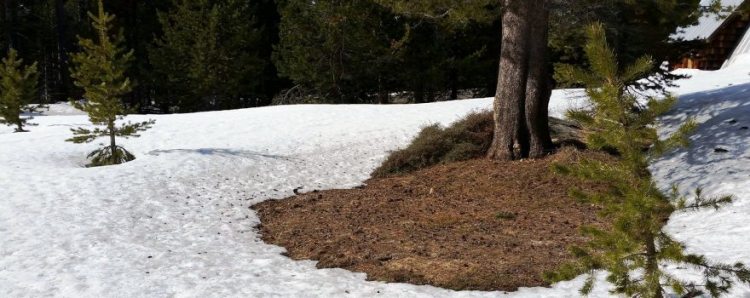
The Department of Water Resources (DWR) conducted its third media-oriented snowpack survey of the season today 90 miles east of Sacramento just off Highway 50 in the Sierra Nevada. Phillips Station is one of about 250 snow courses measured manually several times each winter.
Frank Gehrke, chief of the California Cooperative Snow Surveys Program, and his survey team measured snow that was 58.3 inches deep at Phillips with a water content of 27.1 inches. The Phillips readings are the best for early March since 2011 , but individual snow courses are not generally representative of the entire mountain snowpack.
The statewide readings suggest this may not be a drought-busting year unless California receives heavy rain this month as it did during the “March Miracles” of 1991 and 1995.
“Right now, we’re obviously better than last year but still way below what would be considered adequate for any reasonable level of recovery at this point,” Gehrke said.
Electronic readings of northern Sierra Nevada snow conditions found 23.1 inches of water content 89 percent of normal for March 1), 21.7 inches in the central region (85 percent of normal) and 17 inches in the southern region (75 percent of normal).
Today’s snow measurements at Phillips were markedly improved compared to March 2015, when the depth was only 6.5 inches and the water content just 1 inch. Dry conditions persisted in March, and Governor Edmund G. Brown Jr. stood on bare ground on April 1 when he mandated a 25-percent reduction in water use throughout California.
Traditionally, half of the state’s annual water falls as rain or snow during December, January and February. Precipitation in December and January measured at weather stations monitored electronically by DWR was 170 percent of the two-month average, but October, November and February rainfall was far below normal. Snowfall since December 1 has mirrored that pattern.
In normal years, the snowpack supplies about 30 percent of California’s water needs as it melts in the spring and early summer. The greater the snowpack water content, the greater the likelihood California’s reservoirs will receive ample runoff as the snowpack melts to meet the state’s water demand in the summer and fall.
Results of today’s manual readings by DWR near Echo Summit are as follows:
Location Elevation Snow Depth Water Content % of Long-Term Average Alpha 7,600 feet 60.5 inches 22.5 inches 77 Phillips Station 6,800 feet 58.3 inches 27.1 inches 105 Lyons Creek 6,700 feet 70.5 inches 27 inches 93 Tamarack Flat 6,550 feet 60 inches 25 inches 97 Among the eight reservoirs with capacities of 1 million acre-feet (MAF) or more tracked by DWR at the website below, all are currently below average storage for this date, from New Melones (31 percent) to Lake Shasta (83 percent). The only major reservoir with current storage above its historical average on this date is Folsom Lake (111 percent).
Detailed information on major reservoir storage is found here: http://cdec.water.ca.gov/cdecapp/resapp/getResGraphsMain.action
Electronic snowpack readings can be found at: http://cdec.water.ca.gov/cdecapp/snowapp/sweq.action
For earlier readings, click the calendar icon below the map, select a date, then Refresh Data.
Governor Brown declared a drought State of Emergency on January 17, 2014 and directed state officials to take all necessary actions to prepare for water shortages. On April 1, 2015, when the statewide snowpack’s water content was historically low at 5 percent of that date’s average, Governor Brown mandated a 25-percent reduction in water use across the state.
Conservation – the wise, sparing use of water – remains California’s most reliable drought management tool. Each individual act of conservation, such as letting the lawn go brown or replacing a washer in a faucet to stop a leak, makes a difference over time.
Water Year 2016 precipitation is found at: http://cdec.water.ca.gov/snow_rain.html Look in the right-hand column for the Northern Sierra 8-station index for updated rainfall readings in the critical northern portion of the state, as well as the San Joaquin 5-station and Tulare Basin 6-station links
For a broader snapshot of current and historical weather conditions, see DWR’s “Water Conditions” and “Drought” pages:
Water Conditions Page: http://www.water.ca.gov/waterconditions/waterconditions.cfm
Drought Page: http://www.water.ca.gov/waterconditions/index.cfm
Everyday water conservation tips at Save Our Water: http://www.saveourwater.com
Information on the State’s turf and toilet rebate program: http://www.saveourwaterrebates.com/
——————————————–
Sign up for daily email service and you’ll always be one of the first to know!
- Sign up for daily emails and get all the Notebook’s aggregated and original water news content delivered to your email box by 9AM. Breaking news alerts like this one, too. Sign me up!
 Maven’s Notebook
constantly watching over the world of California water
