

Since the passage of the Sustainable Groundwater Management Act (SGMA) in September of 2014, the Department of Water Resources (DWR) has been working to fulfill its statutory obligations under the legislation. With the overwhelmingly successful formation of Groundwater Sustainability Agencies (GSAs) this summer, the focus of the Department now turns to the development and adoption of Groundwater Sustainability Plans (GSPs). At the December meeting of the California Water Commission, DWR staff reported on their implementation efforts to date.
Taryn Ravazzini, Deputy Director for DWR and Executive Sponsor for the Department’s Sustainable Groundwater Management Program began the presentation with some opening remarks.
“The Department has a unique role when it comes to SGMA implementation because not only are we required to review these plans that are coming before us, which is a regulatory role from developing those regulations, but then we also have a very robust assistance role in technical, financial, and planning assistance,” she said. “This is really where the Department has its strength in working at the local and regional levels to really help these GSAs pull together what we hope to be adequate plans for sustainable groundwater management.”
UPDATE ON GROUNDWATER SUSTAINABILITY AGENCY FORMATION
Mark Norberg, Senior Engineering Geologist with Sustainable Groundwater Management program, then updated the Commissioners on the Groundwater Sustainability Agency (GSA) formation process, noting that overwhelmingly, local agencies did a great job with 99.9% of the basins subject to SGMA being covered by a GSA.

The remaining areas not covered are mostly small fringe areas on the outside of adjudicated basins or very small areas that weren’t covered by a local agency. Counties had the responsibility to cover the unmanaged areas, and most of them did step up, he noted.
In total, 265 GSA notifications were received. The GSAs come in all shapes and sizes, from local agencies covering a small portion of one basin to local agencies that covered all the alluvial basins in the entire county; Some local agencies posted multiple notifications.
All totaled, 141 basins now have GSAs, 108 of which are subject to SGMA. The other 33 basins are low or very-low priority basins or don’t yet have a priority. Most of those basins were covered by counties, for example, Imperial County and Tehama County. Alternatives plans were submitted by 22 basins; 11 of those basins have full GSA coverage and 9 of those basins don’t have any GSAs formed.
BASIN BOUNDARY MODIFICATIONS
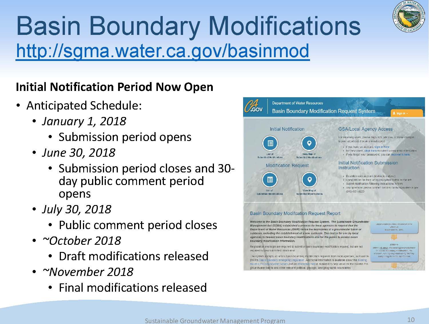 A second round of Basin Boundary Modifications will formally open on January 1st that will go through June 30, 2018. Once the period closes, DWR will be accepting public comments for a period of at least 30 days. They anticipate getting draft modifications out by October of next year with final modifications released in November or by the end of the year.
Basin boundary modifications can be either jurisdictional or scientific modifications. As part of this process, the Department will draft recommendations, conduct public hearings, and present those basin boundary requests to the Water Commission. The Water Commission’s role in this aspect of SGMA is to hear and comment on the draft modifications.
PLANNING, TECHNICAL, AND FINANCIAL ASSISTANCE
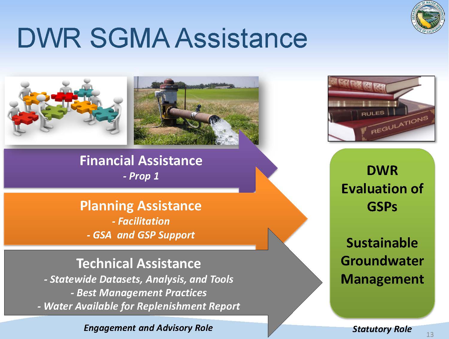 As part of SGMA implementation, the Department is providing planning, technical, and financial assistance. Their role now is more of an engagement and advisory role that focuses on getting the local agencies the information that they need to make informed decisions to develop the groundwater sustainability plans (GSPs).
Groundwater sustainability plans for the state’s 21 critically overdrafted basins are due by January 31st, 2020; in the other high priority basins, GSPs are due January 31st, 2022. Alternative plans were submitted by 22 basins; those alternatives are being reviewed for functional equivalency to a GSP and substantial compliance.
Planning Assistance
The Department has contracted with a variety of professional facilitators that were available to assist local agencies in GSA formation. The facilitators assisted with meeting facilitation, interest- based negotiation, consensus building, and public outreach within the basins. The facilitators helped local agencies work through some challenging governance situations, Mr. Nordberg said.
Facilitation support is also available for development of GSPs. Local agencies can apply online; requests are reviewed on a case by case basis. The Department is focusing on the critically overdrafted basins first as their plans are due two years before the other basins.
The Department has initiated points of contact in their regional offices, located in Red Bluff, West Sacramento, Fresno, and Glendale. The points of contact will help connect local agencies to groundwater experts in the Department as well as organize the consistent flow of information with the SGMA program.
For a PDF of the points of contact at DWR’s regional offices, click here.
Technical Assistance
Steven Springhorn, Senior Engineering Geologist, next described the technical assistance efforts underway at the Department. He noted that the team has been working hard to provide tools and datasets as quickly as possible to aid the GSAs in development of their groundwater sustainability plans.
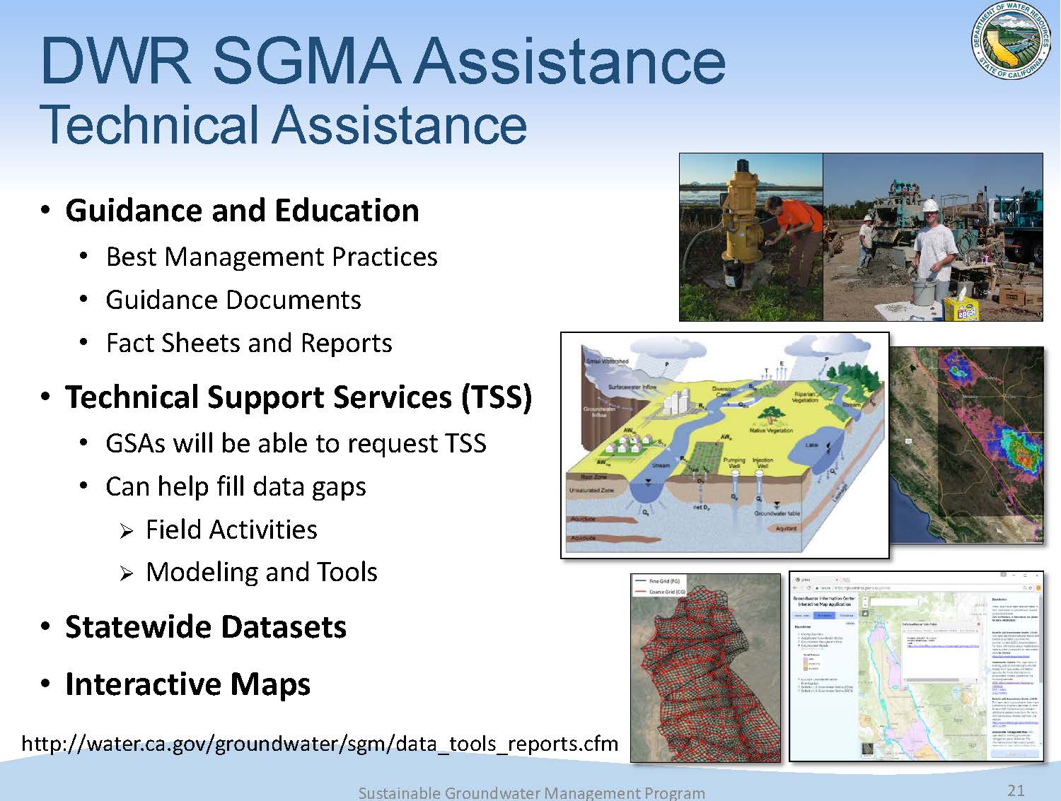
The technical assistance is divided into 3 main categories:
- Guidance and education: This is working towards a common understanding of SGMA and the new requirements, and providing resources such as best management practices and other guidance documents.
- Technical support services: Engaging with the GSAs on a technical nature, such as the ability to install monitoring wells and provide modeling tools.
- Statewide datasets, maps, and tools: The goal is to compile the existing information and make that readily available for the GSAs to use in their plans.
Mr. Springhorn then discussed each of the major components.
Guidance and education
 The Department’s guidance and education efforts are focused on building a common understand of the GSP and SGMA requirements. This starts with fundamental knowledge of groundwater such as Bulletin 118 and the California Water Plan, and they have a dedicated SGMA website for all their information is stored and easily accessible.
They have also developed SGMA-specific references, such as the best management practices. Last year, five best management practices were developed that focused on the critical elements of the groundwater sustainability plans and provided some additional guidance and resources to tackle some of the more complex issues that GSAs have to develop in their plan. Other guidance documents have been developed that provide additional information on important elements of the planning process, such as GSP outlines, documents on engagement with tribal governments, and stakeholder communication and engagement.
The team recently released a sixth best management practice focusing on the Sustainable Management Criteria in draft form for public comment; the comment period closes on January 8th. “That’s truly the heart of the groundwater sustainability plan,” he said. “That’s where sustainability is defined and tracked through time.”
The Department is looking at continuing this form of assistance, because they have received good feedback on their efforts. Additional best management practices could be developed for issues such as water quality, data management systems, and surface water-groundwater interactions.
Technical assistance
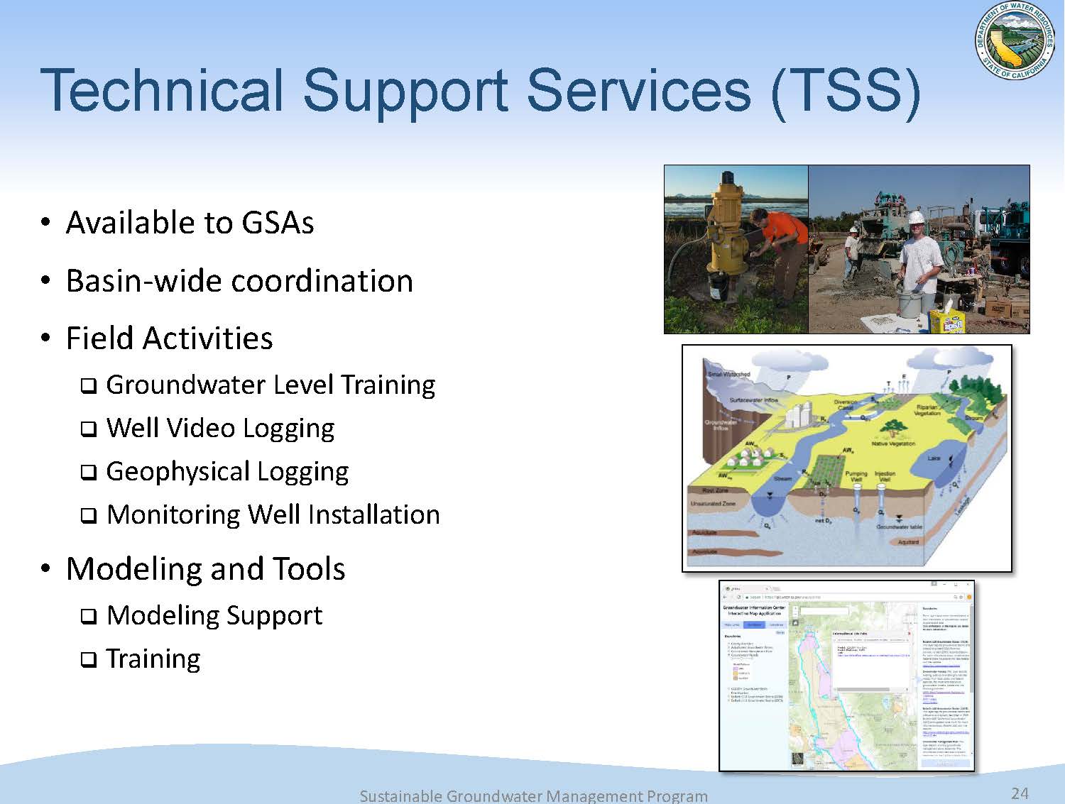 The Department’s technical support services are focused on GSAs and trying to build local capacity in these basins. They are providing field activities, and leveraging a drilling contract of the Department’s that can be used to install dedicated monitoring wells. They are putting the modeling tools of the hands of the GSAs, making sure they understand how to use them, and then they can use them for GSP development.
Another component of technical assistance is the statewide datasets and tools. Mr. Springhorn acknowledged that there is a lot of groundwater or SGMA-relevant information out there, but it is spread across multiple websites so it can be hard to find. The Department is working to put that information in one spot so people can download the information they need, get to the tools and maps they need, and find reports. (Click here to view the webpage.)
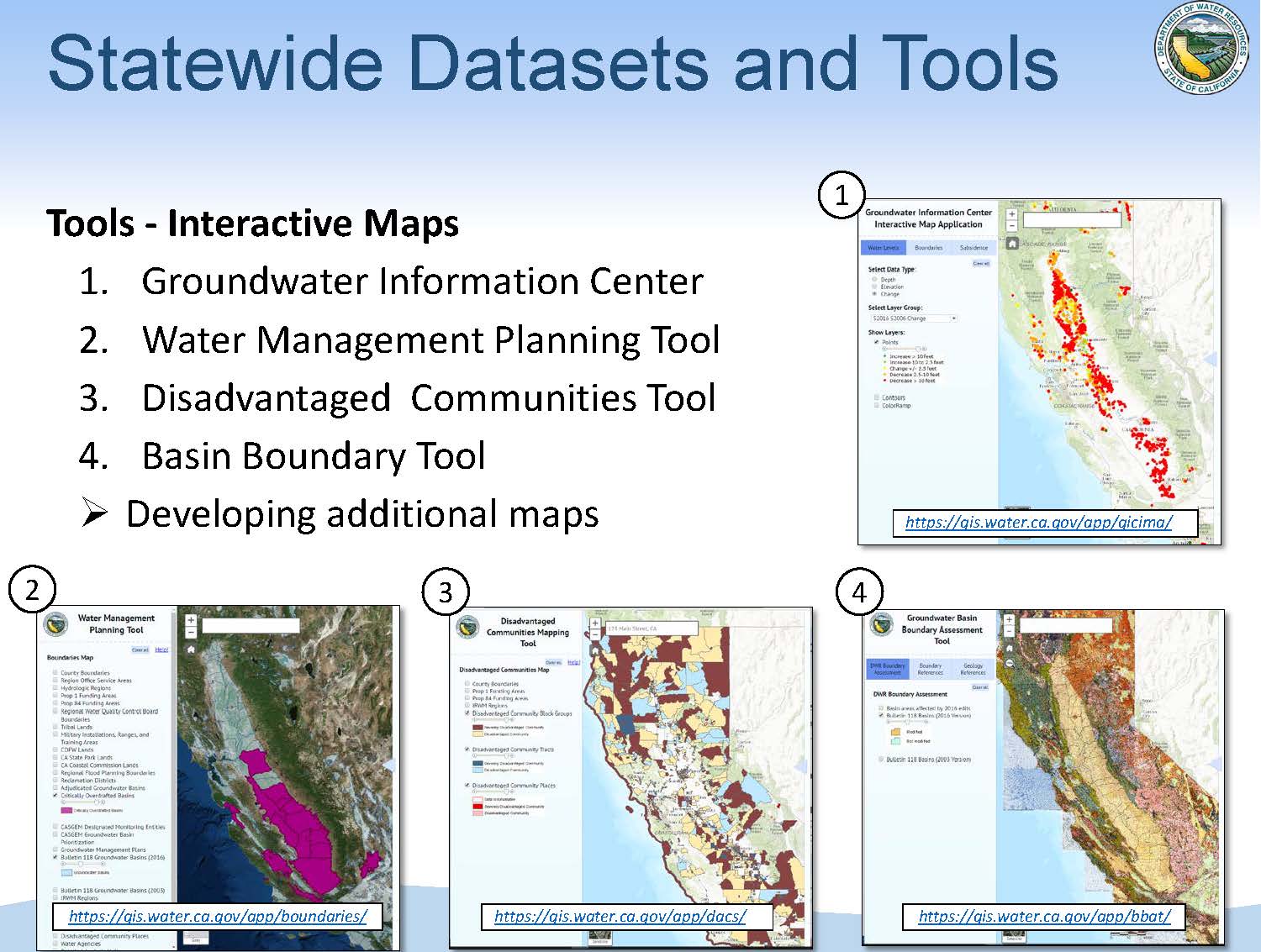 There are also interactive maps available that show information on groundwater levels and subsidence. The water management planning tool helps local agencies to understand the various jurisdictional boundaries in their area, counties and other important boundaries. Another tool is an interactive map that highlights the disadvantaged communities within California, another critical element of SGMA planning and Prop 1 grant applications. There is the basin boundary modification tool which provides some geologic maps and other relevant information for entities looking to modify their basin boundaries.
“A lot of the information here is tied directly to the requirements of SGMA,” Mr. Springhorn said. “We’re trying to align our technical offerings to what the local agencies and their stakeholders need in the basins throughout the state. We are currently developing additional tools that if there’s a gap in information, we’re trying to fill those gaps as quickly as we can, to get that information in the hands of the GSAs so they can put it into their plans.”
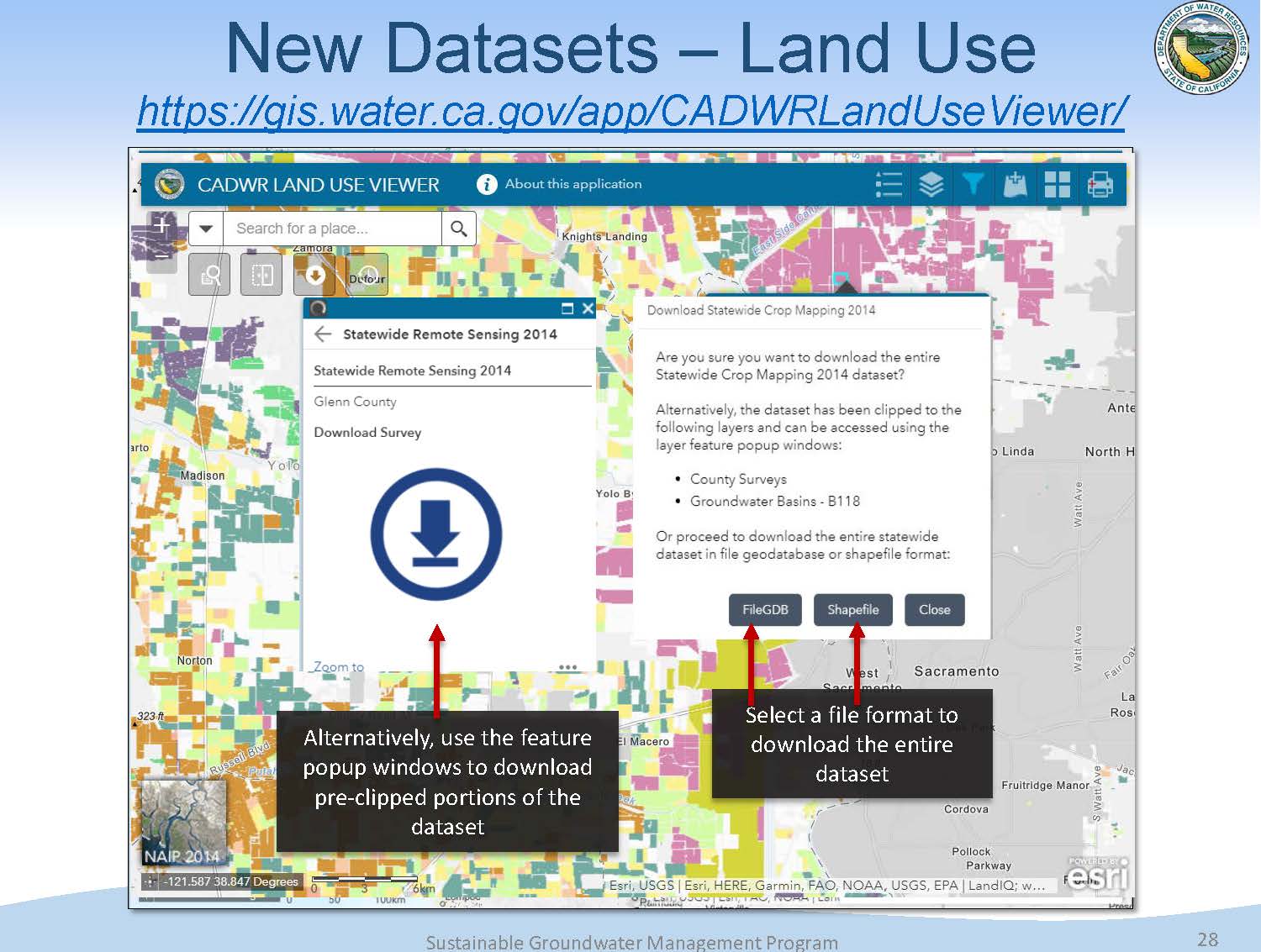 A new dataset that has recently come online is the land use viewer, which has the data for 2014 statewide land use as well as legacy land use data, which shows the variety of different land uses in the state. The data can be downloaded by county or by groundwater basin. They are working to add 2016 statewide land-use, which they anticipate being available mid-2018. “The data is important because there’s a nexus between land use and water use, and so this allows the GSAs and others to see what land use is there and bring that into their GSP planning process,” said Mr. Springhorn.
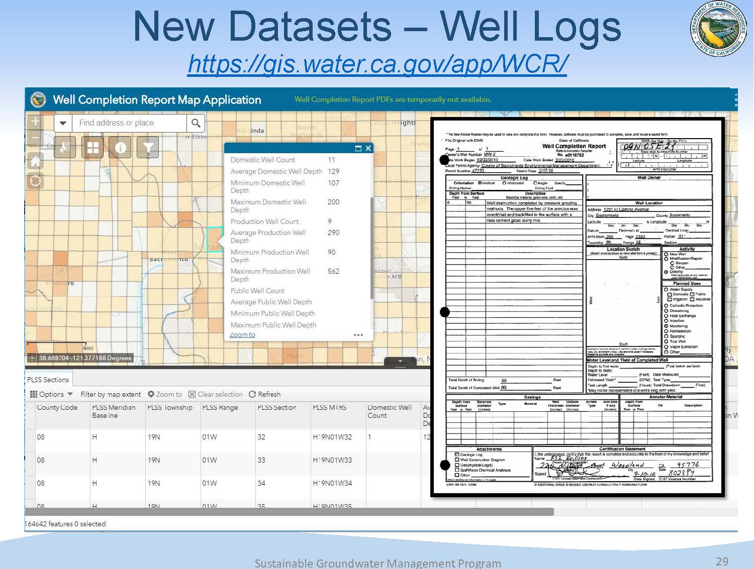 The Department also has put well completion reports online, which allows users to zoom in and see the number of domestic, production, and municipal supply wells and their average depths, with a link provided to get to the log itself.
“This is a big improvement from where we’ve been in making this information available,” said Mr. Springhorn. “You can also download all of the information for each county in the state. This is a requirement in the GSP regulations, getting this information on a map, so this shortens the time for the GSA to compile all this information.”
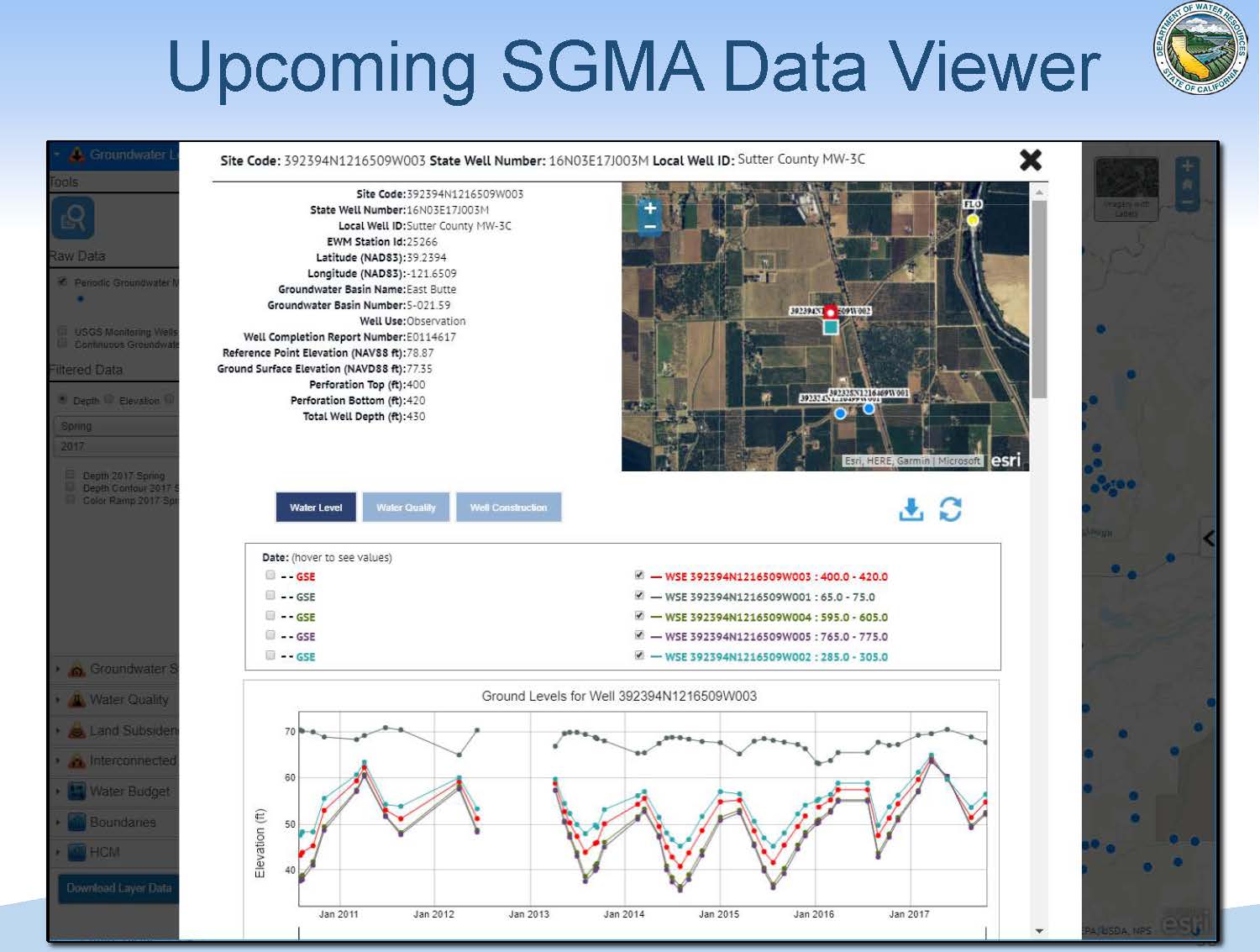 The team is now working to develop a SGMA data viewer which will take existing data and make it map based. The information will be organized by the sustainability indicators such as groundwater levels or land subsidence; users will be able to get the information needed for their basin and download it. They will be able to zoom into any area of the state, look at water levels, and then understand the trends through time.
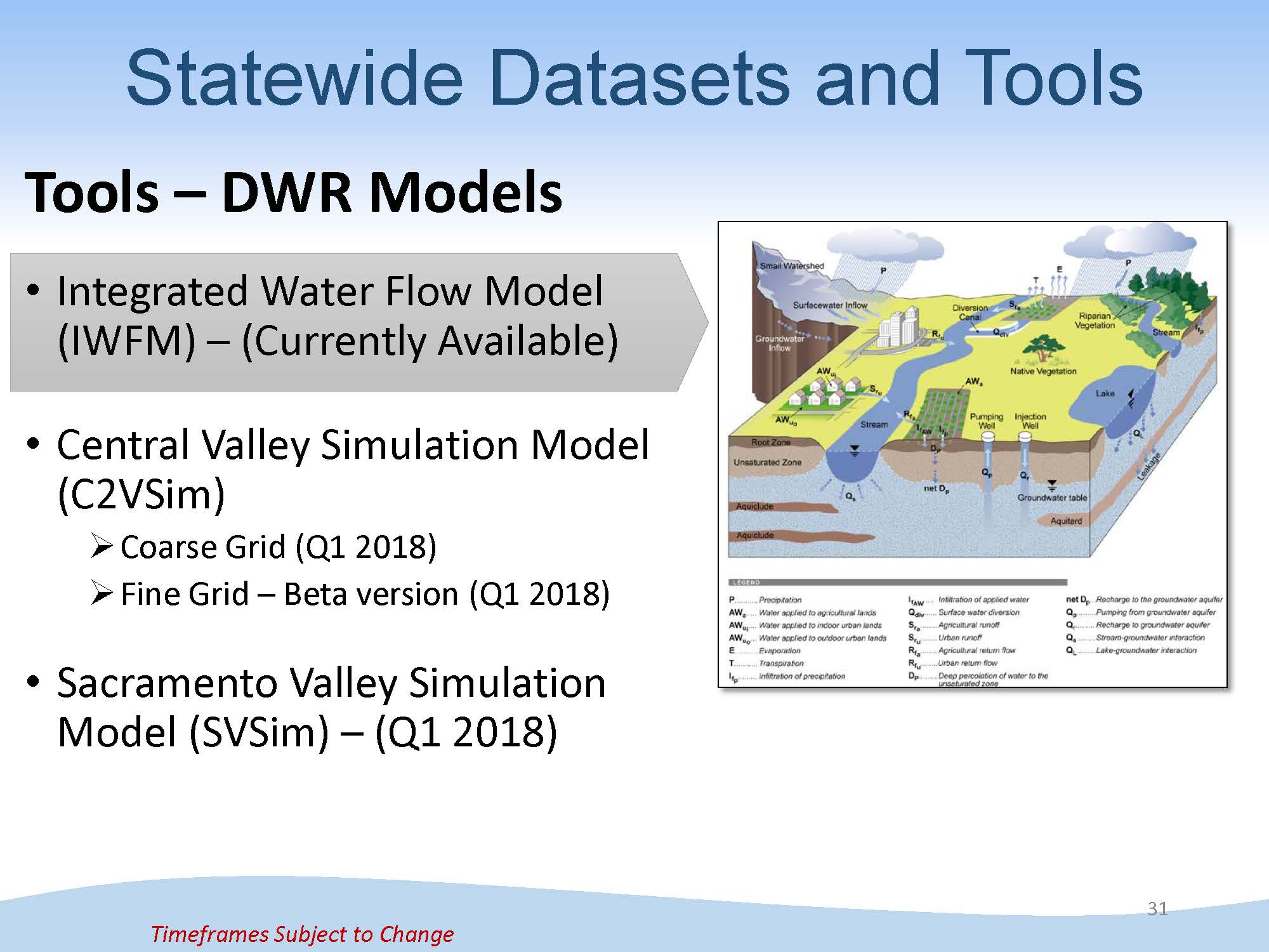 There is also a team at DWR working to enhance modeling tools. They have updated the integrated water flow model, which is the engine that runs the models. In the first quarter 2018, the Department plans to release an updated Central Valley-wide simulation model, as well as a more refined finer grid version directly applicable to SGMA. There is also a specific model that’s been refined for the Sacramento Valley that will be available in early 2018.
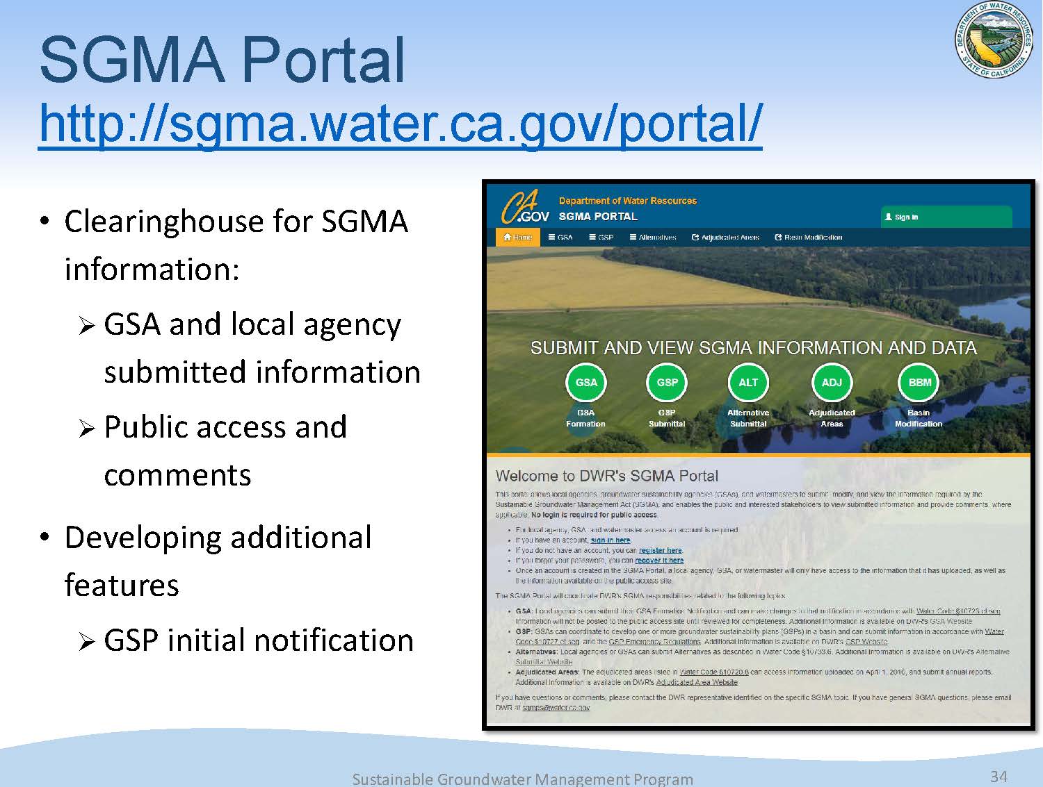 The SGMA information portal is essentially a clearinghouse for all the SGMA information received from the local agencies. This will also be where the GSAs will submit their GSP to the Department. They will be making that information accessible to the public, as well as allowing for public comment.
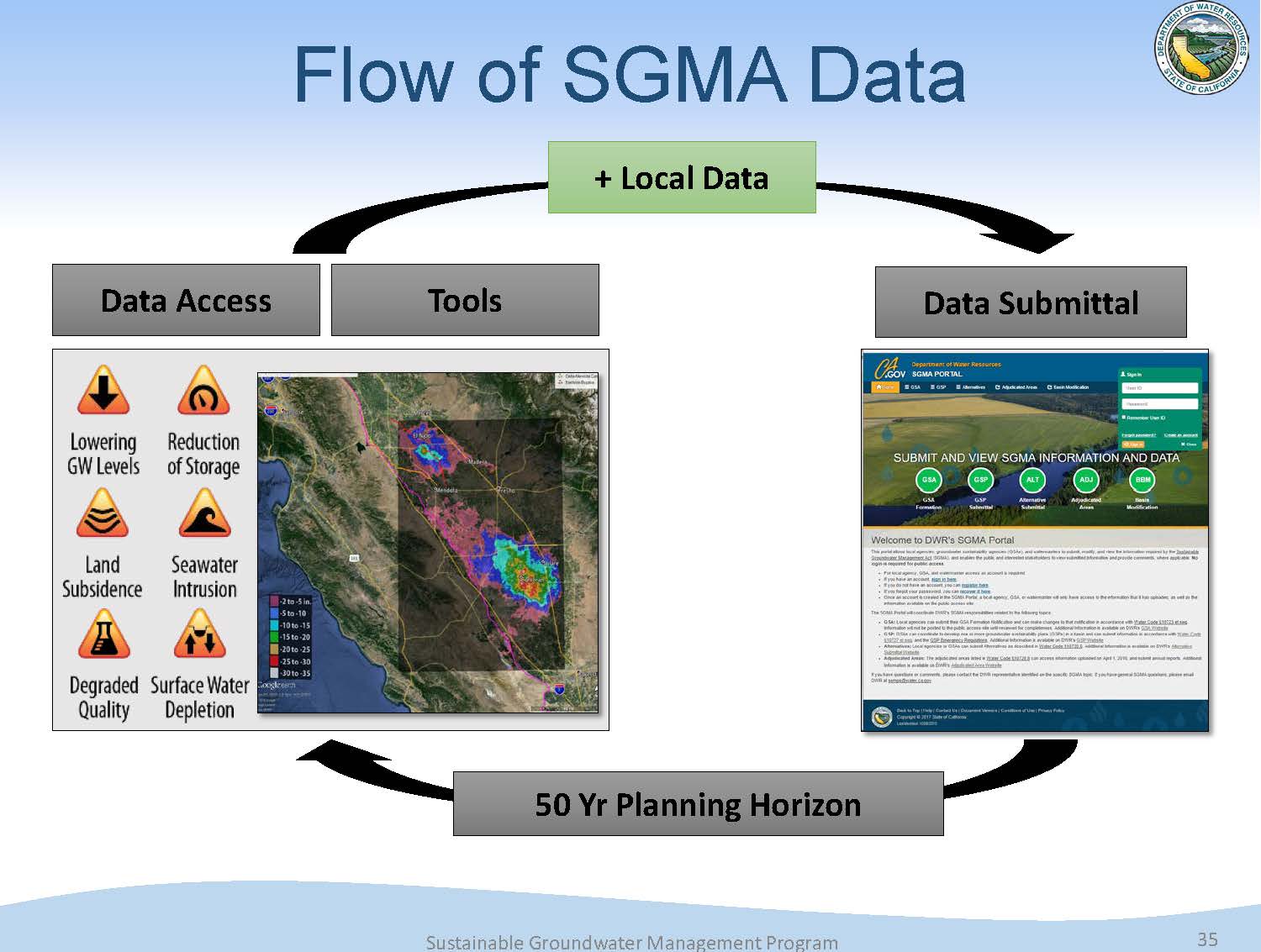 “A lot of information is needed as the foundation of those plans, and to make informed decisions,” said Mr. Springhorn. “There is a lot of information that’s needed over the planning horizon which is 20 years. So our goal with the SGMA data viewer and these other tools is that GSAs can grab the information that’s readily available for them. They will likely have to add some of their local data to it to comply with the regulation, and then they’ll submit it to us in the SGMA portal. The important point here is closing the loop, because SGMA requires annual reporting and 5 year updates, so with the information we’ve received, we want to put that back into the tools, so the GSAs and other members of the public can see updated groundwater information in the state.”
Commissioner Maria Herrera asked about the drilling contract that’s available to help the GSAs install monitoring wells. Steven Springhorn acknowledged that the funding is limited. “We’re really focused on the critically overdrafted basins this first round with the funding we do have, so we wanted to make sure that the GSAs didn’t think we could install the wells for them, but we are coordinating with our Prop 1 team in understanding what was requested and how we can use these additional funds to supplement them.”
The total amount available on the contract is only around $2 to $3 million. Depending on the type of wells, it could potentially fund 20 to 30 wells across the state. “We’re focusing these first years on the 21 critically overdrafted basins. It’s not that many, but it’s definitely a good head start or first step in getting that critical information out there in those basins.”
FINANCIAL ASSISTANCE
 Trevor Joseph then briefly updated the Commissioners on the financial assistance available, noting that it is managed within the financial assistance branch in the Division of Integrated Regional Water Management. Proposition 1 provided $101 million for competitive grants for plans and projects to develop implementation plans. In 2015, $6.7 million of that was awarded to counties with stressed groundwater basins.
A grant proposal was released in the early fall that had $86.3 million available, with a minimum $10 million that had to be available for severely disadvantaged communities. The application period recently closed; 78 applications were received for a total of $86.4 million. Applications for severely disadvantaged communities totaled $16.8 million; the remaining $69.6 million of the applications were for GSAs submitting for GSP development. The financial assistance branch is still reviewing the applications, but it looks like they will be able to fund a majority or all of those funding requests, said Mr. Joseph.
FOR MORE INFORMATION …
- For DWR’s Sustainable Groundwater Management Page, click here.
- For DWR’s page of SGMA tools and datasets, click here.
- To learn more about groundwater, click here.
 Sign up for daily email service and you’ll never miss a post!
Sign up for daily emails and get all the Notebook’s aggregated and original water news content delivered to your email box by 9AM. Breaking news alerts, too. Sign me up!
